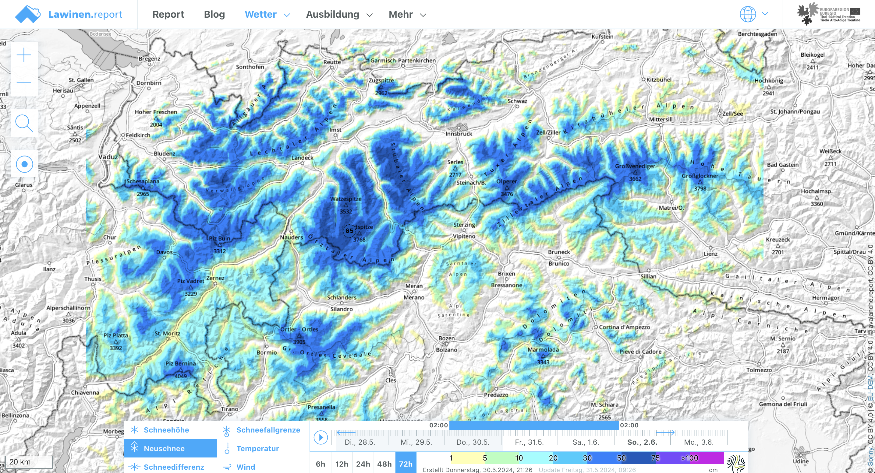
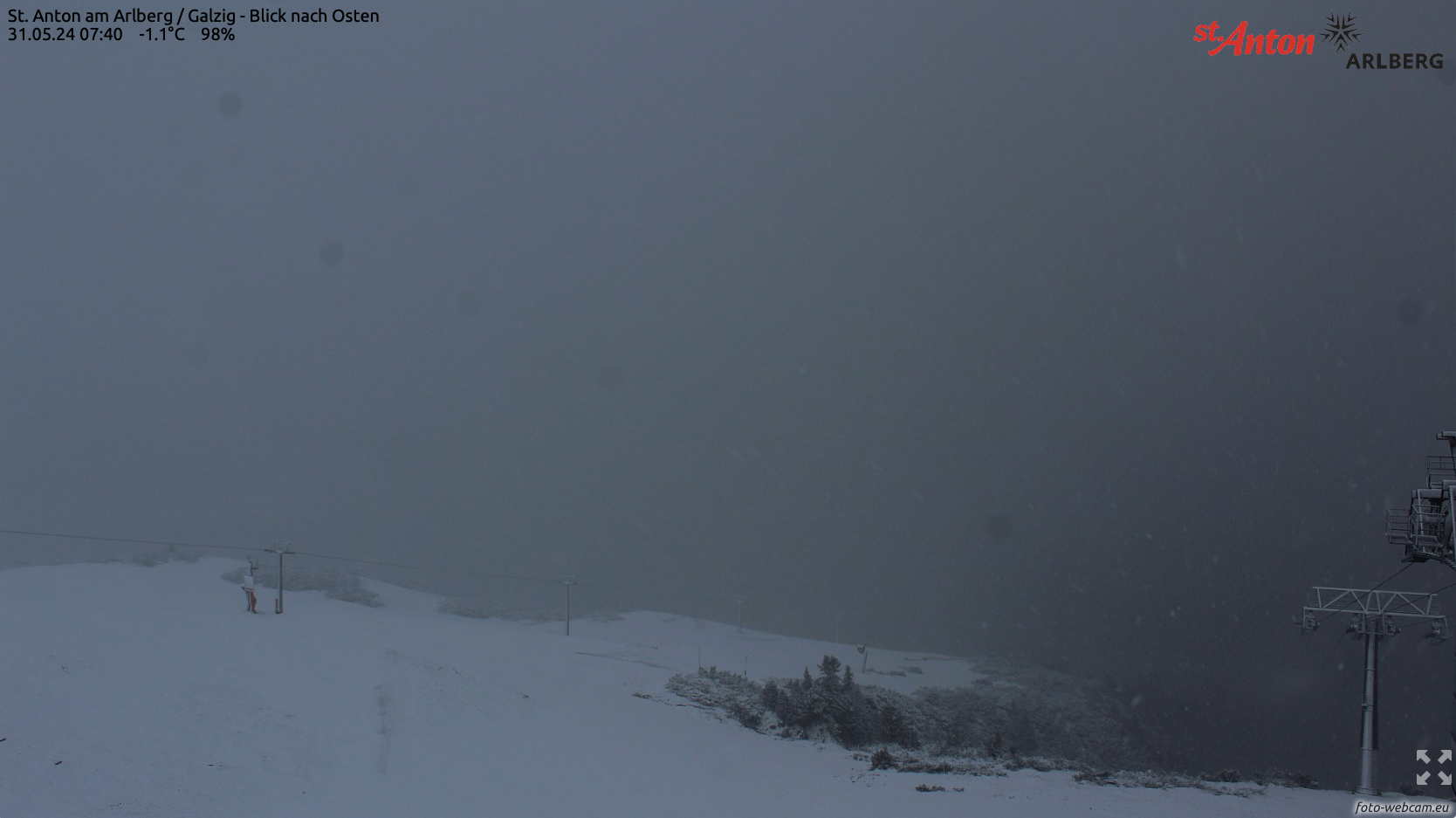
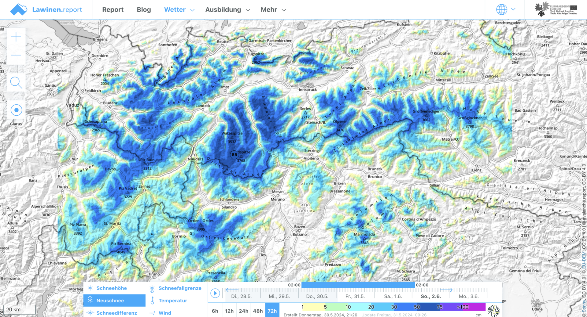
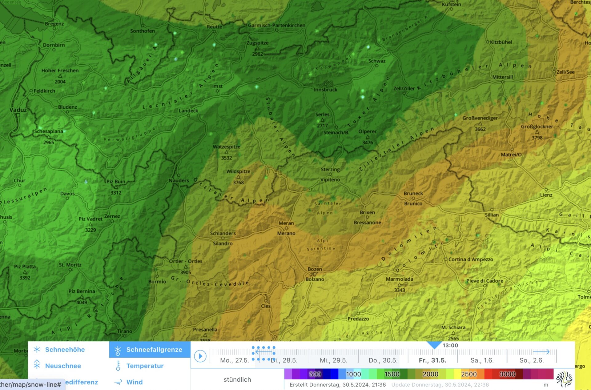
Since Thursday, 30.05, there has been intense rainfall/snowfall. In high alpine regions, i.e. above 2500m, we expect 40-50 cm of fresh snow by Sunday, 02.06, in places up to 60cm. Since precipitation is intense, the snowfall level on Friday, 31.05, could descend to 1700m for a time. As fresh snowfall and winds increase, avalanche danger in high alpine regions will, too.
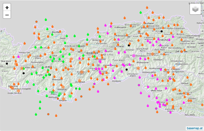
The Avalanche Warning Service has very little information from outlying terrain. Thus, careful on-site inspection is important to determine local avalanche danger.
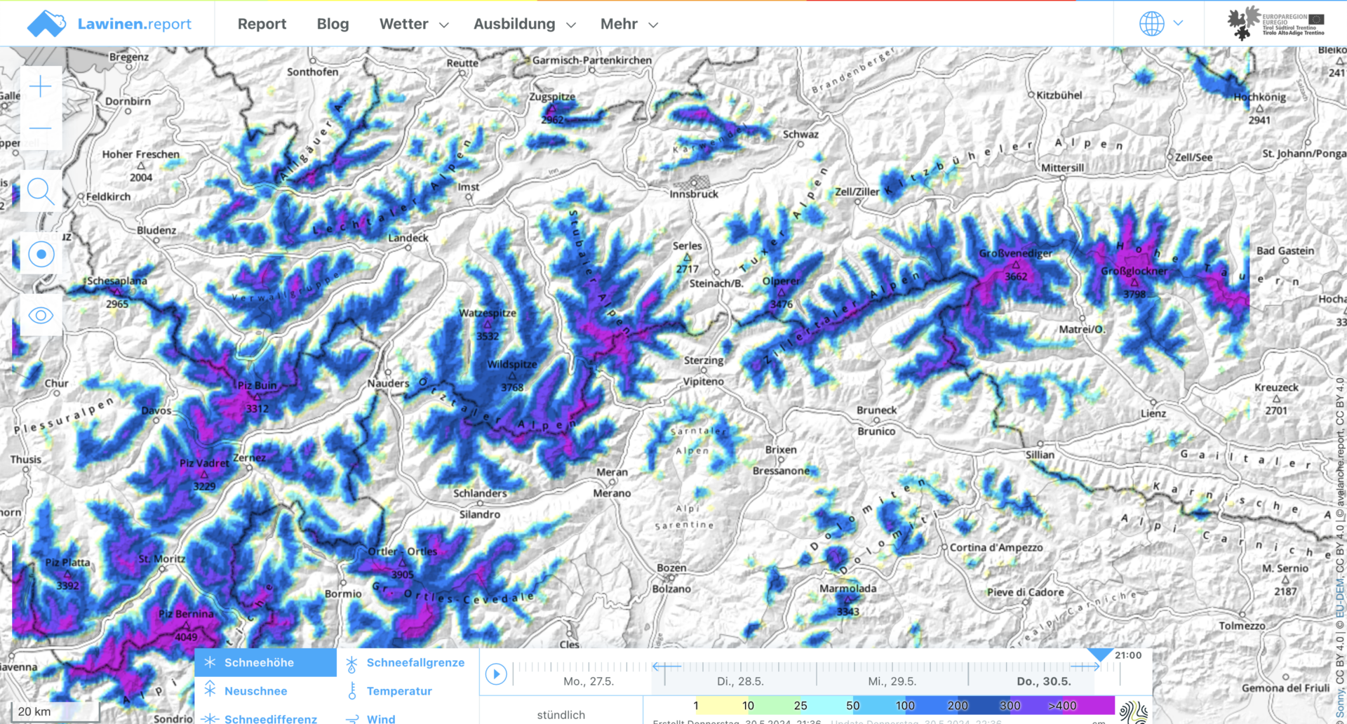
Lots of fresh snow in high alpine zones
Since yesterday afternoon, Thursday 30.05, there has been ongoing and intense rainfall in most parts of North Tirol. Showers and thunderstorms moved through. According to measurments of the Hydrological Service Tirol, 15-30mm of precipitation has been registered over far-reaching areas in the last few hours. In particular in the eastern regions of North Tirol and the border regions between South and East Tirol, more than 30mm has been registered since early Friday morning. The snowfall level on Friday morning is at 2500m, but is expected to descend over the course of the day.
By Saturday evening, 01.06, we expect intense precipitation in many places. In the Lech valleys, along the Main Alpine Ridge and northwards therefrom and in the Hohe Tauern, up to 60cm of fresh snow is possible above 2500m.
Briefly heightened avalanche danger
In high altitudes there is currently more snow on the ground than is usual at the end of May, beginning of June. Particularly above 2500m there is a cohesive area-wide snow cover by and large. The snowpack up to 3000m is thoroughly wet in all aspects. Atop this snowpack the fresh fallen snow is being deposited, accompanied by moderate to strong northerly winds. Between the wet old snowpack surface and the fresh snow and fresh drifts, a crust will form which is not capable of bearing loads.
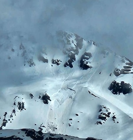
We expect some avalanche activity during the coming hours. Dry slab avalanches can trigger particularly in the fresh snow and freshly generated drifts. This will occur frequently during the snowfall. Since we assume there are weak layers in the fresh snow and drifts, we are faced with short-lived weak layers at the moment. One person can trigger avalanches, including large-sized ones. In addition, isolated naturally triggered avalanches are possible during the course of the day. Danger zones are frequent. Thus, for a brief spell, we will be confronted with higher avalanche danger.
As a result of (diffuse) solar radiation, we also anticipate heightened activity of medium-sized loose-snow avalanches. These can fracture down to deeper layers of the snowpack and have larger slab avalanches as a consequence. Also here, we see this as a short-lived problem.
Especially at intermediate altitudes, but often higher up, the snow is falling on bare, warm ground. Thus, it will presumably melt quickly. Snow depths are not expected to rise much, and also that snow will melt rapidly. Nevertheless, isolated small glide-snow avalanches and wet slides can’t be ruled out.
In greenlands it is possible to be surprised by avalanches unleashing from higher altitudes. This needs to be taken into consideration in planning a tour, whether to a hut, a hike or whatever.
Outlook
What is favourable are the temperatures: no longer as wintery. That will insure a rapid stabilization of the freshly fallen snow. Nonetheless: it is going to be wet, instable and cool for awhile.