Due to fresh snow, higher weekend danger of natural loose-snow avalanches, isolated danger zones for dry avalanches in high-alpine regions

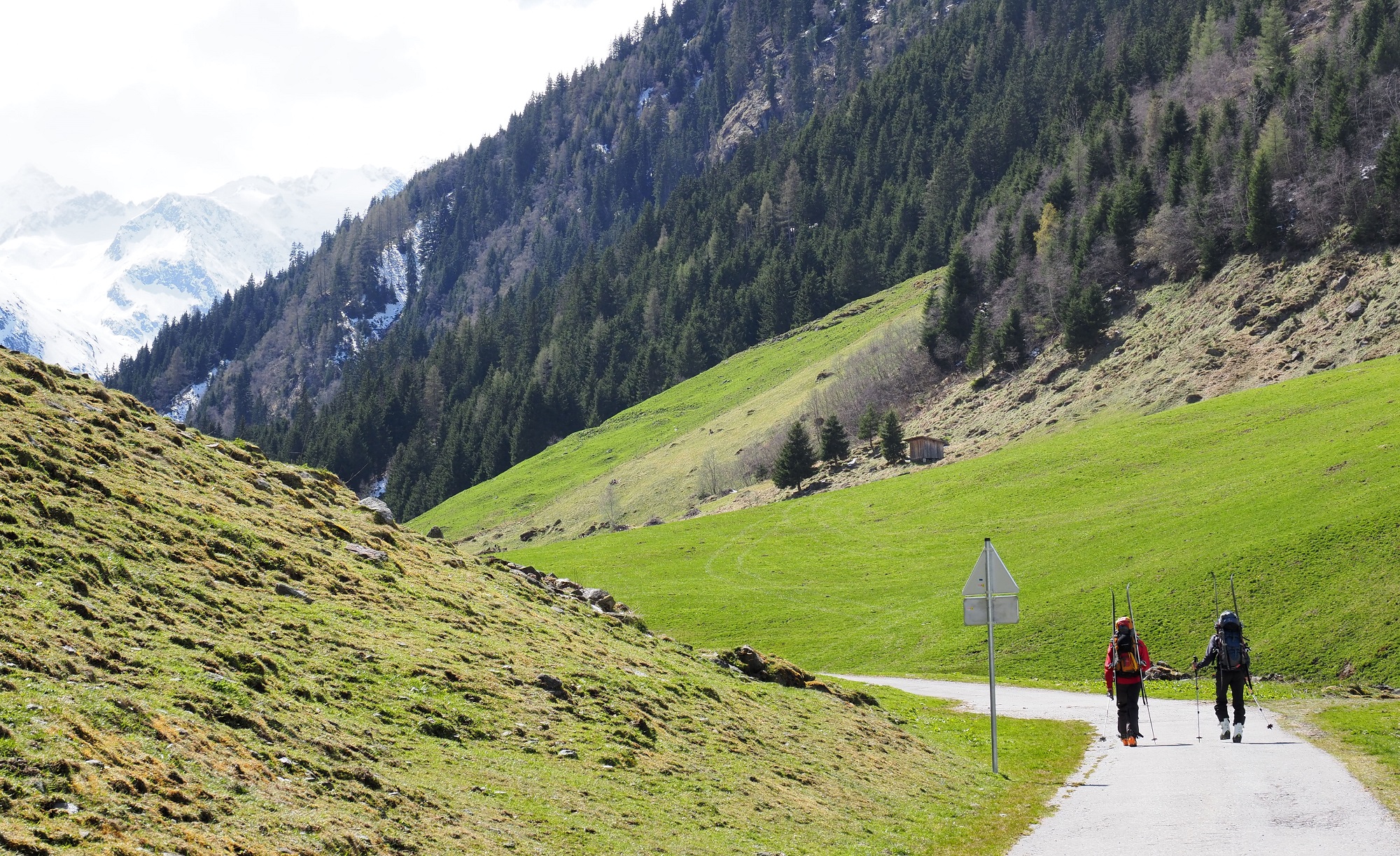
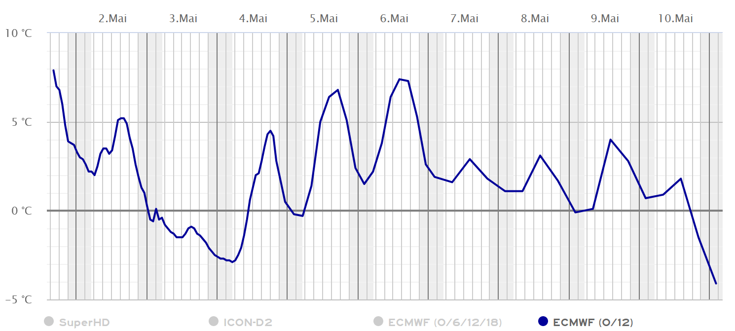
Starting on Thursday, 02.05, until Saturday, 04.05, some fresh snowfall is expected in the mountains of Tirol. It will be deposited atop a wet snowpack. Due to (diffuse) solar radiation the fresh snow will swiftly moisten, starting on Saturday. In steep rocky terrain in all aspects, numerous naturally triggered small-to-medium avalanches are anticipated which can also sweep along the entire thoroughly wet snowpack. On very steep shady slopes in high-alpine regions, freshly generated snowdrift accumulations are prone to triggering in isolated cases.

Weather and avalanche developments

Low pressure impact will bring some fresh snow

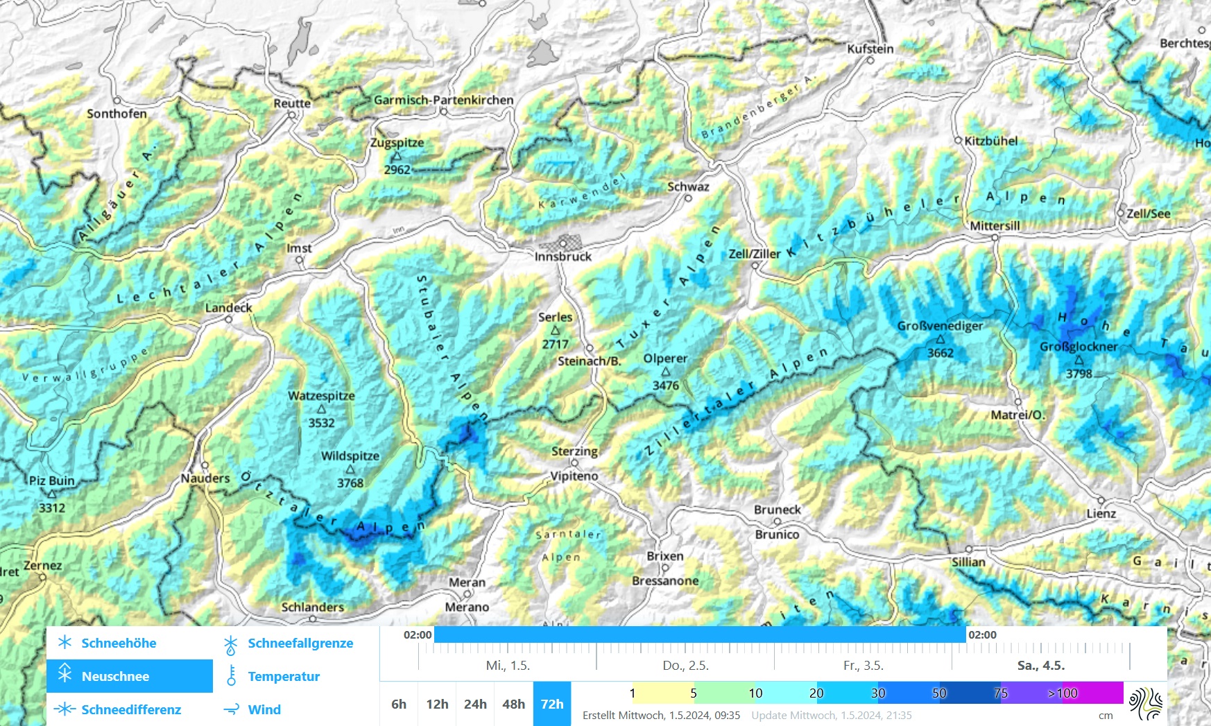
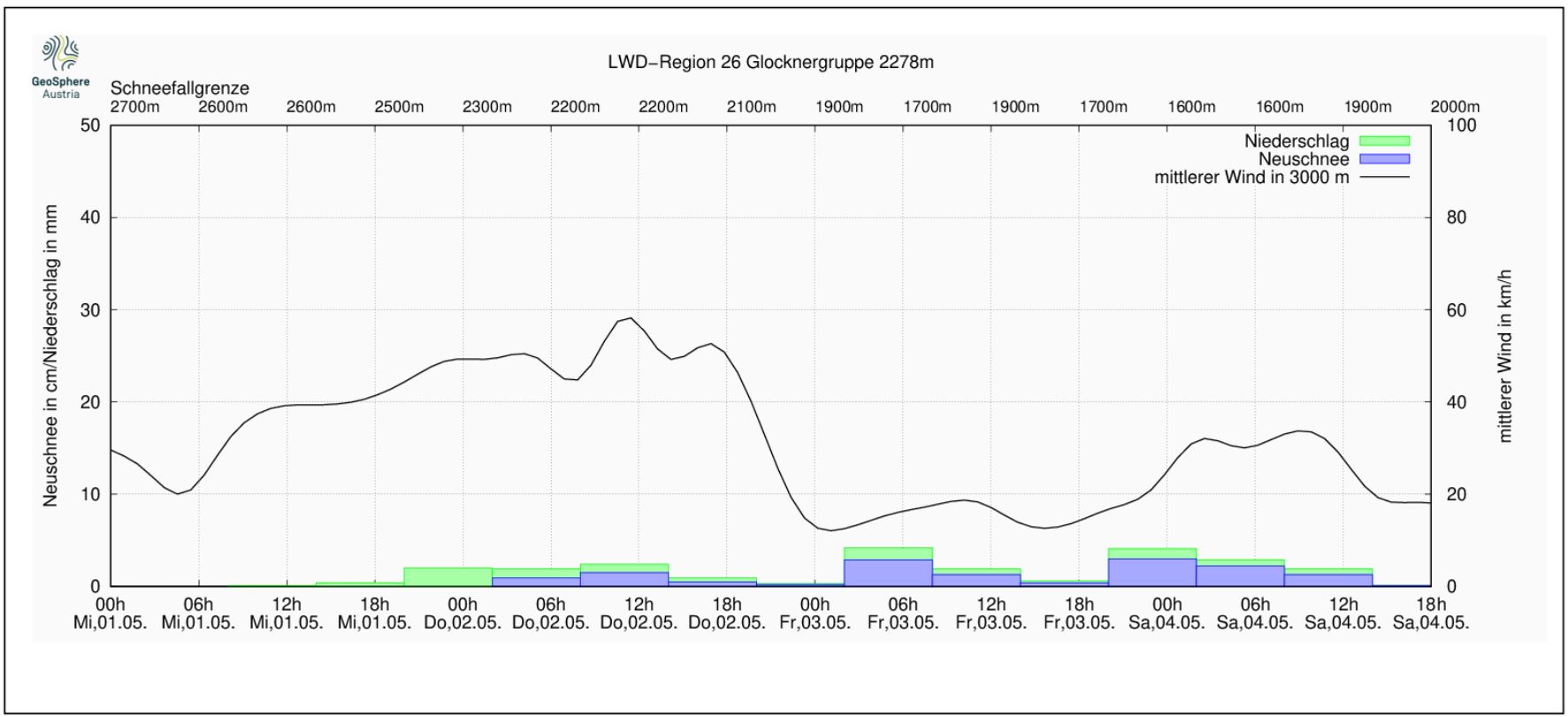
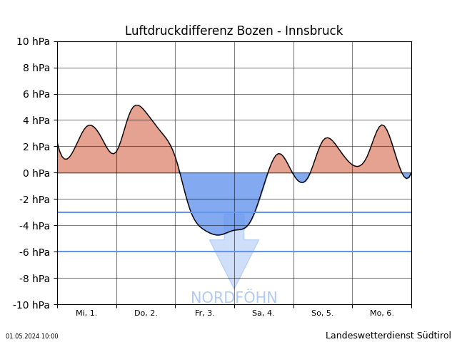
On Wednesday night, 01.05, in East Tirol and along the Main Alpine Ridge, some precipitation will set in, falling as snow above 2300-2500m. On Friday, some fresh snow can be expected throughout Tirol, the snowfall level descending to the timberline. Winds will be mostly moderate from (north)westerly directions, stronger along the Main Alpine Ridge and southwards therefrom as a result of northern foehn.

Bis Samstag, 04.05. fallen verbreitet 10 bis 20cm Neuschnee, lokal auch bis zu 30cm.
By Saturday, 04.05, 10-20cm of fresh snow is expected, locally up to 30cm.
Prognostizierte Neuschneemengen, Mittelwind und Schneefallgrenze (obere horizontale Achse) für die Glocknergruppe.
Forecast amounts of fresh snow, middle wind and snowfall level (upper horizontal) for the Glockner range.
Am Donnerstag ist es in Nordtirol noch recht föhnig, bevor dieser in der Nacht auf Freitag einbricht. Der Nordföhn sorgt ab Freitag im Südabhang des Alpenhauptkammes für Schneeverfrachtungen (©Landeswetterdienst Südtirol).
Thursday daytime, North Tirol will suffer foehn impact before it collapses on Thursday night. The northerly foehn wind will transport the snow particularly as of Friday, esp. on the southern flanks of the Main Alpine Ridge. (©Landeswetterdienst Südtirol).

Following the precipitation the air will dry out during the course of the day on Saturday, conditions will become more pleasant. On Sunday, from today’s perspective, instable springtime weather can be expected.

Prognostizierte Lufttemperaturen für den Patscherkofel (2247m). Ab Samstag, 04.05. ist wieder mit einem Anstieg der Temperaturen zu rechnen (©Kachelmannwetter).
Forecast air temperatures for the Patscherkofel (2247m). Starting on Saturday, 04.05, temperatures are expected to start climbing again. (©Kachelmannwetter).

Main danger: naturally triggered loose-snow avalanches, isolated snowdrift masses at high altitudes

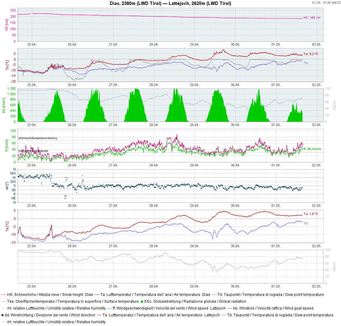
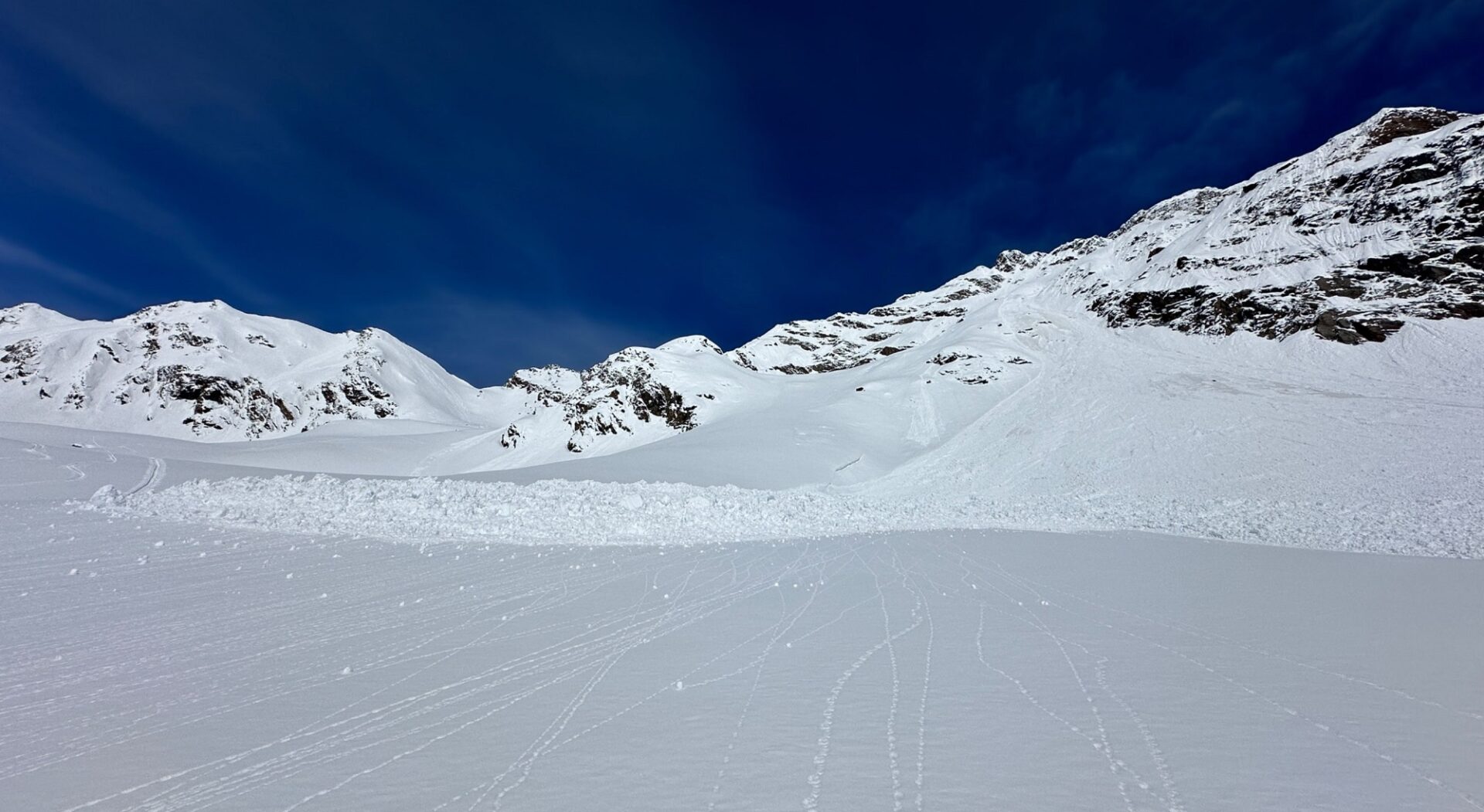
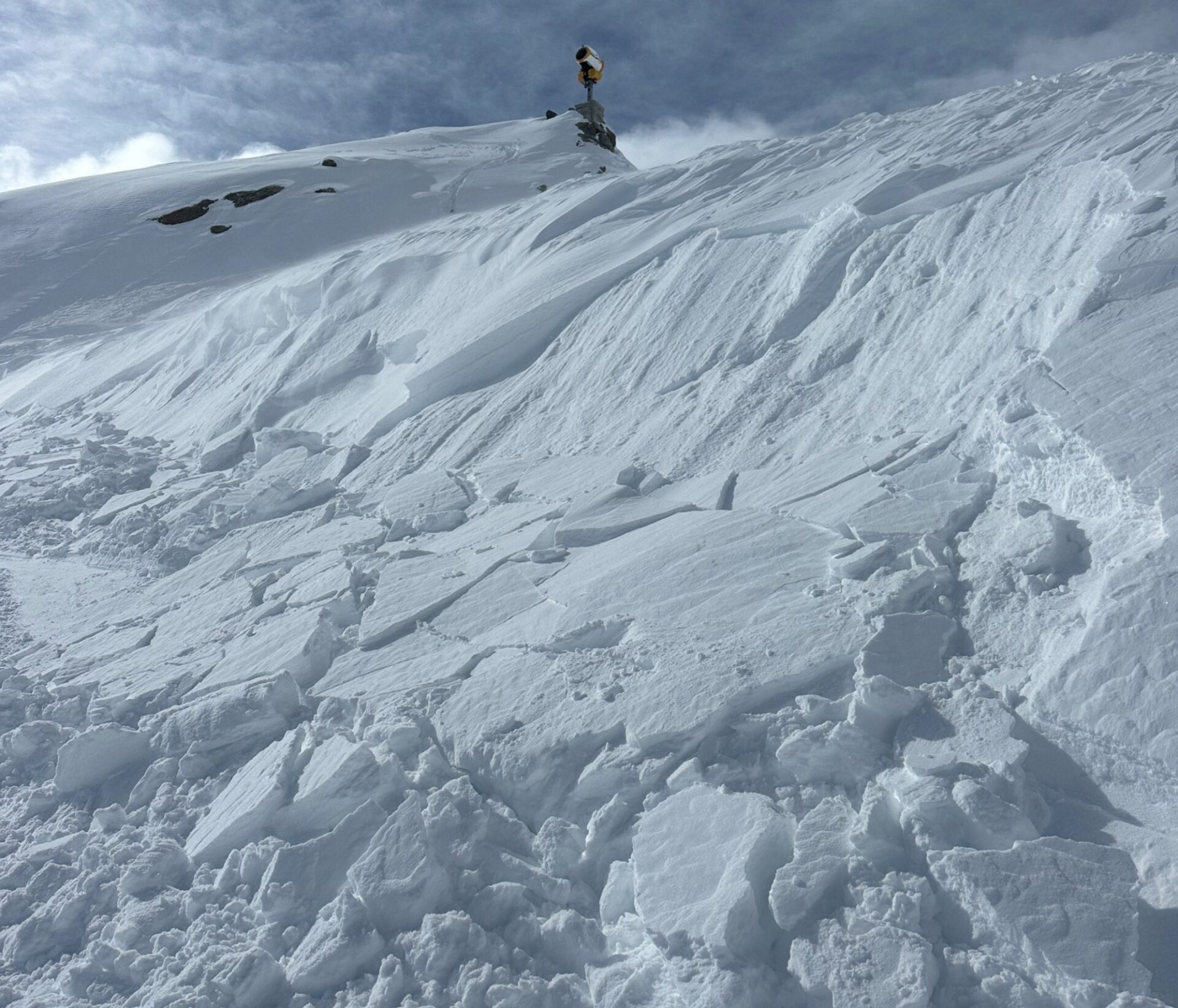
The fresh snow will be deposited atop a wet old snowpack surface up to high-alpine altitudes in all aspects. Between old and fresh fallen snow, only a thin melt-freeze crust will be able to form. In high alpine regions, particularly in the regions along the Main Alpine Ridge where precipitation is heavy, snowdrifts from the fresh snow and wind can accumulate. These will be mostly small-sized, but can be trigger-prone on very steep shady slopes. Potential weak layer: loose fresh snow or graupel. As a result of rising temperatures and somewhat diffuse radiation, the snowdrift masses will swiftly consolidate.

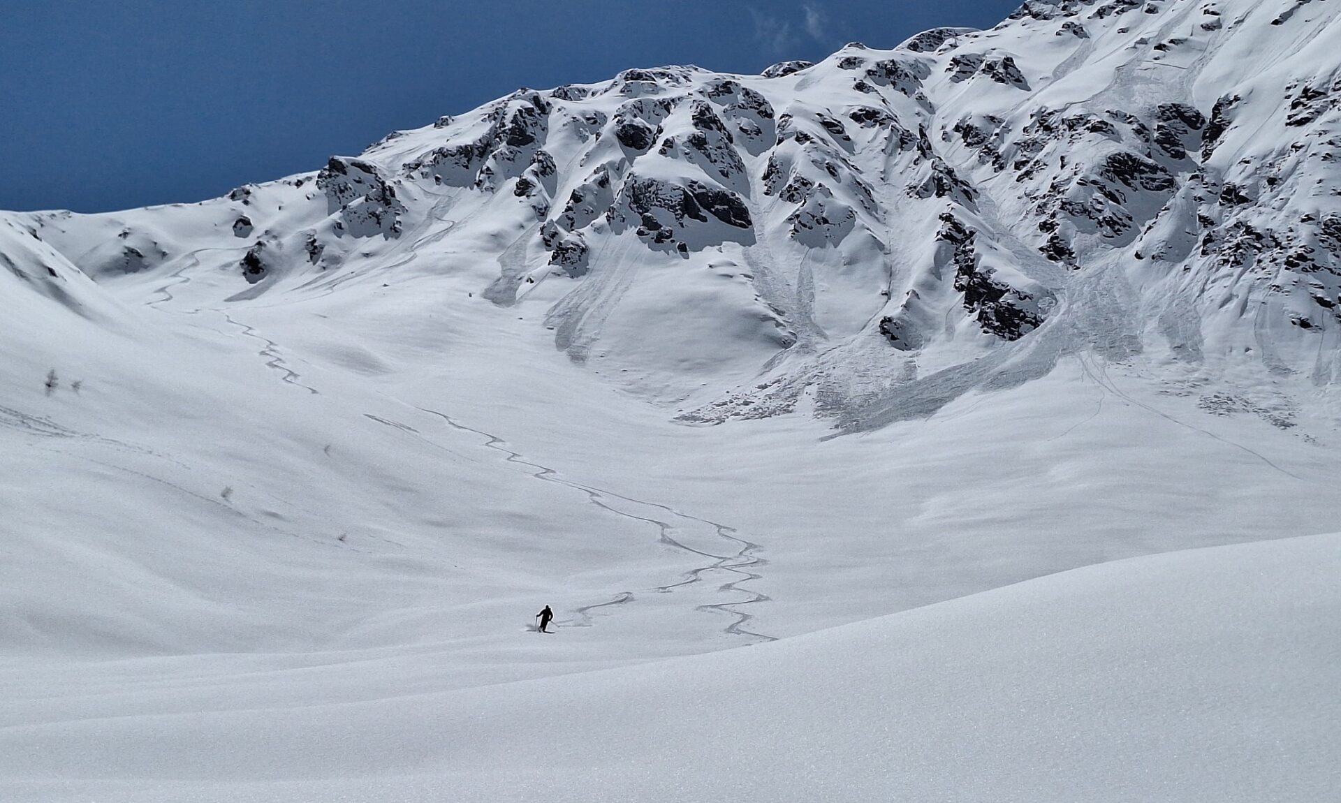
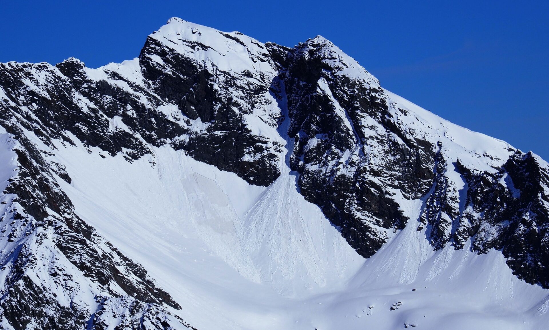
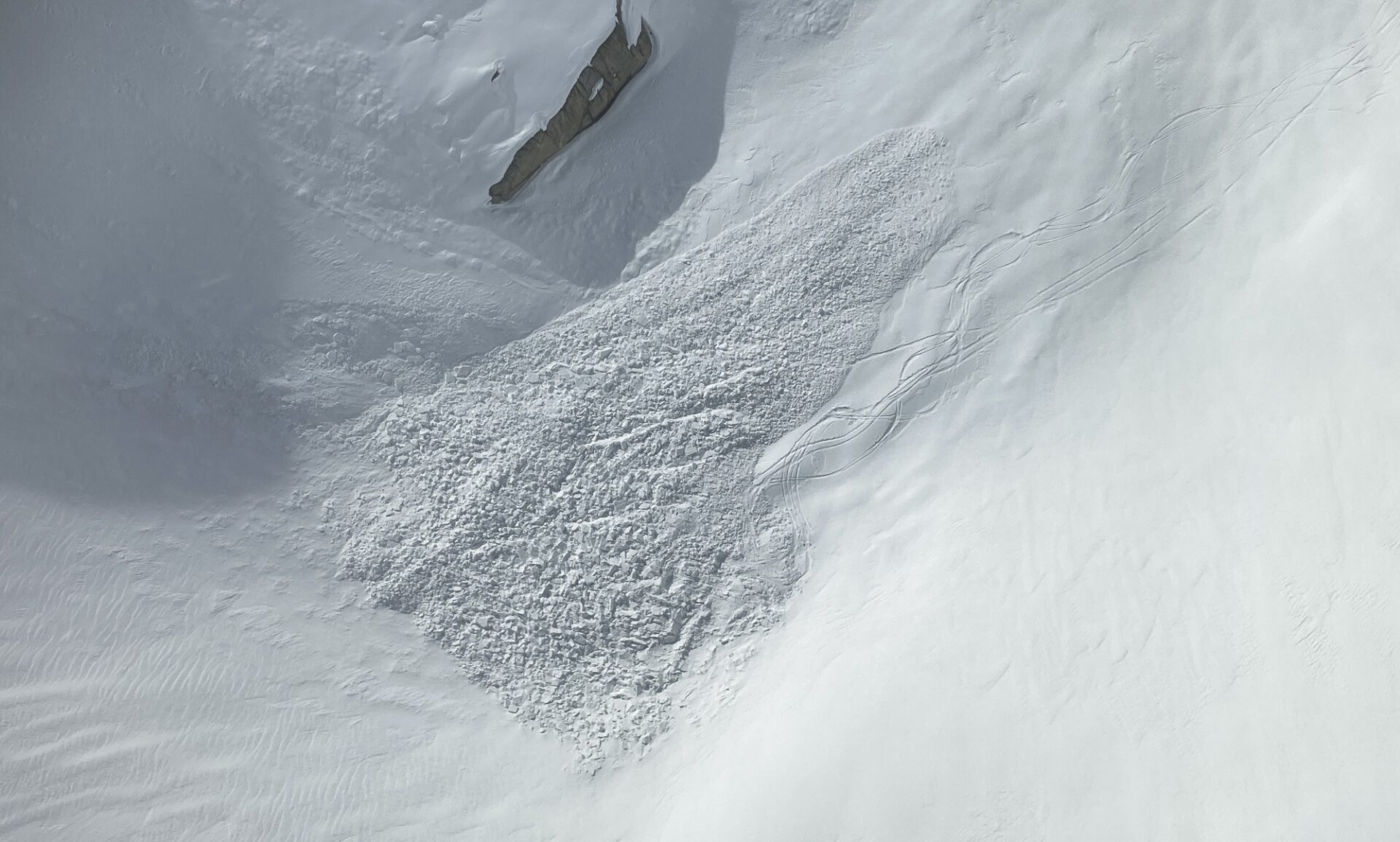
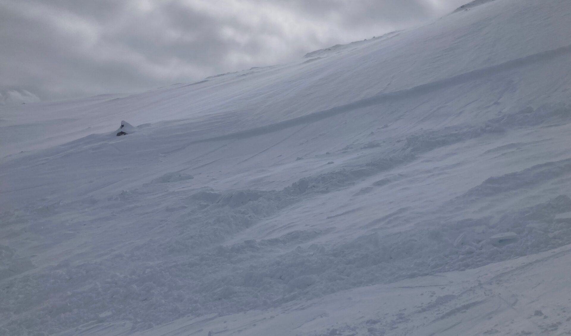
At the same time, (diffuse) solar radiation and daytime rise in temperatures on Saturday and Sunday will lead to the moistening of the fresh snow, which will then forfeit its firmness. Subsequently, numerous small and medium-sized (where snowfall is heavy) naturally triggered loose-snow avalanches are anticipated in steep rocky terrain in all aspects. If the fresh snow is bonded from settling, also shallow slab avalanches are possible. Possible weak layer: the melting forms below the slab. Through the impulse of naturally triggered avalanches, also the wet and unbonded snow beneath it can be swept along on extremely steep plummet paths. Avalanches can thus become dangerously large. Caution is urged in the danger zones!

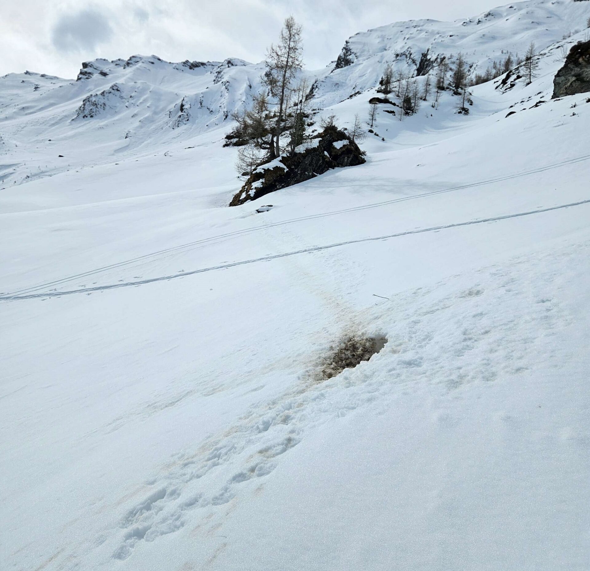
On steep slopes and on grass-covered slopes which were previously bare of snow in the areas of heavy precipitation, it can be expected that the fresh snow will glide over the warm ground. Such avalanches will be mostly small-sized.

Review of last week

Seit Donnerstag, 25.04. stiegen die Temperaturen nach dem Kaltlufteinbruch, welcher uns seit Mitte April begleitete, wieder sukzessive an. Die Schneedecke wurde in der Folge an allen Expositionen und bis ins Hochgebirge hinauf angefeuchtet. Die Schneehöhen gingen deutlich zurück.  Ab Freitag, 26.04. setzte Südföhn ein.
Since Thursday, 25.04, temperatures after the mid-April cold snap have been rising successively. The snowpack was subsequently moistened up to high-alpine altitudes in all aspects. Snow depths deteriorated radically. Starting on Friday, 26.04, southerly foehn wind visited North Tirol.
In den ersten sonnigen und bei noch recht kühlen Temperaturen konnte man vergangene Woche Nordseitig noch guten Pulverschnee finden. Aus extremem Steilgelände lösten sich trockene Lockerschneelawinen. Teilweise initiierten diese die kantige Schwachschicht, welche sich nach dem Gefahrenmuster kalt auf warm unter dem Neuschnee ausgebildet hatte (siehe Blog vom 25.04.; Foto: ©LWD Tirol, 25.04.2024).
During the first sunny but cool days last week there was still good powder to be found on north-facing slopes. In extremely steep terrain, dry loose-snow avalanches released naturally. Some of them launched the weak faceted layer which lay beneath the fresh snow, corresponding to the danger pattern cold-on-warm. (see blog of 25.04.; photo: ©LWD Tirol, 25.04.2024).
Hochwinter-feeling in den Deferegger Alpen in Osttirol. Im Bild nicht zu erkennen: Bis zum Bereich der Waldgrenze liegt auch hier kein Schnee mehr (©LWD Tirol, 25.04.2024).
Feelings of deep winter in the Deferegger Alps in East Tirol. Not visible in photo: up to the timberline the ground was (and still is) bare of snow. (©LWD Tirol, 25.04.2024).
An Sonnenhängen wurde der Neuschnee mit starker Sonneneinstrahlung rasch angefeuchtet. Es lösten sich zahlreiche kleine mit mittelgroße spontane Lockerschneelawinen. Sehr vereinzelt konnte beobachtet werden, dass die kantige Schwachschicht auf der Schmelzkruste angesprochen und dadurch eine Schneebrettlawine ausgelöst wurde (©LWD Tirol, 27.04.2024).  
On sunny slopes the fresh snow rapidly became moist due to intense solar radiation. Numerous small-to-medium naturally triggered loose-snow avalanches were the result. In very isolated cases the faceted weak layer atop the melt-freeze crust was triggered and unleashed a slab avalanche. Stubai Alps (©LWD Tirol, 27.04.2024).  
Auch bei dieser Lawine im Bereich der Mutterberger Seespitze in den Stubaier Alpen initiierte eine Lockerschneelawine in ihrer Sturzbahn eine Schneebrettlawine. Die Schwachschicht stabilisierte sich in den Folgetagen rasch und konnte kaum mehr angesprochen werden (©Günter Chwojan, 26.04.2024).
This loose-snow avalanche near the Mutterberger Seespitze in the Stubai Alps also initiated a slab avalanche along its plummet path. The weak layer stabilized in the following days and was no longer triggerable. (©Günter Chwojan, 26.04.2024).
Nasse Lockerschneelawinen konnten (und können auch am kommenden Wochenende) in steilen Sturzbahnen vereinzelt weit vorstoßen. Brandjoch, Nordkette (©Walter Würtl, 28.04.2024).
Wet loose-snow avalanches could (and still can, this weekend) plummet a long ways along their path. Brandjoch, western Karwendel (©Walter Würtl, 28.04.2024).
Ab Freitag, 26.04. staute sich feuchte Luft von Süden gegen die Alpen. Im Bild die Föhnmauer hinter Ochsenkogel, Rötenspitzen und Wetterspitzen (v.l.n.r.) im hinteren Stubaital (©LWD Tirol, 27.04.2024).
Starting on Friday, 26.04, moist air masses from the south lodged against the mountain flanks. Photo: the foehn wall behind Ochsenkogel, Rötenspitzen and Wetterspitzen in rear Stubal Valley (©LWD Tirol, 27.04.2024).
Mit dem Südföhn entstanden frische aber meist kleine Triebschneeansammlungen, welche an Schattenhängen hinter Geländekanten oberhalb rund 2400m kurzfristig störanfällig waren. Als Schwachschicht diente hierbei entweder lockerer Pulverschnee oder Oberflächenreif – welcher Sich in der Nacht auf Freitag, 26.04. teilweise ausbilden konnte (©Günter Chwojan, 27.04.2024).
As a result of southerly foehn wind, fresh, usually small snowdrift accumulations were generated which for a short spell were prone to triggering on shady slopes behind discontinuities in the terrain above 2400m. Weak layer: either the loose powder or surface hoar, which formed on Thursday night, 25.04. See weather station graph above; ©Günter Chwojan, 27.04.2024).
Im Bild die Ablagerung einer kleinen bis mittelgroße Schneebrettlawine im Bereich des Schwarzensteinkeeses in den Zillertaler Alpen. Die Lawine wurde am Samstag, 27.04. durch eine sich im Aufstieg befindliche 4- köpfige Skitourengruppe an einem Nordhang auf 2450m ausgelöst. Alle Personen wurden von der Lawine erfasst, konnten sich jedoch rasch selbst befreien. Eine Person wurde leicht verletzt. Unfallkausal war auch hier frischer Triebschnee, welcher durch den Südföhn entstanden war (©Alpinpolizei, 27.04.2024).  
Deposit of a small-to-medium slab avalanche near Schwarzensteinkees in the Zillertal Alps. The avalanche was triggered on Saturday, 27.04, by a ski touring group of 4 persons on a north-facing slope at 2450m. The group was caught in the avalanche but were all able to get clear of it, only one person was slightly injured. Cause: fresh snowdrifts generated by the southerly foehn. (©Alpinpolizei, 27.04.2024).  
Diese kleine Schneebrettlawine wurde am darauffolgenden Sonntag, 28.04. unterhalb des Gablers (3261m) in der Reichenspitzgruppe ebenfalls an einem Nordhang auf ca. 2400m aus 20m Distanz fernausgelöst (©Valentin Leeb, 28.04.2024).  
This small slab avalanche was remotely triggered the following Sunday, 28.04, below the Gabler (3261m) in the Reichenspitz range, also on a north-facing slope, at 2400m from a distance of 20 metres. (©Valentin Leeb, 28.04.2024).  
Auch die Murmeltiere sind bereits wieder unterwegs (©Domenik Jenewein, 28.04.2024)
The marmottes are active again. (©Domenik Jenewein, 28.04.2024)
Abschließend noch ein Schnappschuss einer Schneerolle. Diese sind vor allem dann zu sehen, wenn lockerer Pulverschnee erstmalig feucht und pappig wird (©LWD Tirol, 27.04.2024).
To wrap things up, a snapshot of a snow roll. These occur when loose powder first becomes moist and sticky. (©LWD Tirol, 27.04.2024).

At the end of the daily Avalanche Bulletins for winter season 2023/2024 we would like to thank all those persons who sent us valuable reports and observations from outlying terrain via SNOBS during the course of the season.

A special debt of thanks goes to the observers who stuck their nose into the snow all season long in order to inform us about the developing avalanche situation. They form the spine of our work.

Until the start of the next season, information on the snow and avalanche situation will be published in our blog, in case of radical changes in the situation.