In the last Blog we pointed out a potential persistent weak layer based on danger pattern dp.4 “cold on warm.” Further analysis and reports have confirmed this danger. The overall picture is somewhat diffuse.
The arc stretches from reports of stable conditions over intensive skiing of very steep terrain all the way to worrisome snow profiles/snowpack analysis and isolated near-surface slab releases, triggered both naturally and by winter sports enthusiasts.
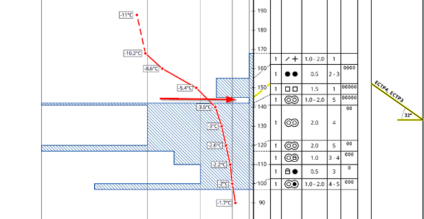
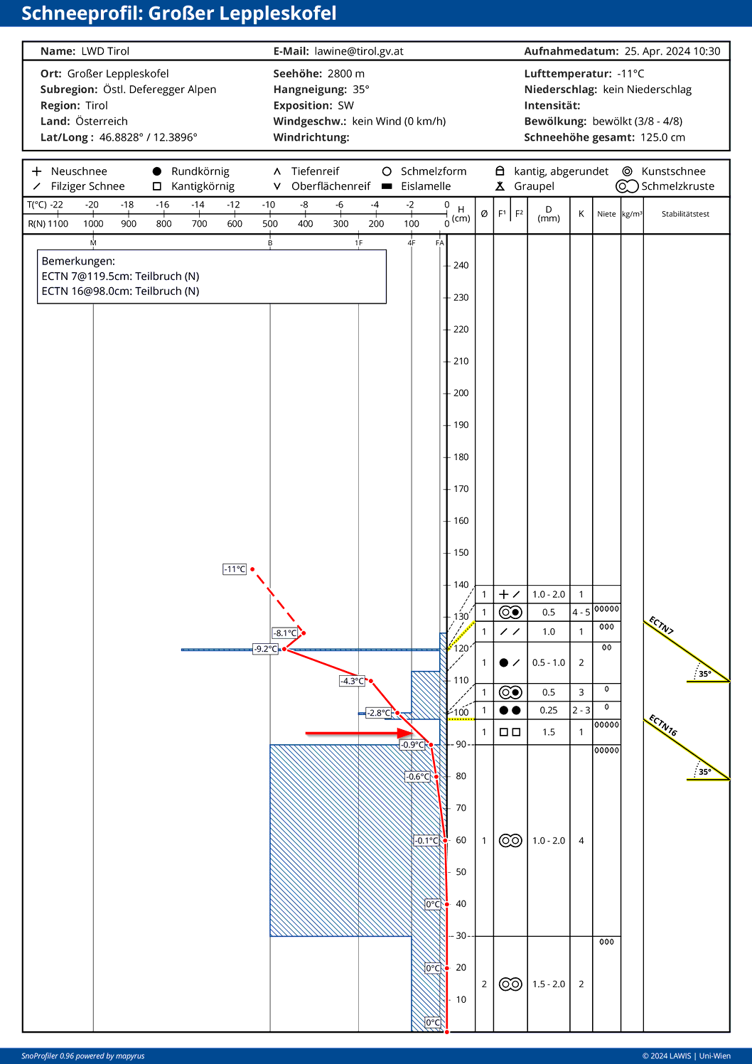
The only potential weak layer for slab avalanches is a faceted layer that formed as of 15.04 near a previously wet or moist old snowpack surface.
Zones of danger
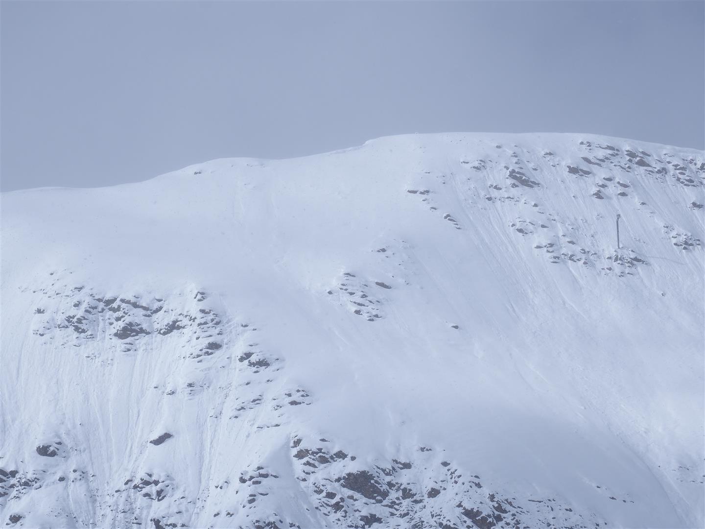
We limited today’s avalanche report (for 26.04) to generously drawn potential danger zones: very steep shady slopes between 2200m and 2800m, in other aspects starting at about 2200m and upwards. In the interim a report has reached us from the Gurgler range. On shady slopes between 2700m and 3100m there is a potential weak layer consisting of faceted crystals. Whereas today, 25.04, the surface moistening on sunny slopes continued so that the danger on sunny slopes should soon recede. Increasingly struck are the southern regions of Tirol. At least East Tirol, where we harvested the worst results from our snowpack analysis (see our youtube-video). From the Carnic Ridge, even near-surface naturally triggered slab avalanches were reported.
Ongoing loose-snow and glide-snow avalanches
As temperatures are now climbing again, accompanied by intensive (diffuse) radiation corresponding to the season, near-surface layers will moisten rather quickly. Since fresh snow reacts well to the initial thorough-moistening, we expect continuing loose-snow avalanches in extremely steep terrain. If the snowpack becomes massively wet, these can be large-sized.
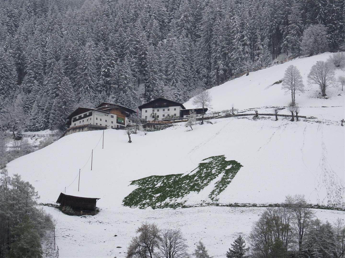
Particularly grass-covered slopes which were bare of snow before the recent cold snap – following numerous glide snow slide releases – will be struck by further glide snow slides and, in the major areas of precipitation, also glide-snow avalanches. Large-sized glide-snow avalanches sweeping away the entire snowpack will also be possible in isolated cases.
Deteriorating snow quality
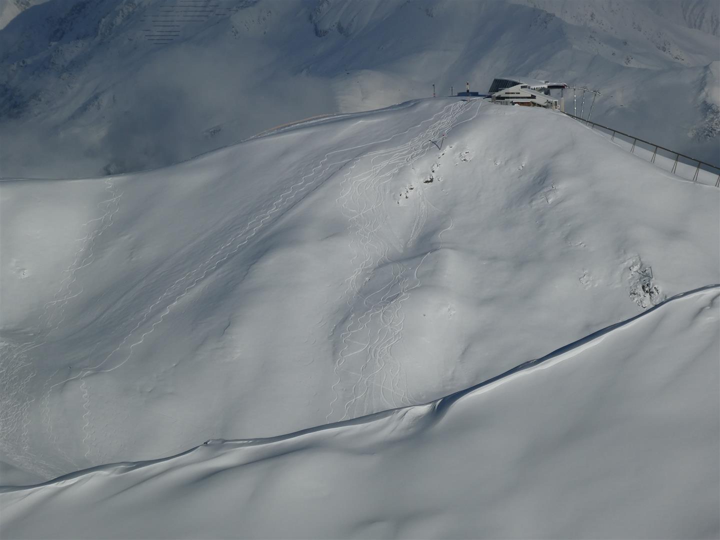
Snow quality is changing rather rapidly, in step with the season. Wherever there was perfect powder two days ago there are now mostly breakable crusts.
Sprays of powder only in high-alpine shady zones starting tomorrow, Friday, 26.04. And even that power will soon “bite the dust” – and thus the current snowpack surface will not be a potential weak layer for the increasing snowdrift masses at high altitude starting tomorrow, Friday, 26.04.