Increasing danger of dry-snow avalanches

Low temperatures, fresh snow and wind are the ingredients of current avalanche danger. Particularly in gullies, bowls and behind discontinuities in the terrain, the freshly-generated trigger-prone snowdrift accumulations are often hard to recognize due to poor visibility. Especially in areas where fresh snow has been heavy, such avalanche prone locations are frequent and far-reaching. Releases can grow to medium size. The gliding snow problem dropped into the background when temperatures descended, nonetheless such natural triggerings are still possible.

Wintery weather brings back wintery avalanche danger

Powerful fronts delivering additional northern barrier cloud systems

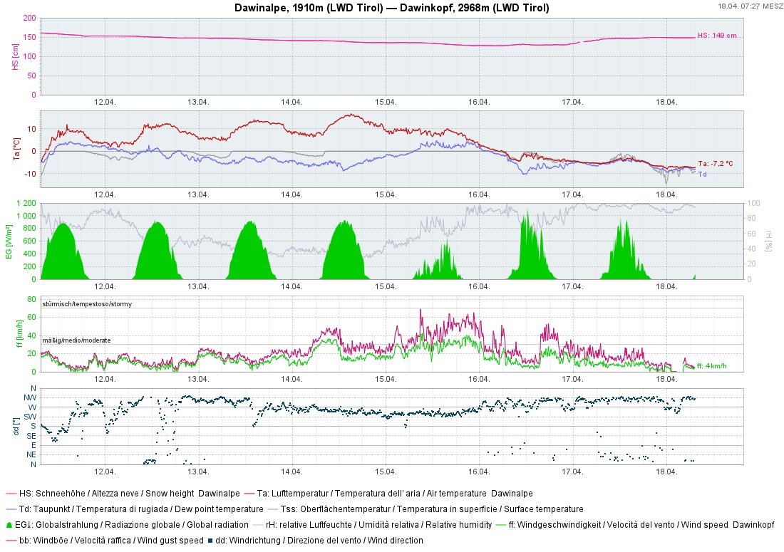
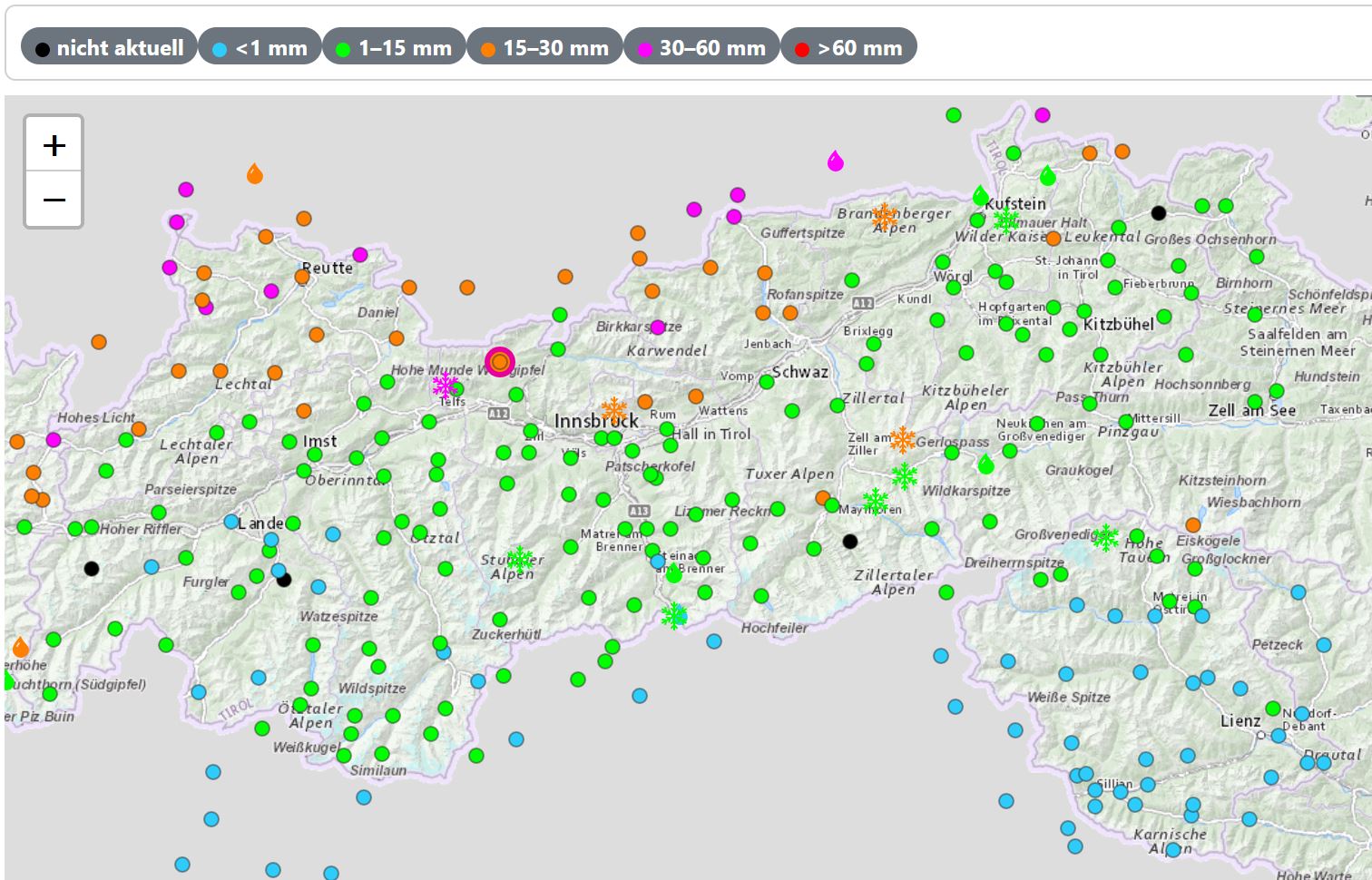
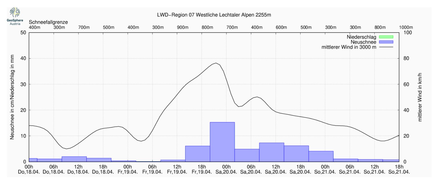
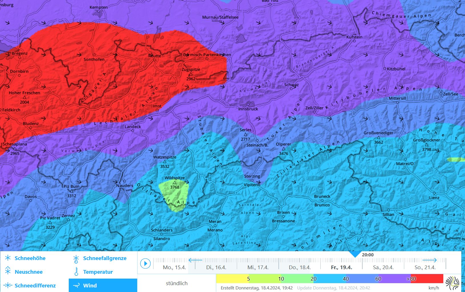
Since temperatures dropped significantly on Monday night, the snowfall level has been 1000 m and lower and snowfall followed on its heels. Most of it was registered in western and northern regions, inneralpine zones had less than anticipated.

Winds were often above transport speed, thus generated fresh snowdrift accumulations. At the same time, the wet and weakened snowpacks we had last weekend were able to consolidate again. Often up to high alpine regions there is currently a thick melt-freeze crust which is capable of bearing loads beneath the fresh snow and drifts .

In der Nacht auf Dienstag, 16.04. sind die Temperaturen um mehr als 10 Grad gefallen und haben der hohen Nassschneeaktivität der Tage zuvor ein Ende gesetzt. In den Tagen danach bildete sich an der Schneeoberfläche eine zunehmend dicke Kruste, auf welcher nun etwas Neuschnee abgelagert wurde.
On Monday (15.04) during the night temperatures dropped more than 10 degrees and put an end to the heightened wet-snow activity of the days prior. Thereafter the snowpack surface formed an increasingly thick crust atop of which fresh snowfall was then deposited.
Niederschlagsverteilung seit Dienstag, 16.04.: In den Nordstaulagen vom Arlberg bis ins Karwendel wurde am meisten Niederschlag verzeichnet. Die Schneefallgrenze lag dabei stets in tiefen oder mittleren Lagen.
Distribution of precipitation since Tuesday, 16.04: most of it in the northern barrier cloud regions from Arlberg to Karwendel. Snowfall level was at low-to-intermediate altitudes.

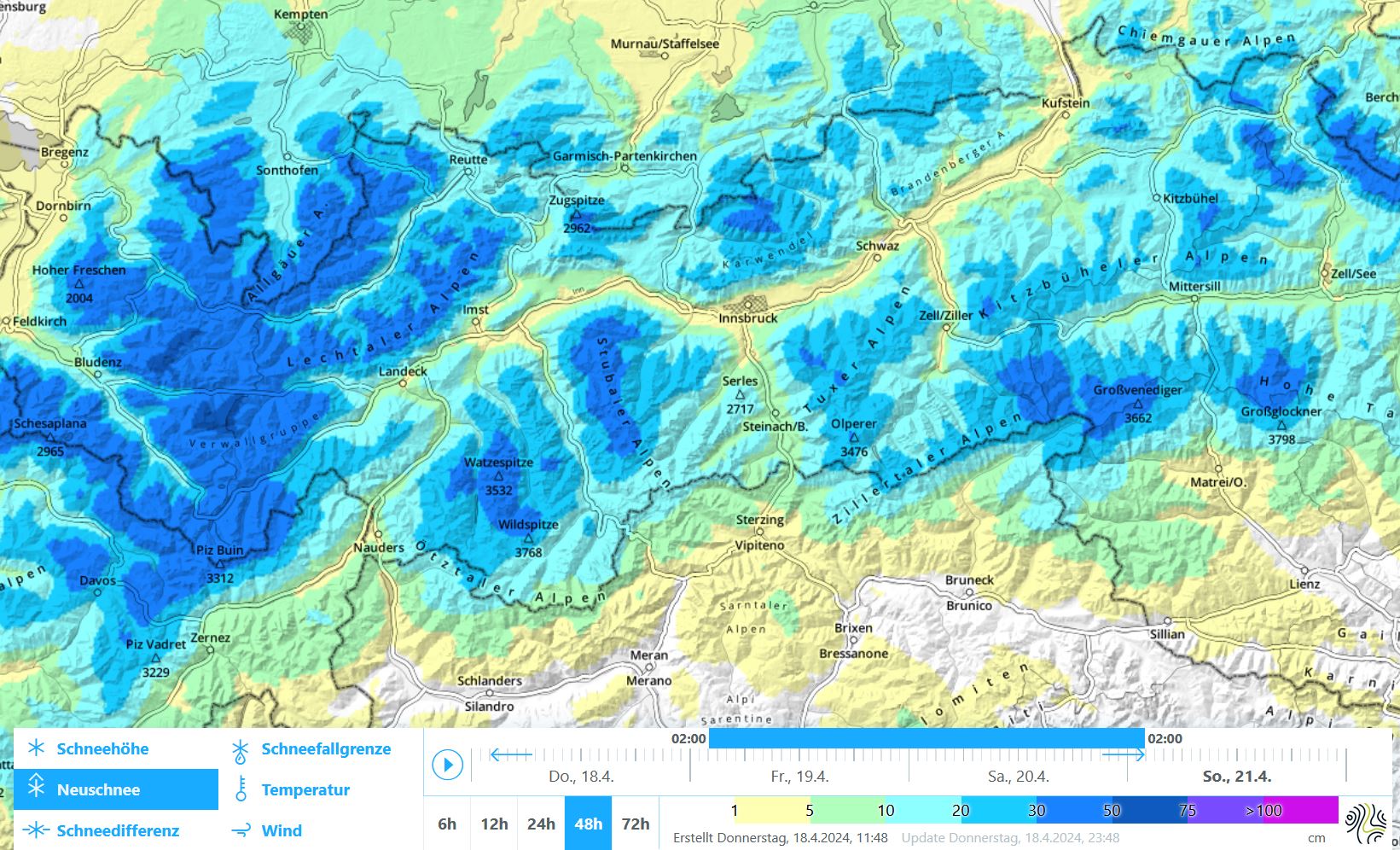
On Friday, 19.04 a further front will reach us from the north. After a dry start to the day, precipitation is expected to set in during afternoon or evening. Persistent, heavy snowfall is anticipated particularly from Arlberg to Karwendel. By Saturday evening, 20-40 cm of fresh snow is expected, in the barrier cloud regions 50 cm is possible. Intensifying winds will transport the fresh snow anew.

48h- Neuschneesumme (inkl. Setzung) von Freitag, 19.04. und Samstag, 20.04. Es ist nicht unwahrscheinlich, dass - abweichend dieser prognostizierten Verteilung - die Nordstaulagen am meisten Neuschnee abbekommen werden.
48-hr fresh snow (incl. settled amounts) from Friday, 19.04 and Saturday, 20.04. It is quite possible that contrary to the above forecast, the northern barrier cloud regions will get the largest part of it.
In den Lechtaler Alpen beginnt es bereits am Nachmittag zu schneien. Die Hauptintensität wird noch in der ersten Nachthälfte erwartet. Der Wind (schwarze Linie) legt deutlich an Stärke zu.
In the Lechtal Alps, snowfall will begin in afternoon, the most intense phase is expected in the early nighttime hours. Winds (black line) will intensify noticeably.
Prognostizierter Mittelwind in 3000m Höhe: Der Wind weht am Freitagabend zunächst stark bis stürmisch aus westlichen Richtungen, dreht bis Samstag vermehrt auf Nord und lässt an Stärke etwas nach.
Forecast middle wind at 3000 m: strong to stormy on Friday evening from the west, shifting to northerly on Saturday and slackening off somewhat.

Main danger: freshly generated snowdrift accumulations

The wintery weather is mirrored in the avalanche danger situation. The wet-snow problem which dominated the overall situation until Monday, 15.04, is gone, at least for the moment. The snowpack which was often moist-to-wet down to the ground currently lies beneath a thick crust which will not trigger.

What remains: fresh snowdrift accumulations which have been generated by moderate winds over the last few days and which will grow in frequency and in size starting on Friday afternoon due to heavy snowfall and strong winds. Particularly in the regions with heavy snowfall, Danger Level 3, Considerable, will be reached on Friday evening. Avalanches can grow to medium size and be highly dangerous for winter sports enthusiasts. Potential weak layers: loose fresh snow or graupel. Danger zones occur especially in very steep gullies, bowls and behind discontinuities in the terrain above 2000 m. They will be difficult to recognize due to poor visibility.

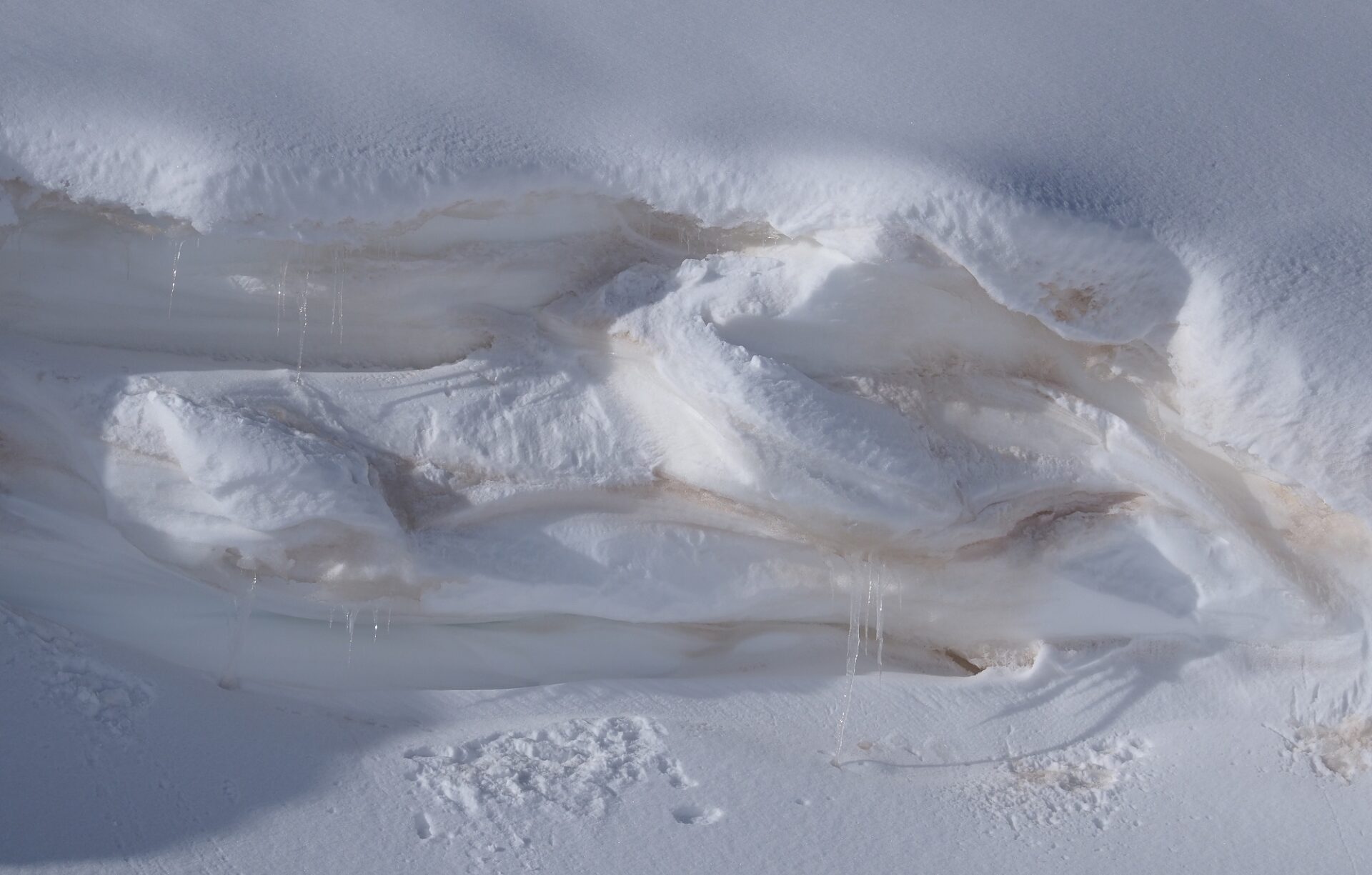
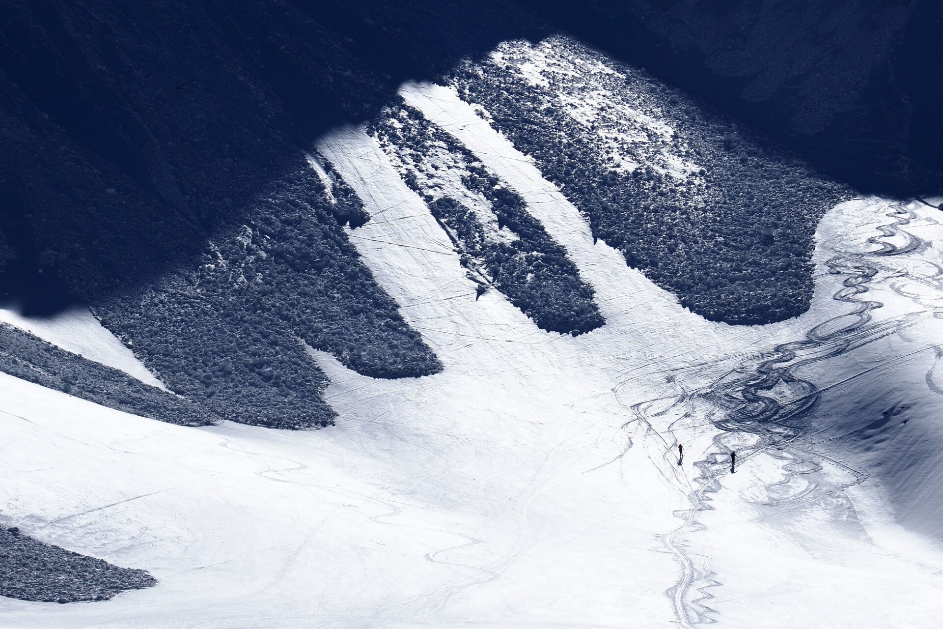
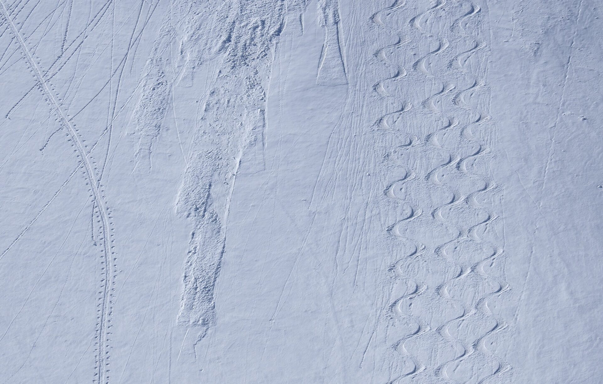
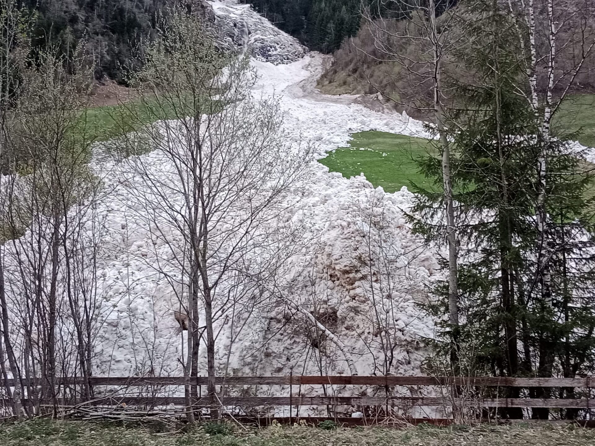
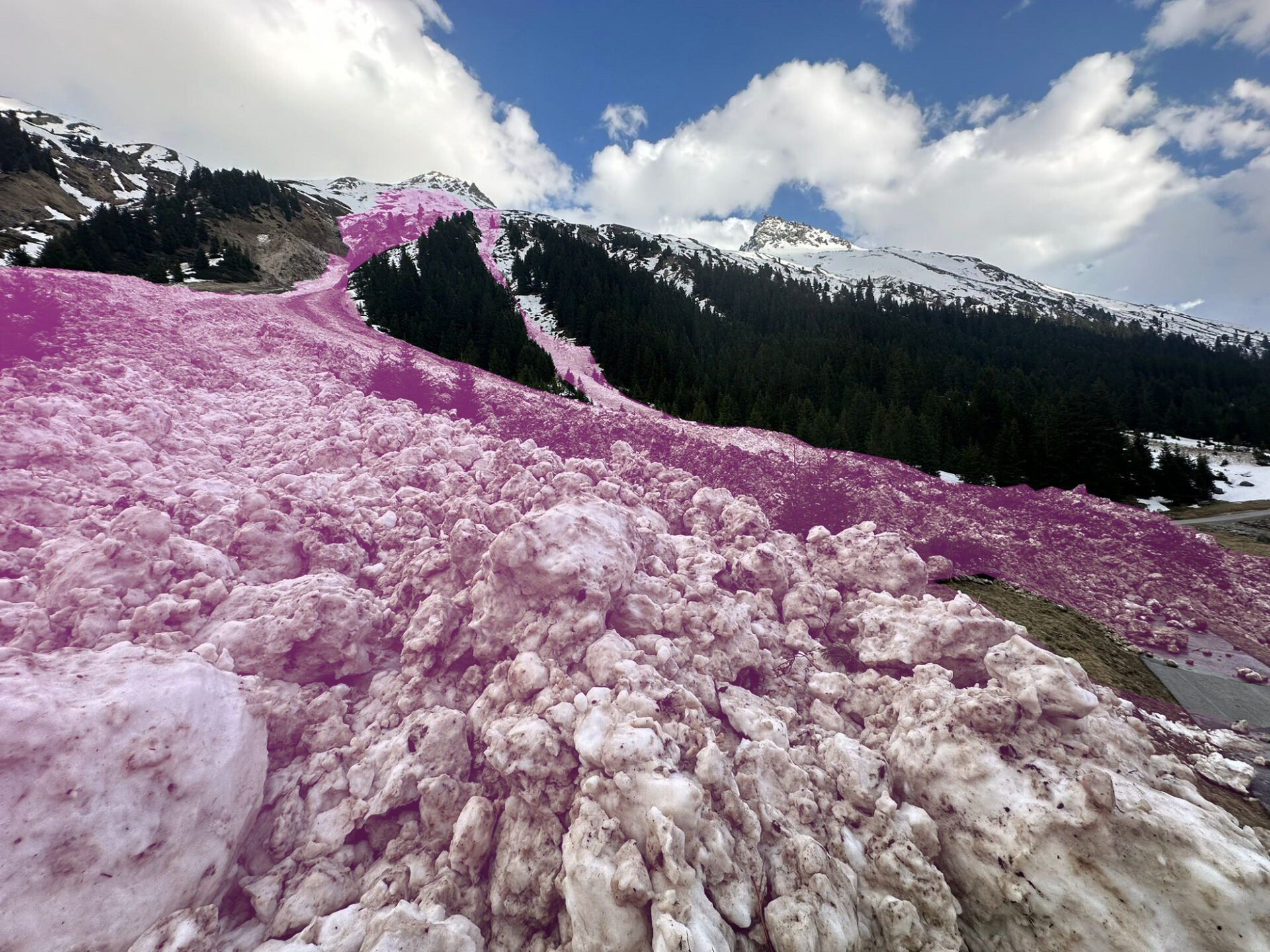
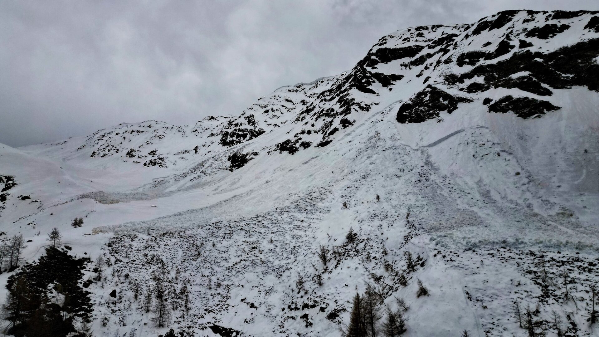
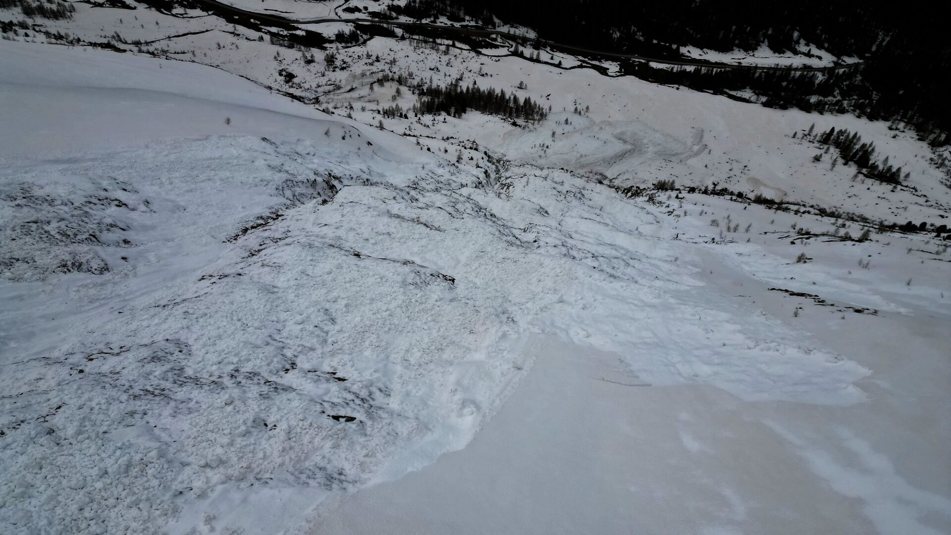
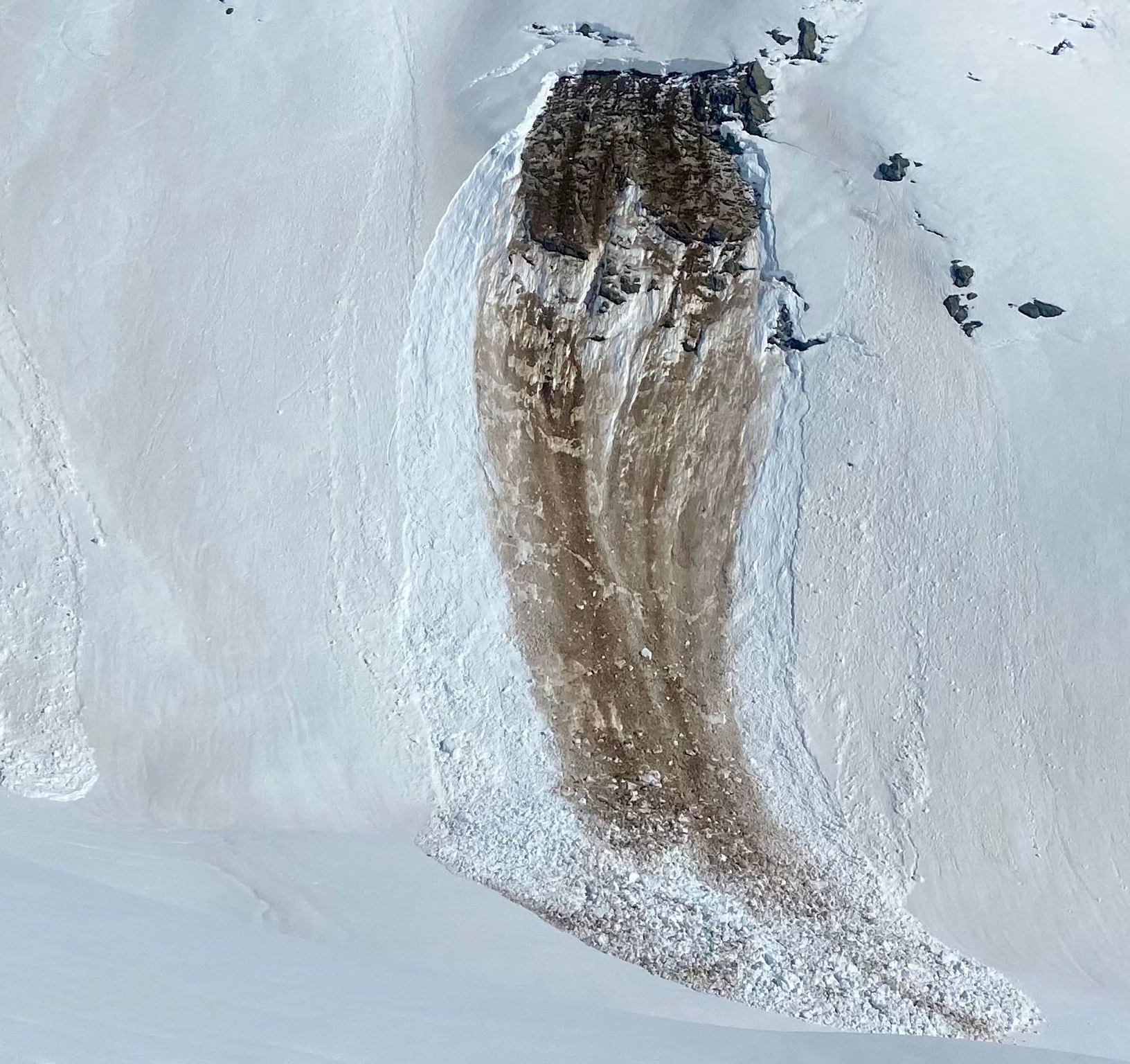
Gliding snow activity has receded measurably in the last few days. Isolated avalanches were still reported, however. Even if the danger is no longer as acute and there seems to be far less activity, attentiveness to glide cracks remains imperative in order to avoid the avalanche prone locations.

Sehr hohe Gleitschneeaktivität war in den vergangenen beiden Wochen zu beobachten. Seit der Abkühlung ist auch die Gleitaktivität spürbar weniger geworden (Foto: 13.04.2024, ©Markus Lorenz).
High glidiing snow activity over the last two weeks. Since temperatures dropped, it receded. (photo: 13.04.2024, ©Markus Lorenz).

Starting on Sunday: weather slowly improving, still low temperatures

On Sunday, 21.04, the weather will start to improve. Winds will slacken off, clouds may disperse. In case of solar radiation and diffuse light, numerous small-to-medium loose-snow avalanches will trigger naturally in steep rocky terrain. At the same time, the radiation will help the snowdrift accumulations to quickly settle and consolidate, at least on sunny slopes. On very steep shady slopes they will remain prone to triggering for a bit longer.

Next week the weather will continue to improve in the mountains. Sunshine and clouds will alternate, temperatures gradually climb, but it will remain cool.

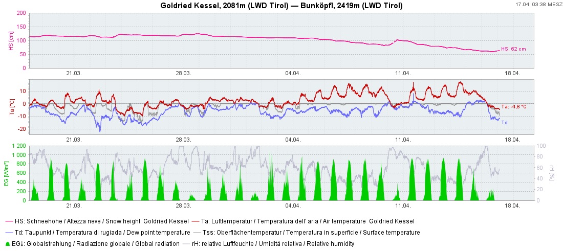
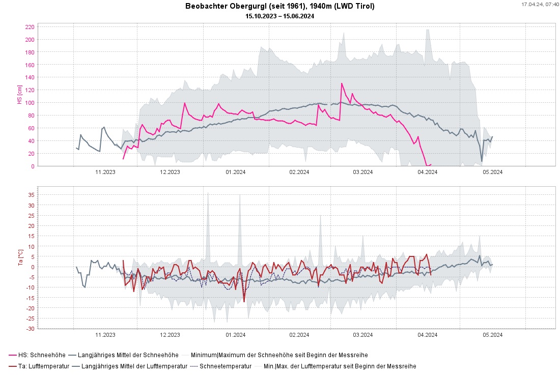
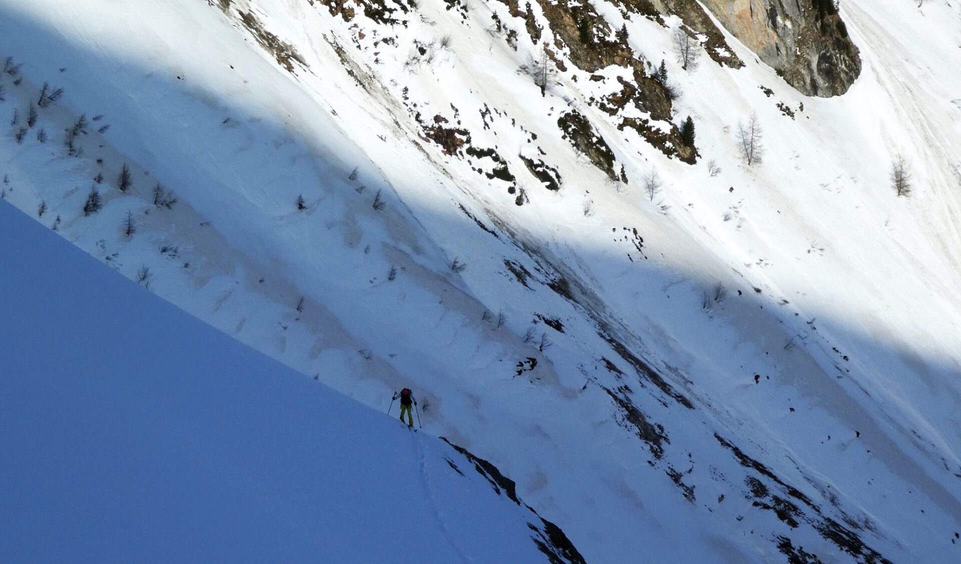
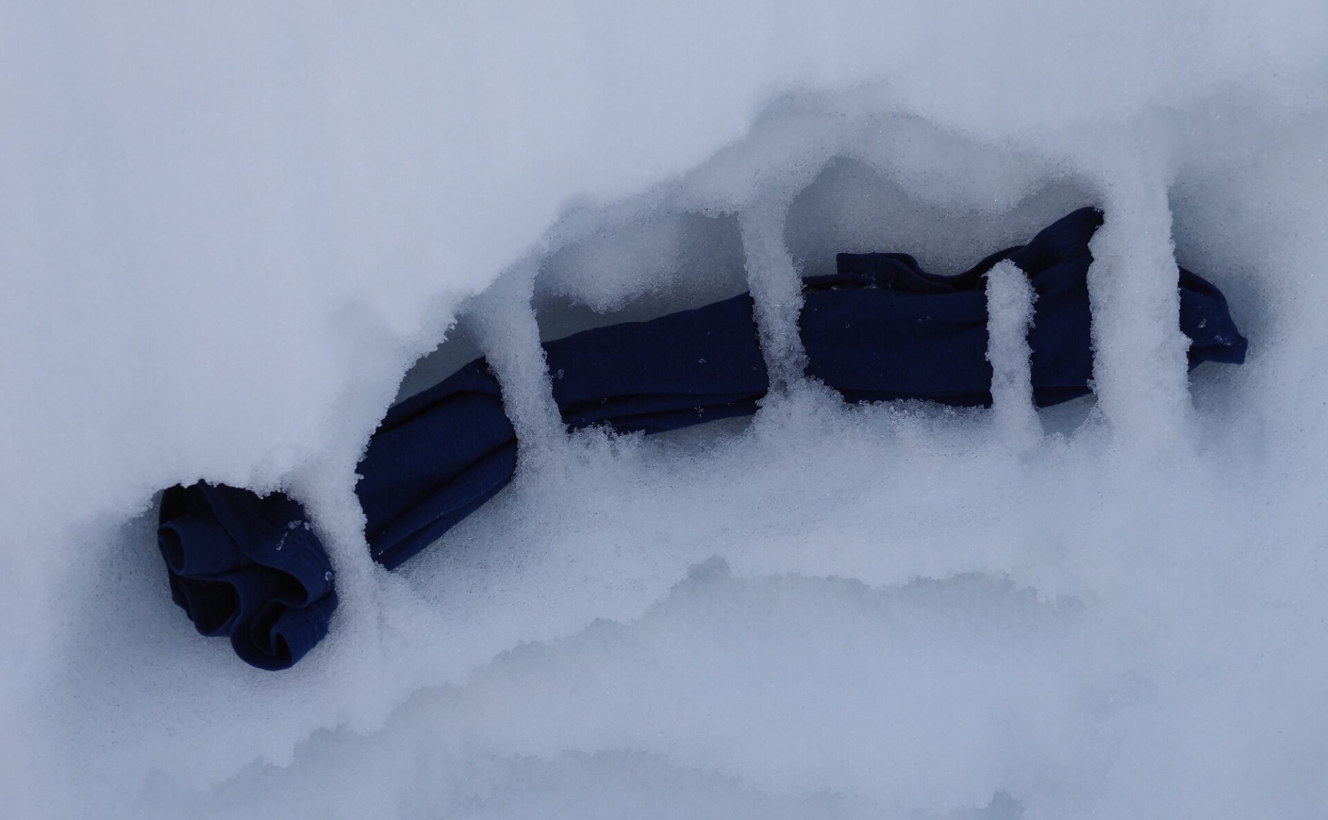
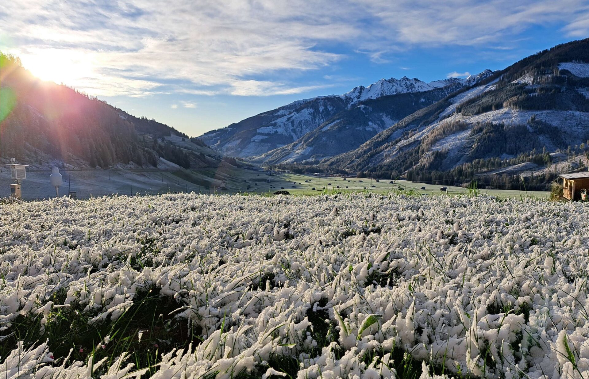
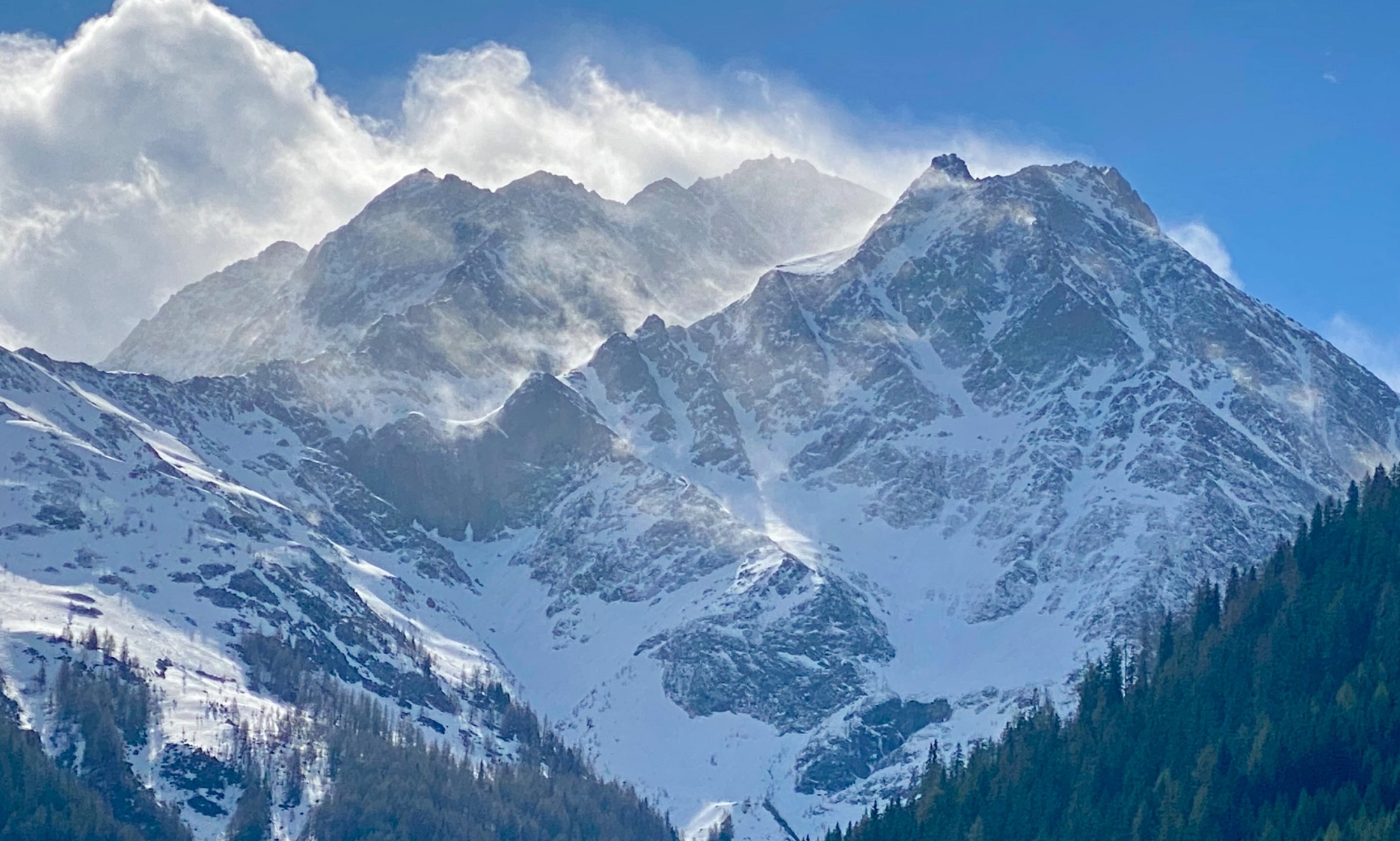
Pictorial review of last week

Vor allem unterhalb 2400m haben die außergewöhnlich warmen Temperaturen in den vergangenen zwei Wochen für einen deutlichen Rückgang der Schneehöhe gesorgt. Besonders augenscheinlich wurde dies an Sonnenhängen. Im Bild die Daten der automatischen Wetterstation 'Goldried Kessel' in der Granatspitzgruppe in Osttirol.
Especially below 2400 m the unusually high temperatures during the last two weeks reduced snow depths noticeably. Above: data from Goldried Kessel weather station in the Granatspitz range in East Tirol.
Während die Schneehöhe (magenta, oben) bei unserem Beobachter in Obergurgl Anfang März im Vergleich zum Mittel der vergangenen 60+ Jahre (blau) noch überdurchschnittlich war, schmolz diese bis Mitte April vollends ab. Unten die gemessenen Temperaturen (rot) im Vergleich zum Mittel (blau).
While the snow depths (upper graph, magenta line) were still above average in Obergurgl at the beginning of March compared to the mid-sixties (blue line), by mid-April it had all melted. Lower graph: the temperatures (red line) compared to the medium value (blue line).
Die Rücken im Hintergrund des Skitourengehers sind abgeblasen. Zum Vorschein kommt der Saharastaub, welcher dort am 09.04. mit Niederschlag abgelagert wurde. Kleiner Kaserer (Foto: 12.04.2024, ©Barbara Fink).
The broad ridges in the background are windblown. Sahara dust is visible, which was deposited on 01.04 and 09.04 together with the precipitation. Kleiner Kaserer (photo: 12.04.2024, ©Barbara Fink).
Auch in dieser Schneeformation lässt sich der eingelagerte Saharastaub erspähen (Foto: 12.04.2024, ©LWD Tirol).
Even in this snow sculpture, the Sahara dust is easily visible. (photo: 12.04.2024, ©LWD Tirol).
In sogenannten Schmelzkanälen erfolgt während Phasen intensiver Schneeschmelze ein kanalisierter Wasserfluss von der Schneeoberfläche hin zum Boden. Wird es wieder kälter gefriert das Wasser naturgemäß und hinterlässt Eissäulen im Schnee (Foto: 11.04.2024, ©LWD Tirol).
In so-called melting channels, water drainage from the snowpack surface down to the ground is intensified during periods of heightened melting. When it gets cold again, the water freezes, leaving behind ice pillars in the snow. (photo: 11.04.2024, ©LWD Tirol).
Mit den warmen Temperaturen verlor die Schneedecke an Festigkeit. Besonders zahlreich konnten während dieser Zeit nasse Lockerschneelawinen beobachtet werden. Kühtai (Foto: 13.04.2024, ©LWD Tirol).
In the higher temperatures the snowpack forfeited its firmness. During this summer-like period there were numerous wet loose-snow avalanches observed on extremely steep slopes. Kühtai (photo: 13.04.2024, ©LWD Tirol).
Bie gutem Timing konnten v.a. am Freitag, 12.04. und Samstag,13.04. auf den Bergen teils sehr gute Bedingungen angetroffen werden (Foto: 13.04.2024, ©LWD Tirol).
If your timing was good, particularly on Friday, 12.04, and Saturday, 13.04, there were excellent conditions to be enjoyed in the mountains. (photo: 13.04.2024, ©LWD Tirol).
Gleichzeitig schwächten die hohen Temperaturen und die Sonneneinstrahlung die Schneedecke im Tagesverlauf. Teilweise lösten sich große spontane Lawinen, welche wie hier im Kaunertal auch bis ins Grüne vorstießen (Foto: 13.04.2024, ©Reinhold Plankensteiner).
Simultaneously, the high temperatures and solar radiation weakened the snowpack during the course of the day. In some places, large-sized avalanches triggered naturally which plummeted down to greenlands, like here in Kaunertal. (photo: 13.04.2024, ©Reinhold Plankensteiner).
Als ein besonders lawinenaktiver Tag zeigte sich der Montag, 15.04. Es regnete bis auf rund 2800m, gleichzeitig war die Luft sehr feucht und der Wärmeeintrag in die Schneedecke hoch. Im Bild eine große bis sehr große, spontane nasse Schneebrettlawine im Jamtal, angebrochen an einem Nordwesthang auf rund 2500m (Foto: 15.04.2024, ©Otmar Hauser).
A particularly active avalanche day occurred on Monday, 15.04. It rained up to 2800 m, the air was very moist and diffuse light conditions reigned. The warmth impact on the snowpack was enormous. In the photo, a large to very-large naturally triggered wet slab avalanche in Jamtal, fractured on a NW slope at 2500 m. (photo: 15.04.2024, ©Otmar Hauser).
Spontane, große nasse Schneebrettlawine vom 15.04. an einem Nordhang auf ca. 2300m im Defereggental (Foto: 16.04.2024, ©Mark Kleinlercher).
Naturally triggered large-sized wet slab avlanche on 15.05 on a north-facing slope at 2300 m in Defereggental (photo: 16.04.2024, ©Mark Kleinlercher).
Ablagerung einer großen nassen, spontanen Schneebrettlawine, welche am 15.04. am Kerleskopf im Bereich des Staller Sattels an einem Nordhang auf ca. 2500m angebrochen war (Foto: 16.04.2024, ©Mark Kleinlercher).
Deposit of a large wet naturally triggered slab avalanche which broke on Kerleskopf near the Staller Sattel on a north-facing slope at 2500 m on 15.04 (photo: 16.04.2024, ©Mark Kleinlercher).
Der Winter ist auch in Obertilliach wieder bis ins Tal zurückgekehrt (Foto: 17.04.2024, ©Hansjörg Schneider).
In the interim, winter has returned down to the valley also in Obertilliach. (photo: 17.04.2024, ©Hansjörg Schneider).