Early summer brings marked increase of wet-snow avalanche danger!

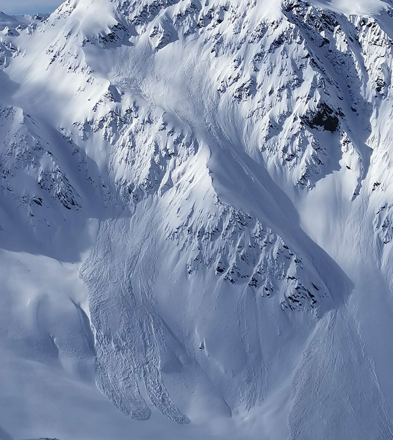
Solar radiation and high temperatures are leading to increased water penetration of the snowpack over coming days. We expect, particularly on east and west-facing slopes, but also on south-facing slopes in high alpine regions, a completely wet snowpack for the first time. And with it, a striking increase of avalanche danger. Numerous naturally triggered wet-snow avalanches are anticipated. Simultaneously, gliding snow activity will again increase. Avalanches can grow to large size and plummet in canalized plummet paths down to greenland. This coming weekend it will be necessary to terminate backcountry tours and ascents to huts during the morning hours.

Outlook for this weekend

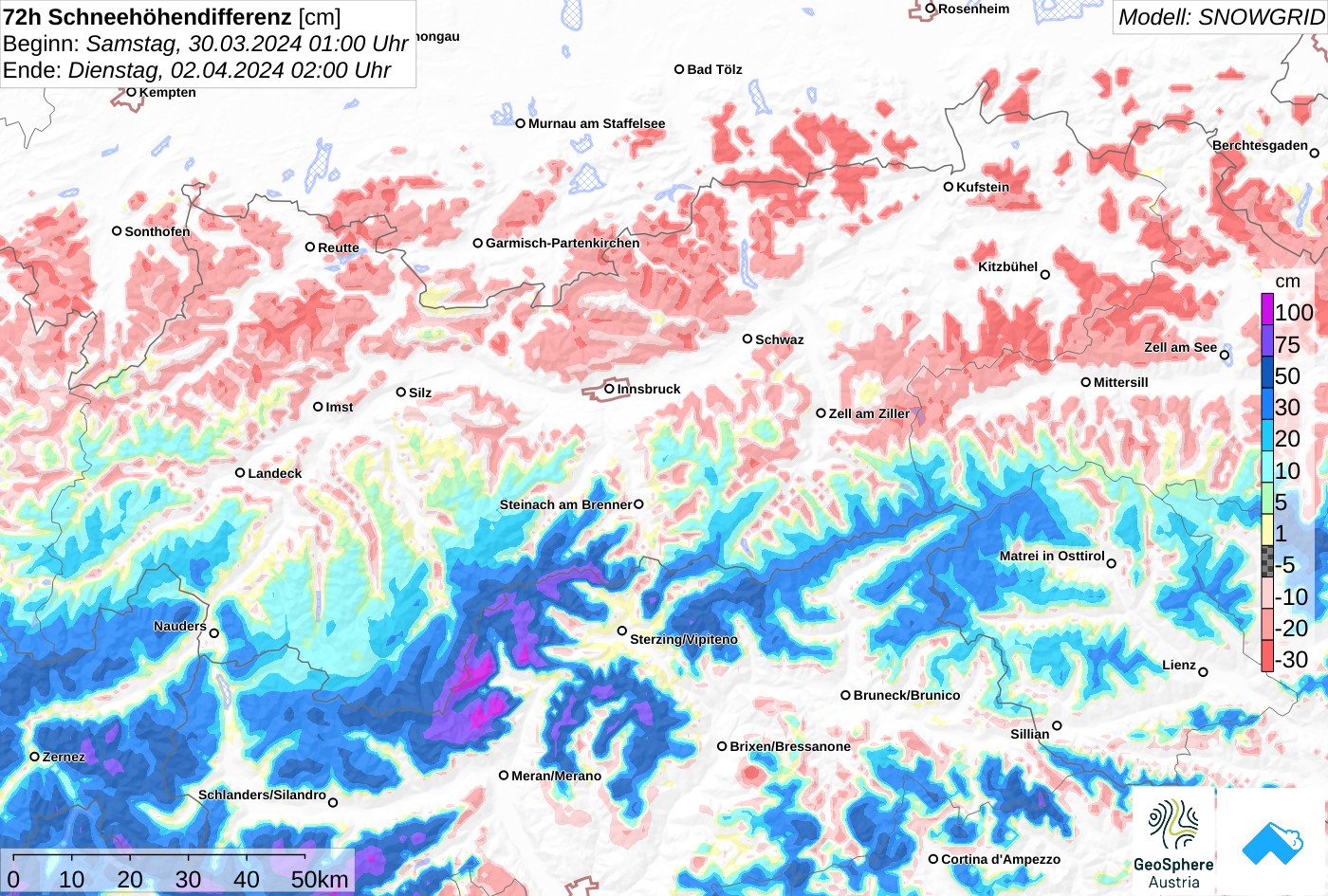
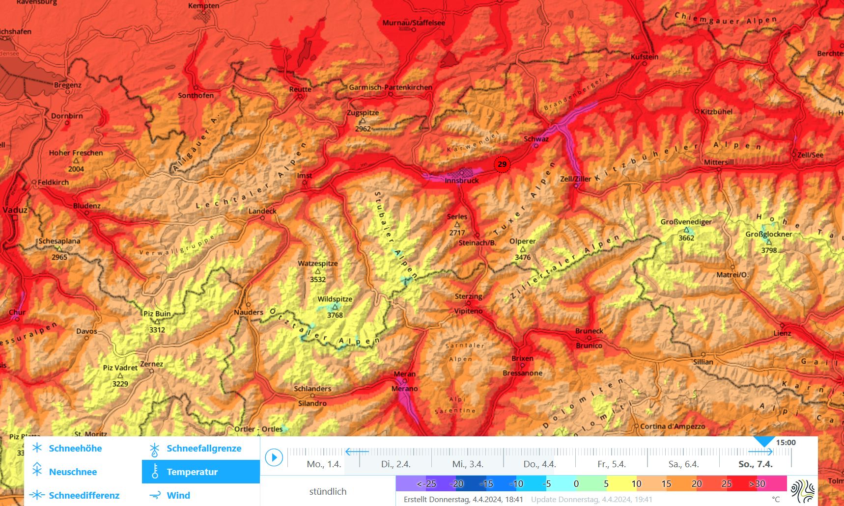
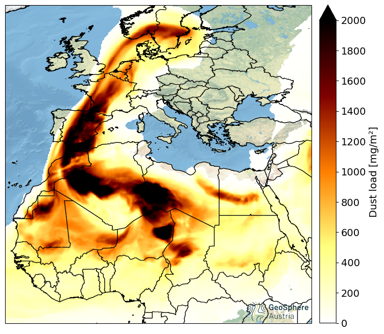
Extremely mild air masses, Sahara dust

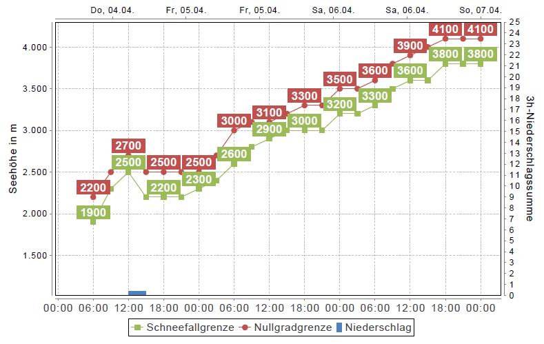
Over the next few days, a southwesterly airstream will bring dry and (for this juncture of the season) extraordinarily warm air masses our way. The zero-degree level will climb to above 4000m by Sunday, 07.04. That means that even at 3000m the thermometer could climb to 10 degrees. In the Inn Valley we might reach summertime values of 30 degrees. And once again, dust from the Sahara Desert will be blown our way and make the atmosphere hazy.

Die Temperaturen steigen in den kommenden Tagen von Tag zu Tag etwas an. Die Nullgradgrenze stößt am Sonntag in für die Jahreszeit außergewöhnlich große Höhen vor (©Oberlandwetter).
Temperatures will rise from day to day. On Sunday the zero-degree level will reach extraordinary altitudes for this juncture of the season. (©Oberlandwetter).
Prognostizierte Temperaturen für Sonntagnachmittag, 07. April. Im Inntal sind gebietsweise bis 30 Grad möglich.
Forecast temperatures for Sunday midday, 07.04. In the Inn Valley, 30 degrees is possible in some regions.
Mit der Südwestwetterlage wird erneut Saharastaub in unsere Breiten transportiert. Allerdings geschieht dies voraussichtlich in geringerem Ausmaß als Ende vergangener Woche (©GeoSphere Austria).
Due to a southwesterly airstream, Sahara dust will again be transported to our latitudes. This time, however, to a lesser extent than last week. (©GeoSphere Austria).

Moisture deeply penetrating the snowpack

The snowpack has been quite wintery until now. Moisture reaching down to the ground has only been evident on south-facing slopes below 2800m, and in general below 2200-2400m. This will change radically in the next few days: weather like in early summer and strong solar radiation will make the snowpack wetter than ever.

Schneeprofil an einem 29 Grad steilen Südhang auf rund 2800m in der Glocknergruppe. Die Schneedecke ist noch trocken und wird in den kommenden Tagen erstmals durchfeuchtet werden.
Snow profile on south-facing slopes at 2800m in Glockner Massif. The snowpack is still dry, but will become thoroughly wet in the coming days.

We expect the snowpack to become thoroughly wet down to the ground for the first time on west and east-facing slopes up to 2800m and up to high-alpine altitudes on south-facing slopes. Also on shady slopes, a moistening of the uppermost part of the snowpack up to 2400m will play a part, but a completely wet snowpack down to the ground is only to be expected where there is little snow.

Modellierte Schneedecke bis Montag, 8.4. für einen 35 Grad steilen Westhang an der Wetterstation Sonnbergalm (2529m) in der Gurglergruppe. Die in hellroter Farbe gekennzeichneten Schmelzformen entstehen aufgrund des Eindringens von Wasser in die Schneedecke. Rot-schwarz strichliert dargestellt sind Schmelzkrusten. Diese entstehen an der Schneeoberfläche durch das Wiedergefrieren der Schmelzformen während meist klaren Nächten.

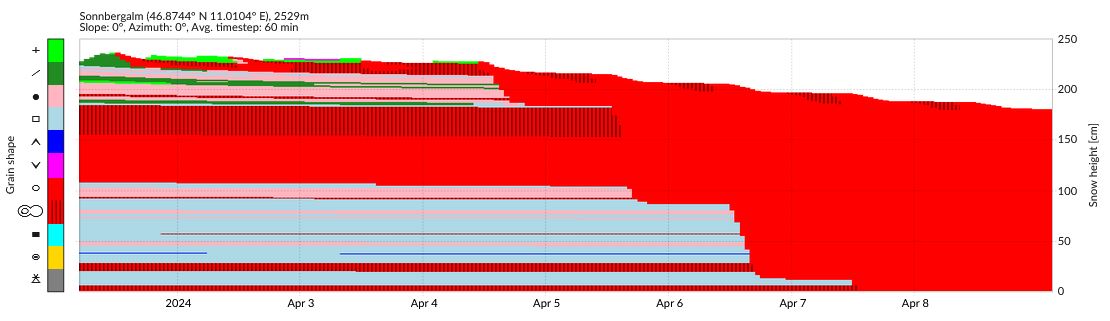
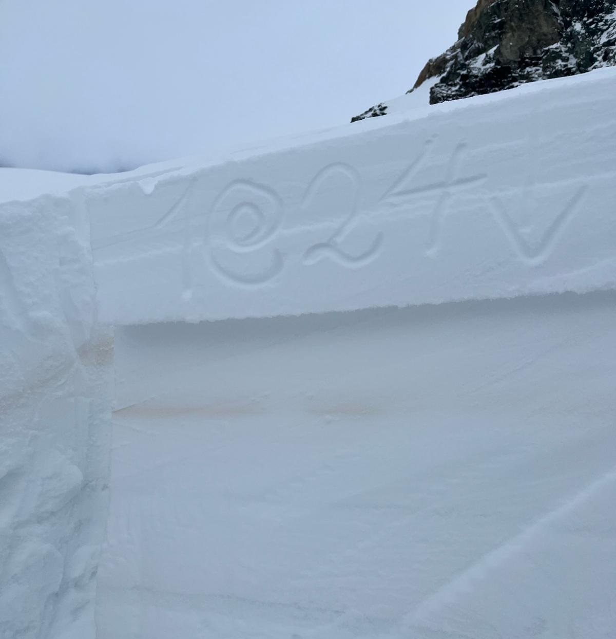
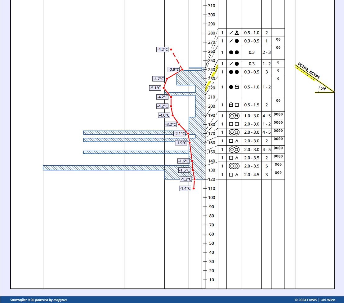
Snowpack model until Monday 8.4 for a 38° steepness gradient west-facing slope at Sonnbergalm weather station (2529m) in the Gurgler range. The bright red zone characterizes melting forms which are generated by water penetrating the snowpack. Red-black dashes depict melt-freeze crusts which are generated on the surface by re-freezing of melting forms during nights of clear skies.

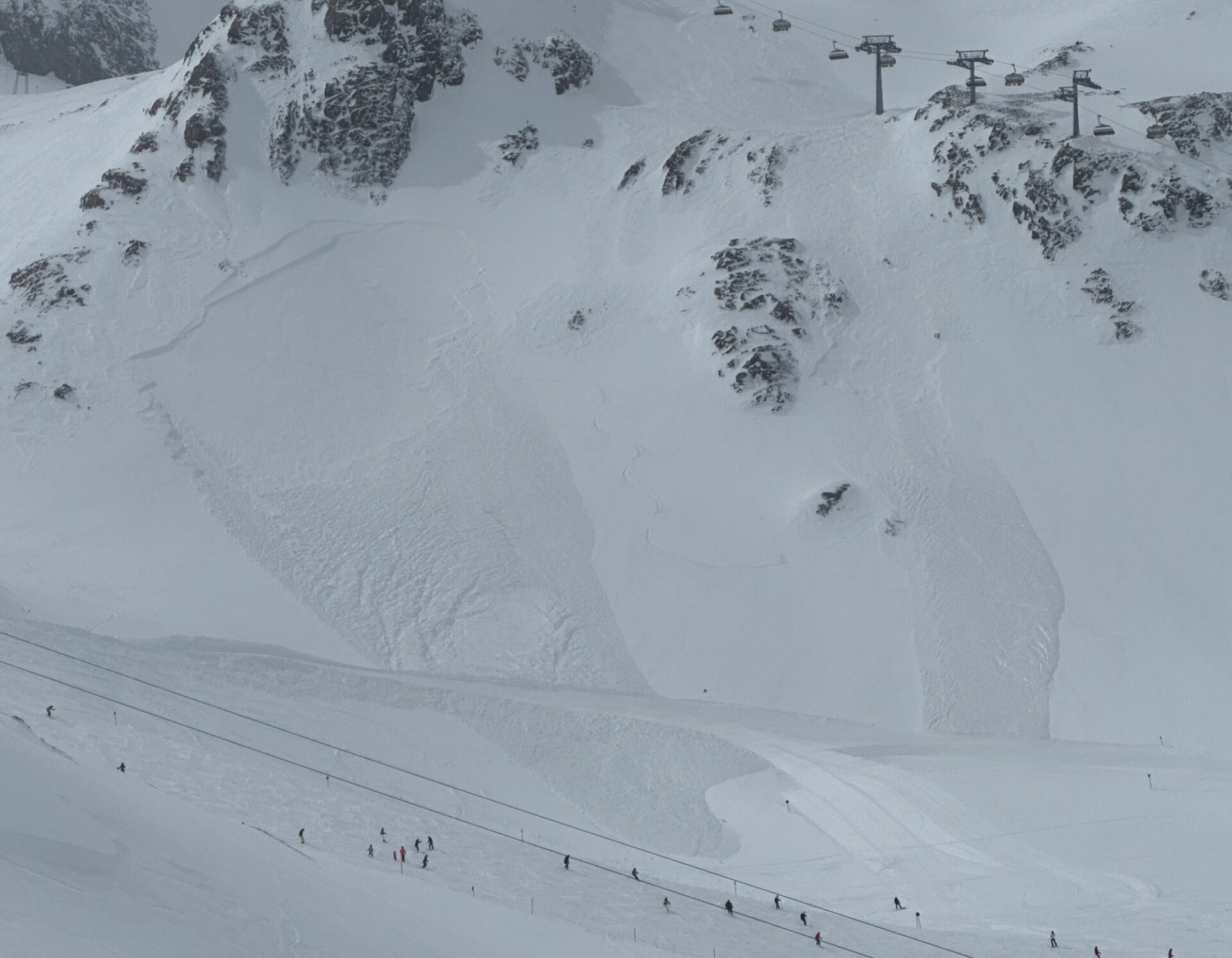
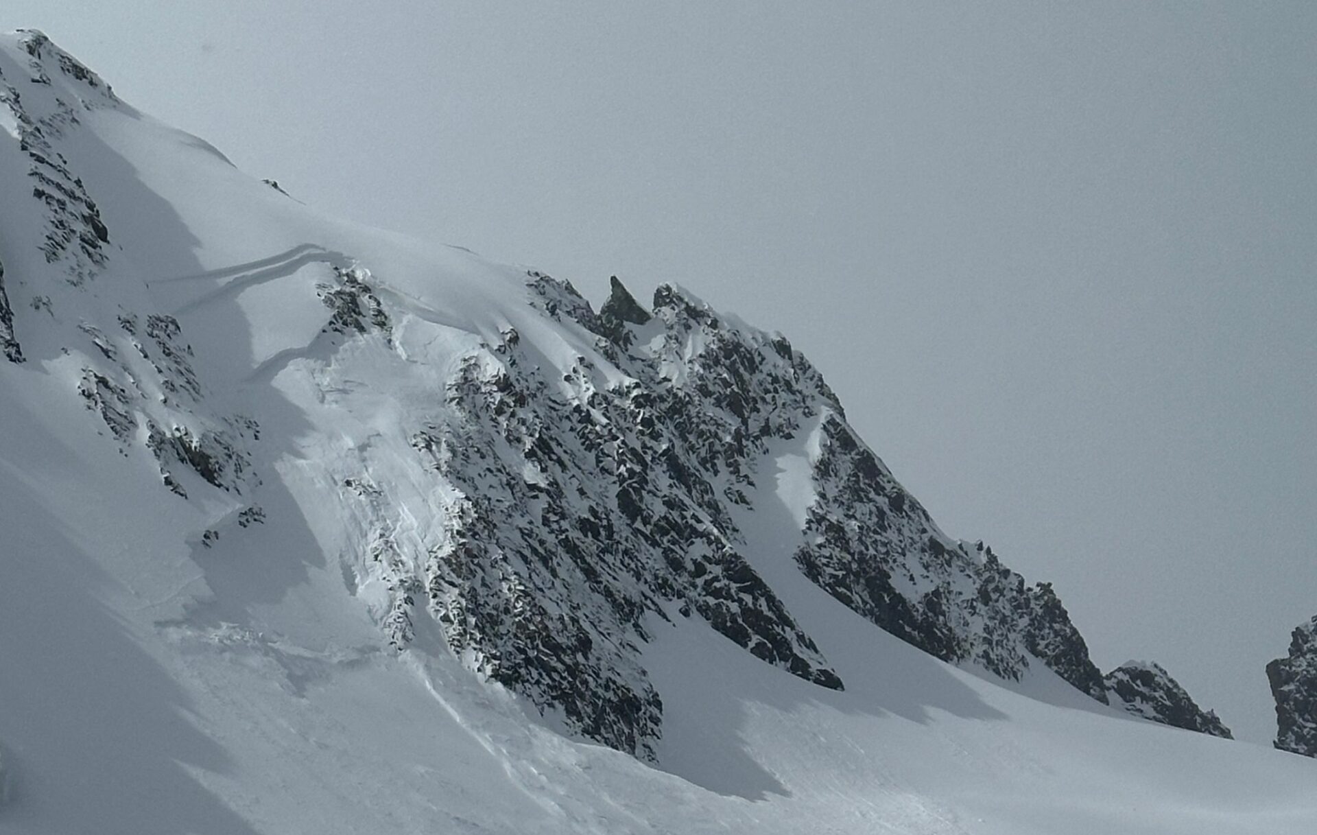
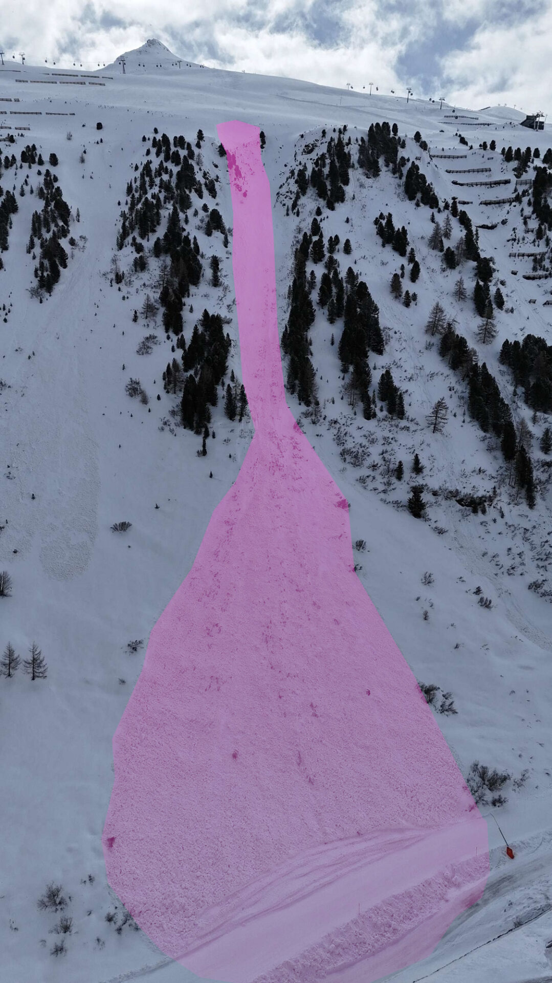
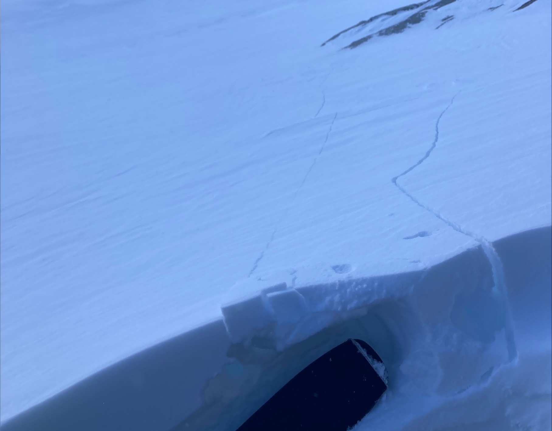
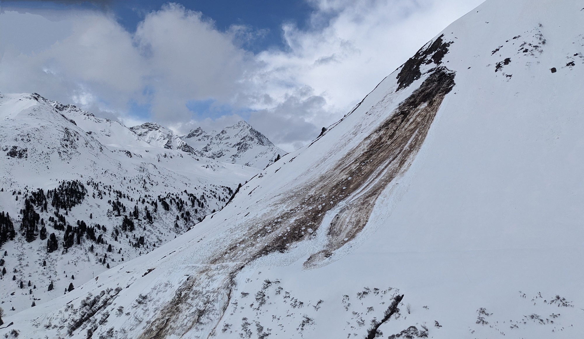
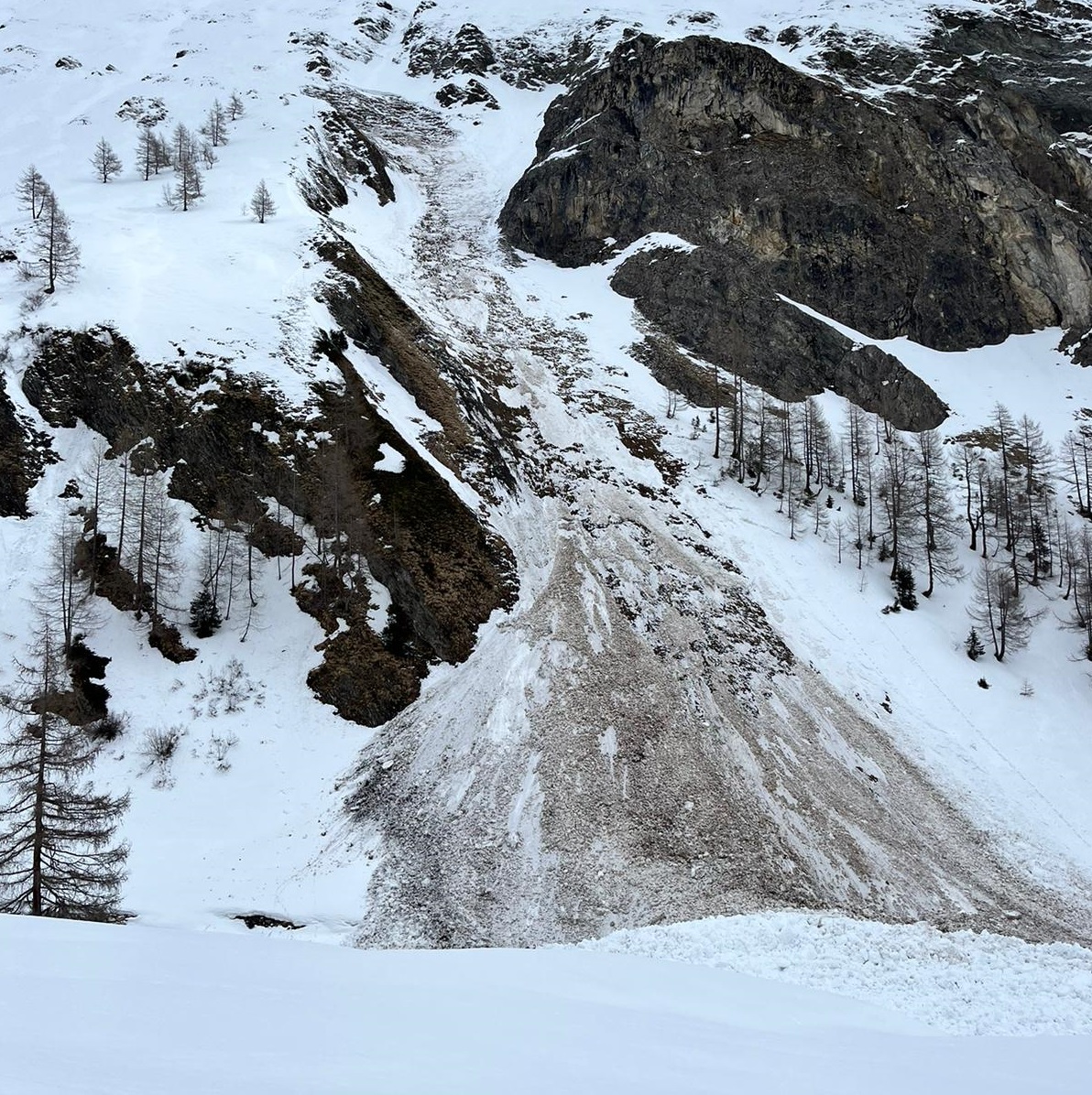
Through the melting processes the firmness of the snowpack deteriorates. Increasingly frequent wet loose-snow avalanches can be expected. As a result of water penetrating deeper into the snowpack, the likelihood of wet slab avalanches also increases somewhat from day to day. This is because rough-crystal soft layers in the lowermost part of the snowpack are weakened by the penetrating water. The good news is that the snowpack layering thereby becomes highly stable. Wet slab avalanches will thus occur only in isolated cases. Least favorable will be central and southern East Tirol and the southern Ötztal Alps, where a somewhat delayed winter launch created a less favorable structuring of the snowpack base.

At the same time, the moisture in the snowpack will also stimulate gliding snow activity. At this point in the season the gliding process is dominated by water inside the snowpack more than anything else. Thus, glide-snow avalanches will correspond increasingly to the daytime cycle of avalanche danger.

Wet-snow and glide-snow avalanches can sweep along the entire “rotten” snowpack along their plummet paths. For that reason, even large-sized avalanches are possible, reaching down to zones where there is no snow on the ground along canalized plummet paths such as gullies and trenches.

Diese Gleitschneelawine hat in ihrer Sturzbahn den nassen, ungebundenen Schnee bis zum Boden hin mitgerissen. Aufgrund der zunehmenden Durchnässung der Schneedecke wird dies in kommenden Tagen auch in hohen Lagen vermehrt ein Thema werden. Lawinen können dadurch große Ausmaße annehmen (Foto: ©Anton Riepler, 02.04.2024).
This glide-snow avalanche swept along the wet, unbonded snow down to the ground in its plummet path. Due to increasing wetness of the snowpack, this will occur frequently even at high altitudes over the next few days. Avalanches can thereby grow to large size. (©Anton Riepler, 02.04.2024).

The earlier you launch, the higher you go, the better it is

A high-pressure front will bring sunny weather as of Friday, 5.4, and nights of clear skies. Thereby, the snowpack, in spite of warm temperatures, can cool off at night and form a melt-freeze crust on the surface. This nocturnal longwave outgoing radiation will create a favorable avalanche situation in early morning, before the solar radiation swiftly softens the melt-freeze crust and avalanche danger rapidly rises during the morning hours.

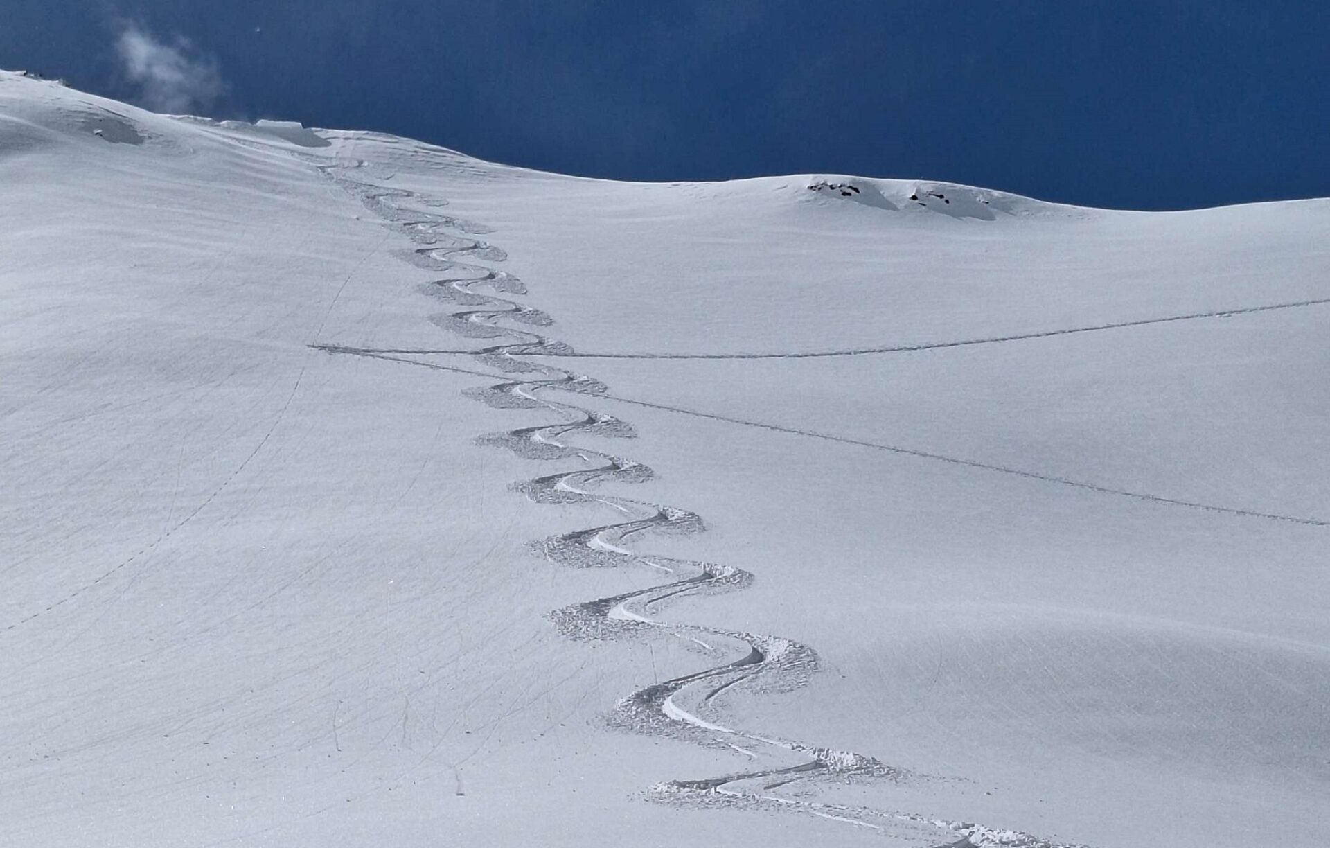
For winter sports enthusiasts, the rule of thumb this weekend is: The earlier you start and the higher you venture, the better off you are. Backcountry tours and also (endangered) ascents to huts should be brought to an end early in the day. The softening snowpack (rotten snow) and first naturally triggered (loose-snow) activity are indicators of rising danger.

Starting Wednesday, temperatures will drop

The early-summer weather, seen from today’s perspective, will persist at least into the beginning of next week before an intensifying southerly foehn wind arrives on Tuesday, 09.04, and temperatures drop, accompanied by minor precipitation. At that point, the danger of wet-snow avalanches will recede.

Review: another mercurial week

Vergangene Woche an der Wetterstation Valdafur in der Glockturmgruppe: Markant war insbesondere der über mehrere Tage anhaltende, stürmische Südföhn. Am Ostermontag, 01.04. brach der Föhn zusammen und es folgte (gebietsweise ergiebiger) Niederschlag mit einem gleichzeitigen Rückgang der Temperaturen.

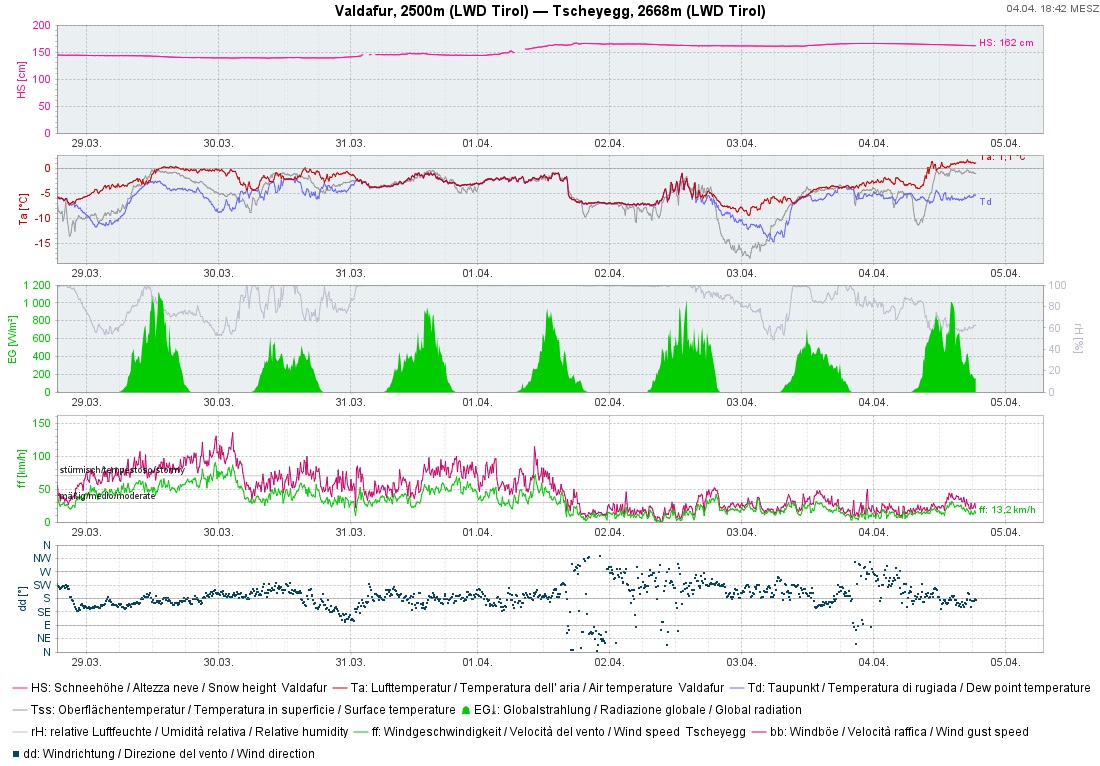
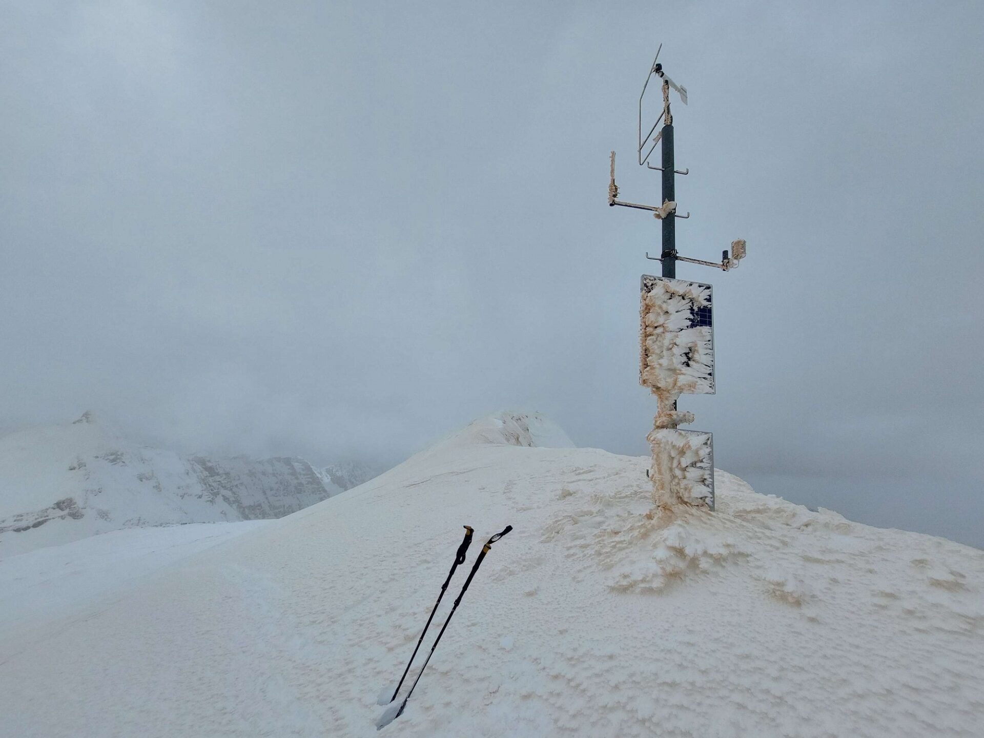
Last week at Valdafur weather station in the Glockturm range: particularly striking was the storm-strength southerly foehn wind which persisted for several days. On Easter Monday, 01.04, the foehn collapsed and precipitation followed, heavy in some places, along with lower temperatures.

Mit der Südstaulage wurden auch große Mengen Saharastaub an die Berge herangetragen. Wetterstation am Hochgasser in der Venedigergruppe (Foto: ©Peter Fuetsch, 30.03.2024).
The southerly barrier cloud situation also brought large amounts of dust from the Sahara to the mountains. Weather station on Hochgasser, Venediger Massif (©Peter Fuetsch, 30.03.2024).
Über die Osterfeiertage hat es in den Südstaulagen oberhalb von rund 2100m (in Osttirol mitunter deutlich höher) teils ergiebig geschneit. Am meisten Niederschlag wurde in der Gurglergruppe verzeichnet. Im Bild die 72h- Neuschneesumme von 30.03. bis 01.04.
Over the Easter holidays, southerly regions where barrier clouds lodged against the mountain flanks also had heavy snowfall above 2100m (higher in East Tirol). Most precipitation was in the Gurgler range. On Saturday, 01.04, avalanche danger level 4 (high) was reached. Above: 72-hr fresh snow map 30.03-01-04.
Besonders in Osttirol wurden uns von unseren Beobachtern mittelgroße bis große Schneebrettlawinen rückgemeldet, welche sich während des Niederschlags spontan lösten. Vermutlich lässt sich diese hohe Aktivität auf eine kurzzeitigen Anstieg der Temperaturen während des Schneefallereignisses zurückführen (©Mark Kleinlercher, 02.04.2024).
Particularly in East Tirol, our observers reported numerous medium-to-large sized slab avalanches which triggered naturally during the precipitation. Presumably this high activity was due to a brief rise in temperatures during the snowfall. (©Mark Kleinlercher, 02.04.2024).
Als Schwachschicht für die spontanen Schneebrettlawinen diente lockerer Neuschnee, welcher von etwas wärmerem, gebundenen Neu- und Triebschnee überlagert wurde. Gut zu erkennen ist auch die Saharastaubschicht etwa 20cm unterhalb der Bruchfläche. Das Bild gehört zum Profil im oberen Teil dieses Blogs (©Anton Riepler, 02.04.2024).
Weak layer for the naturally triggered slab avlanches was loose fresh snow which was blanketed by warmer, bonded fresh snow and snowdrifts. The layer of dust from the Sahara is easy to recognize about 20 cm below the fracture. This photo corresponds to the snow profile earlier in this blog. (©Anton Riepler, 02.04.2024).
Gute Sprengerfolge auch im Skigebiet Stubaier Gletscher (Foto: ©Günter Chwojan, 01.04.2024).
Artificially triggered avalanches in Stubai Glacier ski area were successful. (©Günter Chwojan, 01.04.2024).
Vereinzelt sind Lawinen auch in Schwachschichten tiefer in der Schneedecke durchgerissen. Auch hier handelt es sich um eine gesprengte Schneebrettlawine am Stubaier Gletscher (Foto: ©Günter Chwojan, 02.04.2024).
Isolated avalanches also fractured down to weak layers more deeply embedded in the snowpack. Above, an artificially triggered slab avalanche on Stubai Glacier. (©Günter Chwojan, 02.04.2024).
Dieses, ebenfalls bei Sprengarbeiten ausgelöste Triebschneepaket im Waldgrenzbereich in der Gurglergruppe hat in der Sturzbahn nassen Schnee mitgerissen. Links und rechts sind weitere Ablagerungen erkennbar (Foto: ©Ronald Ribis, 02.04.2024).
This artificially triggered mass of snowdrifts near forested areas of the Gurgler range swept along wet snow with it. Left and right: deposits of smaller wet-snow avalanches are recognizable. (Foto: ©Ronald Ribis, 02.04.2024).
In der Höhe waren die frisch gebildeten Triebschneeansammlungen am Dienstag, 02.04. stellenweise noch störanfällig. Der tageszeitliche Anstieg der Temperaturen und diffuse Strahlung sorgten jedoch für eine rasche Verfestigung und einen entsprechenden Rückgang der Gefahr von trockenen Lawinen. Wildkarspitze, Zillertaler Alpen (©Christopher Ludwig, 02.04.2024).
At high altitudes the freshly generated snowdrift accumulations were often still trigger-prone on Tuesday, 02.04. The daytime increase in temperatures and diffuse radiation quickly consolidated them, however, and danger of dry-snow avalanches receded. Wildkarspitze, Zillertal Alps (©Christopher Ludwig, 02.04.2024).
Mit dem Neuschnee konnten teils sehr gute Tourenbedingungen angetroffen werden. Östliche Deferegger Alpen (©Alois Mariacher, 02.04.2024).
As a result of fresh snow, good backcountry touring conditions were possible in places. Eastern Deferegger Alps (©Alois Mariacher, 02.04.2024).