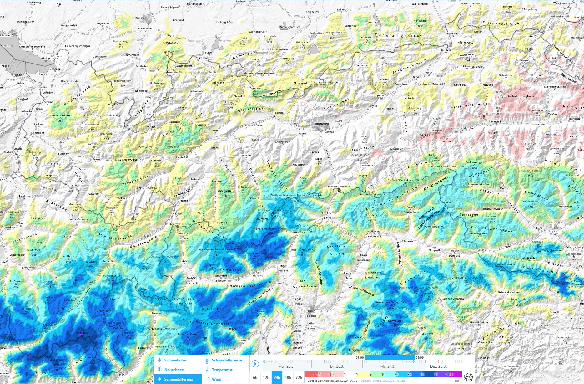
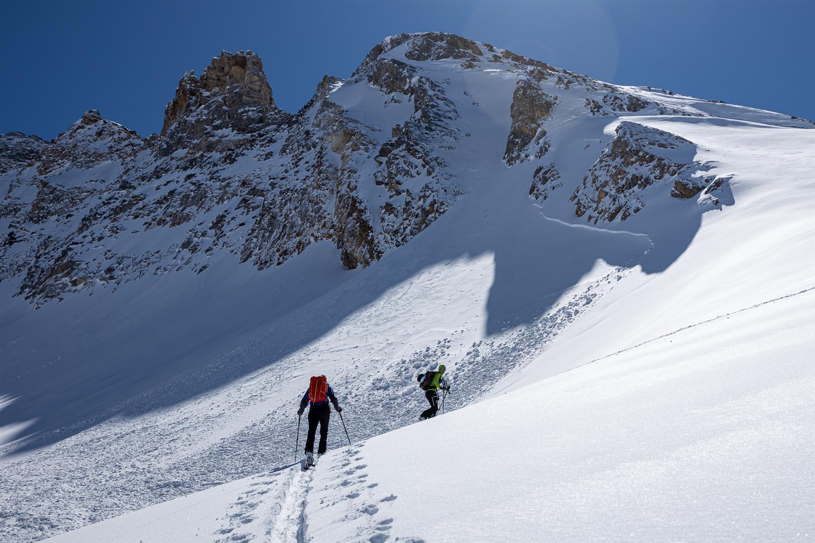
Spring is already palpable, in all its facets: deep winter at high altitudes in southern regions. Fresh snow and storm-strength winds have generated (and still do) far-reaching often trigger-prone snowdrift masses. At lower altitudes the snowpack is becoming quite moist/wet and this will continue over the next few days. We expect numerous loose-snow avalanches in extremely steep terrain, and also increasingly frequent glide-snow avalanches on steep grass-covered slopes, even on north-facing slopes depending on the degree of wetness. Danger pattern cold-on-warm may have formed a near-surface weak layer locally/regionally since 23 March. Currently, this is relevant on shady slopes above 2200 m in southern regions.
Capricious weather
Last week was marked by highly fluctuating weather: W/NW airstreams and southern barrier clouds. At high altitudes, a strong to stormy wind was frequently blowing.
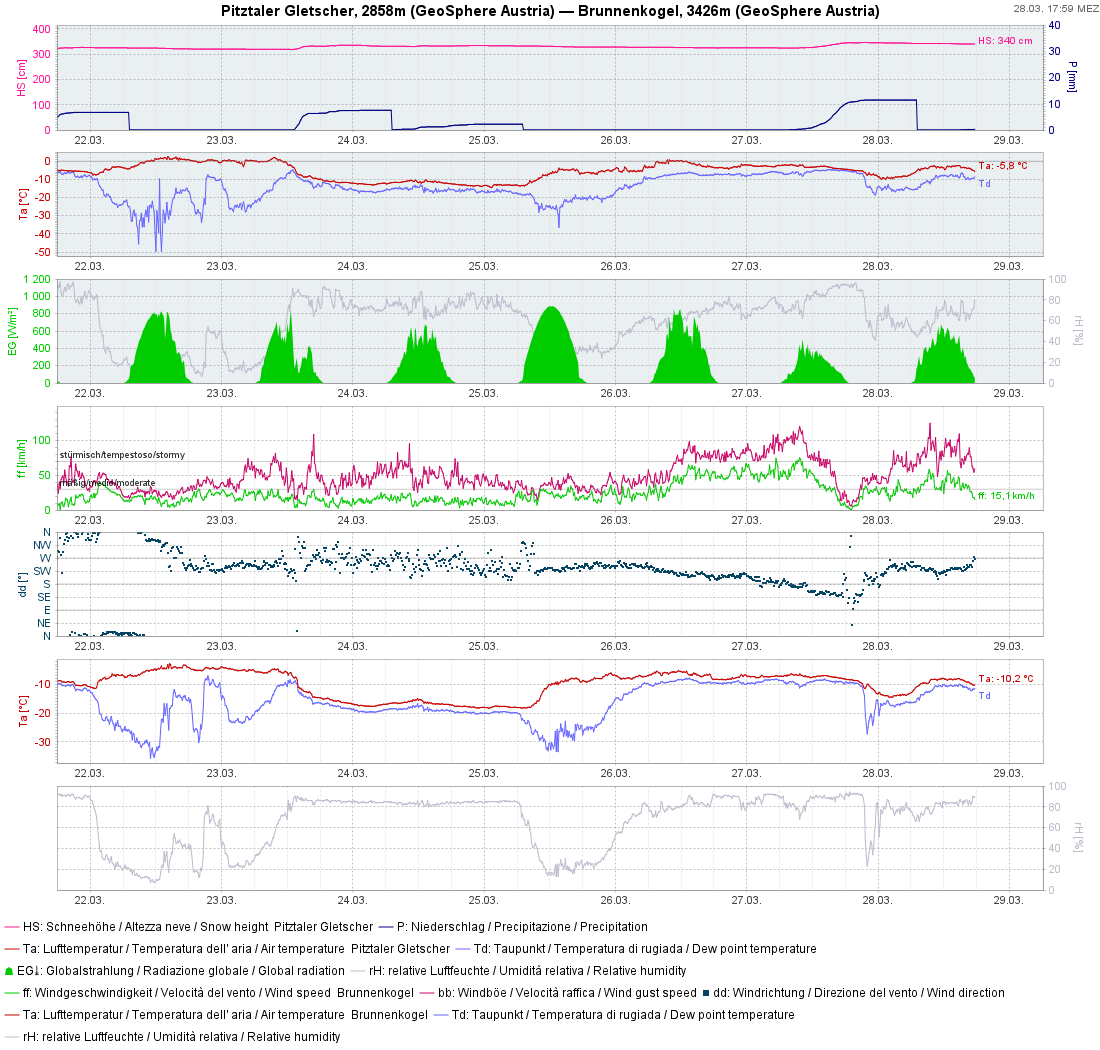
The marked cold front on 23.03 with storm-strength gusts, plummeting temperatures and thunderstorm-like precipitation was striking.
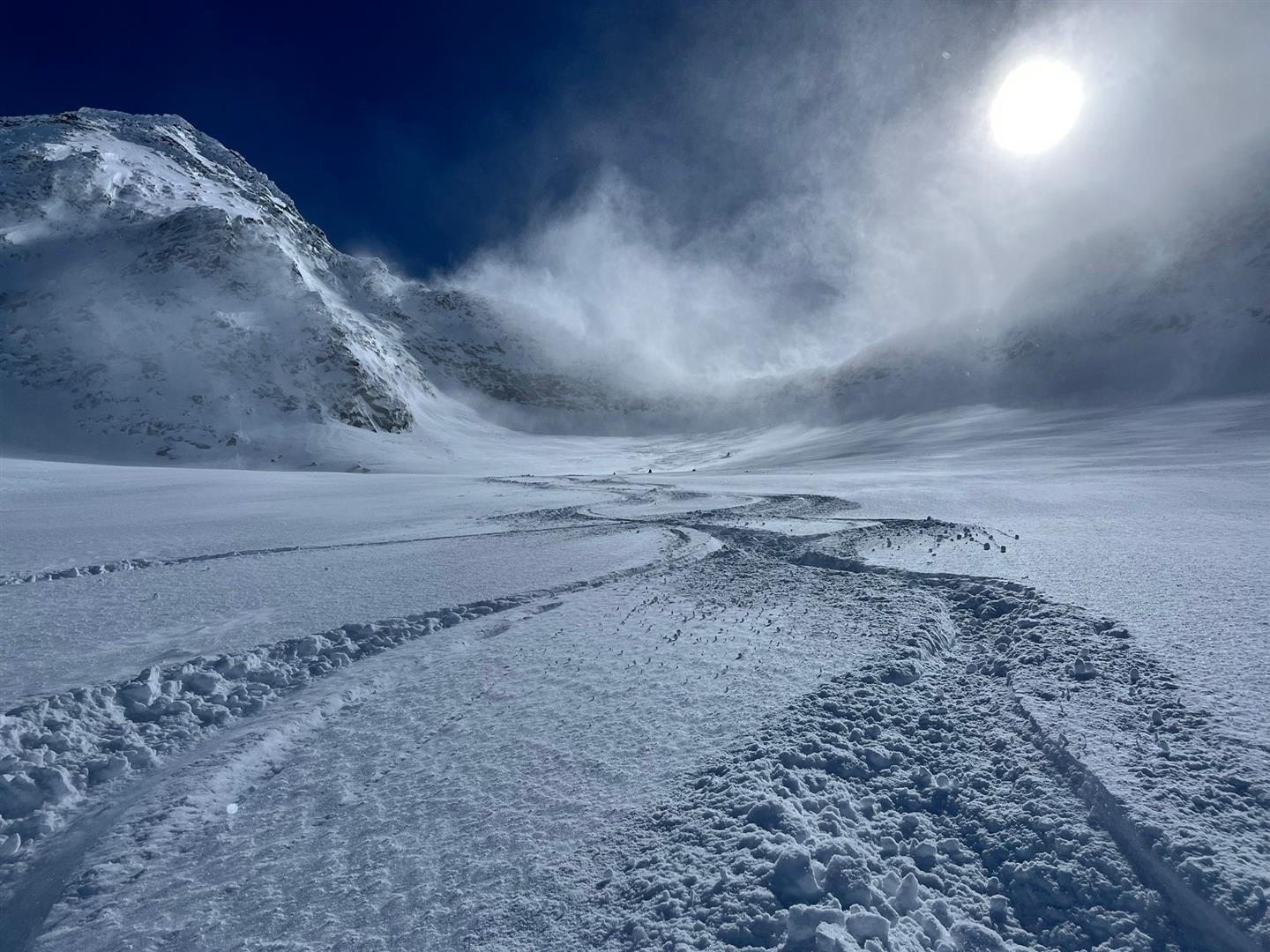
Snowdrift accumulations: assess with caution at high altitudes
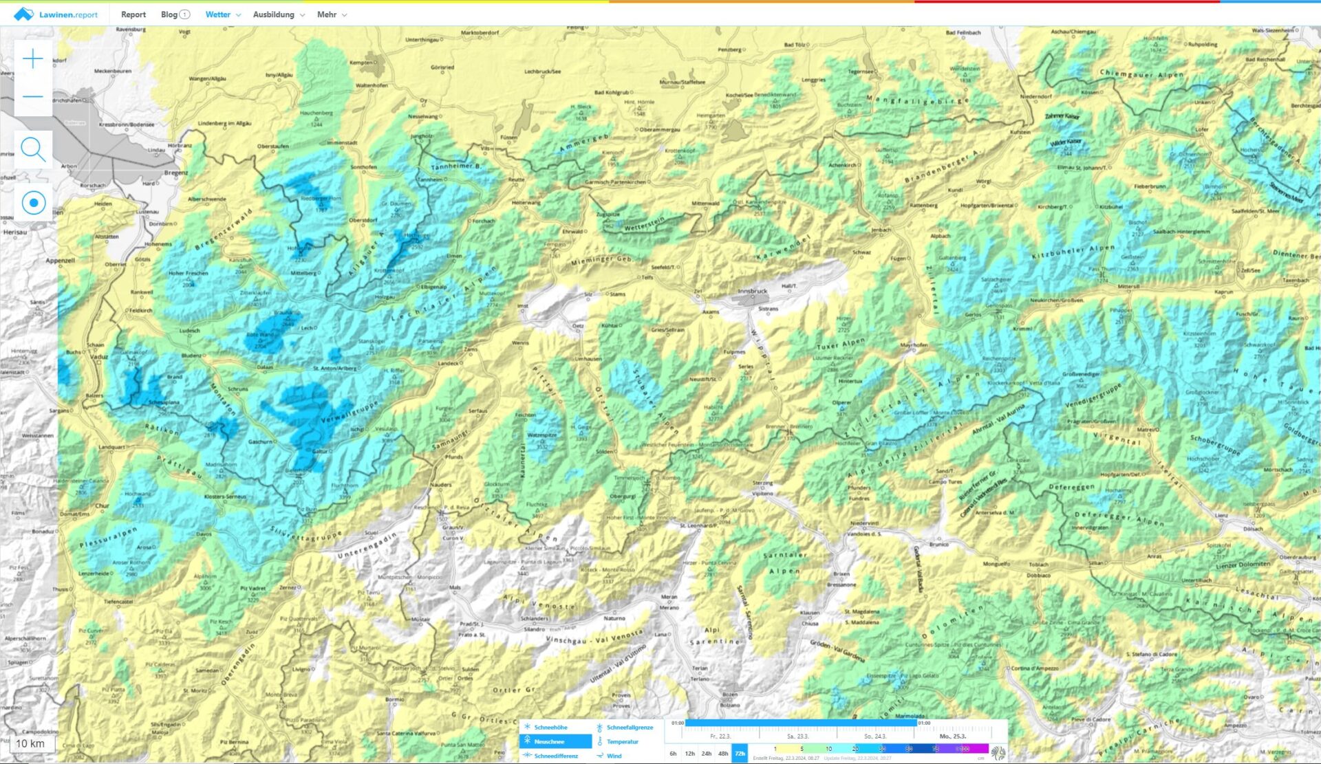
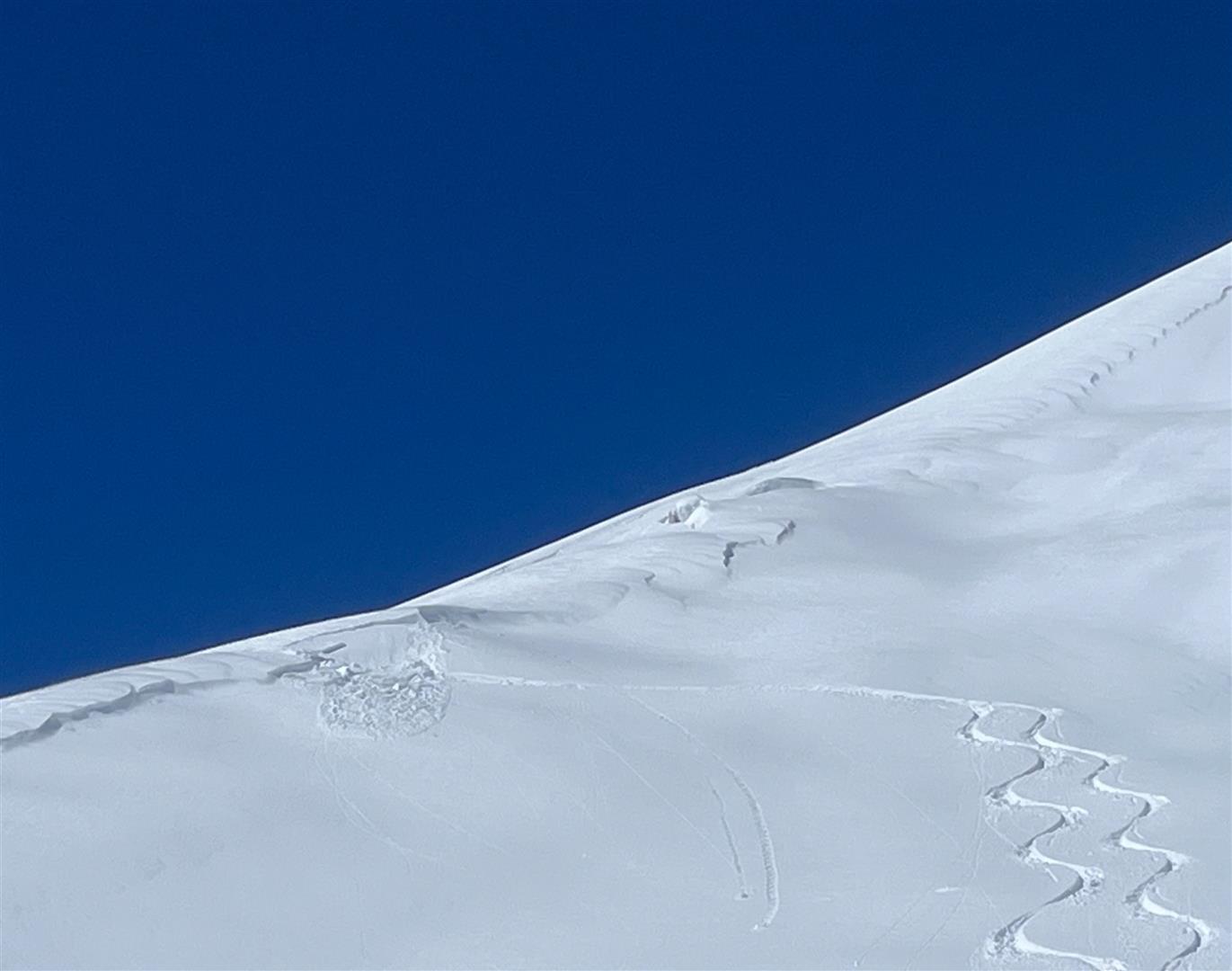
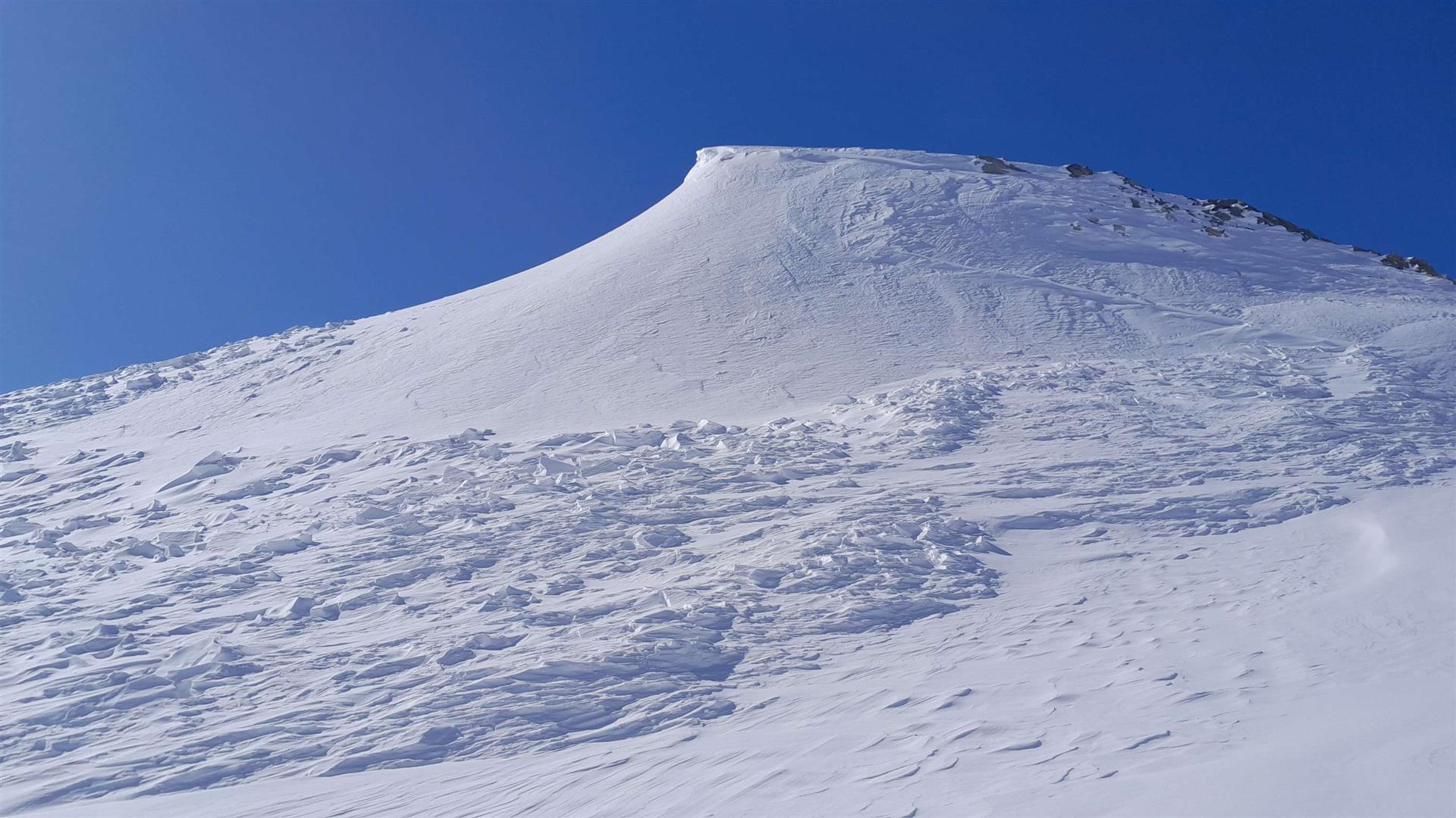
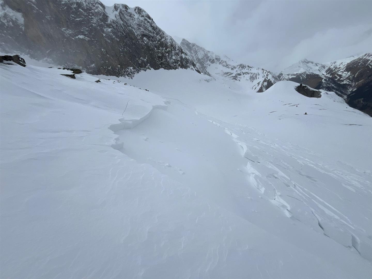
Main problem currently (28.03.2024): fresh and recently generated snowdrift accumulations. Weak layer for the snowdrifts repeatedly observed last week: increasing, often massive layers of graupel, deposited in several bouts during the showerlike precipitation since the middle of last week.

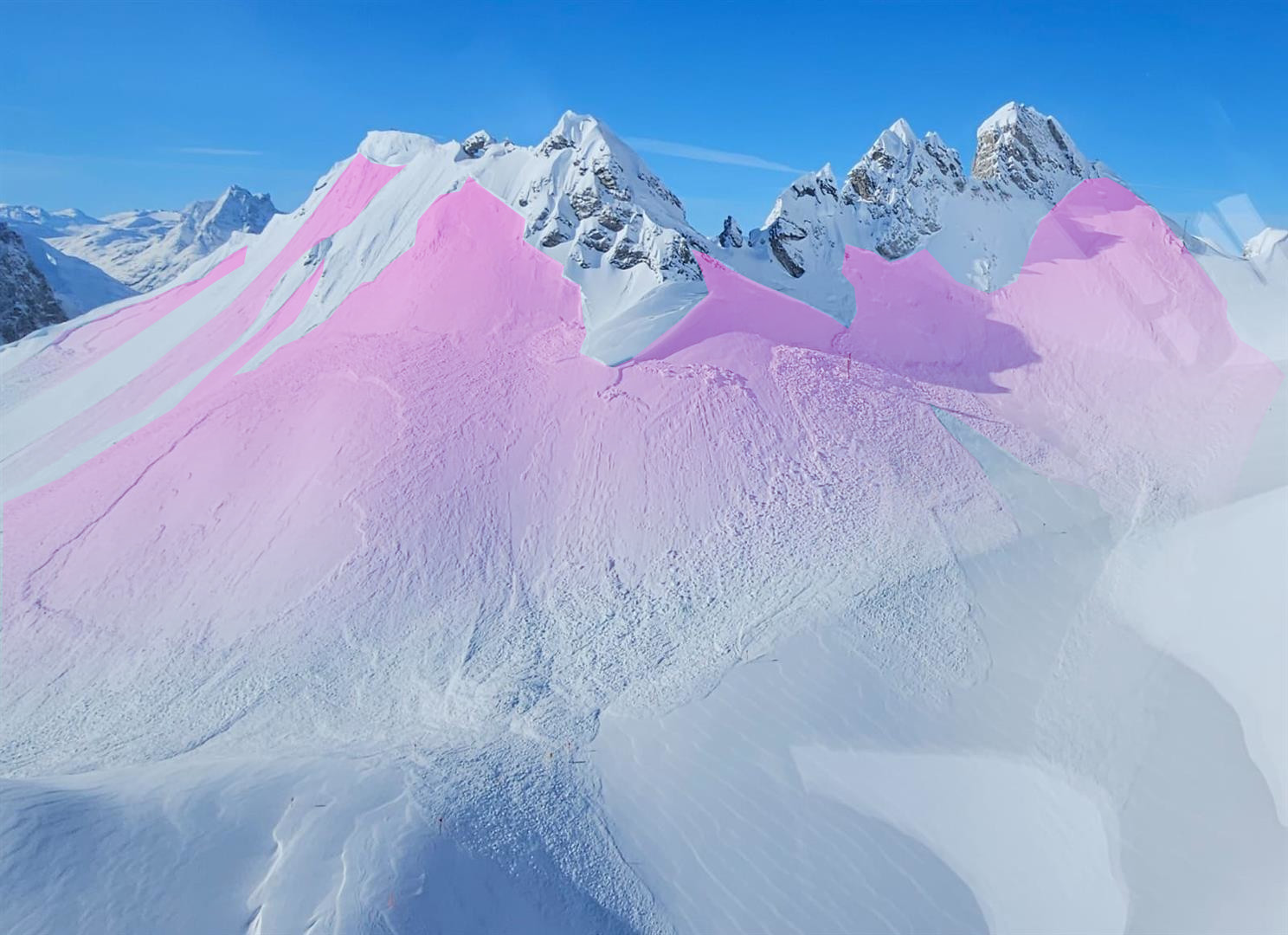
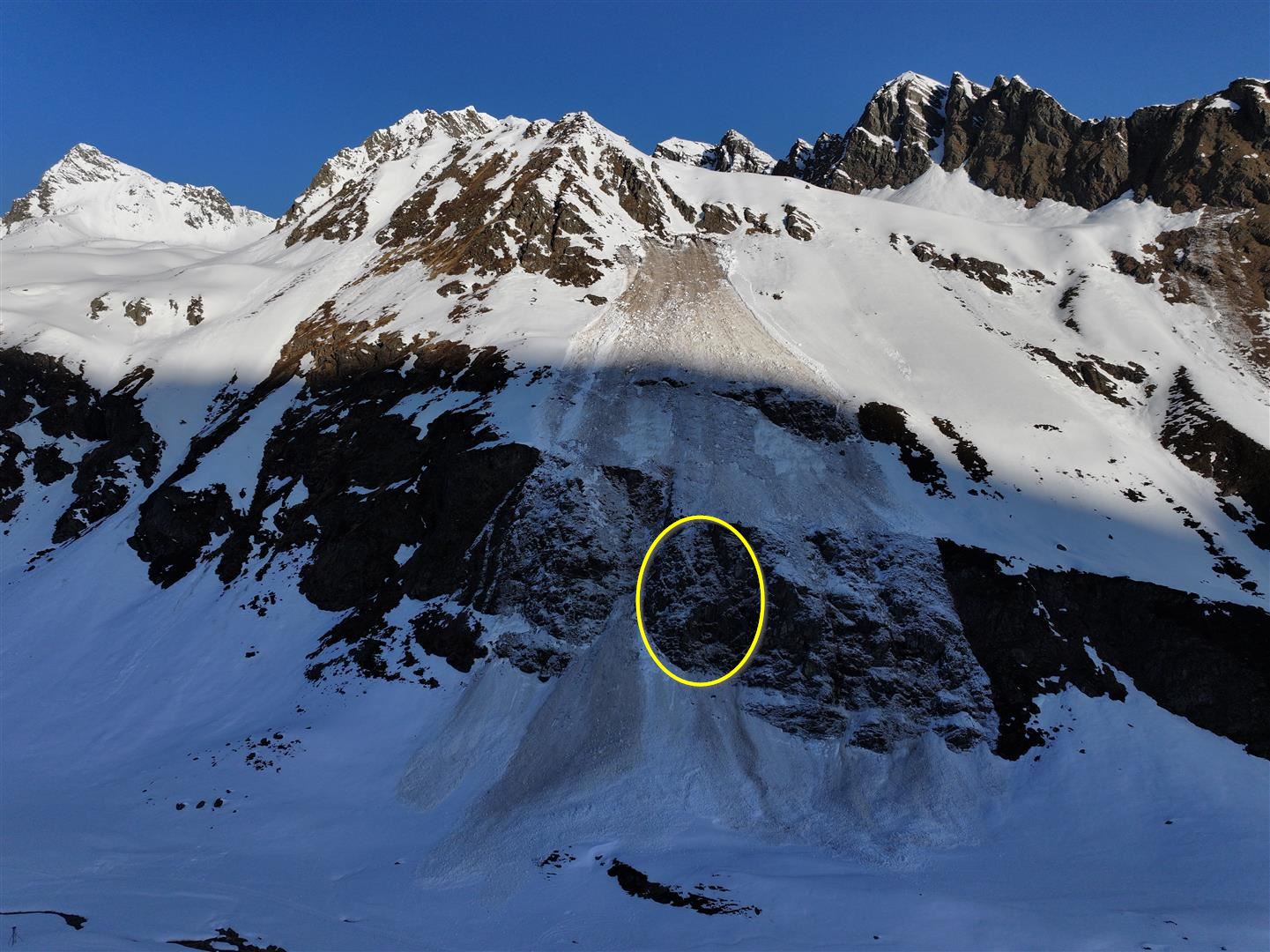
Two surprisingly large-surface avalanche releases were reported from the Arlberg region. One was due to explosives, one a release presumably because a cornice broke. The primary fracture was generated when a layer of graupel was articifially triggered, a secondary fracture occurred when a more deeply embedded faceted layer atop a melt-freeze crust was struck. At the time of the avalanches the slab was particularly well established for a brief time following stormy conditions.
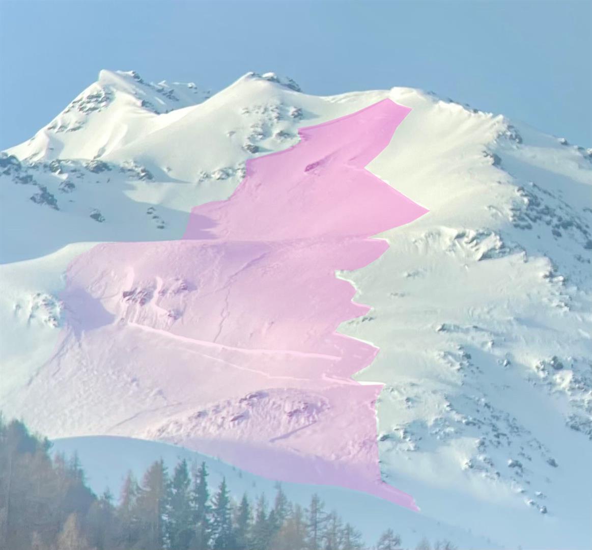
As a rule, reported avalanches were small-sized, a few were medium, always near ridgelines or behind discontinuities in the terrain and usually on shady slopes. The blanketed fresh snow was a short-term weak layer.
Possible “cold on warm” weak layer
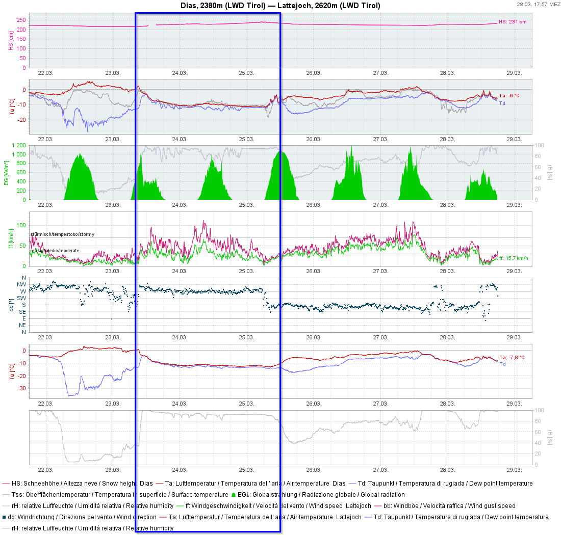
We are groping our way in the dark, but it seems that on shady slopes around 2200m since 23.03 locally or regionally a weak layer has formed due to danger pattern cold-on-warm. A report today (28.03) from southern Zillertal corroborates this suspicion. The prerequisites exist since temperatures plummeted on Saturday, 23.03: a moist snowpack surface blanketed by cold fresh snowfall. In principle, this phenomenon is also relevant (up to 2600m?) for the southern regions which have recently received fresh snowfall. We would be grateful for any and all reports from outlying terrain (please include altitude!), mailed to lawine@tirol.gv.at
Gliding snow: latent danger
Last week the snowpack was thoroughly moist until 23.03 due to rain impact. This had an effect on gliding snow activity (which later tapered off). However, we do not get tired of telling you: circumvent zones below glide cracks.
What’s next?
Warmth penetrating the snowpack, diffuse solar radiation, these will make the snowpack moister. We expect increasingly frequent moist/wet loose-snow avalanches in extremely steep terrain starting on 29.03.2024. Glide-snow avalanches can also be heightened in equal measure.
At high altitudes, fresh and recently generated snowdrift accumulations are the big problem. Stormy winds are again coming to the mountains. From Sunday to Monday in the southern regions, significant amounts of fresh snow are expected. In the southern Ötztal Alps, about 50cm of fresh snow is anticipated. Thus, the situation for winter sports enthusiasts remains delicate in the southern regions at high altitudes where snowfall will be heavy.
Visibility will be poor at times, making it difficult to evaluate the dangers on-site. In order to reduce the risk, particularly in southern regions, lots of experience and much self-restraint are called for.
Further north, conditions will be better. Nevertheless, in springtime tiny weather changes bring big changes in avalanche danger over very short periods. For that reason, ongoing information and acute observation of backcountry terrain and quick reacting to the conditions are of paramount importance.
The entire team of the Avalanche Warning Service of Tirol wishes all of you Happy Easter! (As soon as the avalanche situation changes and we have information about it, we will publish another blog.)