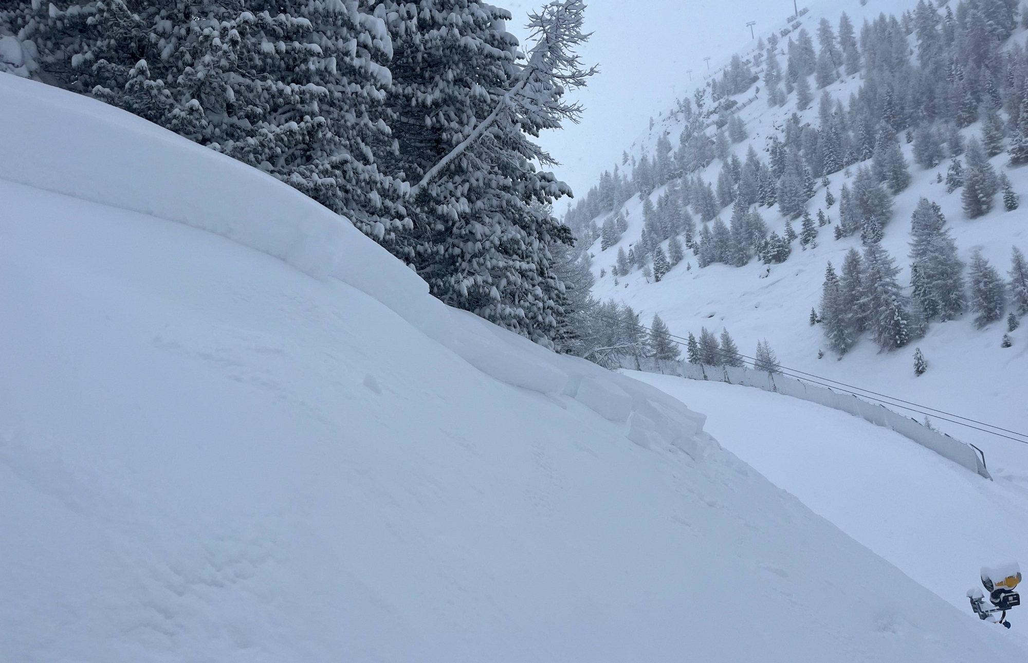
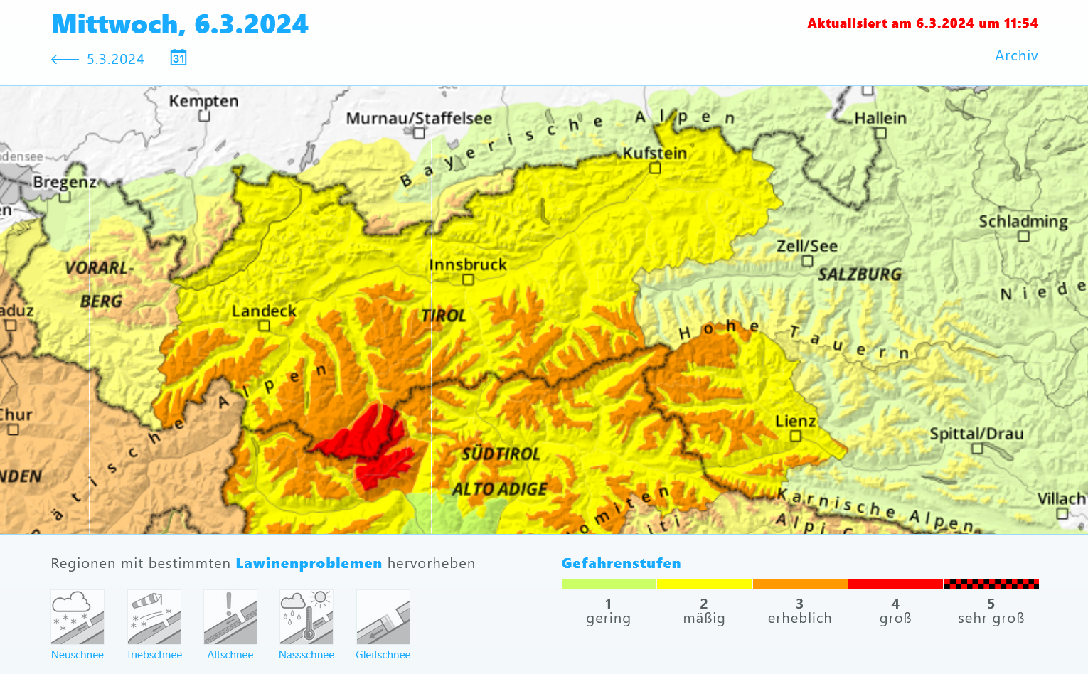
Since Tuesday afternoon (05.03) there has been up to 80 cm of fresh snow registered regionally in the mountains. The fresh fallen snow covers an old snowpack which has marked weak layers in the uppermost part. Reports from observers about naturally triggered avalanches and artificial triggerings with explosives confirm the tense situation. Over the next few days we expect high proneness to triggering of the snowpack. Since fine weather is forecast, this threatens to be an accident-prone period. We advise high caution and lots of self-restraint!
Current situation
With little wind impact and dropping temperatures, there was ample snowfall in Tirol’s mountains yesterday, 5 March. The snowfall level was around 1300 m, then dropped to below 1000 m. Due to the low temperatures and little wind, the snow often fell quite lightly, its density is very low and fresh snow depths high.
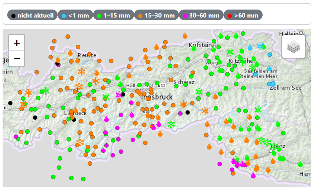
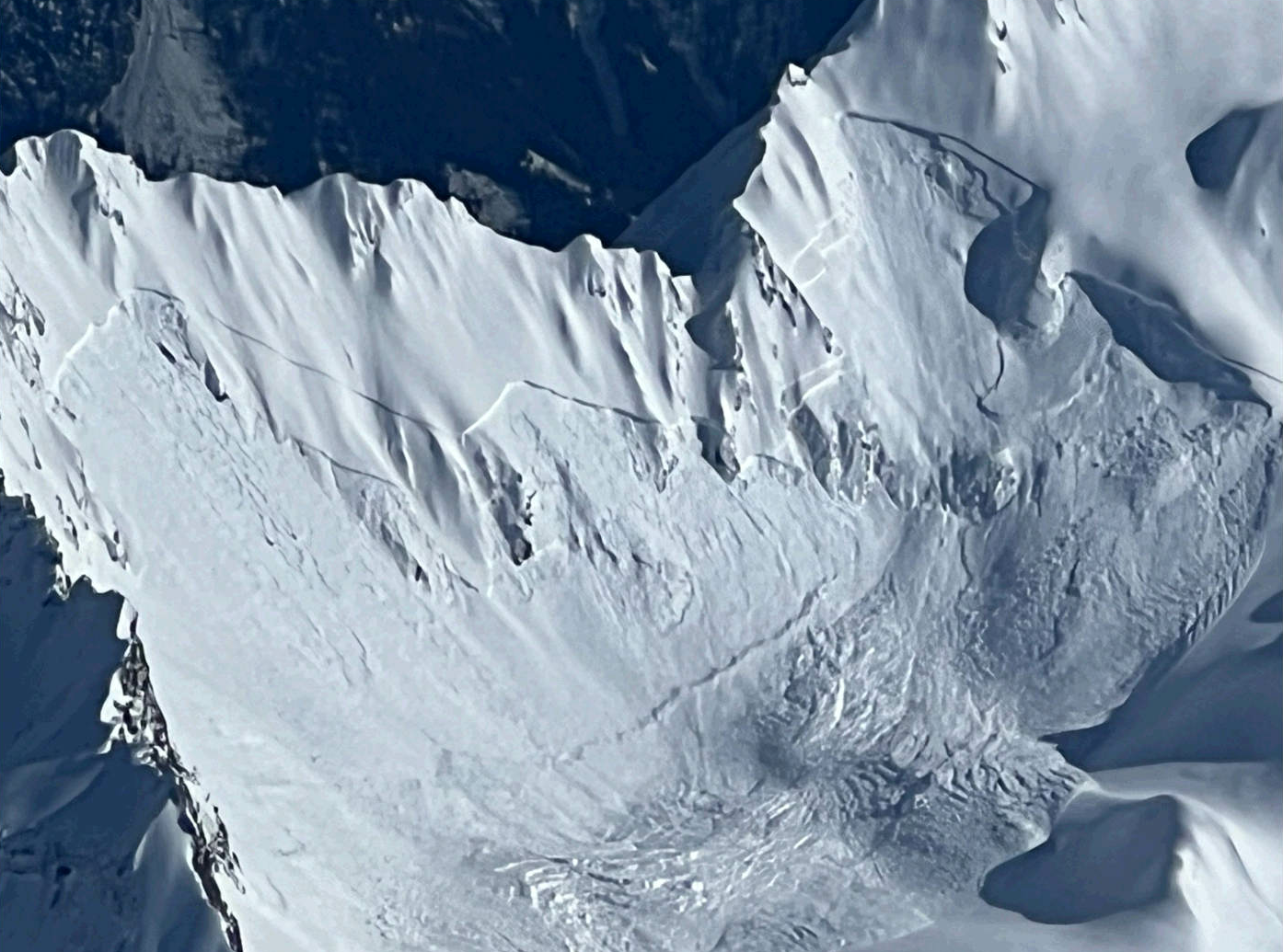
Most of the precipitation was between Gurgler Range and Zillertal Alps along the Main Alpine Ridge, and on the Carnic Ridge in southern East Tirol: 30 to 50 mm of precipitation (up to 80 cm of loose fresh snow) was registered. Apart from these regions there was less precipitation (mostly 20-30 mm), except for eastern regions.
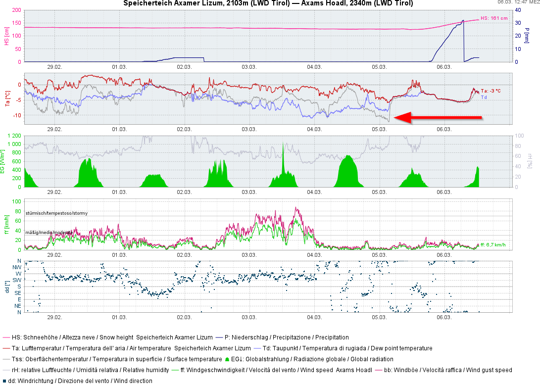
Near the surface, weak layers have formed in the last few days which have now been covered by fresh snow. On the one hand, surface hoar that formed on Monday night beneath star-studded skies amid relatively high air moisture and little wind. On the other, soft layers clinging to melt-freeze crusts which are potential weak layers for slab avalanches.
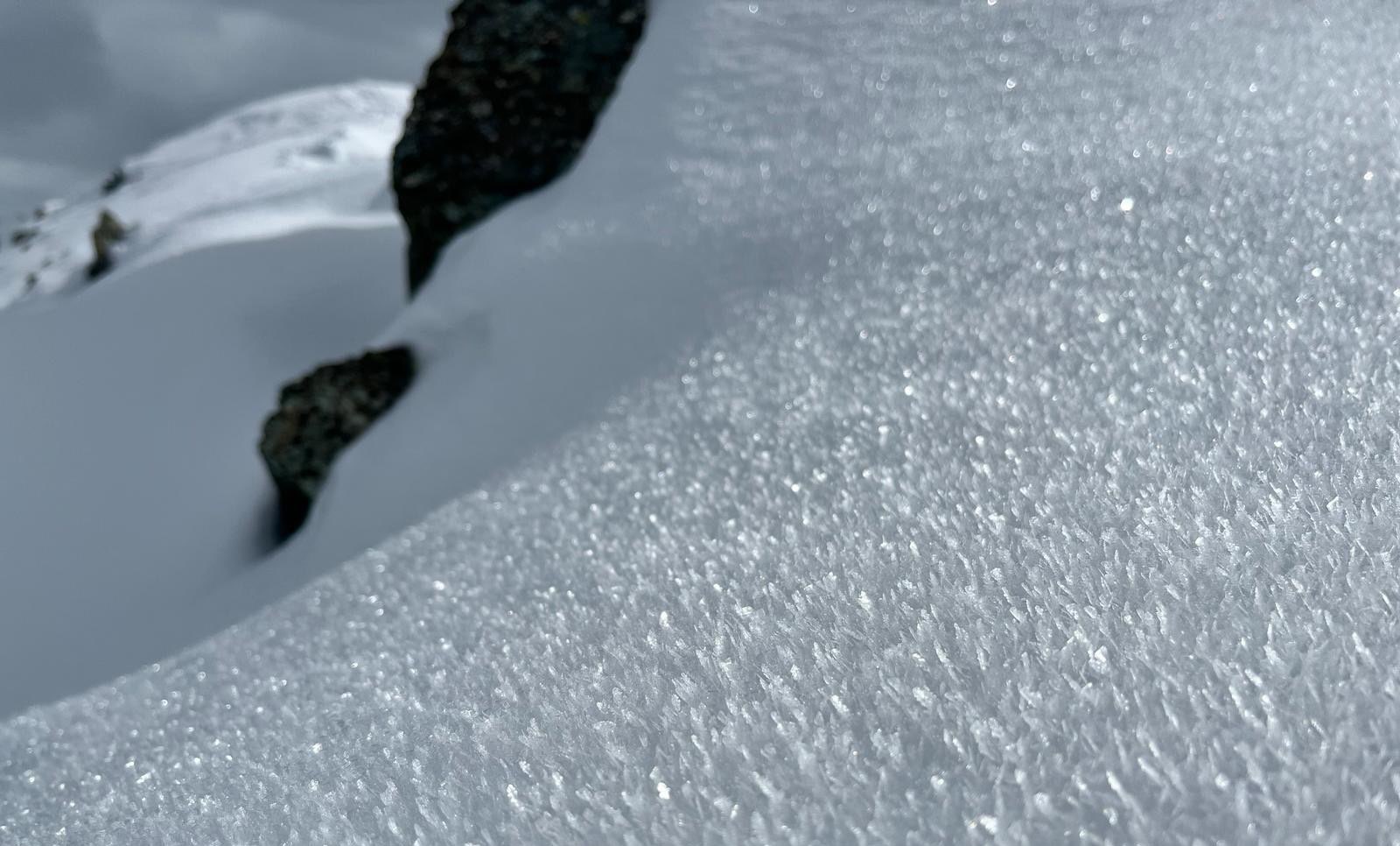
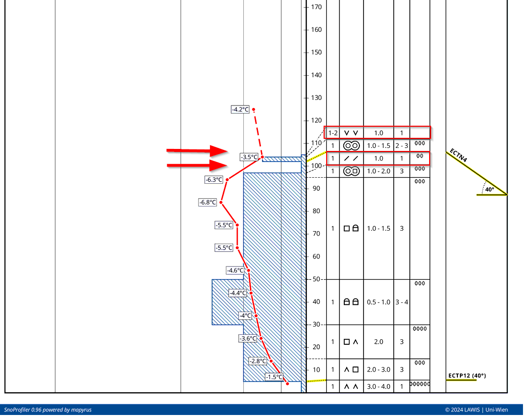
Also at mid-level inside the snowpack are weak layers in the form of faceted crystals clinging to melt-freeze crusts which in isolated cases can lead to large-sized slab avalanches. Especially conceivable are small avalanches which fracture deeper down in the weak layer. Reports reveal that this problem is currently marked in the Ötztal Alps on the border to South Tirol.
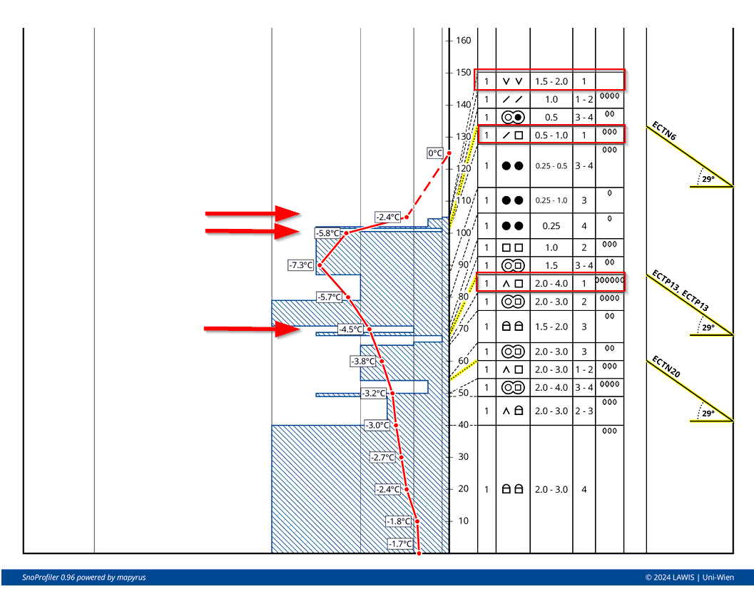
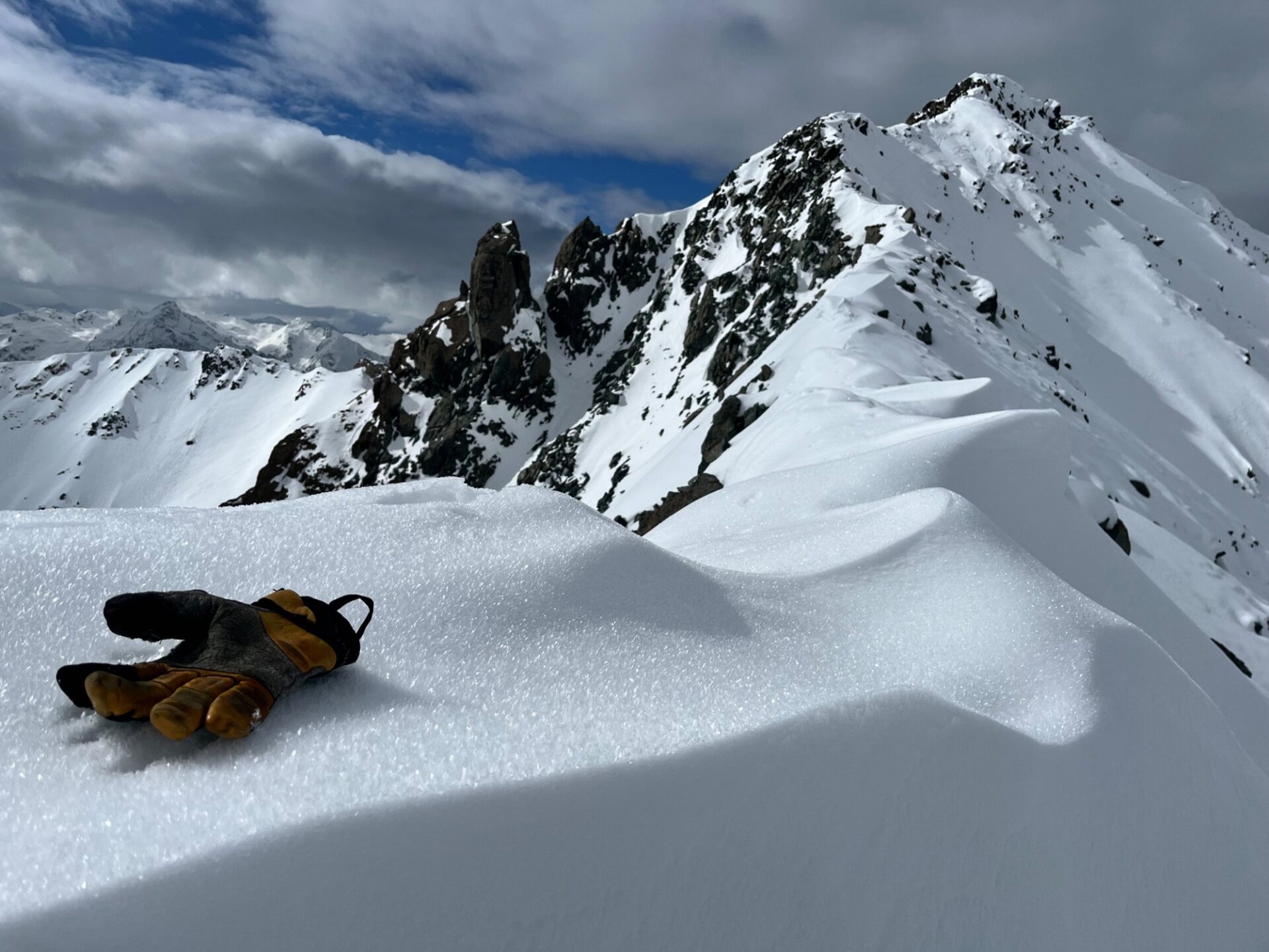
First reports from today, Wednesday, 6 March, describe excellent artificial triggerings with impressive fracture propagation, a significant indicator of an extremely trigger-prone weak layer.
What’s coming next?
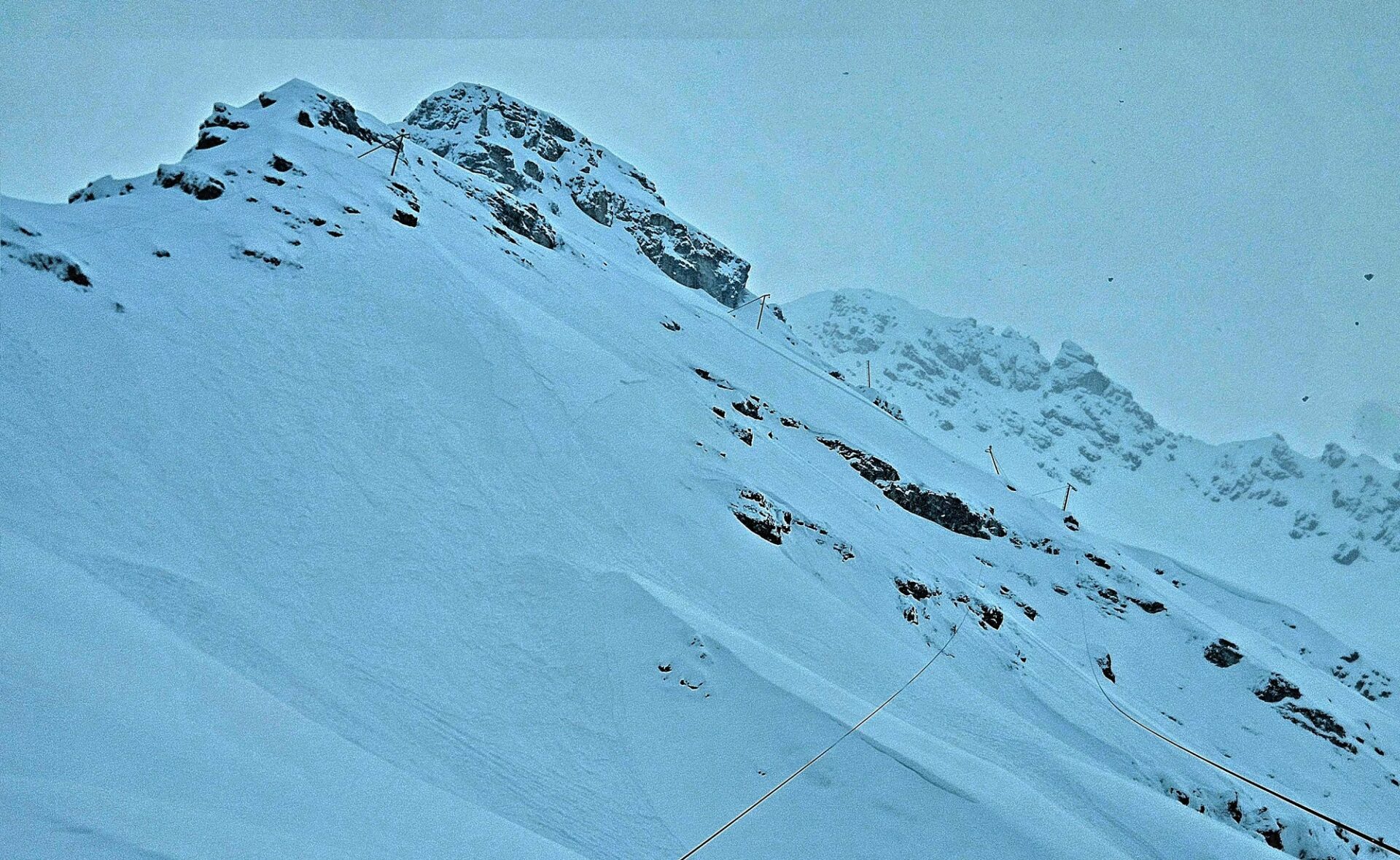
The settling process of the fresh fallen snow is about to begin, amplified by diffuse light conditions on Thursday, 07.03, which will form and fortify the slab. Existing weak layers beneath this slab, particularly the surface hoar, will be easy to trigger over the next few days. Also remote triggerings and isolated naturally triggered slab avalanches are possible. Least favorable of all: W/N/E facing slopes above 2200 m in the regions south of the Inn where recent snowfall has been heaviest. In this region, steep slopes and zones beneath them should be avoided whenever possible. Whumpf noises, shooting cracks and fresh avalanches are alarm signals: indicators of acute danger.
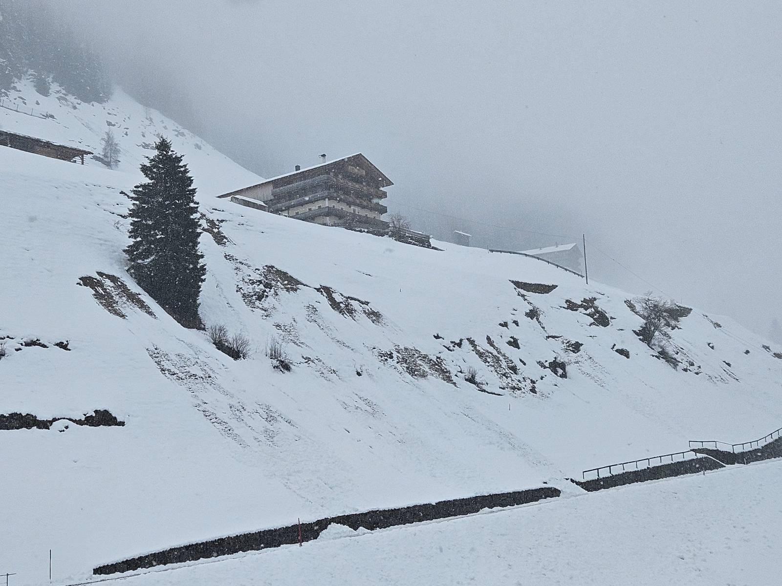
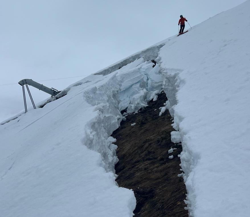
In addition, due to solar radiation, numerous naturally triggered loose-snow avalanches of medium size can be expected on extremely steep sunny slopes. Gliding snow activity will also increase on steep grass-covered slopes.
Snowdrifts are currently a secondary problem, only pertinent in ridgeline and pass areas at high altitudes. This situation will change later this week, since southerly foehn winds are forecast for Friday.