For the coming days Geosphere Austria has forecast variable weather conditions. Rainfall is expected up to intermediate altitudes at least. Starting Saturday, 2 March, southerly foehn winds will arise, reaching storm-strength on Sunday, with more clouds in the south than in the north, and very mild. The variable weather includes diffuse light conditions which will further moisten and weaken the snowpack. Activity of glide-snow and wet-snow avalanches will increase. At great altitudes the fresh snowdrifts will remain trigger-prone in places, particularly on shady slopes.
The warmest February in measurement history
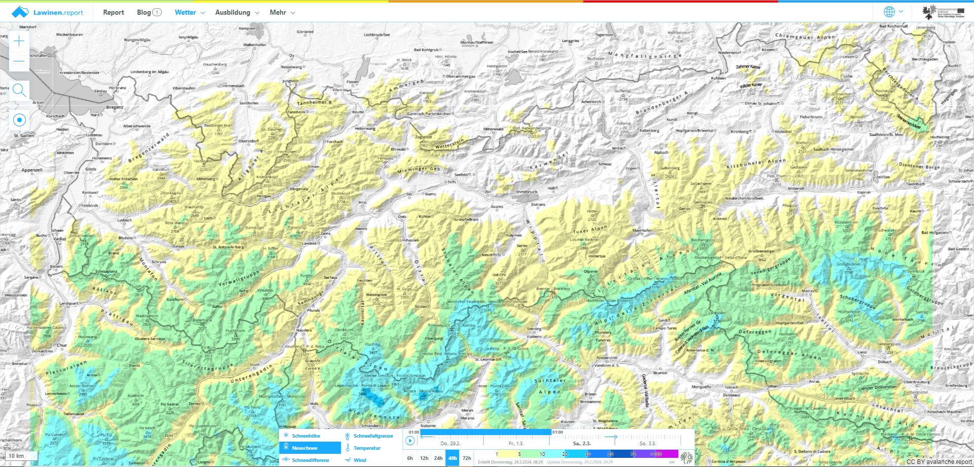
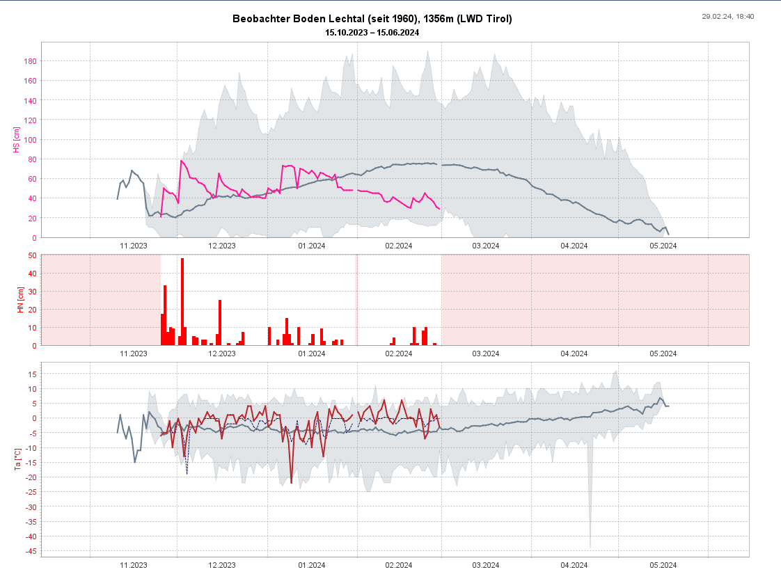
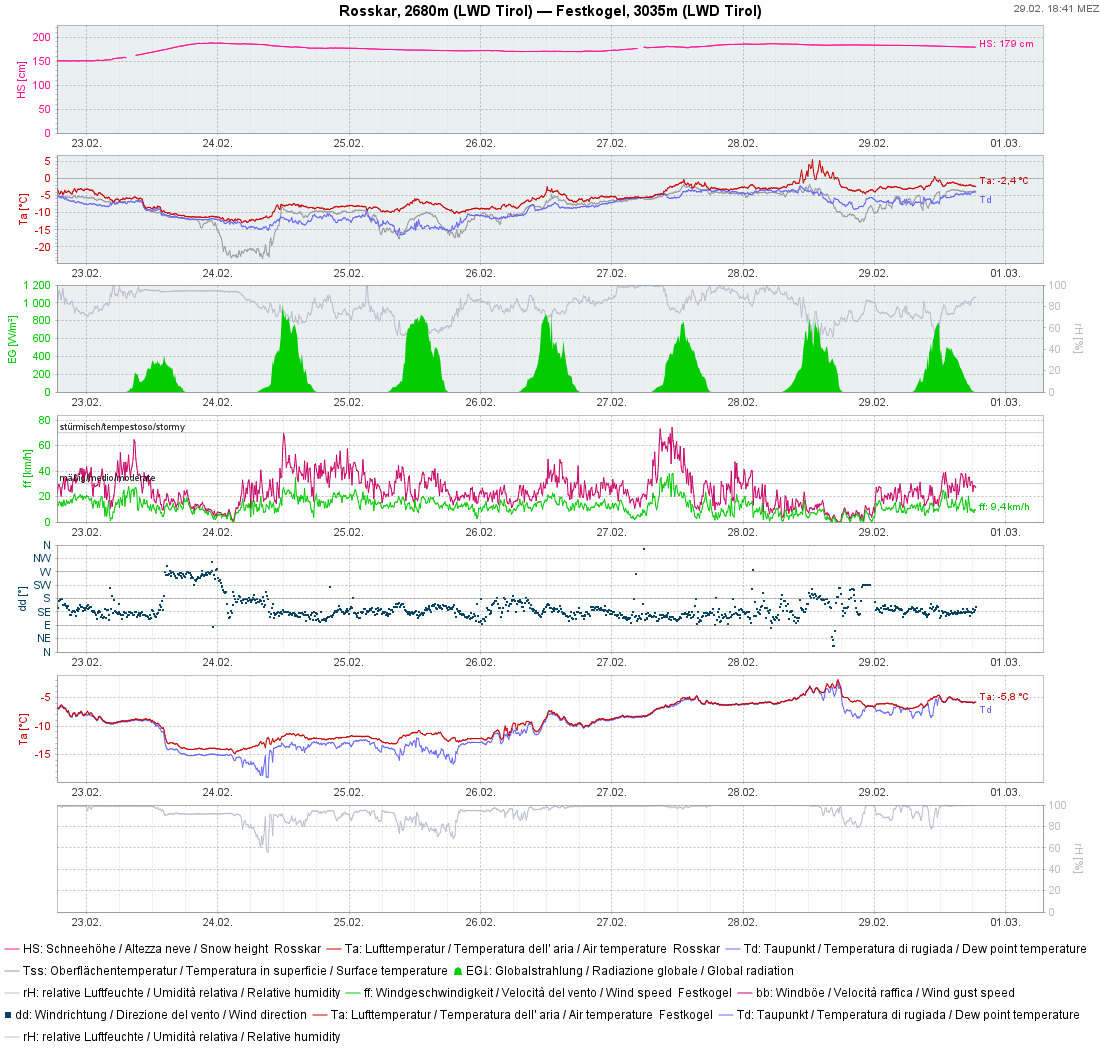
According to data from Geosphere Austria, we have just witnessed the warmest February in the 257 years of taking measurements. Temperatures in the mountains, depending on period of focus lay 2.8°C (1991-2020) or 3.9°C (1961-1990) above the average. This is mirrored both in the snow cover and snowpack layering. At low and intermediate altitudes there is far too little snow on the ground for this juncture of the season due to higher temperatures and lots of rain, and the snow depths at great altitudes are below average.
Snowpack moist and weakening further
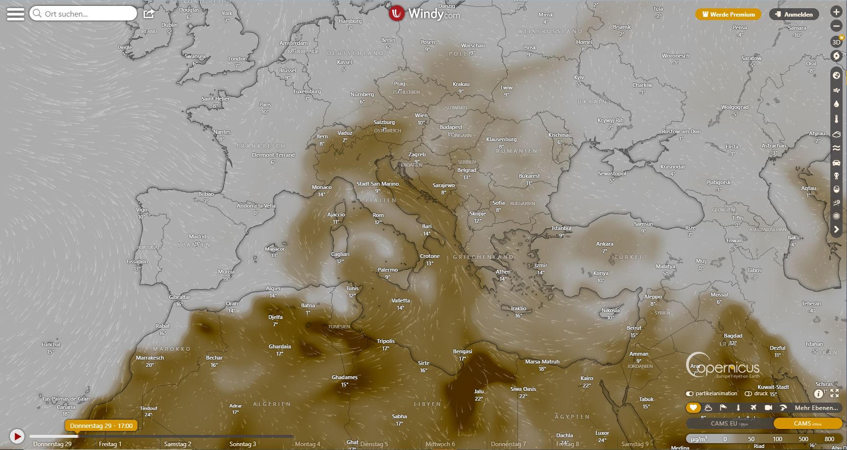
Several factors have led to an increased moistening of the snowpack up to 2400 m at least, in East Tirol up to 2600 m: *Regionally some rainfall, most in the southern regions. *Variable weather with fog intensified the impact of solar radiation and seepage of warmth into the snowpack. * It was too warm for this juncture of the season. * Southerly airstreams deposited dust from the Sahara.
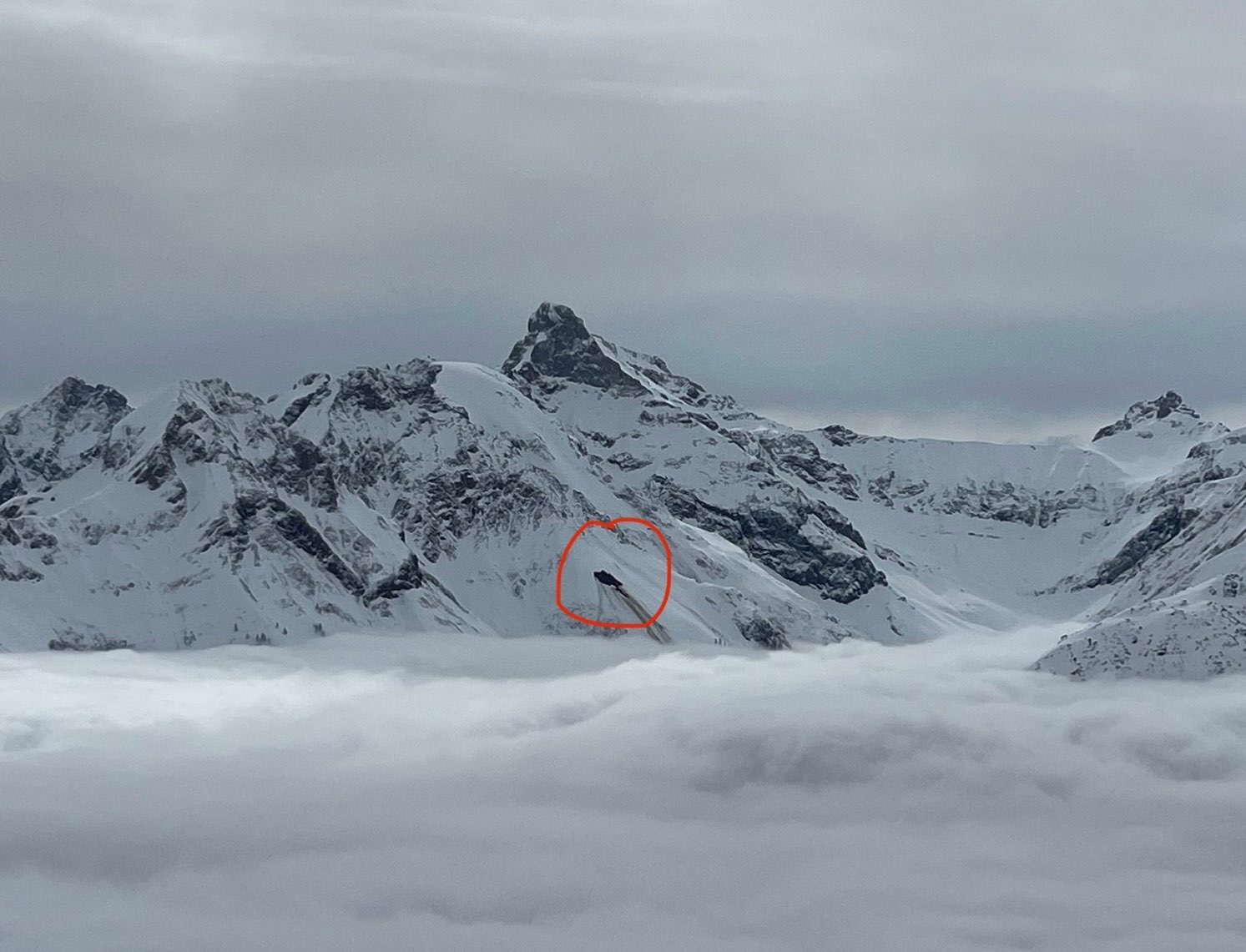
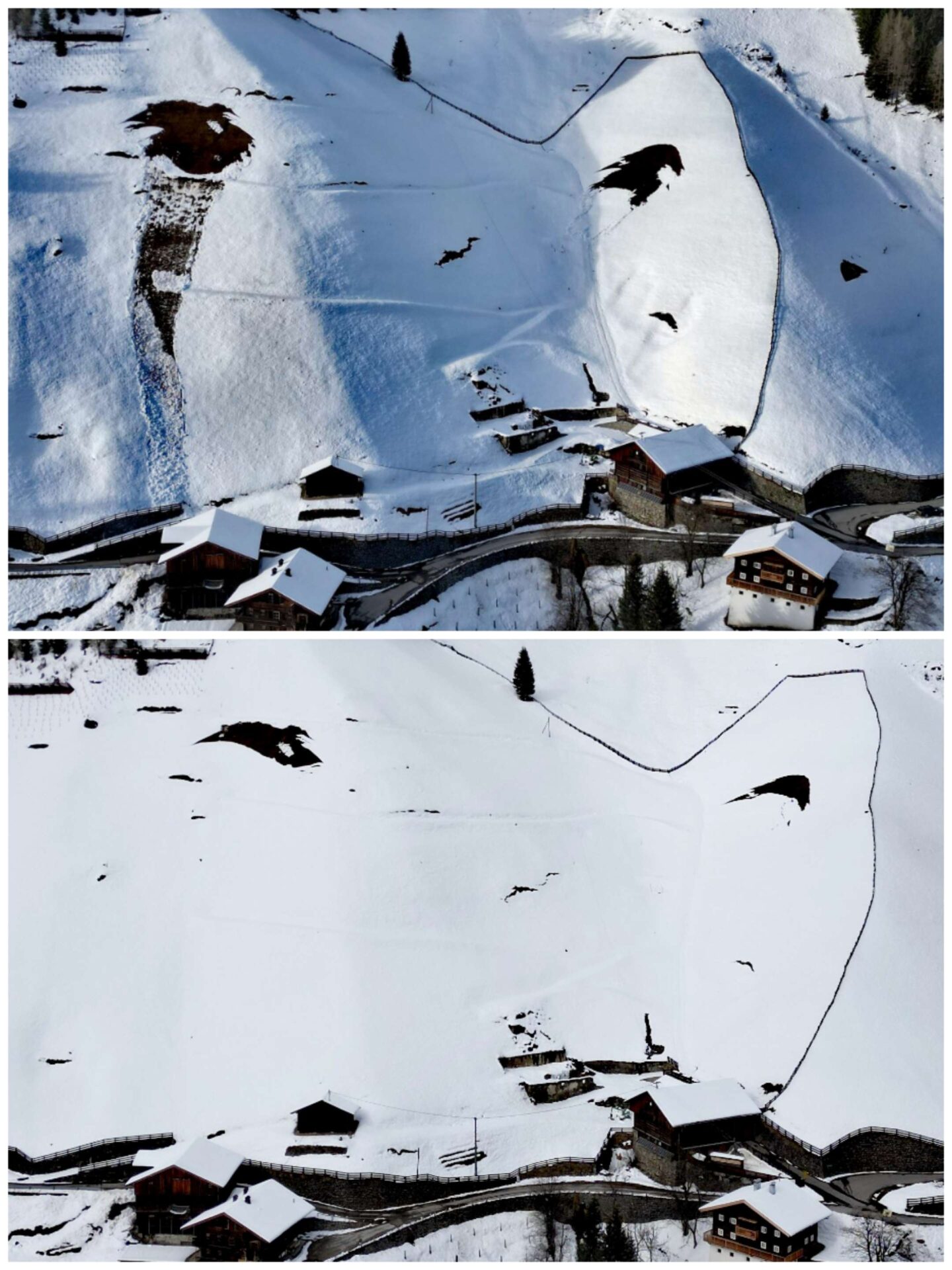
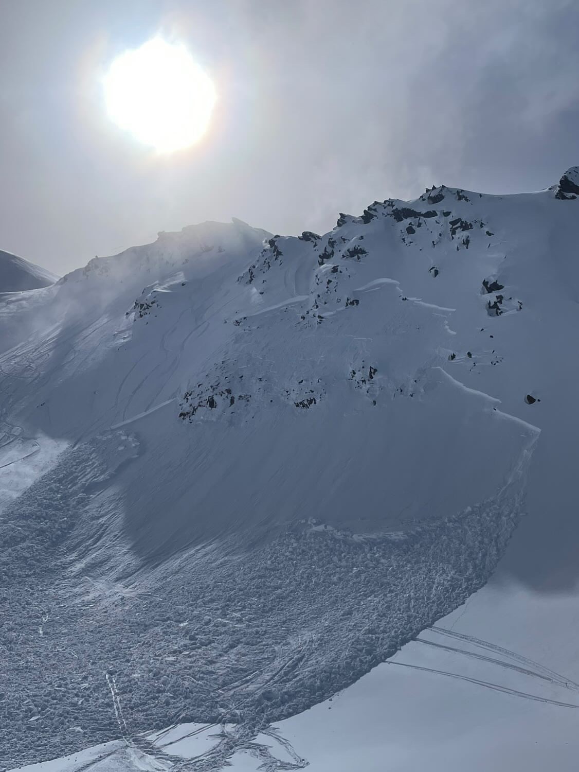
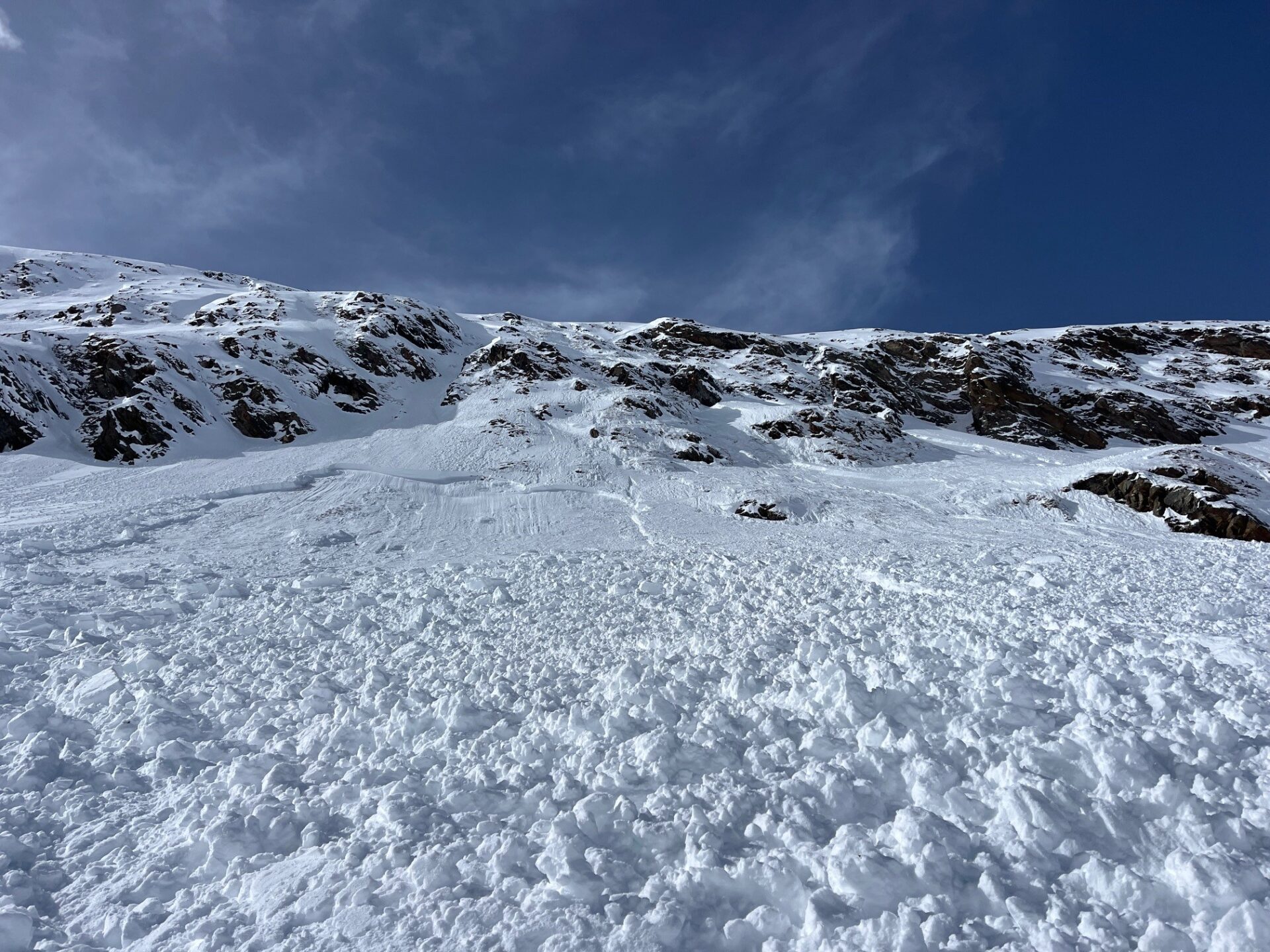
Increasing gliding snow activity, wet loose-snow avalanches
During the last few days, glide-snow avalanche activity accelerated again, an indicator of the recently increased wetness of the snowpack. During the next few days we expect more frequent wet loose-snow avalanches due to near-surface moistness of the snowpack. Wherever the snowpack is wet down to the ground, avalanches can grow to large(er) size.
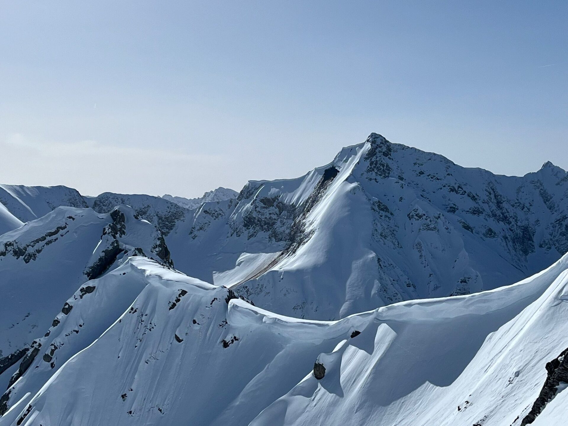
Slab avalanches
Slab avalanches can still be triggered by winter sports enthusiasts, esp. at great altitudes, increasingly near ridgelines on shady slopes. Freshly generated snowdrift accumulations constitute the main danger there.
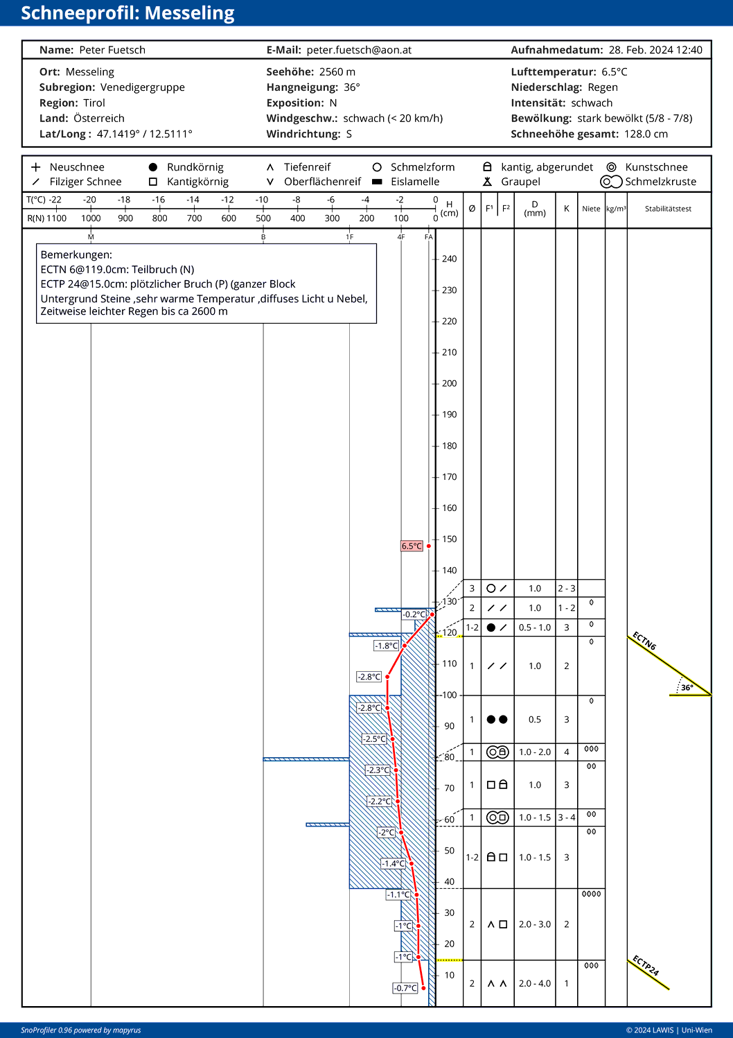
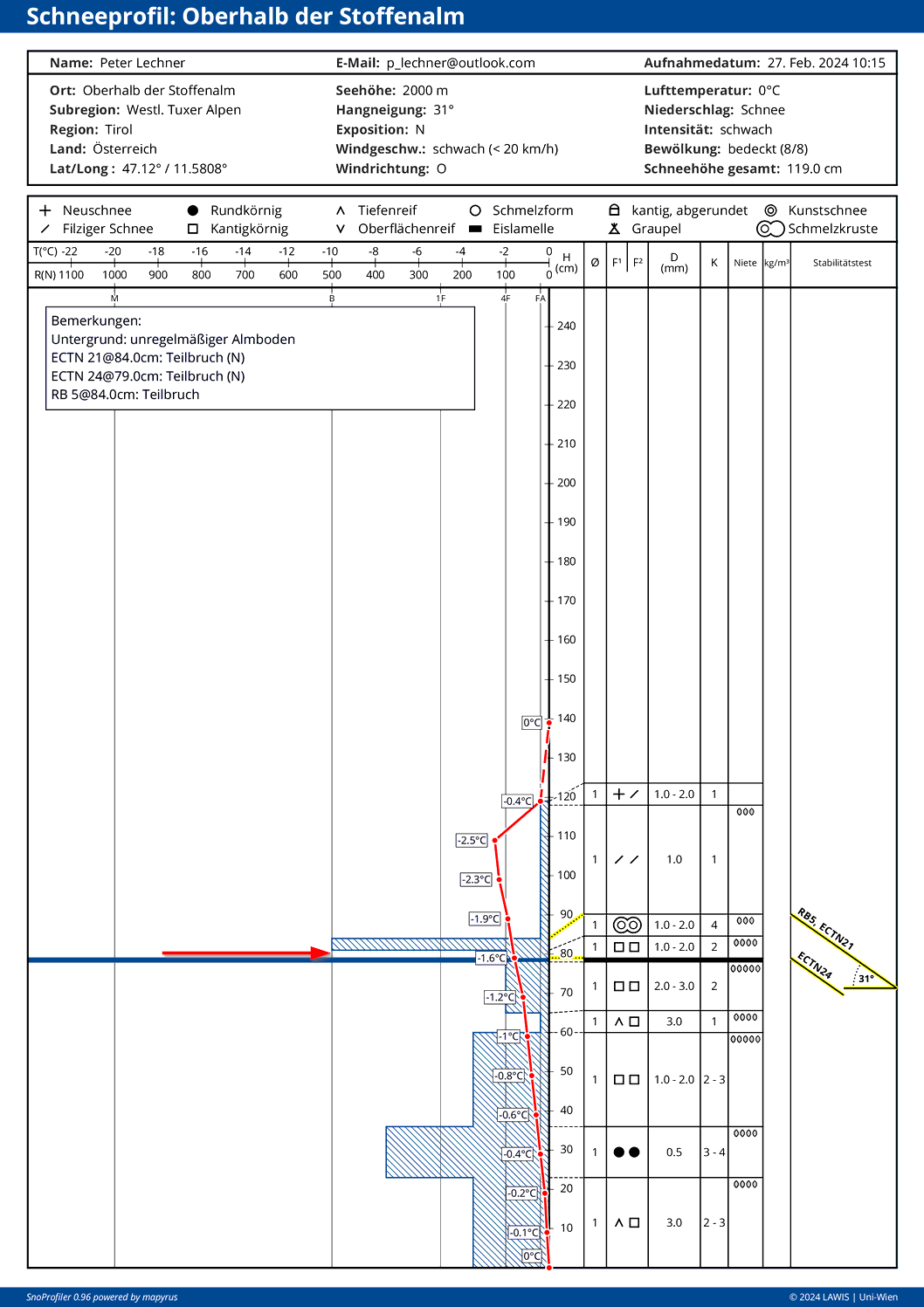
Isolated slab avalanches between 2100 and 2300 m altitude on very steep shady slopes: possible if near-surface weak layers of faceted crystals are weakened by loss of bonding due to water seepage.
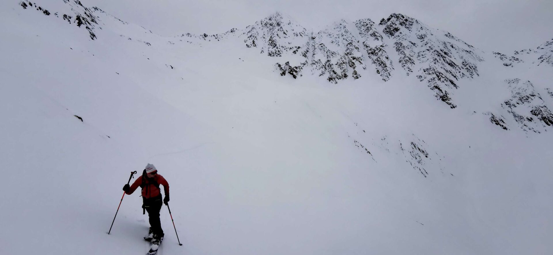
Deteriorating snow quality
One or our observers from East Tirol described current snow quality as “leg-breaking snow” and the anticipated weather as “leg-breaking weather.” The snowpack surface is moist all the way up to 2600 m in all aspects.