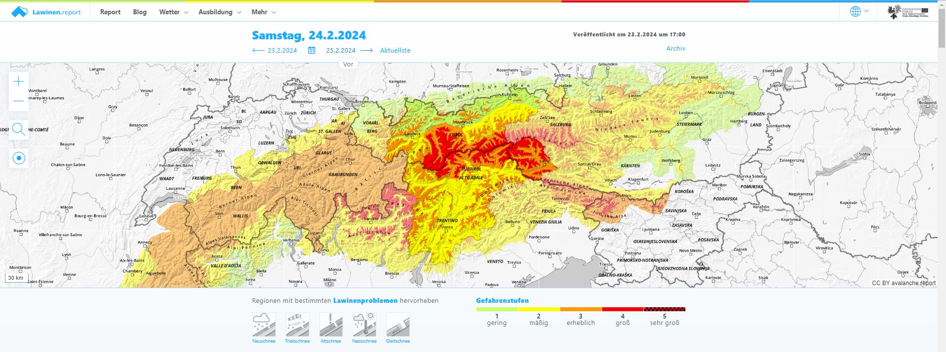
Last weekend’s Geosphere Austria forecasts were spot on. In the southeastern regions of Tirol there was generally between 40 and 60 cm of fresh snow, more at higher altitudes. Further north, the amounts of precipitation lessened incrementally. Avalanche danger on Friday and Saturday (23-24 February) was high in some regions, the consequence of wind impact. Wherever winds were in play, there was for a brief spell an extremely trigger-prone snowpack, although in wind-protected terrain there was mostly great powder to be enjoyed. Numerous avalanche triggerings involving persons were reported, all of them without injuries.
At the forefront, fresh-snow problem, persistent weak layer
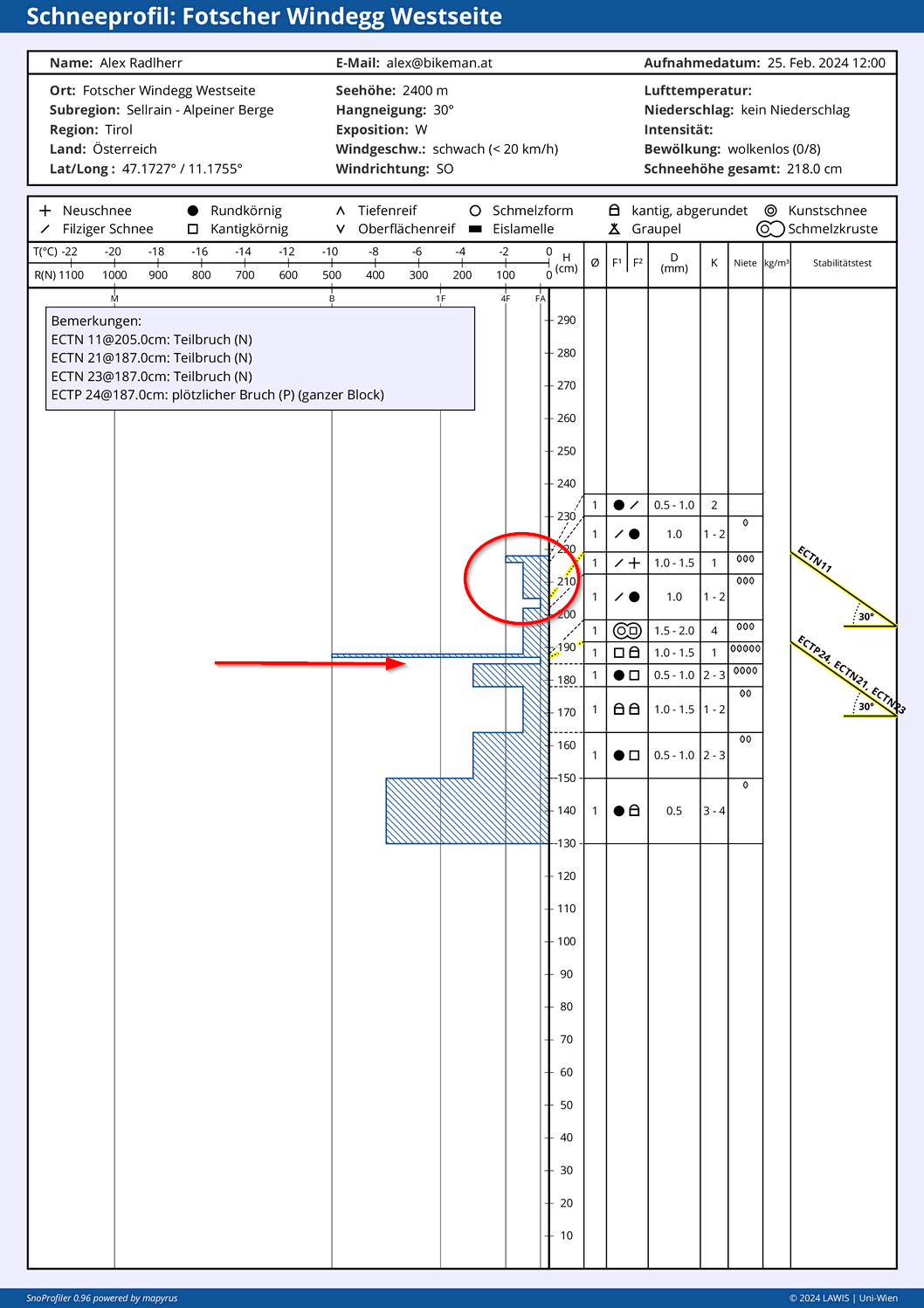
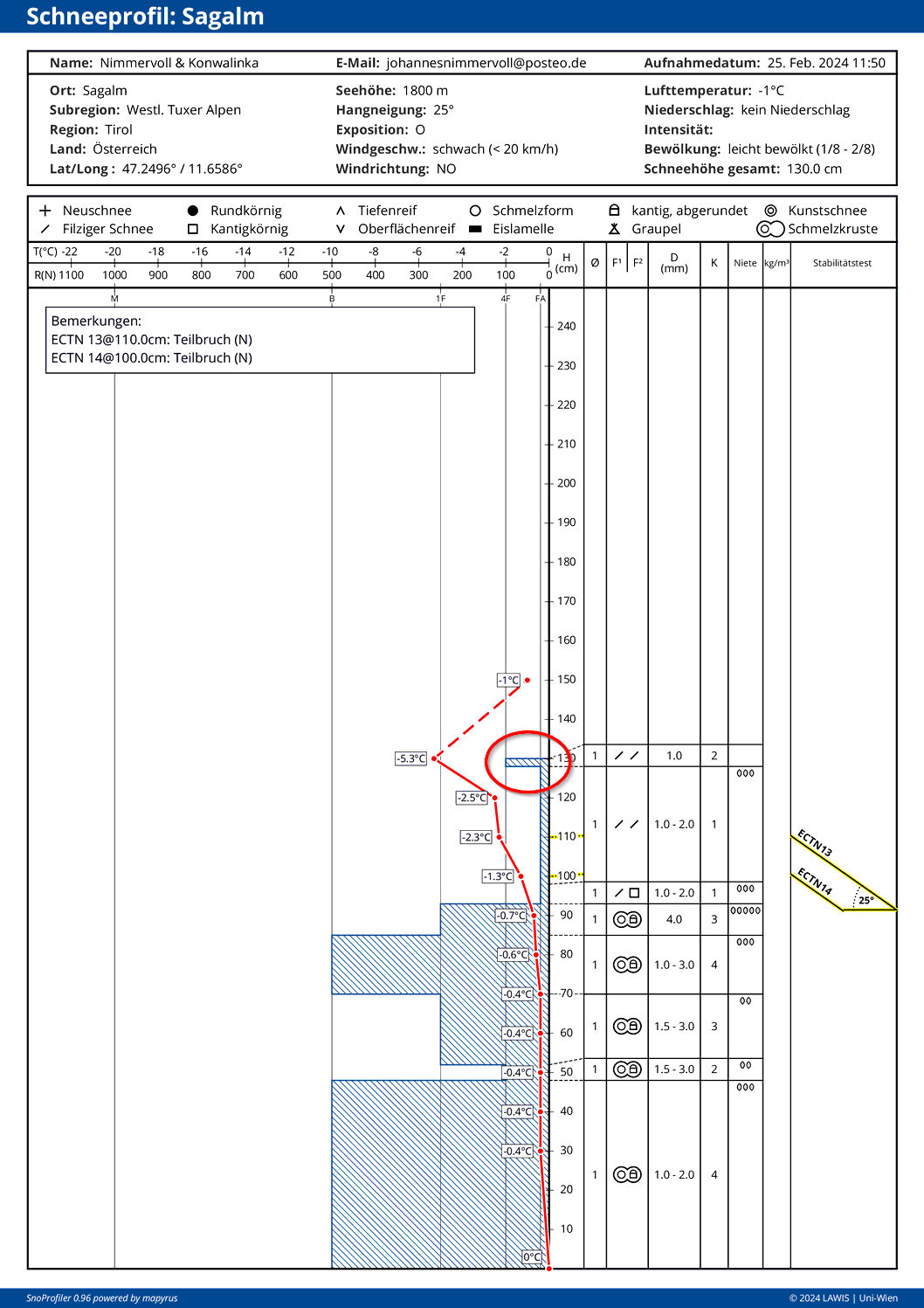
The degree of each particular avalanche problem is what determines the Danger Level. Over the weekend (23-25.02) there was a fresh-snow problem and a persistent weak layer problem. The persistent weak layer came about due to shallow weak layers beneath near-surface crusts of the old snowpack until 22.02 (see last Blog), particularly on W/N/E facing slopes above 2400 m. The fresh-snow problem was due to a briefly threatening weak layer in the form of loose fresh fallen snow. The necessary slab was generated either by wind impact or the bonding of fresh snow on the surface due to higher temperatures and solar radiation.

Numerous danger zones, but also a relaxed situation with great powder
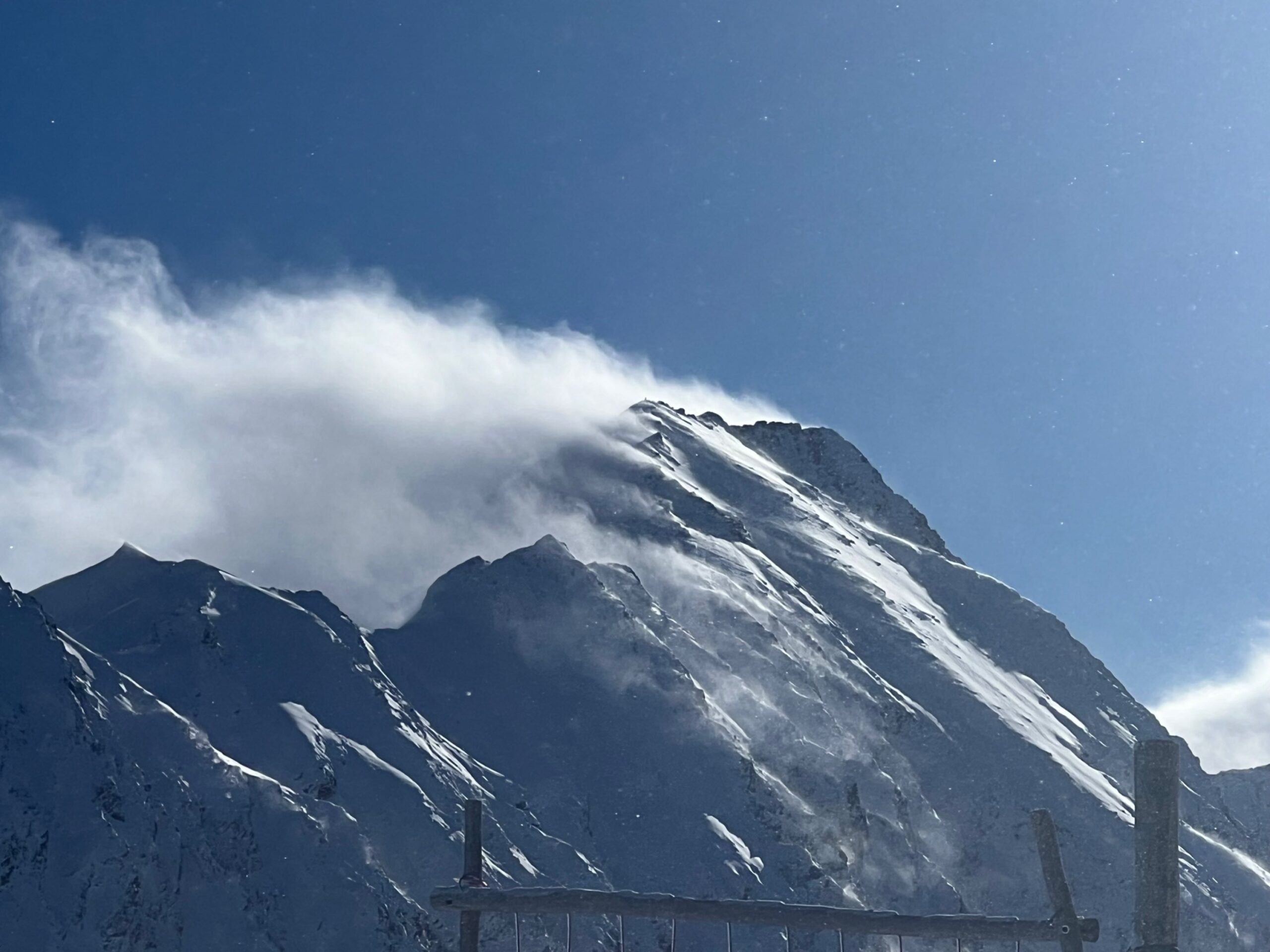
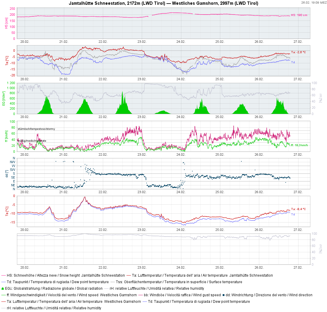
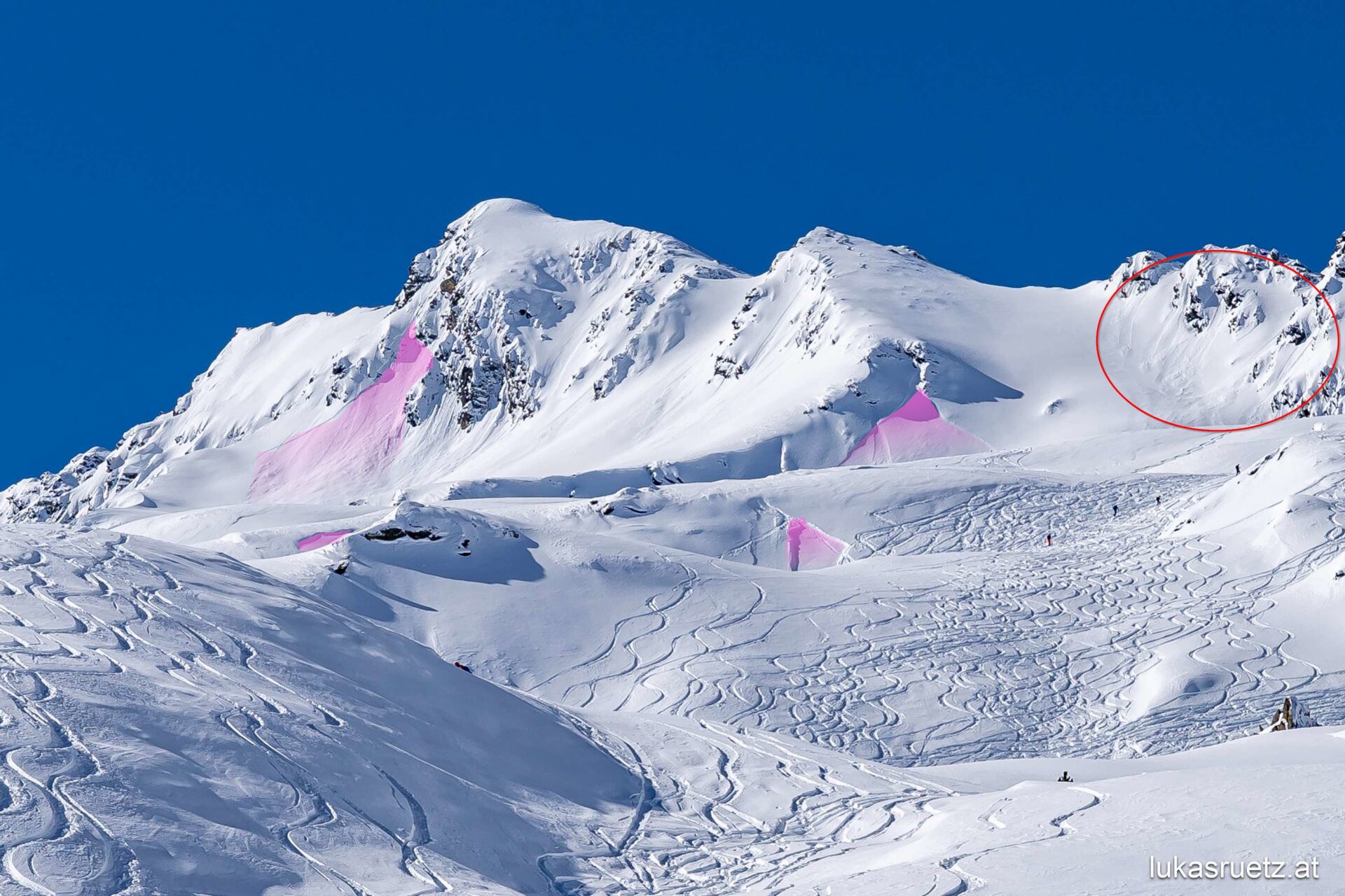
The weekend was reminiscent of one at the beginning of December 2023. About 50 cm of fresh snow accompanied by lessening winds led to a situation where the slab atop potential weak layers was not striking. Thus, in wind-protected zones, terrific powder could be enjoyed. BUT: starting in the nocturnal hours of 22.02, Geosphere Austria forecast increasing wind impact from the south, which proved correct. And then, we quickly had an extremely trigger-prone snowpack in the areas where there was wind: the weak layer consisted of loose powder, the slab of freshly generated snowdrifts. Predictably, the frequency of avalanche reports soared. Successes were obtained from artificial triggerings with explosives. On steep, wind-protected, usually ridgeline slopes, numerous avalanches triggered naturally. Many were also triggered by winter sports enthusiasts. The fact that the slab was relatively soft helped most of the winter sports enthusiasts to escape from the released snow masses. In wind-protected terrain, on the other hand, loose-snow avalanches on extremely steep slopes dominated.
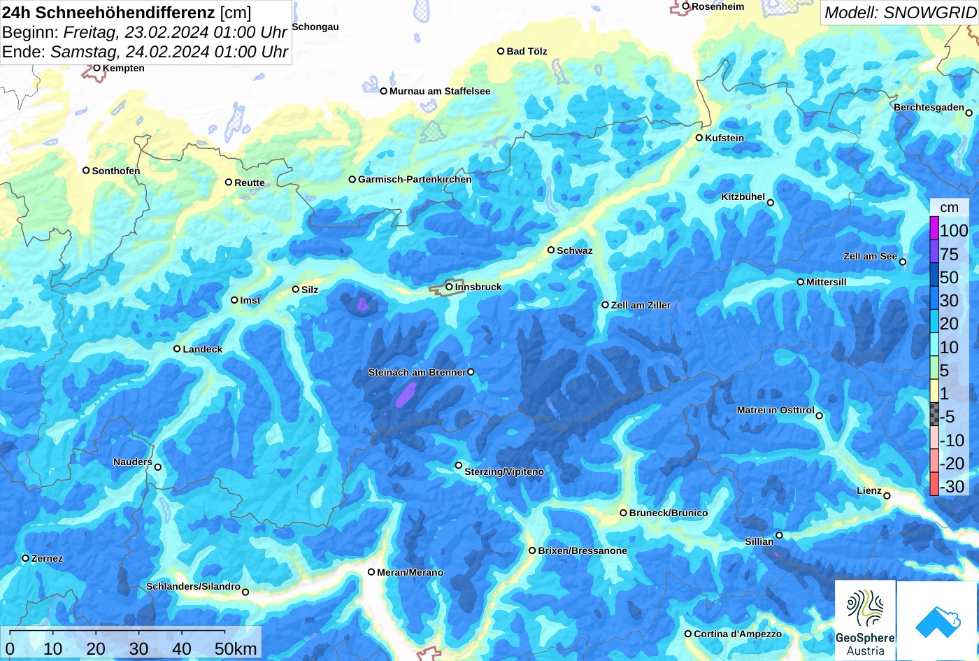
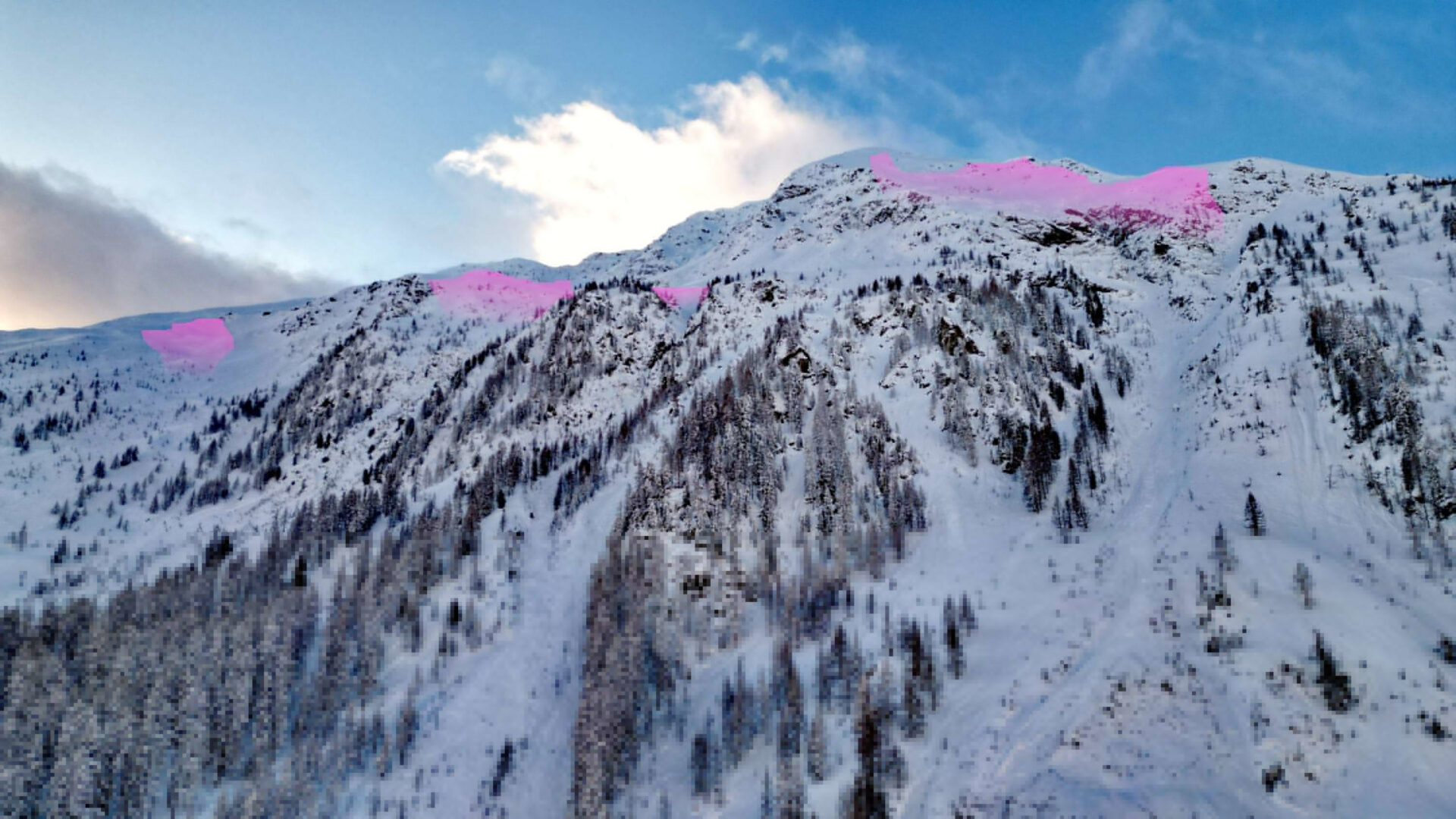
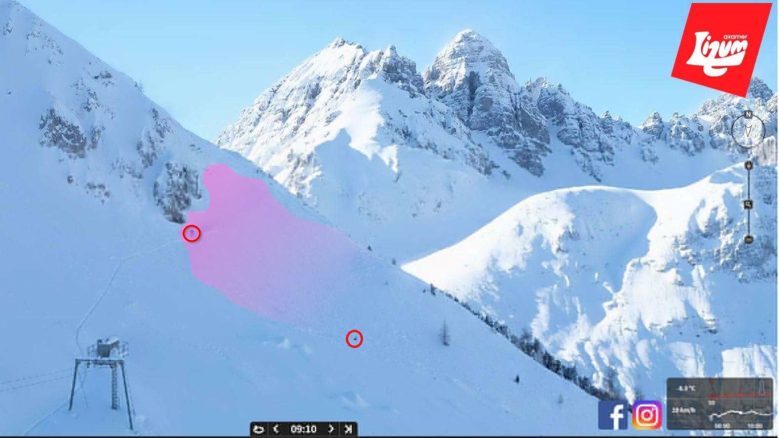
Distribution of fresh snow on 23-24.02.2024
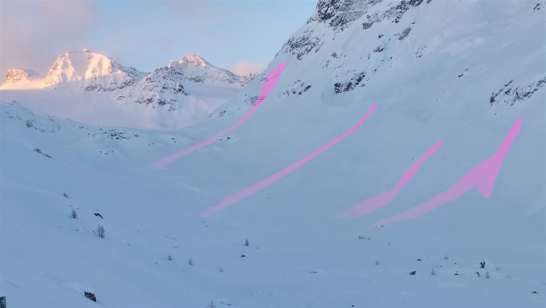
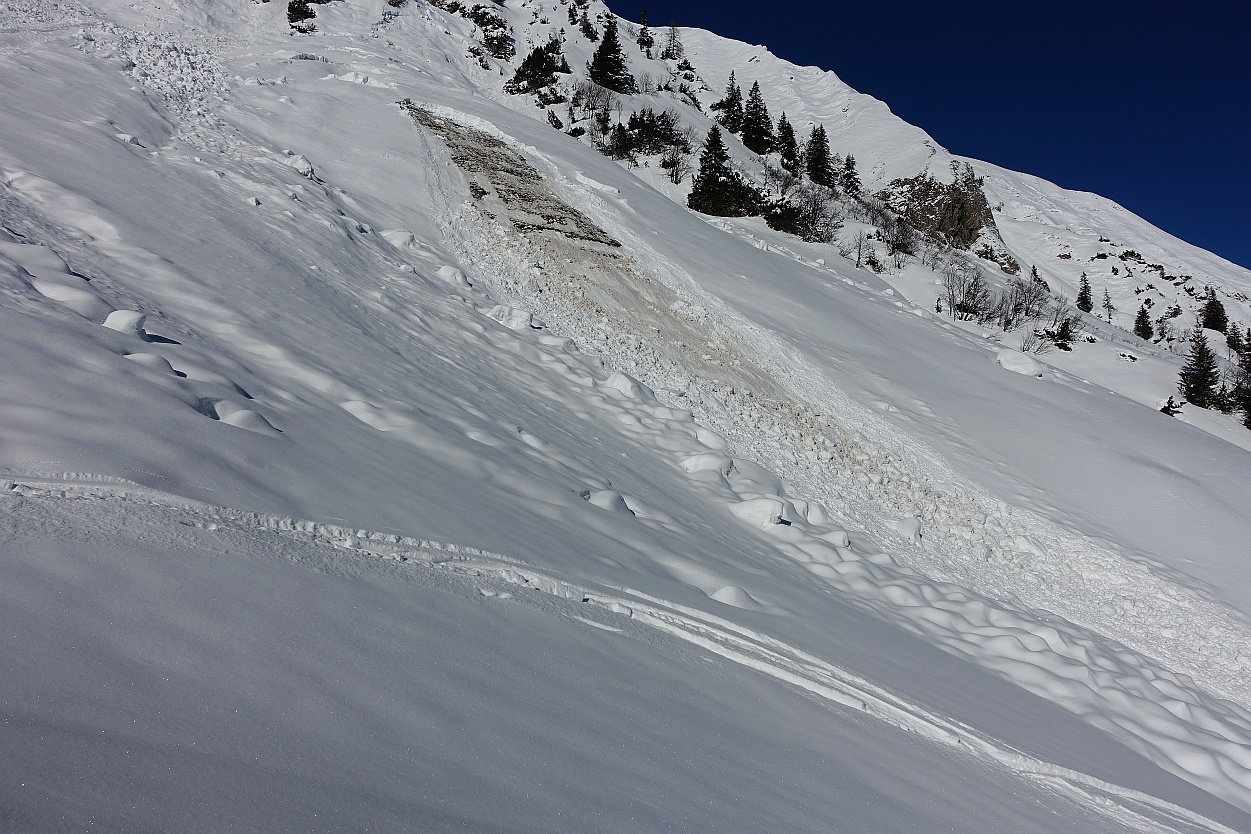
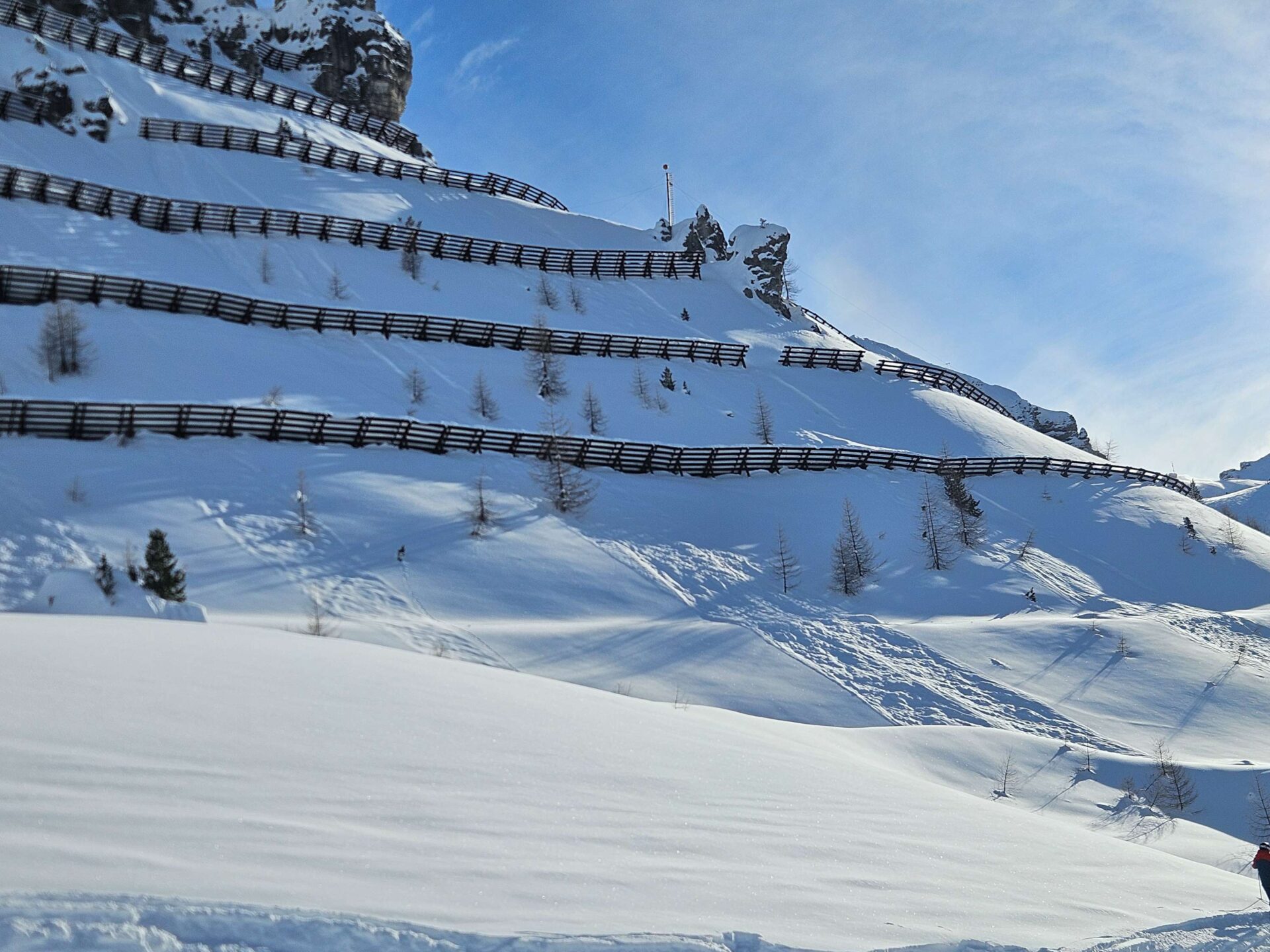
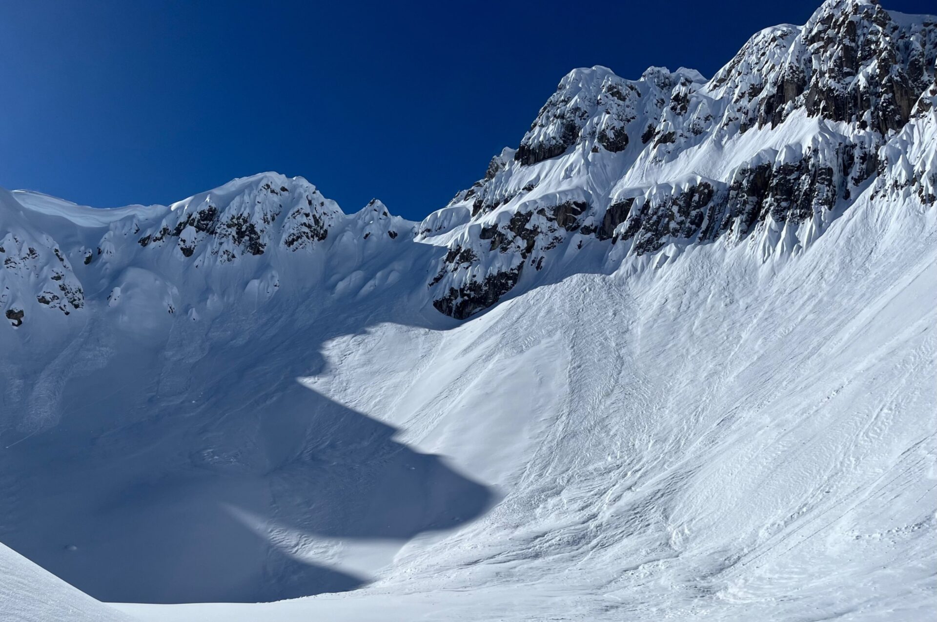
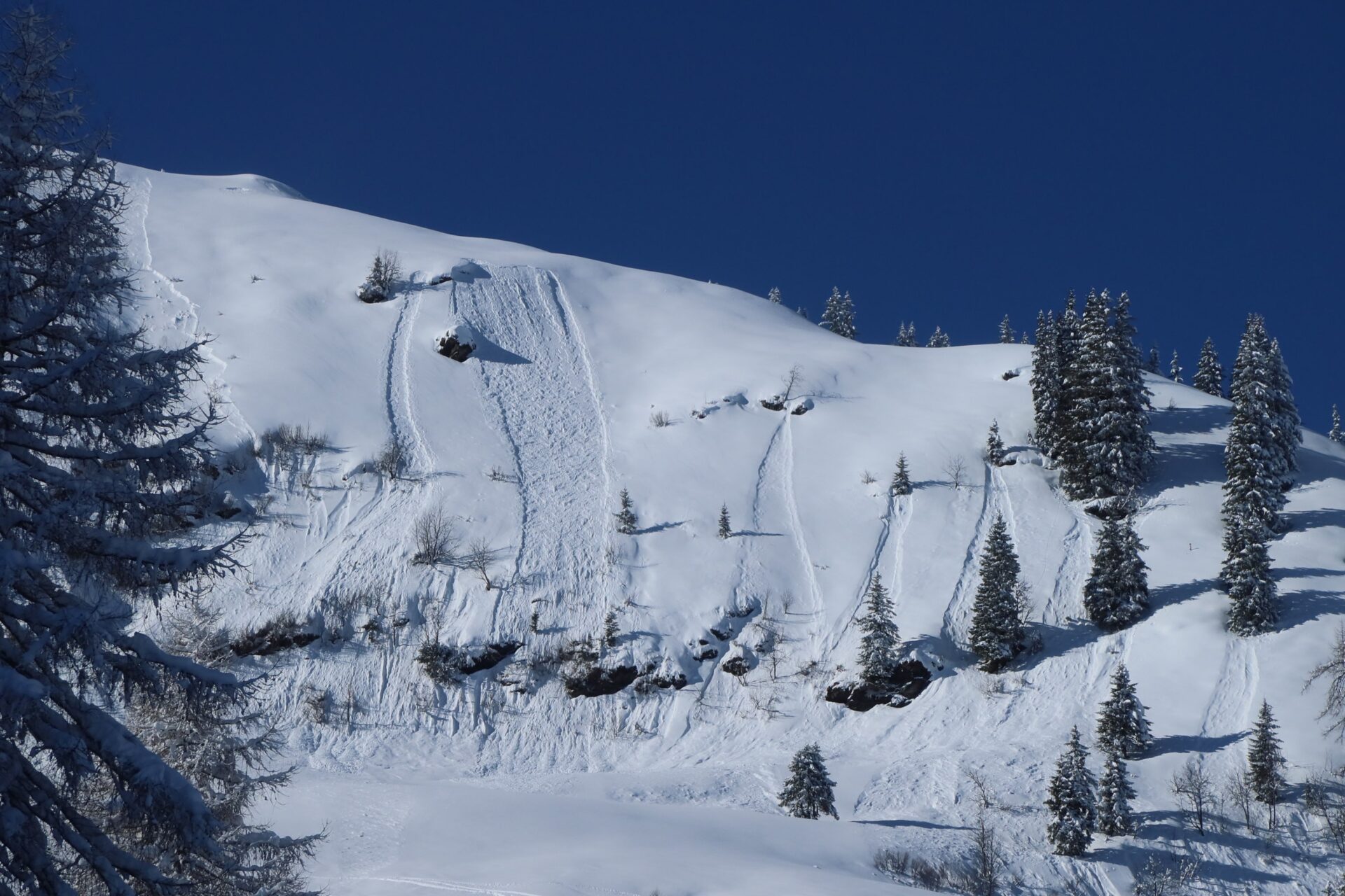
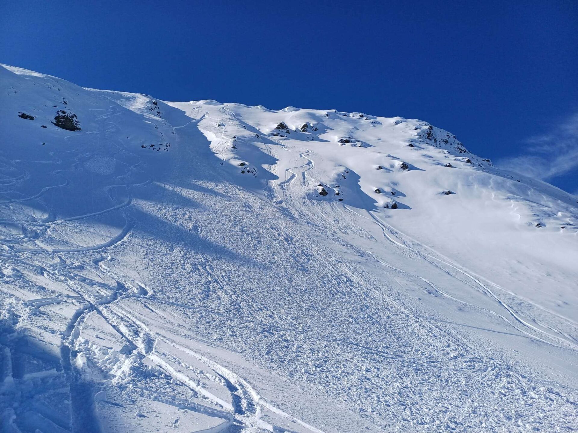
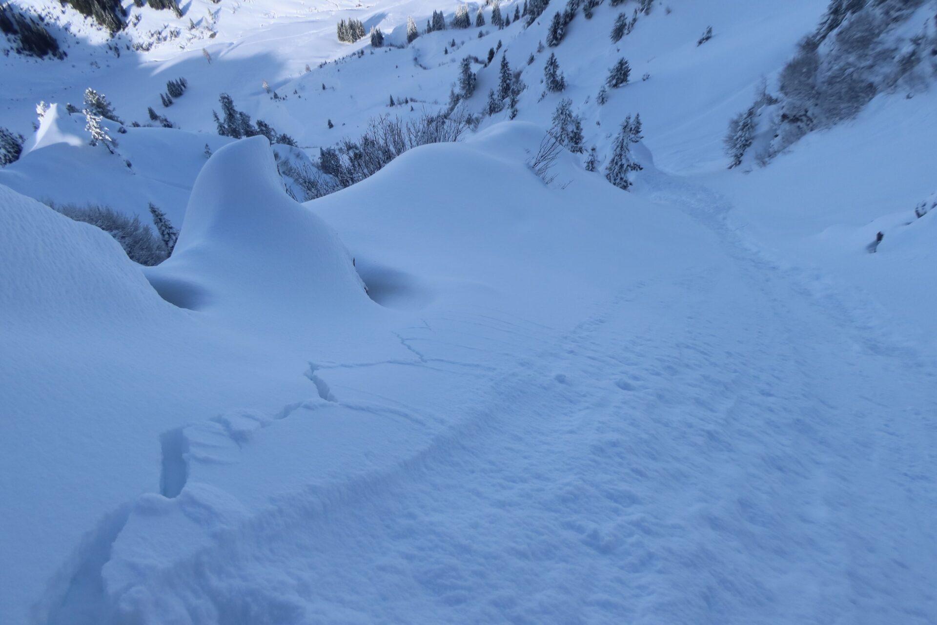
Slab avalanches and loose-snow avalanches
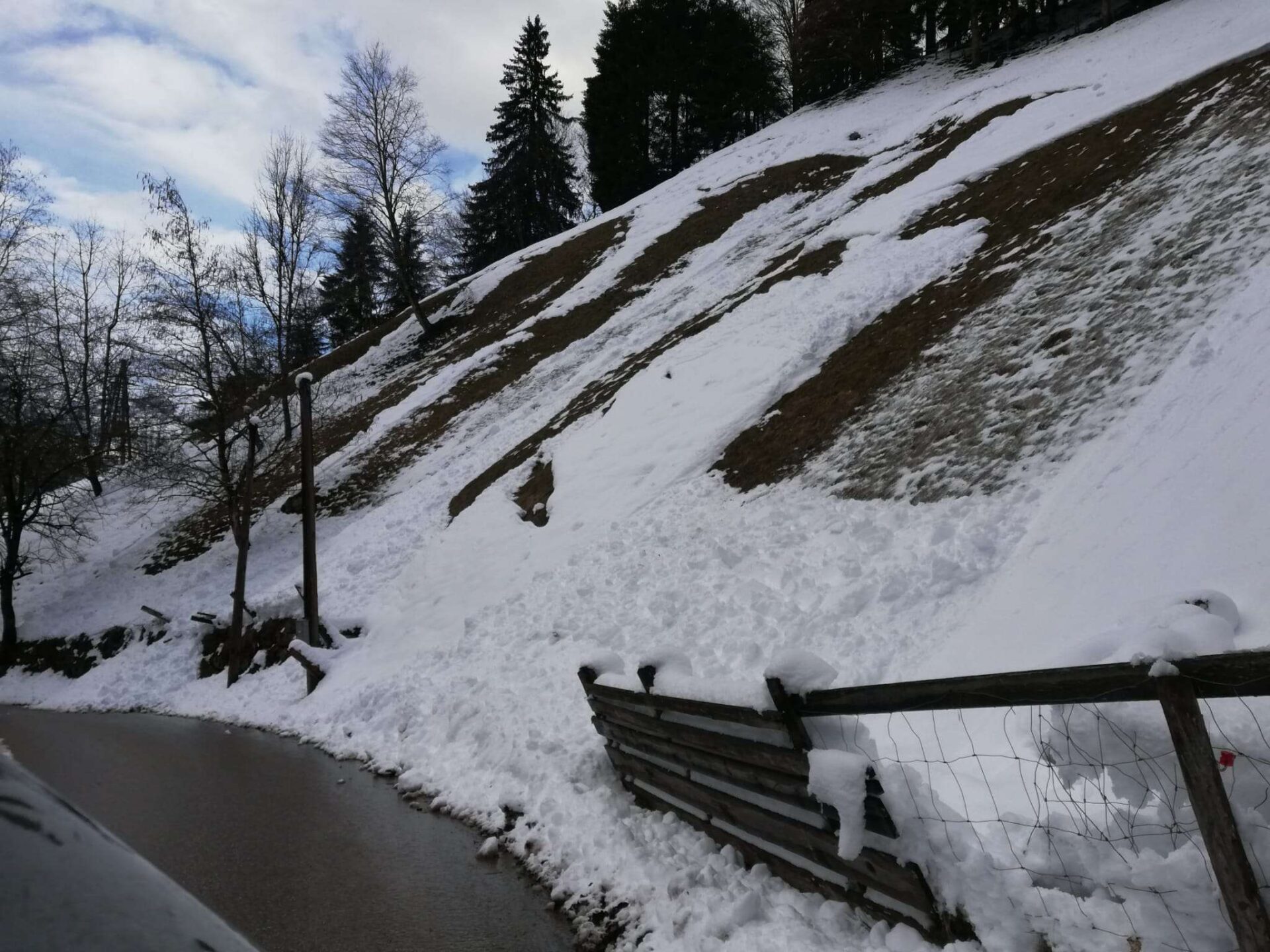
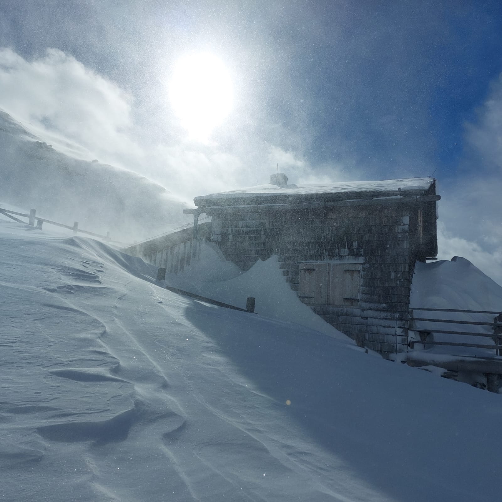
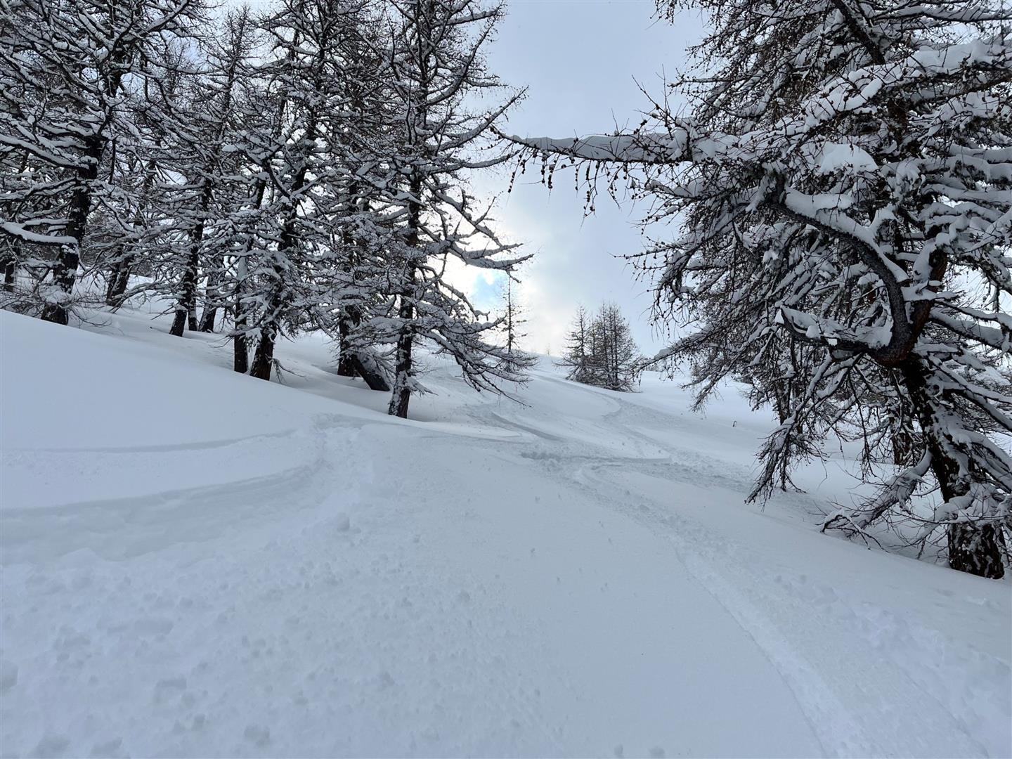
Here a few photos which reflect the overall situation…
31 avalanche triggerings reported to Tirol Headquarters, most involving persons
Between Friday and Sunday (23-25.02.2024) Tirol Headquarters received reports of 31 avalanche releases. In most there were persons involved. By and large they were triggered by the persons themselves. No casualties or injuries were reported. In the Hintertux Glacier ski area a child was completely buried, with only one foot peeking out of the snow masses, yet came away unscathed. Also some roads were buried by avalanche snow. Most of the releases were loose-snow or glide-snow avalanches. In one near Matrei am Brenner, two cars were involved.

The tiny instant separating good from bad
As referred to above, the interim between fine powder snow and trigger-prone snowpack was very brief.
And again, increased gliding snow
Once the near-surface layers have stabilized (but caution: this will take longer at high altitudes in the regions where snowfall was heaviest), the latent gliding snow problem will again come to the forefront…