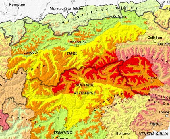
As a consequence of fresh snow, avalanche danger is increasing markedly throughout Tirol. Most of the snowfall is anticipated in East Tirol and in the eastern sector of the Main Alpine Ridge, where Danger Level 4, High, will be reached above the timberline. Particularly on Friday, naturally triggered medium-to-large sized slab avalanches are likely. For winter sports enthusiasts this is a dangerous situation, since avalanche prone locations are numerous and can’t be recognized. We advise self-restraint over the weekend, meaning: defensive behavior at all times.
Current situation
Weather
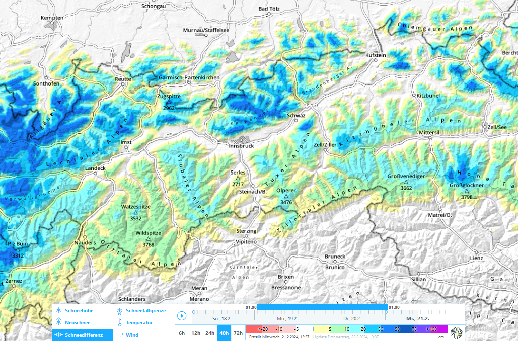
In a striking SW airstream, moist air masses are being delivered to the southern flank of the Alps. In North Tirol this became noticeable on Thursday, 22.02, through often storm-strength southerly foehn winds in the mountains. In the southern regions it has already begun to snow.
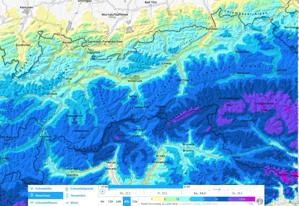
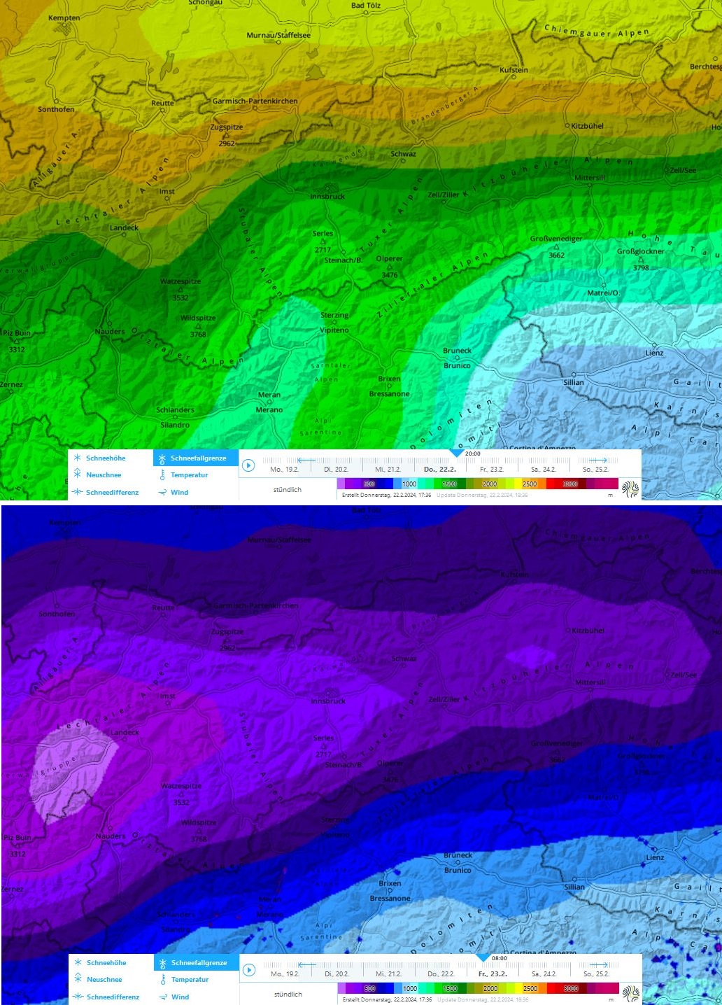
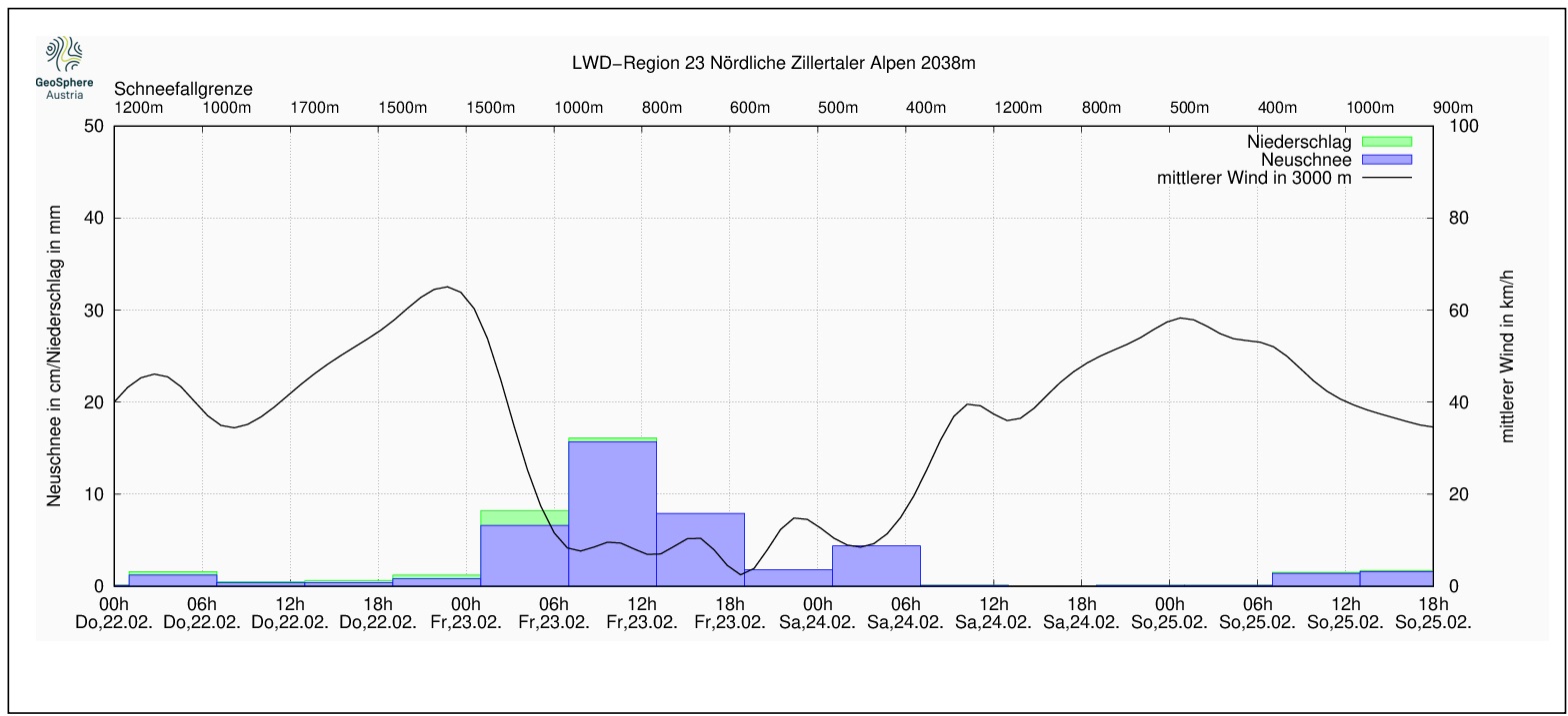
On Thursday night the foehn will collapse and precipitation will spread over all of Tirol. The snowfall level will descend swiftly down to low lying areas. By Saturday morning 50 to 70 cm of fresh snow is anticipated in the mountains of East Tirol and the Zillertal Alps; elsewhere south of the Inn, 30 to 50 cm expected, north of the Inn 15 to 30 cm.
Winds in the early hours of the precipitation will still be moderate to strong from the west (in northern regions) and from the south (in southern regions), then will slacken off significantly as the precipitation unfolds.
Avalanche situation
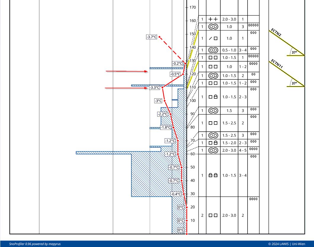
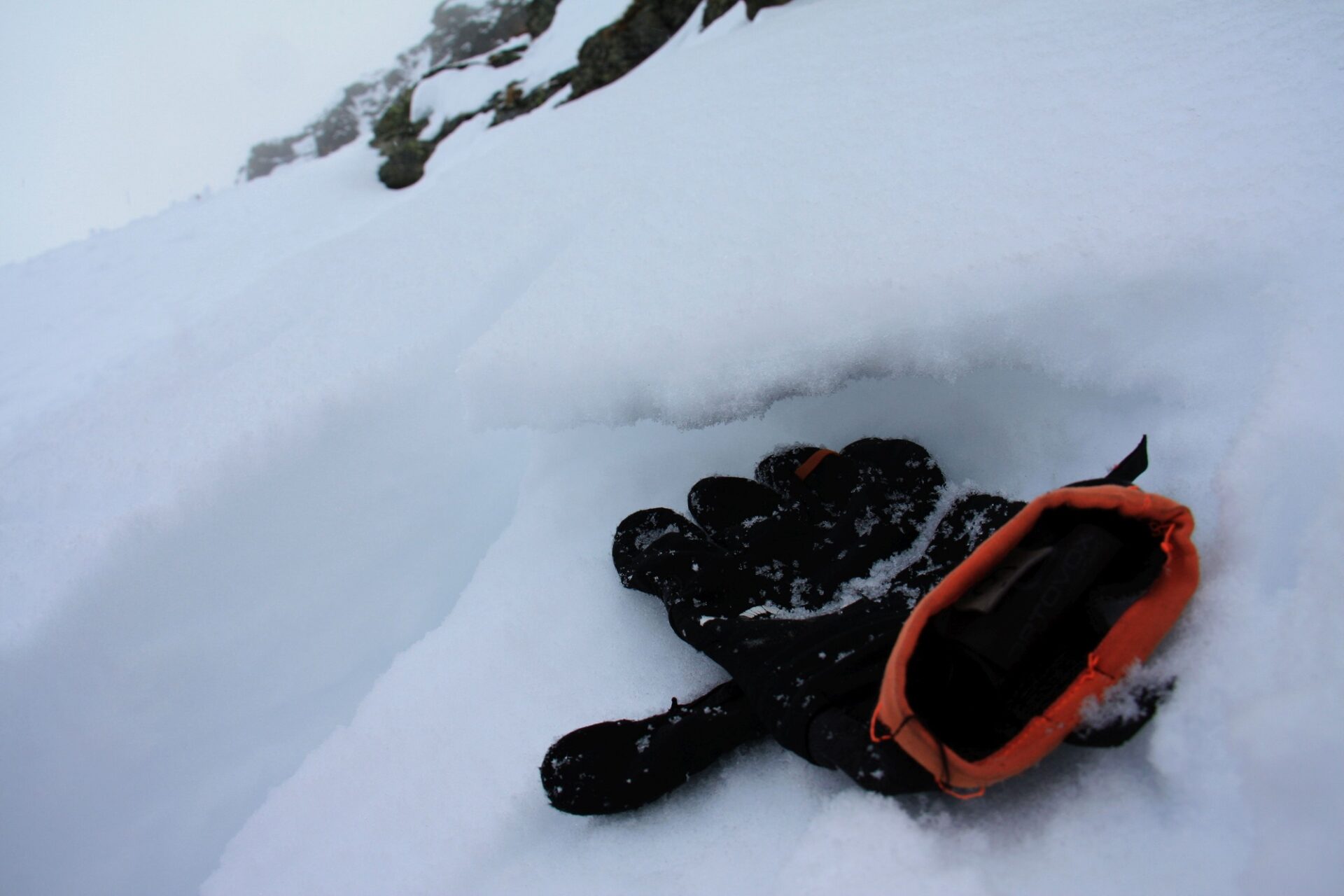
We have undertaken comprehensive snowpack analysis over the last few days, including with the support of the Helicopter Police. This revealed that particularly the uppermost part of the snowpack contains weak layers for slab avalanches. Due to warm temperatures last week and rainfall up to high altitudes, esp. on Friday night, 16.02), a number of melt-freeze crusts formed on which weak layers of faceted crystals formed. But before now, a slab lying on top of those layers was lacking; precisely this is what is expected to develop in the coming snowfall. More than anything else it is these weak layers which could lead to large-sized naturally triggered slab avalanches in areas where snowfall is heaviest. Since the weak layers consist of faceted crystals and so could remain problematic for a longer period of time, they will be referred to in Avalanche Bulletins as Persistent Weak Layers. We assume that this problem will prevail especially on W/N/E facing slopes above 2400 m.
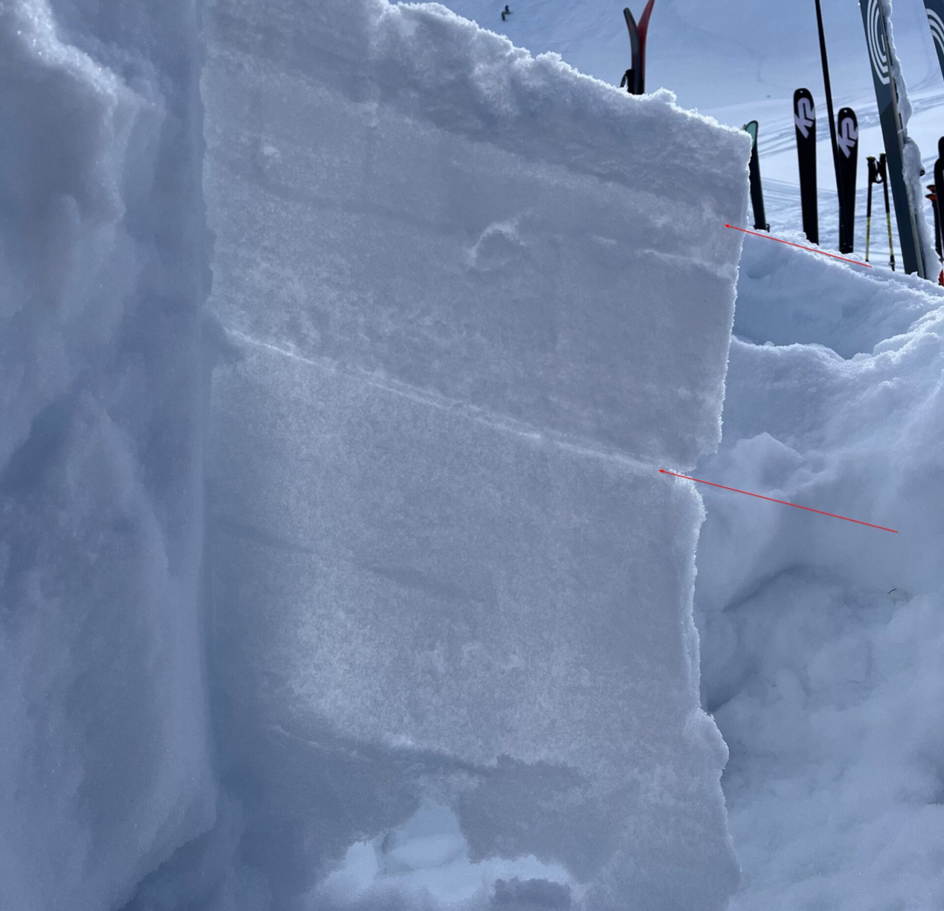
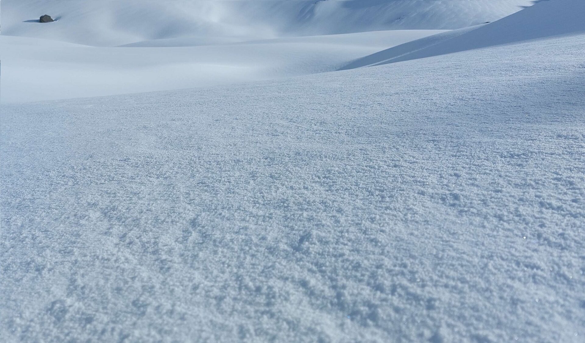
In addition, weak layers can also form inside the fresh snow and snowdrifts wherever there is lots of snowfall, and these can be prone to triggering particularly during and for several days following the precipitation. What is most treacherous is the disappearance of winds during the precipitation. Freshly generated snowdrift accumulations thus will get blanketed over by fresh snow and no longer be recognizable. There was also lots of graupel deposited in many places during the precipitation at the beginning of this week, which for a short spell can serve as a weak layer.
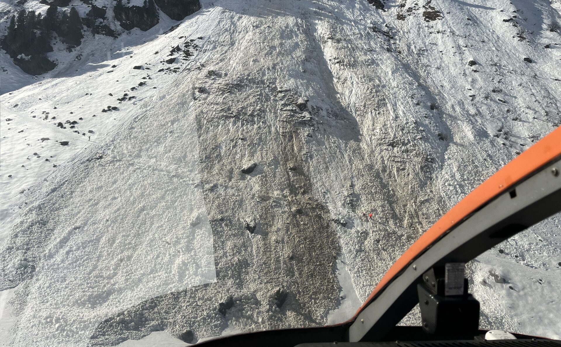
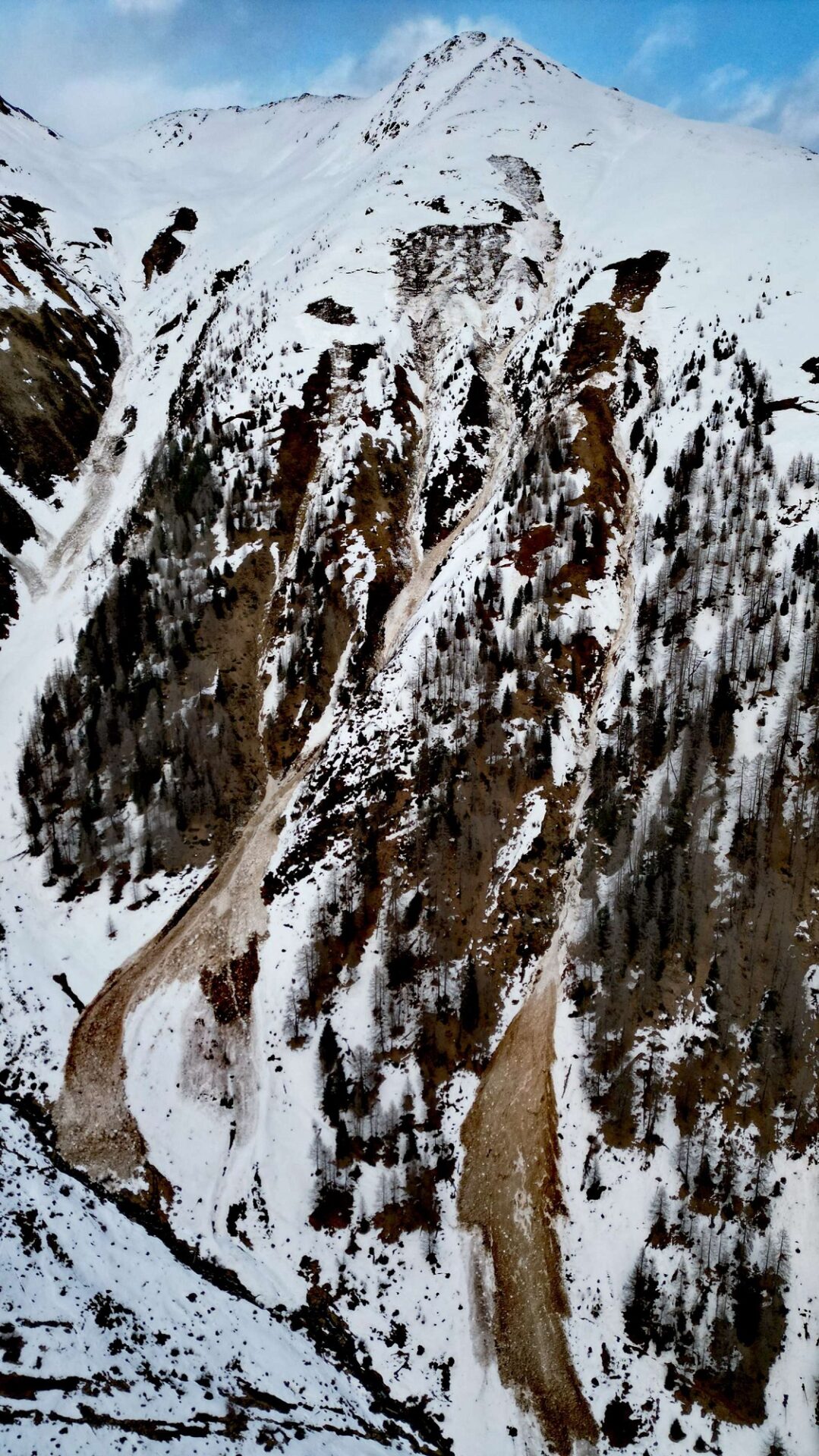
In addition, danger of glide-snow avalanches will increase as a result of the fresh snow, esp. on steep grass-covered slopes. Experience shows that gliding snow activity usually increases following precipitation with a slight delay, in other words, as soon as the snowpack as settled somewhat. Thus, this will be a special danger on the weekend and during the days following.
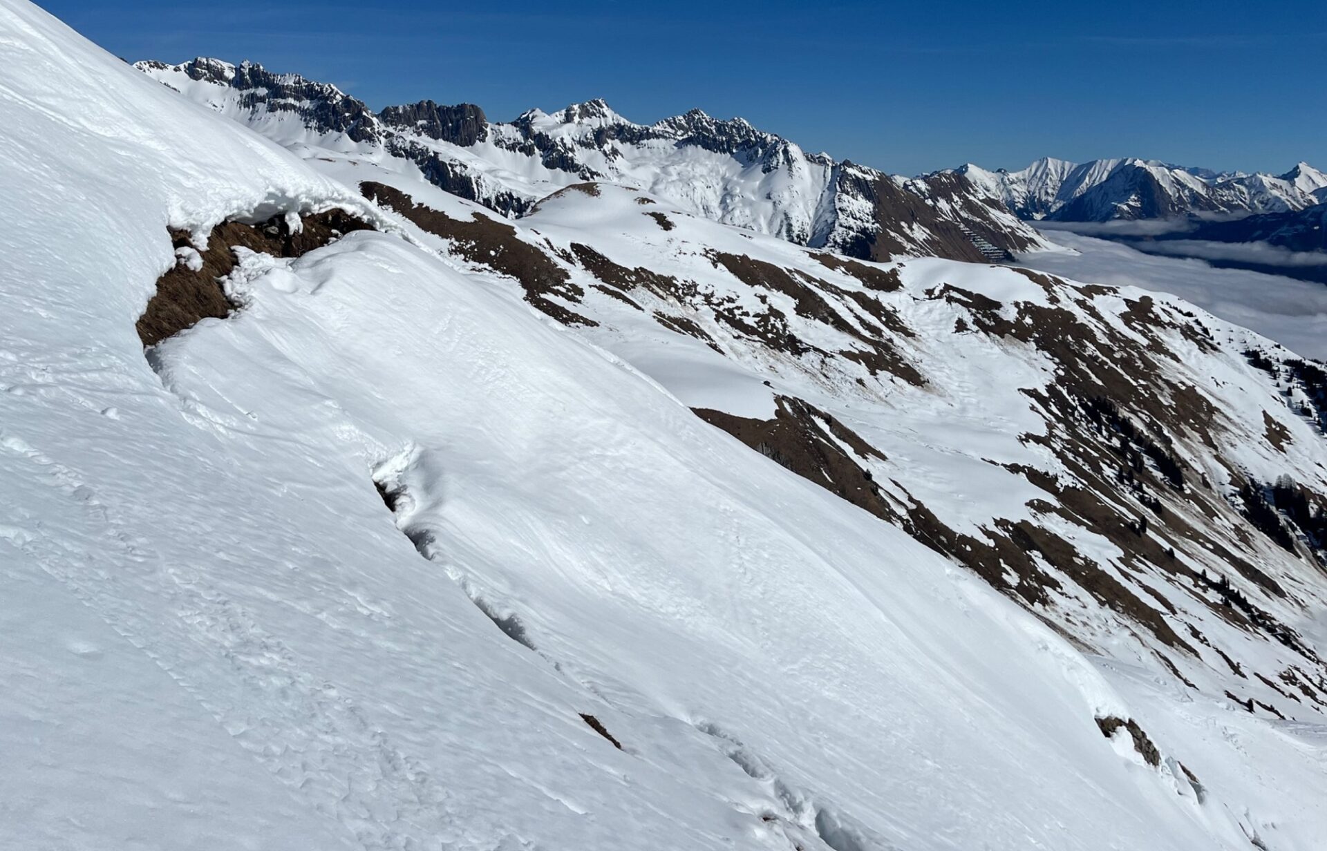
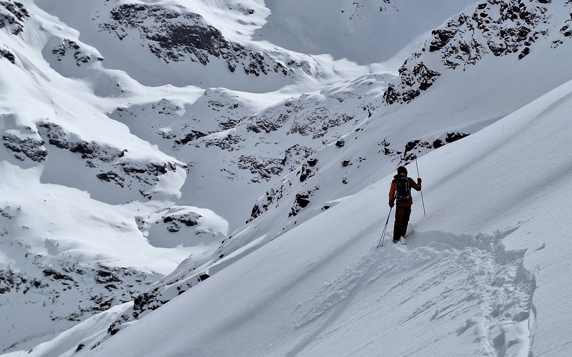
All in all, a complex situation. And for winter sports enthusiasts, a threatening avalanche situation. While naturally triggered slab avalanche activity will decrease as the precipitation comes to an end, slab avalanches on the weekend will easily be triggered by one single person. Keep on eye out for loose-snow avalanches which will become more numerous with solar radiation. We advise over the next few days: extremely defensive behavior, particularly in the regions where snowfall is heaviest.
Review
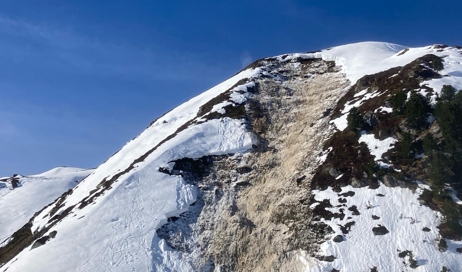
Last week was marked by highly variable weather conditions. Seen from the point of view of avalanche science, last weekend was most striking: the cold front that moved in on Friday night, 16.02, brought rainfall to above 2500 m. The air was surprisingly moist and warm, making warmth seepage into the snowpack quite striking. This unexpected development found its reflection in the Avalanche Bulletin. Especially on Saturday but also on Sunday, numerous wet-snow and glide-snow avalanches were observed. On Sunday, 18.02, there was also an avalanche incident involving persons. Near the Pfundsalm in Hochfügen, two persons were caught in a naturally triggered, large-sized glide-snow avalanche. They were lucky, and were able to stay on the surface, so got away unscathed.
On Monday, 19.02, temperatures dropped somewhat and a cold front brought 10-30 cm of fresh snow to the northern regions.