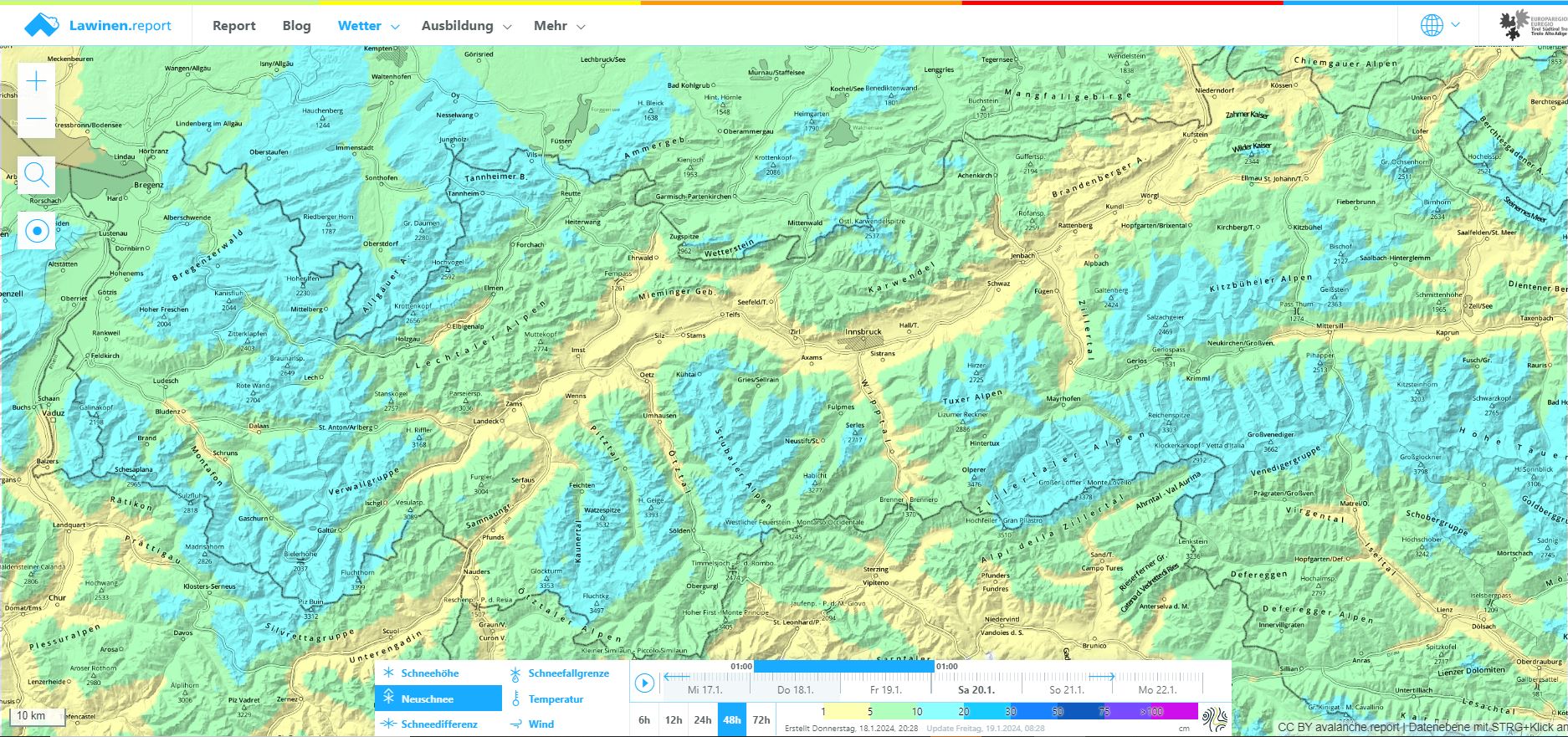
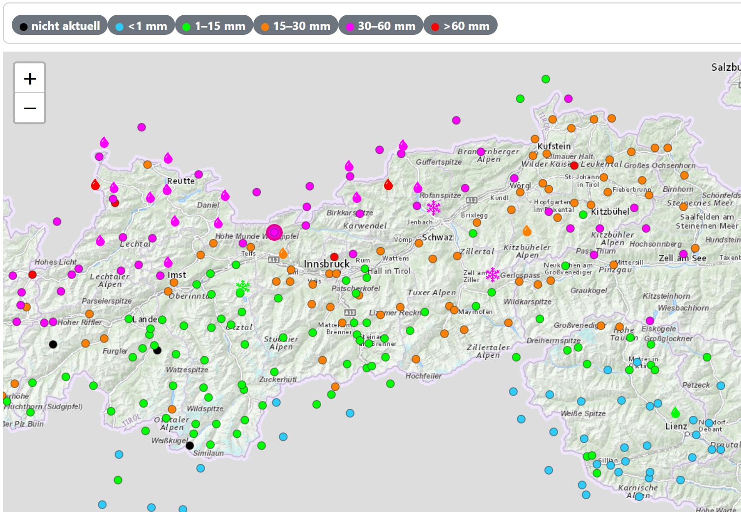
Heavy precipitation in far-reaching parts of North Tirol accompanied by often storm-strength NW winds have negatively affected avalanche danger levels. The snowdrift problem remains preeminent, avalanche prone locations have become far more frequent. In some places avalanches can be easily triggered and become highly dangerous for winter sports enthusiasts. We recommend a defensive route selection on the weekend. In addition, the activity of glide-snow avalanches has increased as a result of the recent loading atop the snowpack and rain impact.
The avalanche situation in central and southern East Tirol is more favorable. In these regions there is little change since last week.
Current situation
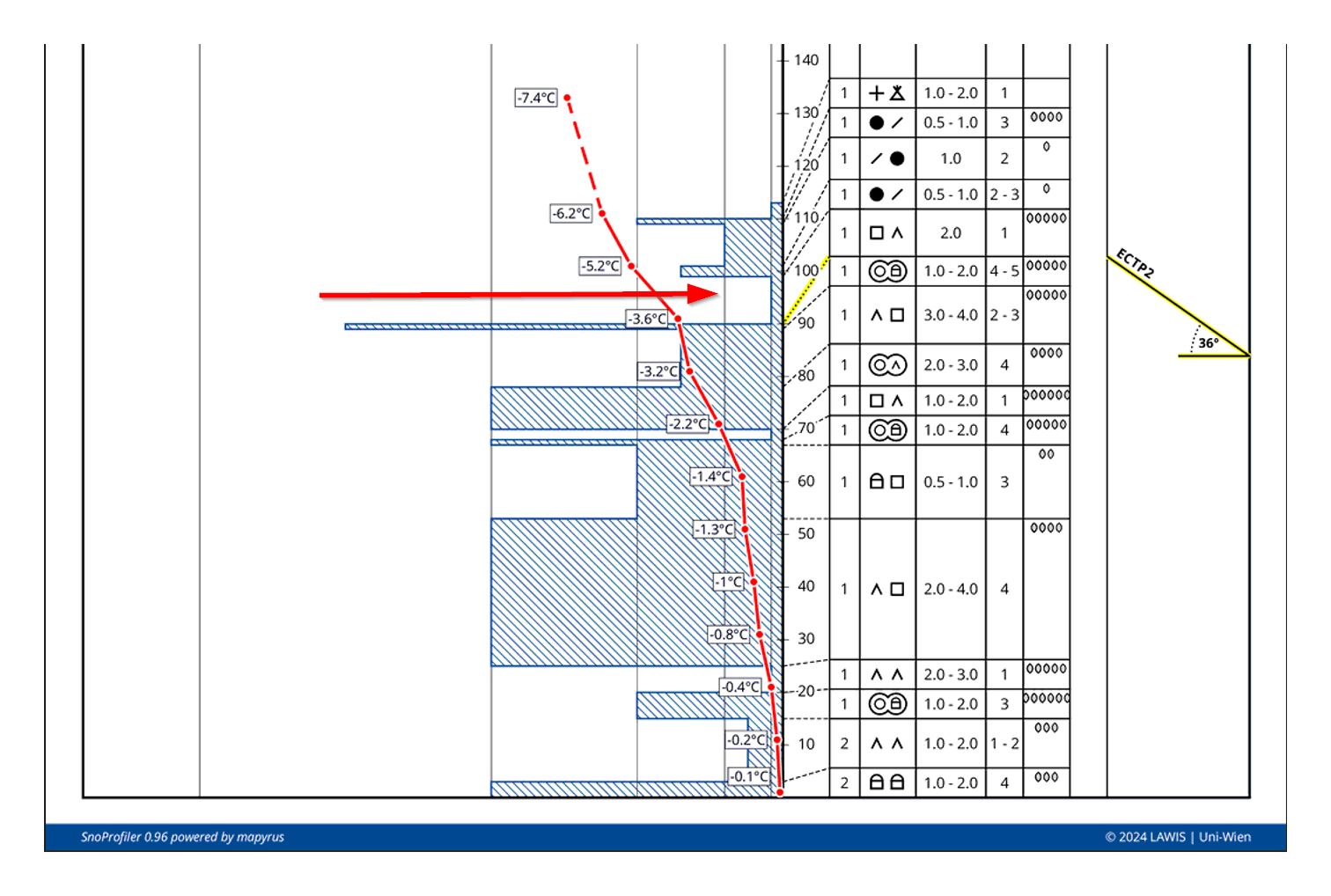
Snowdrift problem & potential persistent weak layer
The fresh snow and drifts from the last few hours have been deposited atop a favorable old snowpack at least up to 2200 m, which is significantly moistened due to the marked rise in temperatures and rainfall on 24 January. The warmth dissolved all the weak layers near the snowpack surface. Fresh snow and drifts below 2200 m are bonding well with the moistened snowpack surface.
At higher altitudes the situation is different: possible short-lived weak layers inside the fresh snow and snowdrifts in the form of loose fresh snow. With ascending altitude such avalanche prone locations become more frequent.
Potential (long-lived) weak layers may have been generated near a melt-freeze crust which formed as of 9 January in the form of faceted crystals. We assume a potential danger particularly on sunny slopes (E/S/W) above 2400 m, on shady slopes potential between 2200 and 2400 m. This applies particularly to regions where snowfall has been heavy. We look forward to reports from observers on-site (snobs.live).
As regards the coming sunny weekend we advise self-restraint in outlying terrain following this highly variable phase of weather conditions. Pay close heed to the fact that we have had a largely stable snowpack in recent weeks, and only small near-surface avalanches could be triggered. This situation has now changed. Danger zones are much more frequent and triggerings can have far greater consequences. In addition, there is uncertainty about how trigger-prone the weak layers beneath the fresh snow and drifts actually are. Our recommendation: to begin with, avoid the big, steep slopes and wait until the coming warmth gradually improves the situation.
Gliding snow problem & loose-snow avalanches
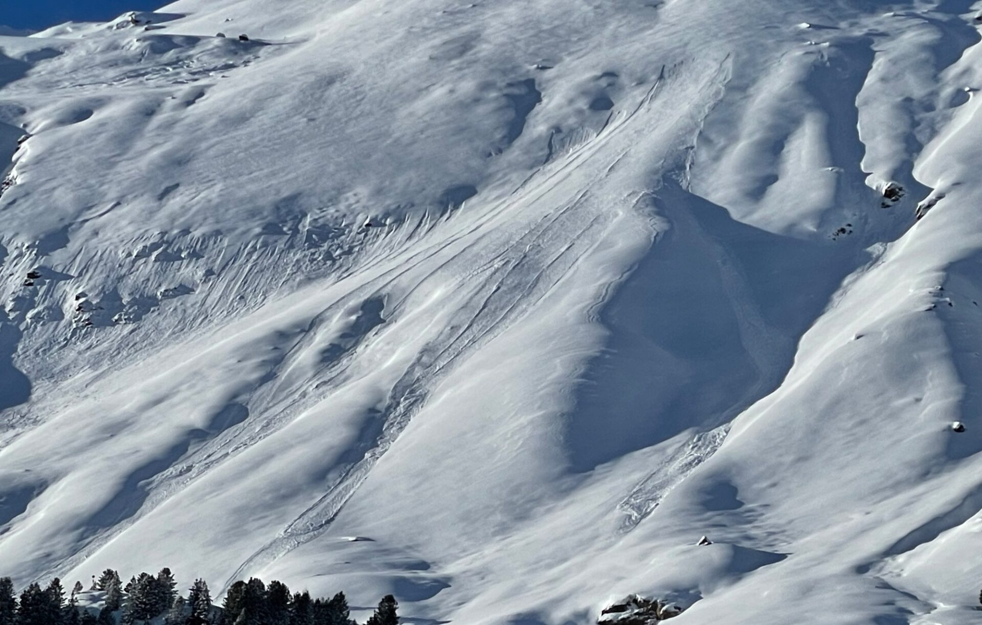
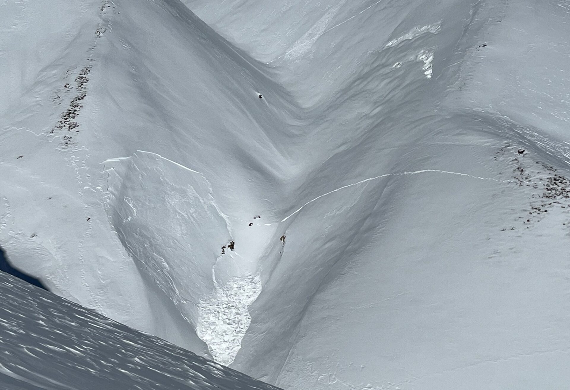
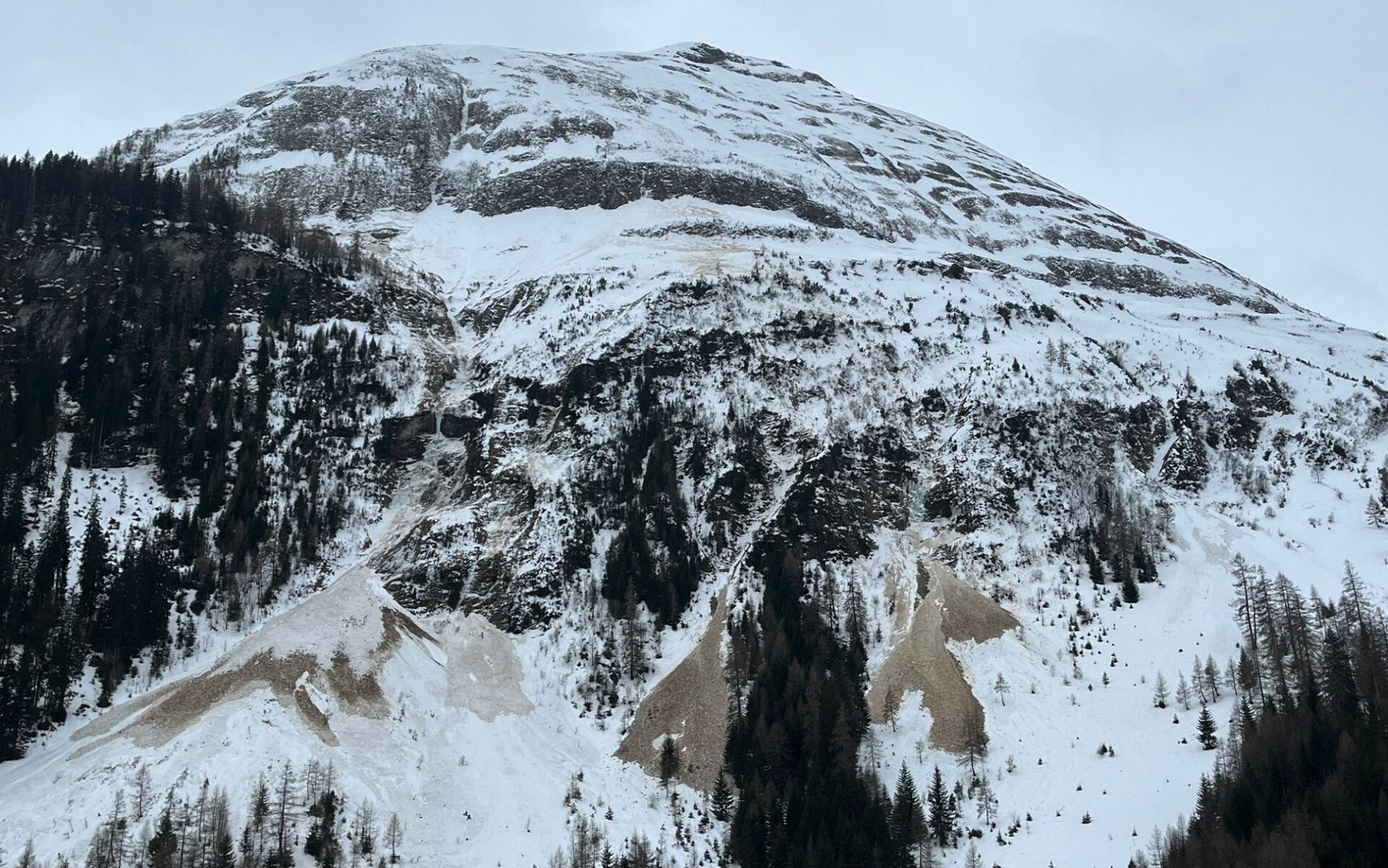
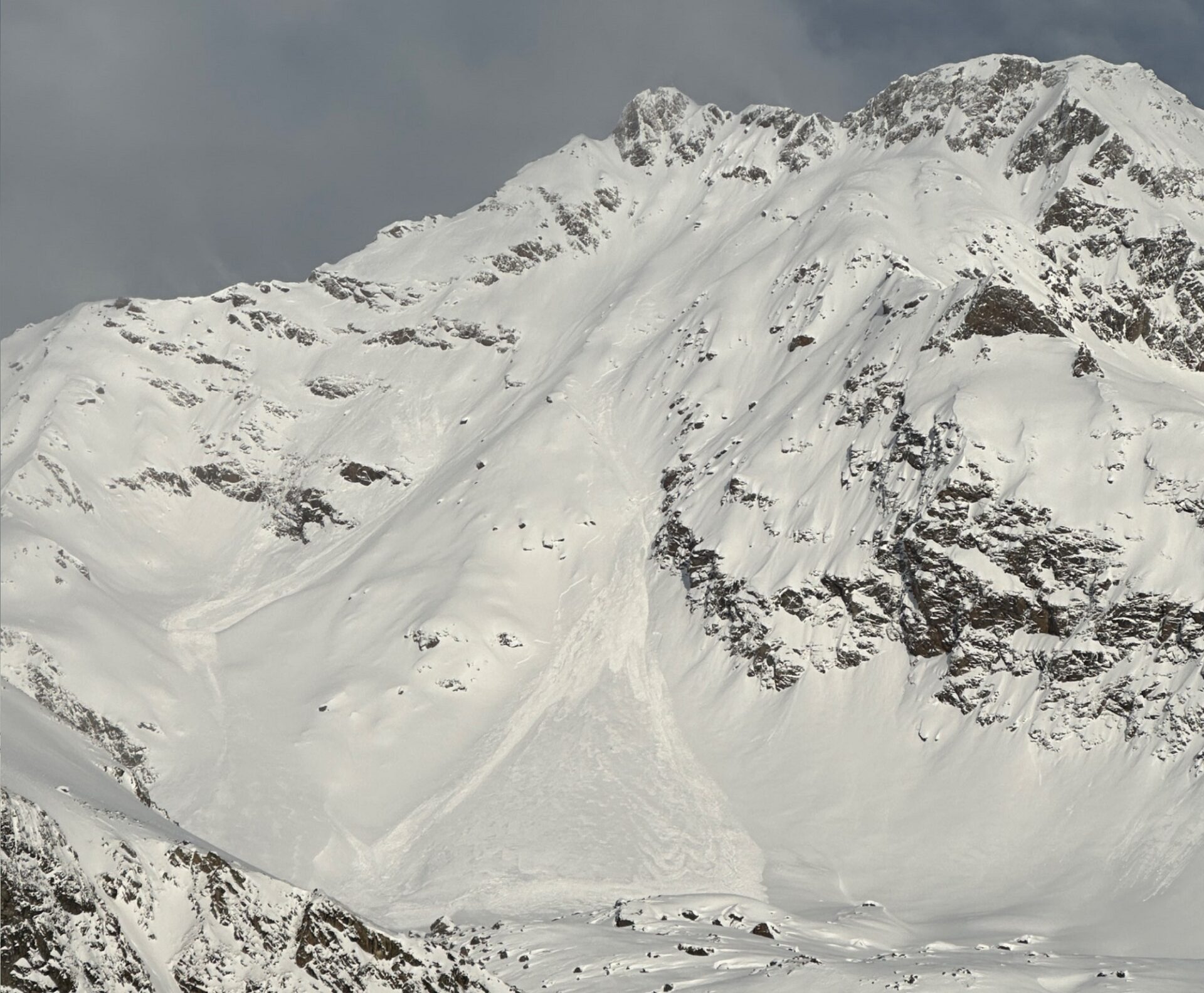
The precipitation has generated a load atop the snowpack which is reinforcing gliding snow activity. At intermediate altitudes the rainfall made the snowpack thoroughly wet. Over the next few days at intermediate altitudes (and also where snowfall was heavy), isolated large-sized glide-snow avalanches can be expected. This type of avalanche is always naturally triggered, and is thus utterly unpredictable. Pay close heed to the dangerous spots on your planned route and to potential runout zones, and insist on circumventing them whenever possible.
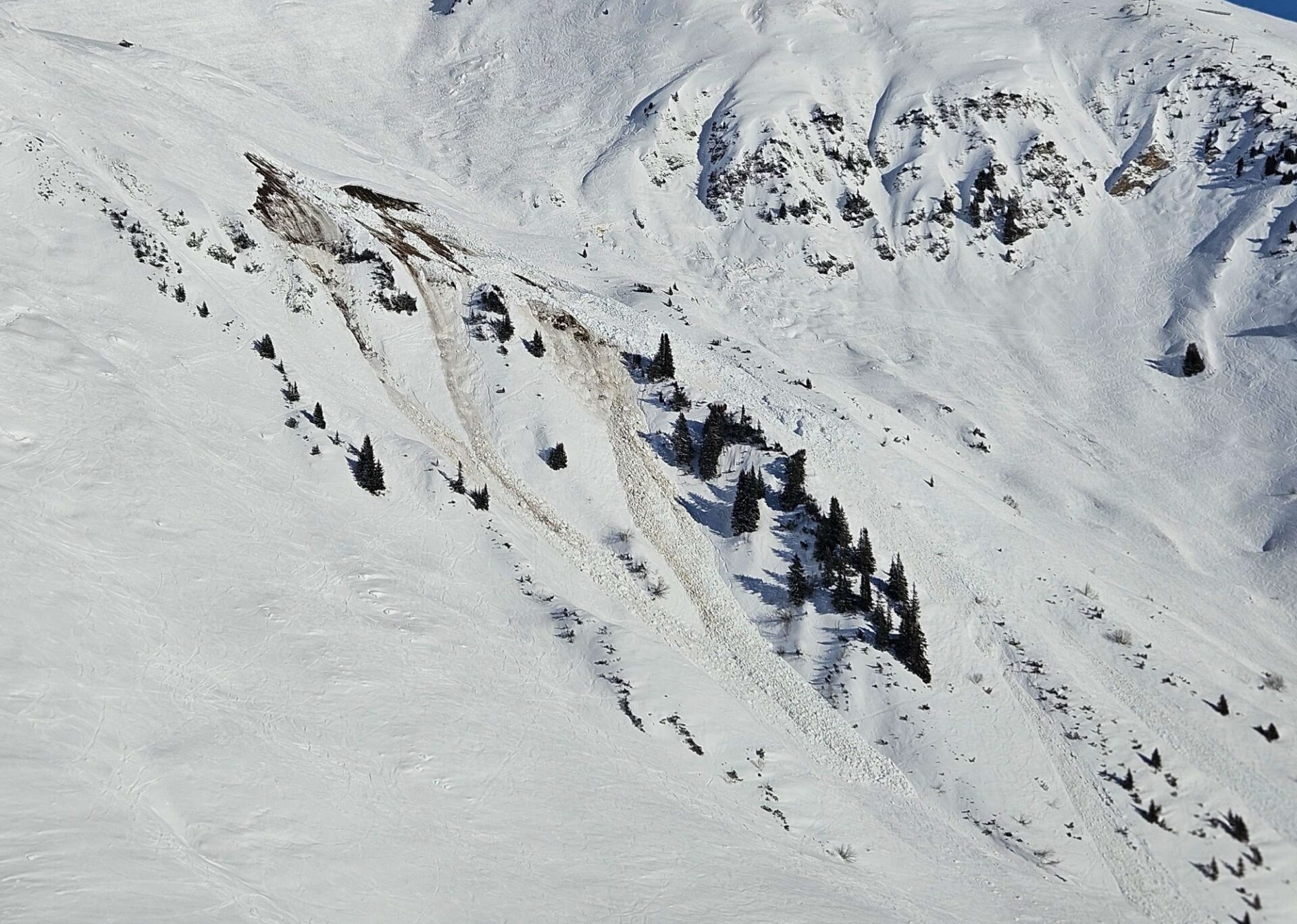
In addition, as a result of solar radiation and ongong mild temperatures on Friday, 26 January, numerous naturally triggered loose-snow avalanches can be expected in extremely steep terrain. Their magnitude will vary, depending on the amounts of fresh snow. The avalanche prone locations occur particularly on sunny, rocky slopes.
A short review
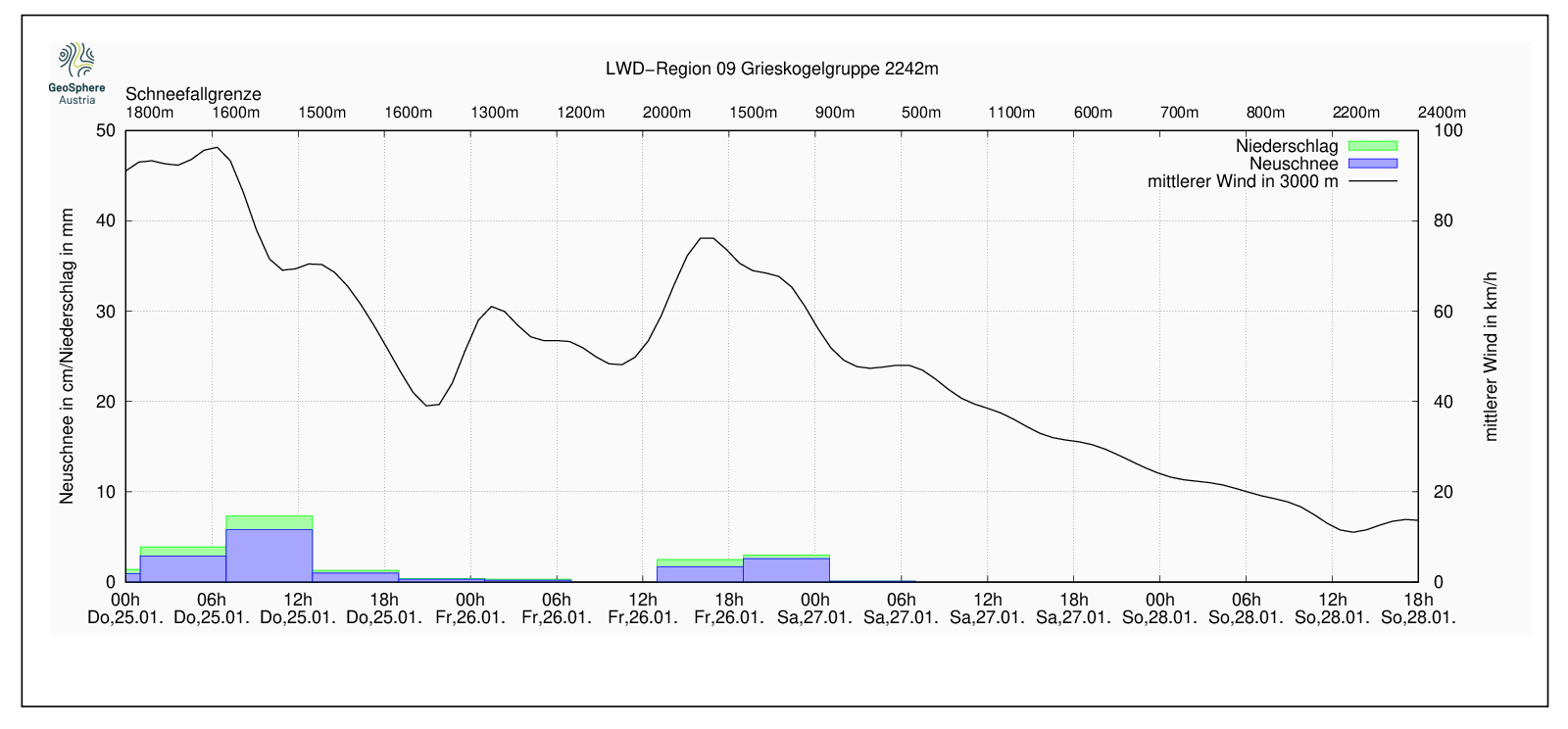
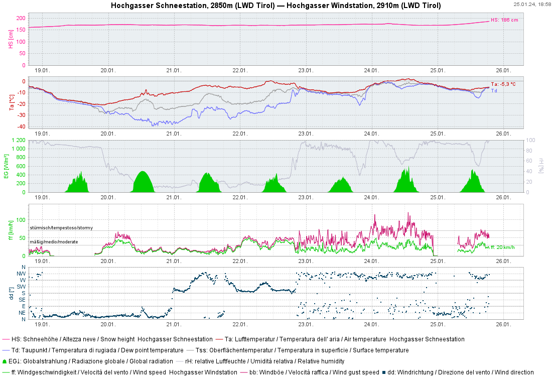
The last few days were marked by highly fluctuating temperatures. Rain, snow, wind, in all their variations, a roller-coaster of conditions for snow lovers. Initially some snowfall with little wind as temperatures plummeted (19 January), then beautiful winter days with temperatures rising continually. Then a succession of fronts emerging from a mild/moist and turbulent NW airstream. A cold front in the early hours of Thursday, 25 January, brought lots of precipitation regionally. The snowfall level on that evening was above the timberline to start with, descended incrementally during the night down to intermediate altitudes.
Outlook
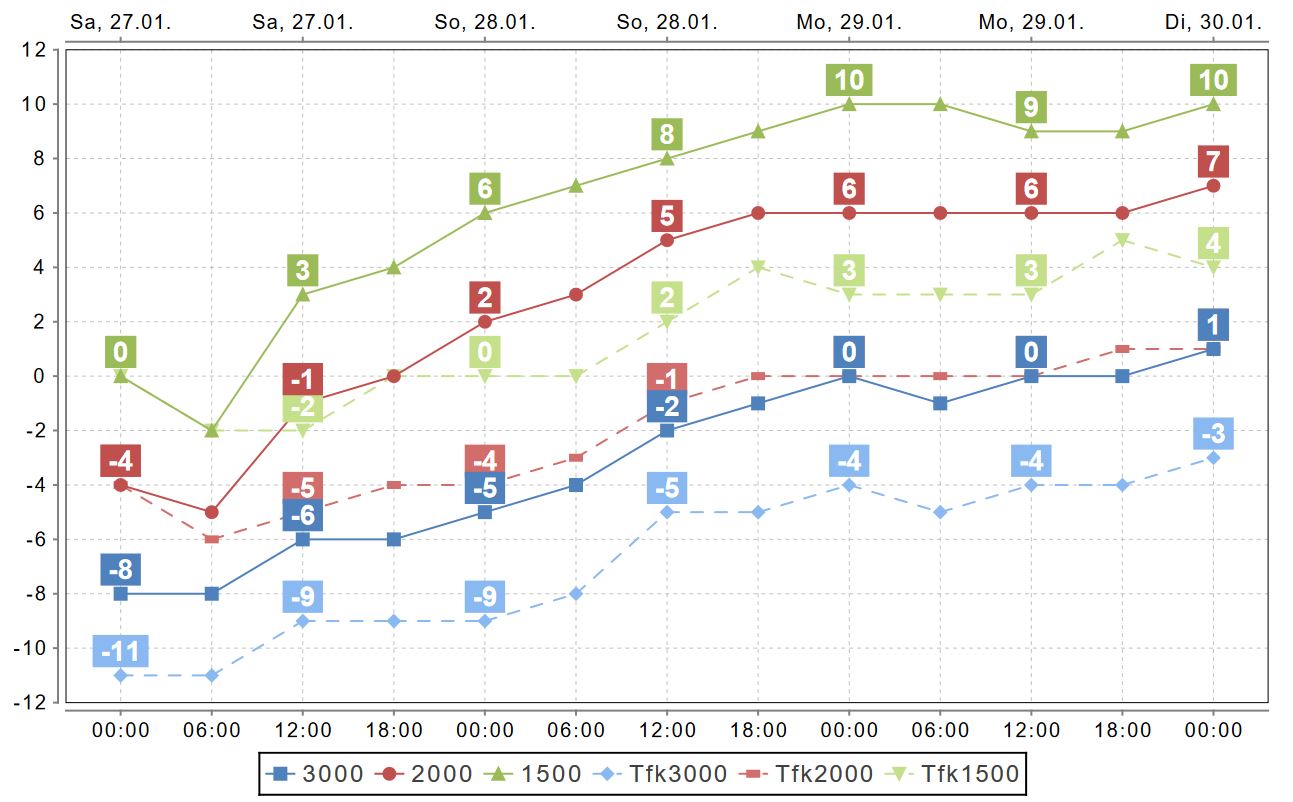
What’s next? First a brief quiet period until Friday afternoon, 26 January, followed by a weak cold front, bringing some precipitation on Friday night. Winds will again be strong and will transport the fresh snow. On the weekend, tranquil conditions will follow and persist for awhile. A period of mild beautiful weather will follow.