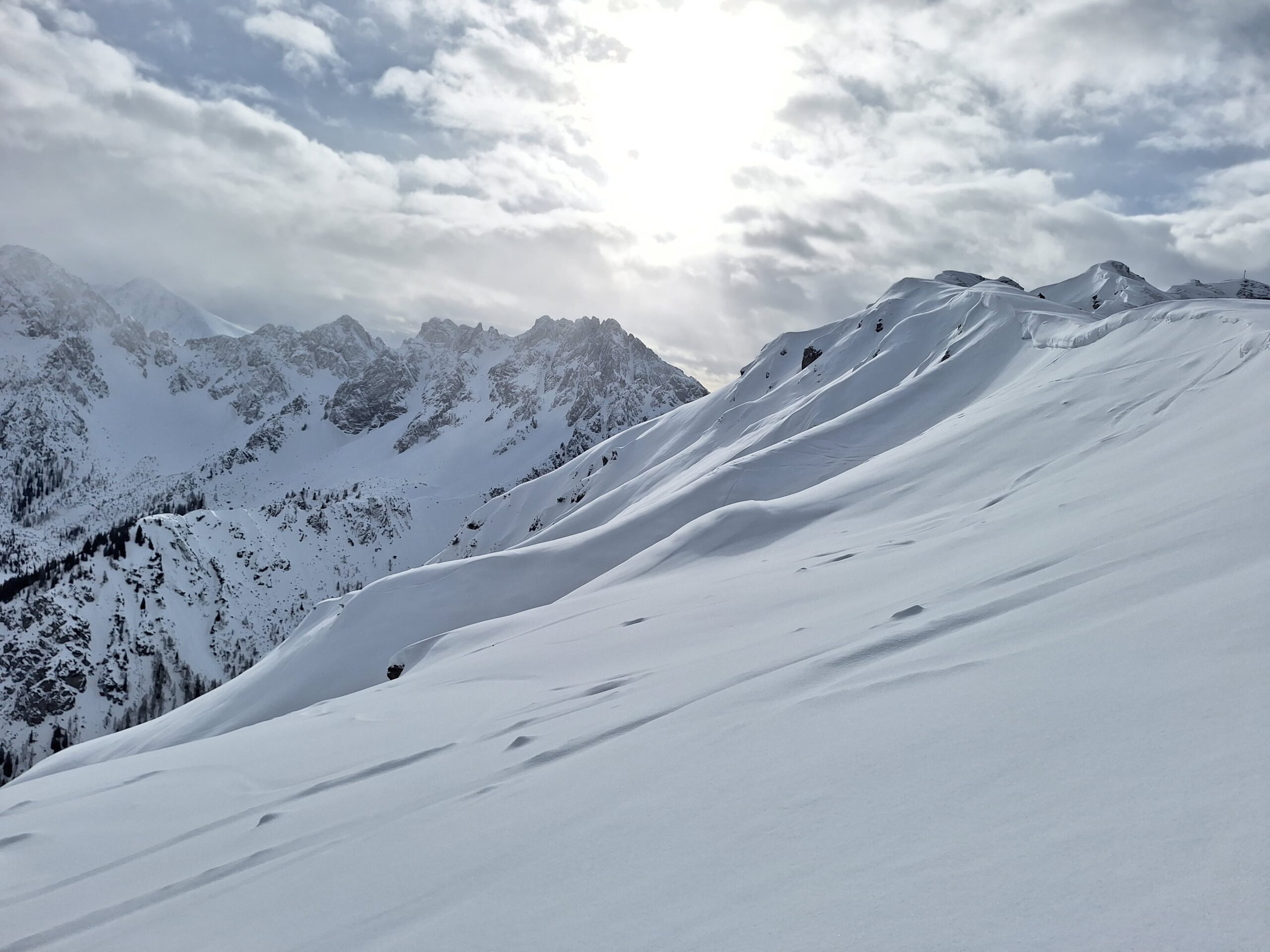
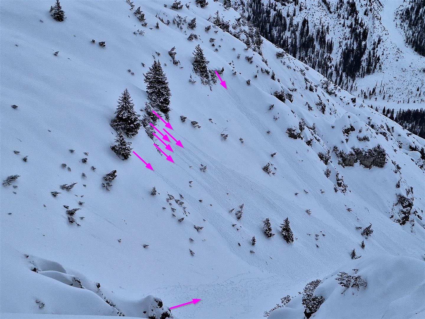
Recently and freshly generated snowdrift accumulations are still the main danger. These accumulations are generally not very deep but often easily triggered. In extremely steep terrain pay close heed to the dangers of being swept along and falling. Caution urged esp. above forest edges on W/N/E facing slopes and in steep ridgeline terrain in all aspects.
Frequent avalanche incidents last week
Last week, and in particular last weekend, there were frequent reports of avalanches involving persons. This was a result of increasing wind impact, which generated many new, sometimes very trigger-prone snowdrift accumulations, particularly where the drifts were deposited atop surface hoar or atop a loose snowpack surface of faceted/decomposed crystals. This occurred mainly on W/N/E facing slopes above the timberline. Forest clearances were also struck. (For details, see the last blog from 15.01.2024 and lawis.)
Short impact of warm weather on avalanches
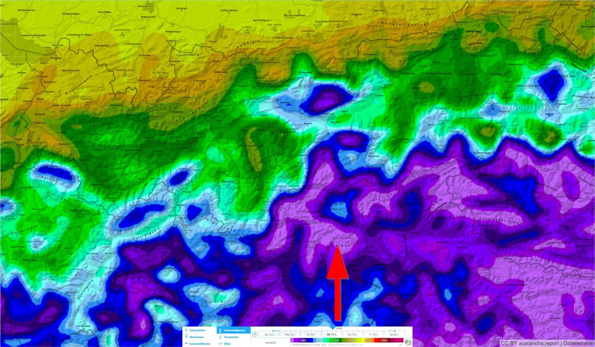
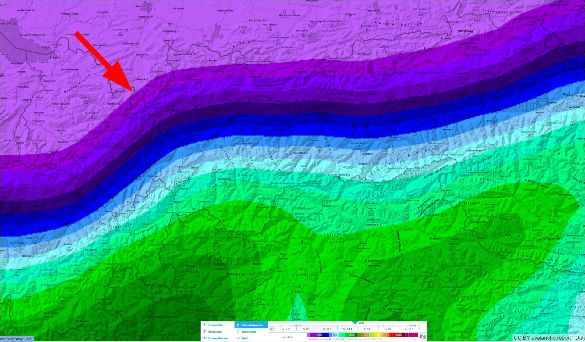
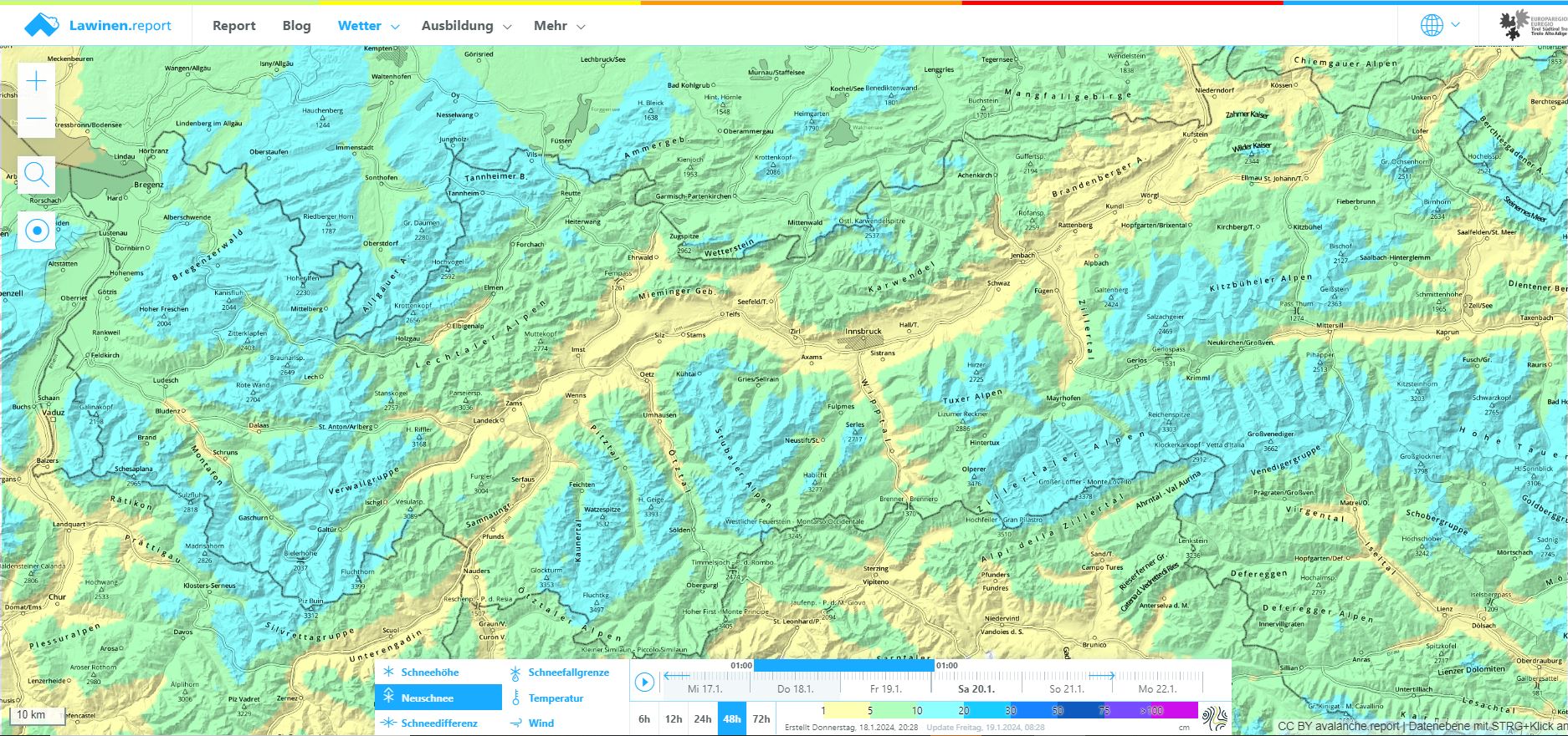
We are dealing with highly variable weather conditions at present. According to Geosphere Austria we are currently (18.01) faced with a very moist and warm westerly airstream which will be replaced on the evening of 18.01 by a cold front. Winds will shift to northwesterly, snowfall is expected down to low lying areas (5-15 cm, up to 20 cm in the western regions).
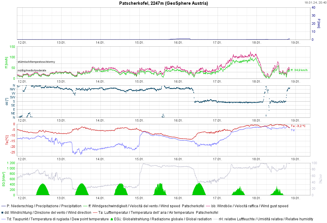
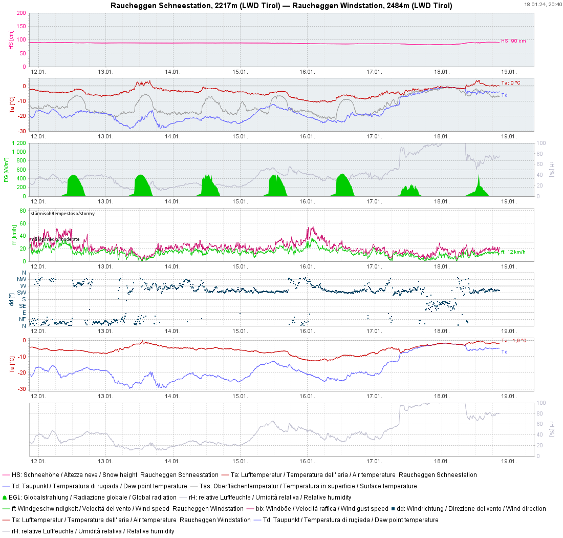
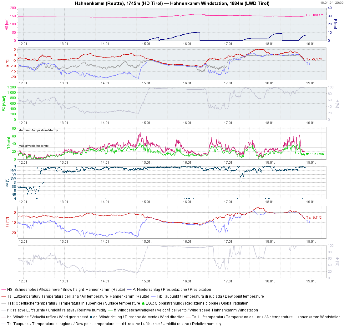
Due to plummeting temperatures and moistening of the snowpack up to intermediate altitudes, the slab-like quality of the recently generated snowdrift accumulations increased up to 2400 m. Thereby there was a short-term trigger-proneness of the snowpack for slab avalanches.
In addition, rain weakened the snowpack surface in wind-quiet zones. For that reason, increasingly frequent moist and wet loose-snow avalanches triggered in extremely steep terrain. With the cold front, this danger will swiftly recede.

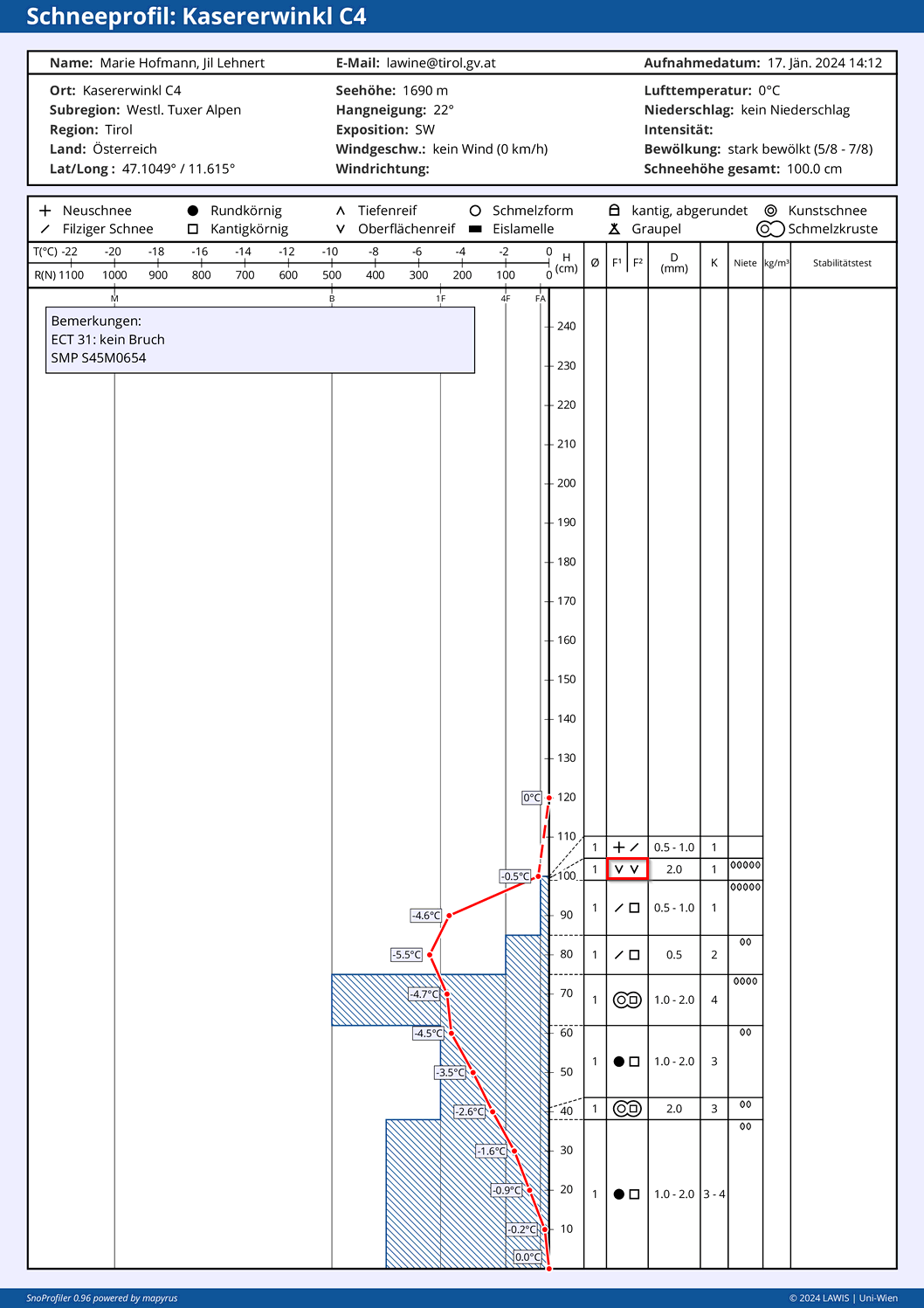
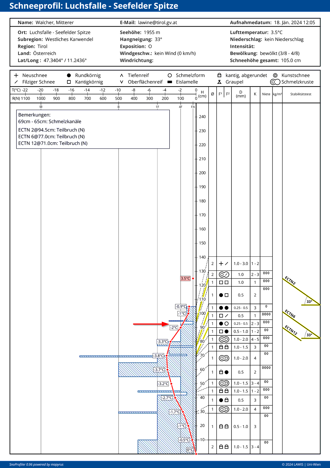
A glance inside the snowpack
Potential problem zones are found esp. in near-surface layers.
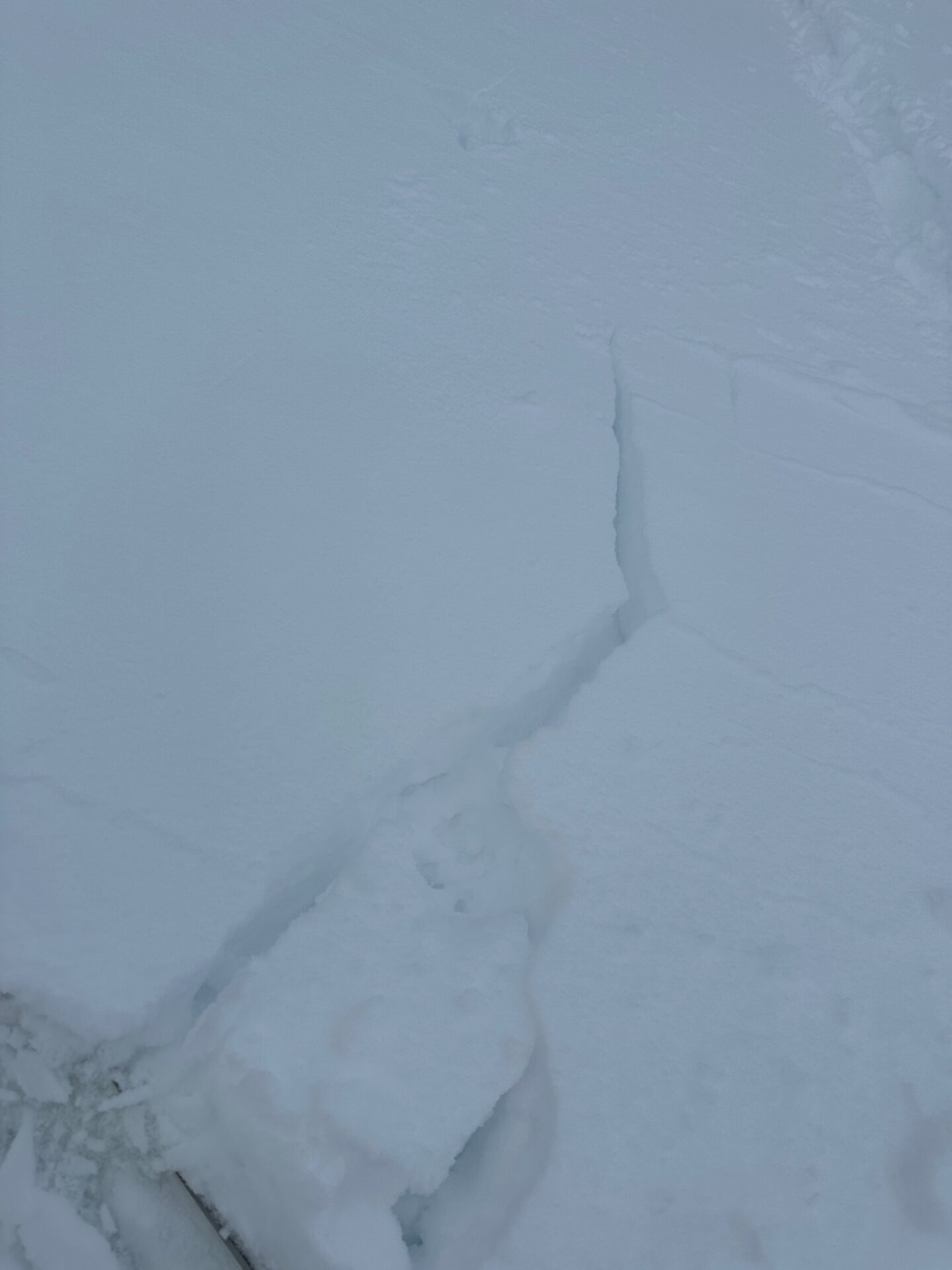
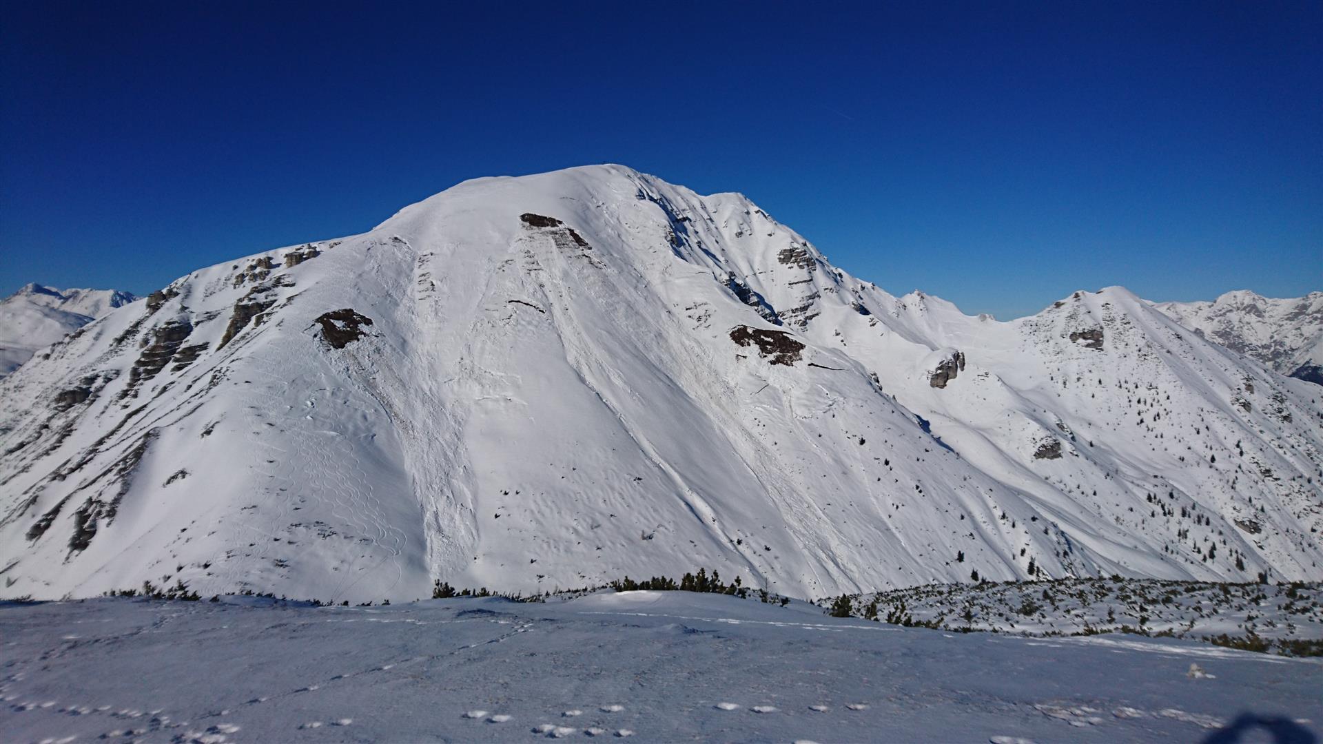
Isolated glide-snow avalanches (also large-sized) still possible
Glide-snow avalanches remain a hard-to-evaluate danger. Infrequent in high-altitude zones where there has been a lot of snowfall, but they can become quite large there. Steer clear of cracks in the snowpack.
At lower altitudes, on the other hand, the deep-down wetness of the thin snowpack makes glide-snow avalanches trigger more frequently. As cold air masses move in, this type of slide will occur far less often.
A brief look ahead
Main danger will persist: recently generated snowdrift accumulations. Their proneness to triggering will decrease slightly over the next few days, avalanche danger levels ditto.
Caution: recently generated snowdrift masses will be blanketed over by fresh snowfall, making them very hard to recognize. Danger zones occur increasingly on steep W/N/E-facing stopes and in ridgeline terrain in all aspects above the timberline. The releases are usually small, sometimes medium-sized. In extremely steep terrain, the dangers of being swept along and taking a fall need to be considered.
The latent danger of glide-snow avalanches will persist. Wet loose-snow avalanches are unlikely due to the temperature drop. Dry loose-snow avalanches could, in case of sunshine, occur starting on Saturday, 20.01.2024.