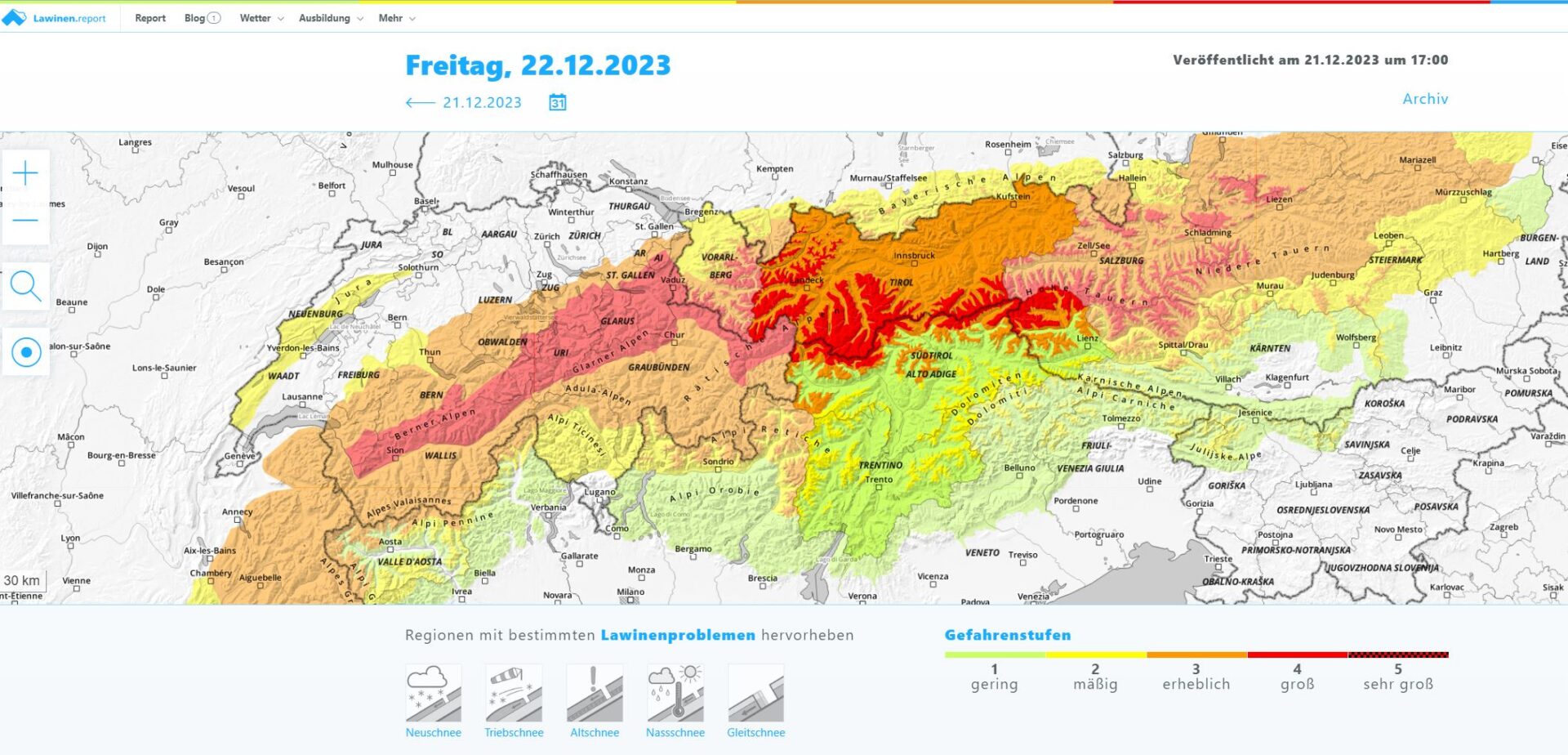
Up to 150 cm of fresh fallen snow and storm-strength winds are creating a critical avalanche situation regionally, with High avalanche danger (level 4). Increasingly frequent naturally triggered releases are expected during the period of intensive precipitation, with numerous avalanche prone locations for winter sports enthusiasts. In the major areas of precipitation the dangers in outlying terrain are extreme.
Swiftly rising avalanche danger
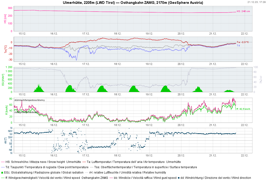
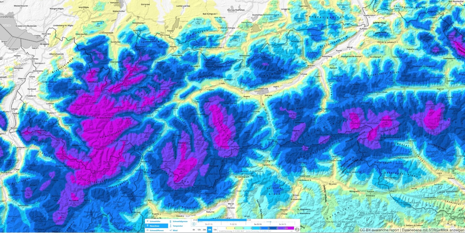
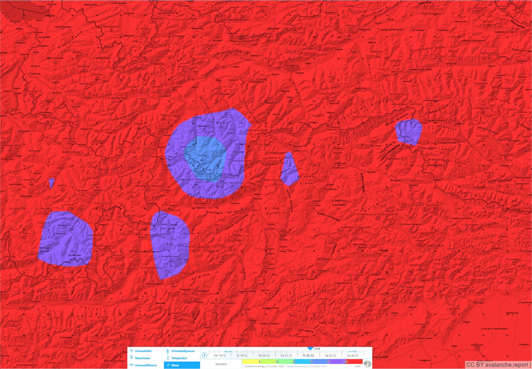
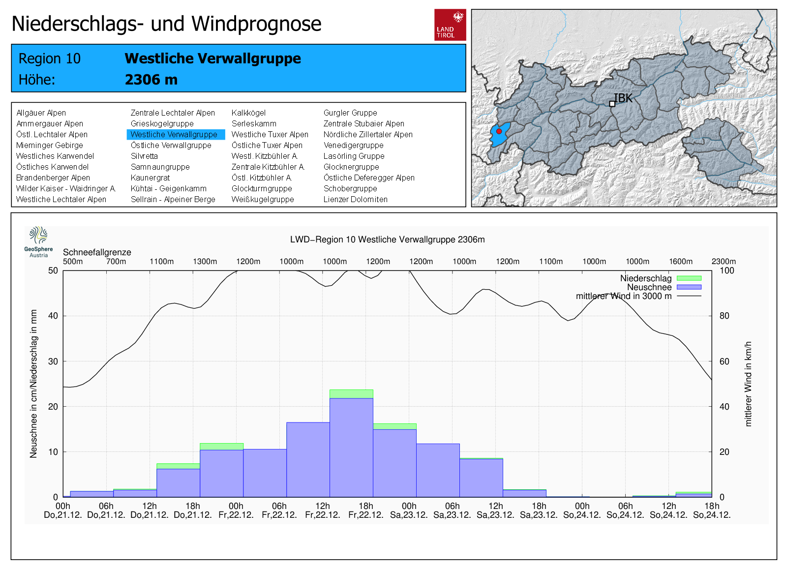
GeoSphere forecasts are clear as day: intensive snowfall and rainfall in many parts of the land over the next few days. On top of that, storm-strength, sometimes gale-strength winds. Snowfall level around 1200 m, with deviations due to wind and intensity of precipitation. Currently (21.12.2023 at 6:00 pm) precipitation has begun in the western regions. Rainfall level at the moment: 1500-1800 m.
Avalanche problems
High danger above the timberline due to marked snowdrift problem in all aspects, large expected avalanches and the start of very poor snowpack stability. When a snowdrift problem prevails, danger zones can be recognized pending good visibility.
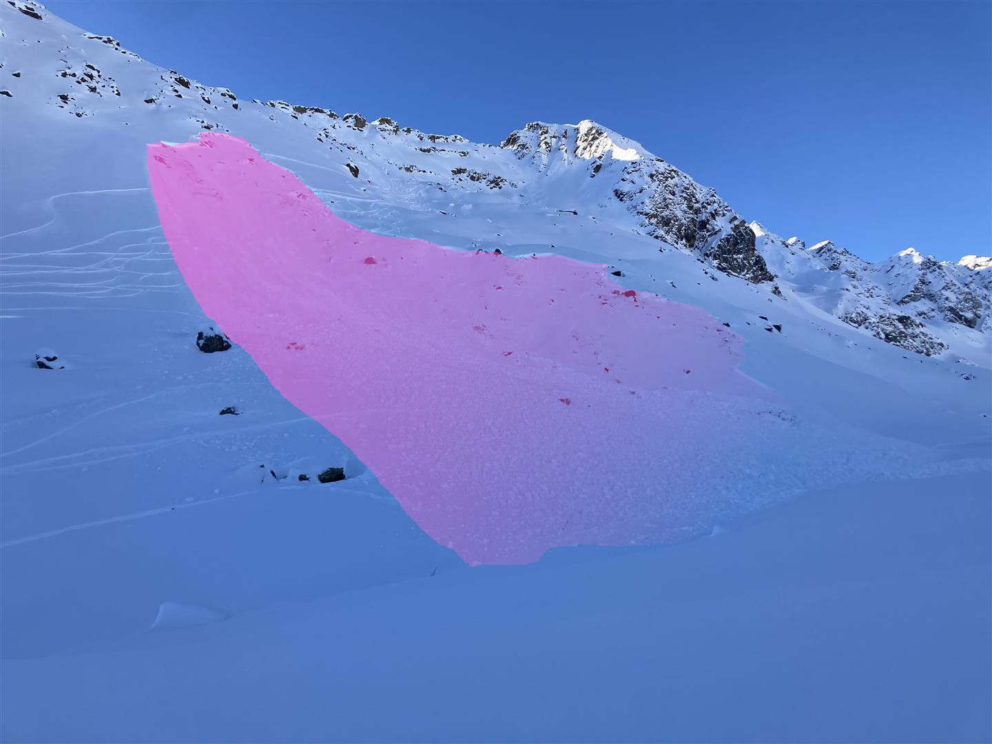
Below the timberline in the areas of major snowfall, the dominant problem is the fresh fallen snow, with possible weak layers inside it. Danger zones here cannot be recognized.
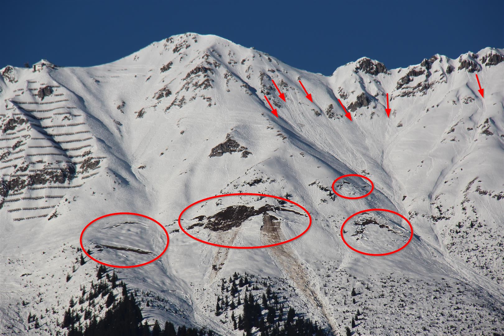
In addition, a marked gliding snow problem persists below 2400 m, in fact is getting worse.
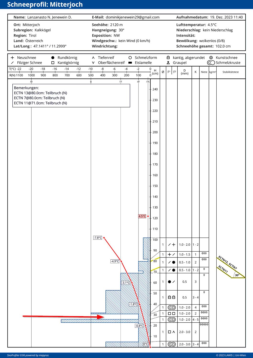
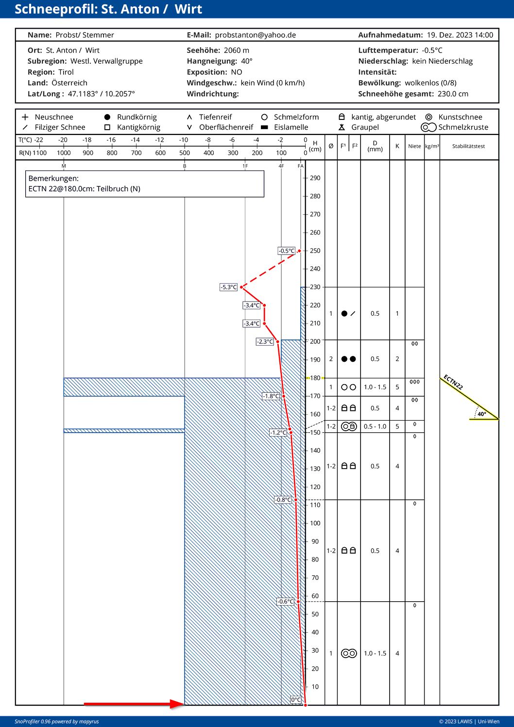
Snowpack analysis: basis of avalanche scenarios
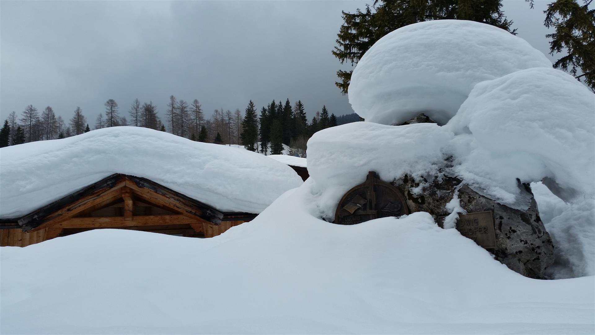
As often mentioned in recent blogs, snow depths are above average for this juncture of the season. Quite often the snowpack is very compact. Weak layers inside the old snowpack are, thus, not widespread. In principle this is a good pre-requisite for the intensive precipitation we anticipate. Our focus is directed at the snowpack surface and the potential weak layers there:
In zones which have been wind-protected until now, esp. on north-facing slopes, the snowpack surface is still loose ragged crystals or slightly faceted forms of crystals.
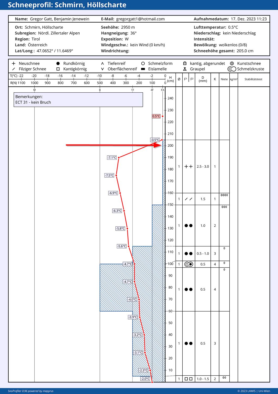
On steep sunny slopes a thin melt-freeze crust has formed over the last few days due to the high temperatures and solar radiation. At altitudes above 2400 m up to 2800 m, expansively metamorphosed crystals formed just below this crust.

In the lower part of the snowpack there is a series of crusts and some soft layers. Snowpack analysis shows only isolated fractures and potential weak layers. We assume that a fracture in this area is most possible in the southwestern regions of North Tirol (Samnaun range, Kaunergrat, Glockturm range, Weisskugel range, Gurgler range).
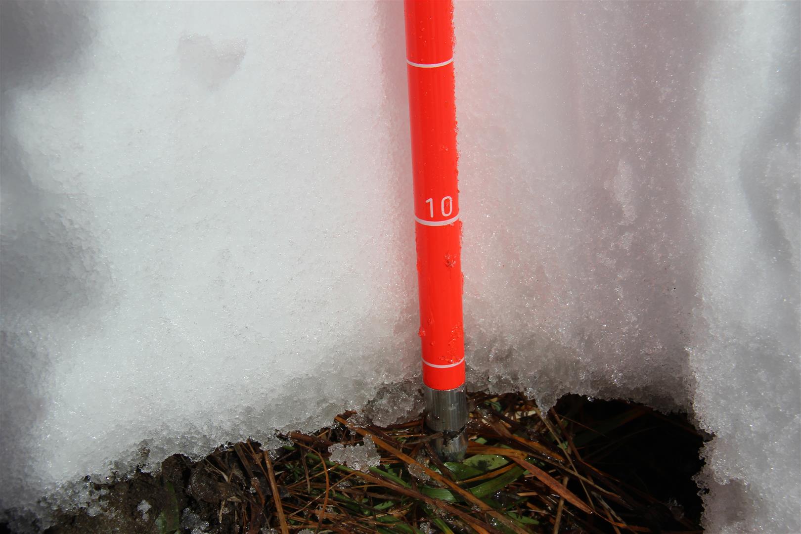
Due to the high amount of rain in the snowpack, but also due to the early snow blanketing the ground, the snowpack is moist/wet at least up to intermediate altitudes. If the snowpack is compact, it can easily glide over steep smooth surfaces such as grassy slopes or smooth rock plates. The gliding snow activity will be heightened by the rain impact which is forecast, but also enhanced by the weight of the snow on top of it.
High avalanche risk in outlying terrain
Over the next few days, winter sports enthusiasts will be taking great risks in backcountry. For that reason, we advise keeping away from steep slopes and to be very mindful of avalanche runout zones.
Outlook
The critical avalanche situation will presumably last until Sunday, 24.12.2023. Thereafter we expect continuing improvements in the situation.