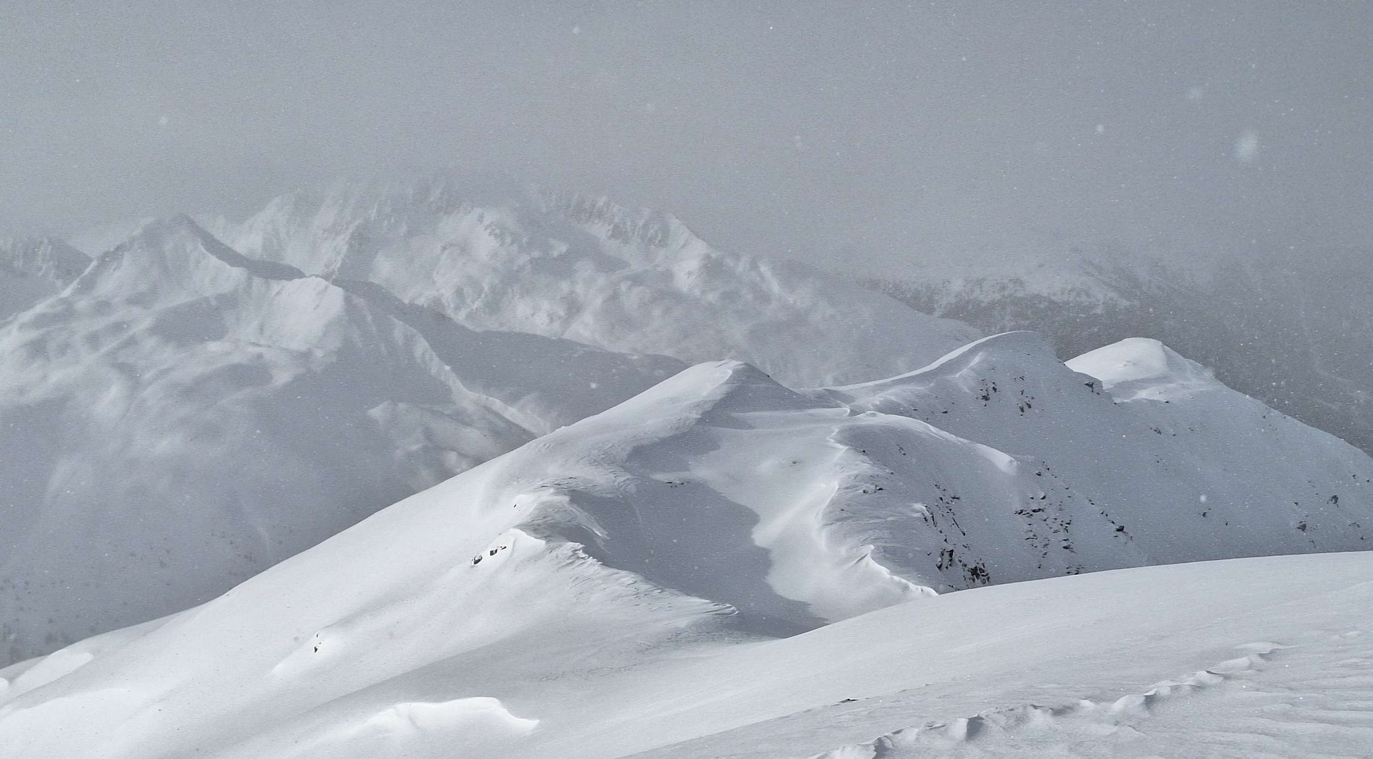
There has been lots of precipitation throughout Tirol in the last few days. Accompanied frequently by strong winds, far-reaching snowdrift accumulations have been generated which were then often blanketed by fresher snow. These remain prone to triggering at high altitudes. Especially on very steep slopes behind crests, ridges or protruberances, these spots will be prone to triggering in the next few days. In addition, glide-snow avalanches on steep grassy slopes lurk as a latent danger, even if winter sports enthusiasts see this as manageable.
Recent weather developments
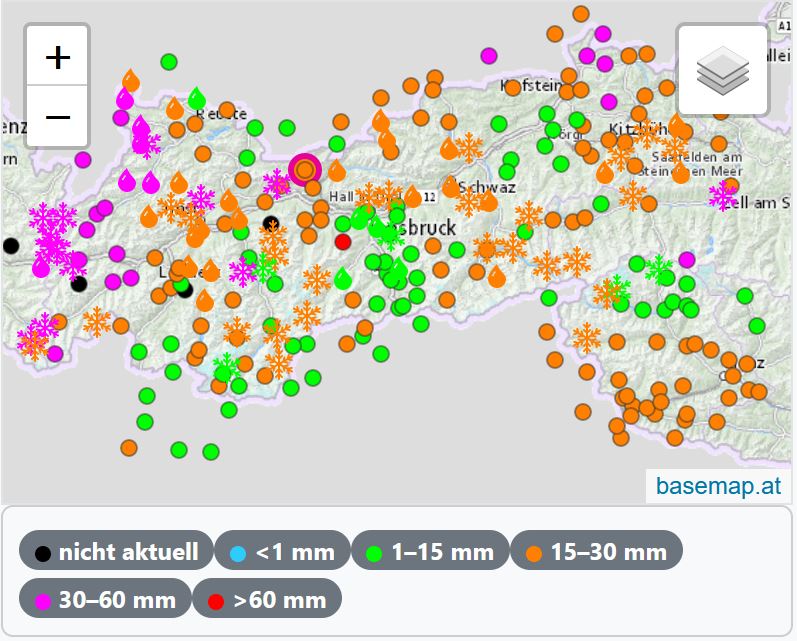
During the last 5 days there has been 30 to 50 mm of precipitation registered throughout Tirol. In the western and northern regions there was 70 to 100 mm, focal point in the Lechtal and Allgäu Alps. Snowfall level until Tuesday lay at or over 2000 m, particularly in North Tirol, at low and intermediate altitudes it fell as rain. Yesterday, 13.12, temperatures dropped noticeably.

Coming weather developments
The northwestern barrier clouds are dispersing, on Friday hardly any snowfall is expected. Starting on Saturday, 16.12, high-pressure front effects will take over, azure skies and quite mild air from Sunday til Tuesday, the zero-degree level will ascend to over 3000 m! Northerly winds will be blowing at moderate to strong velocity on the Main Alpine Ridge and in East Tirol until Saturday morning, then slacken off somewhat. Developments as of mid-week are still uncertain. But we are focused on it, and will inform all our readers as soon as we have clarity about what’s coming.


Avalanche situation
Snowdrift and fresh-snow problem
Now, a bit about near-surface short-term weak layers:
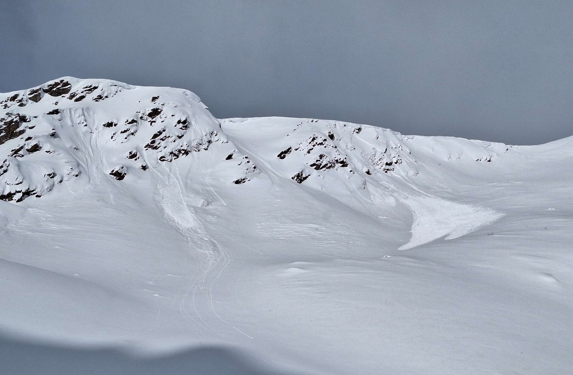
Winds have transported lots of fresh fallen snow. Varying wind directions and velocities have piled hard layers atop fresh snow and drifts. Bonded drifts (the slab) thus lie on top of softer, looser snow, which constitutes a weak layer. At the same time, the snowdrift accumulations were frequently blanketed, making them impossible to recognize.
As a result of mild temperatures in the last few days, these weak layers have consolidated with the fresh snow and drifts and thus, are no longer triggerable. However the freshly generated snowdrift accumulations and older drifts have not yet settled sufficiently and can still be triggered by one sole winter sports enthusiast.
Caution is urged in particular towards very steep ridgeline slopes, but also distant from ridges, behind striking protruberances in the landscape or bowls. Shady slopes are more unfavourable than sunny slopes, high altitudes will be prone to triggering for longer than lower down, since low temperatures slow the process of consolidation.
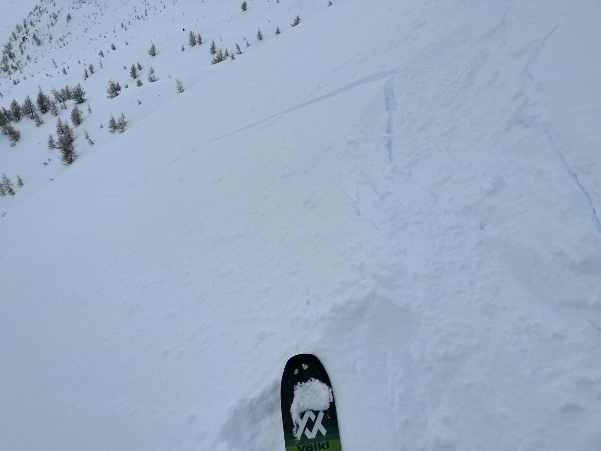

Persistent weak layer
We think that persistent weak layers in the old snow, particularly in zones where there has been less snowfall, can still be triggered. A particular focus: East Tirol. Snowpack analysis and reports from observers show that there, also the old snowpack surface (prior to the snowfall of the last few days) was often expansively metamorphosed (faceted) and was a potential weak layer beneath the bonded snowdrifts.

At least in the northern regions where snowfall has been heaviest we assume that the weak layers have consolidated through the weight of the snow on top of them. In addition, these now lie so deep down inside the snowpack that we don’t think they are still triggerable by winter sports enthusiasts.
Gliding snow problem
Not much is new on the subject of glide-snow avalanches. They can still release at any time of day; glide cracks are a loud-speaking warning! Zones below them should be circumvented. Avalanche prone locations occur on steep grass-covered slopes up to 2400 m, but also higher up depending on the ground, e.g. in northern East Tirol.

The extremely mild weather on the weekend will cause numerous loose-snow avalanches in very steep terrain, particularly on Saturday.