Generally moderate avalanche danger; persistent weak layer; gliding snow problem

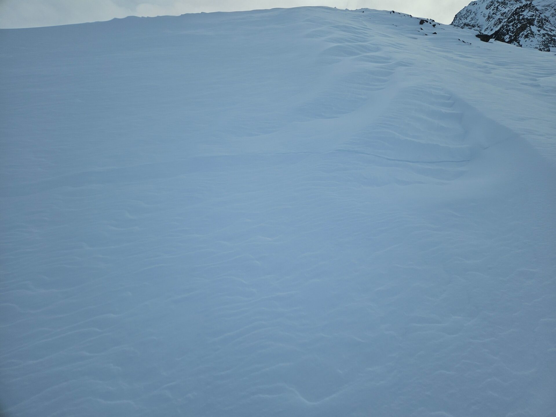
Reports from outlying terrain and recent snowpack analysis currently point to moderate avalanche danger widespread. Triggerings in the old snow are possible esp. above 2200 m. Caution urged particularly in very steep terrain in transitions from shallow to deeper snow. In addition, we are still faced with a gliding snow problem on steep grassy slopes. Avoid zones below glide cracks.

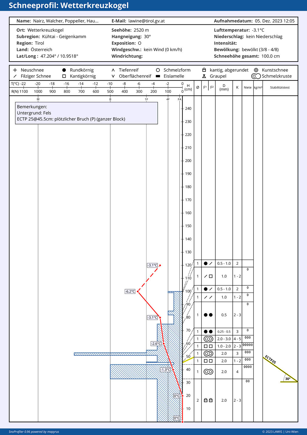
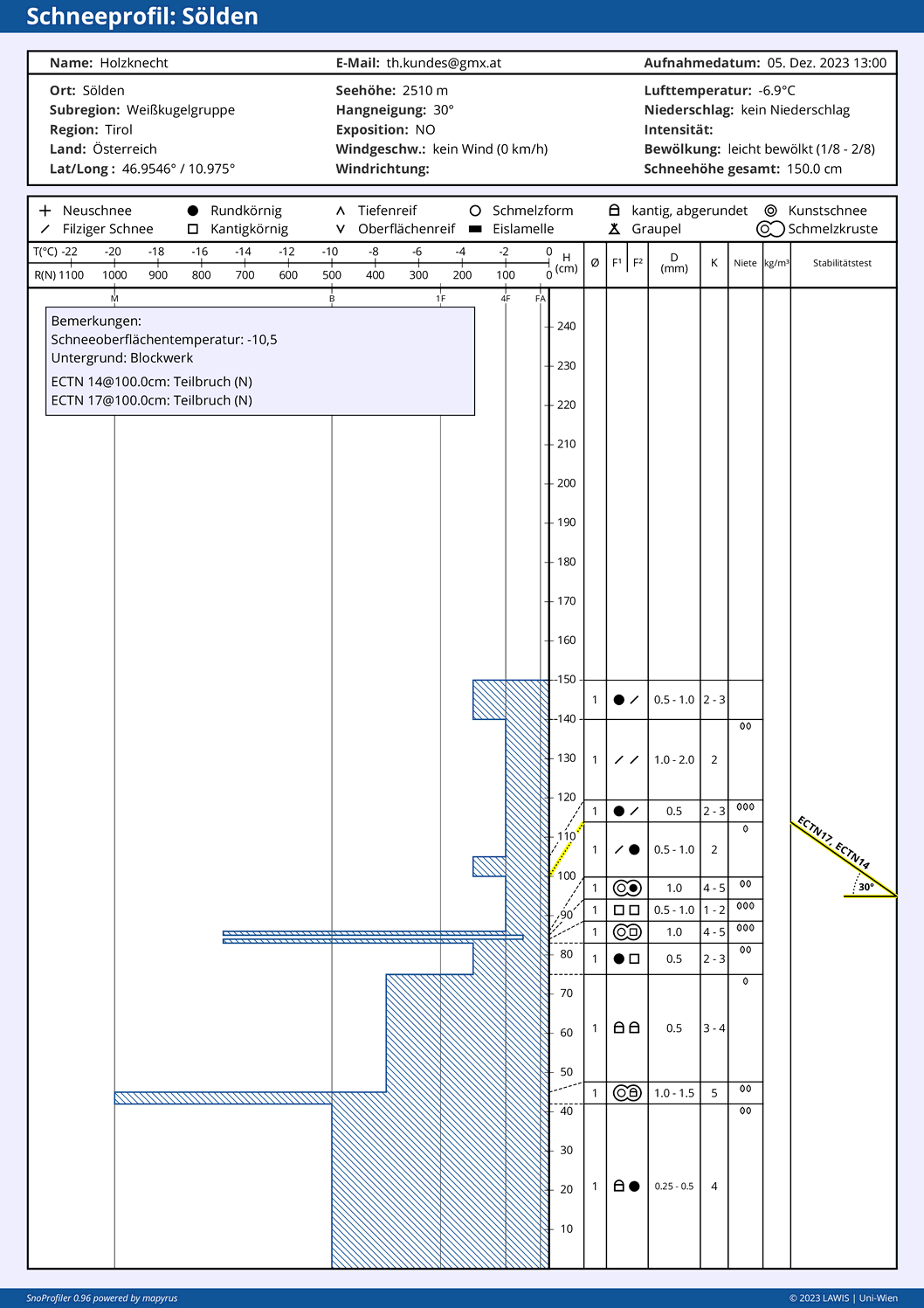
The persistent weak layer

A persistent weak layer comes from a long enduring weak layer inside the snowpack. Such weak layers occur currently at mid-level and in the lowermost parts of the snowpack. Tests show quite different pictures at varying altitudes, making it impossible to differentiate among the endangered areas or point to certain aspects.

Snow profile in Kühtai region at 2520 m, 30°: at mid-level the weak layer is visible. With additional loading, a complete fracture was generated, indicating possible triggering of the weak layer by large additional loading.
Snow profile in Weisskugel Massif in the Ötztal Alps. A crust sandwich (faceted layer between melt-freeze crusts) was not triggered in this profile. Only a partial fracture was generated above it.

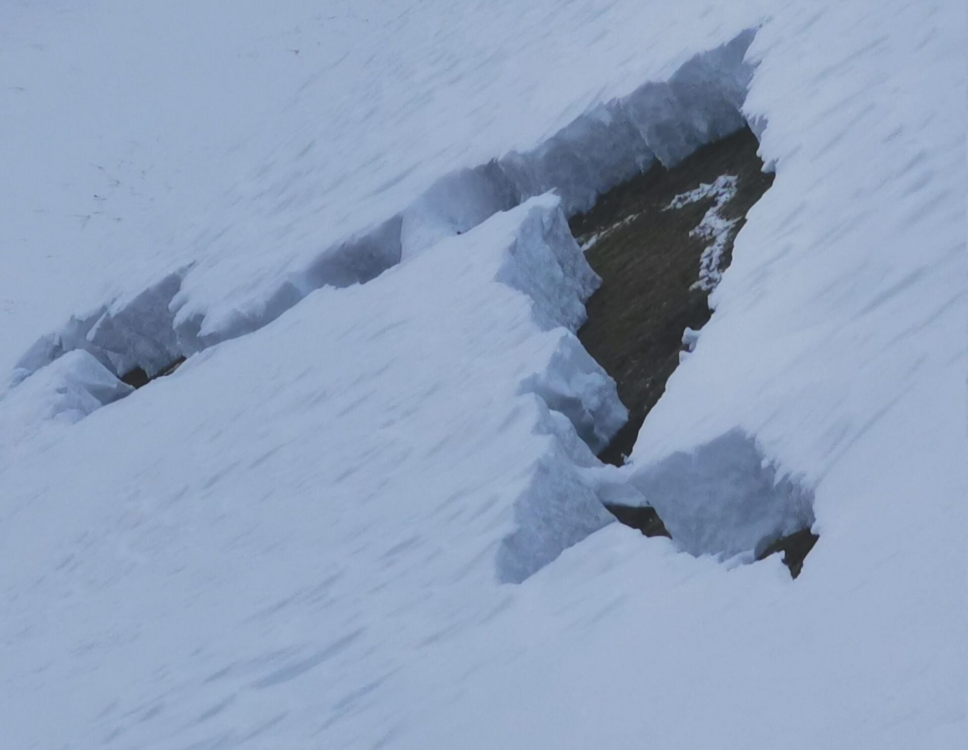
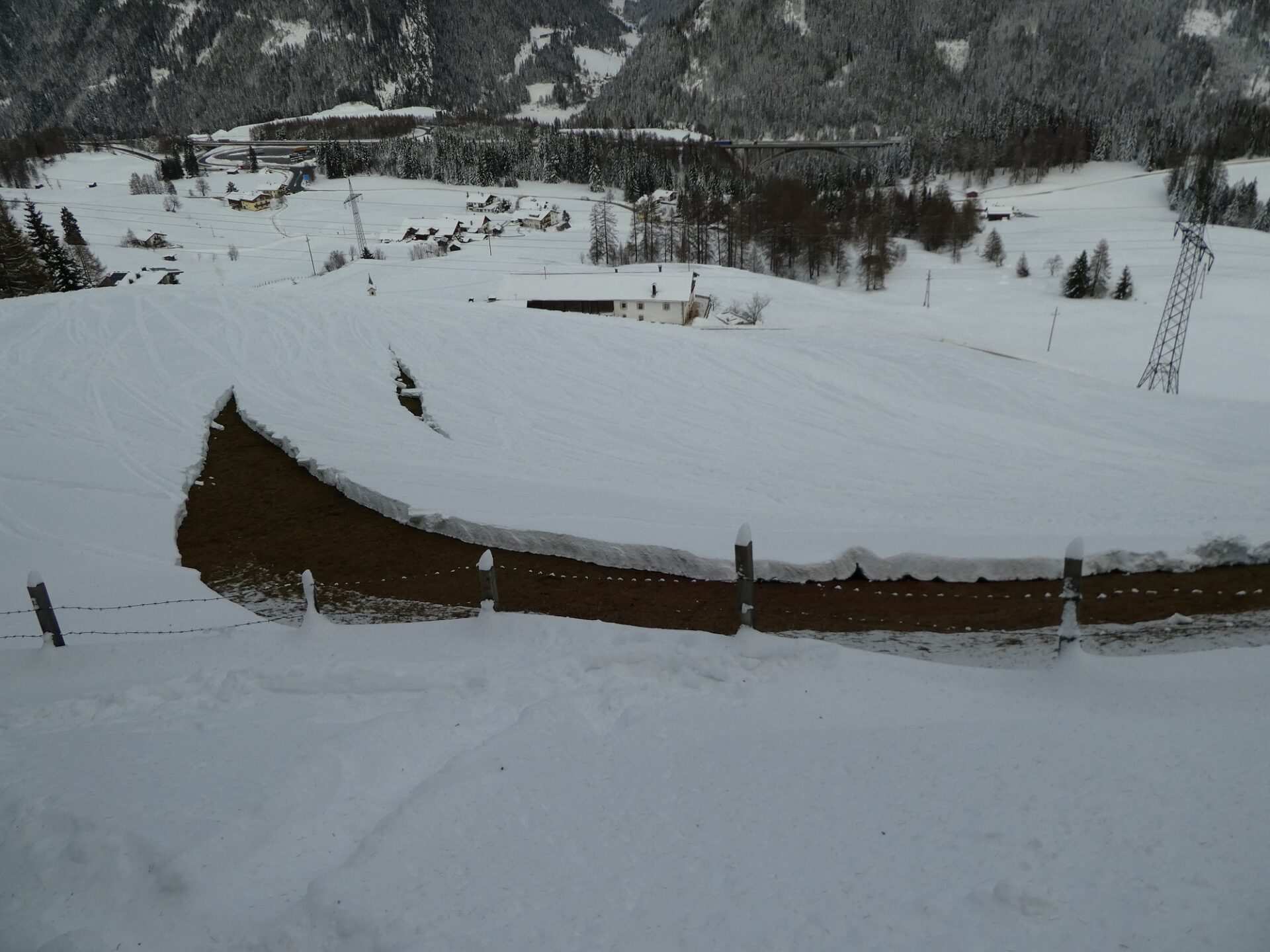
The gliding snow problem

Since last weekend’s snowfall there have been numerous glide-snow avalanches triggered in Tirol, most of them medium-sized. Some buried road sectors. The prerequisites for the entire snowpack gliding downhill are still in place: the snowpack is moist or wet at ground level. Through the rising temperatures, that situation will persist. For that reason, avoid areas below glide cracks. When such an avalanche will trigger is impossible to predict.

Glide snow crack in Ötztal (photo: 05.12.2023 (c) Peter Raich)
Keep an eye on all areas below glide cracks. (photo: 05.12.2023; Nösslach; (c) Barbara Fink)

Assorted

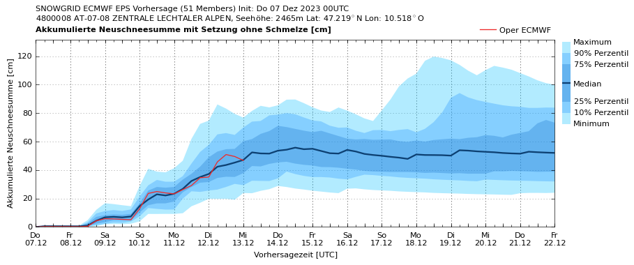
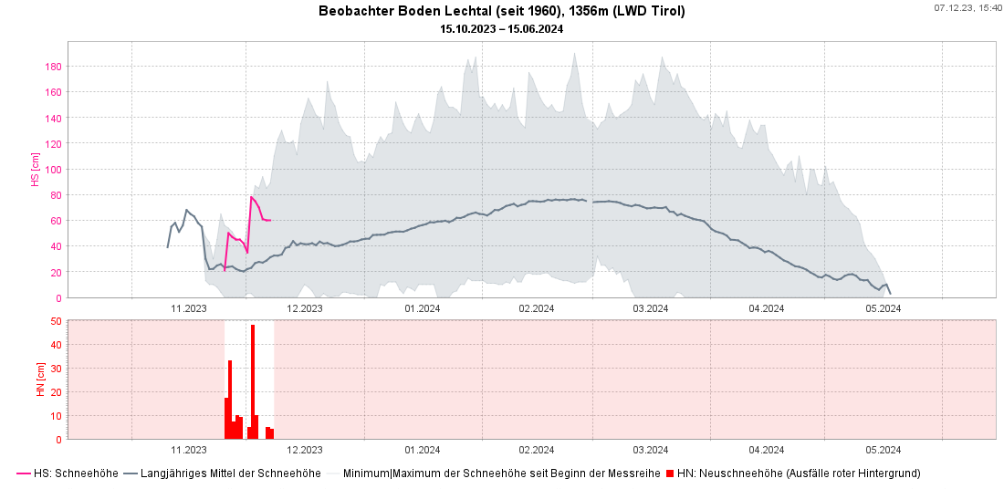
There are above average amounts of snow on the ground for this juncture of the season except in East Tirol at low and intermediate altitudes. Last weekend, most of the precipitation fell as rain there.

Winter launch with above average amounts of snow, as here at the measurement station at Boden in Lechtal (magenta: current snow depths briefly reached the historical maximum since measurements have been taken in 1960).
In North Tirol there is a lot of snow on the ground for this juncture of the season, including in the valleys. (photo: 06.12.2023)
Surface hoar formed on the surface in some places, as here in northern East Tirol. Over small areas this can cause problems due to wind impact. Over time, it deteriorates and disappears. (photo: 05.12.2023 (c) Alois Mariacher)
The snowpack frequently shows severe marks of wind impact. In some places, the hard crusts at mid-level of the snowpack reappear on the surface. In East Tirol, crusts occur more frequently. (photo: Hintertux; (c) Martin Santeler)
A snowpack with striking effects of wind where fresh snowdrifts can easily be triggered, esp. at high altitudes or wherever there is surface hoar. Danger zones are generally easy to recognize. (photo: 04.12.2023; (c) Franz Josef Tanzer)

What’s next?

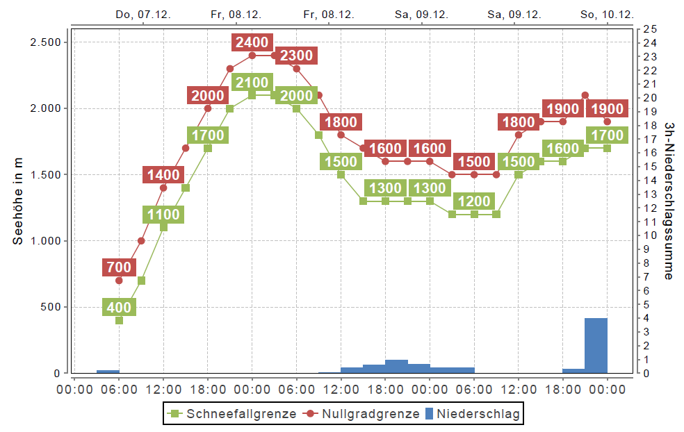
Variable in every sense of the word: repeated bouts of precipitation, a tendency towards rising temperatures with lots of ups and downs. Starting next week, intensive precipitation is predicted by GeoSphere, esp. in northwestern regions. The rainfall level could extend up to higher altitudes.

The avalanche situation isn’t expected to change significantly over the weekend.

Temperature development for the next few days (c) Oberlandwetter
Winds will intensify over the weekend.
Expected precipitation for the next few days