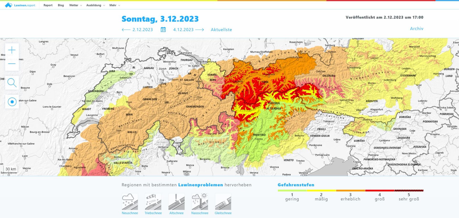
Current situation
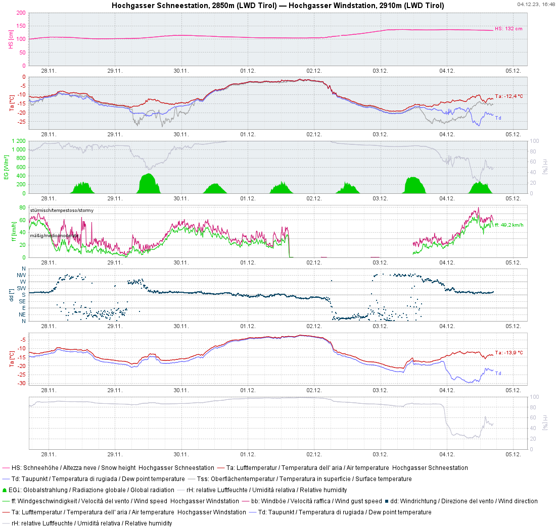
Avalanche danger in far-reaching parts of Tirol is “Considerable” – in other words, Level 3. The persistent weak layer above 2000 m remains treacherous. Furthermore, winds have intensified in the interim: in the foehn-impacted regions, storm-strength winds were blowing today (04.12). The snowdrift accumulations generated by these winds are prone to triggering. Also a glide-snow problem lurks – naturally triggered releases from steep grassy slopes are still possible, although they are dimishing in frequency.
As regards the persistent weak layer we recommend avoiding large, steep slopes, particularly in transitions from shallow to deep snow where large avalanches can be triggered. Snowdrift masses are recognizable, pending good visibility. We also advise avoiding all spots below glide cracks.
Balance of recent days
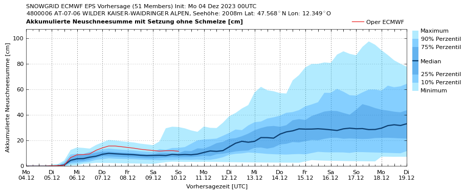
Weather
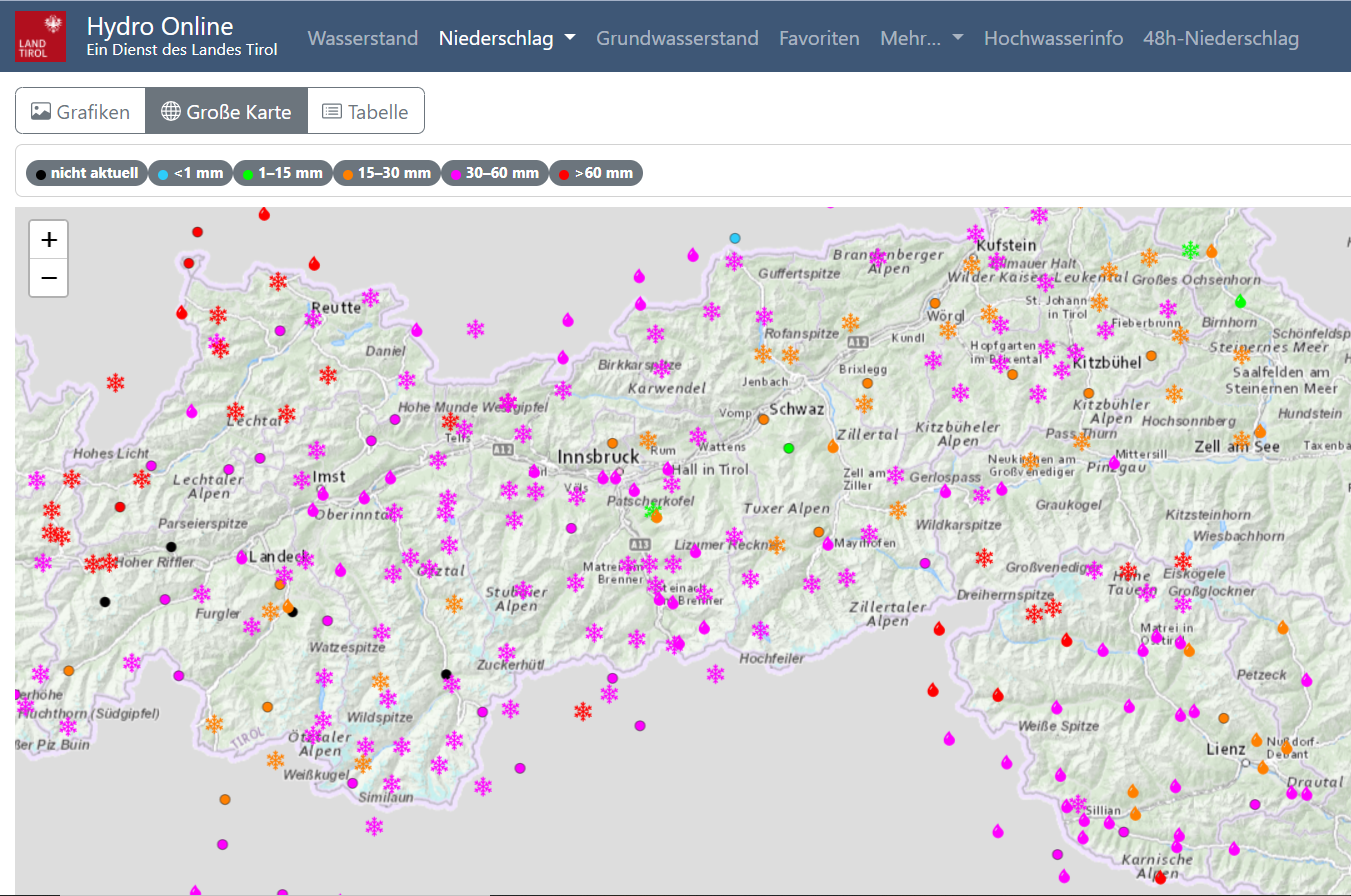
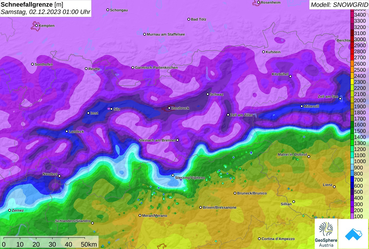
The forecasts of GeoSphere Austria for the precipitation on 01-02.12 were quite accurate. There was 30-50 mm of precipitation registered widespread, in places as much as 80 mm. The unusually tenacious skywall between the air masses in the north and those in the south was striking, as was the delay before the cold air masses thrust their way southwards. Whereas in the northwest on 01.12 the snowfall down to low lying areas began swiftly, it took until midday on 02.12 till snowfall began in southern East Tirol. For that reason, East Tirol got lots of rain up to at least 2300 m.
Avalanche danger
On Saturday, 02.12.2023 and Sunday, 03.12.2023, avalanche danger above 2000 m (in East Tirol above 2200 m) was “High” for a number of reasons:
The information we had about snowpack layering showed a marked persistent weak layer: clear weak layers near melt-freeze crusts, sometimes crust sandwiches. Atop the old snowpack, a thick layer of fresh snowfall was deposited. This mass constituted the requisite slab in many places.
During the nocturnal hours on 01-02 December wide-surface avalanches released until early morning hours in far-reaching parts of Tirol from the high overall snow depths. Also on 02.12, artificial triggerings in ski areas were successful. Moreover, on 02.12, glide-snow activity also got underway.
Seen in retrospect we can say that the avalanches which were observed on 02.12 corresponded quite well with our expectations. That means our assessment and danger level assignment were correct.
Accident-prone Sunday, 03.12.2023
We anticipated a very accident-prone Sunday on 03.12.2023, full of devilish traps: the fresh snow problem and a striking persistent weak layer both made it hard to spot danger zones; avalanches could be easily triggered and grow to large size. For that reason, we anticipated a critical situation for winter sports enthusiasts. Very defensive conduct was called for.
At the end of the day, headquarters reported “only” four avalanches involving persons:
- Freeriding terrain Steinbergkogel in the Kitzbühel Alps, 1 person with a hand injury
- Freeriding terrain Hochfügen in the Tux Alps, no injuries
- Remote triggering on Morgenkogel in the Tux Alps, no injuries
- Avalanche triggered by a chamois in Wörgestal in the Kühtai-Geigenkamm region
The question arises, why relatively few avalanches involving persons were reported by headquarters; and whether we’d correctly assigned the danger level. In the interim we have received numerous reports regarding that day and have attempted to compare the forecast with the reality. Here are some points we considered:
- Did we make every effort to report the accident-prone situation via the media.
- The warnings were taken quite seriously by winter sports enthusiasts. Numerous reports have confirmed their defensive conduct in outlying terrain.
- Many winter sports enthusiasts chose to head into less endangered zones in backcountry, i.e. below 2000 m.
- Nevertheless, quite steep freeriding terrain at high altitudes was heavily trafficked in many places.
- We received some reports that the “slab” – in other words the generally 50-cm thick mass of fresh snow was not solid enough. The fresh fallen snow was frequently so loose that no fracture propagation was possible.
All in all, we still think the Danger Level 4 assessment (High) for Sunday was correct in many places. At the same time, we realize that conditions were more favourable in some places and that trigger-sensitivity was not as high as we expected.
Thank you!
We are exceedingly grateful that there were no fatalities from avalanches on this weekend. For that reason we would like to extend a vote of thanks to all winter sports enthusiasts for their responsible conduct, i.e. for heeding our warnings.
What’s next?
We are facing a very treacherous situation which is also rather complex for this juncture of the season. Defensive conduct continues to be advised.
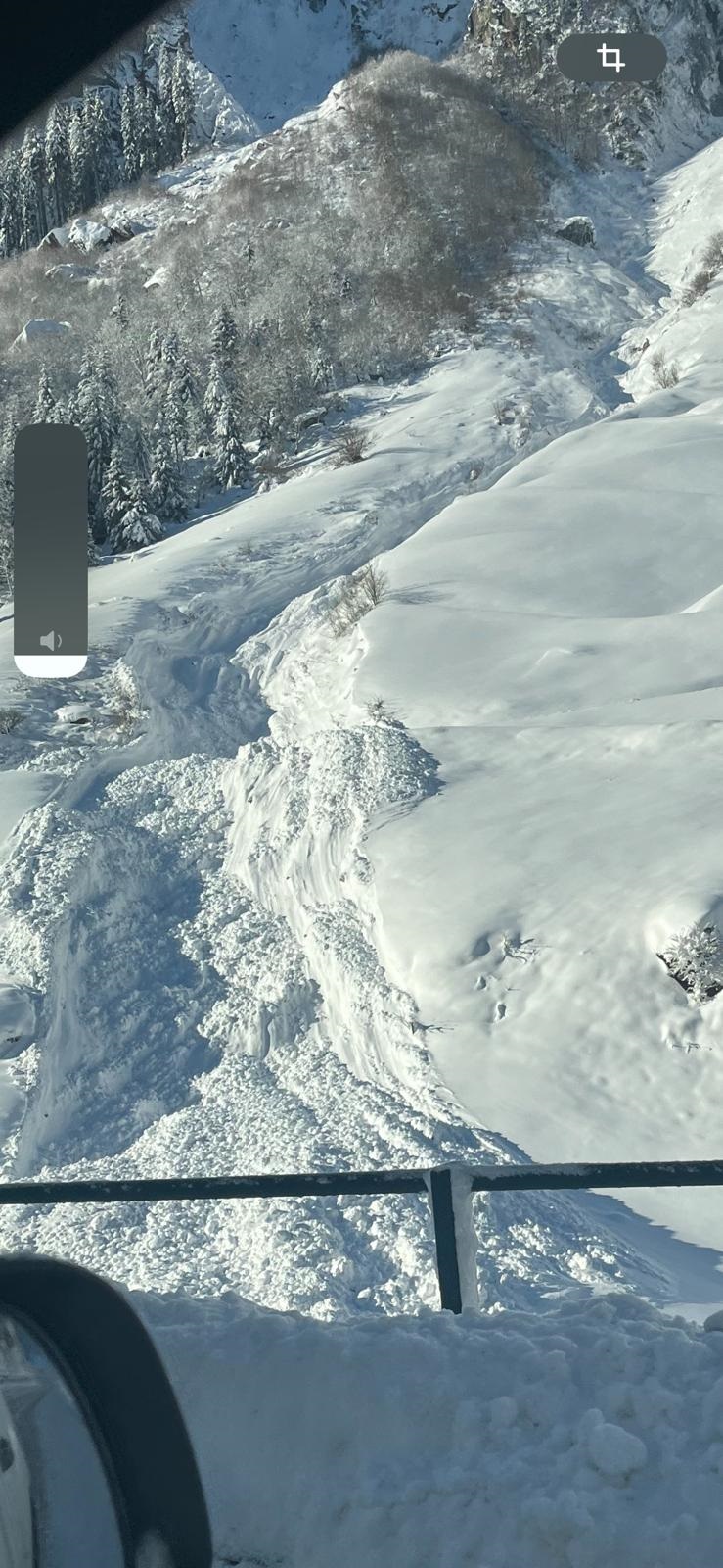
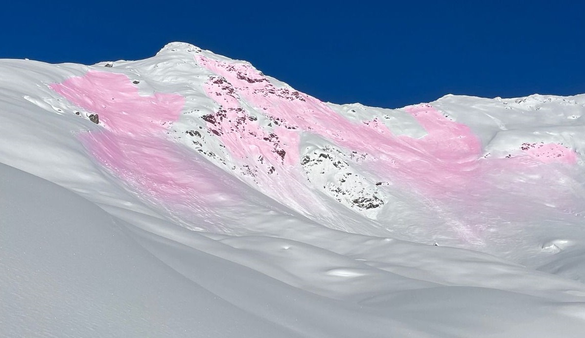
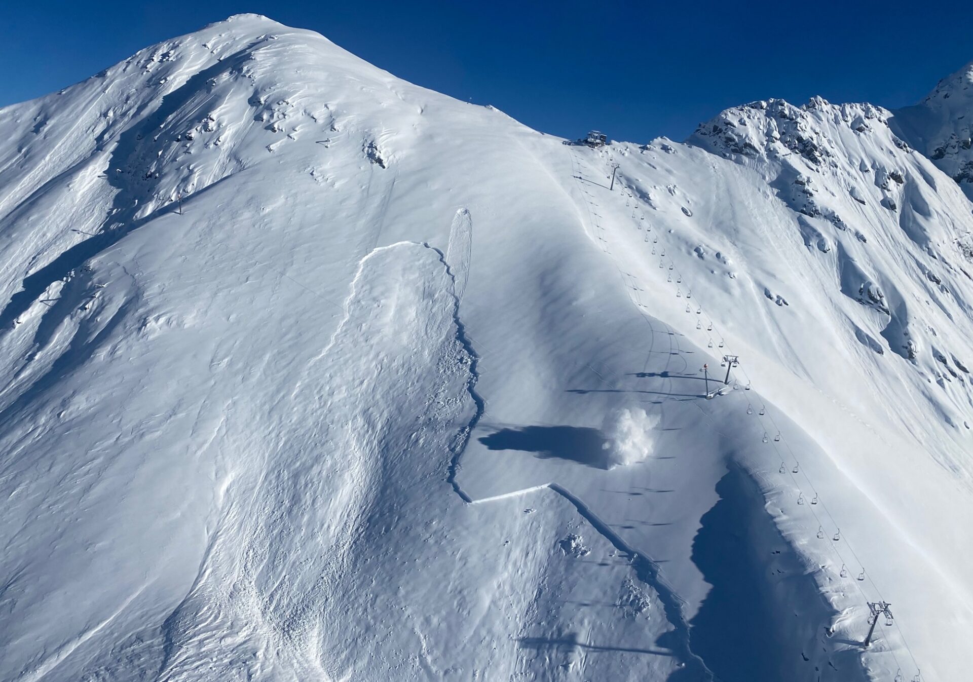
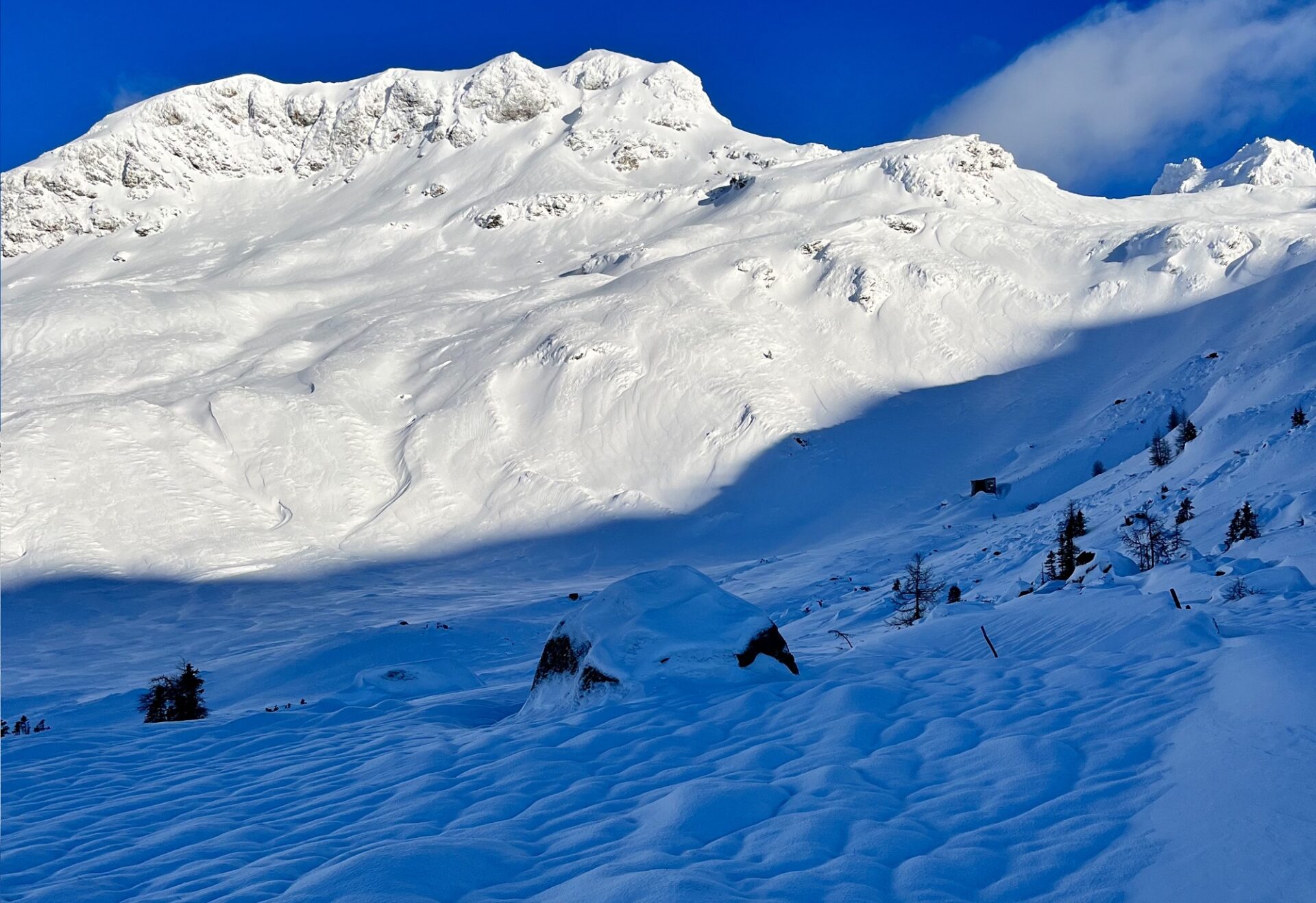
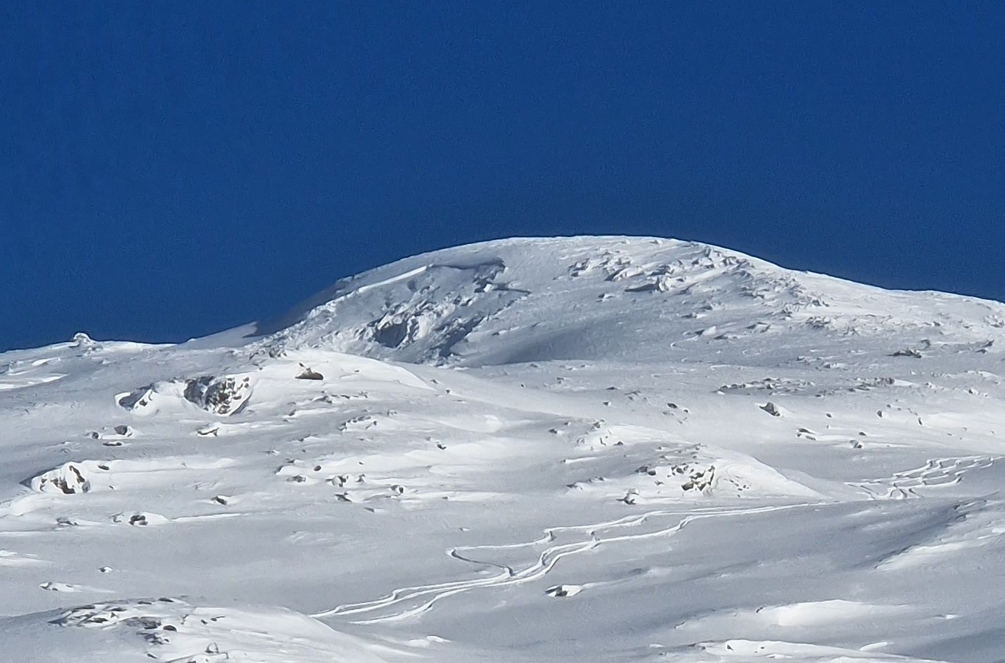
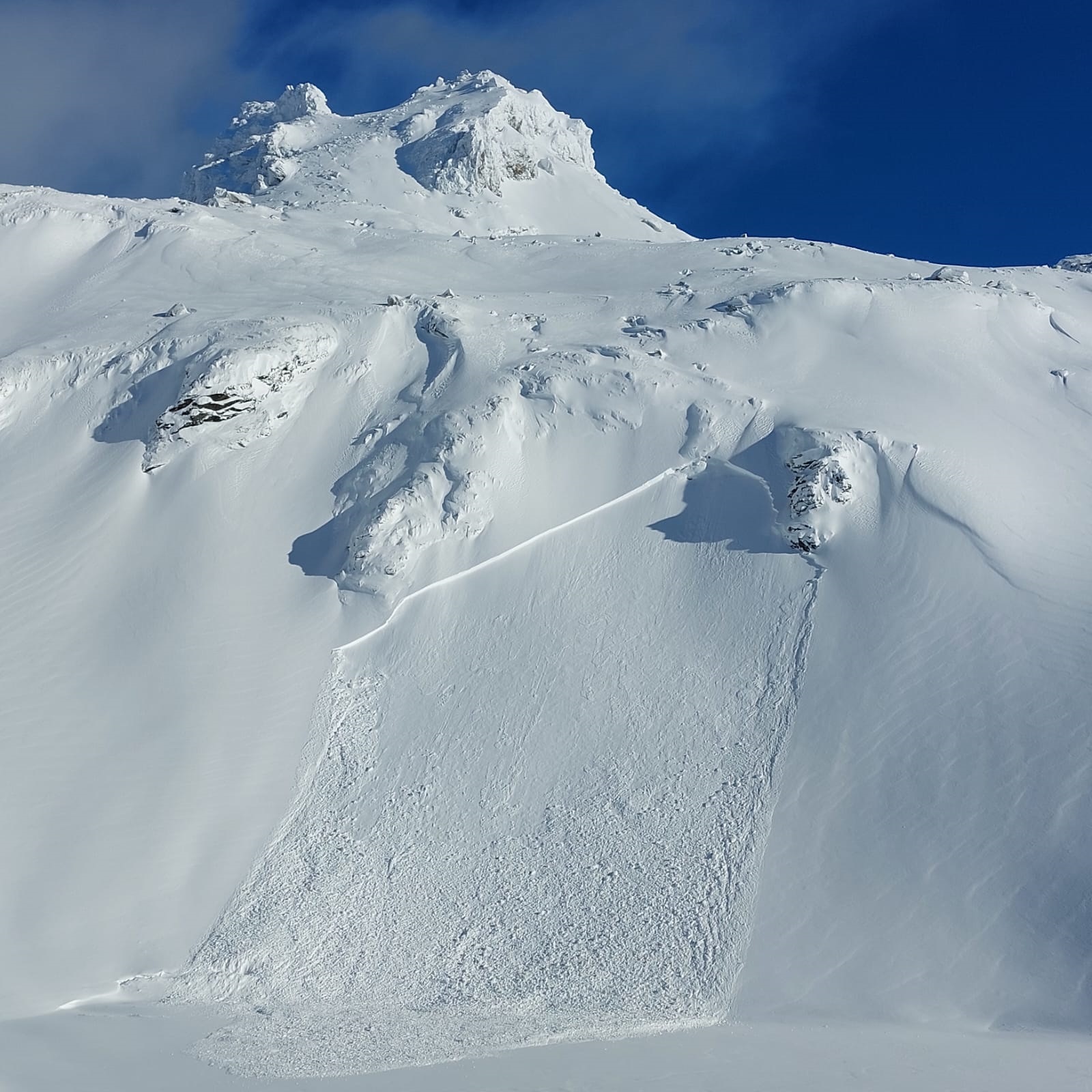
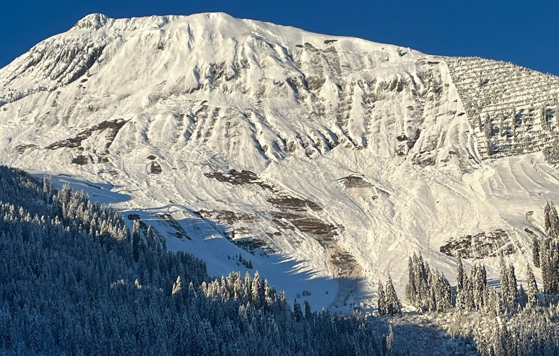
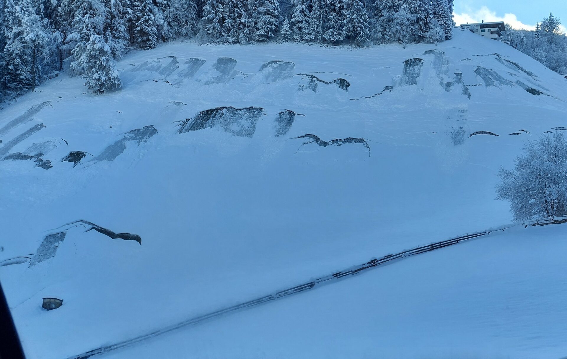
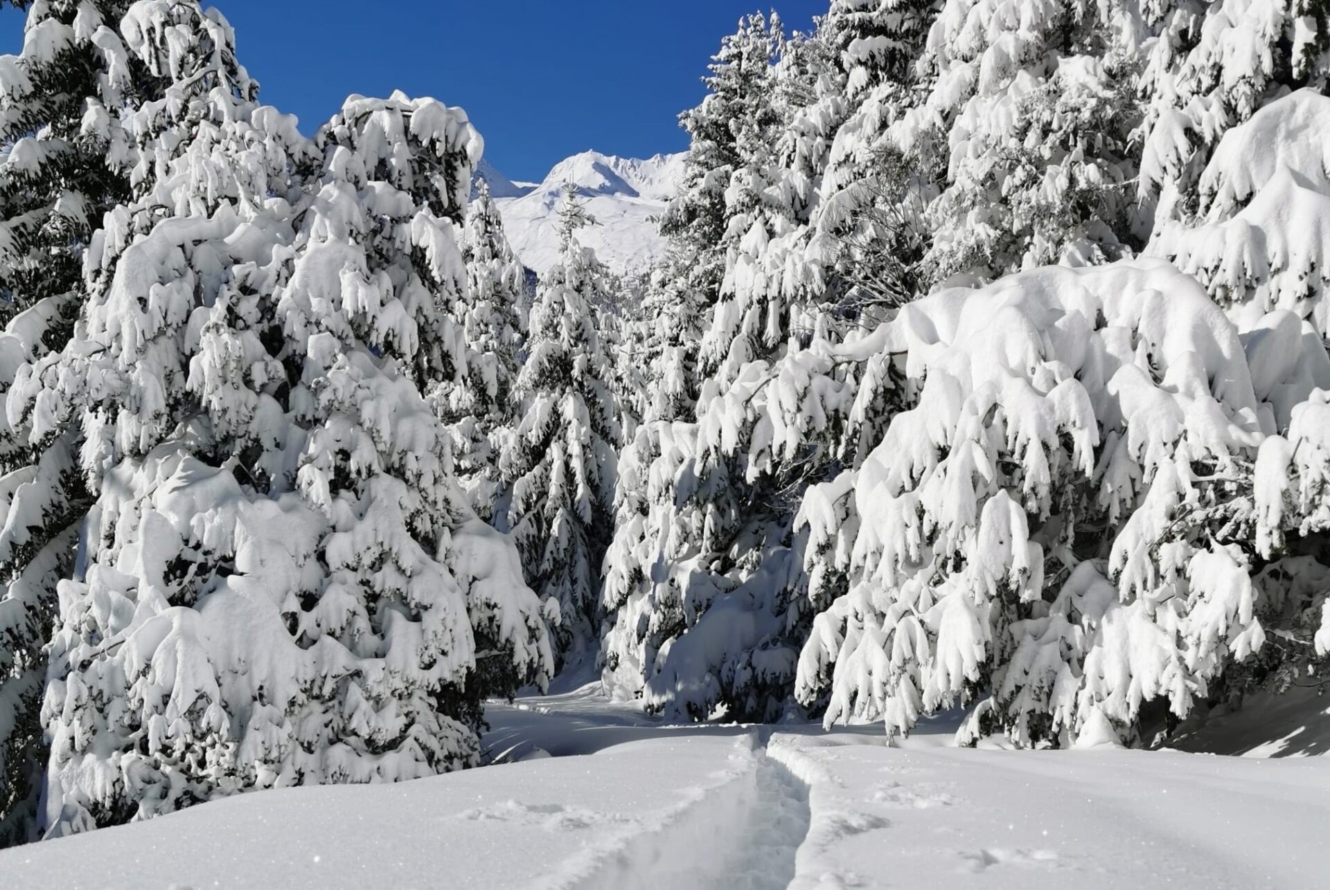
Impressions from recent days