Transceiver on your body, shovel and probe in your backpack. As a result of the first intensive snowfall in Tirol’s mountains, avalanche danger is rising again: major peril stems from freshly generated snowdrift accumulations which are nearly impossible to recognize. Danger spots lie particularly near ridgelines on very steep slopes above about 2600 m and become more frequent with ascending altitude. Medium-sized slab avalanches are possible. In addition, as a result of solar radiation on Saturday, small loose-snow avalanches can be expected.
Weather developments of recent days
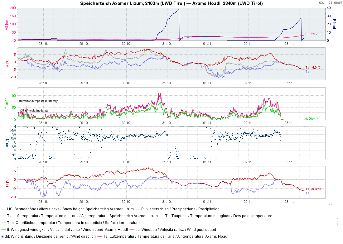
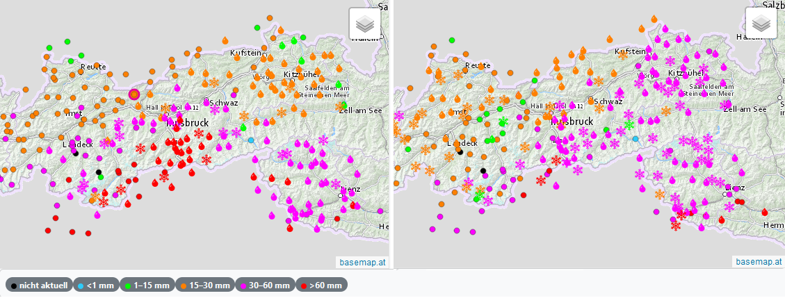
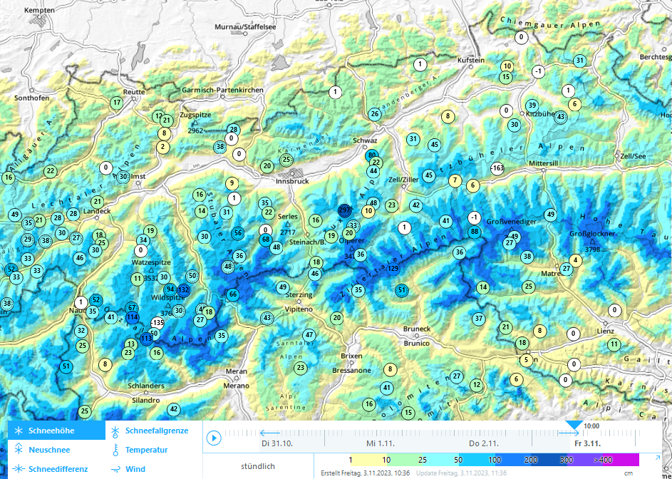
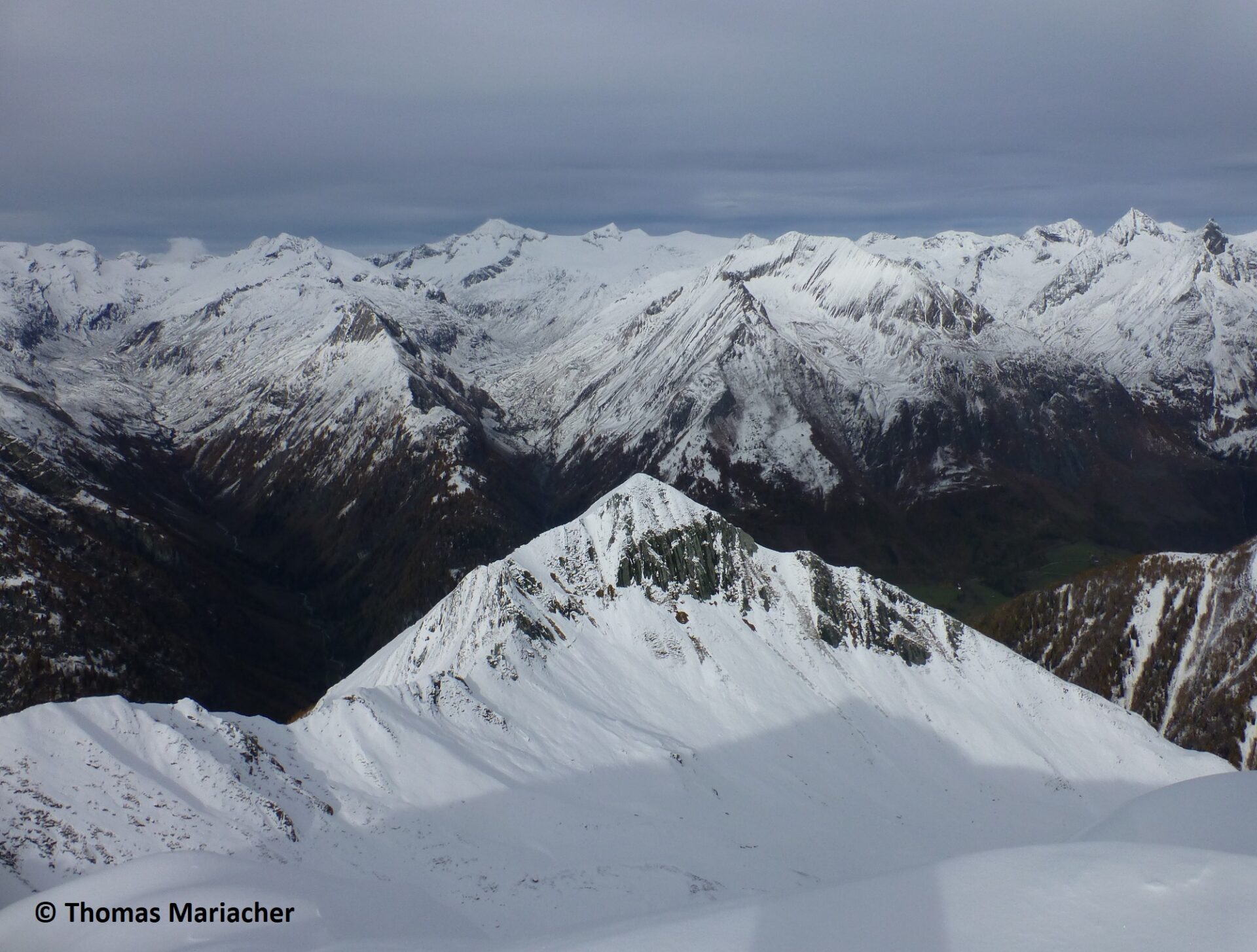
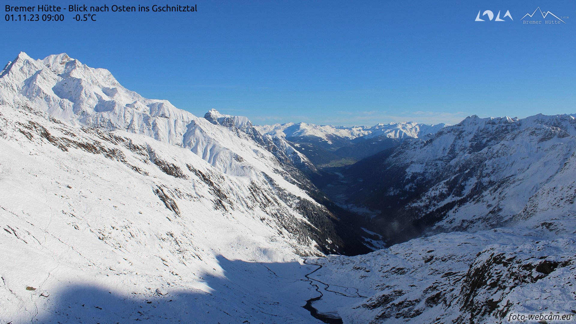
Two striking rounds of precipitation brought a first onset of winter to high and intermediate altitudes over the last few days. On Monday night (31.10) a cold front from the southwest brought heavy precipitation as the snowfall level dropped noticeably, registered along the Main Alpine Ridge and in East Tirol, 60 to 200 mm, locally more was registered. Due to the initially high snowfall level, it snowed only above about 2800 m to start with, but the snowfall level descended during the night down to below the timberline.
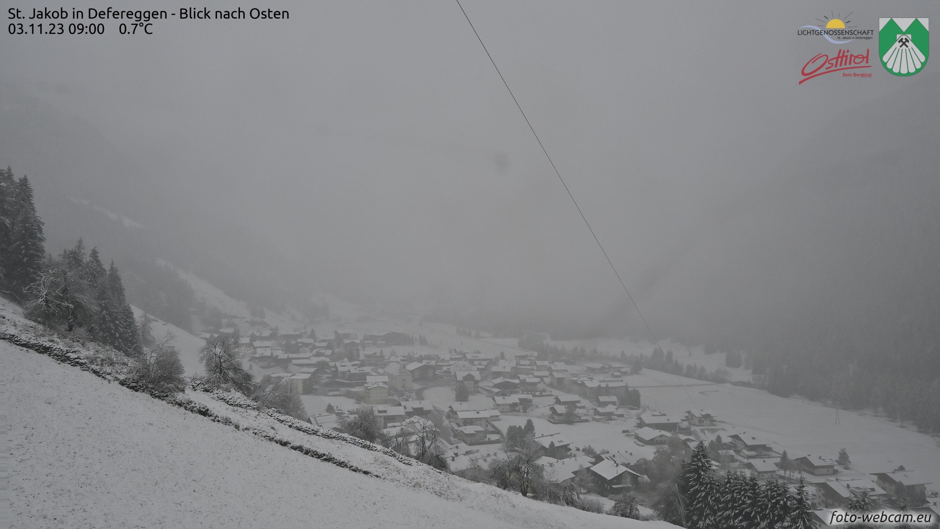
Following a brief interim of improved weather conditions and milder temperatures, a storm-strength foehn wind on the northern flank of the Alps reached us on Thursday evening (02.11) followed by a further cold front. Initially it rained up to over 2000 m, temperatures dropped during the night and it snowed down to the valley floors. Major areas of precipitation were in the southern and eastern regions where an additional 50 to 70 mm of precipitation were registered.
Effects on avalanche danger
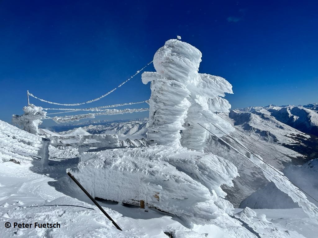
As a consequence of fresh fallen snow, low temperatures and wind, snowdrift accumulations have been freshly generated near ridgelines and in bowls behind protruberances in the terrain. On very steep (>35°) slopes above about 2600 m these are sometimes prone to triggering. This applies particularly to the regions with heavy recent snowfall along the Main Alpine Ridge. Avalanche prone locations tend to become more frequent with ascending altitude, leeward slopes (esp. north-facing ones) are likely to be less favorable. Both small and medium-sized slab avalanches are possible. Since the winds have receded noticeably following the penetration of a cold front on Thursday night (03.11), snowdrift accumulations are often covered and not easily recognized. Whoever is currently in outlying terrain should therefore be highly cautious and restrained in the endangered regions and altitudes.
Particularly on Saturday 04.11 as a result of solar radiation, small loose-snow avalanches can be expected in extremely steep terrain (>40°). Furthermore, small glide-snow slides are possible on steep grass-covered slopes. As the southerly foehn wind intensifies during the course of the day on Saturday, fresh snowdrift accumulations will form. They will be recognizable as such and should be circumvented whenever possible.
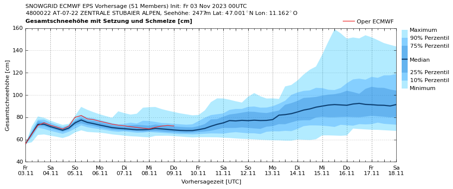
Near-term outlook
On Saturday, a brief interim of improved weather conditions is expected, however the southerly foehn will intensify and transport the fresh fallen snow massively. Thereby, fresh snowdrift accumulations will be generated at high altitudes. On Saturday night (05.11) as a result of a southerly air current, an additional 10 to 20mm of precipitation is anticipated, particularly in the Stubai and Zillertal Alps and in East Tirol. It will be somewhat milder, the snowfall level will lie between 1500 and 1800 m.
Until the end of next week, weather conditions are expected to remain variable, but striking amounts of precipitation are no longer expected. The variable weather conditions will, however, continue to generate fresh snowdrift accumulations, particularly on very steep slopes at high altitudes, which need to be evaluated with enormous caution.