Short review of weather
Fine weather persisted for a month, was briefly interrupted during the night of Easter Monday (13-14.04). A cold front cooled the air masses, brought a few centimeters of fresh snow to far-reaching areas of Tirol above the timberline. On 14.04 the sun swiftly regained the upper hand. What was striking was how dry the penetrating air masses were.
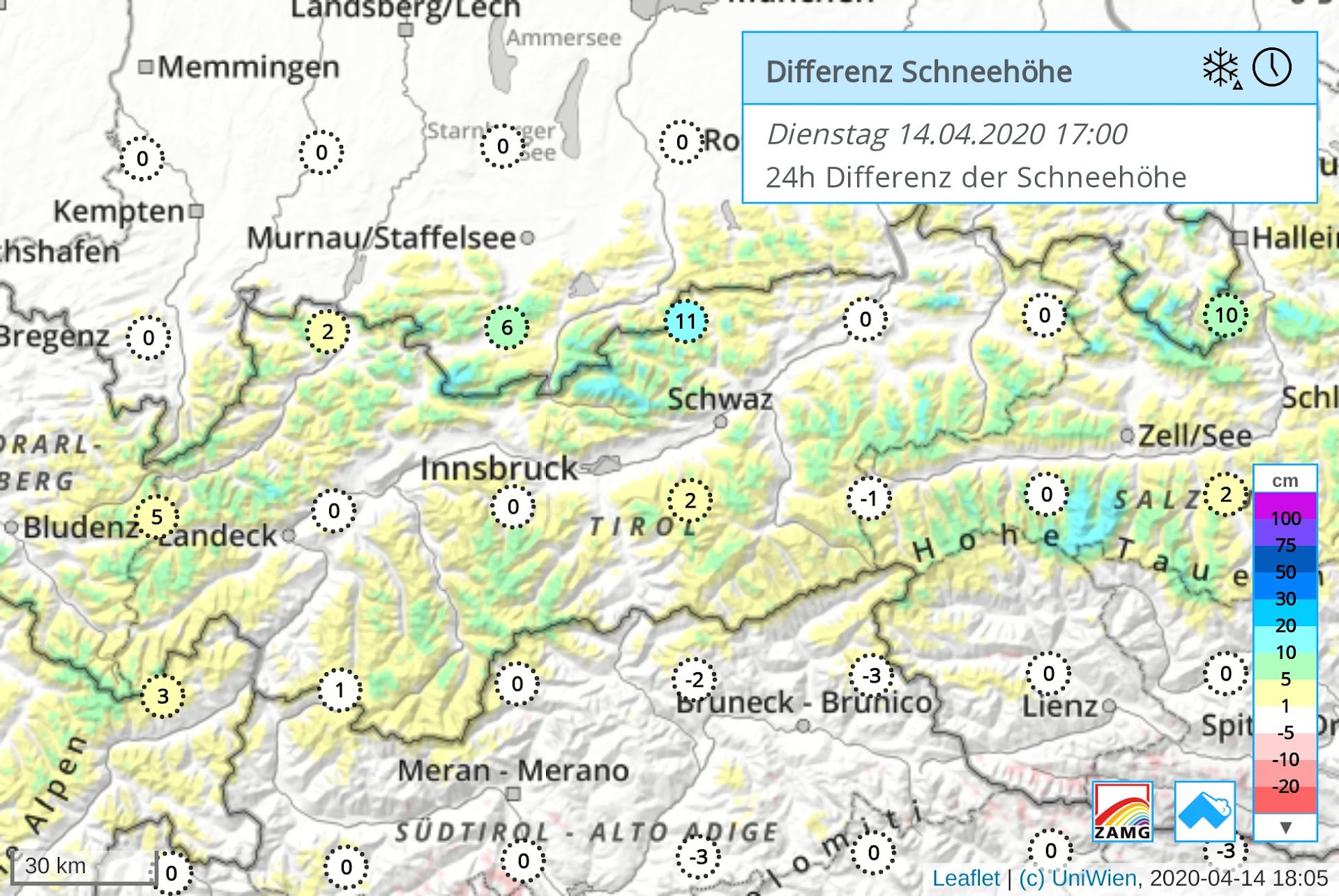 |
| Tirol received a ‘sugar sprinkling’ in the heights. |
The slopes are rapidly becoming bare of snow
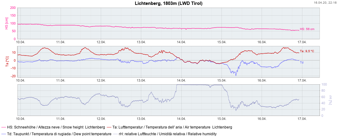
In accordance with this juncture of the season, weather station measurements register receding snow depths, strikingly so at intermediate-altitude stations.
 |
|
| Successive decrease in snow depths at Lichtenberg weather station in Ausserfern. Easy to spot: the cold front which passed through on 13-14.04. |
The diminishing snowpack can also be followed via the web-cams.
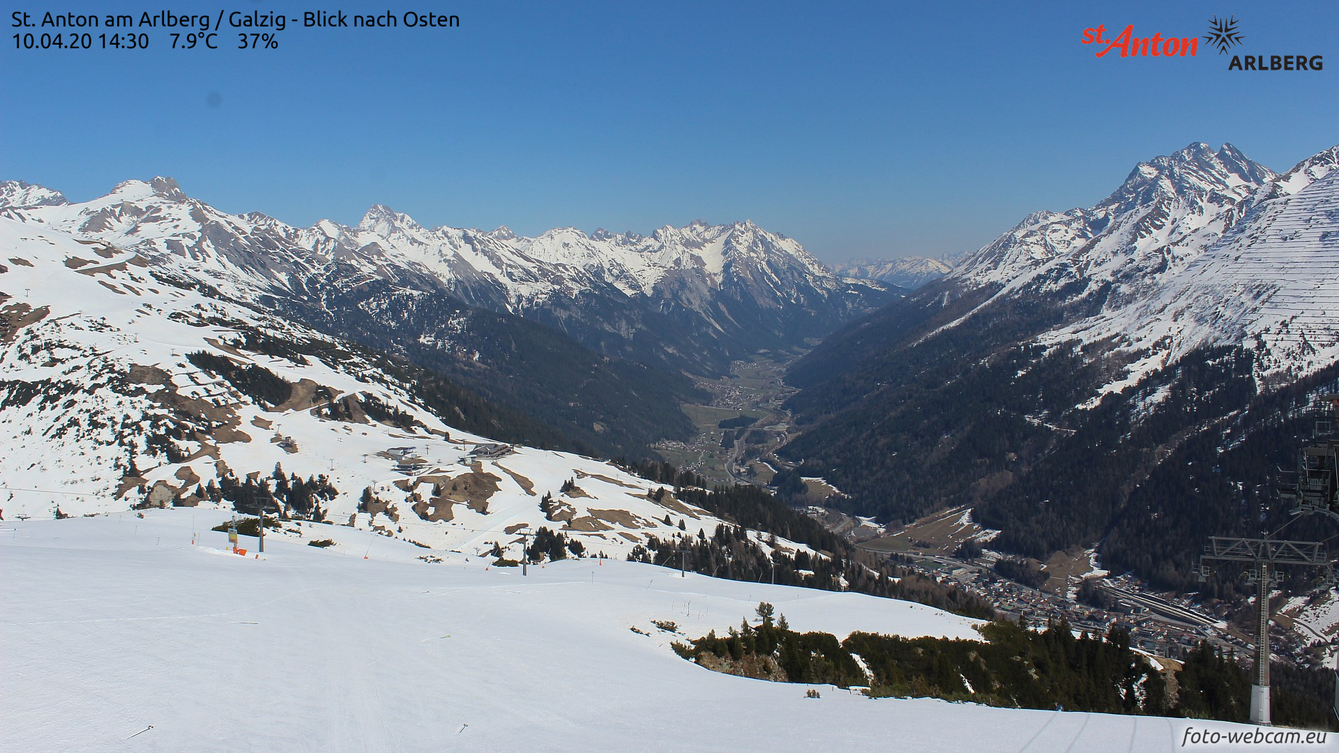 |
| 10.04. |
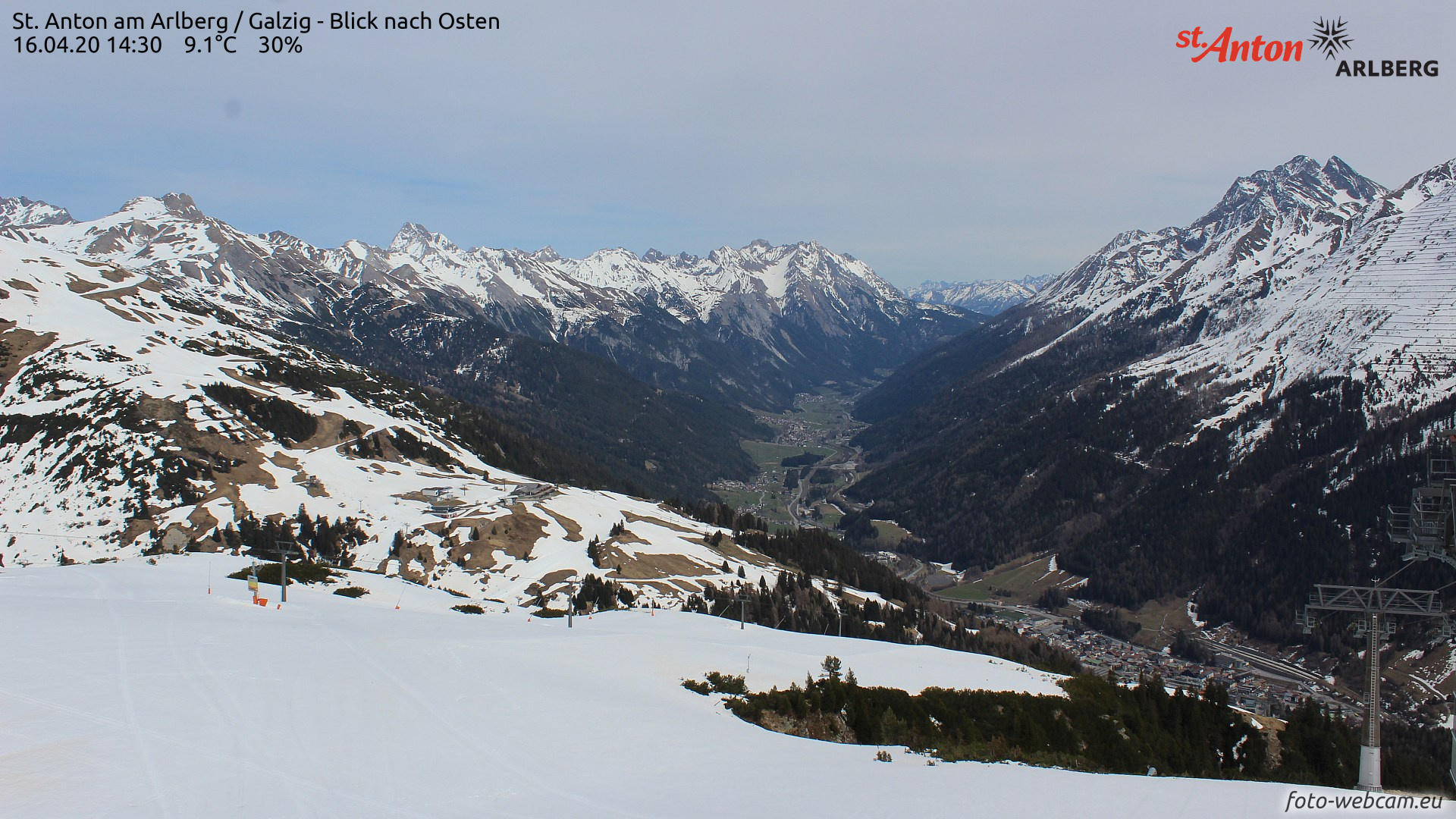 |
| 16.04.2020: a marked increase in grass-covered surfaces, compared to 10.04.2020 |
Very few avalanches observed
Isolated future slab avalanches possible esp. on shady slopes above 2500 m
Information on snowpack layering in outlying terrain is hard to come by. However one thing is certain: the snowpack is only slowly becoming thoroughly wet on high-altitude shady slopes (mostly because of very dry air masses). Nevertheless, we assume that the old snowpack on shady slopes is moist up to about 2500 m. As this process continues (and it can progress quickly in this season, regardless of weather – high air moisture, low clouds, warm temperatures, diffuse solar radiation), we expect some slab avalanches above 2500 m on shady slopes. They will probably be in limited spreads of terrain. Potential weak layer unleashing them: the expansively metamorphosed layer of faceted crystals from January
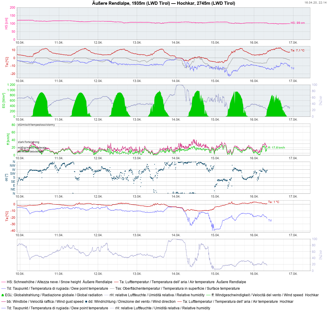 |
| Temperature of snowpack surface is an important indicator of snowpack firmness/wetness at this juncture of the season. At night, melt-freeze crusts are seen to form which, at least on 14-15 April were capable of bearing loads at this station. |
Ongoing daytime avalanche danger cycle
Based on the current weather forecasts, little change is expected initially. We will continue to see a greater or lesser avalanche danger cycle each day.