Normal
0
21
false
false
false
DE-AT
X-NONE
X-NONE
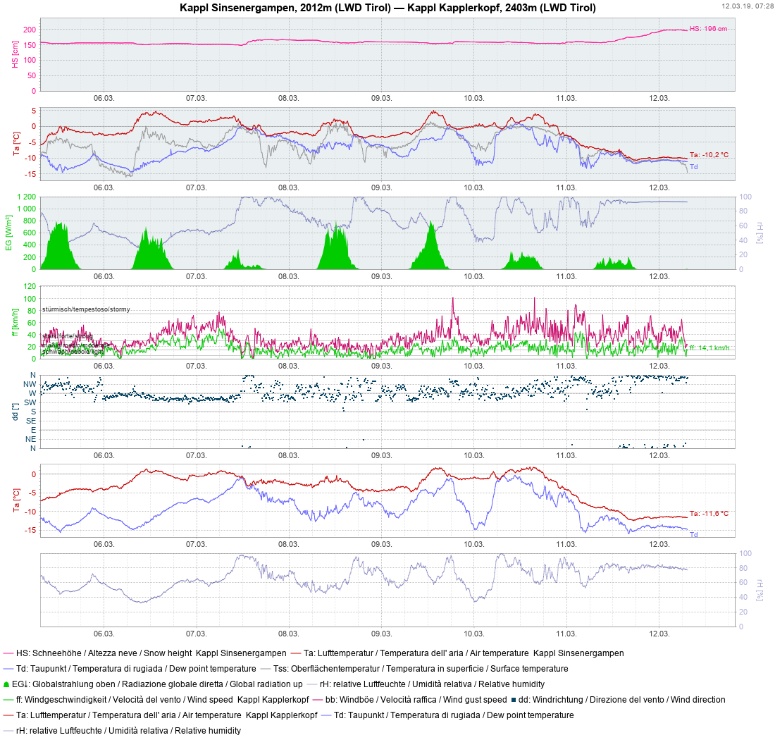
Variable weather has brought some precipitation over the last five days,
most of which fell on 11.03 and 12.03. Initially there was rainfall up to about
2000 m, regionally even higher.
Normal
0
21
false
false
false
DE-AT
X-NONE
X-NONE
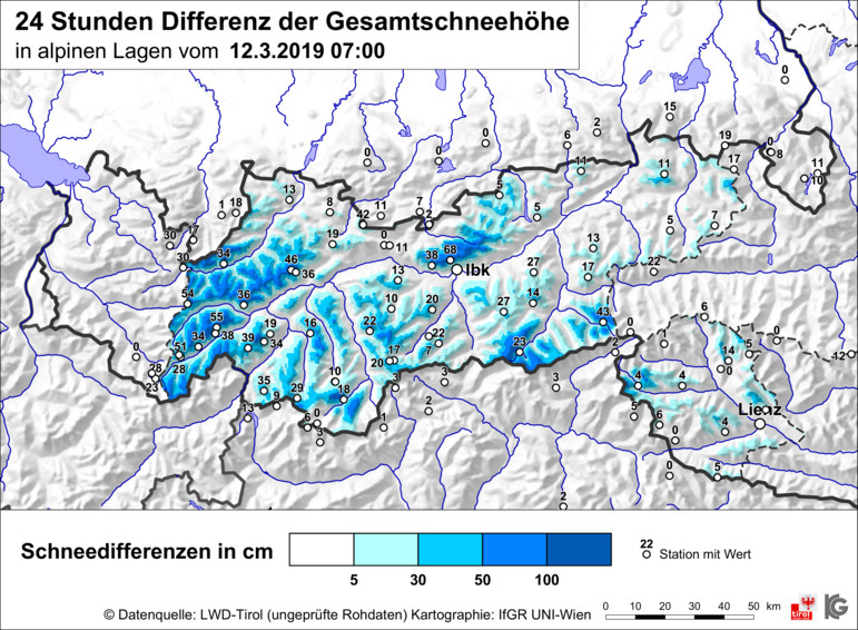
snowfall level began to descend in the evening, eventually reaching the valley
floor. In the western regions, in Karwendel, Tux and Zillertal Alps, there was
generally 30-50 cm of fresh snow registered, as much as 70 cm from place to
place. Strong-velocity winds transported the fresh snow massively in some areas.
Normal
0
21
false
false
false
DE-AT
X-NONE
X-NONE
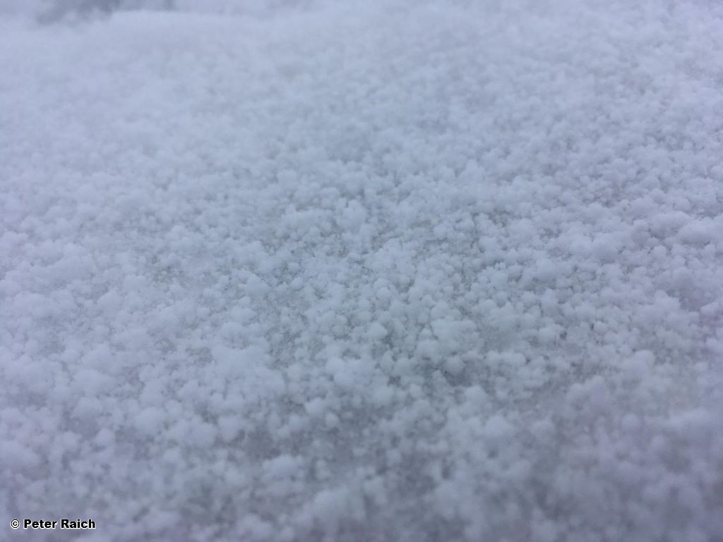
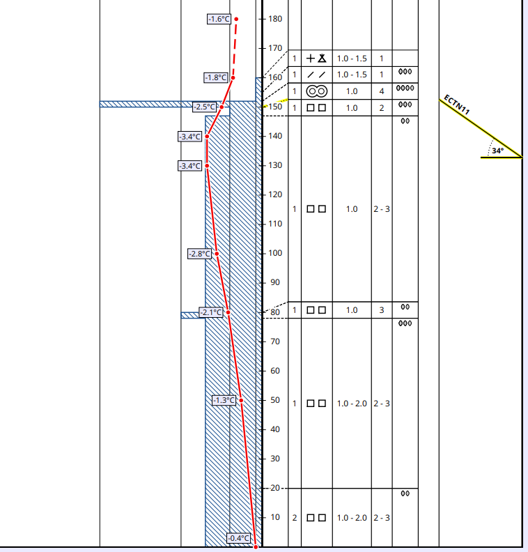
The precipitation, as forecast by ZAMG Weather Service, was highly
convective. We know such situations from summer, when thunderclouds move in and
heavy precipitation results. Convective precipitation favors the formation of
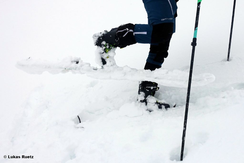
graupel, which is exactly what happened, a layer of it was generated inside the
fresh snow. Graupel is a potential weak layer for any snowdrifts which get
deposited on top of it, especially when the graupel layer is thick (1 cm).
Normal
0
21
false
false
false
DE-AT
X-NONE
X-NONE
Other potential weak layers for slab avalanches are found primarily on
very steep, shady slopes close to the surface. Most likely candidates are the
faceted snow crystals beneath thin melt-freeze crusts at altitudes of 2000-2400
m. In addition, covered powder snow, particularly at high altitudes, is
triggerable for a brief spell and in all aspects.

Normal
0
21
false
false
false
DE-AT
X-NONE
X-NONE
(12.03) including higher temperatures and solar radiation will lead to
heightened avalanche activity. We expect numerous loose-snow avalanches in
extremely steep, sunny terrain. We also expect heightened trigger sensitivity
of the fresh snowdrift accumulations, frequently behind edges in the terrain on
very steep slopes, starting at the timberline.
Normal
0
21
false
false
false
DE-AT
X-NONE
X-NONE
least to start with (powdery). During the course of the day, the snow on sunny
slopes at very least will rapidly become sticky.