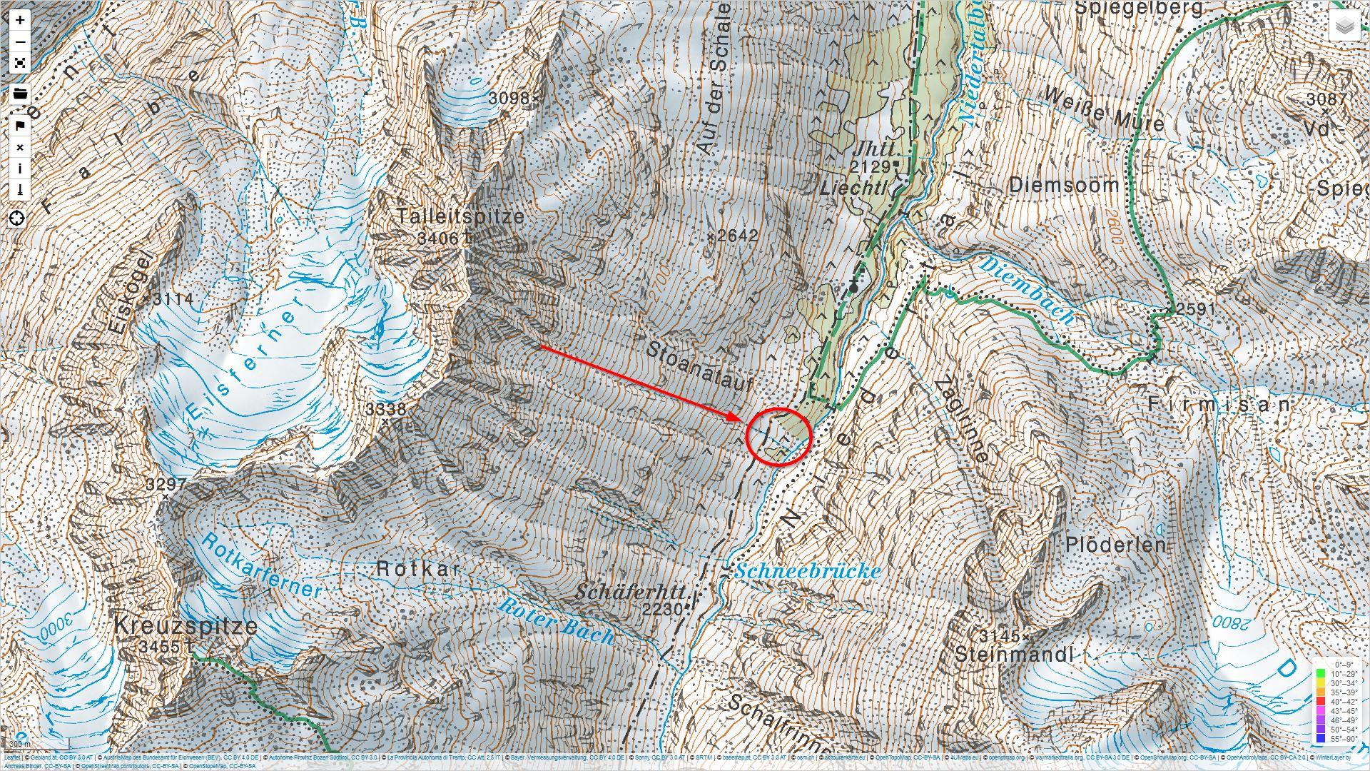
On 11.04.2024 a group of 21 people were ascending from Vent through Niedertal towards the Martin-Busch-Hütte. Below the Talleitspitze several persons were caught in a naturally triggering wet-snow avalanche. Three persons died in the avalanche, one was injured.
Sequence of occurrences
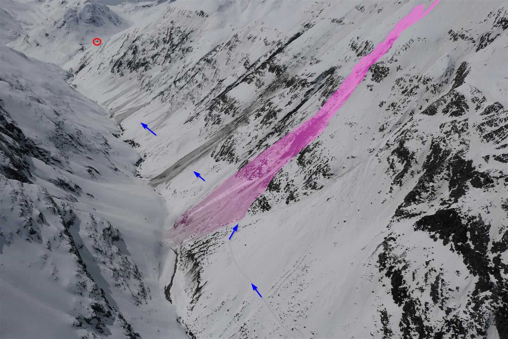
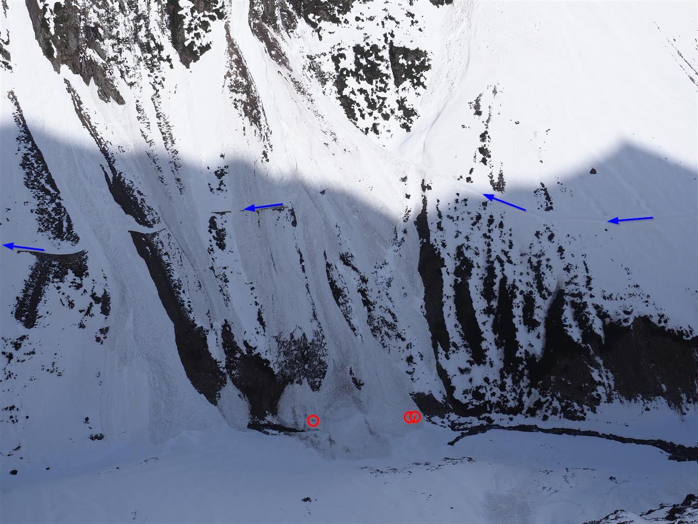
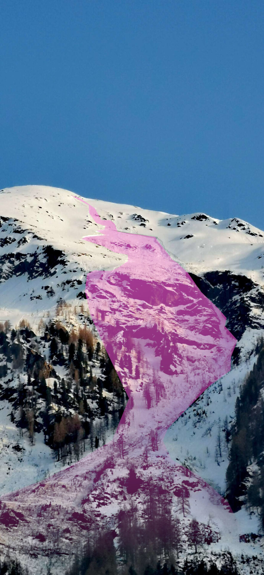
A group of 17 people from the Netherlands and 4 locals intended to climb from Vent up to the Martin-Busch-Hütte. Just before 11:00 am in extremely steep terrain, a primary loose-snow avalanche triggered about 800 m above them which swept along increasing masses of snow along its plummet path. The avalanche was channeled into a furrow and spread out like a fan above the ascent path to the hut. Some persons were caught in its flow, three were killed, one was flown with injuries to the hospital.
Difficult search-and-rescue operation
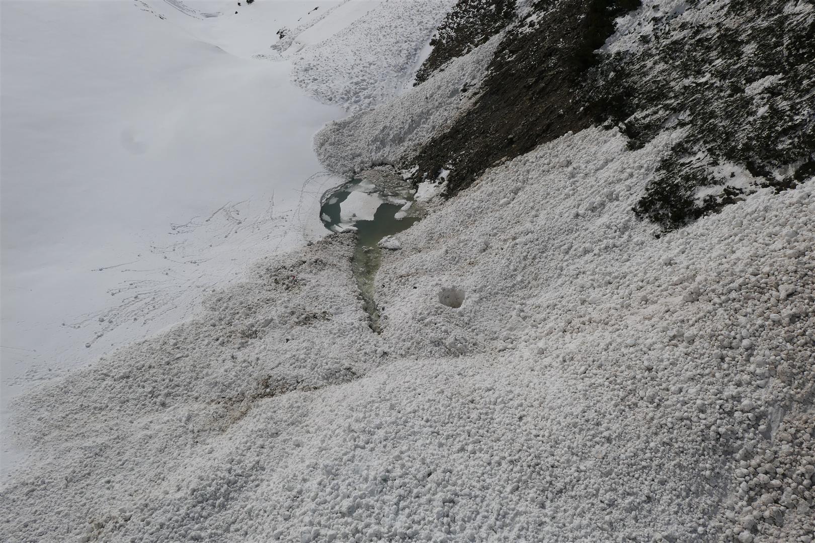
Initial reports at Tirol headquarters saw 10 buried people, later on the assumption was 18 buried persons. This led to a huge search-and-rescue operation (3 helicopters with emergency doctors, state helicopter, all mountain rescue squads of the Ötztal, other emergency services, avalanche dogs and their guides, alpine police). The first persons were quickly located, including a woman who had perished in the wedge of the avalanche snows. Since further avalanches triggered during the search and rescue operation, efforts were concentrated on removing all those who were not buried, including people not involved in the incident, from the danger zone by flying them out. In order to carry out the search and rescue operation without danger to others, it was weighed to artificially trigger specific avalanches in the starting zone. This alternative was rejected once the initially vague picture became clearer. It was gradually concluded that one person who got deeply buried but was partly unearthed was still missing. This person was unburied by the rescue team as they were tied securely to the helicopter. Two other helicopters served as avalanche guardians parallel to this action.
Incident analysis
Type of avalanche
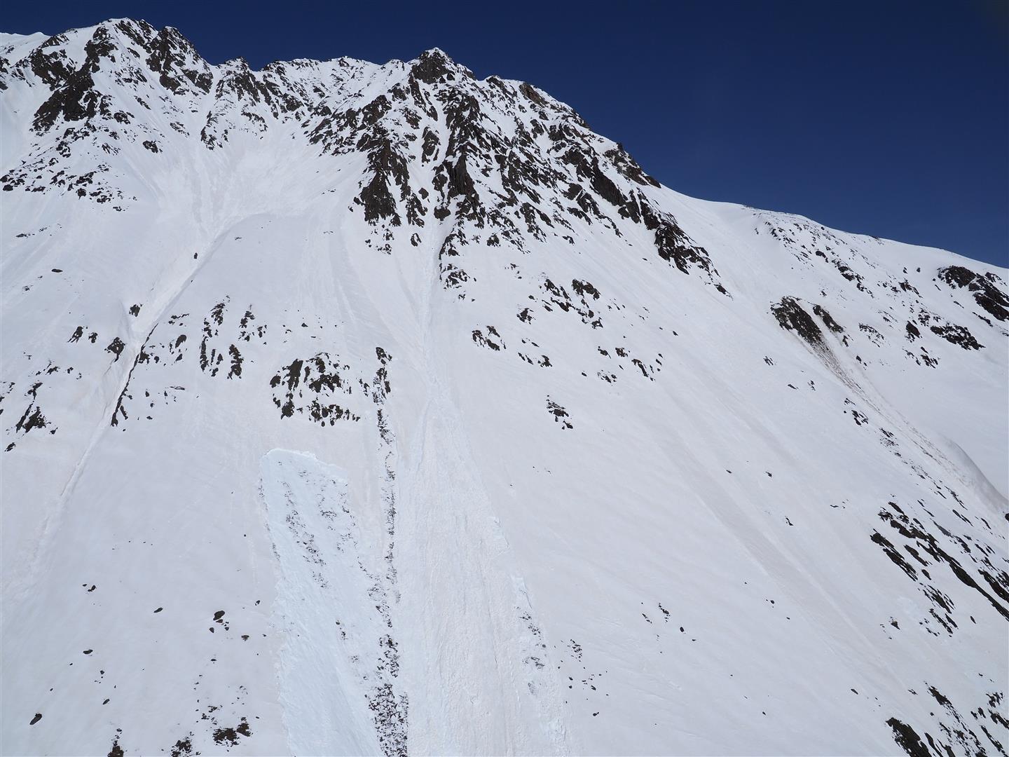
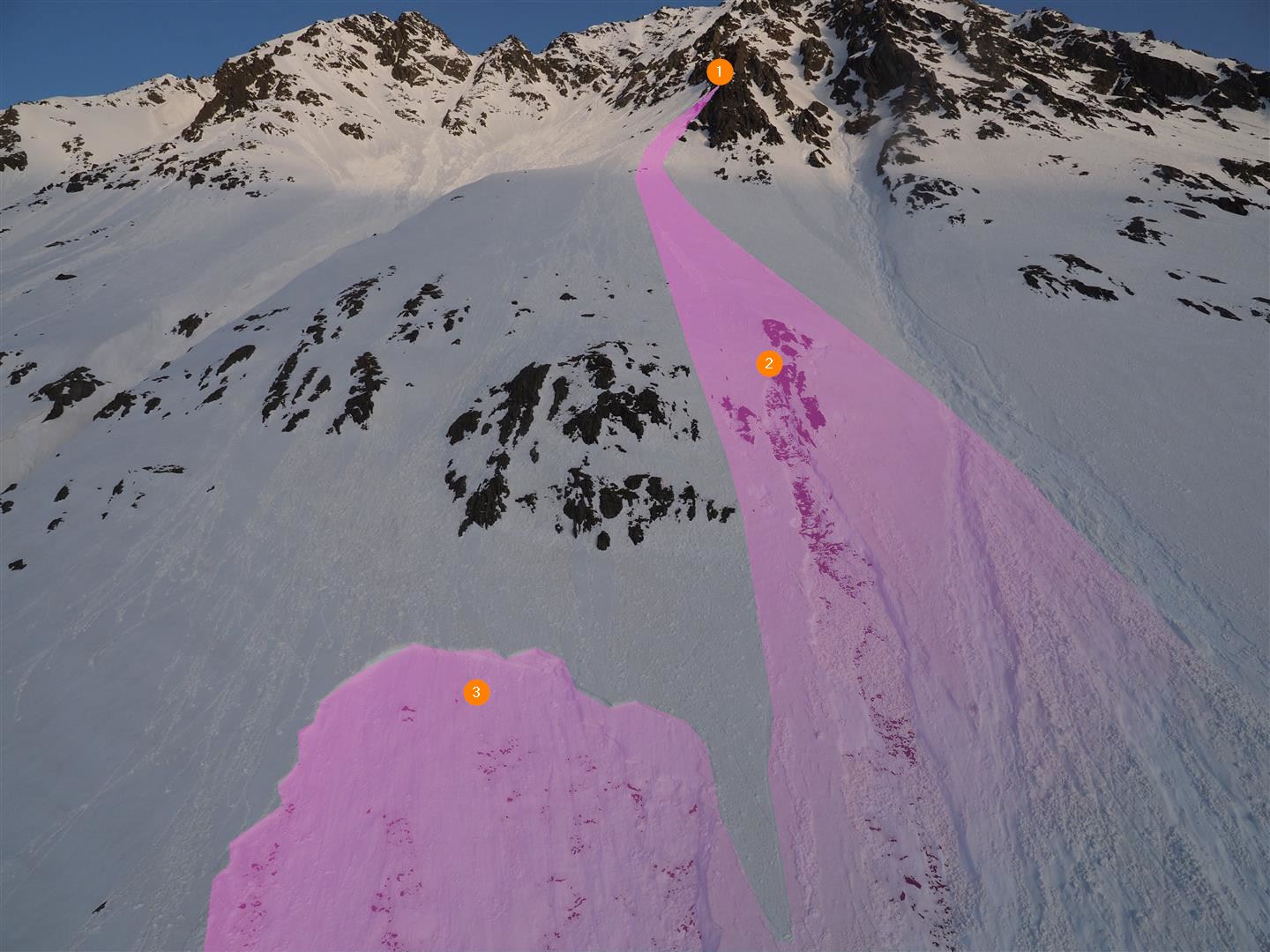
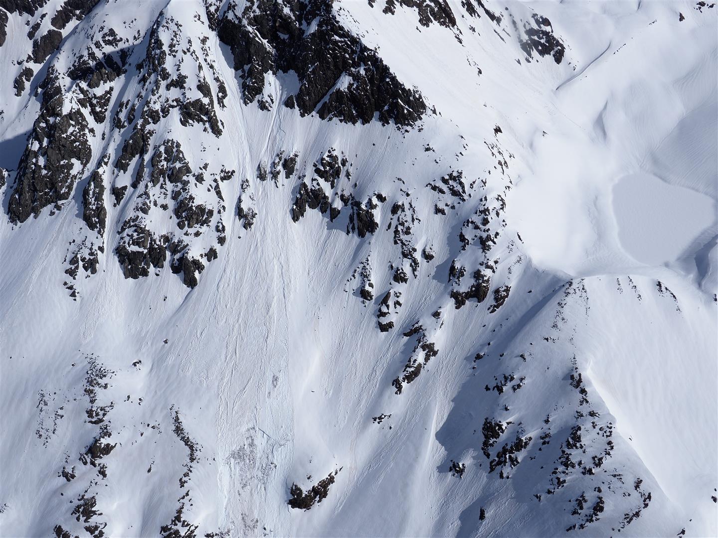
This avalanche was primarily a naturally triggered loose-snow avalanche. It triggered below the Talleitspitze at an altitude of about 3000 m in extremely steep southeast-facing terrain. In the plummet path it broke away additional more deeply embedded layers which were wet down to the ground. Thereafter, these wet snow masses gave an additional impulse for the release of a 20-metre wide slab avalanche, orographically right of the plummet path of the loose-snow avalanche. The fracture of the slab avalanche occurred at 2850m altitude. Ultimately, out of a small loose-snow avalanche, a huge wet-snow avalanche developed.
Course of weather
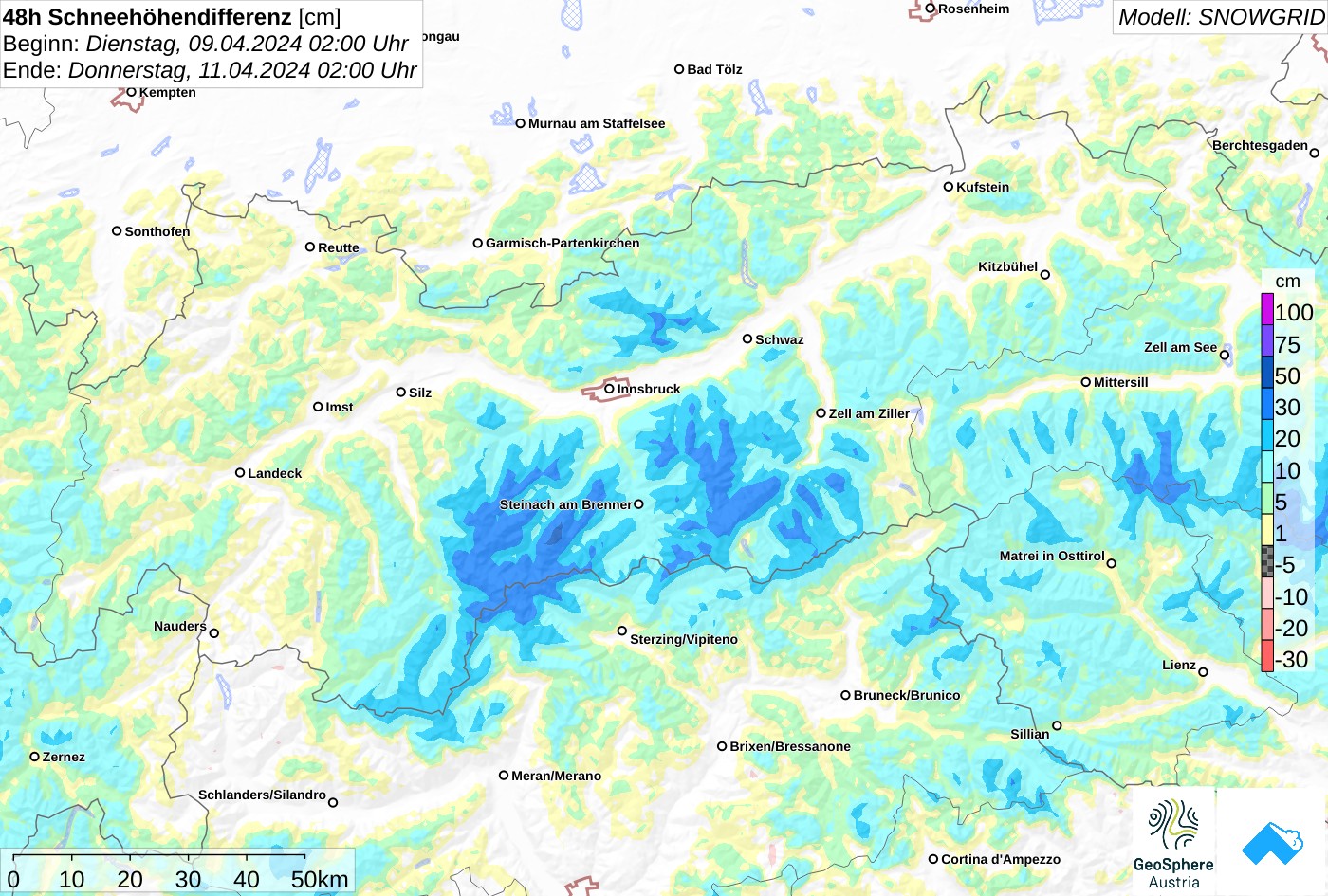
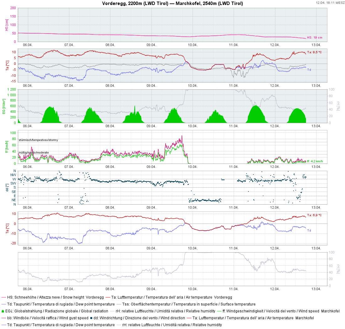
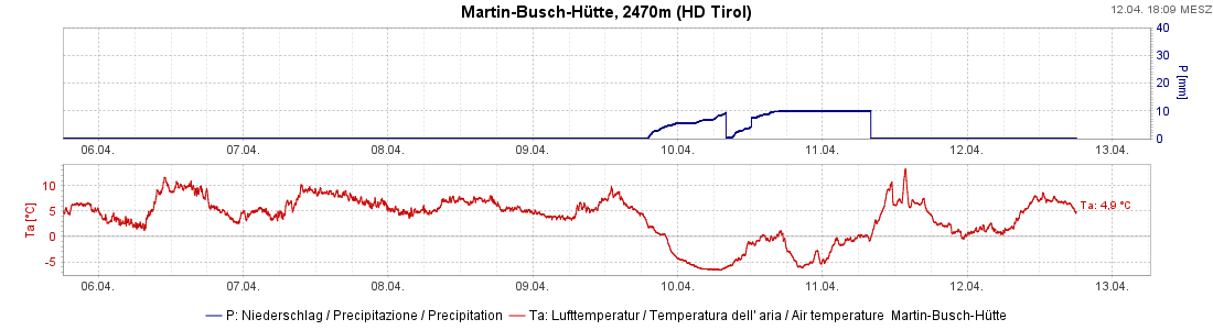
Last weekend we had unusually high temperatures for this juncture of the season. A cold front terminated this phase (briefly) on Tuesday, 09.04. In the avalanche zone there was initially about 20cm of fresh snow registered. During the snowfall, winds slackened off significantly. On 11.04 weather conditions improved swiftly. Temperatures rose markedly and quickly.
The snowpack
The warm weather left its marks on the snowpack. It became wetter and the wetness went deeper, on sunny slopes up to at least 2800m, on shady slopes up to 2400 m. As a result of the cold front on 09.04 fresh snow was deposited atop a moist-to-wet snowpack surface. As temperatures dropped, a thin melt-freeze crust formed with a certain delay on 10.04. The fresh snow deposited atop of that was often loose on the surface, since winds had slackened off during the precipitation.
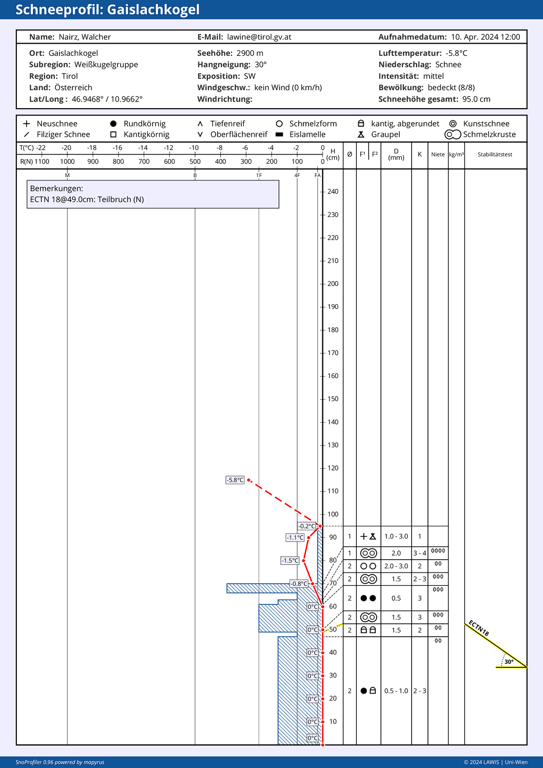
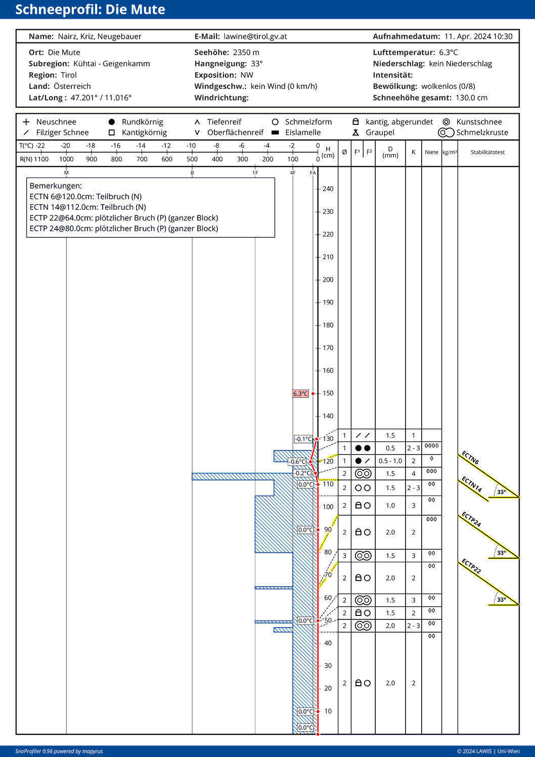
Today in early morning, 12.04.2024, snowpack analysis was carried out with the help of the state helicopter. We selected representative locations for this purpose: further into the valley near the Kreuzspitze at 3455m.
Conditions had changed radically since the incident the day before: the fresh fallen snow on 09-10.04 had become thoroughly moist-to-wet. During the night of clear skies on 12.04 a solid melt-freeze crust capable of bearing loads formed at that altitude. However the snowpack beneath it was moist-to-wet, as on the day of the incident.
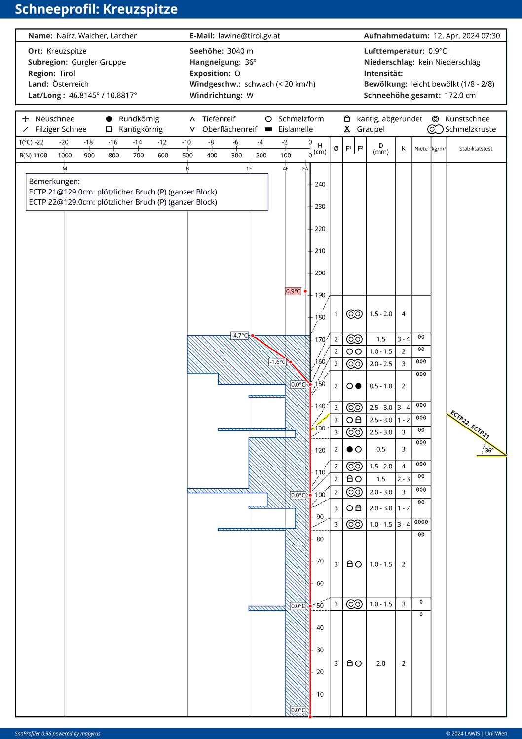
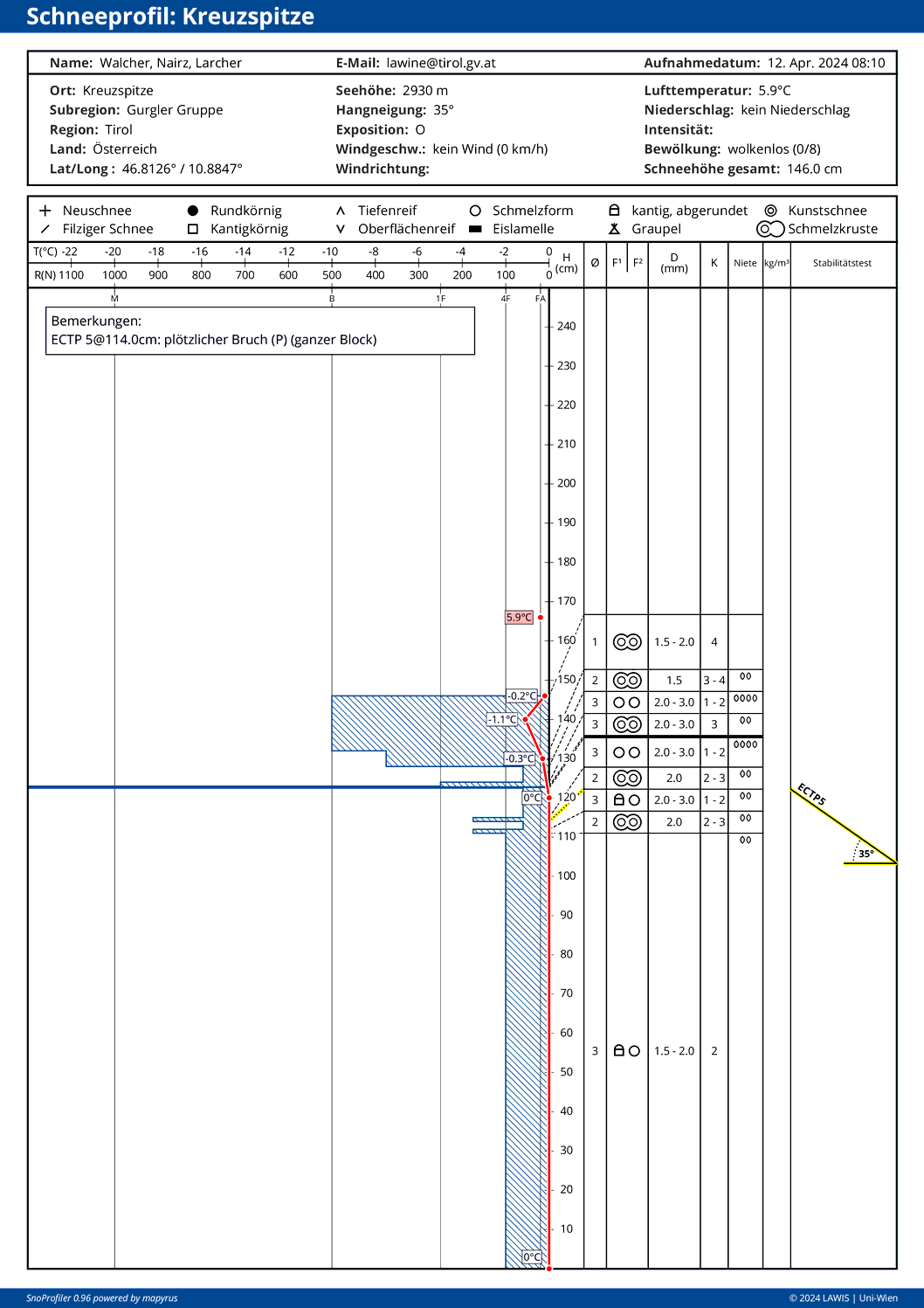
Snow profile near Kreuzspitze at 2930m / E / 35°: freshly formed melt-freeze crust (15cm thick), beneath that a homogenous, soft and 0°C-isotherm snowpack. Yesterday 11.04 without the marked melt-freeze crust, no fracture propagation – and therefore, no slab – would have been possible.
The avalanche terrain
The ascent to Martin-Busch-Hütte runs at the foot of extremely steep slopes. The starting zone above them is vast, the altitude difference great. Thus, the avalanche was able to sweep along huge amounts of snow in its plummet path.
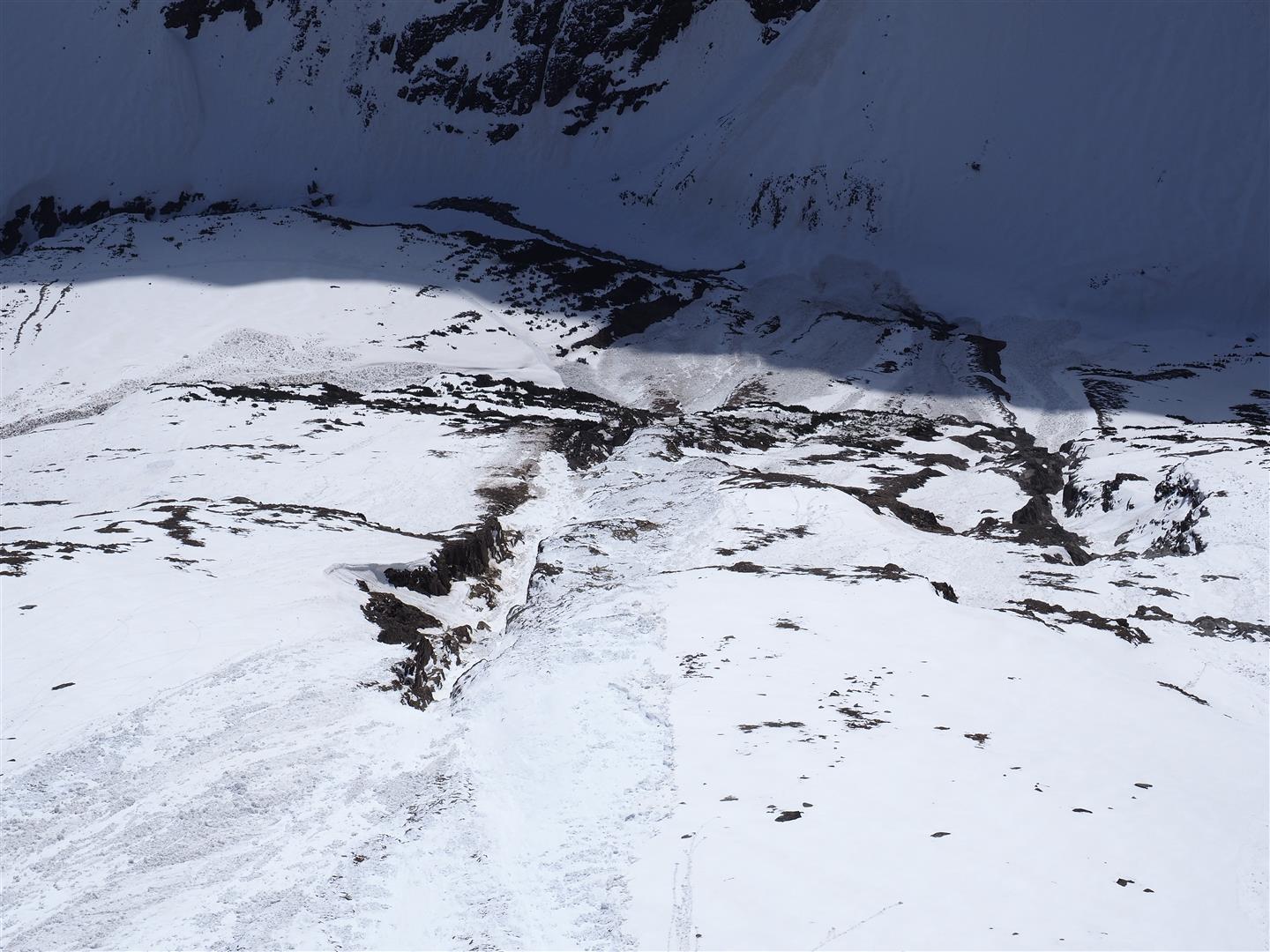
Some of the persons caught in the avalanche were buried so deeply in snow because the avalanche deposits feed into an abrupt change in the terrain: the narrow valley floor.
Further avalanche activity
During our flight over the avalanche area today we were also interested in the avalanche activity as corroboration of our Avalanche Bulletin. We were able to observe numerous small-to-medium sized loose-snow avalanches. Medium-sized loose-snow avalanches that swept along the wet snowpack were much more seldom. Releases which triggered slab avalanches were quite isolated.
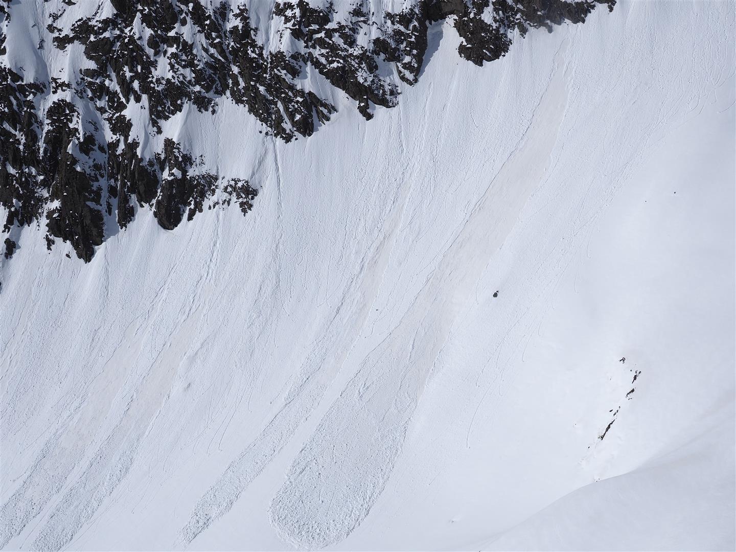
All the slab avalanches which were triggered from the impulse of a loose-snow avalanche had one thing in common: they did not fracture over a wide swath.
Outlook for the weekend
Once again it will be unusually warm for the season. On 13.04 and 14.04, the zero-degree level is expected to lie at 3700m. It will be sunny, but with high-altitude cirrus clouds passing through. On Monday, a cold front will bring rainfall up to high altitudes (initially).
The snowpack will freeze inadequately over the next few days, avalanche danger will increase more quickly than now. The snowpack will tend to sweep away more deeply embedded layers. And, due to the increasing deeper-down wetness of the snowpack, likelihood of slab avalanches will increase. Most threatened will be spots on shady slopes between 2200 and 2600 m where there is not much snow.
For that reason, we advise prudent backcountry-tour planning. The higher you go, the better the conditions will be.