Heightened wet-snow/ gliding snow activity, minor snowdrift problem at high altitudes

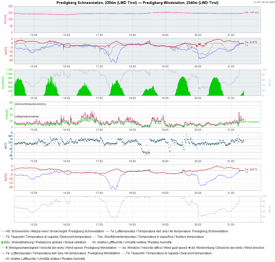
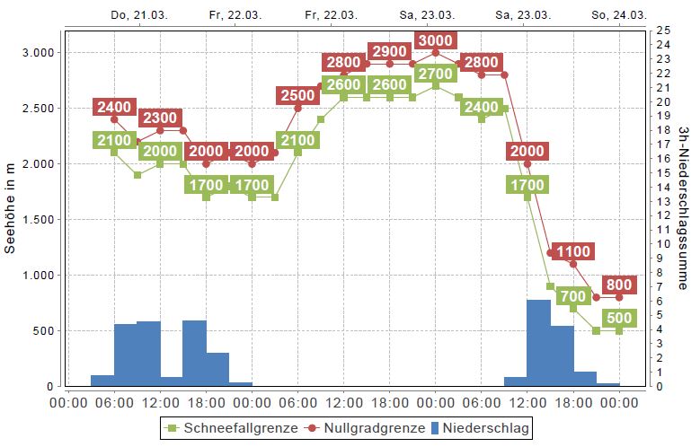
Appropriate for the season, strong solar radiation, rainfall and mild temperatures led (and are still leading) to very wet snow below 2400 m, thus weakening the snowpack. Increasing wet-snow / gliding snow activity is the result. Freshly generated snowdrifts are generally small, but on high-altitude shady slopes prone to triggering. On Saturday, a very sunny start will be followed by a marked cold front, bringing precipitation and plummeting temperatures.

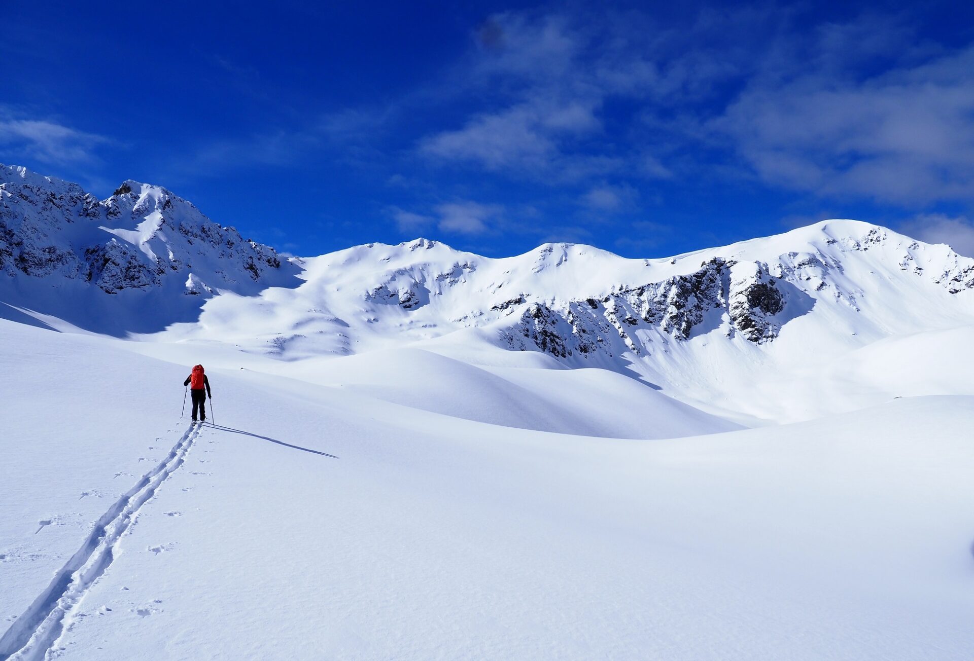
Unfavorable backcountry touring conditions through Friday

On Thursday night skies will be overcast, showers possible, nocturnal outgoing longwave radiation much reduced. Friday will be pleasant, rising temperatures, moist air.

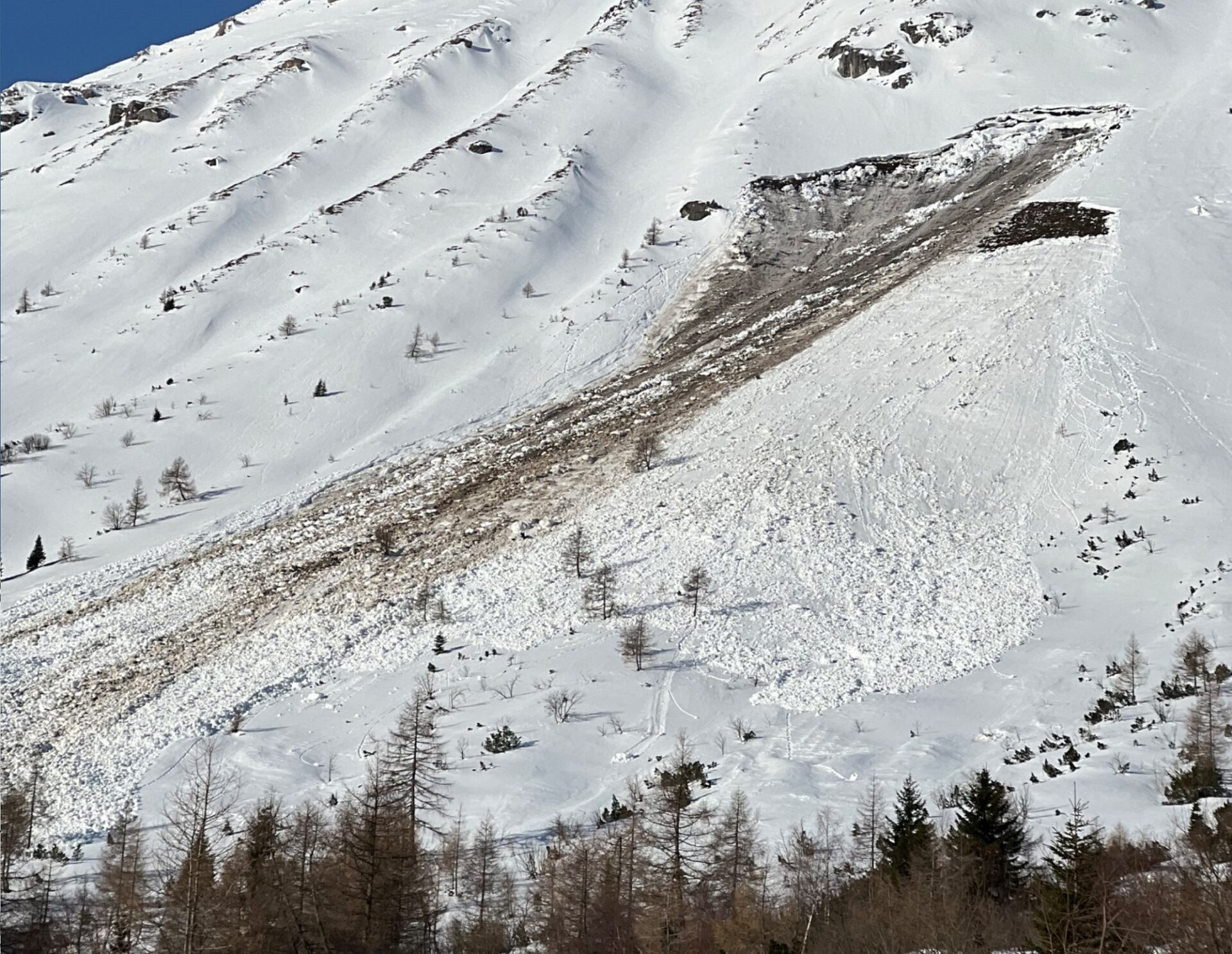
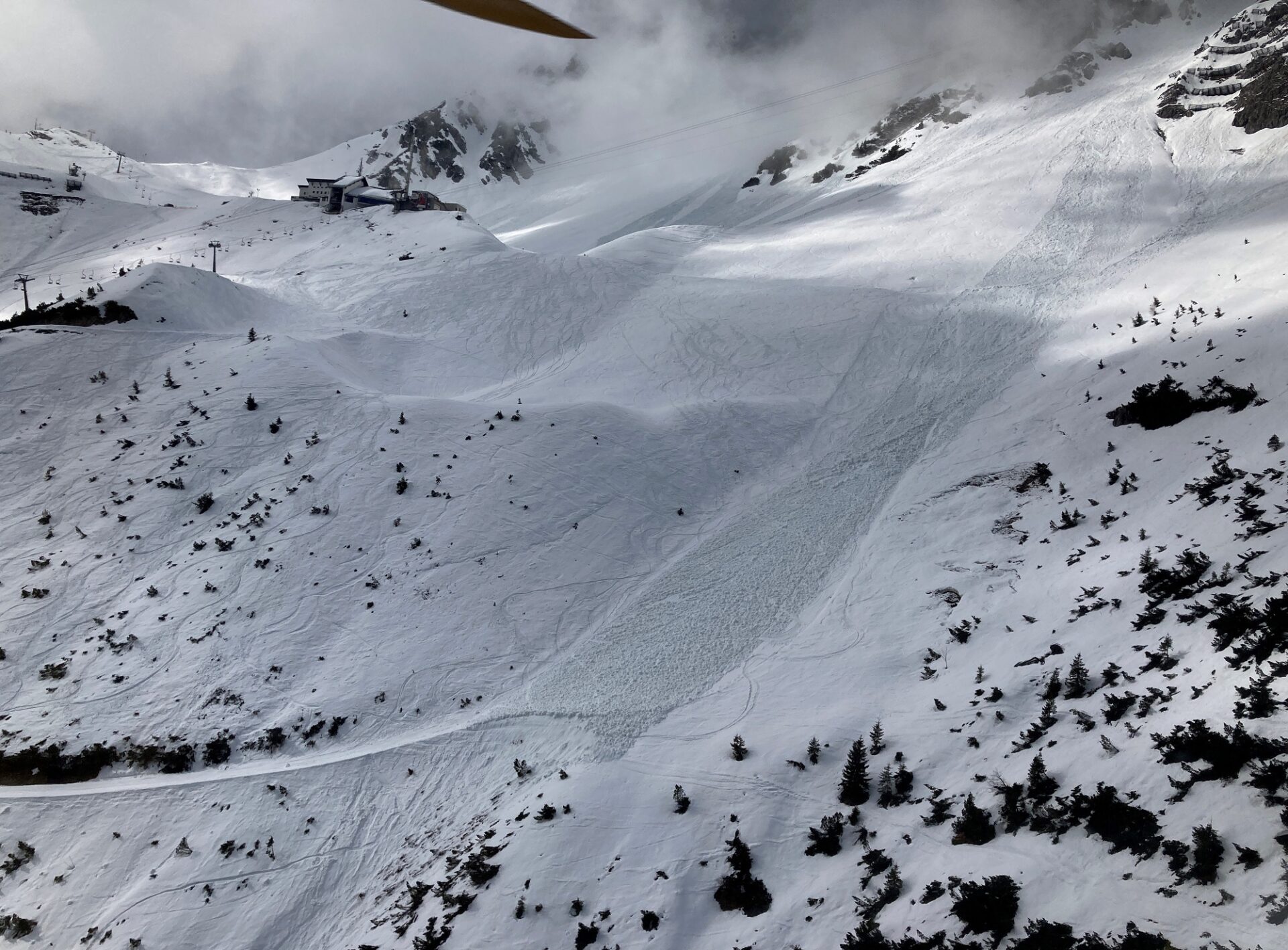
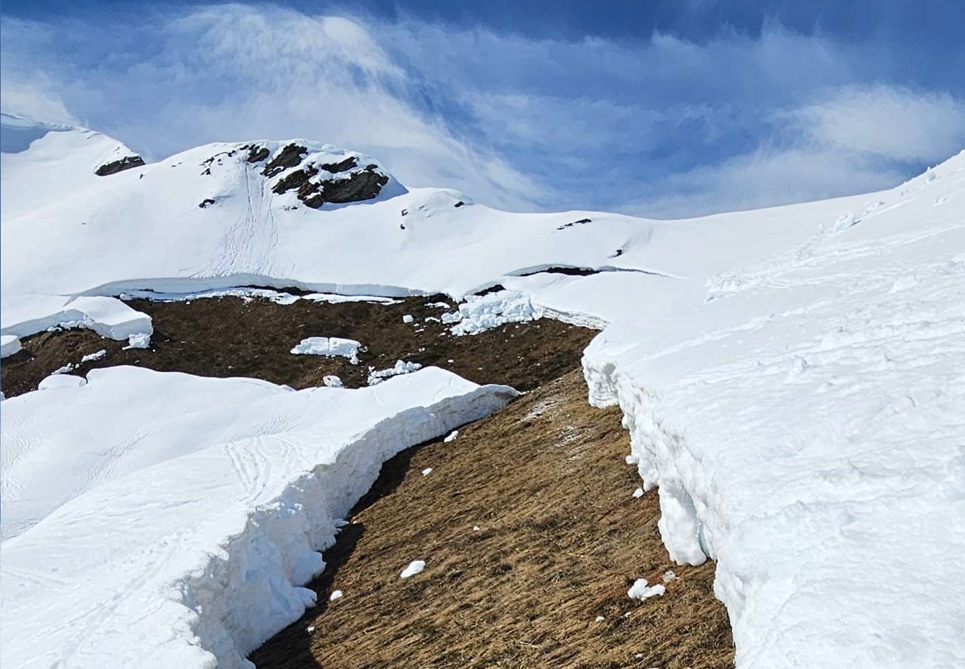
After rainfall and diffuse radiation thoroughly moistened the snowpack up to 2400 m on Thursday (and in the previous days), it can barely radiate warmth on Thursday night. Weather conditions will moisten it further. Danger of wet-snow avalanches thus rises quickly. Due to the first completely wet snowpack, esp. on W/N/E facing slopes where there is little snow, the likelihood of wet loose-snow avalanches triggering and also the danger of wet slab avalanches will increase. As water seeps into the snowpack down to the ground, it also reinforces its tendency to glide over smooth ground.

In addition, the fresh snow from Thursday and Friday (21-22.03) will become moist. For that reason, small-to-medium naturally triggered loose-snow avalanches can be expected on extremely steep high altitude slopes.

Schneeprofil an einem Nordhang auf ca. 2100m im Bereich Kalbenjoch, Stubaier Alpen von Mittwoch, 20.03. Auf dieser Höhe haben auch Schattenhänge nur mehr wenig Temperaturreserve. Eine erste komplette Durchfeuchtung der Schneedecke führt zu einem Festigkeitsverlust und dem Anstieg der Nassschneelawinen- Aktivität.
Snow profile from north-facing slope at 2100 m near Kalbenjoch, Stubai Alps, from Wednesday, 20.03. At this altitude, also shady slopes have few temperature reserves. The first completely wet snowpack will lead to big loss of firmness and a rise in wet-snow avalanche activity.
Zu dieser Jahreszeit reicht oft wenig direkte oder diffuse Strahlung aus, um den Neuschnee anzufeuchten. Dieser verliert dabei kurzfristig an Festigkeit und Lockerschneelawinen aus felsdurchsetztem Steilgelände sind die Konsequenz (Foto: 19.03.2024, ©Christian Riepl).
At this juncture of the season, even a little direct or diffuse radiation is often sufficient to moisten the fresh snow. This forfeits firmness for a brief time. Loose-snow avalanches in steep rocky terrain are the result. (photo: 19.03.2024, ©Christian Riepl).
Gleitschneerisse sind Gefahrenzeichen und Bereiche darunter sollten gemieden werden – ganz besonders gilt dies für Zeiten von allgemein hoher Gleitschneeaktivität (Foto: 17.03.2024, ©Gerhard Figl).
Glide cracks are signals of danger. Thus, avoid zones beneath them. This is especially urgent in times of heightened gliding snow activity. (photo: 17.03.2024, ©Gerhard Figl).

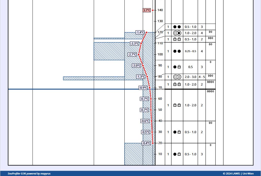
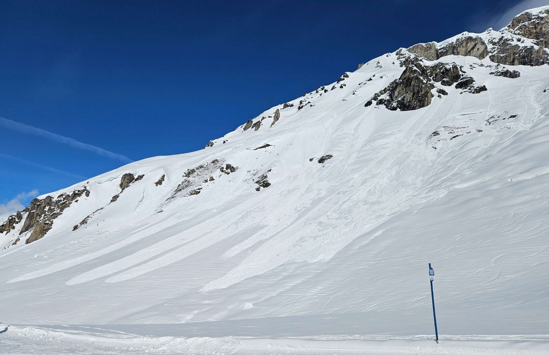
At the same time, warmth inside the snow from higher temperatures and diffuse radiation lead to a very rapid consolidation of the generally small snowdrifts which formed during the recent precipitation on Thursday, 21.03 amid strong NW winds. As a consequence, there are few danger zones for dry-snow avalanches, esp. on very steep shady slopes above 2800 m. In major areas of precipitation, danger zones are more frequent.

Presumably better conditions on the weekend

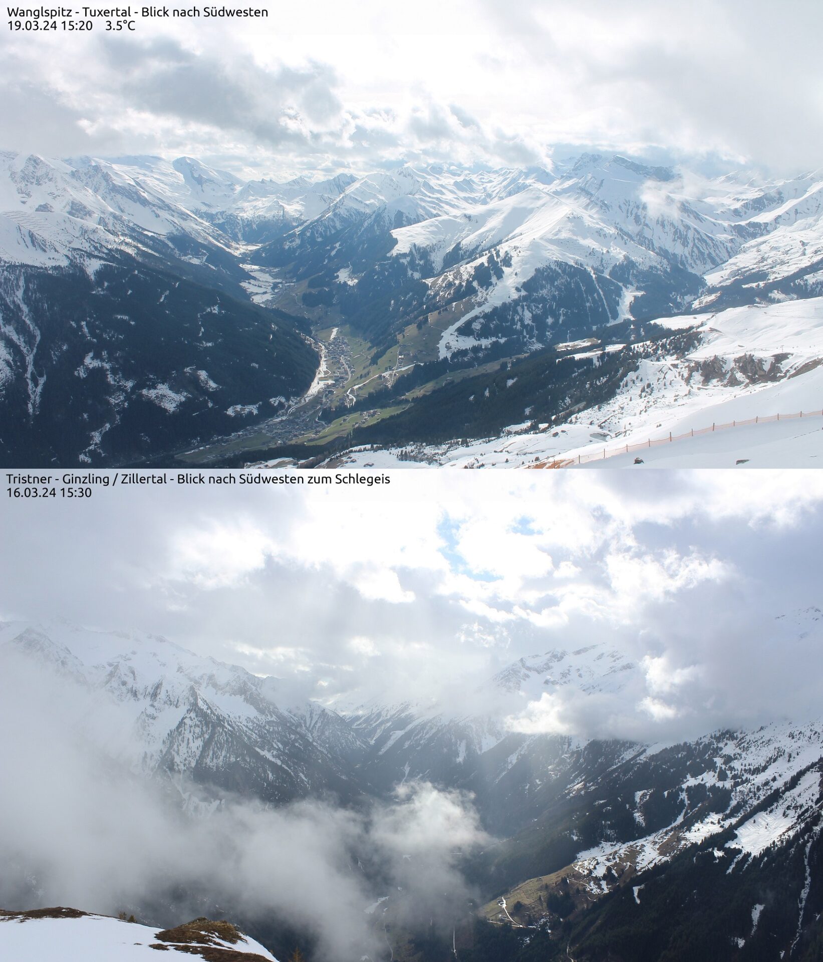
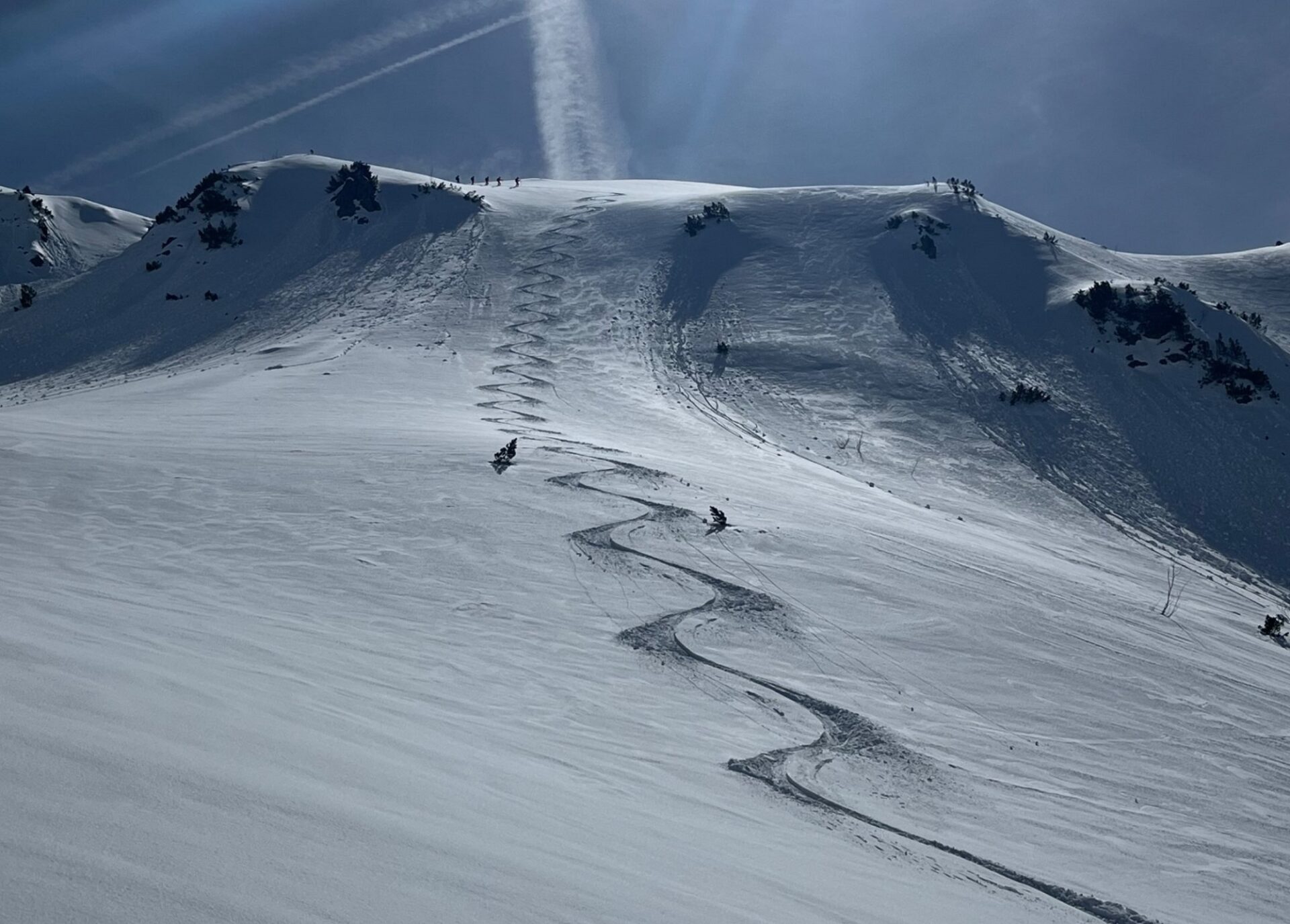
From today’s point of view, Friday night skies will have only scattered clouds. The snowpack can radiate well, form a melt-freeze crust capable of bearing loads, at least on sunny slopes. This will stabilize the snowpack, make avalanche danger recede. On Saturday morning, if you plan carefully, some good quality firn snow is in the offing (esp. in eastern and southern regions).

However, even if the melt-freeze crust is capable of bearing loads, caution is imperative: wherever the snowpack is very wet, loose, unbonded melted forms lurk. If a firm melt-freeze crust forms atop of that on Saturday night, we will have for a brief time the prerequisites for slab avalanches. The loose melt forms constitute the weak layer, the crust is the slab. Through the loading from winter sports enthusiasts, isolated slab avalanches could trigger from minimum additional weight. This scenario occurs the day after thorough wetness if a melt-freeze crust forms due to dry air masses. Precisely then is the weak layer quite striking, composed of melted forms. On the following days, the water contents of this layer decrease, thereby the danger is muted, as is the fracture propagation.

An isothermic snowpack, atop of it a melt-freeze crust capable of bearing loads. Fracture below the crust. Profile from Salzburg; in Tirol, the same prerequisites.

On Saturday 23.03.2024, a cold front will move in, making temperatures plummet. Widespread snowfall in the mountains (5-15 cm).

Prognostizierter Verlauf der Schneefallgrenze und Nullgradgrenze sowie Niederschlag bis Sonntag, 24.02. für die Arlbergregion. Markanter Temperatursturz mit Eintreffen der Kaltfront am Samstag, 23.03. (©Oberlandwetter).
Forecast fluctuations of snowfall level and zero-degree level, together with precipitation until Sunday, 24.03, for the Arlberg region. Marked drop in temperatures as cold front hits on Saturday 23.03. (©Oberlandwetter).
Die Kaltfront wird auch von teils starkem Wind aus westlichen Richtungen begleitet. Dieser sorgt für die Bildung von frischen, teils störanfälligen Triebschneepaketen.
The cold front will be accompanied by strong westerly winds. These will generate fresh, often trigger-prone snowdrift accumulations.

Sunday will be wintery cold, and sunny esp. in southern regions. Solar radiation will again cause small naturally triggered loose-snow avalanches in steep rocky terrain. Due to low temperatures, the snowdrift accumulations which are generated by strong westerly winds will often be prone to triggering.

Next week will be highly variable, as the juncture of the season dictates. But all in all, the avalanche situation won’t change.

Mercurial conditions in review

Milde Temperaturen und oft hohe Luftfeuchtigkeit waren charakteristisch für die vergangene Woche. Am Samstag 16.03. sowie am Montag, 18.03. fiel auf den Bergen etwas Neuschnee. Die darauffolgenden Tage zeigten sich jeweils recht sonnig, was zu vermehrter Lockerschneelawinen- Aktivität führte. Die Nacht auf Mittwoch, 20.03. war klar und es bildete sich ein oft tragfähiger Schmelzharschdeckel – in weiterer Folge konnten am Mittwochvormittag teils gute Firnbedingungen angetroffen werden.
Mild temperatures, often high air moisture characterized last week. On Saturday, 16.03, and on Monday, 18.03, some fresh snow was registered. In the following days it was quite sunny, leading to increased loose-snow avalanche activity. Tuesday night was clear, a melt-freeze crust formed, often capable of bearing loads. That made good firn snow available for a brief spell.
Feuchte Luft, milde Temperaturen und Sonne. An solchen Tagen ist der Wärmeeintrag in die Schneedecke besonders stark. Das genaue Zusammenspiel dieser Faktoren sowie ihre Auswirkung auf die Lawinengefahr ist in der Prognose nicht immer ganz einfach. Umso wichtiger ist im Frühjahr das genaue Beobachten und Einschätzen der Gefahr vor Ort (©foto-webcam.eu).
Moist air, mild temperatures, sunshine. On days like that, the warmth penetrating the snowpack was especially strong. The interaction of these factors and their effect on avalanche danger is not simple to translate into a concrete forecast. For that reason, it is all the more important in springtime to observe carefully and be able to estimate dangers on-site. (©foto-webcam.eu).
Mit Wärmeeintrag in die Schneedecke nahm auch die Gleitschneeaktivität in der vergangenen Woche wieder deutlich zu. Hier exemplarisch ein Bild einer frischen Gleitschneelawine aus den Stubaier Alpen (Foto: 17.03.2024, ©Stephan Gander).
The penetrating warmth made gliding snow activity surge last week. Above is a good example: fresh glide-snow avalanche in the Stubai Alps. (photo: 17.03.2024, ©Stephan Gander).
Diese spontane mittelgroße nasse Lockerschneelawine an der Nordkette führte am Dienstag, 19.03. zu einer aufwändigen Suchaktion. Es kam glücklicherweise niemand zu Schaden (Foto: 19.03.2024, ©Alois Stöckl).
This naturally triggered medium-sized wet loose-snow avalanche in the Northern Massif unleashed a large-scale search-and-rescue action on Tuesday, 19.03. Fortunately, no one was injured. (photo: 19.03.2024, ©Alois Stöckl).
Nach dem Schneefall vom Montag, 18.03. konnte am Dienstag an Schattenhängen oft lockerer Pulverschnee genossen werden, während dieser an Sonnenhängen schnell angefeuchtet wurde. Wetterkreuzkogel, Stubaier Alpen (Foto: 19.03.2024, ©LWD Tirol).
After the snowfall on Monday, 18.03, there was often powder on shady slopes on Tuesday. Sunny slopes quickly turned moist. Wetterkreuzkogel, Stubai Alps (photo: 19.03.2024, ©LWD Tirol).
Abfahrtsspuren im Neuschnee an der Namlosen Wetterspitze in den Lechtaler Alpen (Foto: 20.03.2024, ©Marvin Kärle).
Tracks of a descent through fresh snow on Namlose Wetterspitze in the Lechtal Alps (photo: 20.03.2024, ©Marvin Kärle).