Main problem this coming weekend: fresh snowdrift accumulations, small but easily triggered. In many wind-protected spots beautiful powder with surface hoar. Glide-snow avalanches on steep grass-covered slopes can still trigger naturally and grow to dangerously large size. Circumvent all zones below glide cracks.
Current situation
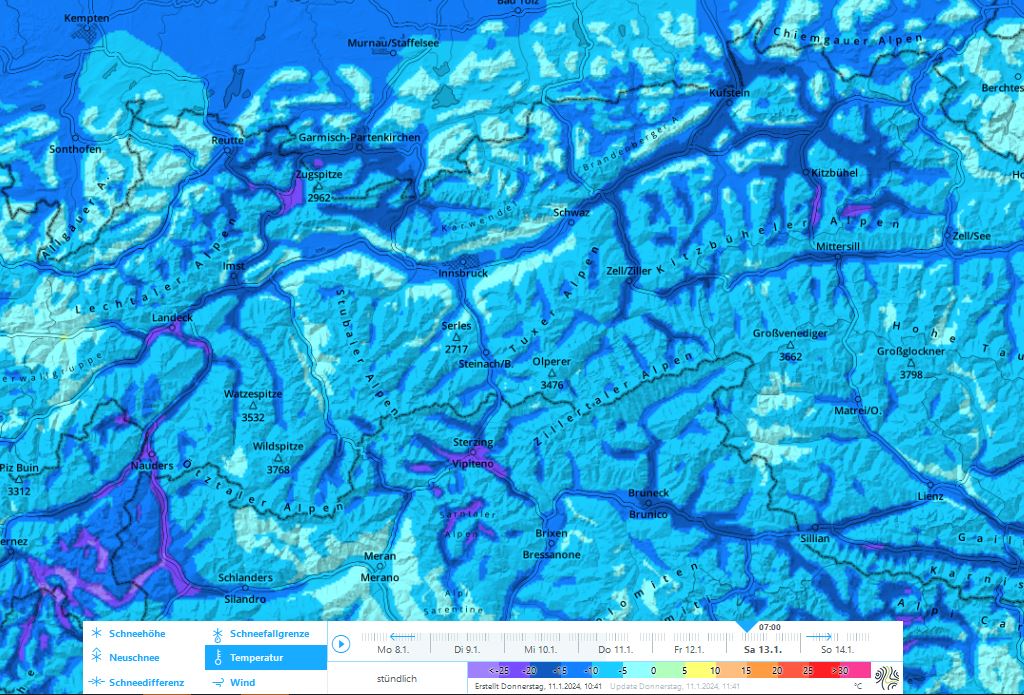
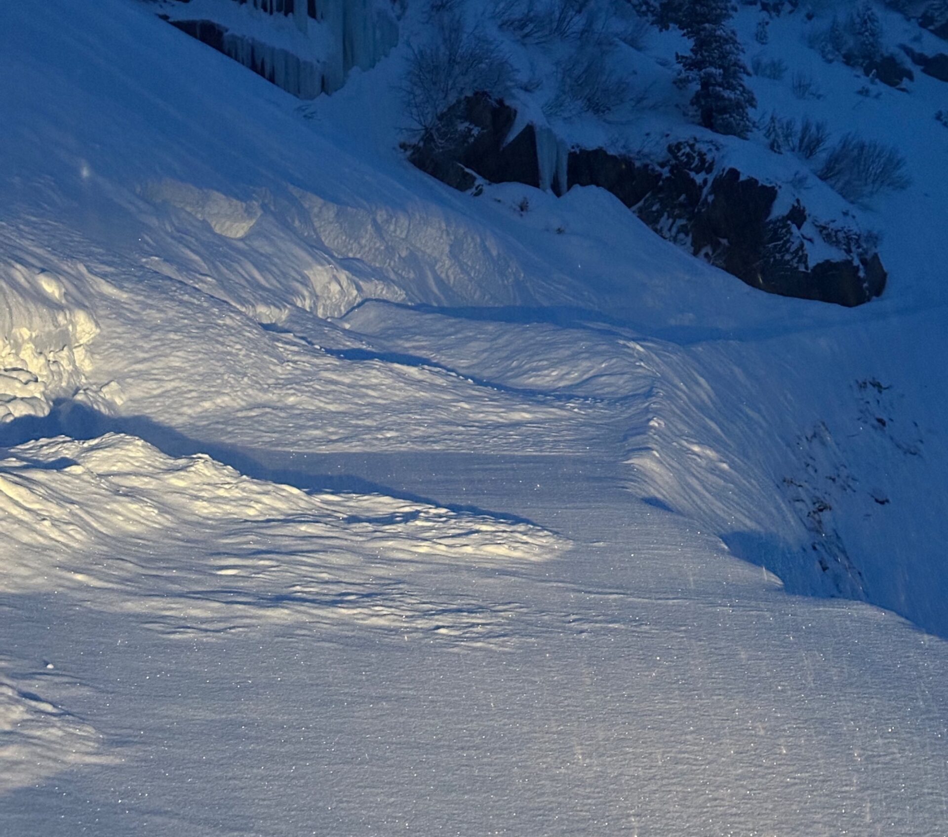
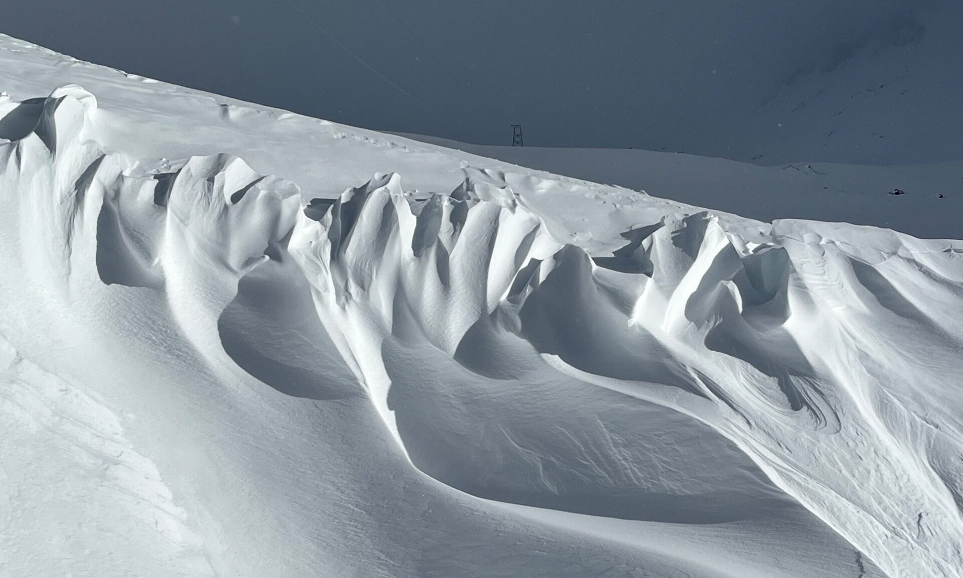
Snowdrift problem
The older snowdrift accumulations from recent days have now stabilized. Starting tomorrow, 12.01, northerly winds will intensify, on Saturday westerly winds are expected. Particularly in zones which till now have been windstill, loose snow on the surface will be transported. Some of the transported snow will be subsumed by the low air moisture. In windstill zones behind discontinuities, in bowls and gullies, the drifts will be deposited atop an unfavorable snowpack surface where there is surface hoar widespread up to high altitudes: we all know that this is a weak layer.
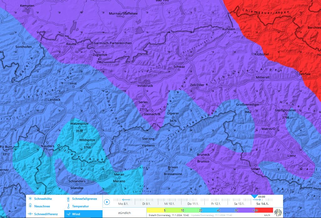
As a result of often strong winds, trigger-prone snowdrift masses will be generated which will be easy to recognize. The drifts should be avoided particularly in very steep terrain and in zones with sudden terrain drops.
Keep your eyes peeled for wind signs and danger zones in windstill areas, the frequency of avalanche prone locations can vary greatly from spot to spot. Wherever there has been little wind influence in recent days, there is more loose snow on the ground which can be transported. Particularly there, snowdrift accumulations can be bigger and a slab of medium size more possible.
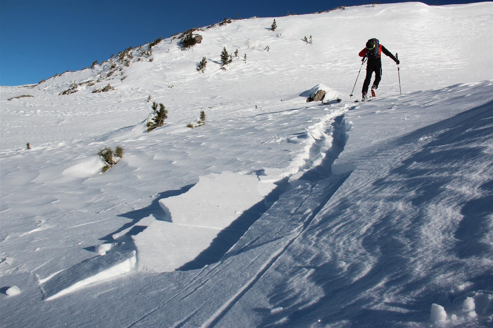
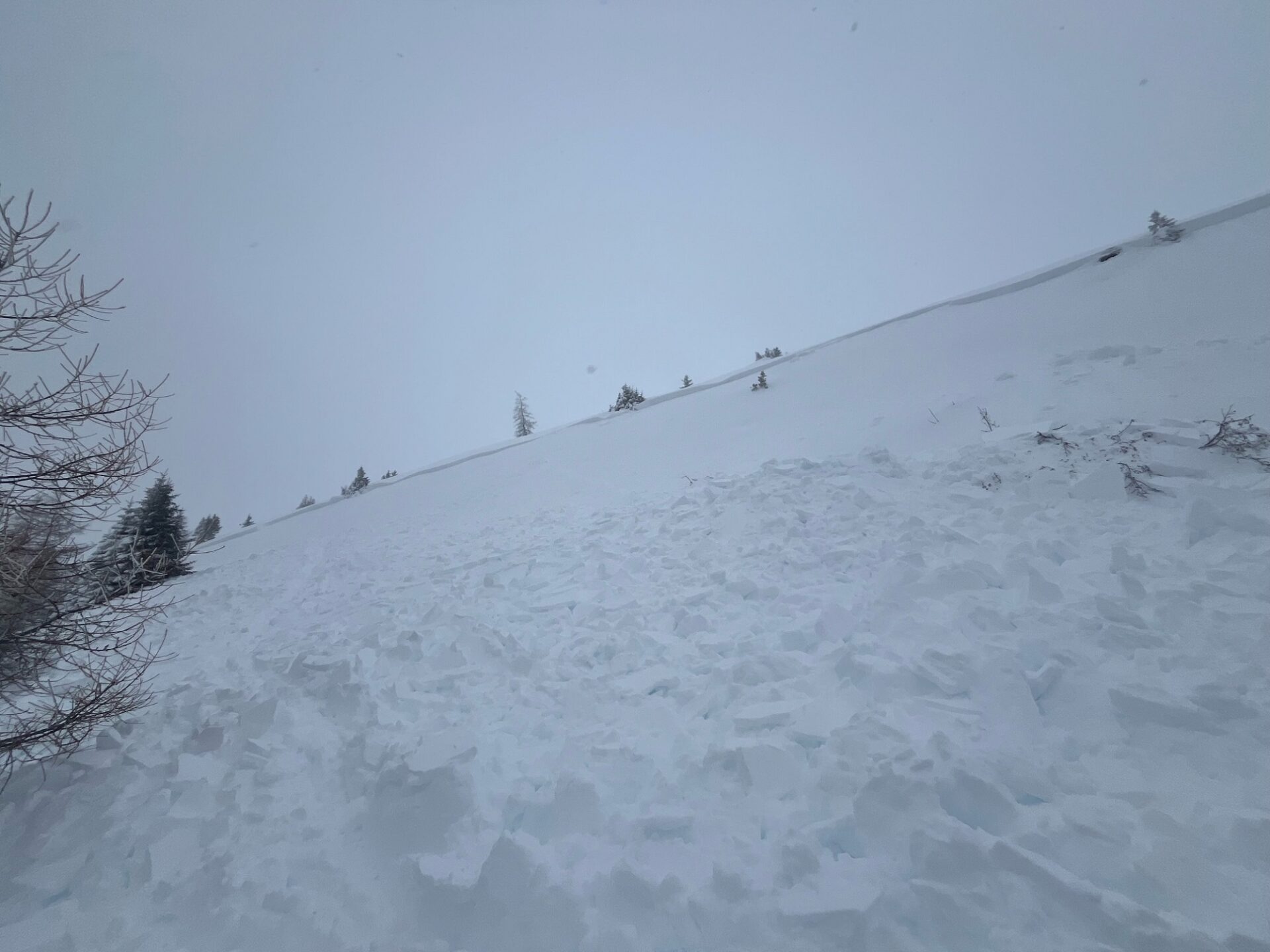
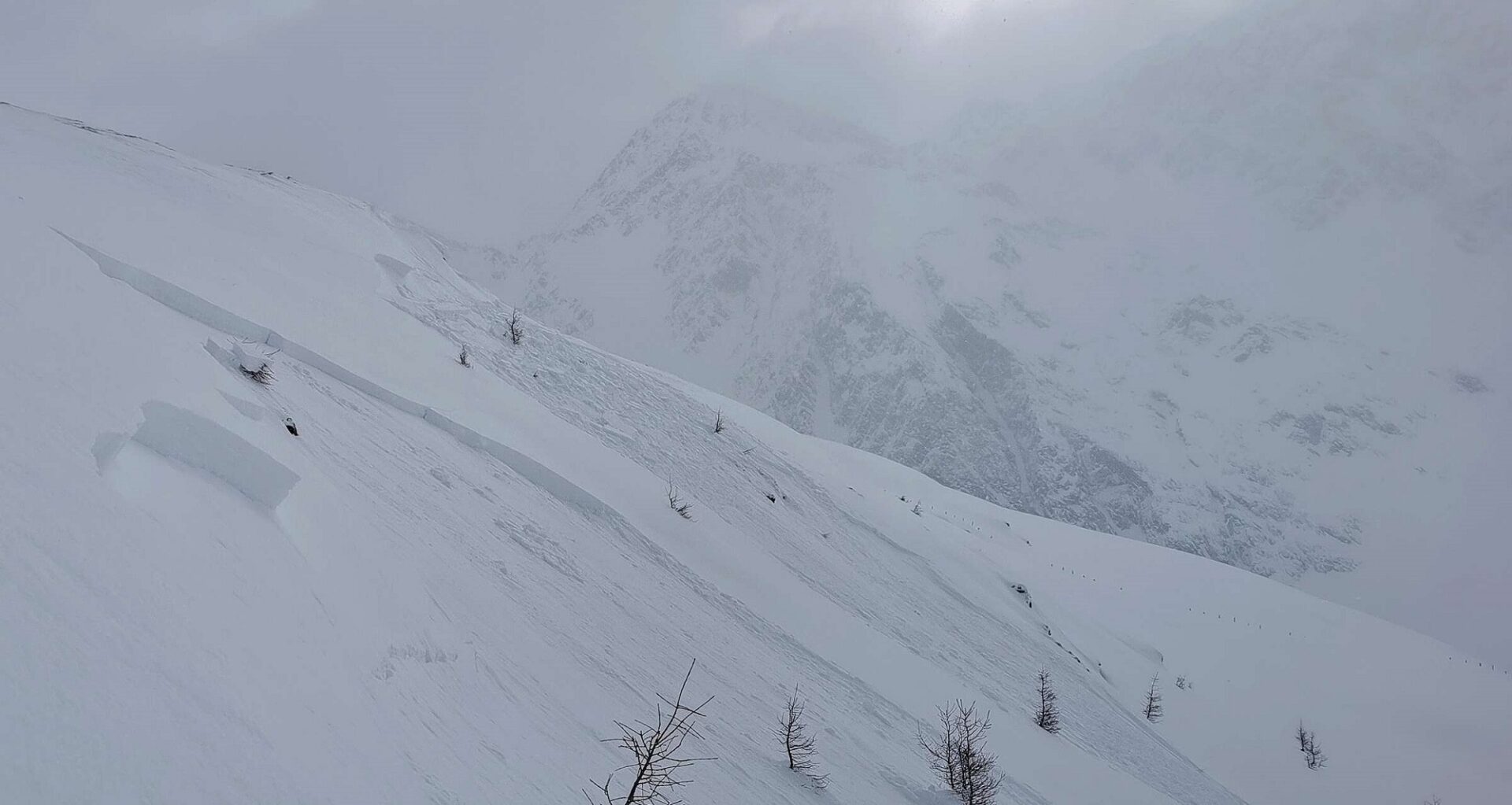
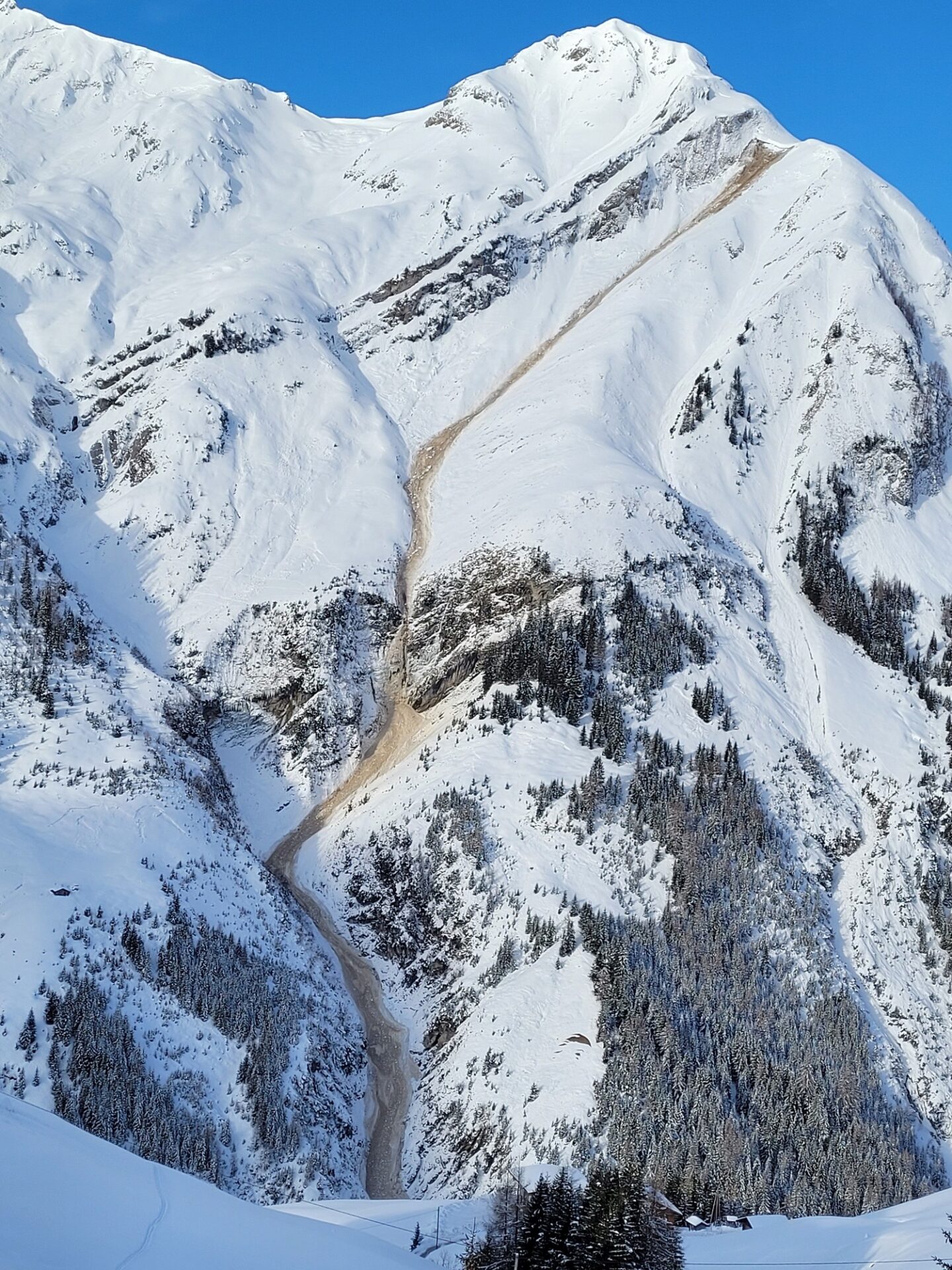
Glide-snow problem
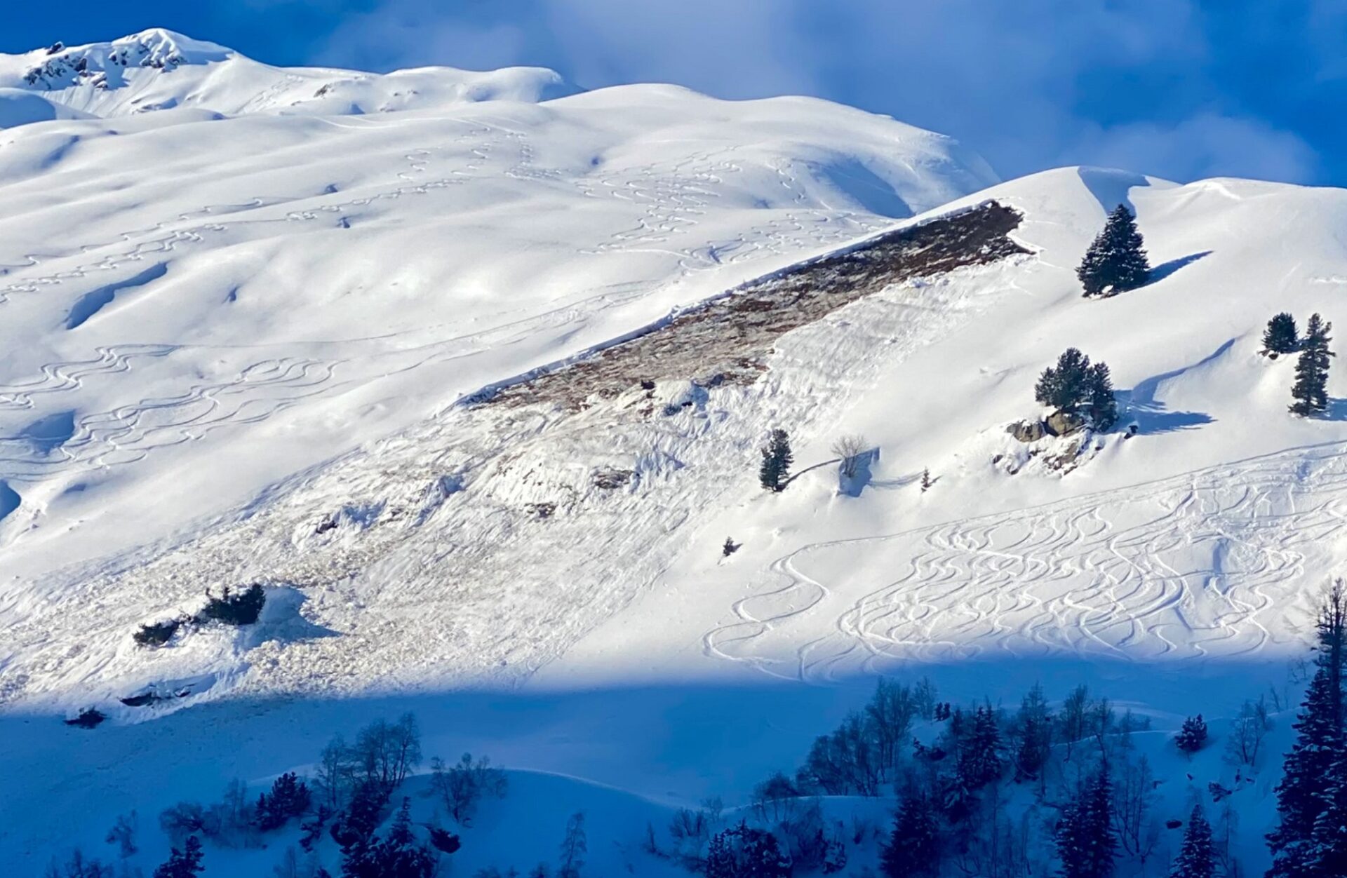
In addition, the danger of naturally triggered glide-snow avalanches persists. We have received many reports of isolated releases, particularly in regions where the biggest glide-snow problem prevails, e.g. west and north of the Inn. Caution urged in these danger zones, naturally triggered releases are still possible. Due to snow depths, they can grow to dangerously large size.
Snow quality
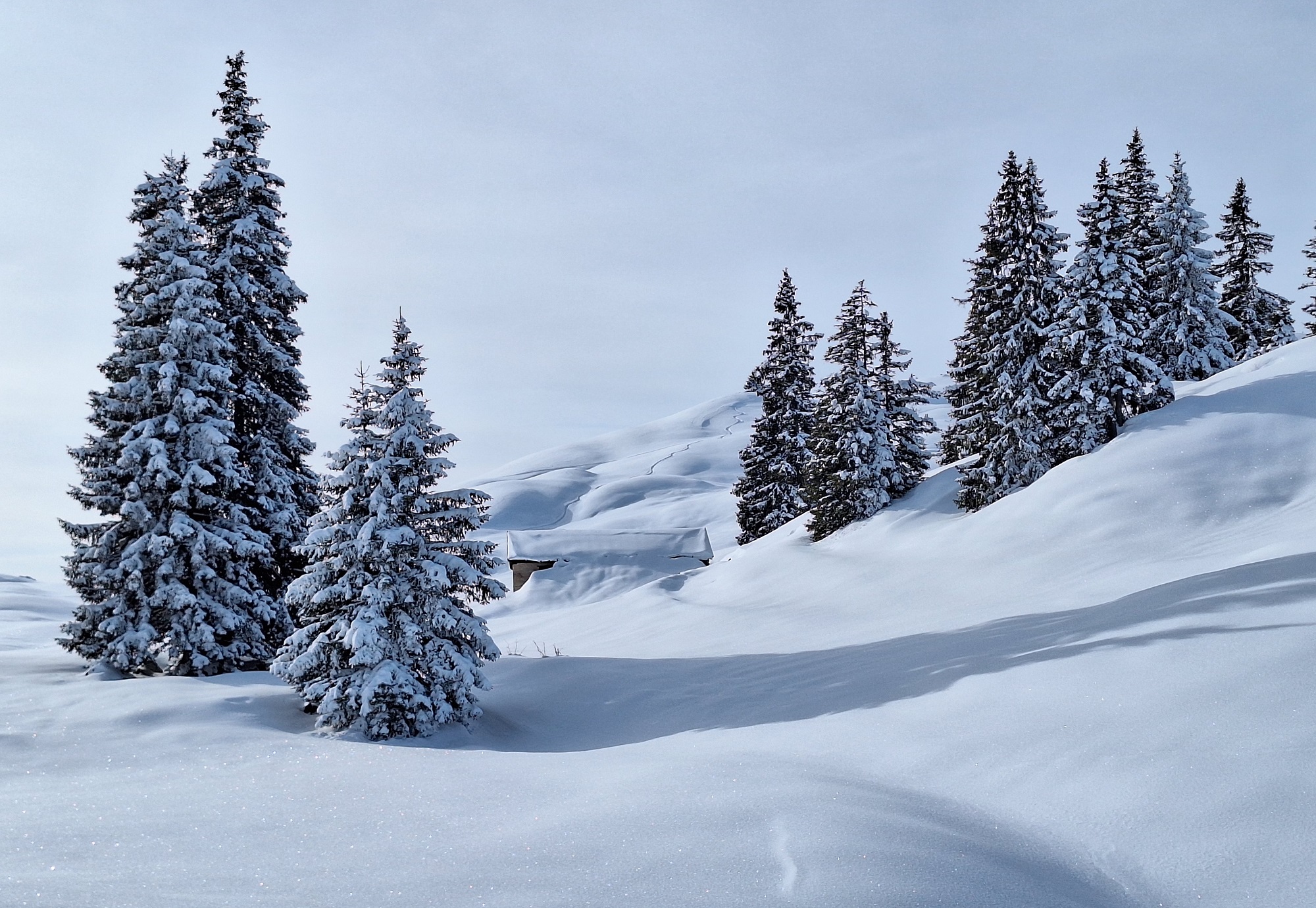
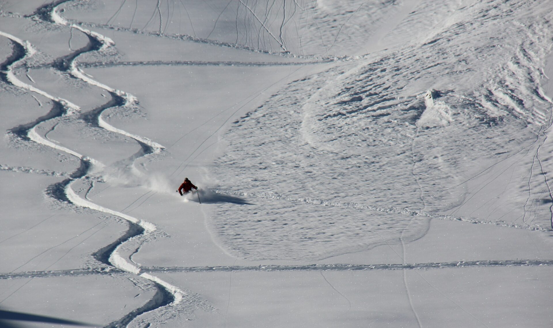
The quality of skiing-snow is currently dependent on how much the winds have battered the snowpack since last weekend. Wind impact was evident esp. along the Main Alpine Ridge and in East Tirol, but also regionally in the Tux and Kitzbühel Alps (above, Kaiser Massif). Below and near the treeline and in wind-protected zones there is often loose powder, but also widespread surface hoar. Steep south-facing slopes often have a melt-freeze crust near the surface due to solar radiation, and are no longer rewarding for skiers.
Review
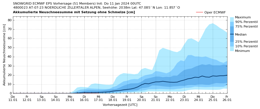
Last weekend there was 30 to 50 cm of fresh snow registered widespread, temperatures dropped noticeably.
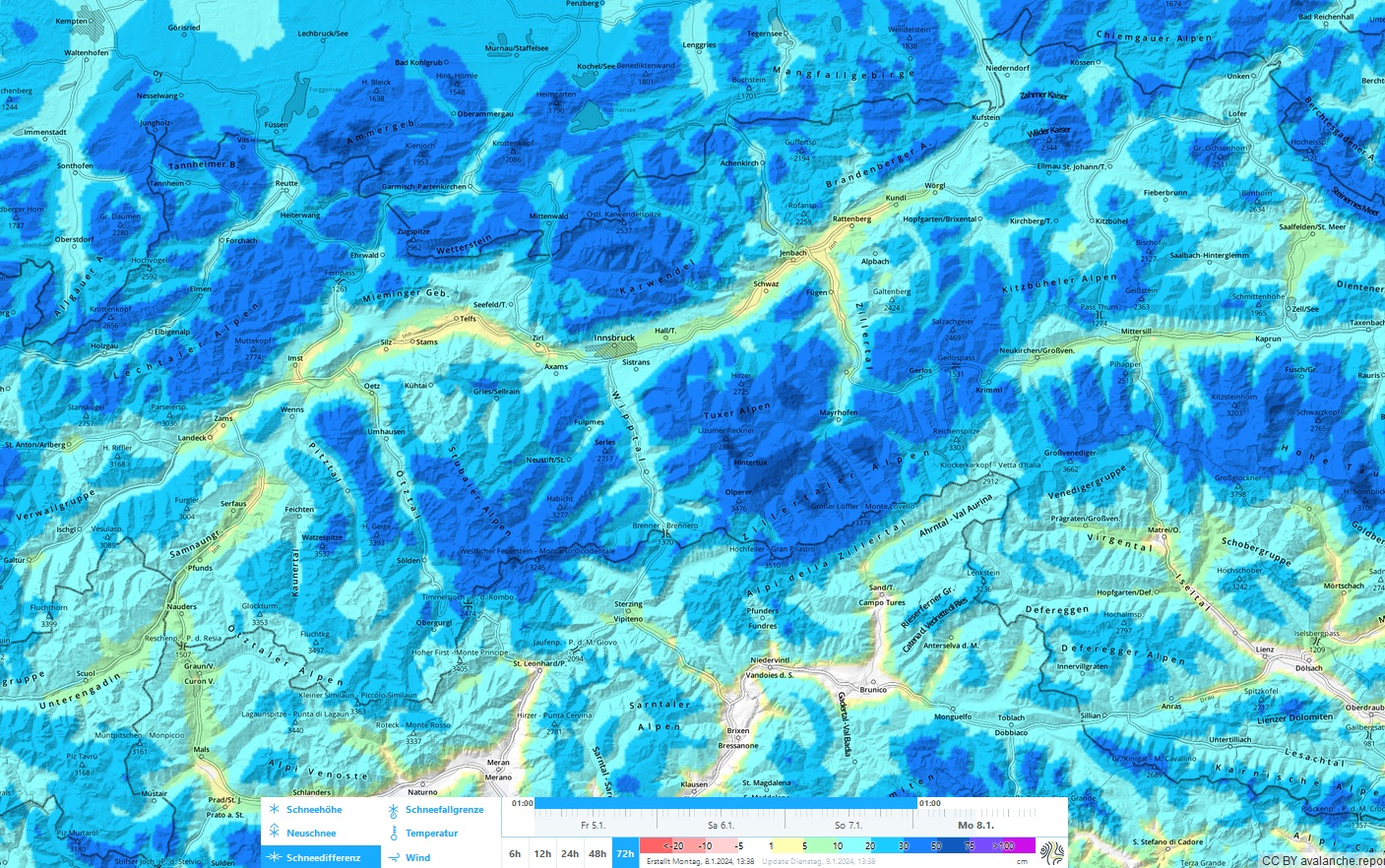
Where winds transported the snow, mostly small but highly trigger-prone snowdrifts accumulated behind discontinuities. They lie deposited atop cold, loose snow, often atop surface hoar. In addition there were numerous loose-snow avalanches in extremely steep terrain which plummeted long stretches and reached medium size.
Some reports reached us about slab avalanches involving persons. In one release near the Blaser on Serleskamm, two persons were injured.


Outlook
Stable high-pressure conditions will persist until after the weekend. At the end of next week the weather will bring a change, the high-altitude airstream could shift to W/SW and bring more variable and milder weather.