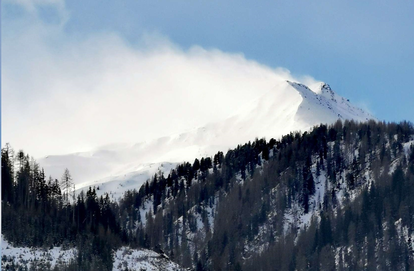
Lots of fresh snow accompanied by strong westerly winds has ratcheted up avalanche danger since yesterday, Sunday, 10.12. Above 2200 m wide-ranging snowdrift accumulations have been generated which are prone to triggering. Especially in the major areas of precipitation they are often blanketed and unrecognizable. On steep grassy slopes the gliding snow activity has increased again beneath the weight of the fresh snow and the rain impact at low and intermediate altitudes. Over the next few days variable conditions will persist, plus more precipitation anticipated. The avalanche situation will remain complex.
Review and current situation
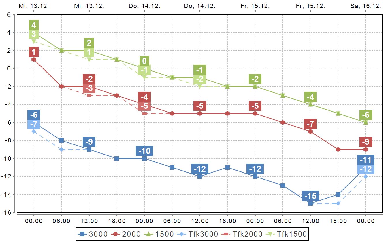
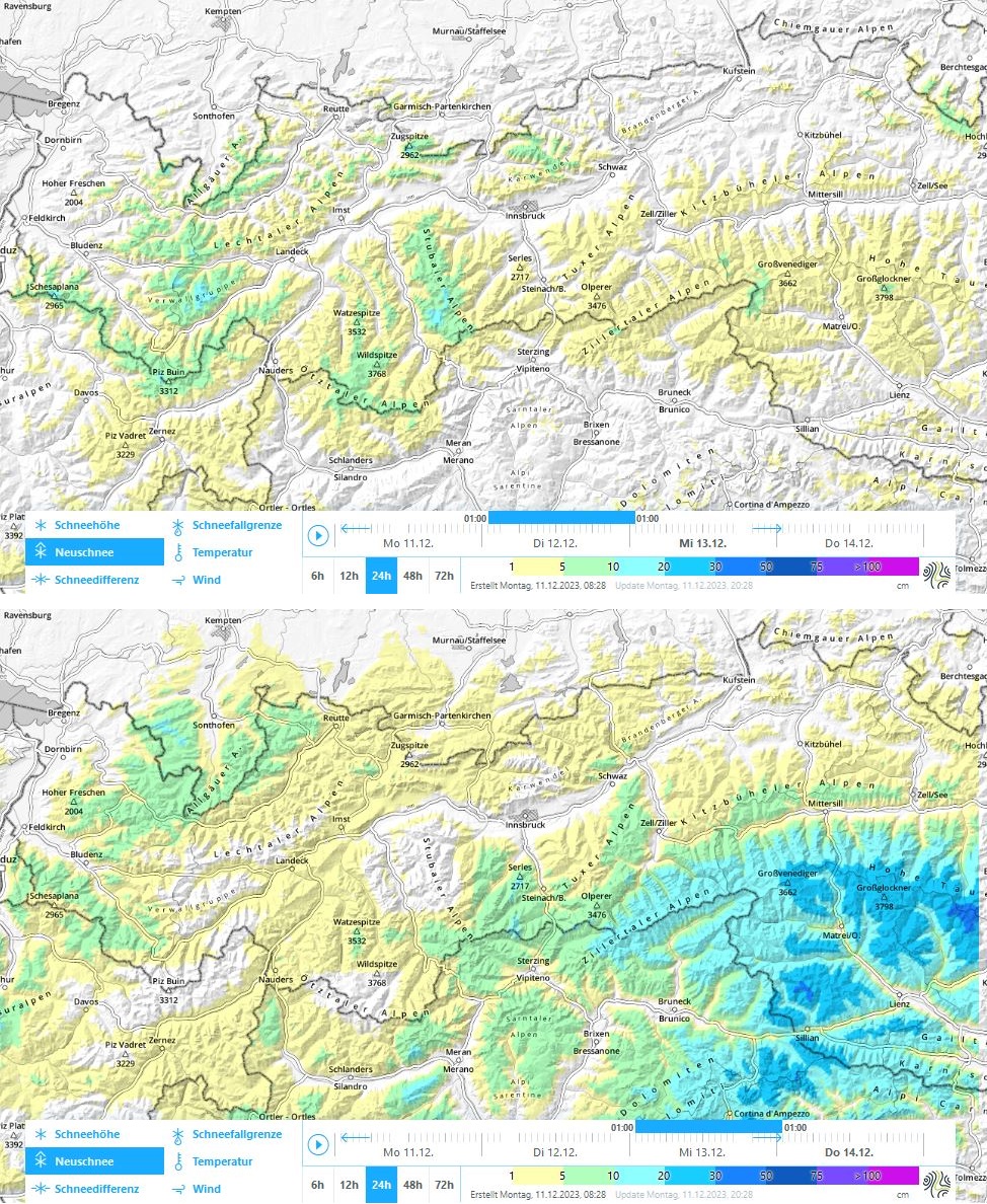
A taut westerly air current has brought moist/mild air masses to the Alps over the last few days. Particularly in the western and northern regions there has been heavy precipitation. Winds were strong, the snowfall level ascended today, Monday, 11.12, to about 1800-2200 m over widespread areas according to reports.
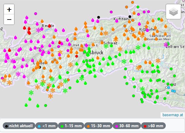
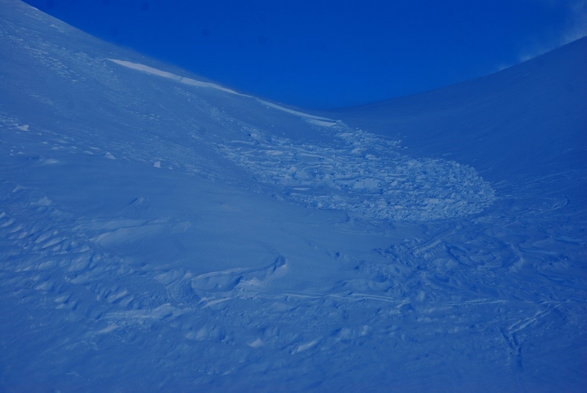
The cold front on Saturday night was accompanied by strong-velocity westerly winds. Fresh snowdrifts accumulated which can be easily triggered. As a result of the reports early on Sunday morning we decided – due to the frequency and the trigger-sensitivity of the drifts – to publish an update of the avalanche report and an assessment of the situation at Danger Level 3, considerable, above 2200 m.
Numerous reports that followed about avalanches triggered by persons and artificial triggerings in ski areas ultimately confirmed this evaluation. The extremely good fracture propagation in places (remote triggerings) alongside a very marked slab in the form of snowdrifts led us to the conclusion that there was a striking weak layer. We assume that cold fresh snow or perhaps surface hoar (both of which were reported) served as an interim weak layer.
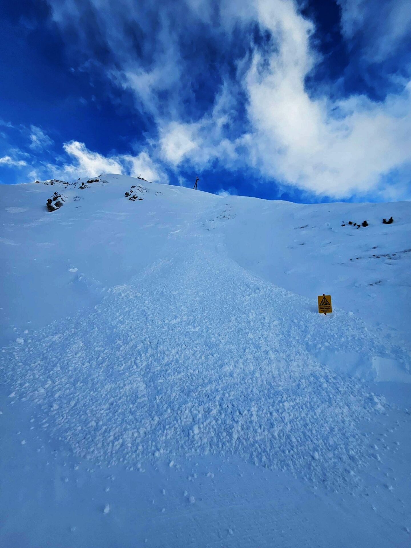
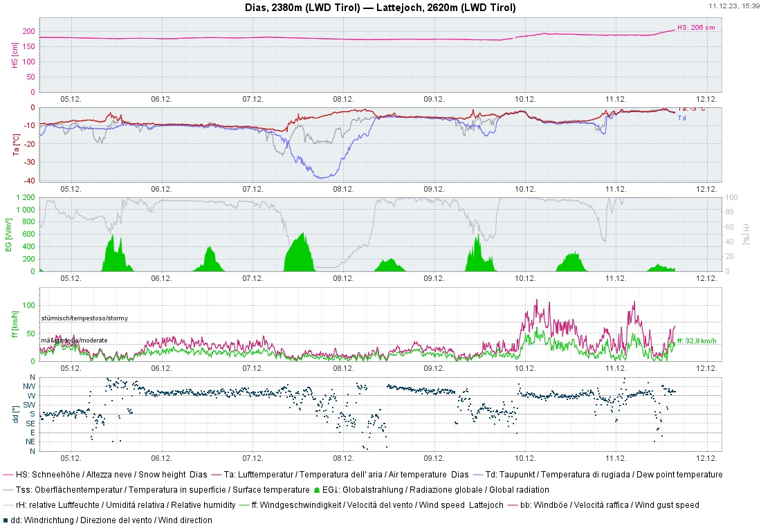
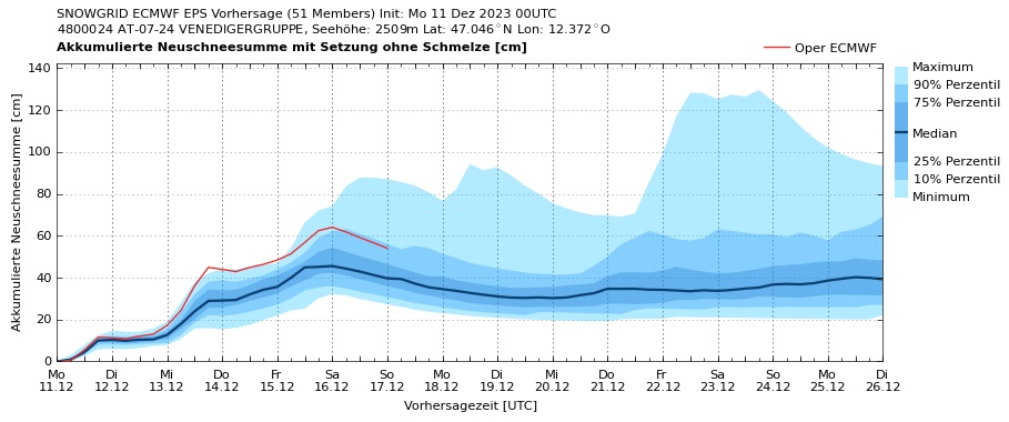
Following a brief improvement in conditions but with persistent winds on Sunday, a warm front bringing large masses of fresh snowfall and ongoingly strong westerly winds reached us during the night. Based on large amounts of fresh snow, wind, ascending snowfall level and observations on Sunday, Danger Level 4, high, was declared in a region on the Vorarlberg border. Below 2400 m, gliding snow increased due to the huge amounts of precipitation which, on the one hand, were a heavy burden on the snowpack and also reinforced the gliding process itself. Below 2000 m there was, besides that heavy burden, also fluid water transported to between snowpack and the ground which enhanced the gliding process still further. In addition, on steep hillsides at low and intermediate altitudes there were small, wet loose-snow avalanches.
Further developments
Weather
For the rest of the week, instable weather can be expected. Tomorrow, Tuesday, 12.12, it will be wet and mild. A few centimetres of fresh snow is anticipated over widespread areas, the snowfall level will again be at about 2000 m, winds will slacken off somewhat. In the following days, temperatures will incrementally drop. On Wednesday, widespread snowfall also in East Tirol after a long interim.
Avalanche situation
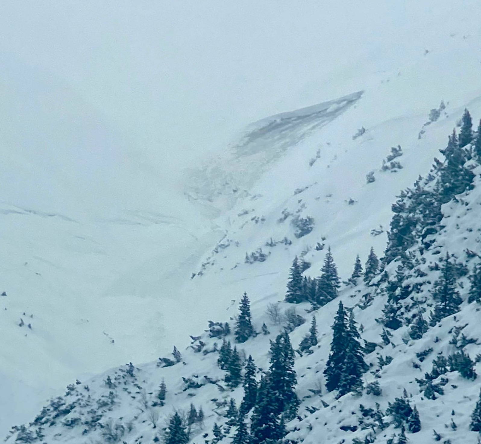
The avalanche situation will remain complex. At high altitudes we are still confronted with snowdrift accumulations and a fresh snow problem. This refers to near-surface weak layers in the form of fresh fallen snow covered by snowdrifts. If we expect that drifted masses will be visible and thus, can be circumvented, we shall declare a snowdrift problem. However, if we are of the opinion that the danger zones are partially blanketed and difficult to recognize (as is currently the case in North Tirol), the fresh snow problem will predominate.
At mid-level and ground-level inside the snowpack we still face a persistent weak layer: faceted crystals alongside melt-freeze crusts (from the rainfall in mid-November). This occurs especially above 2200 m. These weak layers are probably not triggerable by winter sports enthusiasts, if at all, then in transitions from shallow to deeper snow. Nevertheless, it is conceivable that a triggered slab avalanche in very steep terrain could cause a fracture in these layers. At least in the areas where fresh snow is heavy, the weak layer will no longer play a role after the end of this phase of turbulent weather.
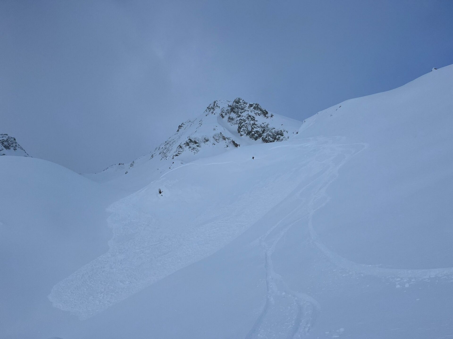
On smooth grass-covered slopes, glide-snow avalanches continue to be expected. These releases can be dangerously large, particularly in regions where precipitation has been heavy. Areas below glide cracks should consequently be circumvented.