Lots of fresh snow will be deposited atop a weak old snowpack over the next few days. Avalanche danger will increase throughout Tirol – significantly. On Sunday (3.12) we expect a very sunny and cold winter day. Coupled with a snowpack which is trigger-sensitive, a day of many accidents may lie ahead of us.
We appeal to winter sports enthusiasts to limit themselves to moderately steep terrain (<30°) and to avoid all zones below steep slopes (remote triggerings).
Development of avalanche danger
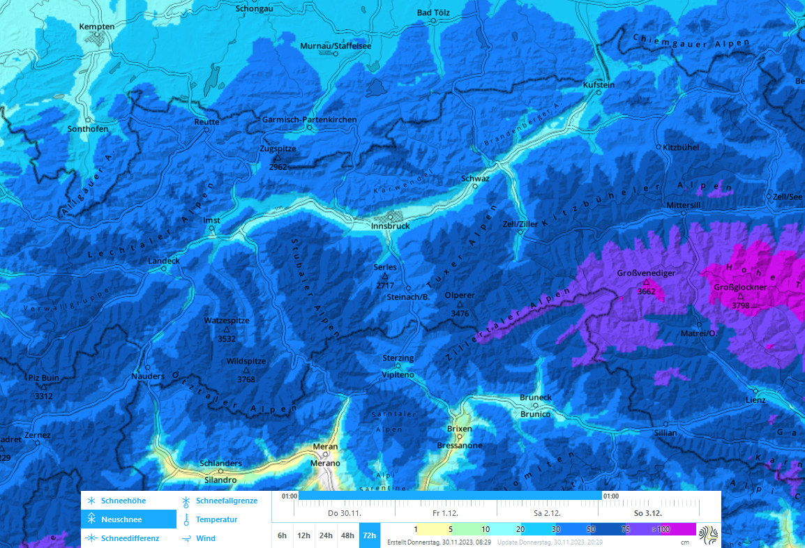
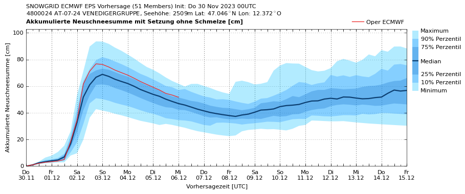
Starting on Friday morning (1.12) and continuing into Saturday night, heavy precipitation is anticipated. South of the Inn Valley, 40-60 cm of fresh snow is expected. In East Tirol, 60-80 cm over widespread areas. In particular along the Main Alpine Ridge and in East Tirol, strong northerly winds will be blowing. The snowfall level on Friday morning (1.12) will lie at about 1500m (this is not certain) but will descend gradually down to low lying areas.
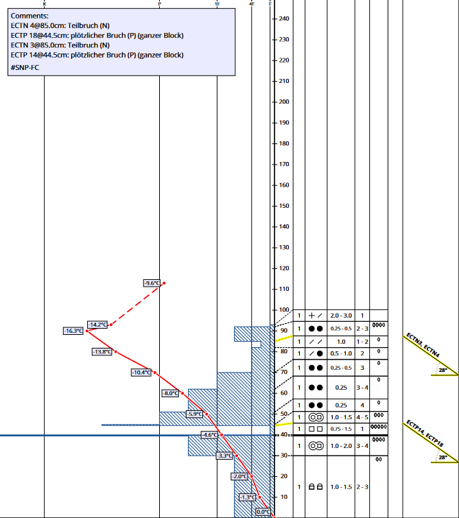
The biggest concerns about the coming rounds of snowfall stem from the layering of the old snowpack (see below). Numerous stability tests and reports of settling noises throughout the land have confirmed the proneness to triggering of a weak layer lodged between two melt-freeze crusts. There is currently no “good” slab on top of that weak layer which would propagate a fracture. But with the coming precipitation, this necessary condition for avalanches could be fulfilled.
Avalanche danger will increase gradually with the start of the intensive phase of precipitation on Friday afternoon (1.12). Naturally triggered avalanches are likely particularly during phases of intense snowfall on Friday night and Saturday morning. However, the snowpack will remain prone to triggering also after the precipitation has ended. That means, on a very sunny Sunday (3.12) slab avalanches can still be triggered on many steep slopes by one sole person and grow to large size. Most of the danger zones lie between 2000m and 2600m. The weak layer also makes remote triggerings from flat to moderately steep terrain possible.
In addition, slab avalanches can also fracture in weak layers inside the fresh snow and inside freshly generated snowdrift accumulations. As is the case with a persistent weak layer, the danger zones are exceedingly difficult to identify in open terrain.
Risk can best be reduced this weekend by acting defensively: avoid terrain above 30° and any runs below steep slopes. Naturally triggered avalanches, settling noises and fractures are all indicators of high trigger-sensitivity.
Snowpack layering
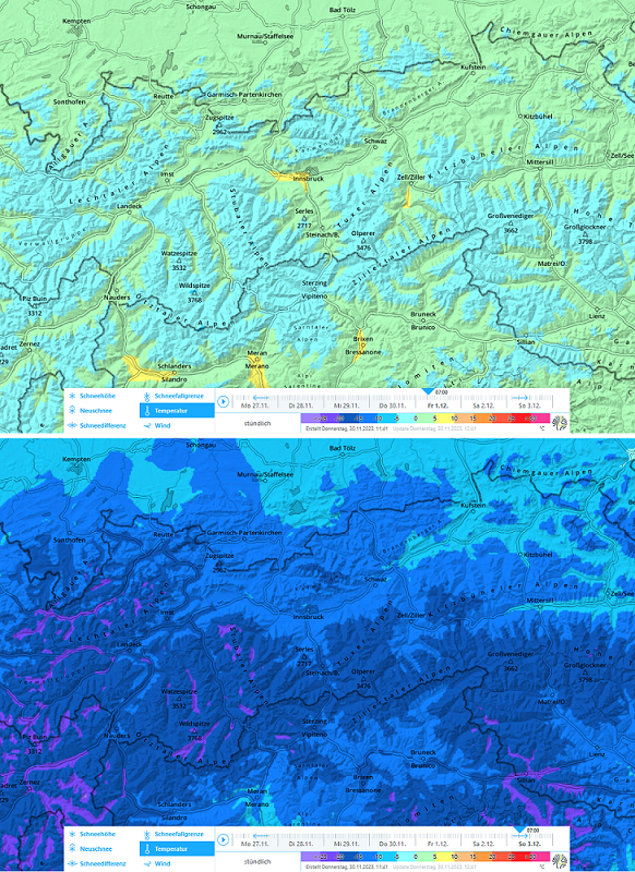
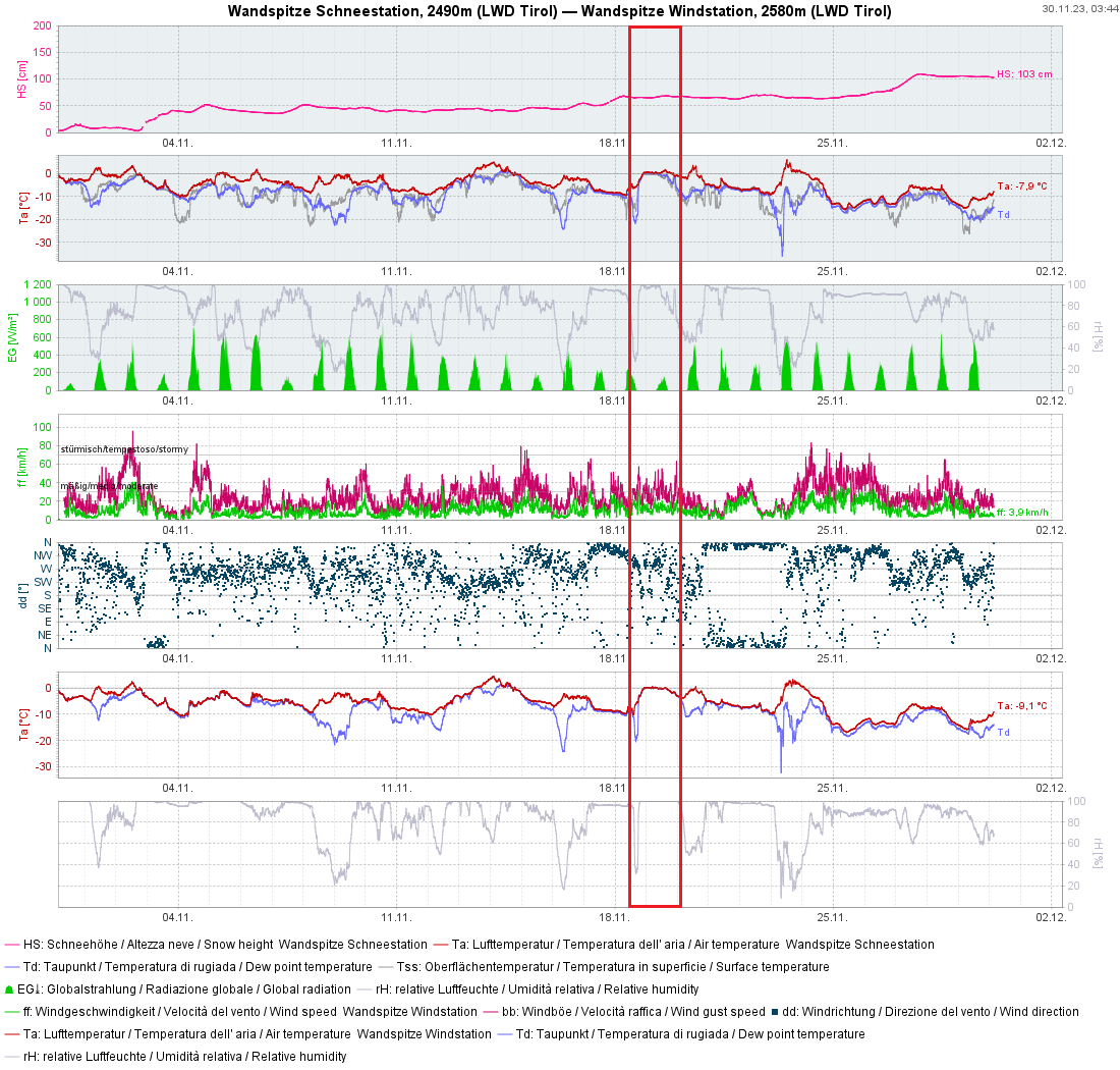
With the exception of the central and southern parts of East Tirol, we currently have average or even below-average snow depths. Backcountry skiing tours and freeriding descents are are possible in many places.
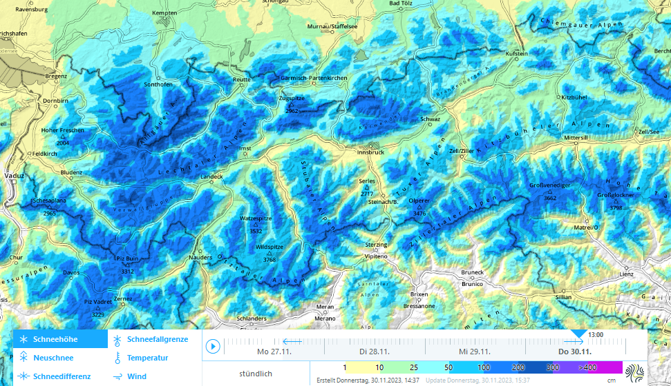
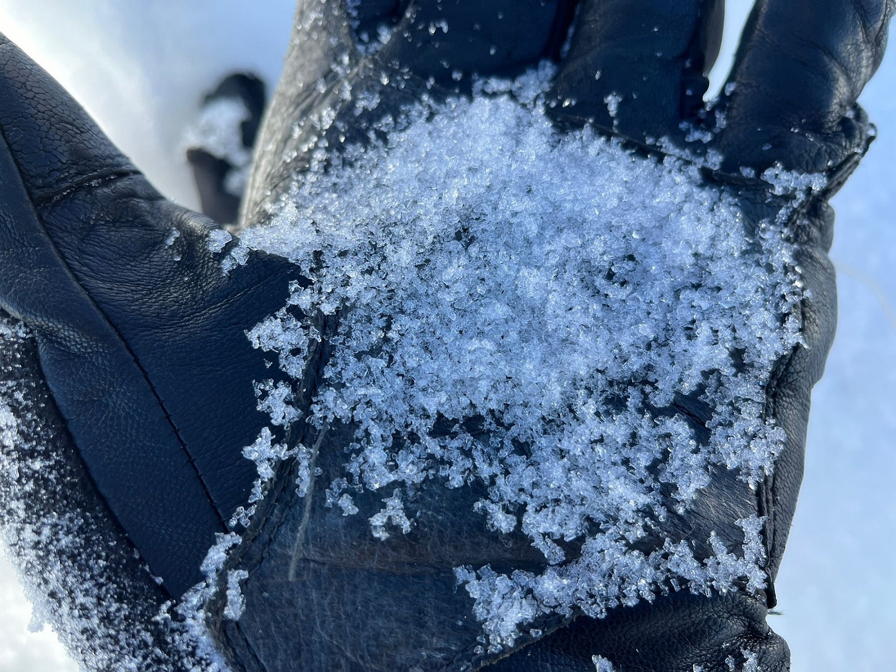
The snowpack surface is highly varied, due to the strong-to-stormy westerly winds which accompanied the precipitation last weekend. Exposed terrain on west-facing slopes in particular are completely windblown or have eroded down to a hard melt-freeze crust. On leeward slopes, in gullies and bowls there is often lots of snow. On slopes with little wind there is frequently loose powder, sometimes with large crystals of fresh snow on the surface. These are a potential weak layer for the fresh snow and fresh snowdrifts which are about to arrive.
At mid-level and lower down in the old snowpack, depending on region, as well as beneath the snow from the precipitation on 24-26 November, we currently find a weak layer of faceted crystals above approximately 2000m over widespread areas, which is often wedged between two melt-freeze crusts. Experience has shown that this “crust sandwich” brings huge fracture propagation in its wake when it is loaded by a good slab on top of it. A situation which promises to become reality in the next few days (see above).
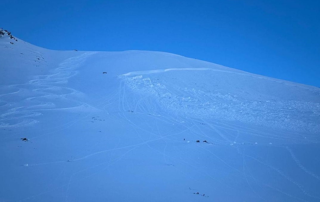
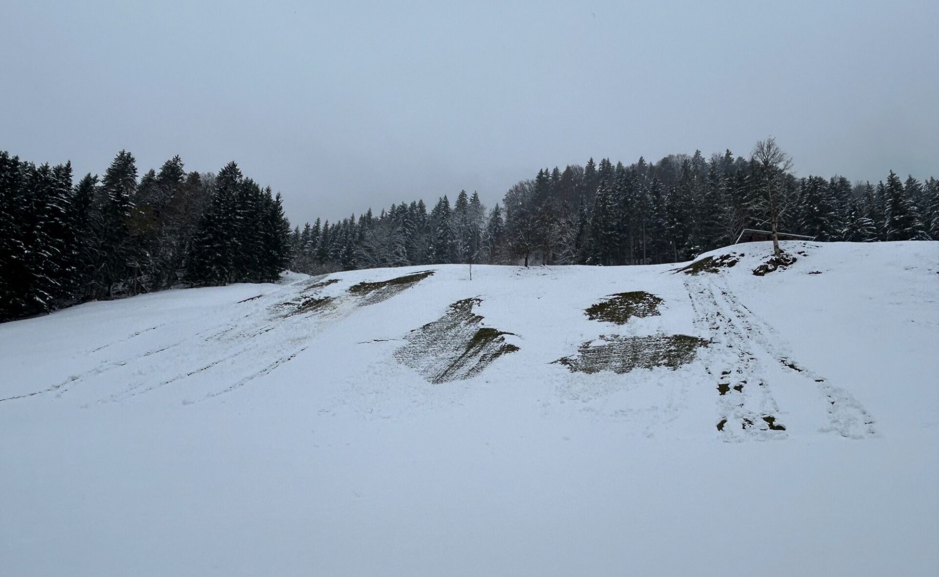
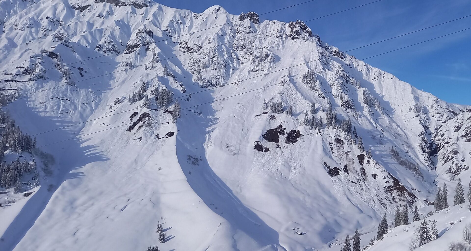
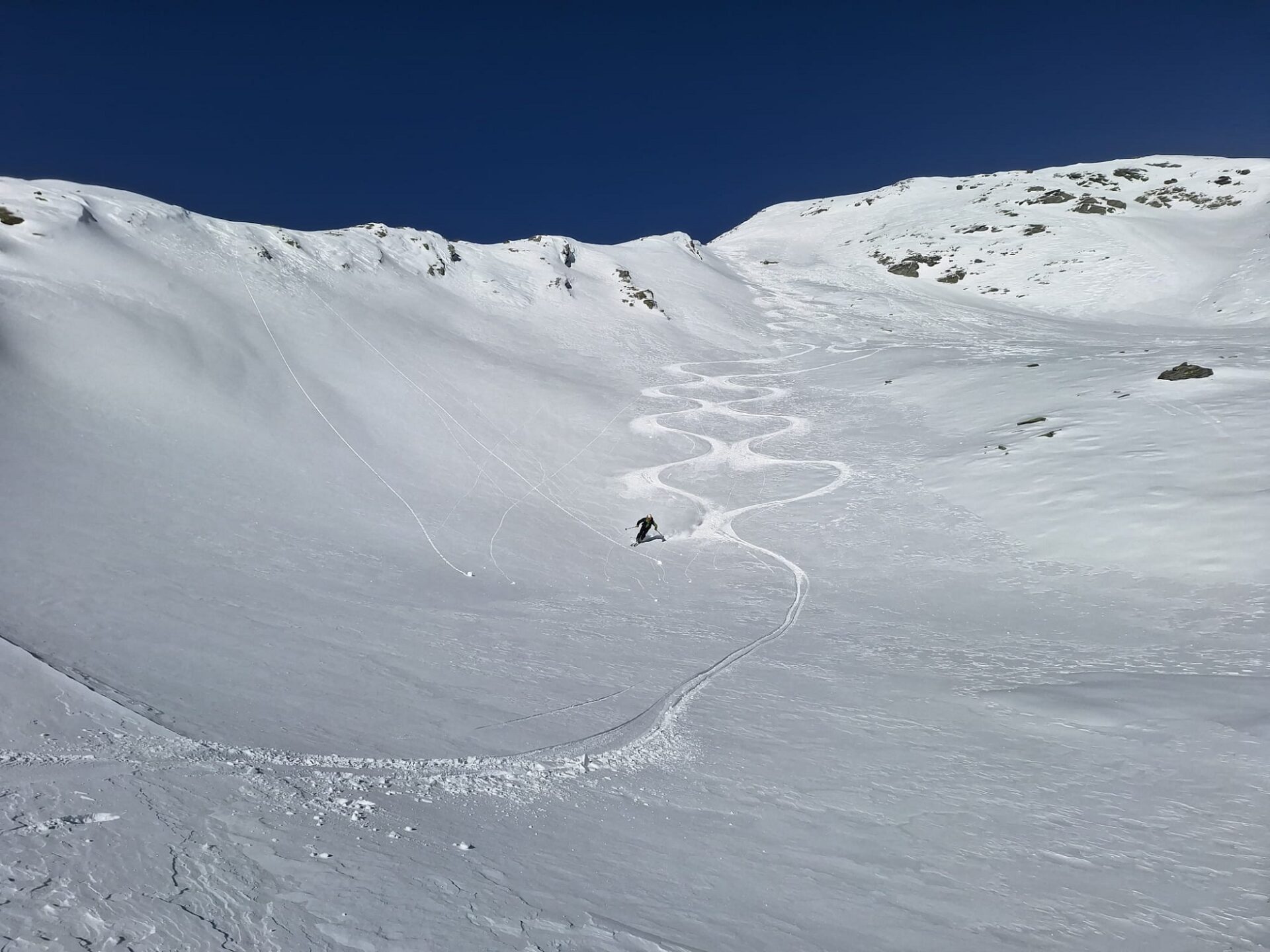
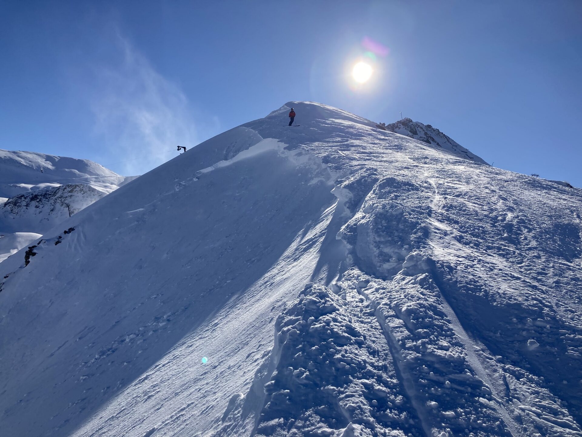
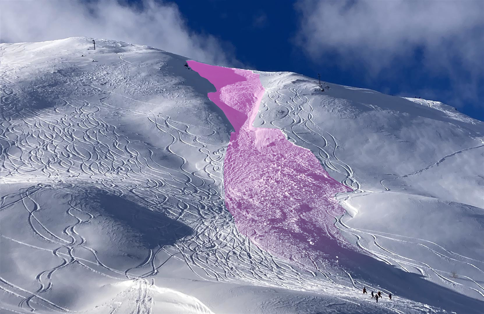
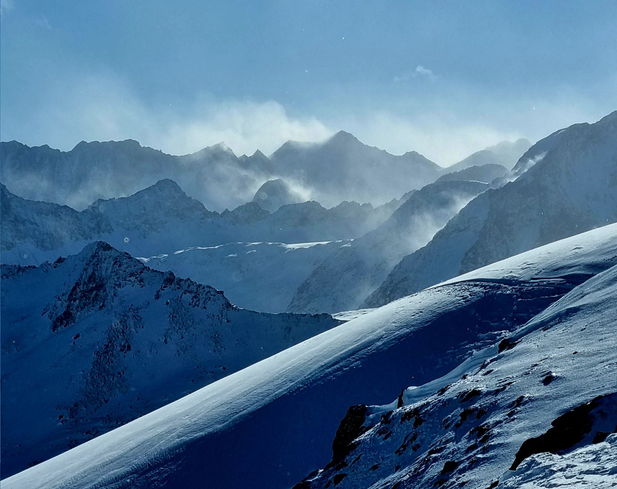
Short review in pictures