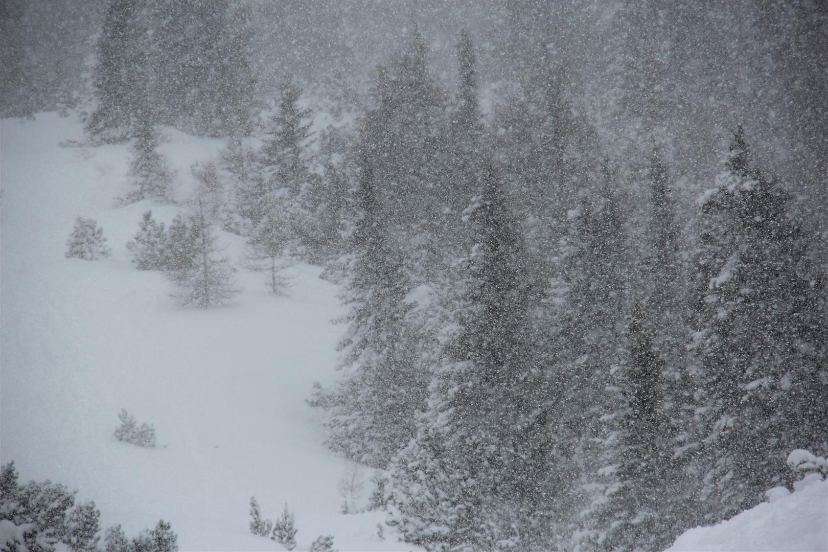
We expect heavy snowfall over the next few days, accompanied by storm winds. Numerous avalanche prone locations will be generated. Winter sports enthusiasts should be keenly aware of the heightened risks of triggering an avalanche in steep terrain during the coming days.
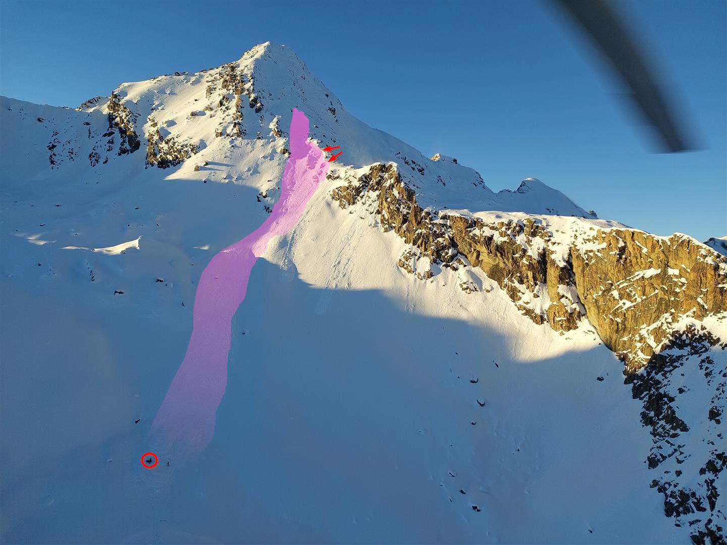
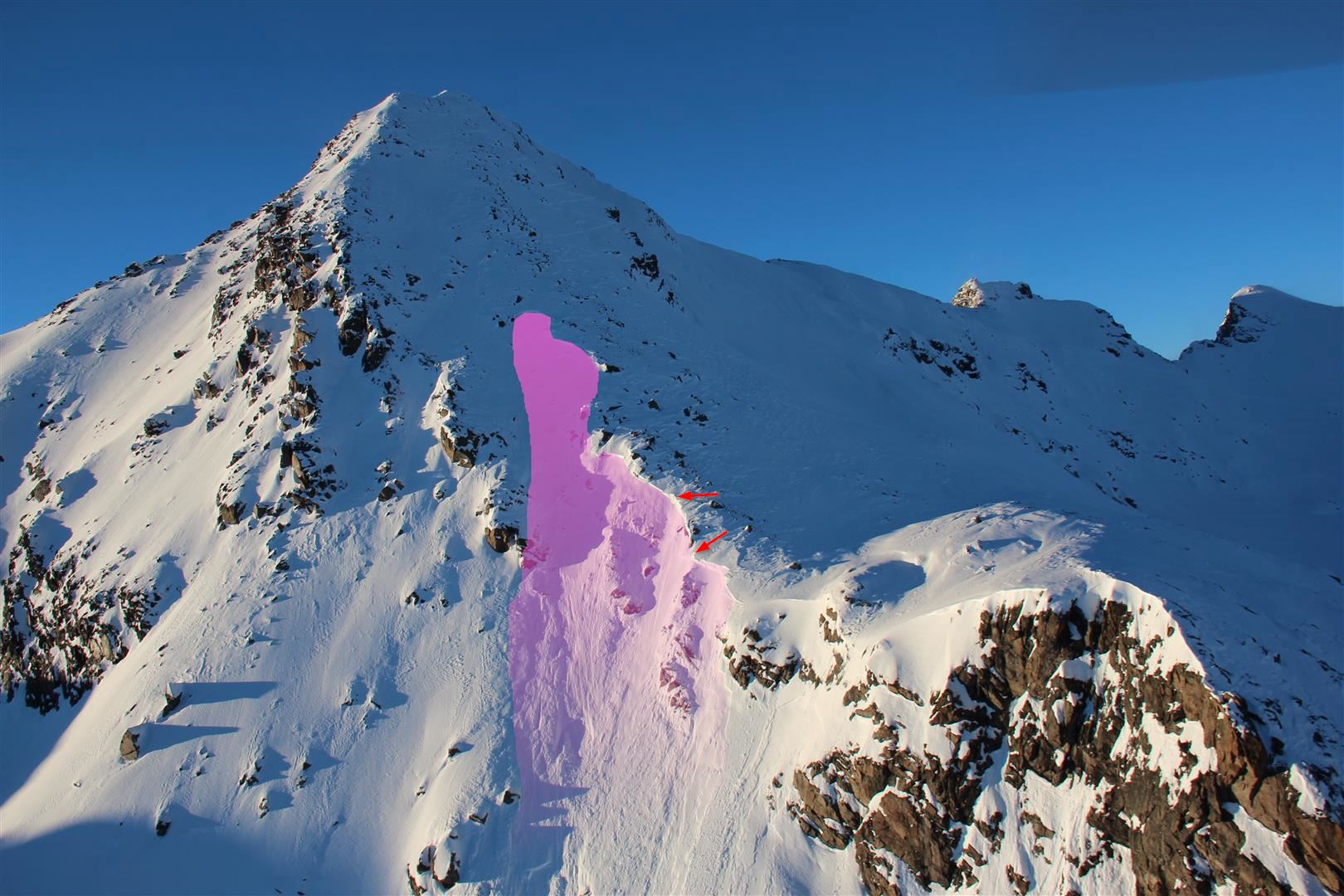
Today (23.11.2023) a slab avalanche was triggered in extremely steep, southeast-facing terrain at about 3250m below the Glockturm in Kaunertal. Two of the persons were swept along by the slab in their descent. One person sustained no injuries, the other needed to be reanimated and brought to the hospital.
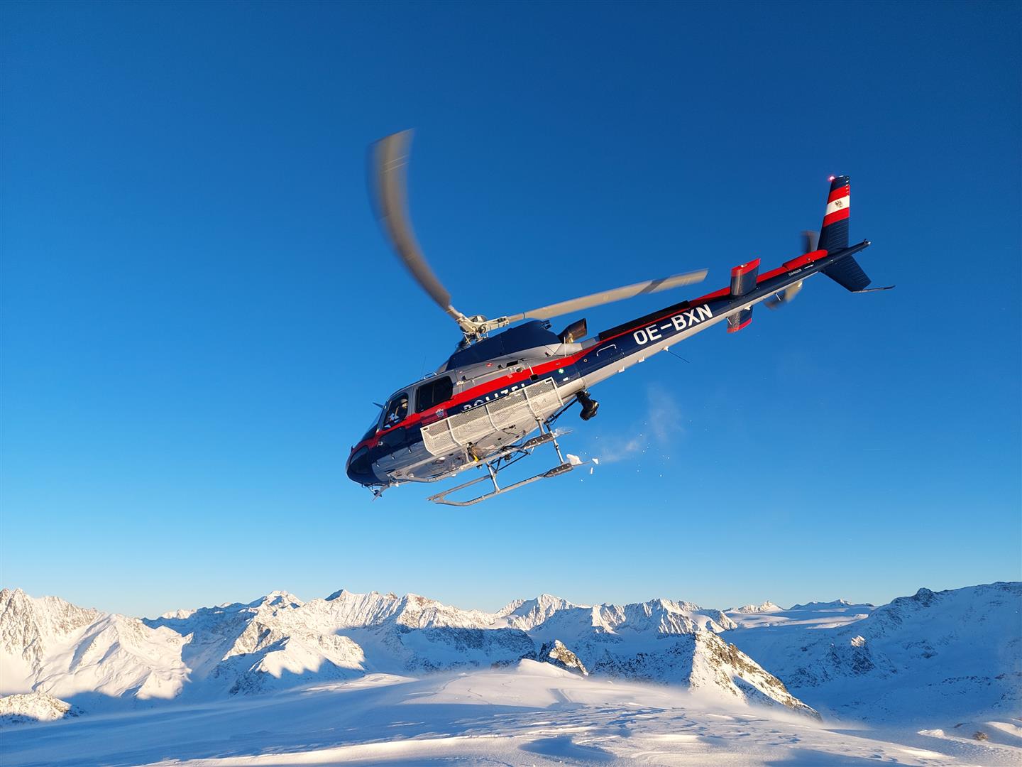
Sweeping terrain explorations with the state helicopter
The team of the Avalanche Warning Service Tirol, with the support of the Alpine Police and the state helicopter, conducted wide-ranging explorations of the terrain today (23.11.2023). The goal was to create a sharply delineated picture of the snowpack layering in the high alpine regions before the forecast snowfall and prior to the launch of daily Avalanche Bulletins tomorrow (24.11.2023).
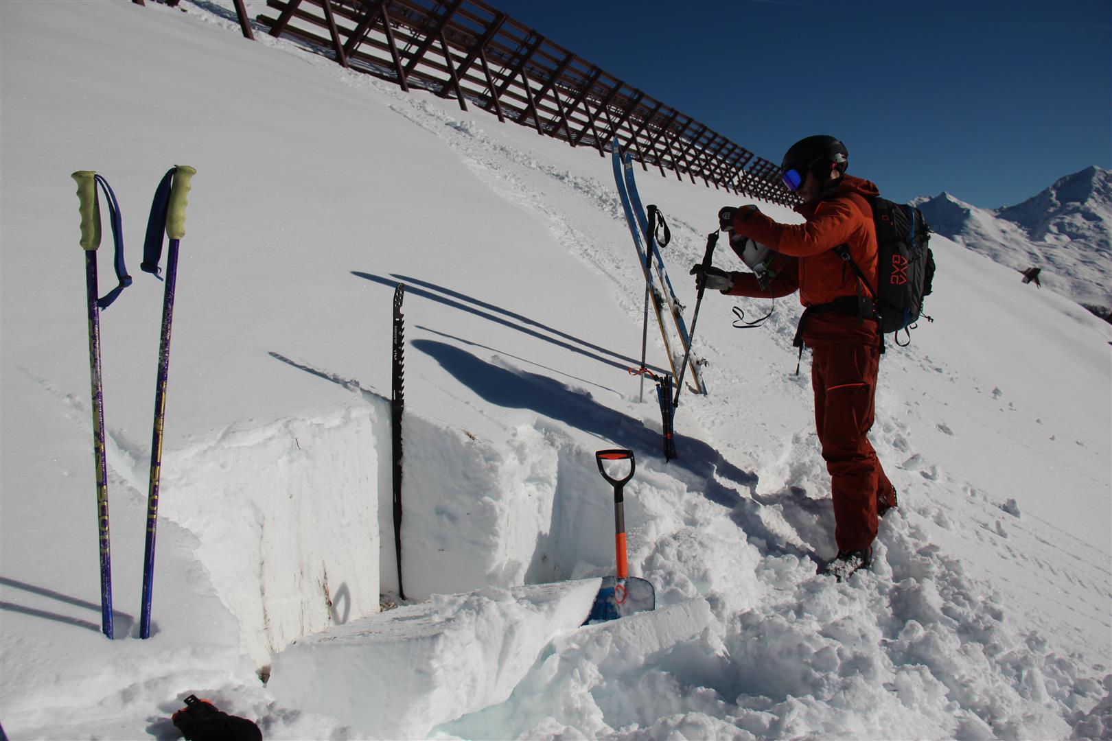
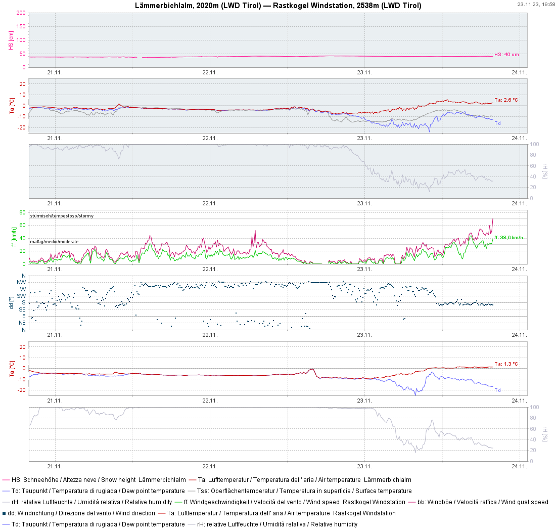
A glance inside the snowpack
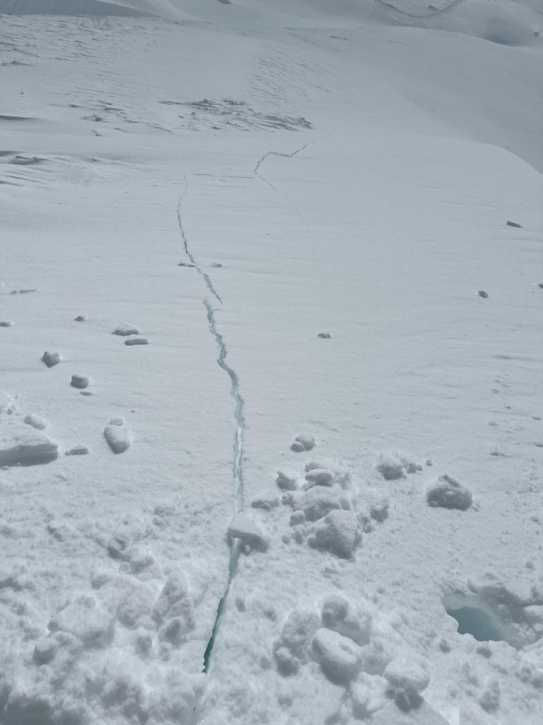
The snowpack bears clear marks of several bouts of rainfall in early winter. Up to at least 2800m there are melt-freeze crusts of varying thickness. In some cases, faceted crystals can be found in the immediate vicinity, thereby creating potential weak layers for slab avalanches.
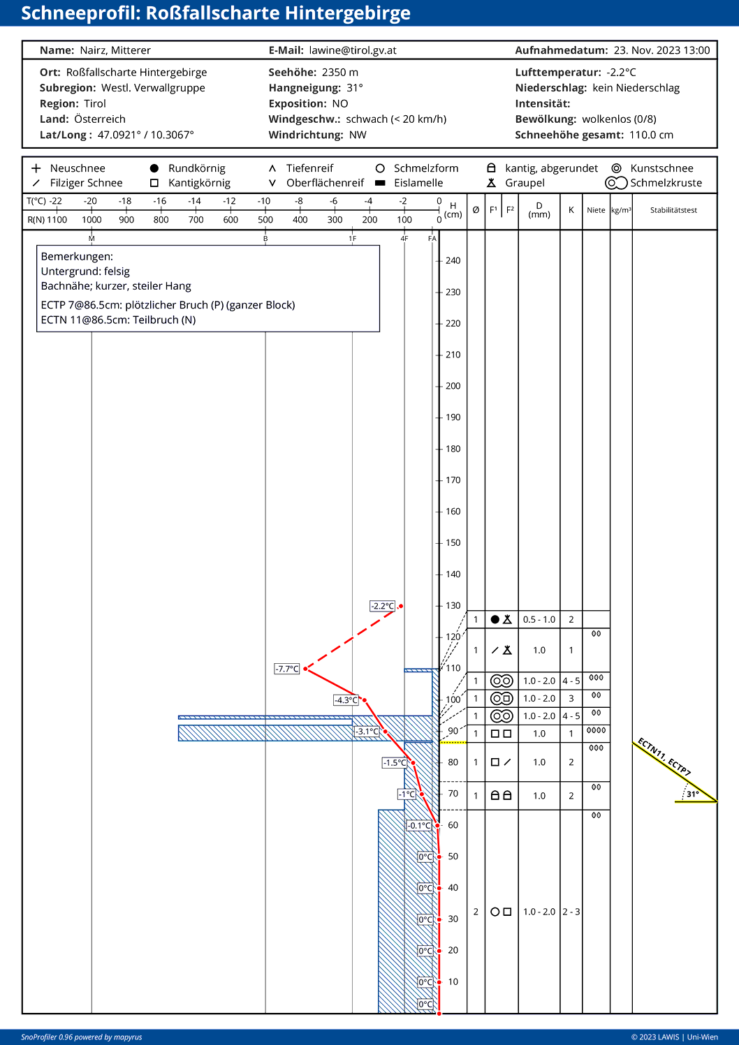
All in all, a snowpack bearing high impact from rainfall. Near the melt-freeze crusts are often thin, faceted weak layers.
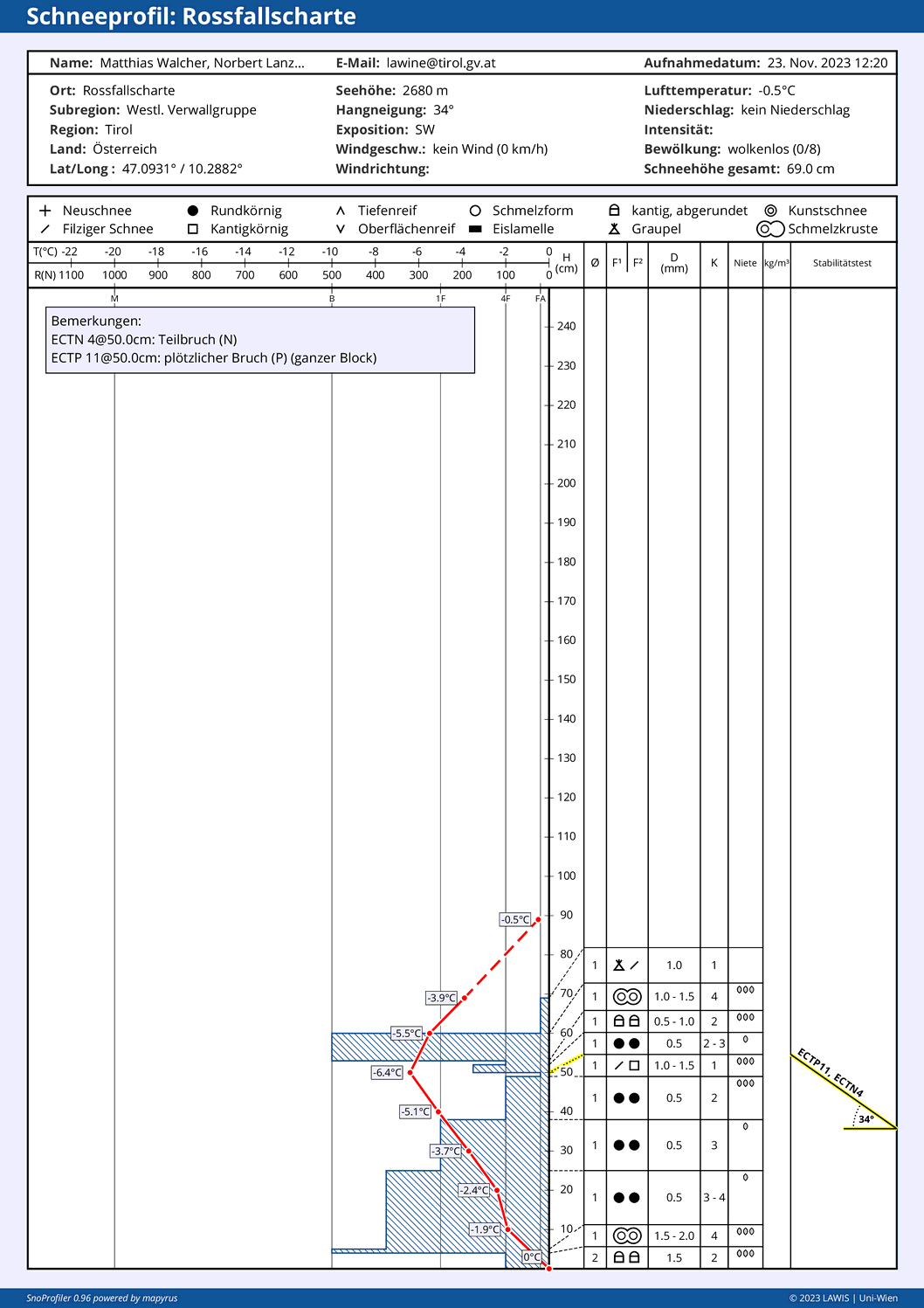
Particularly on shady slopes, but also on west-facing and east-facing slopes at high altitudes, the snowpack surface is by and large loosely-packed. For the forecast snowfall, loose snow is potentially a weak layer for slab avalanches.
Additional recently generated snow profiles can be found, as usual, at: https://www.lawis.at/profile/.
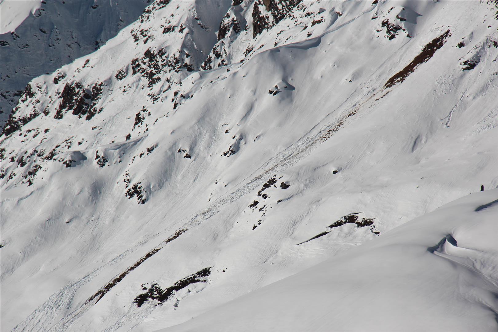
The often moist snowpack near ground level, particularly on steep south-facing, west-facing and east-facing slopes below about 2500m, was unusual. Glide-snow fractures and glide-snow avalanches were frequently observed in those zones.
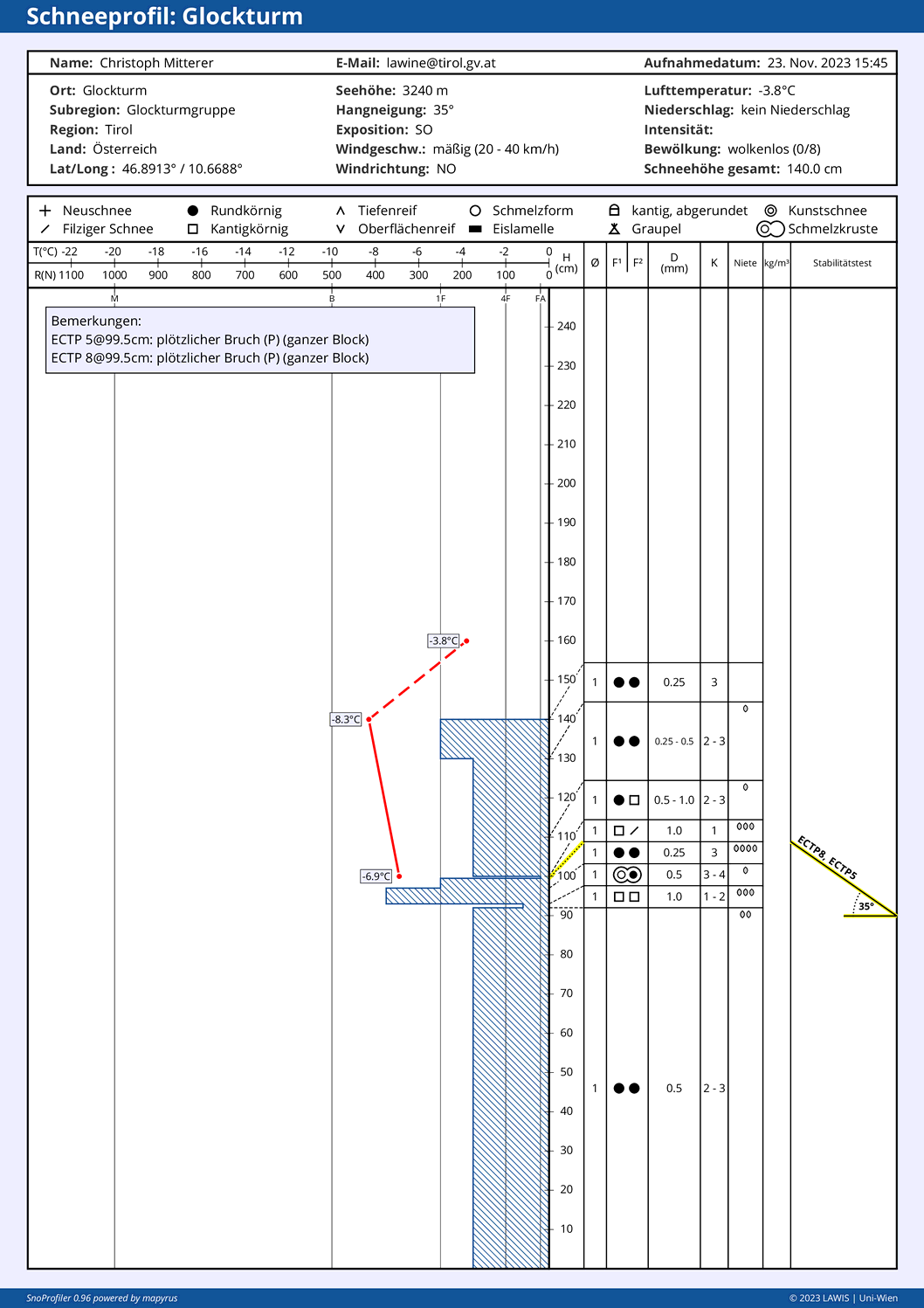
Avalanche Glockturm
Today (23.11.2023), two persons were in their descent on an extremely steep SE-facing slope below the Glockturm in Kaunertal. The entry into the slope lies at about 3250m altitude. As both skied into the slope simultaneously, a slab avalanche was triggered which swept along both of them. One was completely buried in the lower part of the avalanche wedge. The other remained on the surface and was not injured. In spite of relatively swift help, the first person needed to be reanimated and flown to the hospital.
Since at the time of the accident we, through a coincidence, were near the spot where the accident occurred, we were flown there by the state helicopter. Together with the other members of the rescue squad we helped to dig out the buried person and assisted in other first-aid measures. After he was transported we used the tiny time-window to conduct snowpack analysis near the fracture. The avalanche seems to have been caused by a thin, near-surface layer near the ridgeline created by wind, together with the extremely steep terrain.
It’s getting wintery. Avalanche danger is increasing.
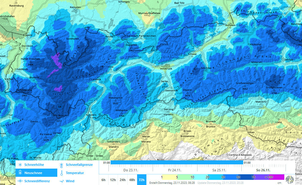
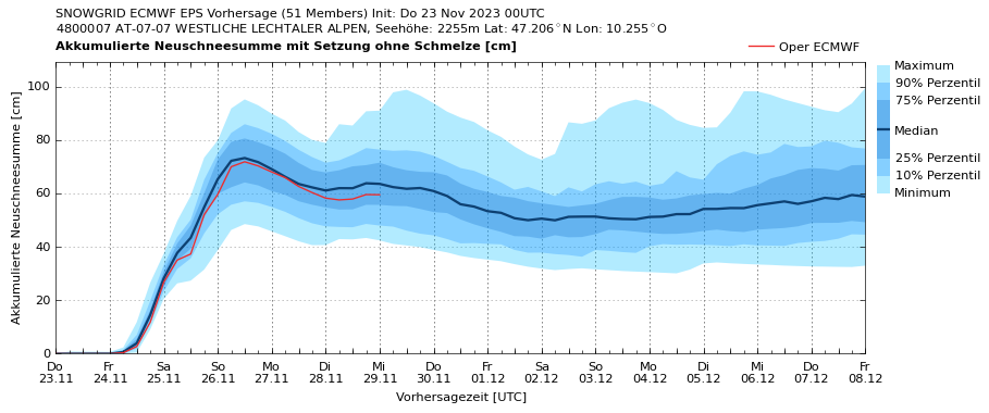
Starting tomorrow (24.11.2023) until Sunday morning (26.11.2023) we expect in western regions 60-80cm of fresh snow, according to GeoSphere; in the other regions between 40 and 60cm, less further south towards southern East Tirol.
The combination of possible weak layers inside the old snowpack and on the surface plus large amounts of fresh snow and storm-strength winds will lead unavoidably to an increase in avalanche danger. Winter sports enthusiasts need to be sharply aware that during the next few days avalanches can be triggered with ease. This is increasingly the case in steep terrain above about 2400m. Caution is also urged in very steep ridgeline terrain and very steep north-facing terrain below about 2400m.
We also expect several naturally triggered avalanches, especially in very steep terrain on north-facing slopes above about 2400m, as well as in general in very steep ridgeline terrain at high altitudes.
The winter season is being launched in some ski areas
As a result of the forecast snowfall, some ski areas are launching their winter season. For that reason, we extend a plea to all variation-sports enthusiasts: be intensely conscious of the risks in outlying terrain. We advise restraint during the coming days in all zones outside the secured ski pistes.