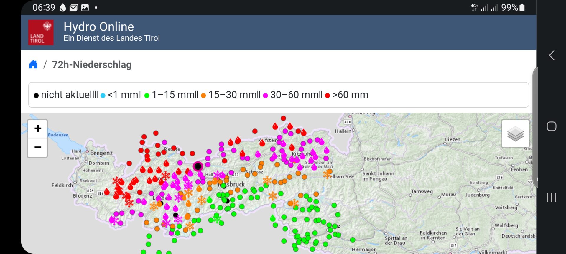
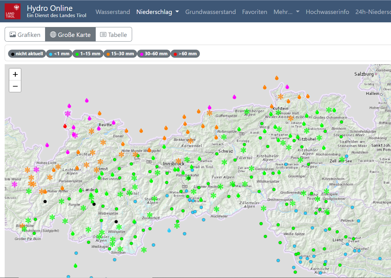
A cold front that reached Tirol yesterday evening (16.11.2023) is bringing snowfall and storm winds to the mountains. It affects mainly (North)western parts of North Tirol, where 30 to 50 cm of fresh snow can be expected. Caution: wide-ranging and generally quite trigger-sensitive snowdrift accumulations will be generated at high altitudes. Furthermore, in the regions where snowfall is greatest over the next few days, increasingly frequent glide-snow activity requires special caution.
Current Situation
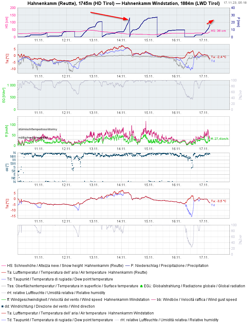
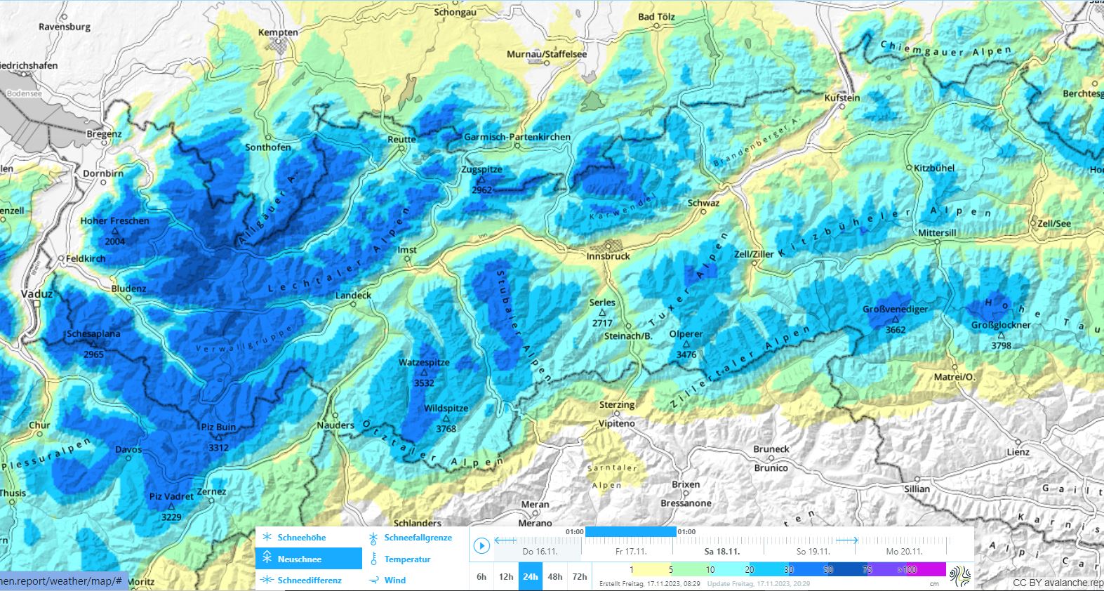
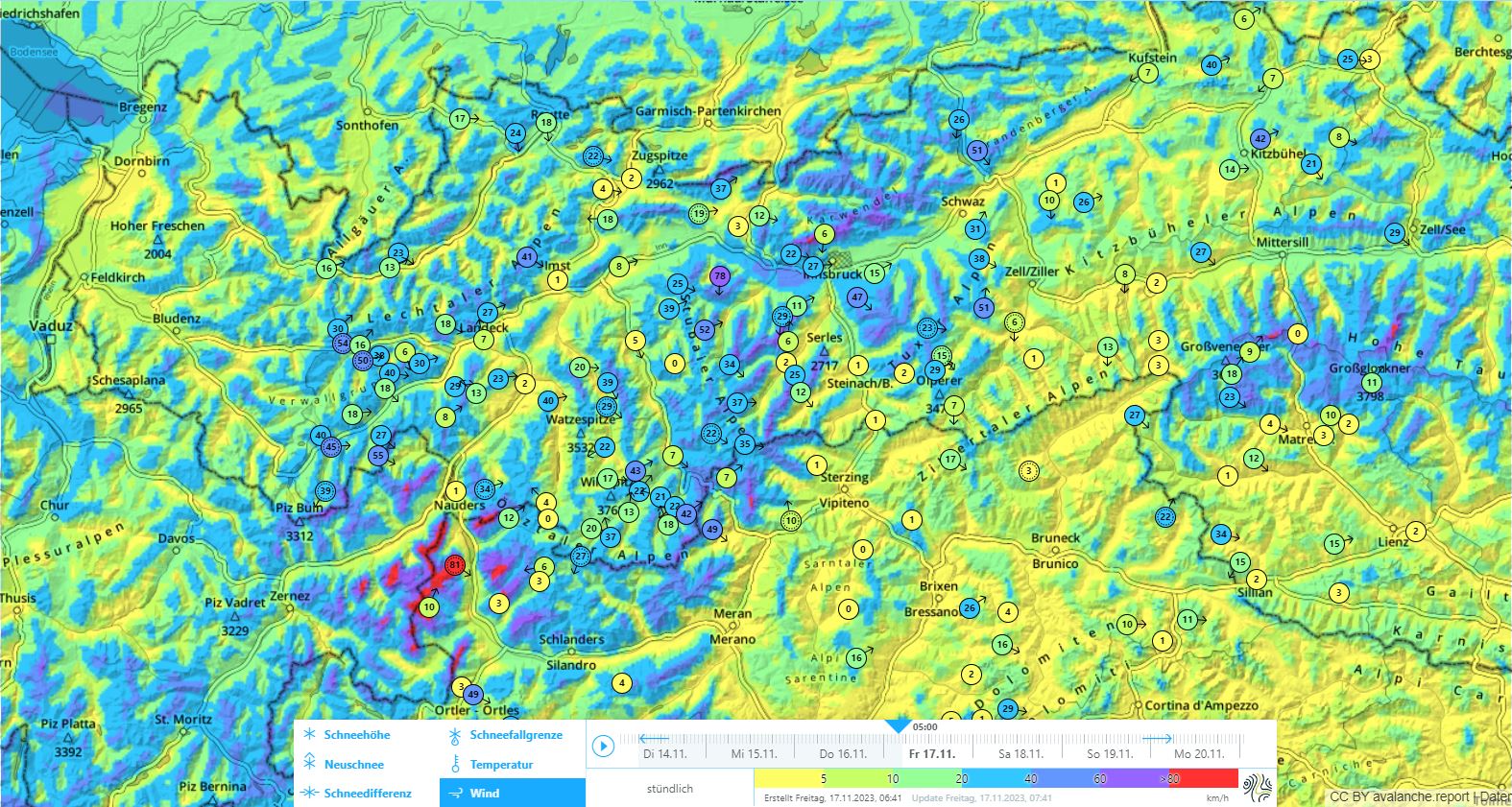
The variable weather conditions will persist. Following very warm days in western and northern regions of North Tirol between 12 and 13 November with precipitation, a cold front will now bring fresh snow down to low lying areas. Most of the precipitation will fall in NW regions of North Tirol: about 40mm. This corresponds to about 40 cm of fresh fallen snow, on top of which there are storm-strength NW winds blowing.
The snowpack
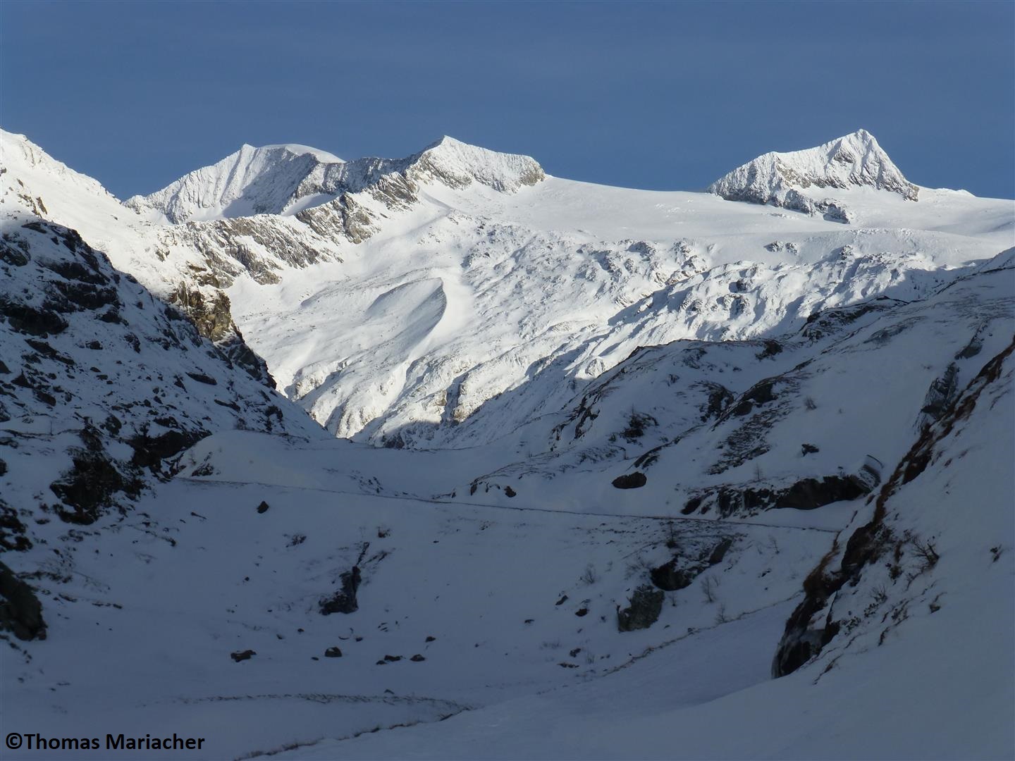
The fresh snow fell mostly on bare ground or onto a massively rain-impacted snow cover at low and intermediate altitudes. At high altitudes, on the other hand, there are already above average snow depths for this juncture of the season. Most of the snow lies in the regions along the Main Alpine Ridge and in western regions at high altitudes. What is most striking about the snowpack is the precipitation as rainfall on 13-14 November up to 2700 m in many places. The warmth and thus, the surface moistening of the snowpack was registered up to over 3000 m, at least on sunny slopes. In the interim there is generally a melt-freeze crust evident inside the snowpack, due to lower temperatures and additional snowfall. It arose from that warm weather with rainfall and is now covered over by fresh snowfall.
The few snowpack examinations we’ve received show a rather fuzzy picture of snowpack stability. Near ridgelines on north-facing slopes, we found surface hoar from place to place (Nigg Effect). Also at about 3000 m on east-facing slopes a report of a thin, trigger-sensitive surface layer, which in the interim is covered over by fresh snow, reached us. On south-facing slopes at 2600 m and southeast-facing slopes at 3000 m, the old snow is stable. These observations refer to the Stubai and Ötztal Alps.
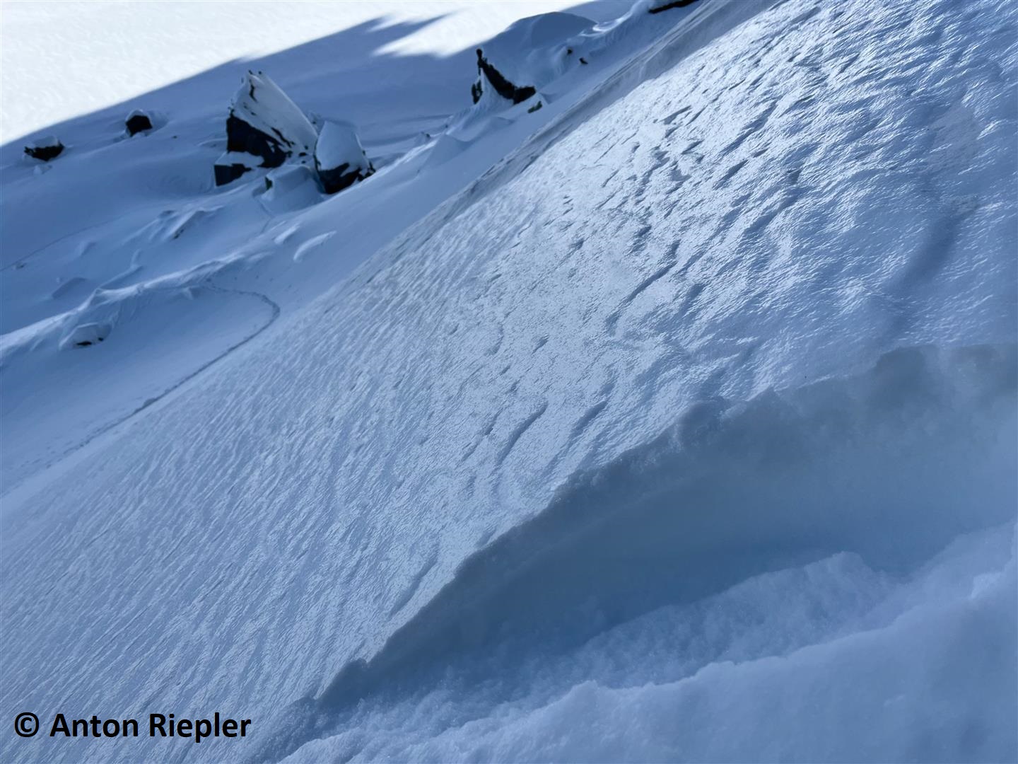
A weak layer for slab avalanches for a brief spell: some near-surface graupel or drifted-over powder.
Avalanches
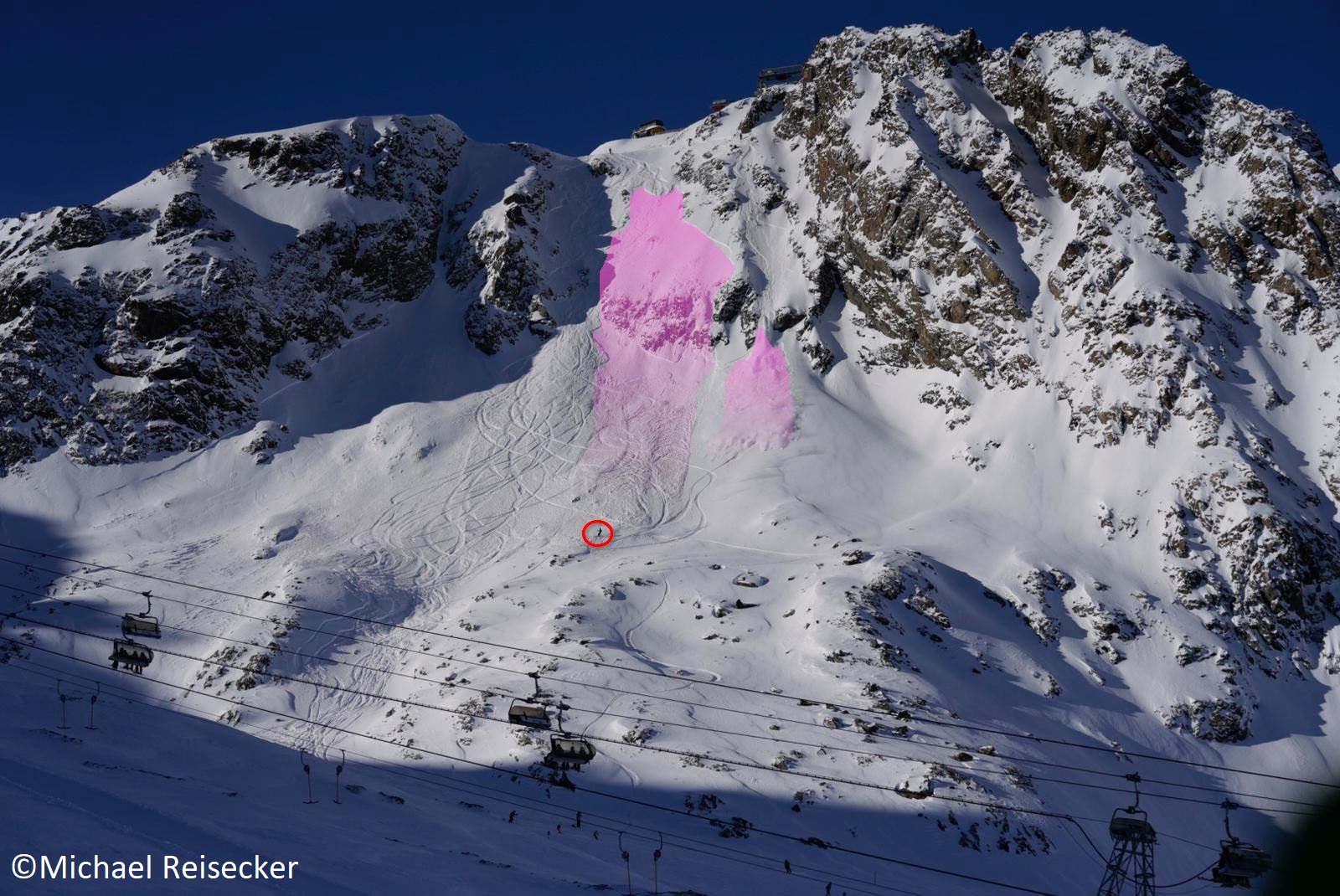
The major danger currently stems from ridgeline, fresh snowdrift accumulations. Even low additional loading is sufficient to trigger slab avalanches in very steep terrain. Most of the time these are medium-sized avalanches. In addition, caution is urged towards the risk of injuries from stones jutting out in early winter. It’s not just avalanches that are dangerous at the moment.
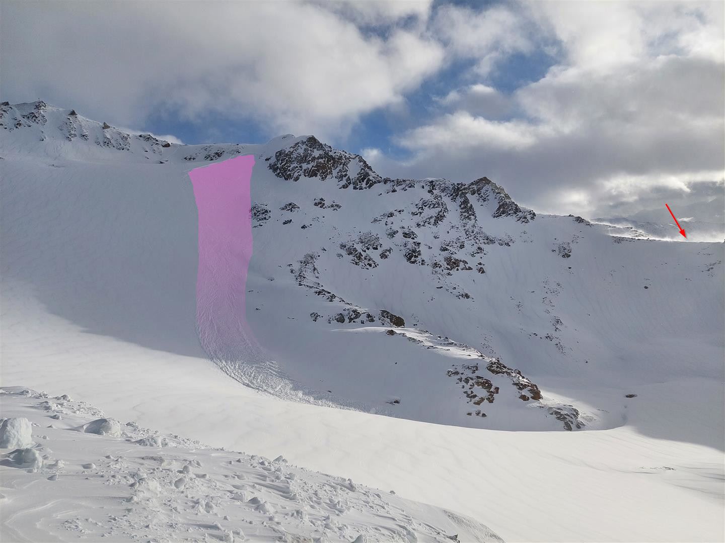
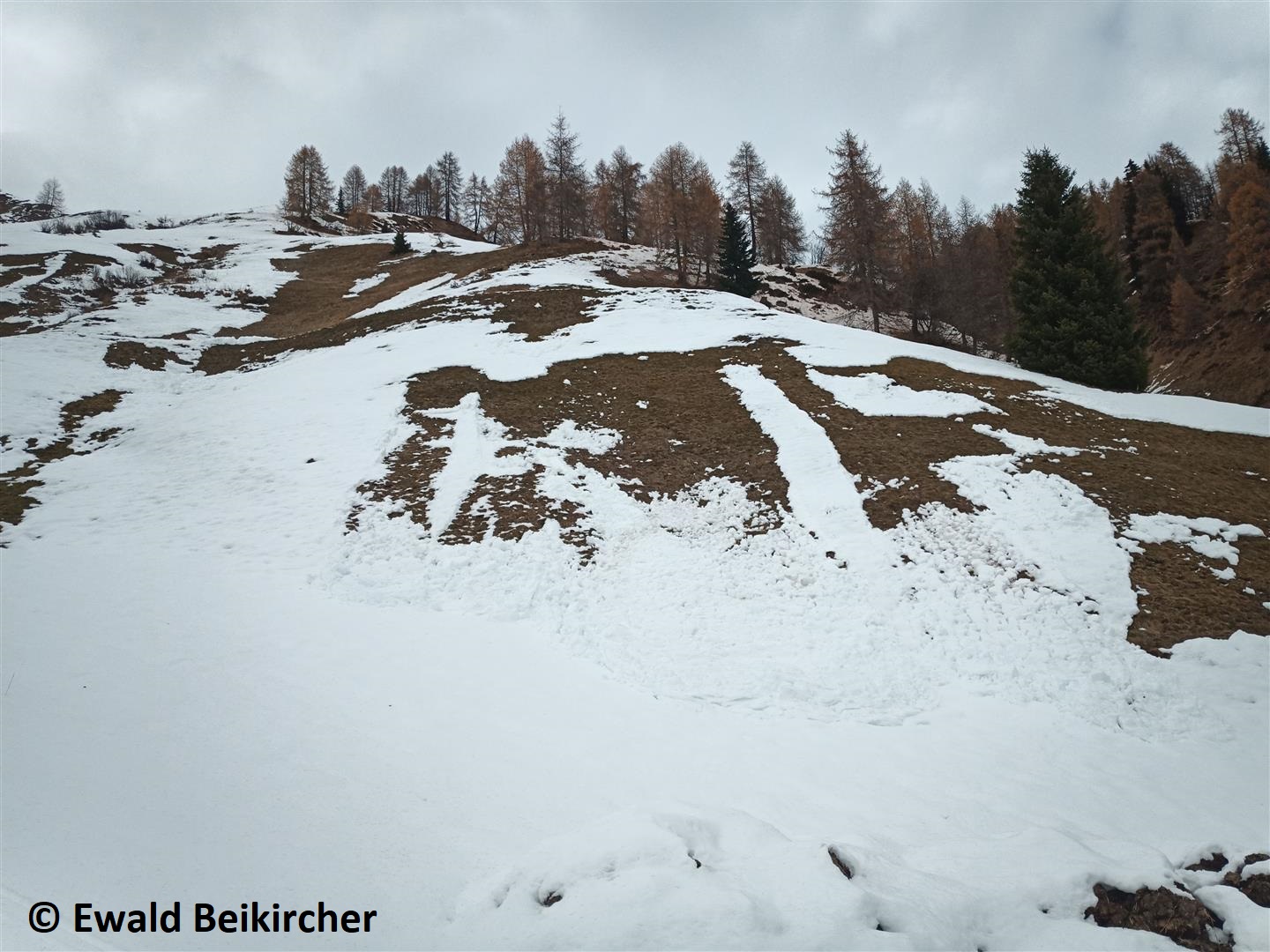
Remarkable: also still glide-snow slides and glide-snow avalanches, particularly on steep grass-covered slopes in the regions where recent snowfall was greatest.
Coming developments
The weather will remain instable with temperatures likely to rise. The major danger stems from freshly generated snowdrift accumulations at high altitudes. Poor visibility can make evaluating avalanche dangers more difficult.
Wherever there is currently lots of snowfall, increasingly frequent glide-snow slides and in places medium-sized glide-snow avalanches can be expected, also due to the increasing moistness of the snowpack which is expected.
Next update: as soon as the general situation changes significantly.