With regard to snowpack stability and likelihood of triggering, little has changed. We continue to face a delicate and often treacherous avalanche situation. A cautious, defensive route selection helps to keep risks at a minumum in outlying terrain.
A long-enduring situation of danger
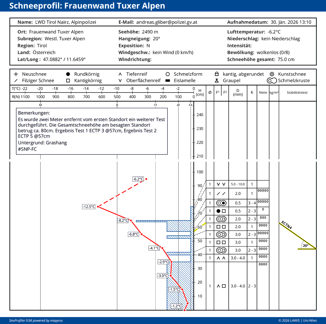
Just under one month, this phase of significantly heightened proneness to triggering of the snowpack has persisted. The reason lies in the extremely marked weak layer (usually faceted crystals and rotten snow in the middle of the snowpack, including surface hoar near the uppermost surface) including a well formed slab on top of it all. The latter component has become amplified over the last week, due to snowfall, on the one hand, and heavy wind impact on the other. Correspondingly numerous have been reports of well-known alarm signals, avalanche triggerings (naturally triggered, unleashed by persons and remote triggerings), fractures forming on the surface and settling noises.
To start with: the solution to the problem
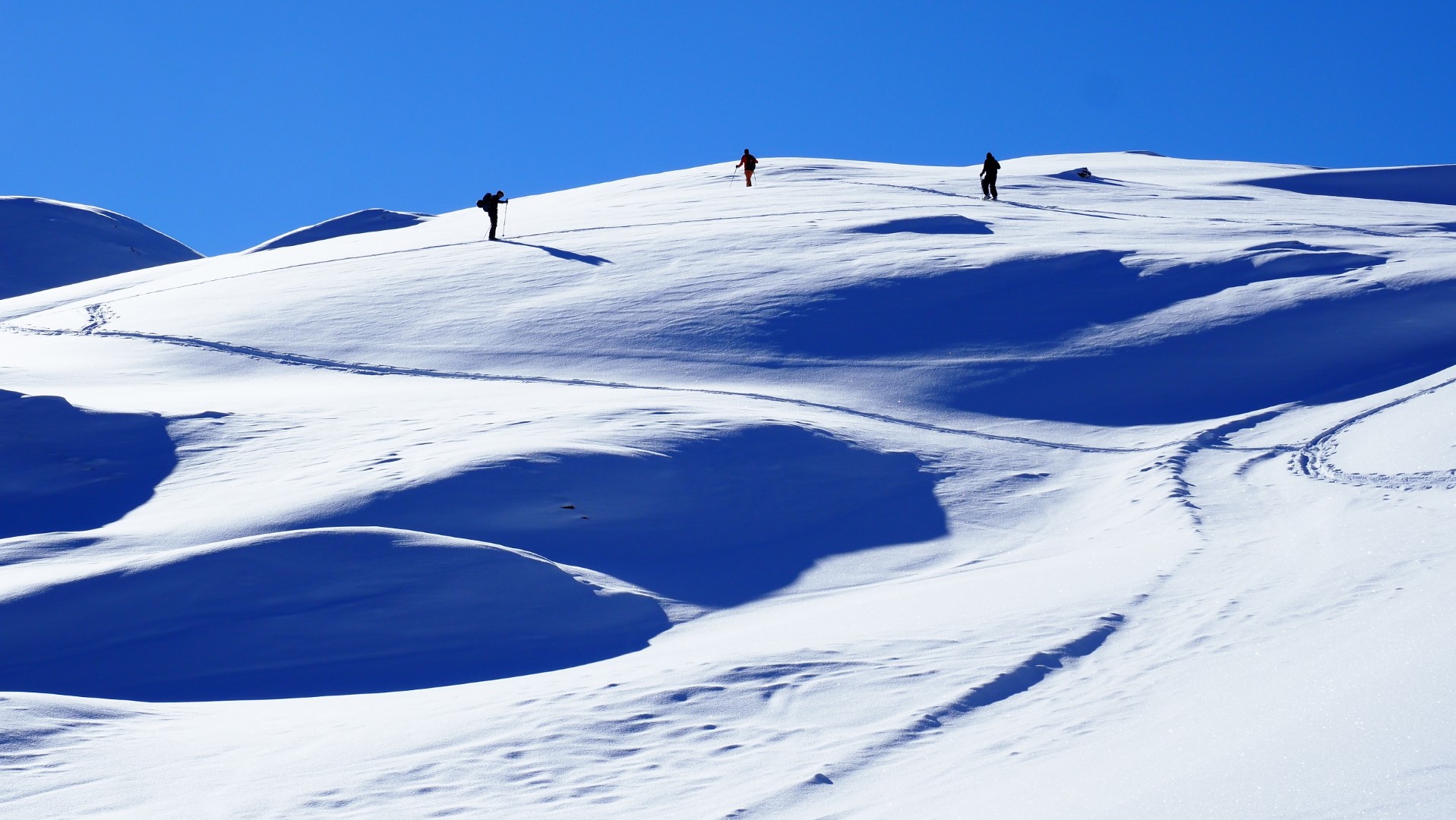
Currently, to be en route with little risk, a great deal of experience and an equal measure of restraint are necessary in far-reaching parts of Tirol. The motto applies: “When the avalanche is the problem, the terrain is the solution.” Backcountry tours in moderately steep terrain, far removed from the huge, evenly-unfolding steep slopes is at this time an often-observed and exemplary manner of conduct.
“Winter sports enthusiasts-high”
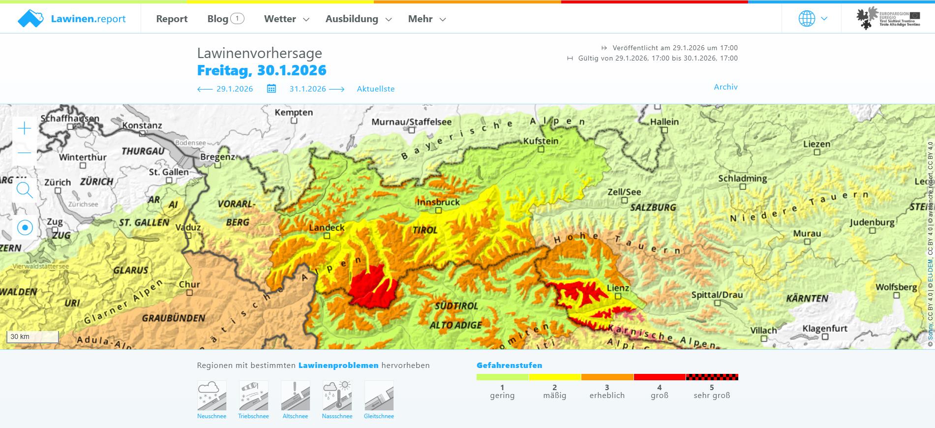
Twice during the last week Danger Level 4 (high) was assigned, in the form of “winter sports enthusiasts-high”. Avalanches could be triggered extremely easily by winter sports enthusiasts, also trigger naturally, usually of medium size, sometimes large-sized.
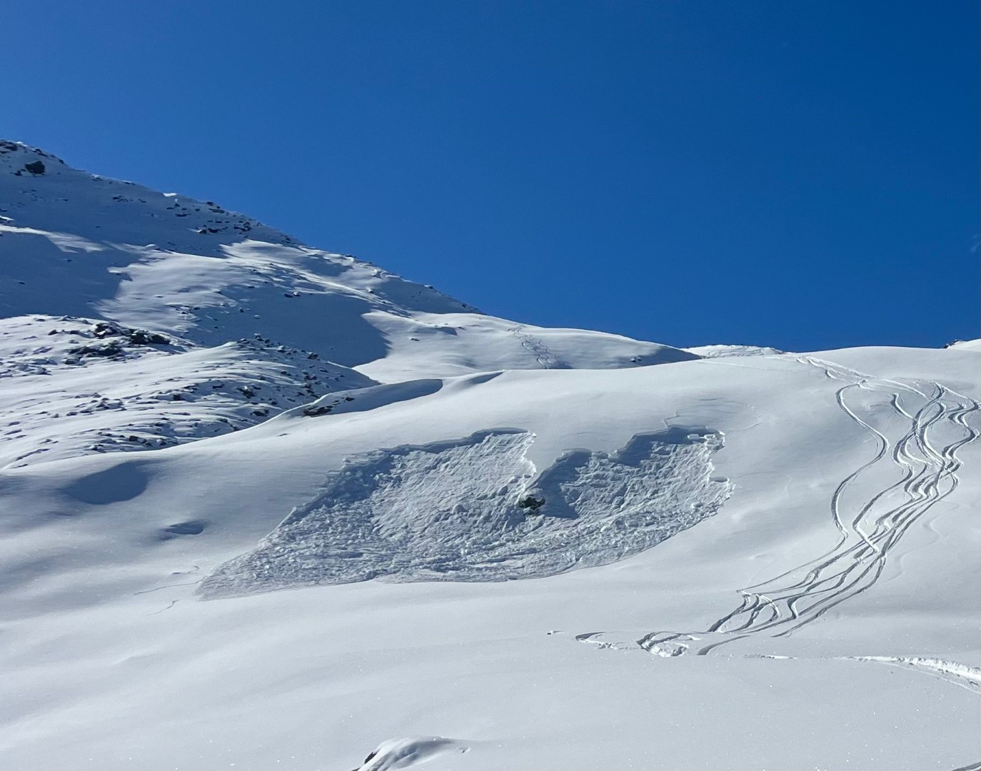
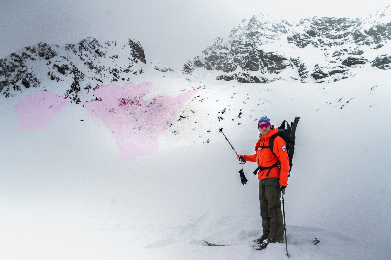
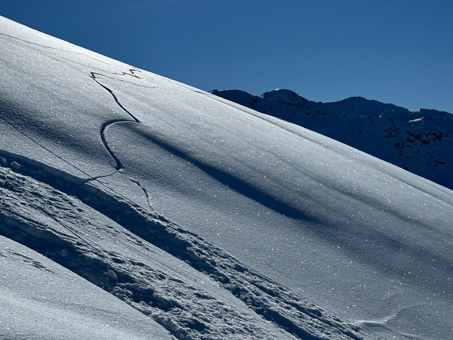
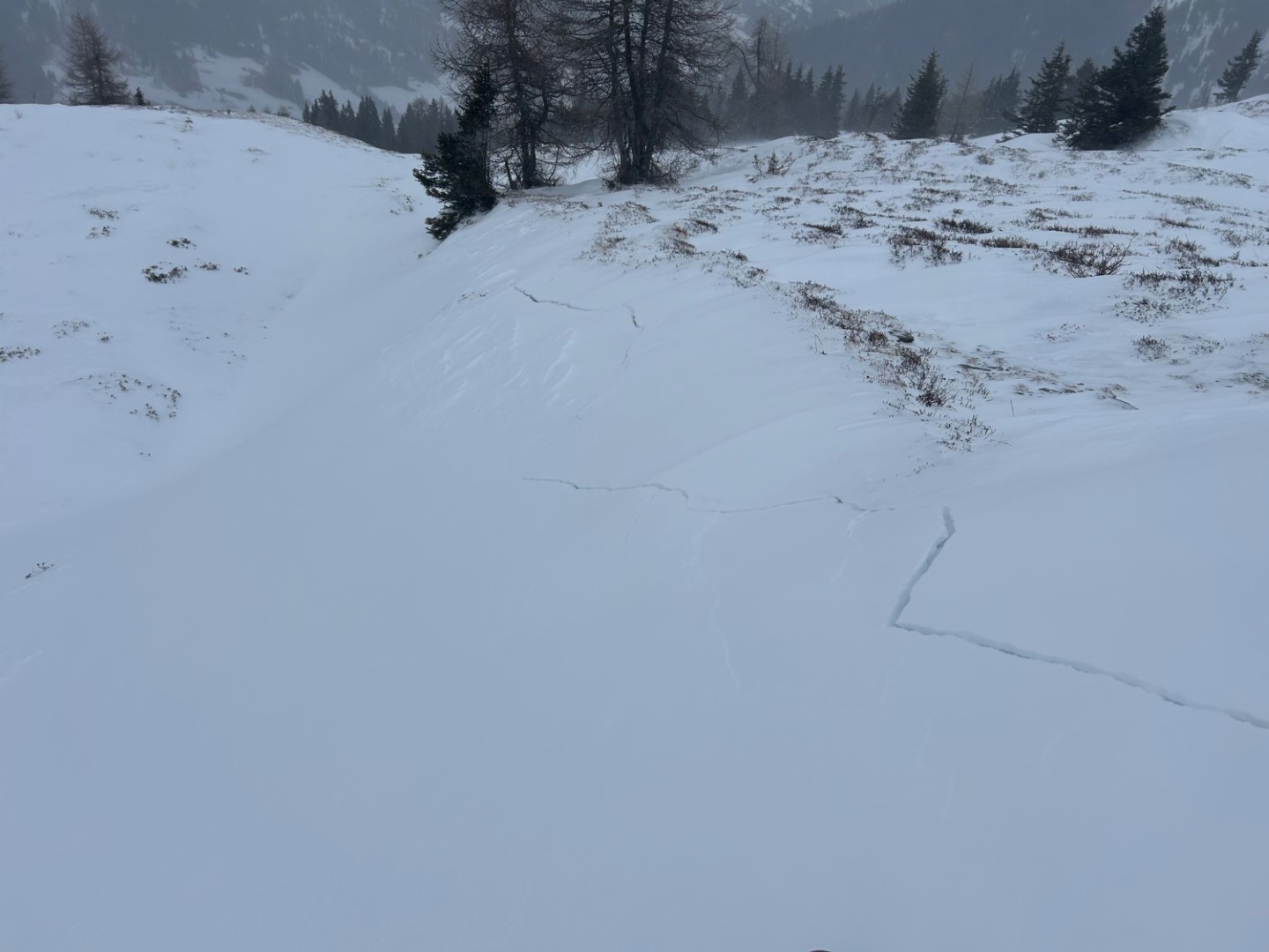
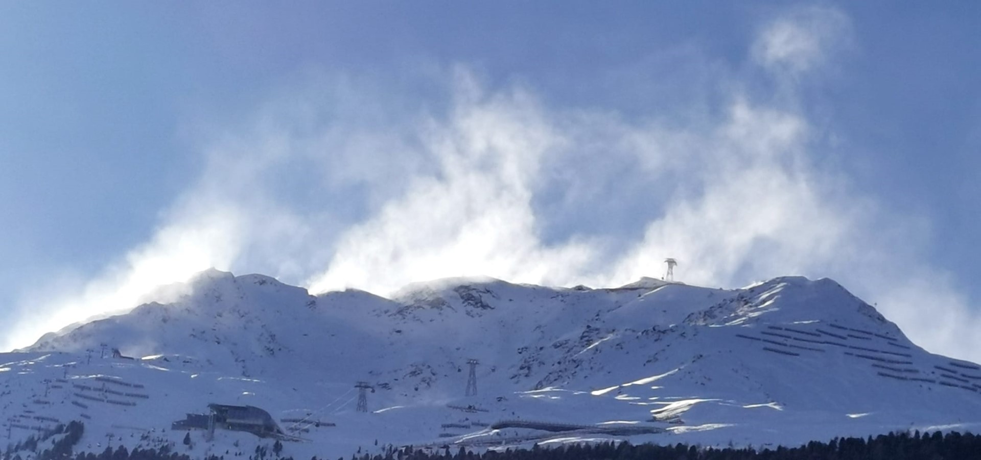
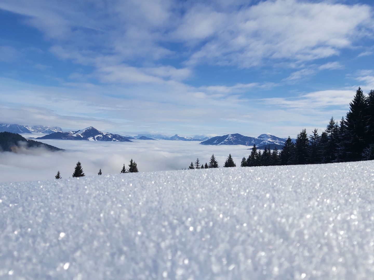
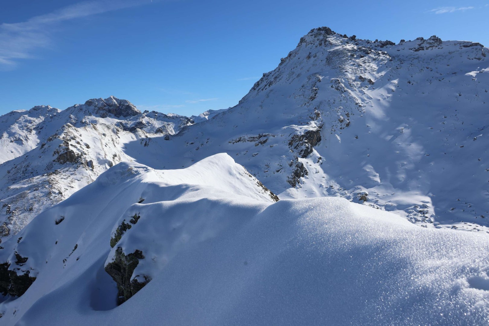
Impressions from last week
To round out our last Blog, a few photos to reflect pretty impressively the present situation.
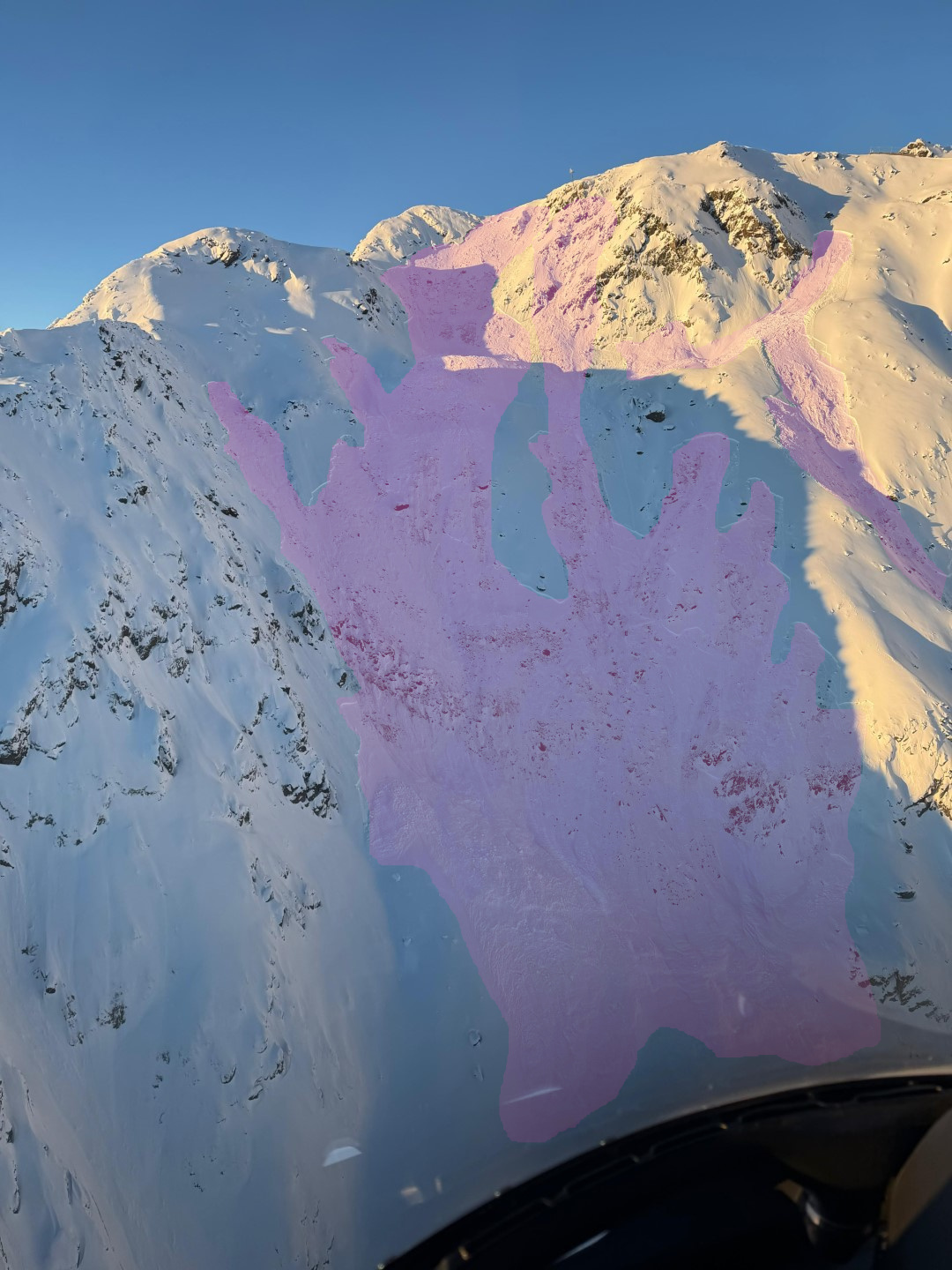
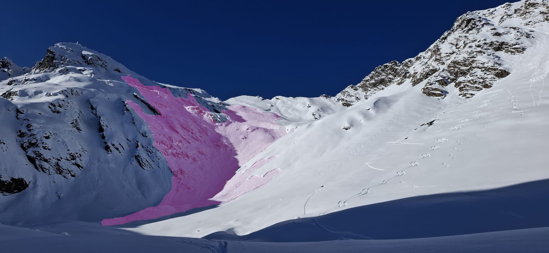
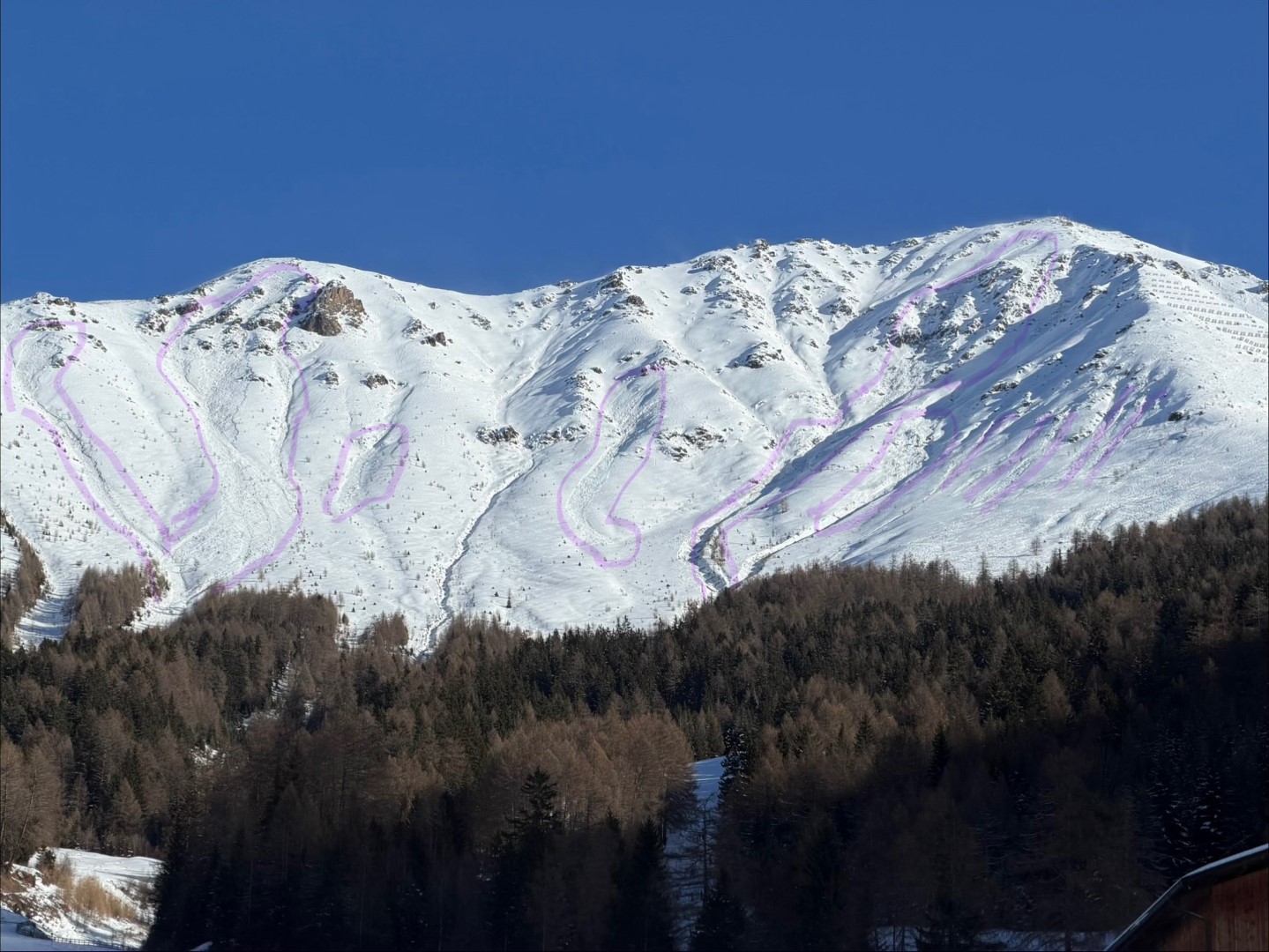
Naturally triggered avalanches and outstandingly successful explosions
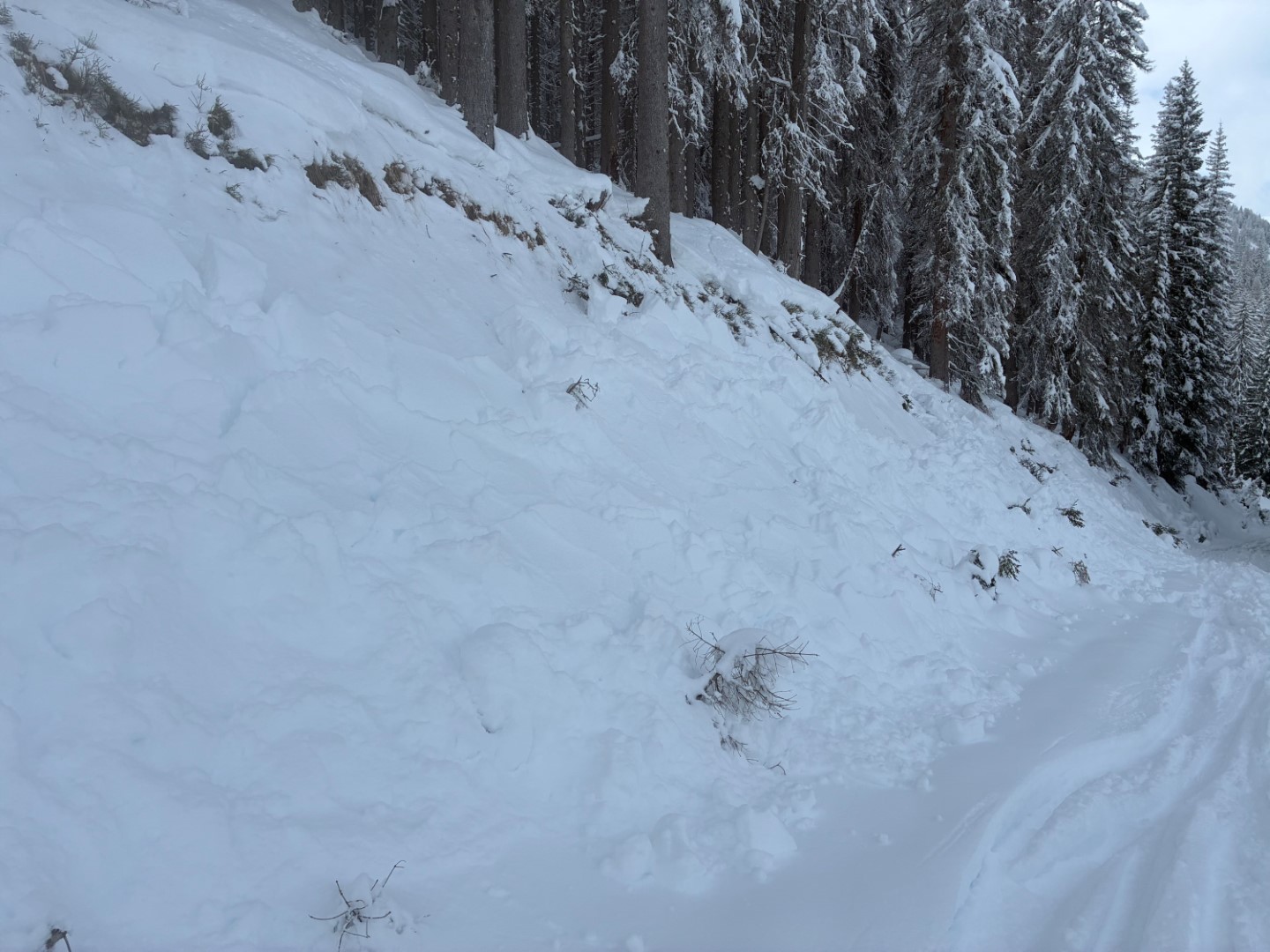
Avalanches triggered by persons (inc. remote triggerings)
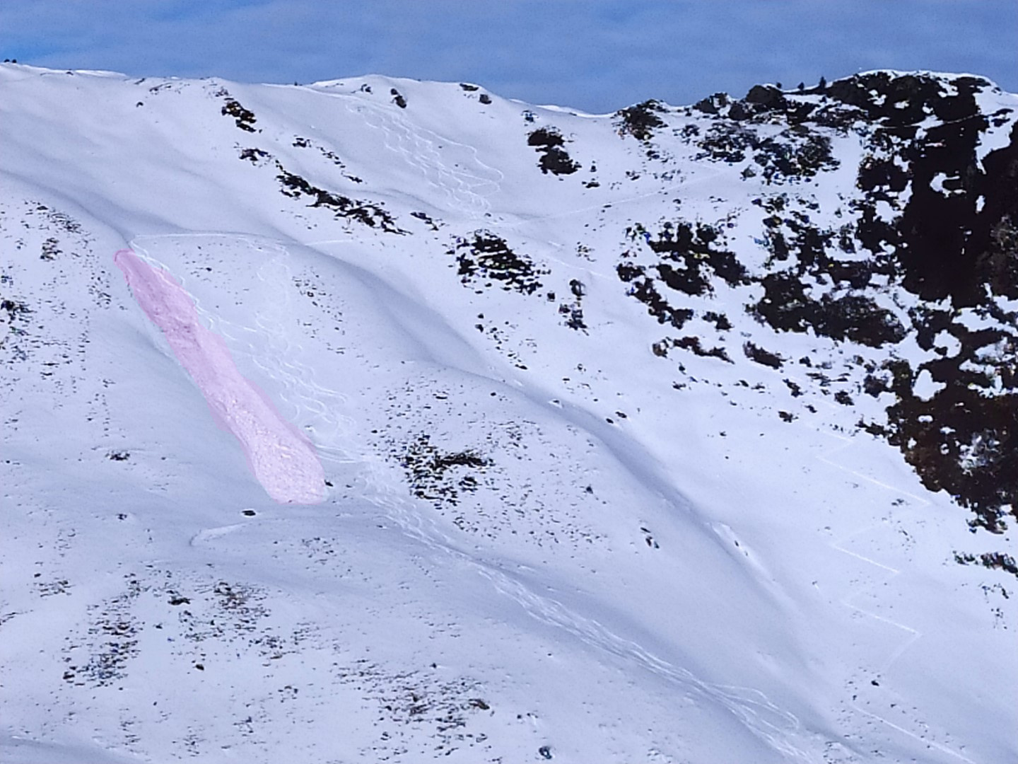
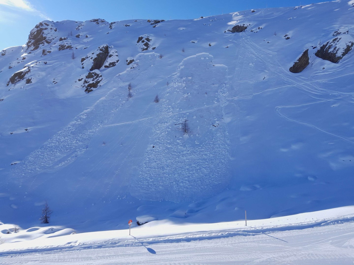
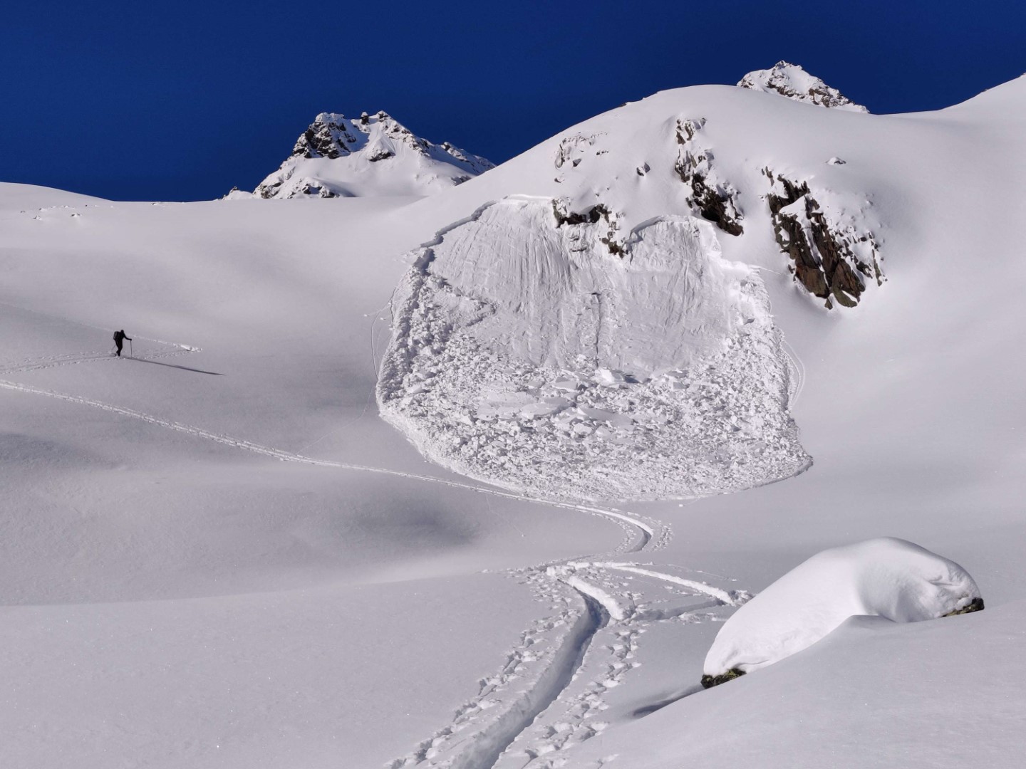
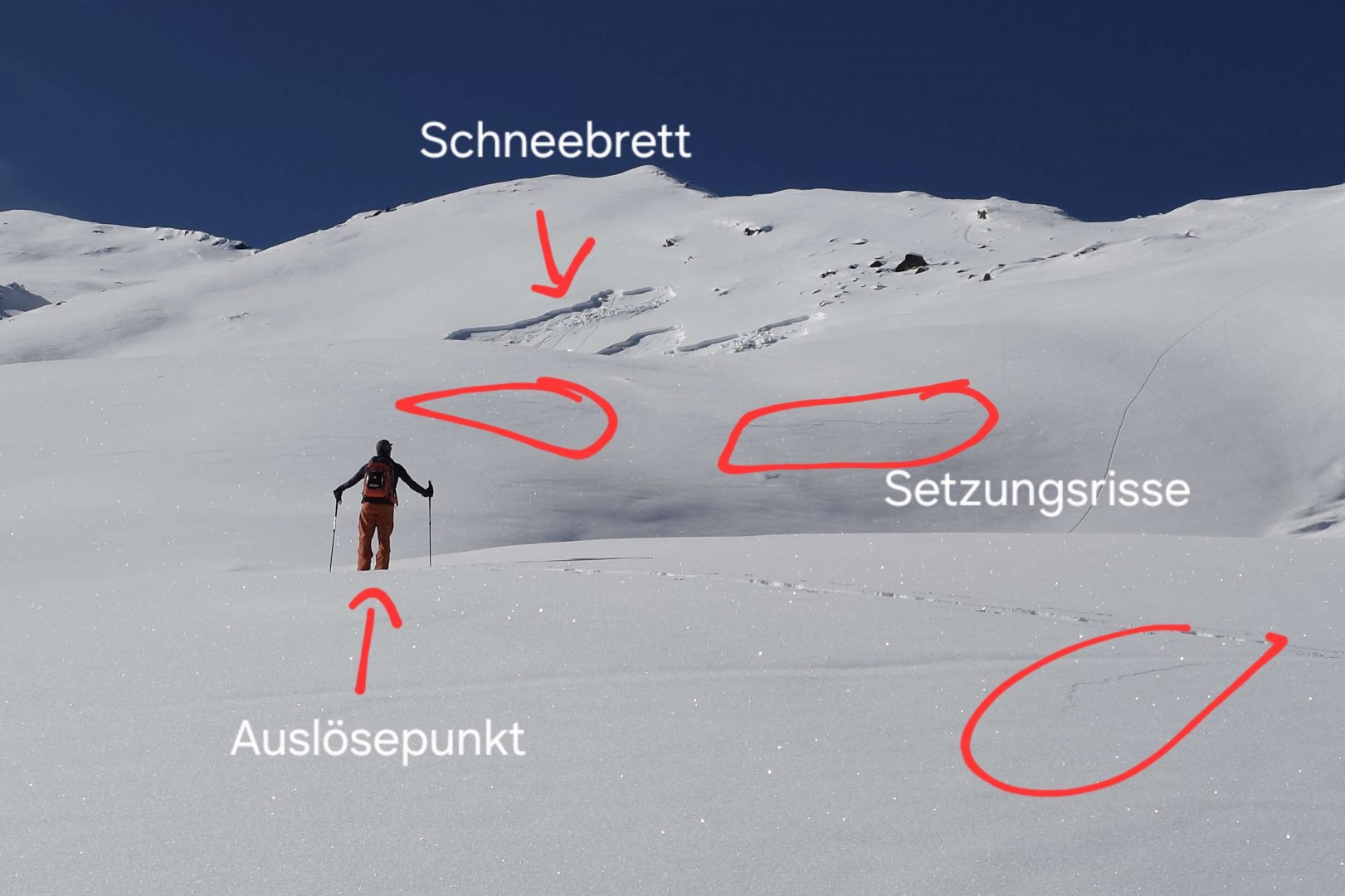
Fractures forming, settling noises
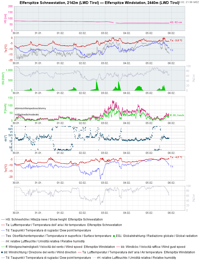
Review: weather and snowpack
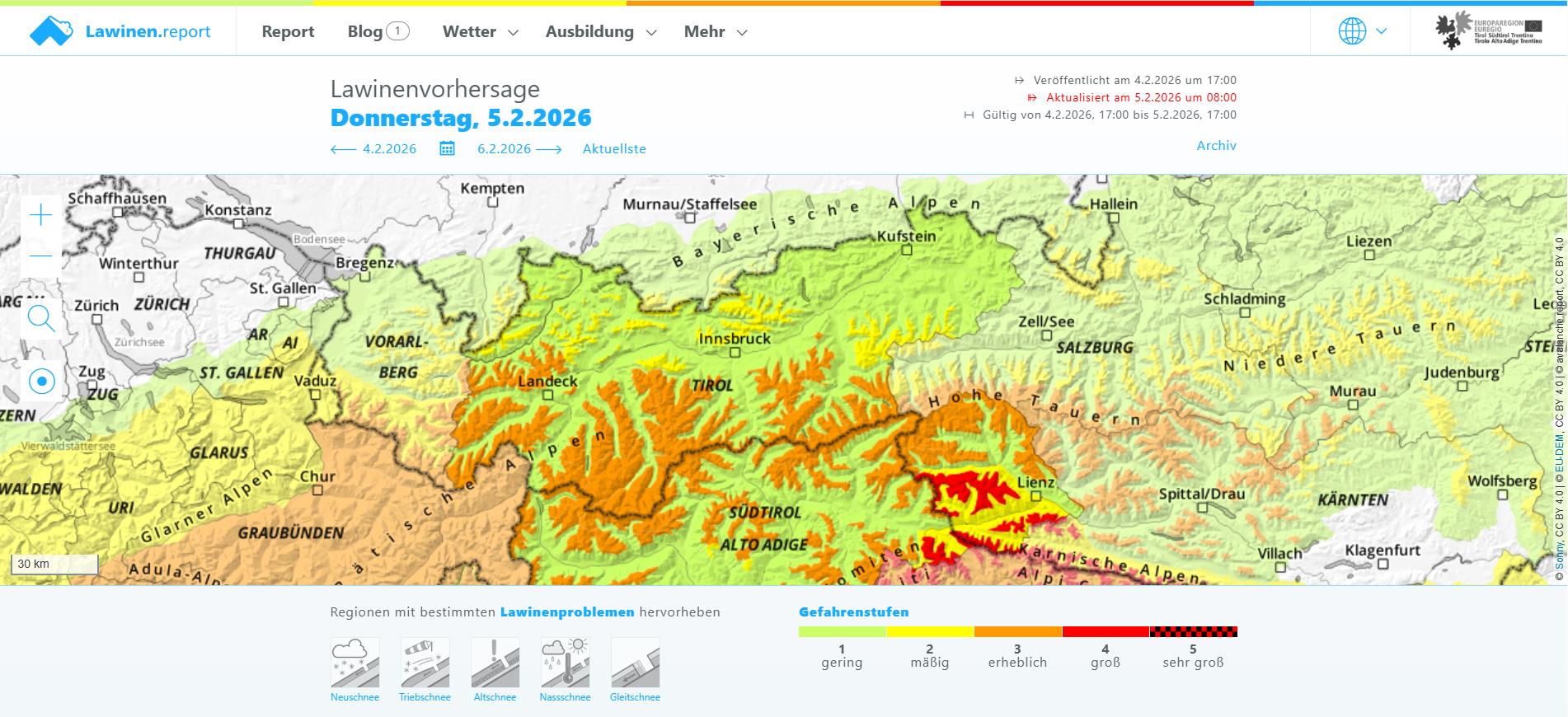
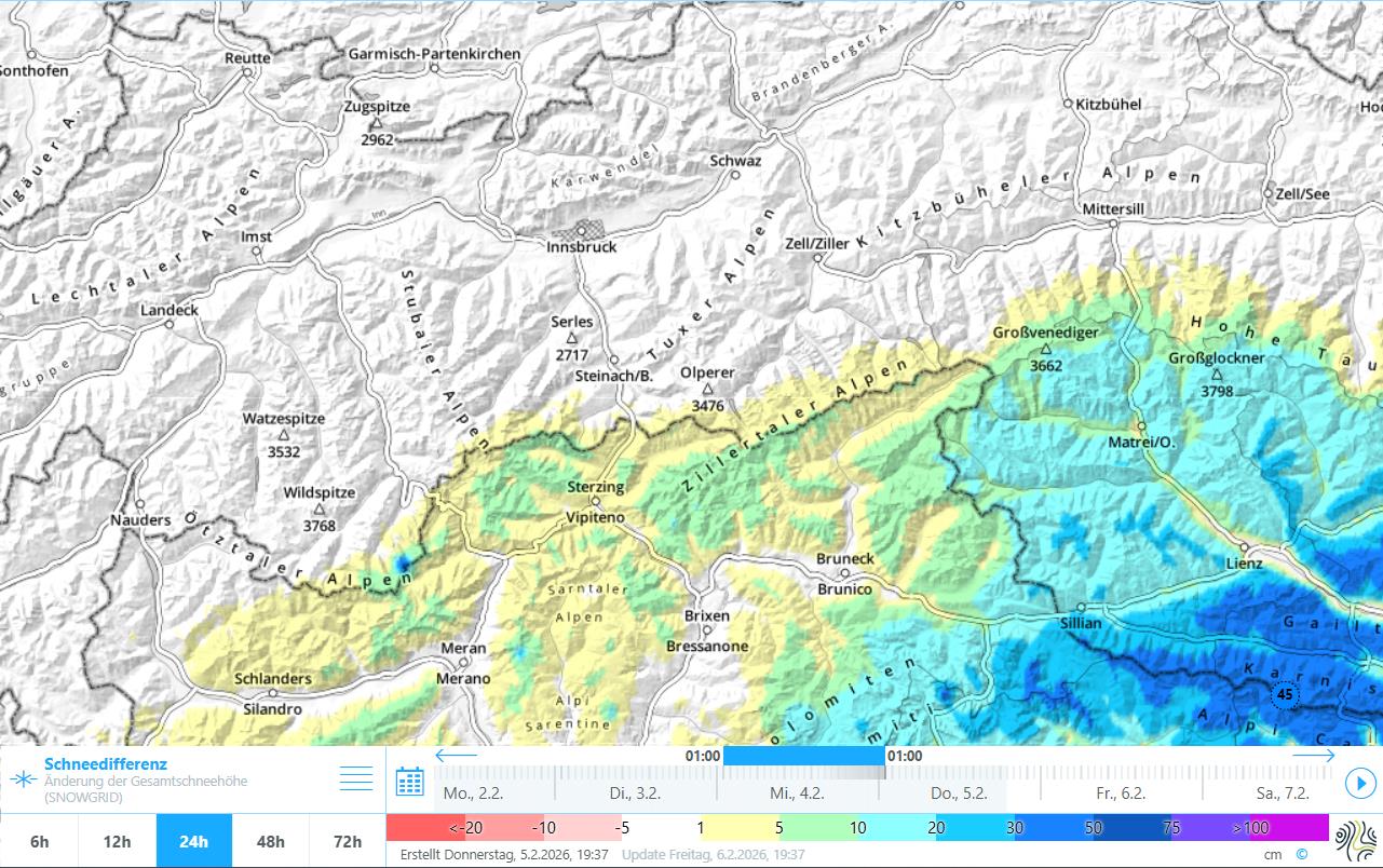
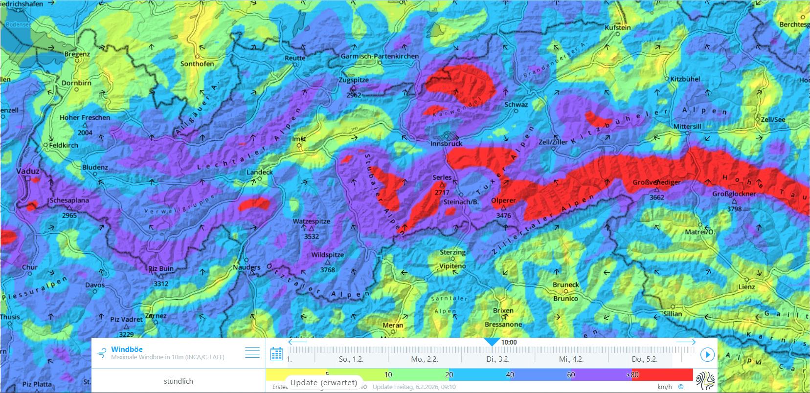
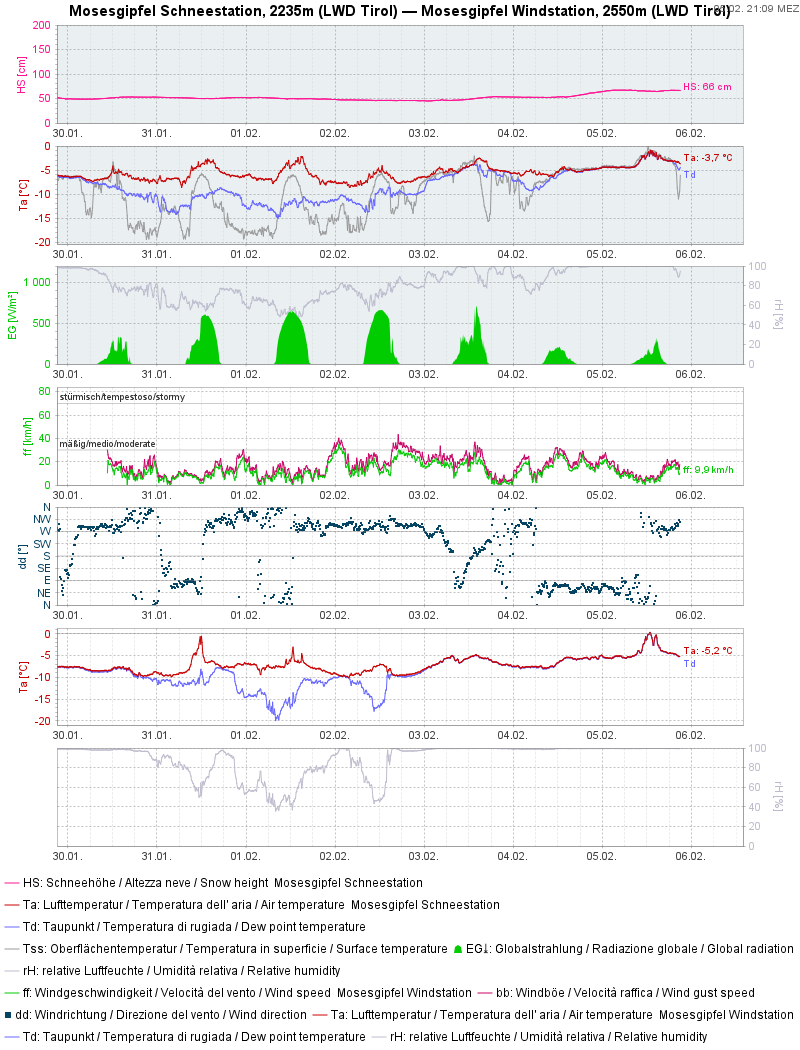
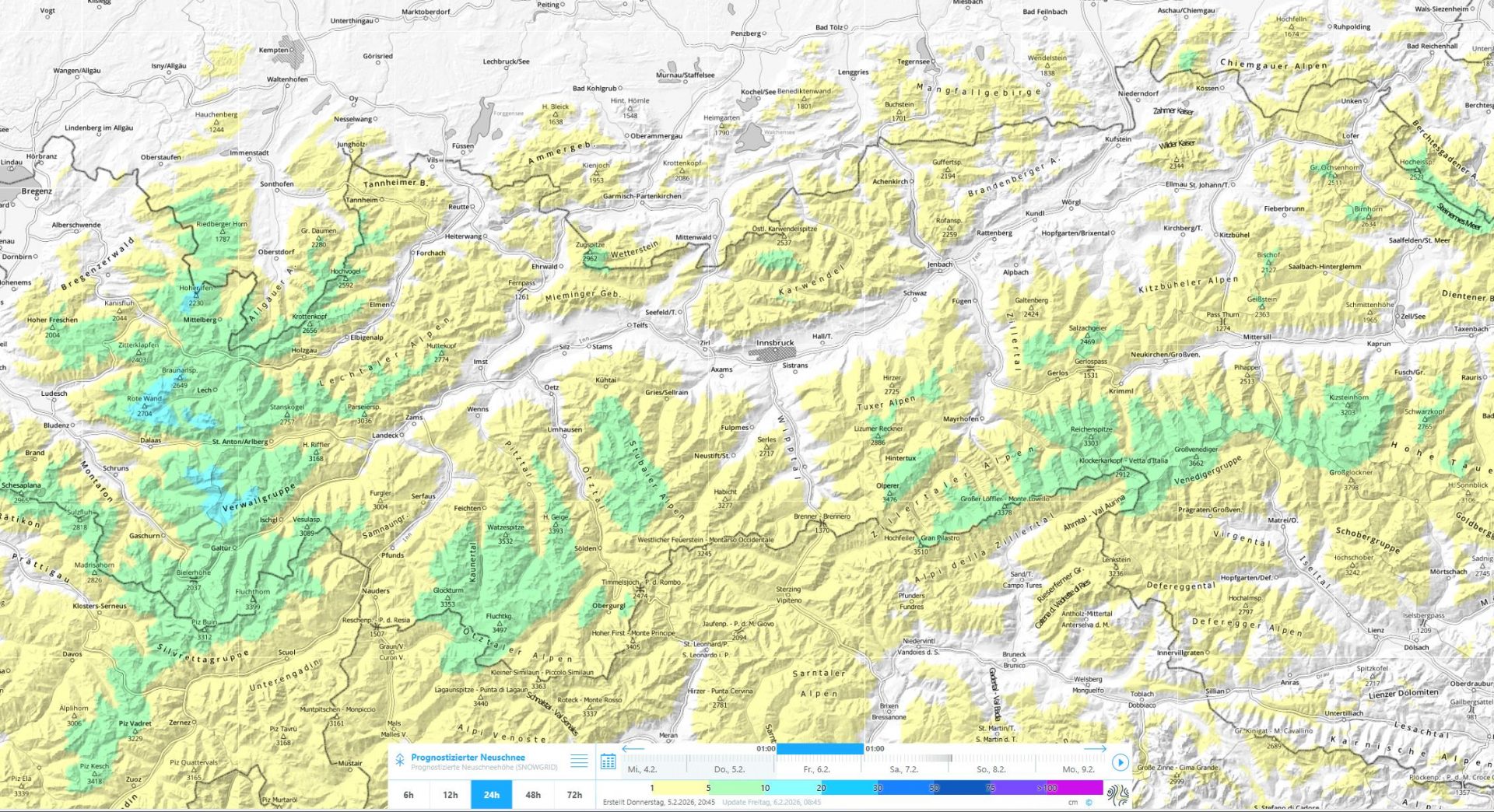
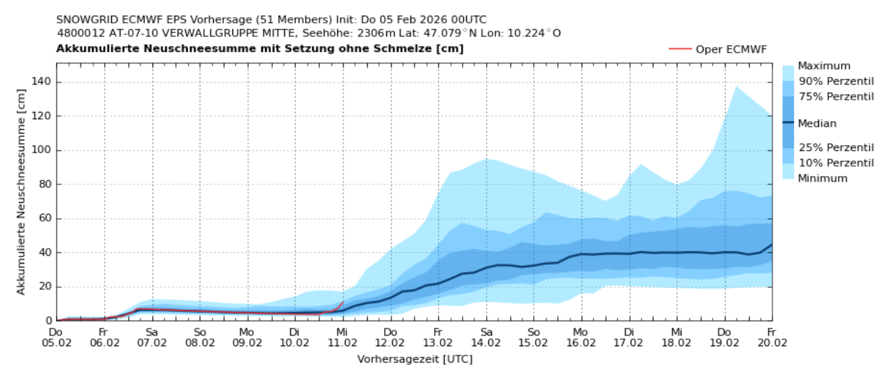
During last week, fine weather conditions prevailed amid a southerly air current. Starting on 3 February, skies began to cloud up from the south, snowfall set in (focus in southernmost East Tirol). Up to 50cm of fresh snow was registered there. The frequently very heavy wind impact on 3-4 February had a marked effect: far-reaching snow transport. The additional burden of the fresh snowfall on the snow cover plus the transported snow heightened the dangerousness of the avalanche situation due to the marked slab.
(Blanketed) surface hoar
It is important to note that as of the snowfall starting on 3 February, the widespread surface hoar was blanketed by fresh snow, even though it was largely dispersed by wind impact, particularly near the Main Alpine Ridge on west-facing and east-facing slopes. Under all circumstances, that brought about a further, extremely prone-to-triggering weak layer inside the snowpack in many places and regions. One sign of this was the naturally triggered shallow snowslides in steep terrain. Following the snowfall, unfortunately impossible to recognize.
What remains, unfortunately, are the marked weak layers in the middle part of the snowpack.
Other developments
A brief perturbance, then tranquil weather conditions til mid-week
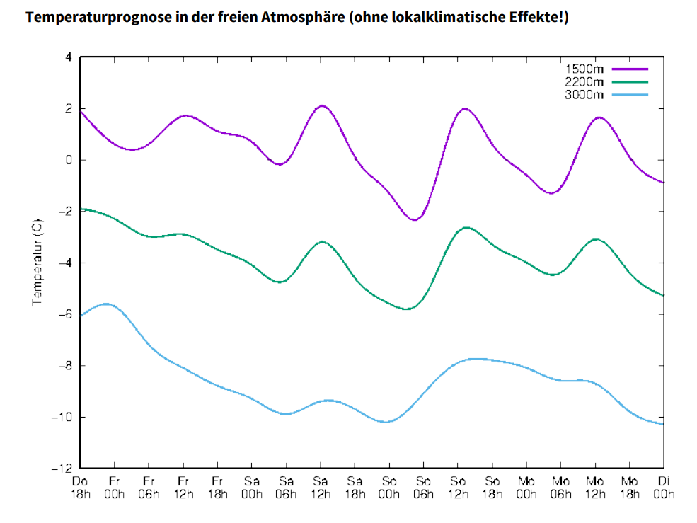
According to GeoSphere Austria, dense clouds followed by light rainfall or snowfall will spread in North Tirol in early morning hours on 6 February, thereafter reaching central areas close to midday and the the Lower Inn Valley in the afternoon. For the remainder of the day it will be cloudy, intermittently wet with light-to-moderate rainfall or snowfall. Snowfall is expected only above 1100-1400m. In East Tirol, skies will remain heavily clouded to overcast, but apart from the Main Tauern Ridge is will remain dry.
Thereafter, weak high-pressure front conditions will continue into next week. It will remain mild for this juncture of the season. Starting at mid-week, weather will become less stable, snowfall is then possible.
Effects on avalanche danger
In case the rainfall extends to higher altitudes on 6 February, that would reinforce slab formation. That would make the snowpack even more prone to triggering than now.
For winter sports enthusiasts, the unfavorable avalanche situation will persist!