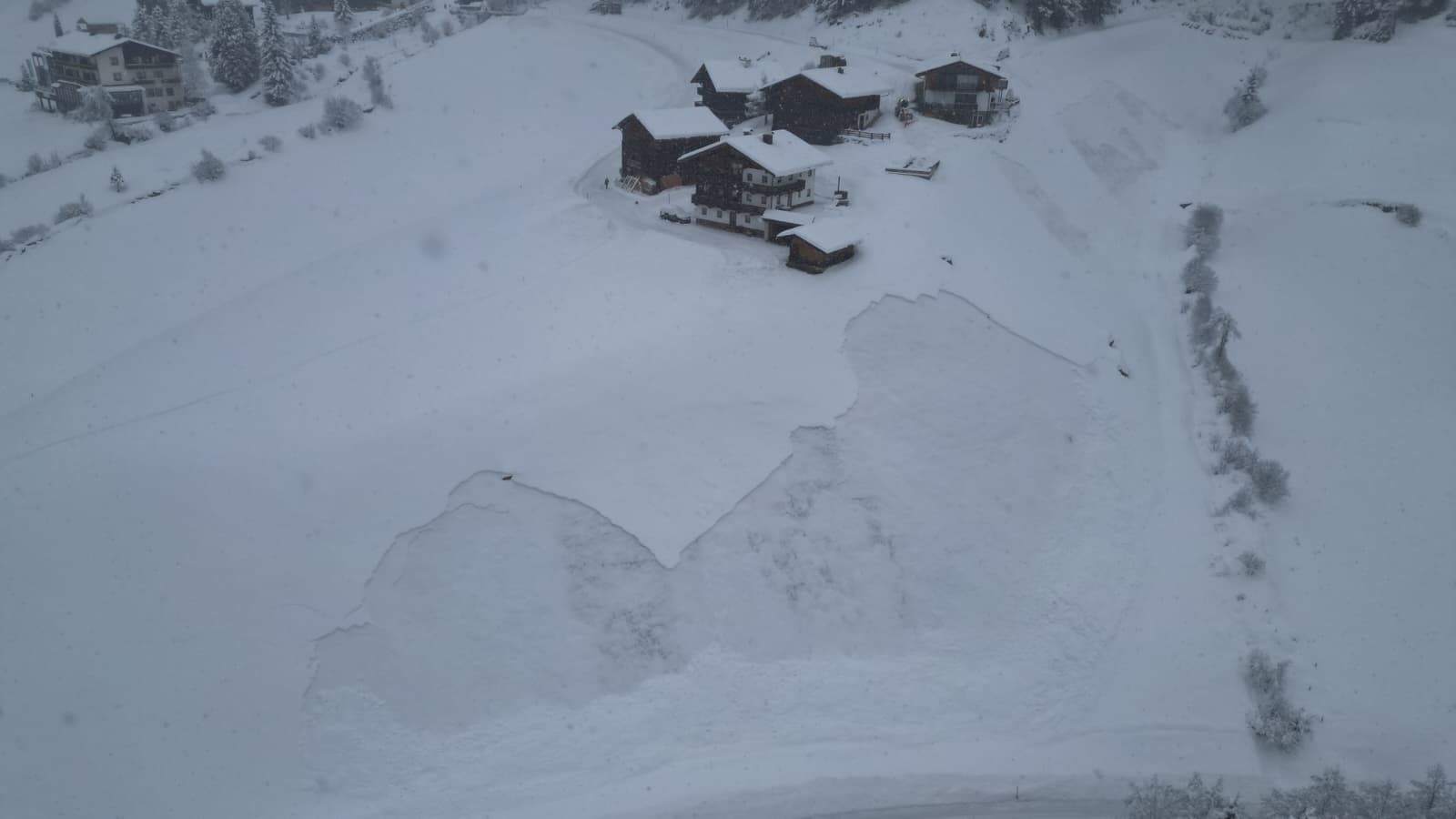
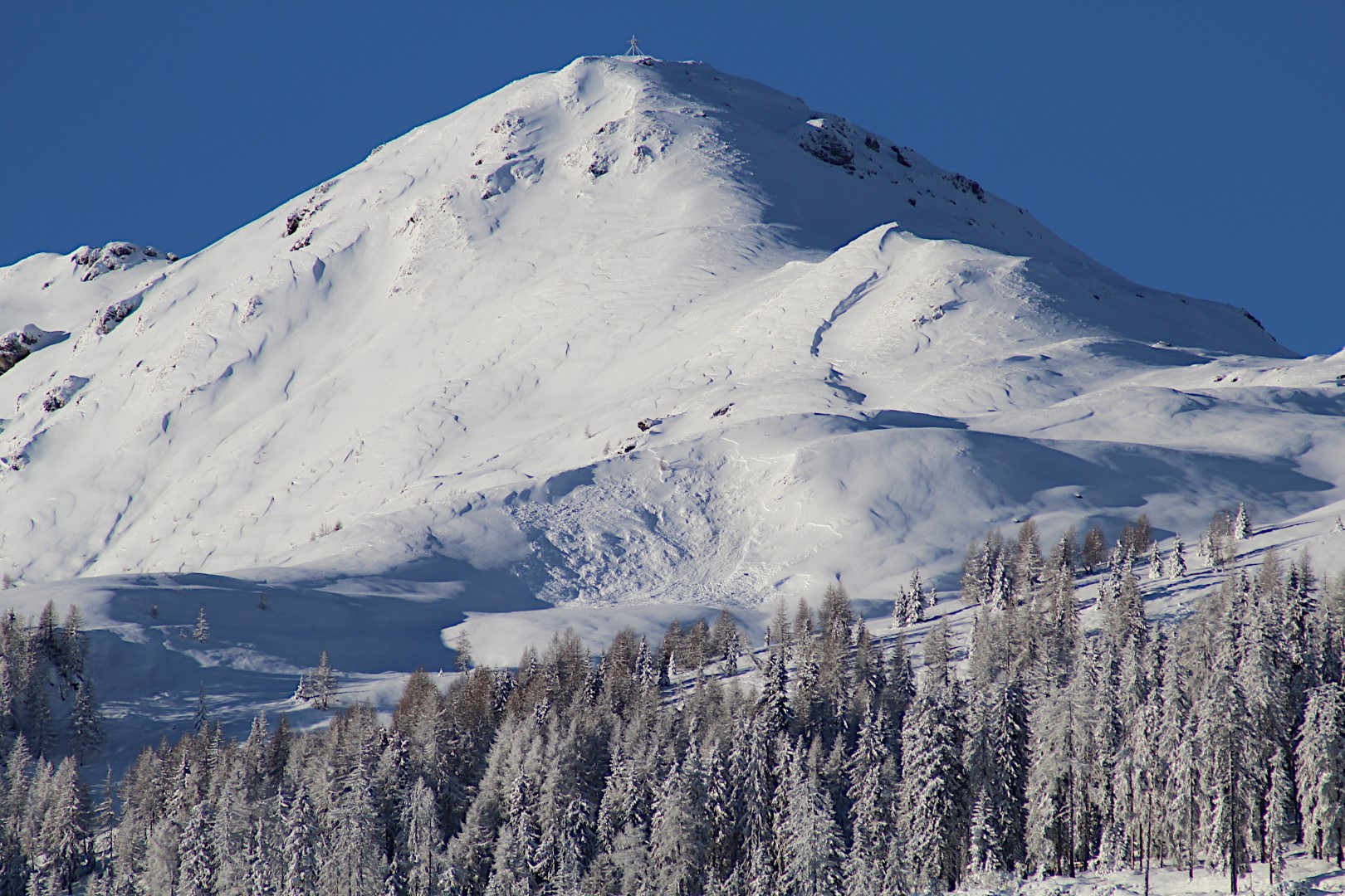
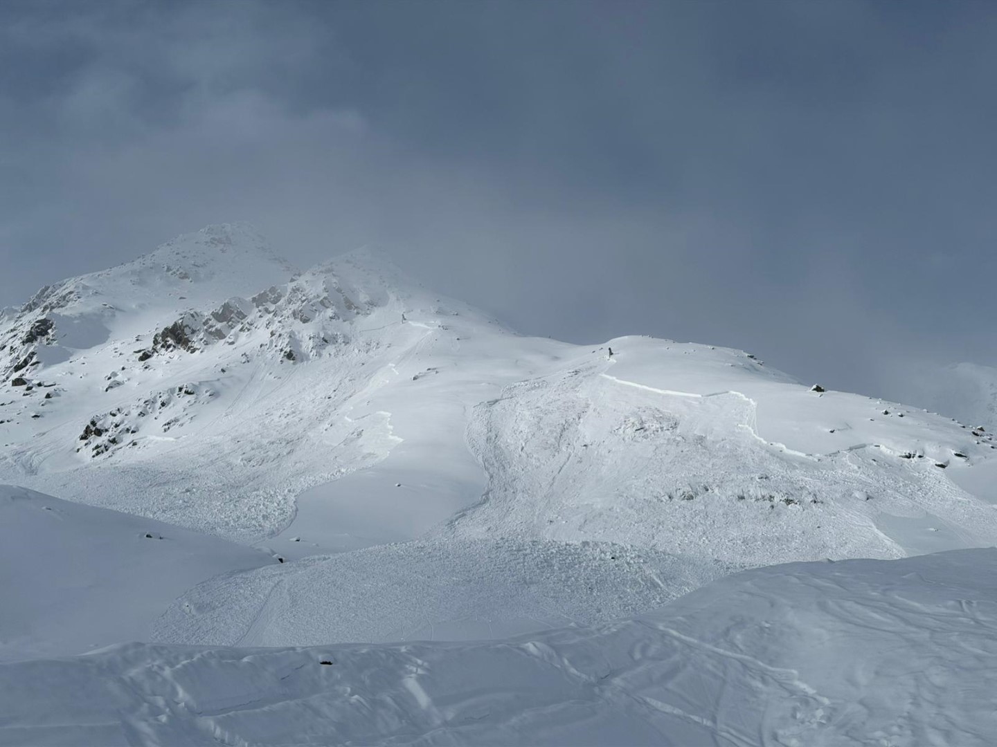
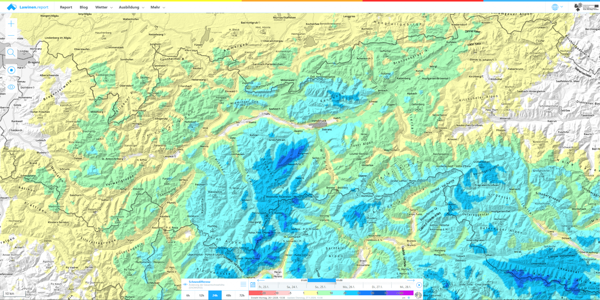
The combination of fresh snow, wind and an extremely weak snowpack has increased avalanche danger regionally. In the southern Ötztal Alps and southwestern East Tirol, HIGH avalanche danger prevails above the treeline (winter sports enthusiasts: beware). Numerous reports of alarm signals, such as naturally triggered avalanches including remote triggerings, settling noises and fractures forming are decisive proof how prone to triggering the snowpack is. Avalanches are usually medium-sized, but also large-sized in the regions with lots of fresh snow.
We advise, again: defensive conduct over the next few days.
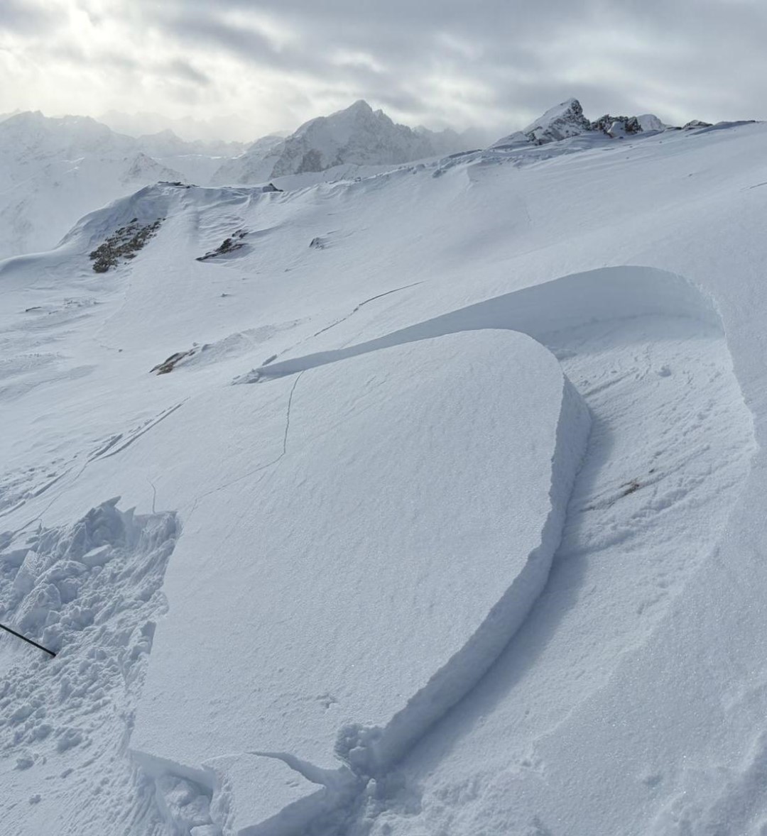
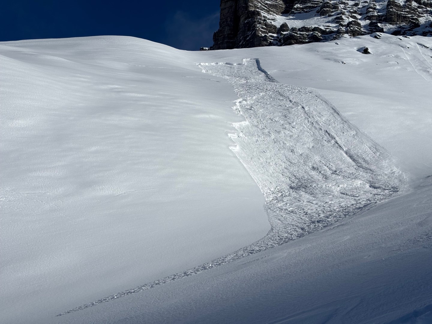
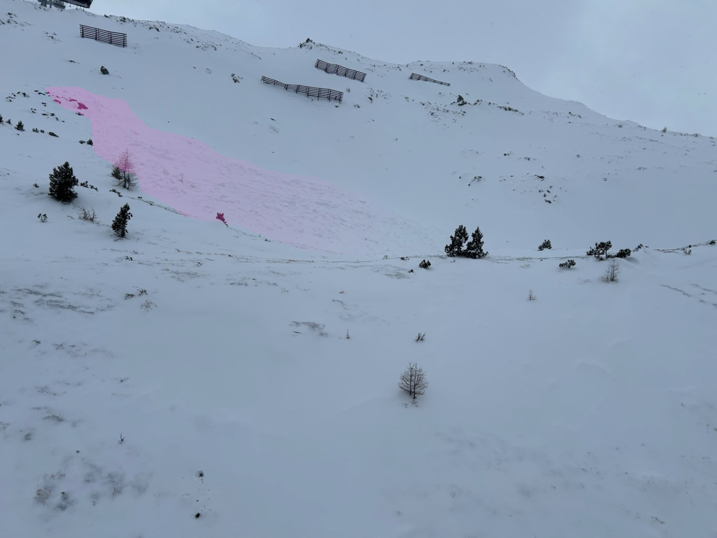
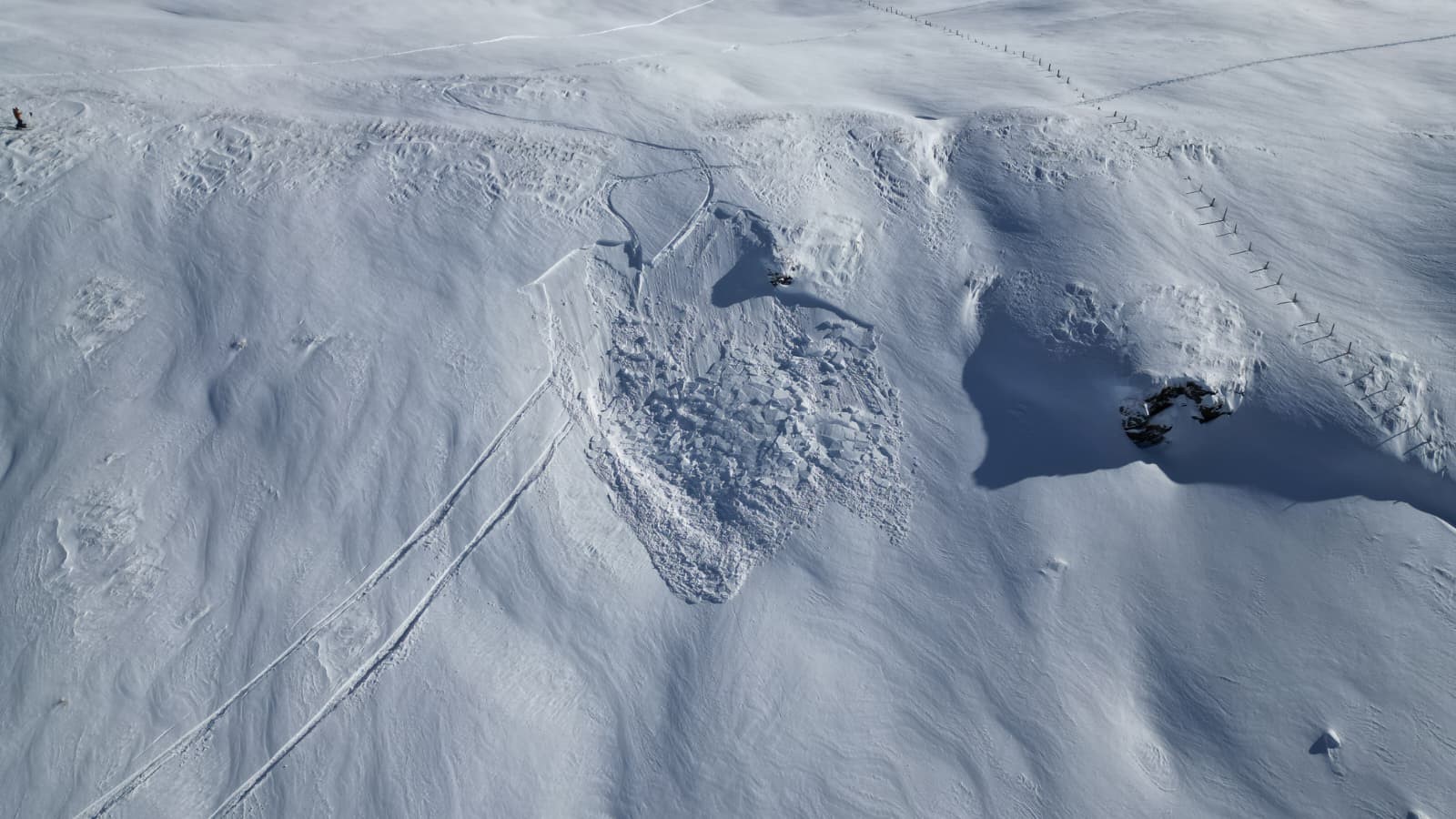
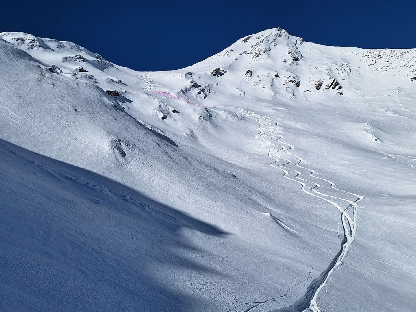
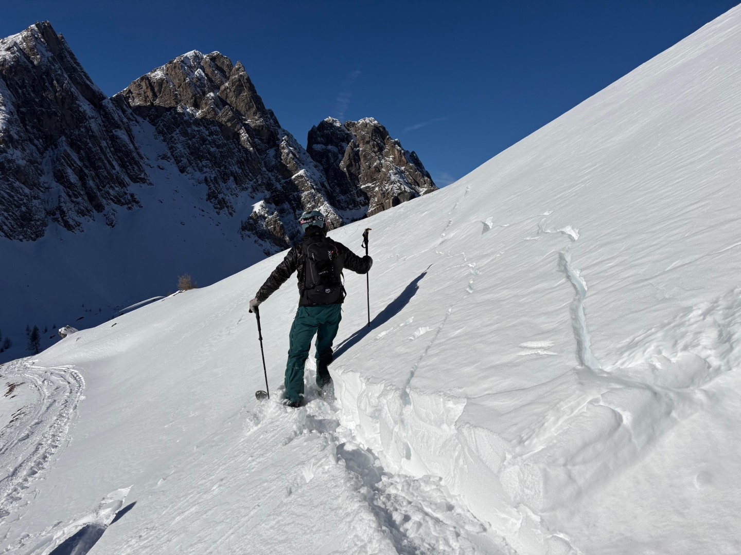
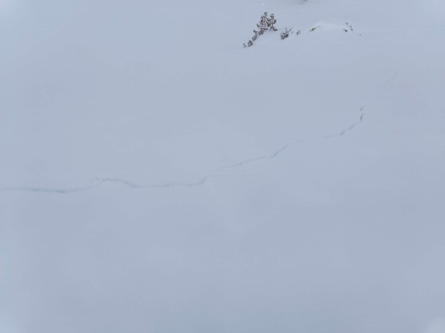
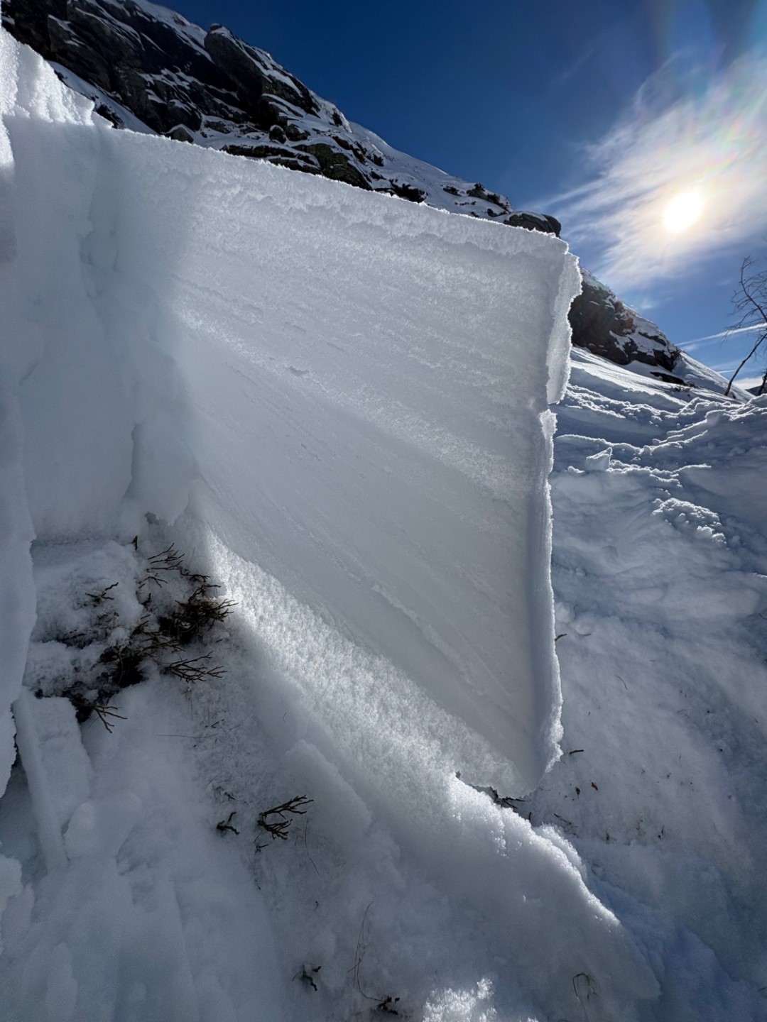
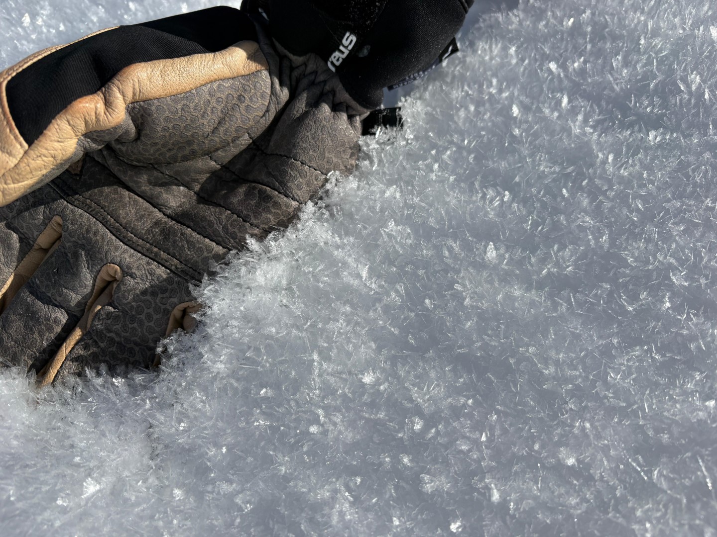
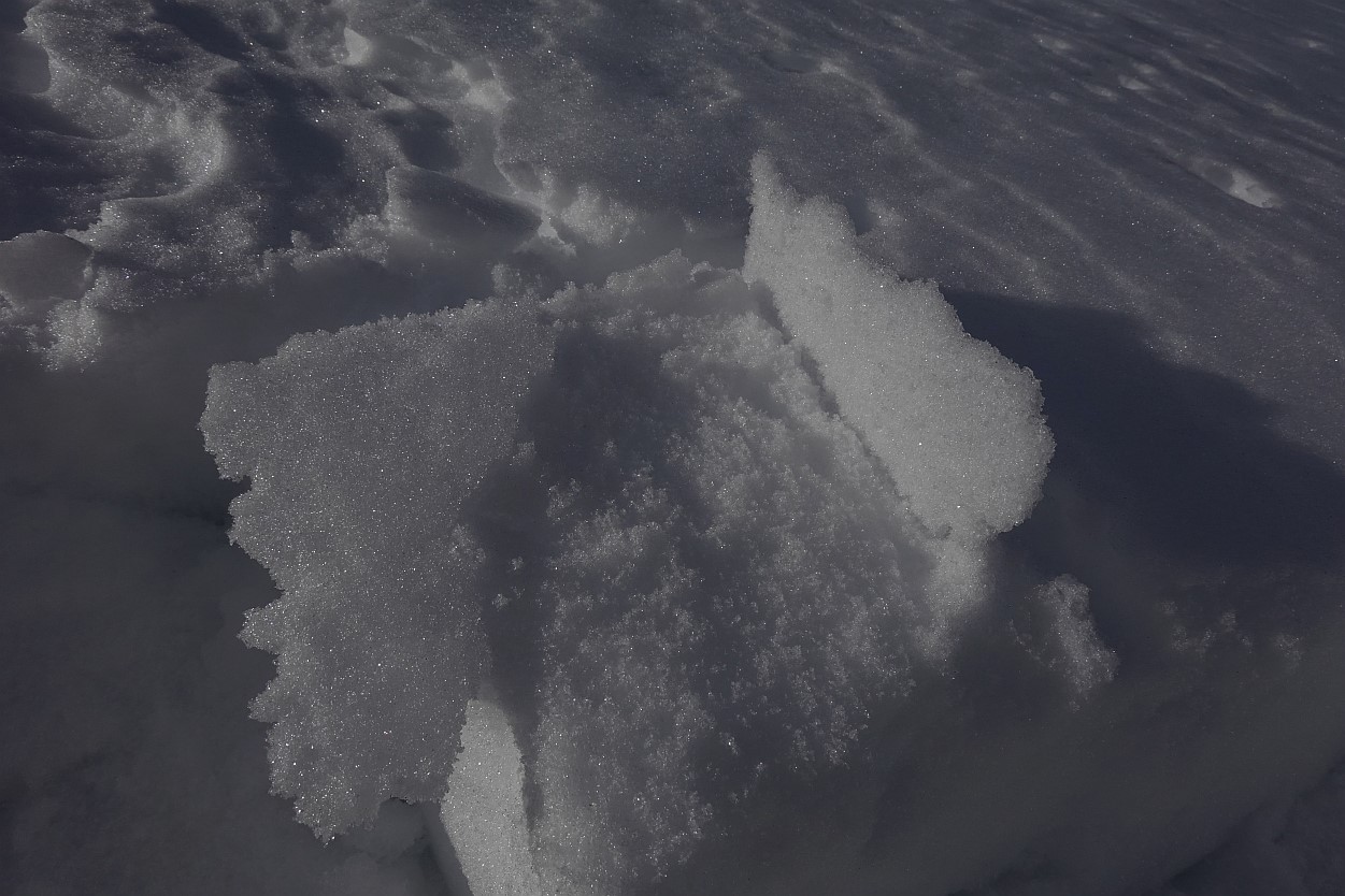
Alarm signals – unmimistakable signs of a weak snowpack
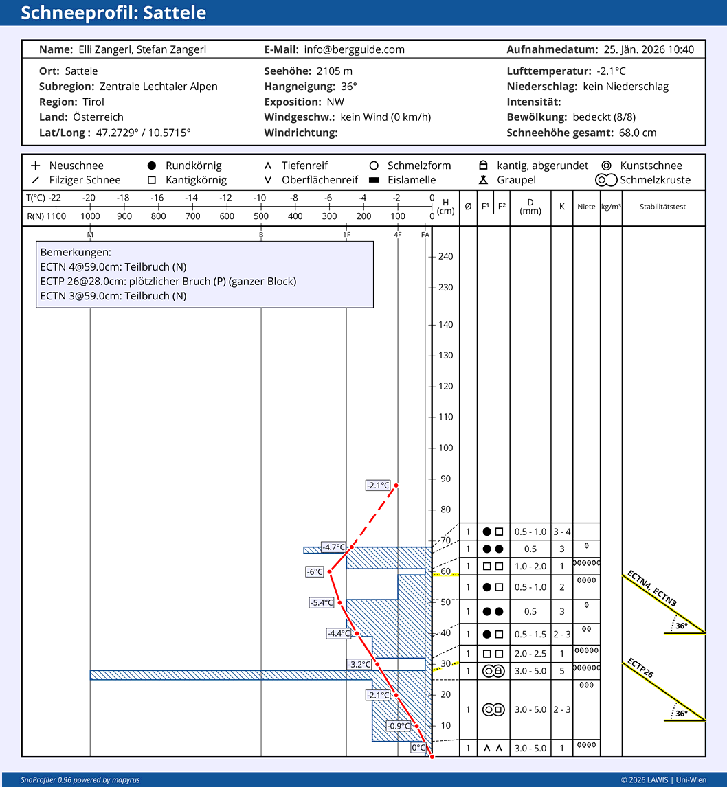
Parallel to the fresh snowfall since Sunday, 26.01, increasingly frequent reports of alarm signals arrived at headquarters, at least in those regions which had the most snowfall. Alarm signals are unmistakable signs of a critical avalanche situation and must be taken very seriously. Therefore, we strongly advise adapting your conduct to the current avalanche danger. Below are a few photos to make the situation visible.
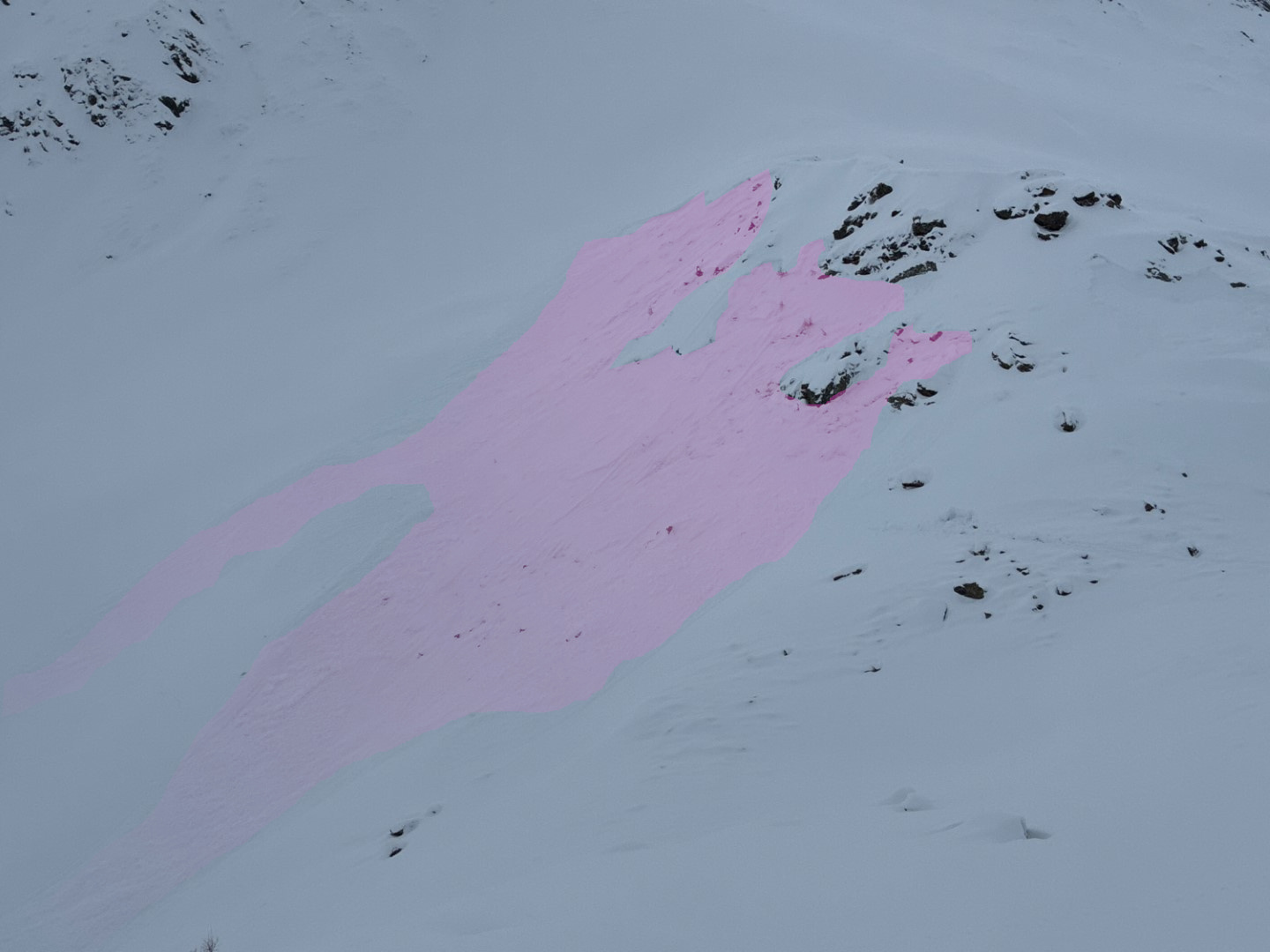
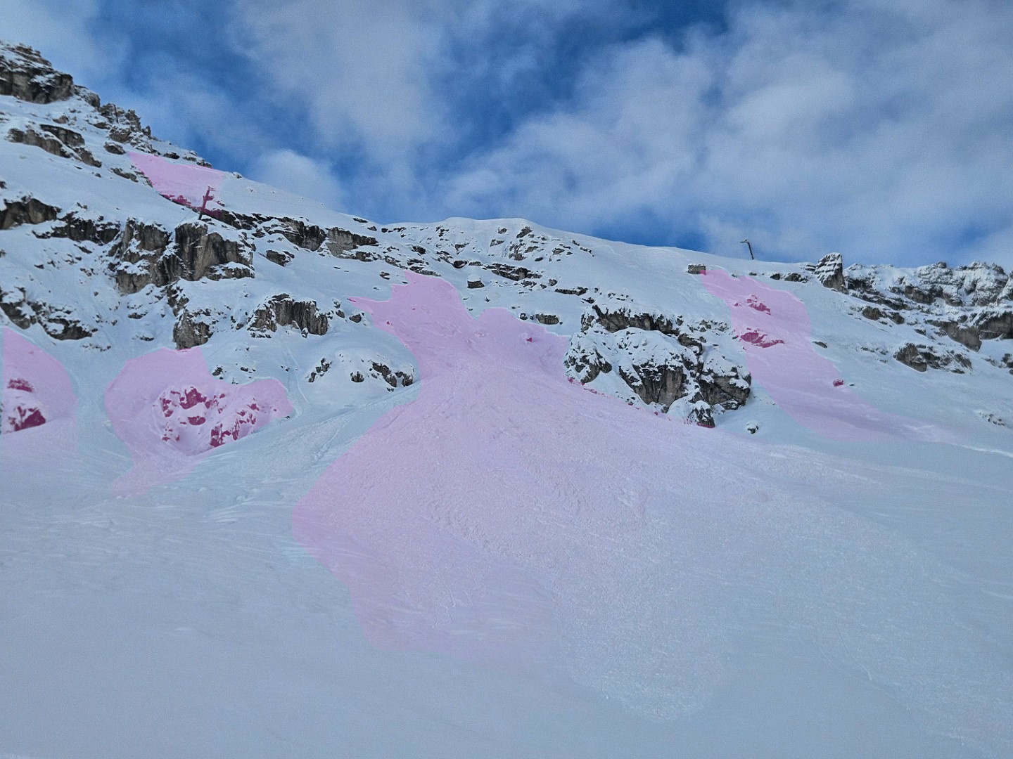
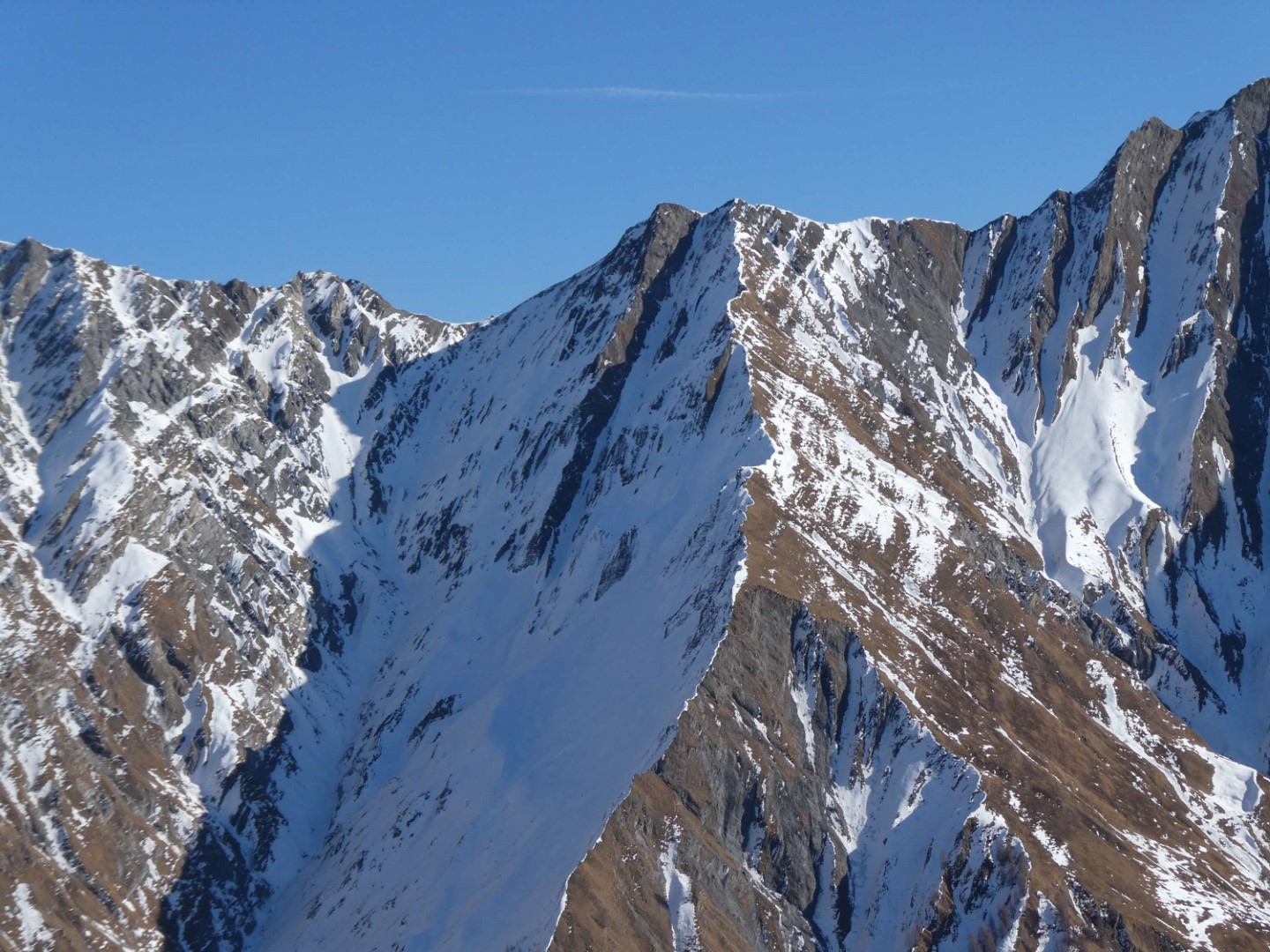
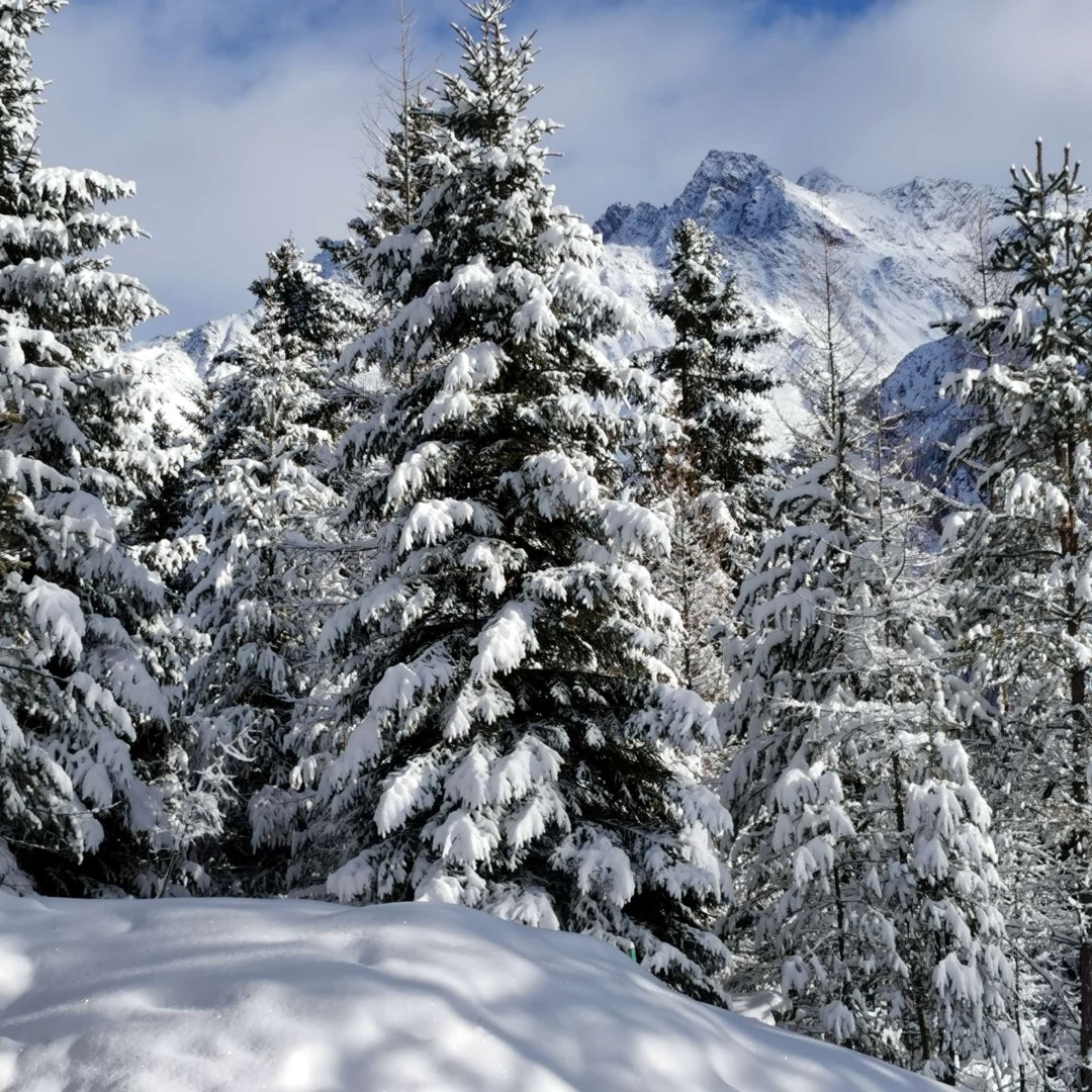
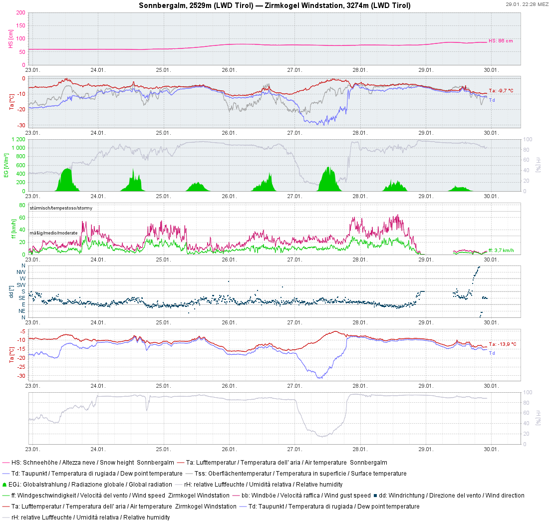
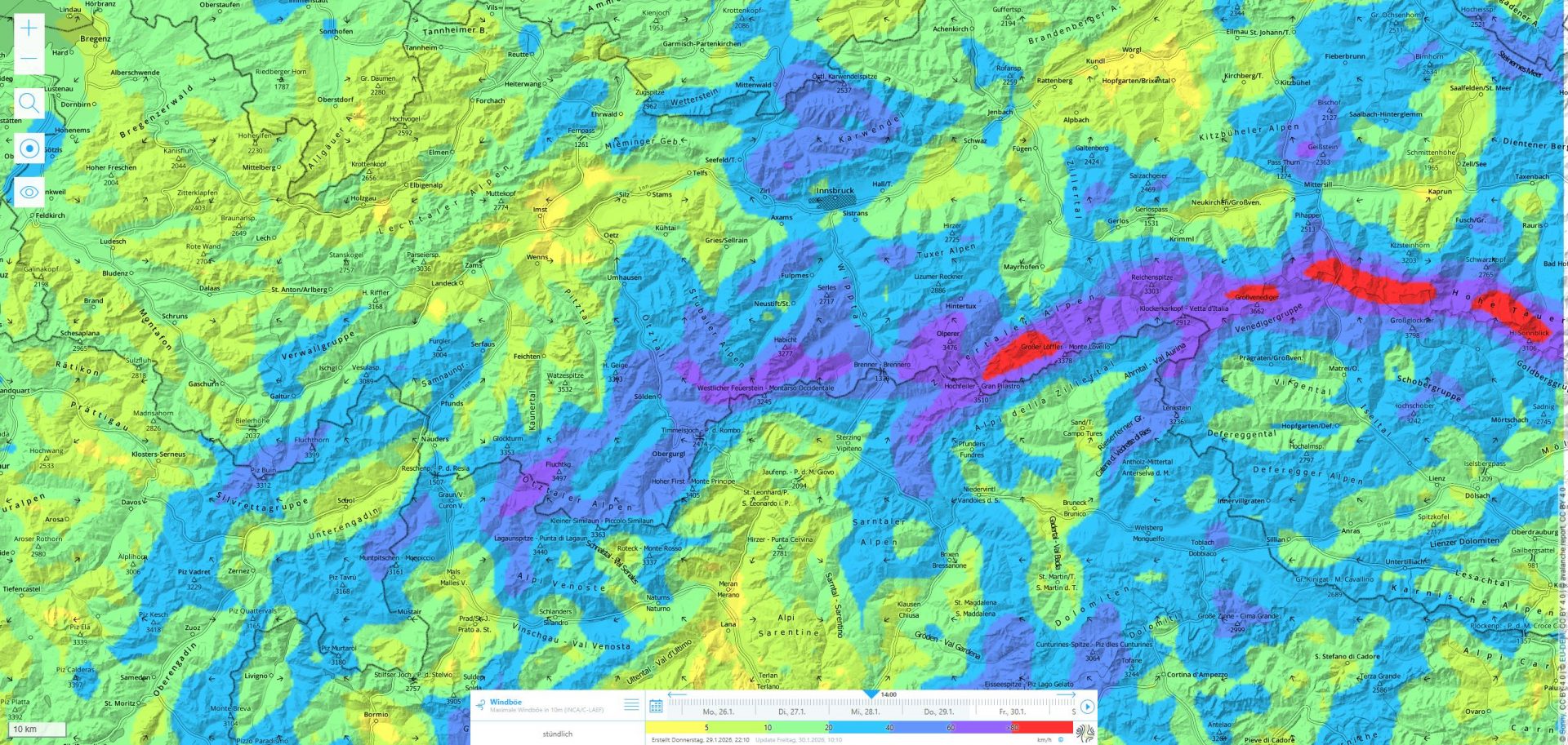
So – following a long period lacking precipitation – starting on 24.01, also in the southern regions, there has been more snowfall. This was generally about 40cm, more from place to place. The fresh snow, at least on Wednesday, 18.01, was accompanied by heavy wind impact and was transported. Thereby, fresh snowdrift accumulations were generated which during the following bouts of fresh snowfall thereafter, were blanketed. Thus, danger zones cannot be seen anymore.
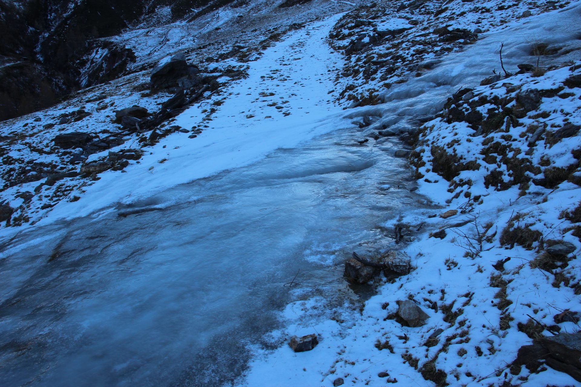
On the one hand, we observed it ourselves; on the other, we received reports about it: easily visible ice flows were recently blanketed with fresh snow and thus are no longer visible. Concrete example: approach to Zwieselbacher Rosskogel from Haggen (first curve) – Sellrain region, Alpein mountains.