Without much change, we are still faced with an extremely prone-to-triggering snowpack widespread. Reports we receive daily including today, 15.01, corroborate this assessment: reports of avalanche releases from winter sports enthusiasts, of settling noises, fractures on the surface and remote triggerings. Avalanche danger is receding continually, but only slowly. Experience and restraint are thus imperative in outlying terrain. Briefly, we also analyze in detail the fatal avalanche incident below the Wetterkreuz on 11.01.2026.
Avalanche incident analysis Wetterkreuz (11.01.2026)
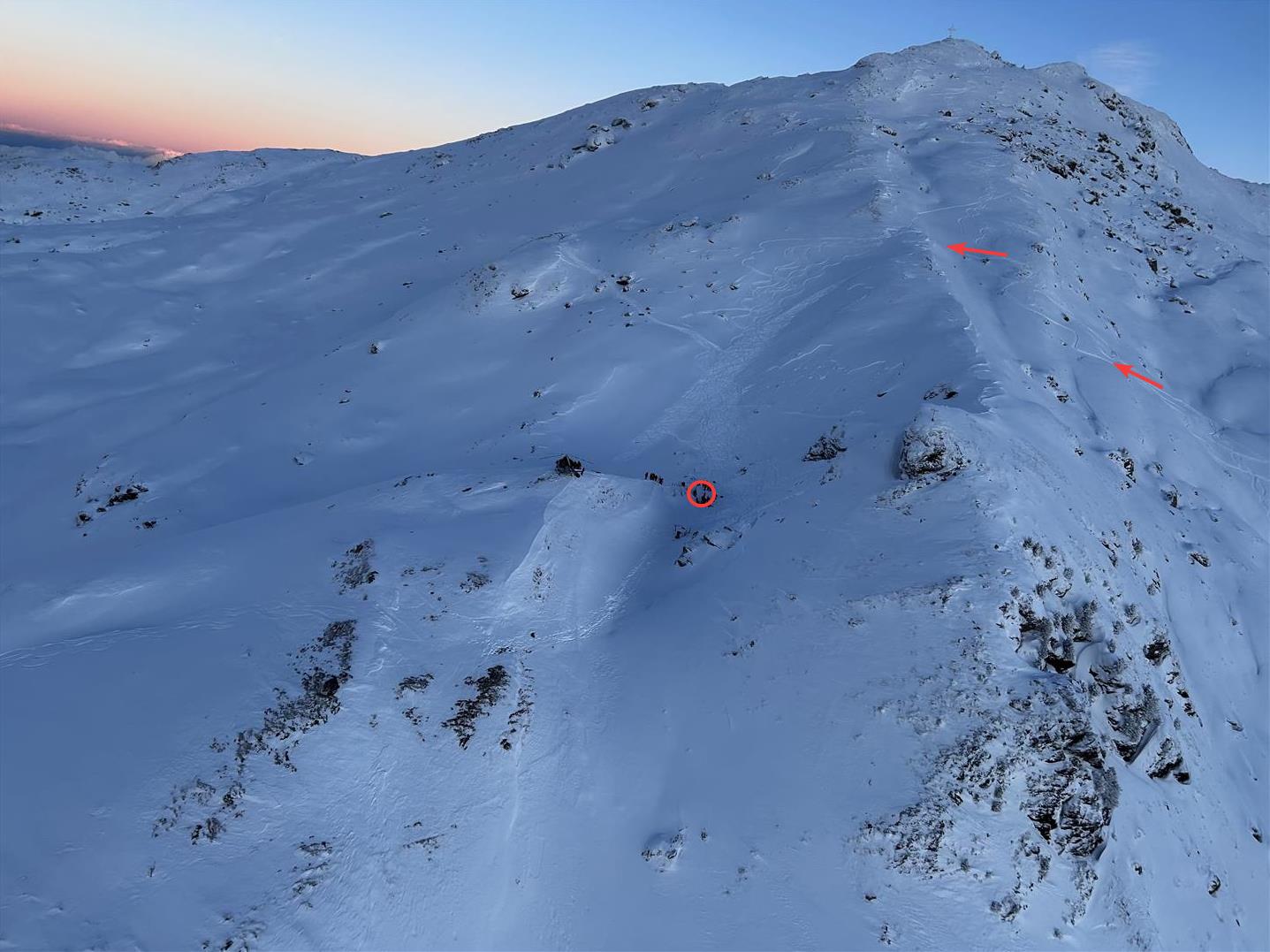
Two persons launched their skiing tour from Gasthaus Hüttegg, initially over the secured ski run, then over backcountry terrain towards the Gilfert. In the area of the Wetterkreuz below the Gilfert they ended their tour and decided to descend on the north-facing slopes. They proceeded to follow the four already evident fresh ski tracks. The persons maintained their distance from each other on the descent. When the person skiing first crossed the north-facing slope, a 100m-wide, 40m-long slab avalanche triggered on the 35°-steep north-facing slope, with an average fracture depth of about 30cm.
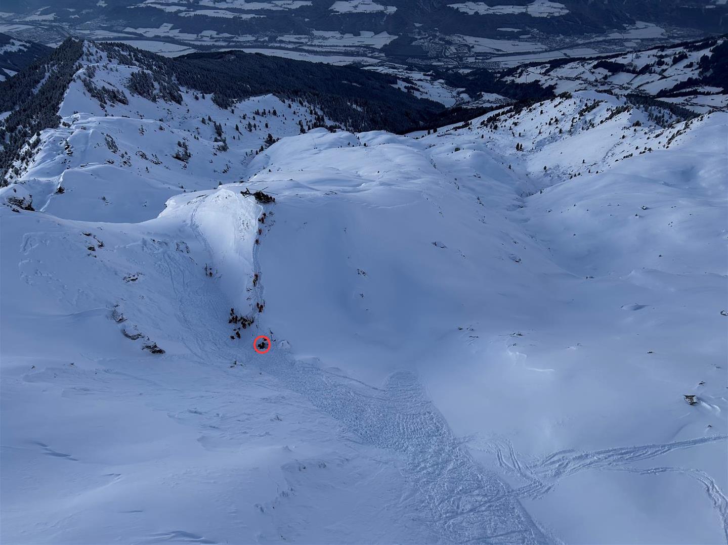
The person skiing second was outside the slab path, perceived it immediately and tried to warn the first skier. But the first skier was caught in the slab and in a terrain drop of 1.7 metres buried deeply in snow masses. Due to a lack of emergency equipment, no efficient rescue operation could be carried out. Very rapidly – just 10 minutes after the avalanche triggered – the first rescue team arrived. After approximately 90 minutes, the person who was buried in snow was uncovered through snow probes, but died the same day in the clinic.
The snowpack
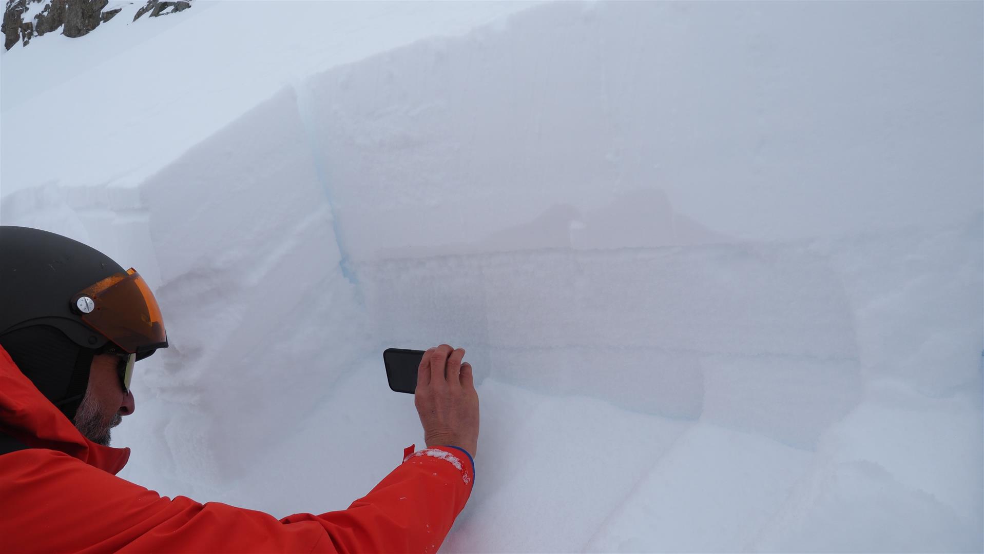
Near the avalanche, we carried out a snowpack analysis together with the Alpine Police and one of our observers on 12.01. What was decisive was the combination of fresh fallen snow/freshly generated snowdrifts and a very weak snowpack surface.
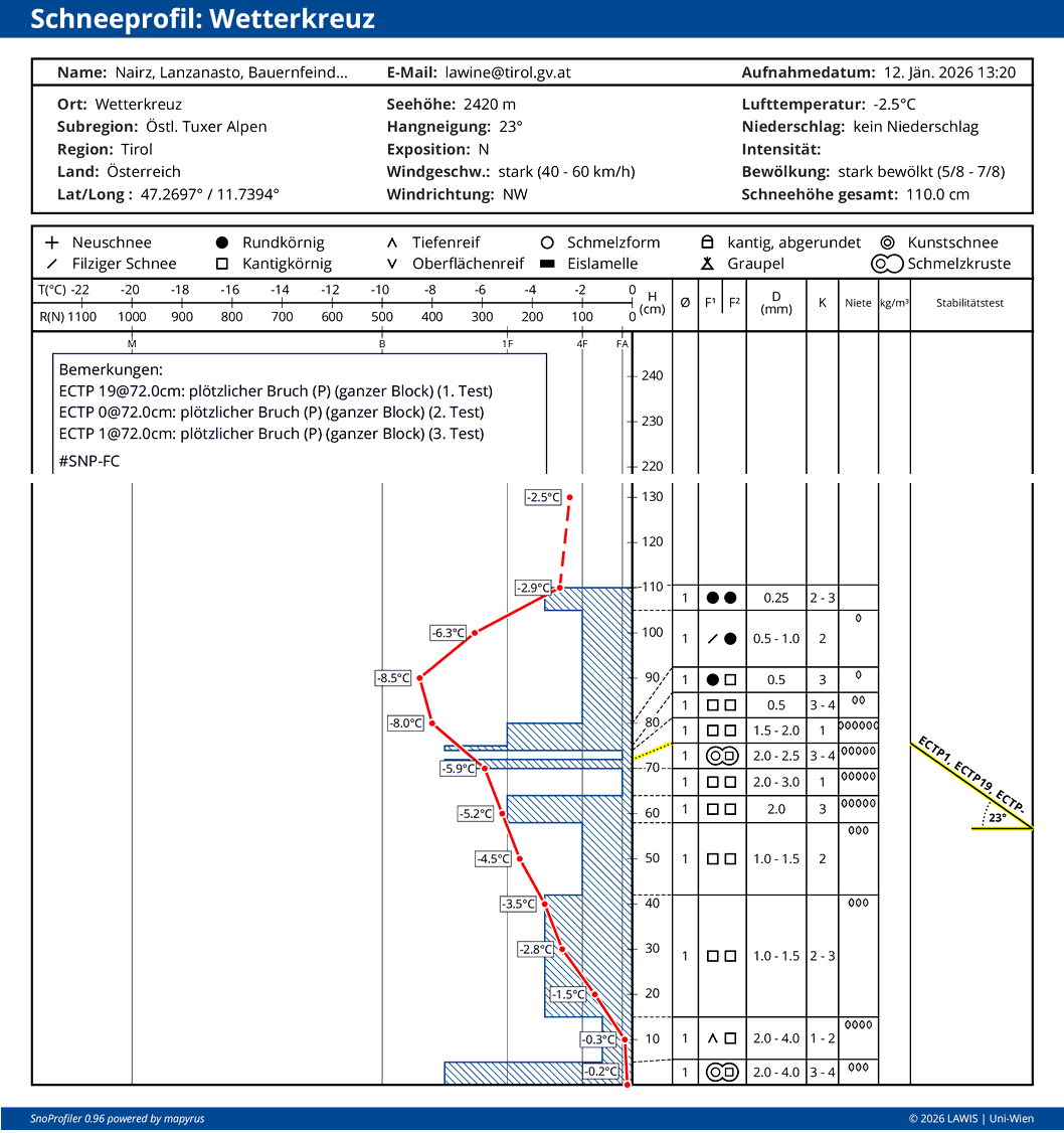
As in far-reaching parts of Tirol, the snow depths were below average for this juncture of the season. What stood out most was the disparity between the snow cover in the region of ascent and behind the ridge, where many snowdrift accumulations lay deposited.
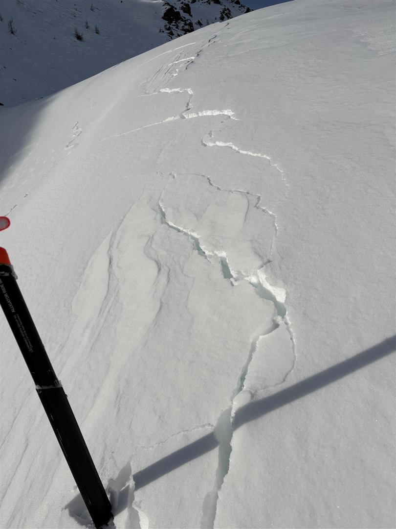
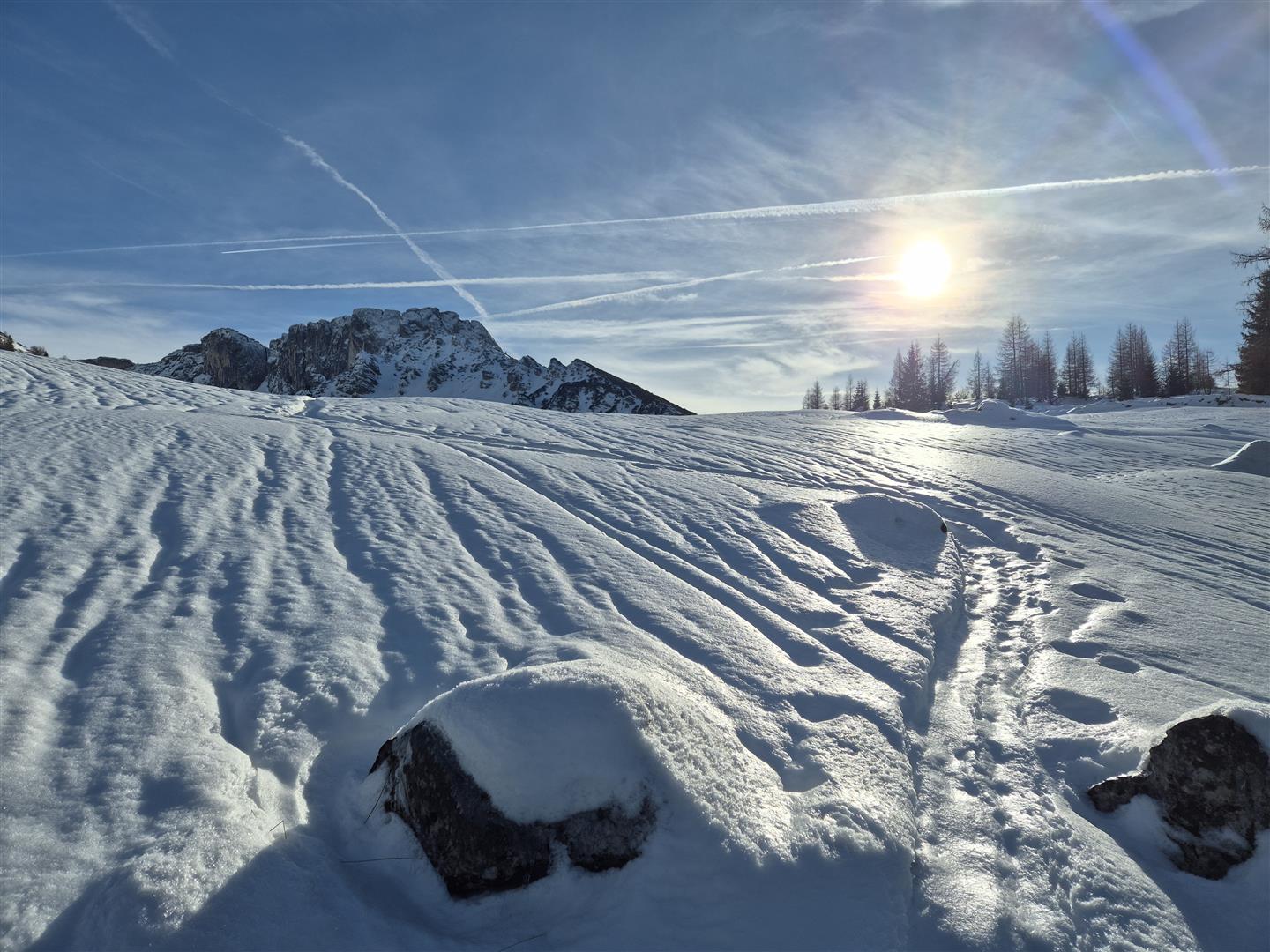
Ongoing alarm signals point to a snowpack prone to triggering
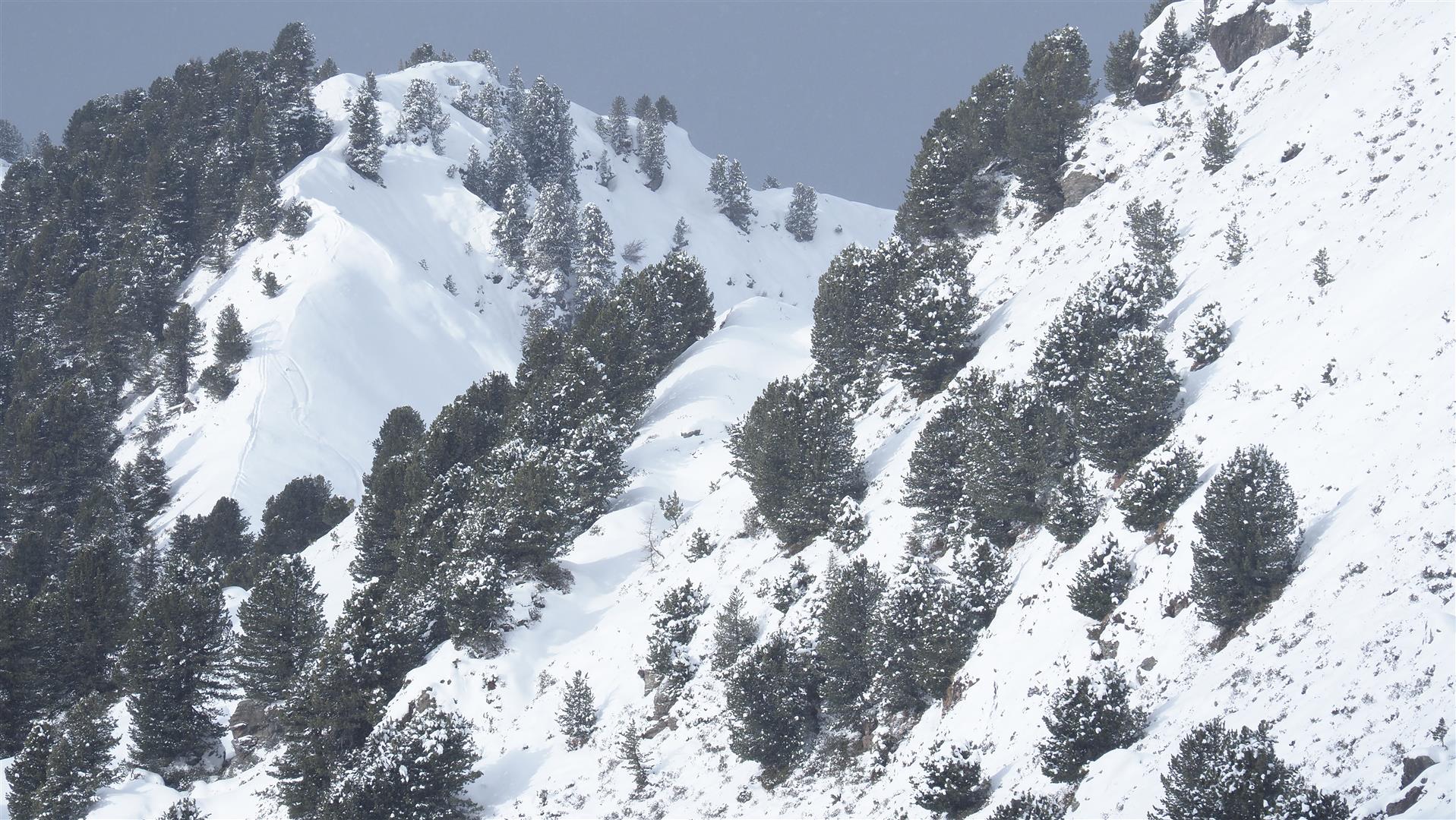
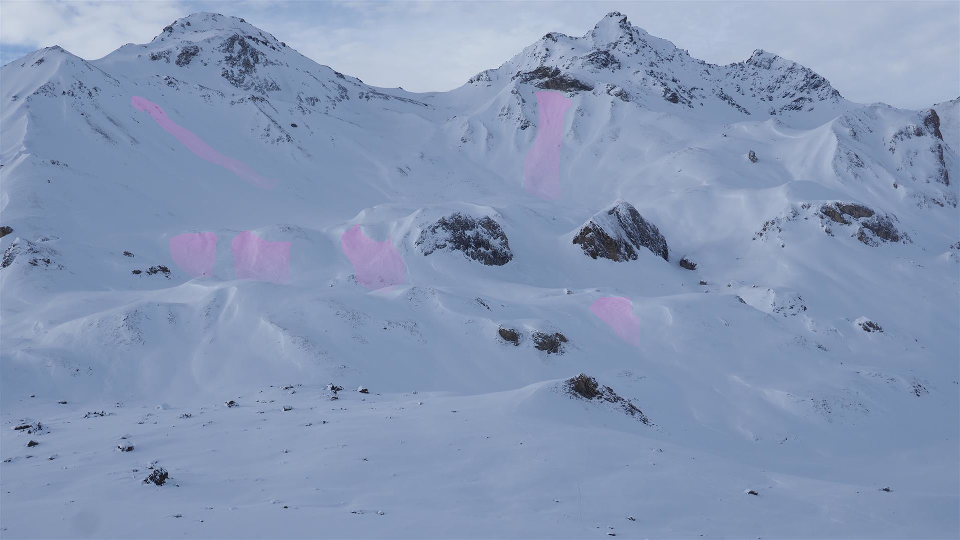
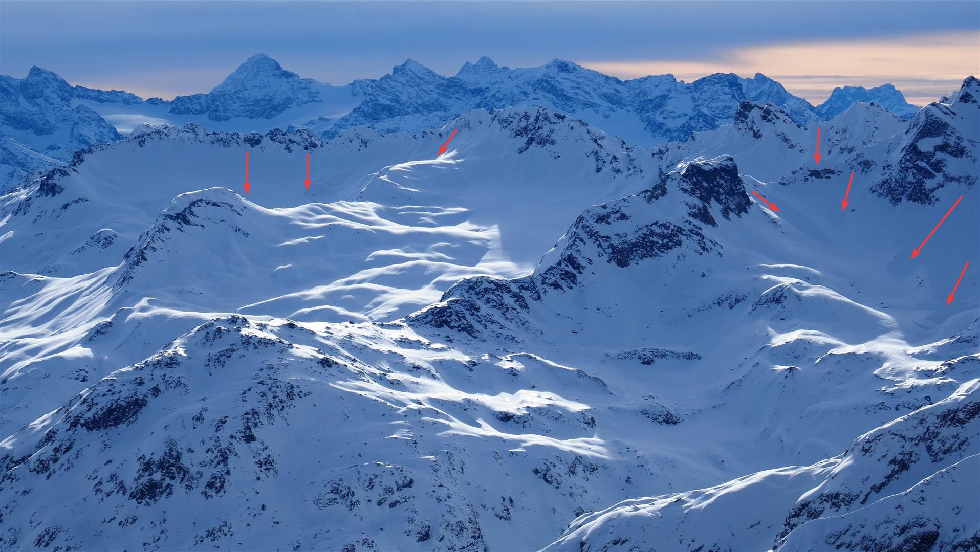
As already mentioned, reports arrived daily all last week about the host of alarm signals, in other words, fresh avalanches, settling noises, fractures forming on the surface and, in addition, remote triggerings. We hope that several photos, complementing those in our last blog, will give a fuller impression of the unusual, long period of reports from outlying terrain.
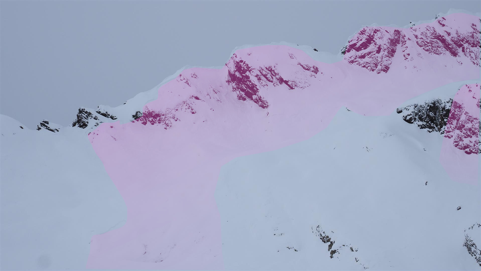
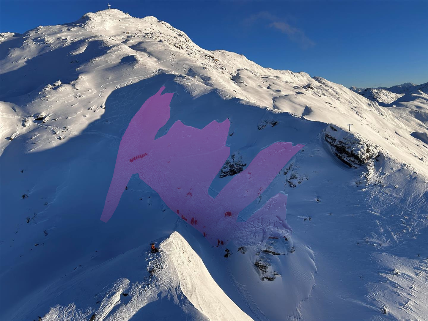
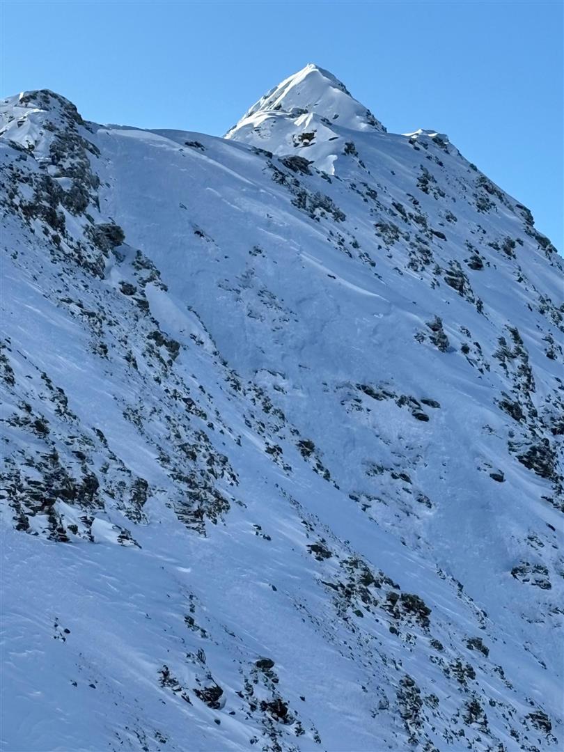
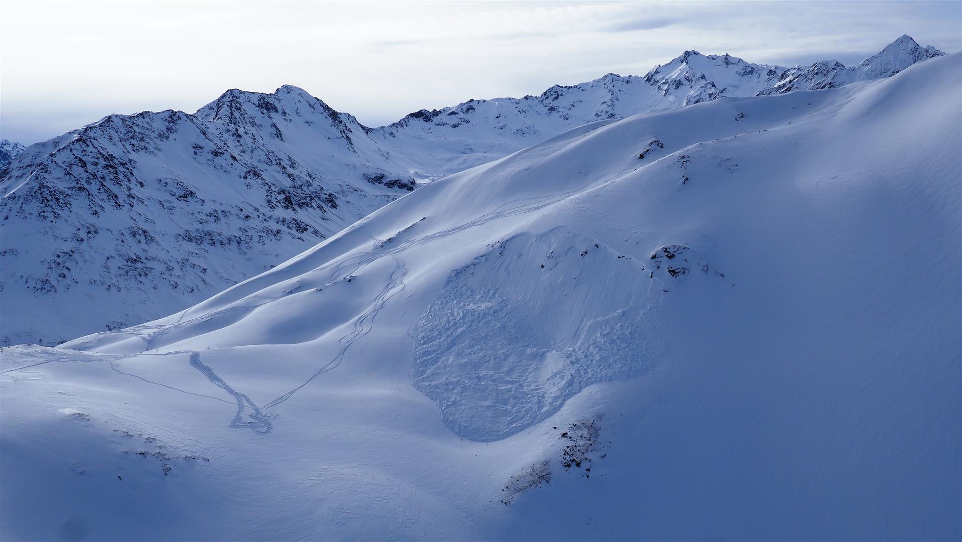
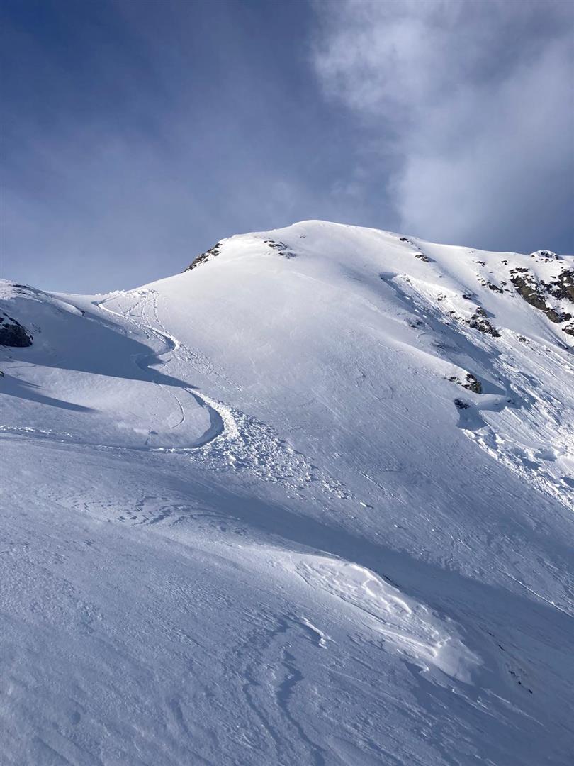
Avalanche releases
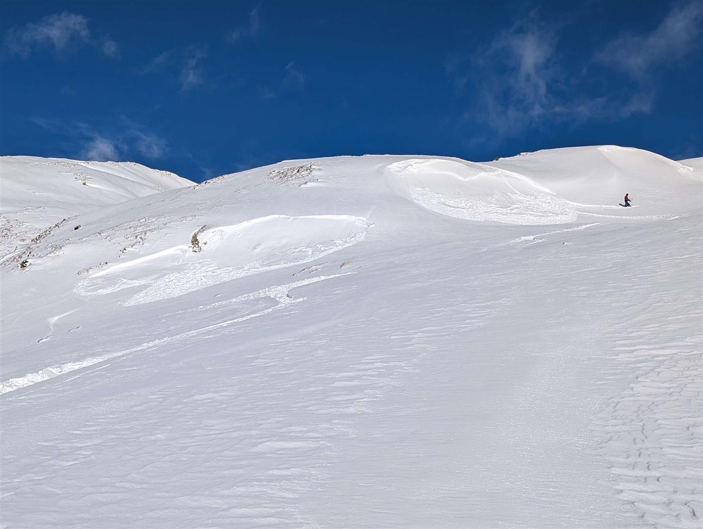
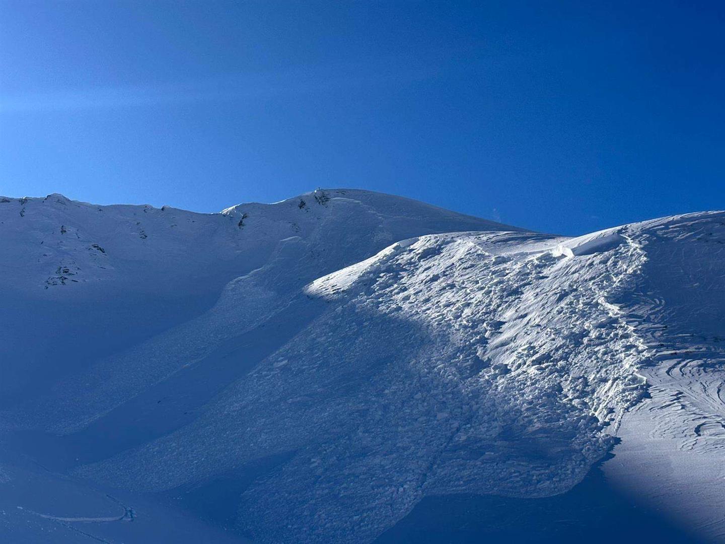
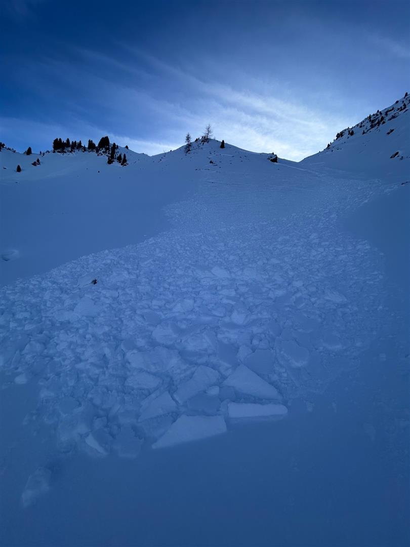
Fractures on the surface, settling noises
Further details about last week
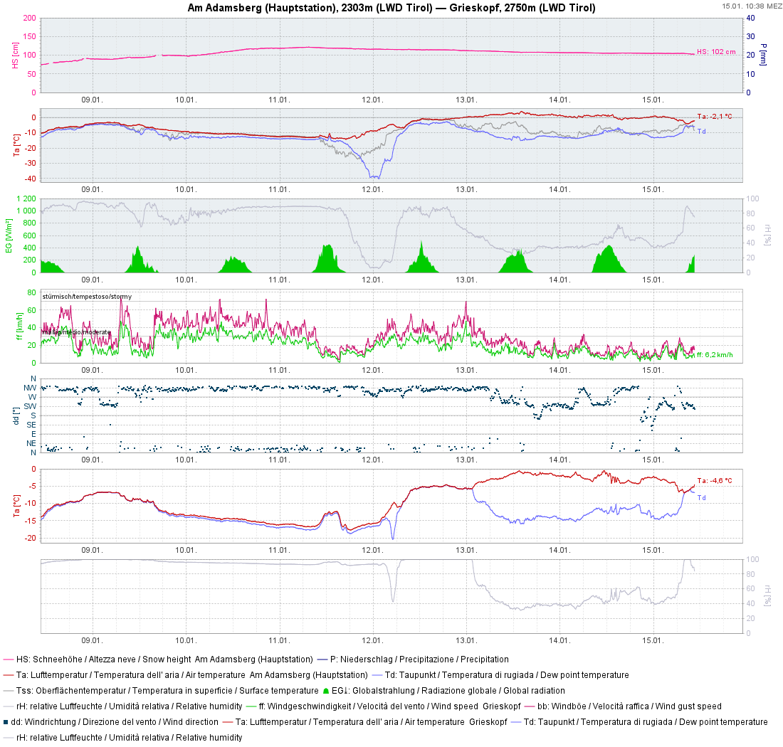
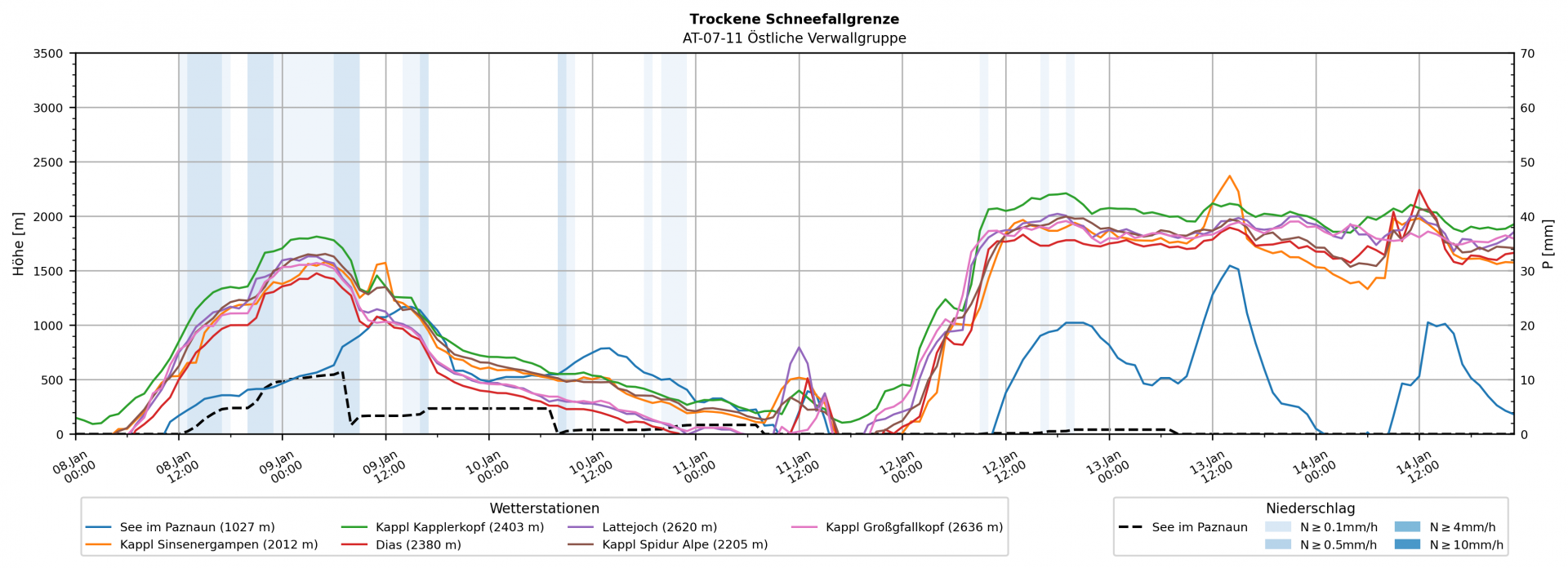
To complete our last Blog, a few final remarks: Fresh fallen snow plus strong-velocity winds dominated the weather from 08.01 until Sunday, 11.01. On Sunday, weather conditions improved during the morning hours. A brilliant sunny day followed, full of people in outlying terrain as a delicate avalanche situation prevailed widespread. On Monday, 12.01, a warm front brought a bit of precipitation: rainfall widespread up to 2000m. However – and this was a surprise to us – we found a thin rain crust up to 2600m during our flight with the Airbourne Police, which must have been generated on 12.01. Therefore, a huge request: we are currently highly interested in reports about this recently generated near-surface crust (send reports of location and altitude directly to SNOBS), since this may well have an effect on avalanche danger in the future (expansive metamorphosis of snow crystals near this crust).
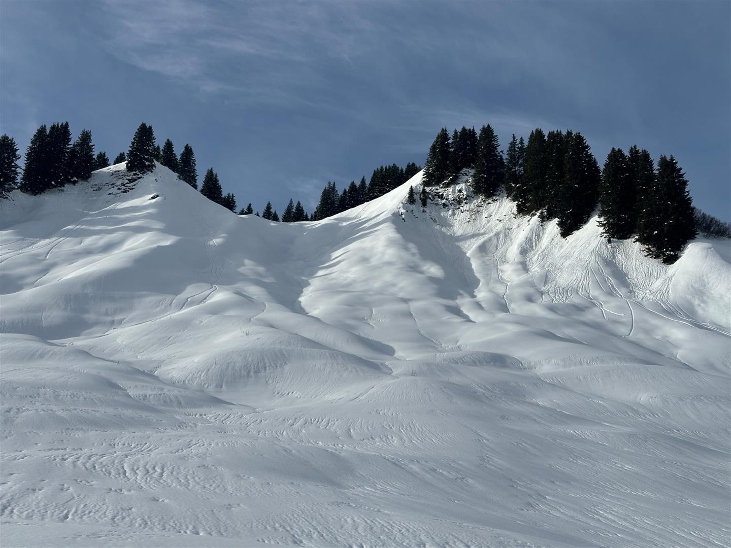
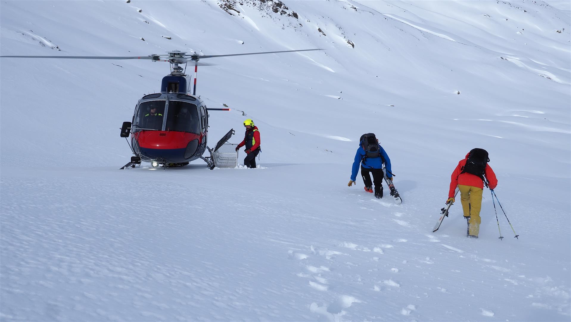
On 13.01 with the help of the Airbourne Police and their helicopter, we gained an overview of the situation. A few impressions follow below.
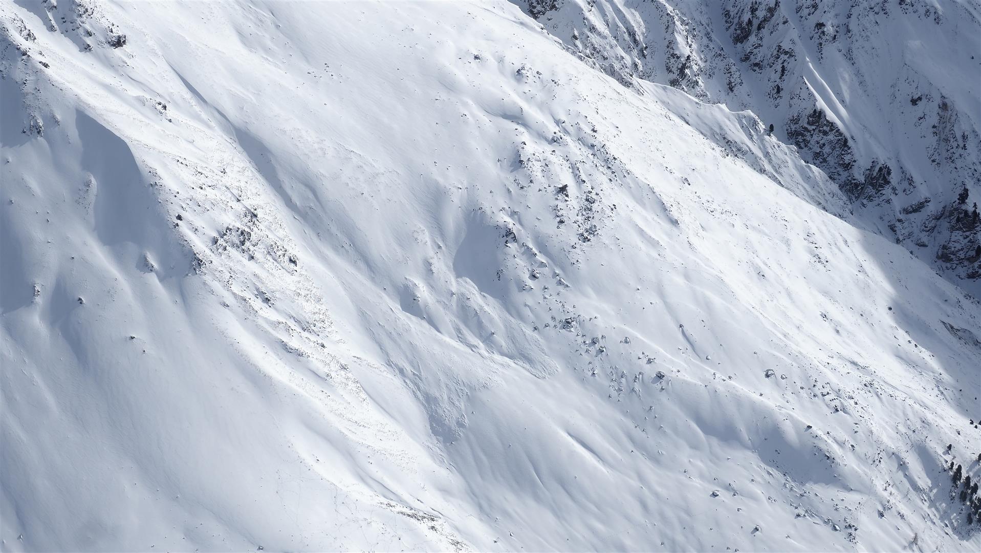
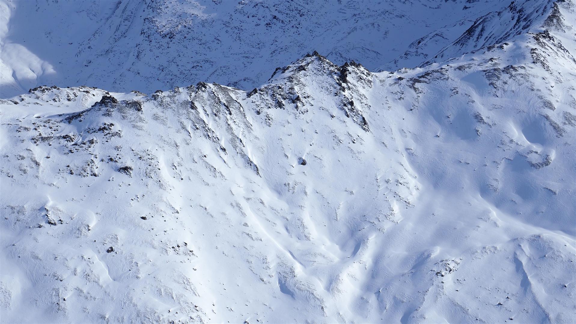
The snowpack throughout the land is similarly structured, i.e. poor. Only the snow depth varies. Currently, most snow lies in western regions of North Tirol and in northern East Tirol at high altitudes.
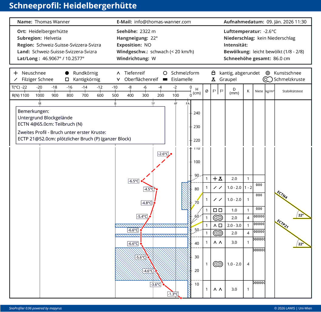
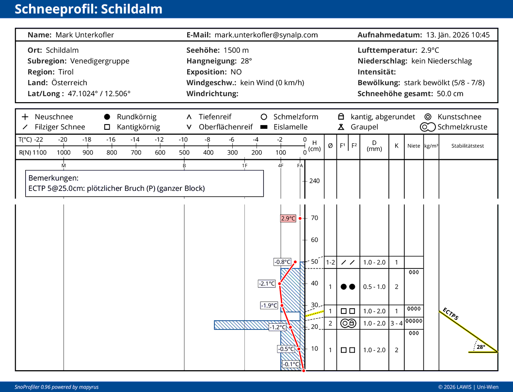
Other profiles can be looked at here on our website:
What lies ahead?
According to Geosphere Austria (GSA), the air current in western Austria will shift heavily towards the south as the weekend approaches, conditions will be slightly foehn-impacted. Air masses moving in will be mild. Precipitation not in sight.
Avalanche danger will gradually recede. We still expect a widespread heightened likelihood of avalanches triggering. Whenever the snowpack is the essential problem, the terrain is the solution! Therefore, we plead with all of you: continue to conduct yourselves defensively in your route selection.