Some fresh snow in East Tirol. Moderate avalanche danger regionally.

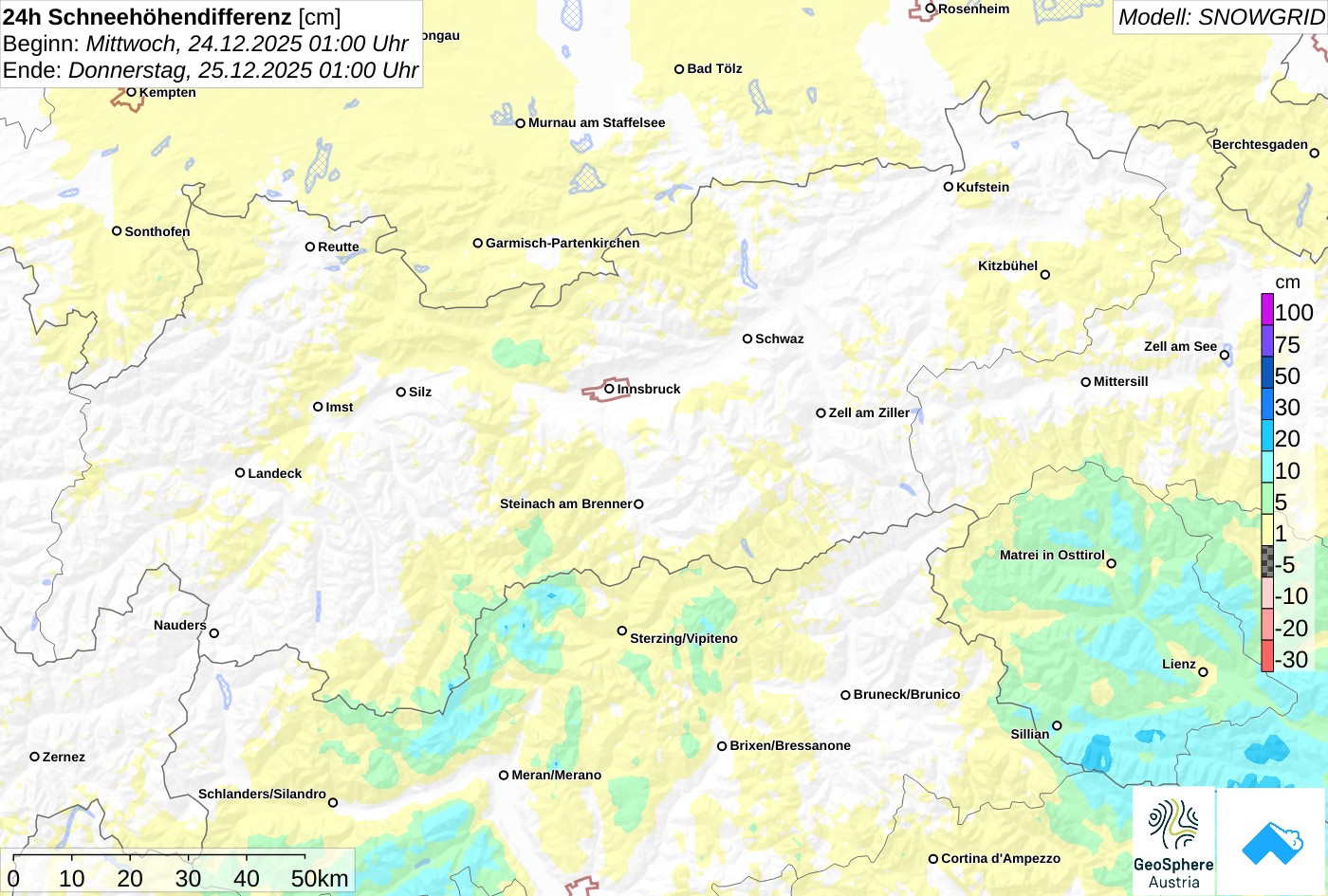
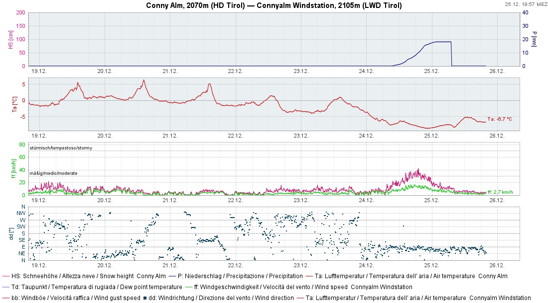
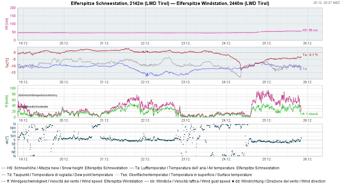
Punctually on Christmas Eve temperatures dropped to wintery levels and snowfall arrived down to the valley floor in East Tirol. About 10-20cm was registered in the mountains, nearly nothing in North Tirol. As a result of stiff easterly winds, snowdrifts accumulated from place to place, particularly where there was fresh fallen snow. Most were small but in unfavorable terrain sufficient to force a fall with possible injuries. Outside of secured ski-runs, skiing conditions remain downright miserable.

Current situation

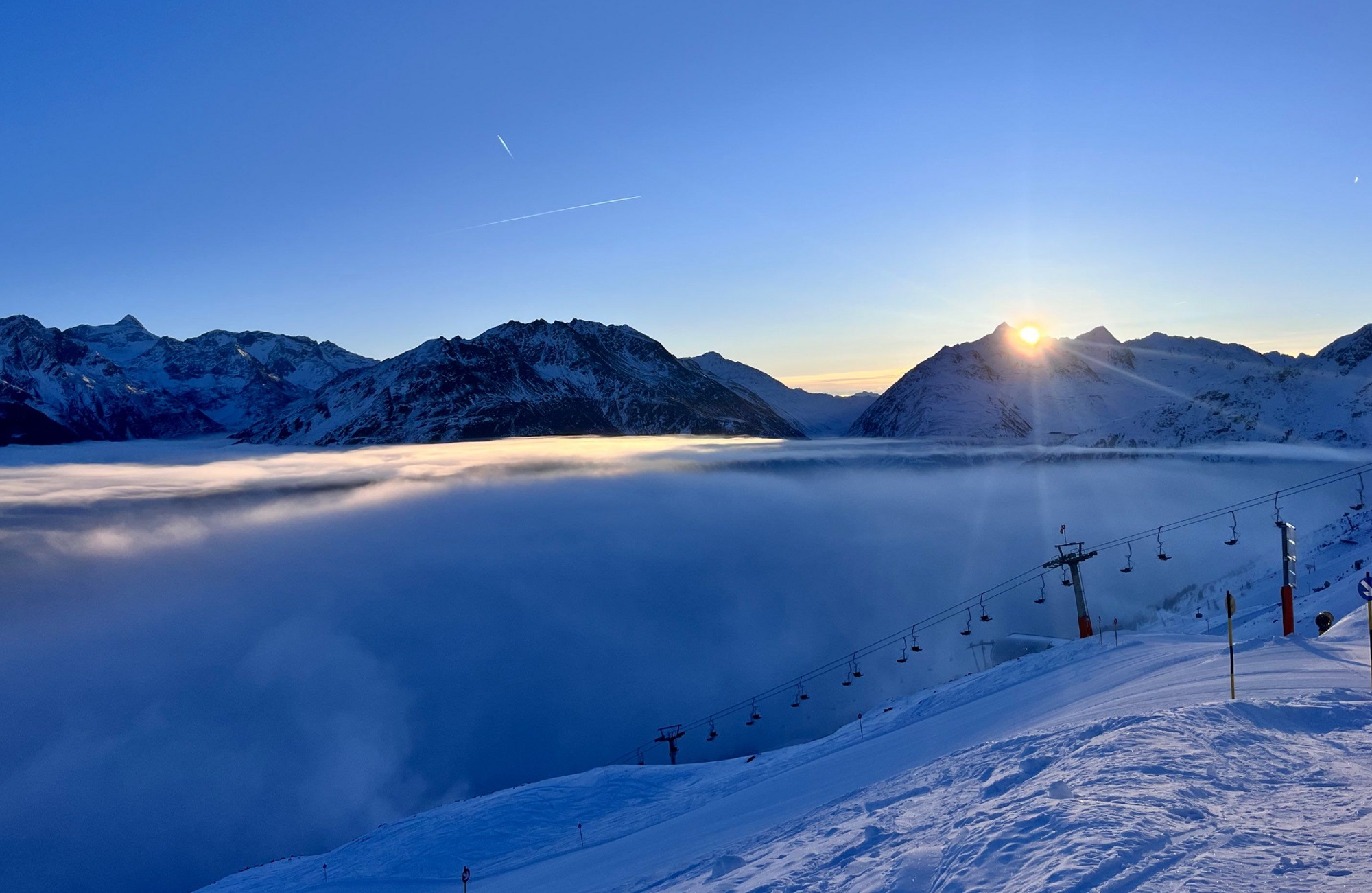
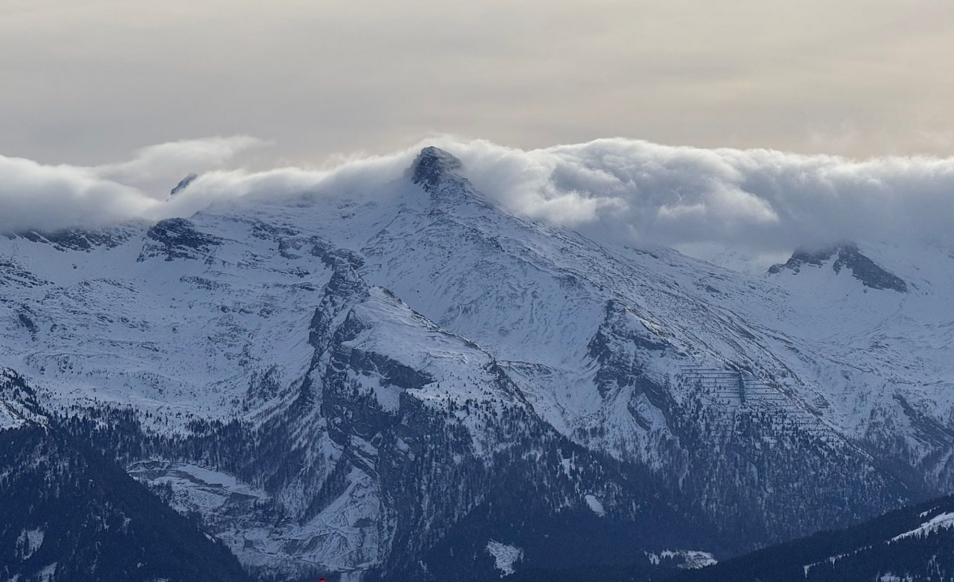
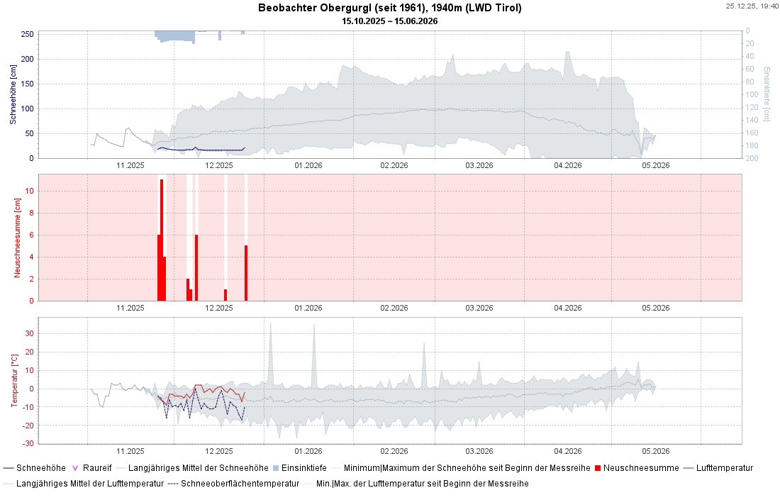
White Christmas in East Tirol

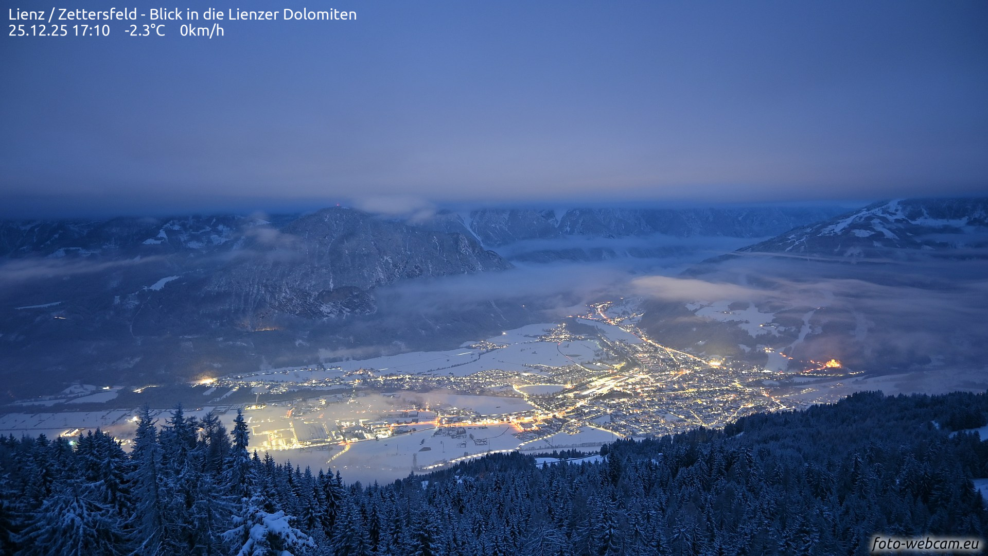
On Christmas Eve there was snowfall in East Tirol extending down into the Lienz basin. It was made possible by the interplay of cold air masses from the east and moist air masses from the Mediterranean. It was hardly heavy snowfall, but in view of the current snow situation even a little bit is welcome.

In southern East Tirol 10-20cm of fresh snow was registered, further north, less. The snowfall was accompanied by frequently strong easterly winds.

Pünktlich an Heiligabend schneite es in Osttirol bis zu 20cm. Nordtirol ging weitestgehend leer aus.
Punctually on Christmas Eve, up to 20 of fresh fallen snow in East Tirol. North Tirol got next to nothing.
An der Wetterstation Conny Alm am Golzentipp ist der Temperaturrückgang deutlich zu erkennen. Der Wind blies aus östlichen Richtungen.
At the Conny Alm weather station on Golzentipp the drop in temperature is clearly visible. Winds were blowing from the east.
Das winterlich verschneite Lienzer Becken am Weihnachtstag (©foto-webcam.eu, 25.12.2025).
The snowed-in basin of Lienz, a wintery Christmas Day. (©foto-webcam.eu, 25.12.2025).
Südstau am Tuxer Hauptkamm (©Stefan Ortner, 23.12.2025).
Southern barrier clouds on the main Tux ridge. The snowpack is still paper-thin. (©Stefan Ortner, 23.12.2025).
Wetterstation Elferspitze in den Stubaier Alpen: auch hier ist der markante Temperaturrückgang am 24.12. zu erkennen. Der Wind blies an der Station in Böen stürmisch.
Eiferspitze weather station in the Stubai Alps: also here, the descent in temperature on 24.12 is visible. Winds were gusty-to-stormy at the station.

Effects on avalanche danger

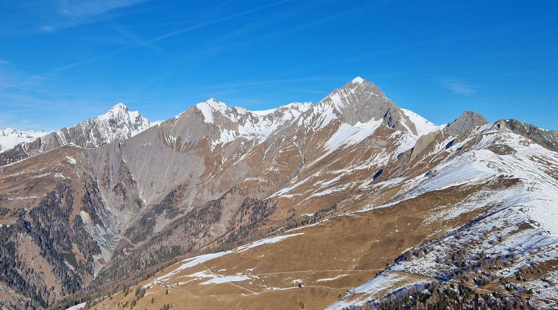
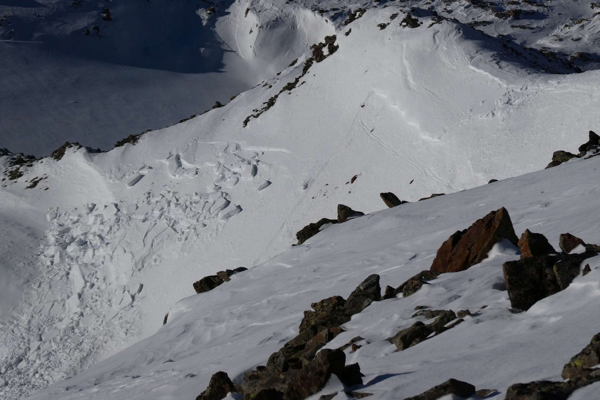
In the mountains of East Tirol the loosely-packed fresh snow was transported by winds, generated fresh snowdrift accumulations. On shady slopes at high altitudes, these were deposited on top of an expansively metamorphosed, shallow old snowpack, on sunny slopes it often fell on bare ground. The currently relevant danger zones are thus concentrated on precisely these north-facing slopes, where in very steep terrain small snowdrifts can be triggered from place to place. The azure skies are cloudless and visibility is superb, so these are easily recognized and can be avoided. These small-sized drifted masses are especially perilous in terrain where falls are risky.

In North Tirol, on the other hand, the situation has changed little since last week, avalanche danger remains low. Due to gusty, often strong-velocity southeasterly winds, isolated small-sized but trigger-sensitive snowdrift accumulations were generated behind protruberances in the landscape on shady slopes above 2600m. Slab avalanches in the old snow are unlikely to trigger at this time, the slab metamorphosed expansively during the period of fine weather so fractures can hardly be expected to propagate.

Der Neuschnee vom 24.12. fiel an Sonnenhängen, wie hier im Bereich der südlichen Granatspitzgruppe, zumeist auf aperen Boden (©Robert Trost, 21.12.2025).
On sunny slopes the fresh fallen snow from 24.12 fell mostly on bare ground, such as here near the southern Granatspitze (©Robert Trost, 21.12.2025).
Kleine frische Triebschneepakete – wie hier exemplarisch am Bild vom Hinteren Daunkopf in den Stubaier Alpen – können in den nächsten Tagen gebietsweise noch ausgelöst werden (©Barbara Fink, 20.12.2025).
Small, freshly drifted snow masses, such as in the photo from Hinterer Daunkopf in the Stubai Alps, can be triggered over the next few days from place to place (©Barbara Fink, 20.12.2025).

Coming developments

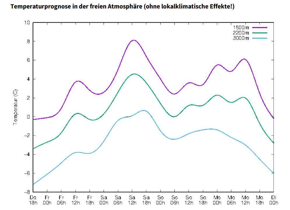
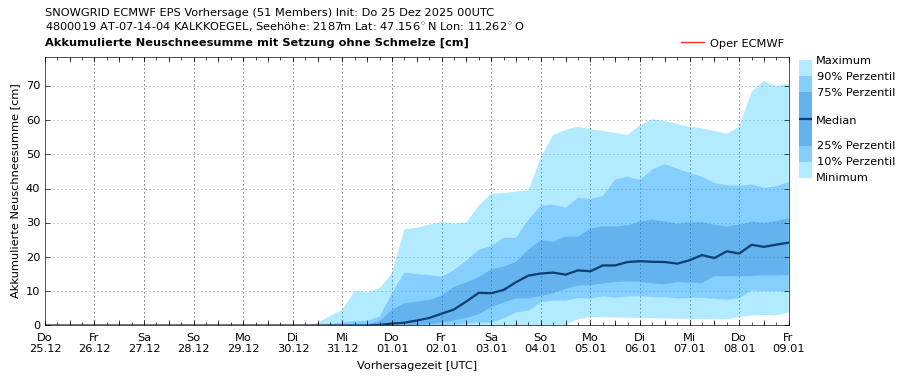
The lack of snow sets clear-cut limits to any plans in outlying terrain, and even the fresh snowfall is more enjoyable to look at than to ski on. Until at least the end of the year this situation is not expected to change. Over the weekend we will have picture-perfect weather amid mild temperatures.

As the new year approaches, temperatures will drop feelably and a possible weather shift is conceivable in the early days of the new year, including snowfall. Long-term weather forecasts are untrustworthy, but we can hope.

Die Messreihe unseres Beobachters in Obergurgl (1940m) reicht bis 1961 zurück. Die Aufzeichnungen des bisherigen Winters zeigen überdurchschnittliche Temperaturen bei unterdurchschnittlichen Schneehöhen.
Measurements from our observation station in Obergurgl (1940m) go back to 1961. The graphs from this winter depict above-average temperatures and below-average snow depths.
Am Wochenende steigt die Frostgrenze über 3000m an, zum Jahreswechsel hin fallen die Temperaturen wieder auf winterliches Niveau (©GeoSphere Austria).
The zero-degree level will ascend to over 3000m on the weekend, at the change to the new year temperatures will drop again to a wintery niveau. (©GeoSphere Austria).
Ab Samstagnachmittag, 27.12. kommt in Osttirol Nordföhn auf (©Landeswetterdienst Südtirol).
Starting on Saturday afternoon, 27.12, foehn winds will arise in East Tirol (©Landeswetterdienst Südtirol).
Die Prognose der akkumulierten Neuschneesumme für die Kalkkögel lässt zumindest fürs neue Jahr wieder Hoffnung aufkommen.
Forecast of accumulated amounts of fresh snow for the Kalkkögel permits an ounce of hope to arise in the new year.

The entire team of the Avalanche Warning Service of Tirol wishes everyone Merry Christmas and a relaxing holiday season.