Onset of winter at the end of April, short improvement at the beginning of May, and then winter will be back again:
Following heavy foehn impact, winter struck again on 26 April.
 |
| Lots of fresh snow in some parts of Tirol |
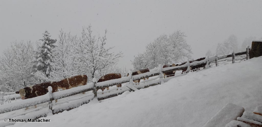
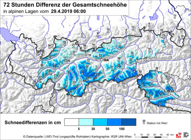
The southern regions won the prize: between Friday 26.04 and Monday 29.04, there was 75 cm of fresh snow registered. Strong winds were blowing in the heights.
 |
| Onset of winter at the end of April: above Lienz in East Tirol (photo: 28.04.2019) |
 |
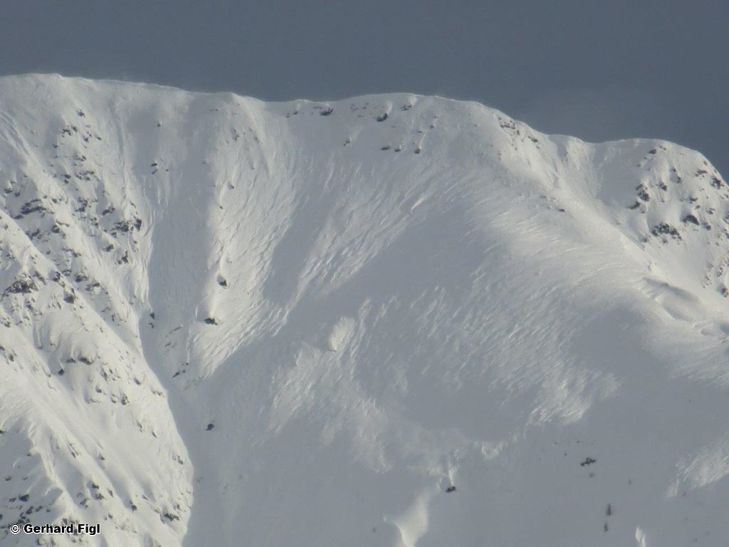
| Wind-transported snow from previous days on the Carnic Ridge (photo: 01.05.2019) |
 |
| Southern Ötztal: the start of the bad-weather phase with lots of precipitation and unseasonably low temperatures, some heavy wind impact. On 1 May, improvements, rising temperatures, but with increasing humidity. |
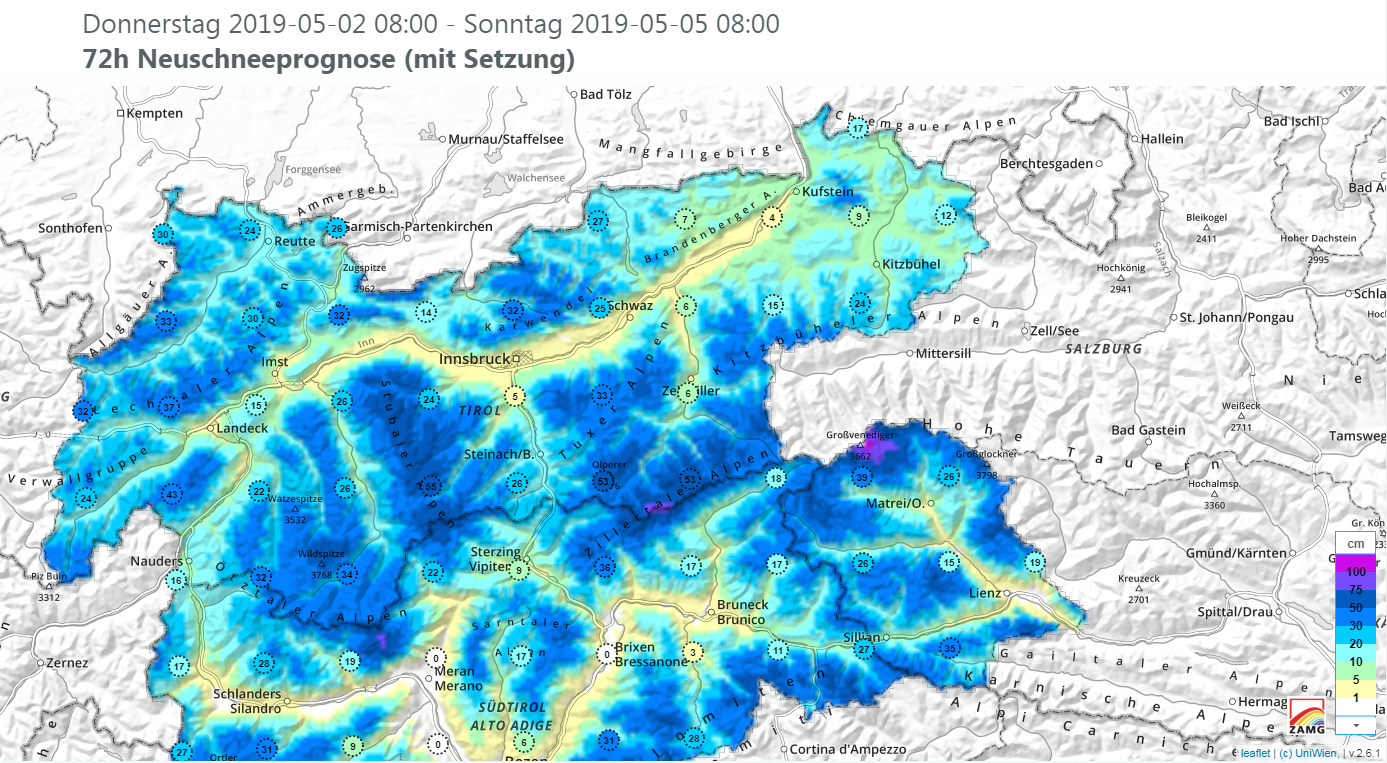
And now, at the beginning of May, the ZAMG weather forecasters predict another outbreak of winter. In wide-ranging parts of Tirol, up to 50 cm of fresh snow is anticipated in the heights. Plummeting temperatures will bring snowfall down to low lying areas. Strong winds are expected over widespread areas.
Effects of the anticipated fresh snow on avalanche danger levels:
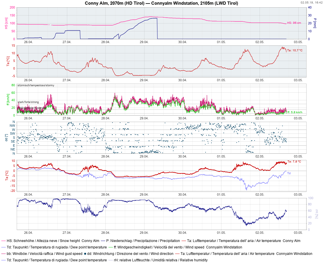
First, let’s have a look at the current situation: at high altitudes there are still above average masses of snow for this juncture of the season, while spring long ago made its entrance in low lying areas.
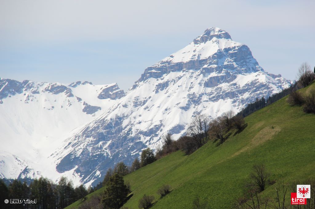
 |
| View of Serles from Navistal in the Tux Alps (photo: 02.05.2019) |
Avalanche releases are currently limited to small loose-snow avalanches, mostly triggered by external impulses, isolated glide-snow avalanches and isolated slab avalanches (the latter especially in high alpine regions at present – 2nd May).
 |
| Loose-snow slides in the Silvretta at the end of April (photo: 01.05.2019) |
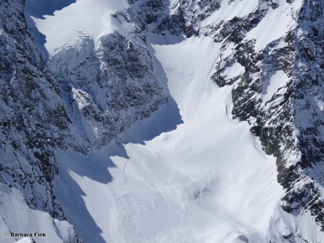 |
| Avalanche release initiated by a breaking serac in the southern Ötztal Alps (photo: 01.05.2019) |
 |
| These avalanches were artificially triggered by explosives at the end of April. (photo: 01.05.2019) |
The winter is fulfilling all wishes with regard to snow quality: just recently there was terrific powder snow in shady terrain at high altitudes, in many places on 1st and 2nd of May, even corn snow was to be had.
 |
| Descent from Mittlere Sonnenkogel in the southern Ötztal Alps (photo: 01.05.2019) |
 |
Due to a brief interim of very dry air, particularly on 1 May, there was corn snow well into the afternoon.
Tux Alps (photo: 02.05.2019) |
The low number of registered avalanches and stability tests showcase a very favourable situation. Only in high alpine regions does the danger pattern cold-on-warm (dp.4) threaten in some regions starting on 26 April, where a weak layer has formed in the surface layers. Reports of fresh releases come mostly from the regions along the Main Alpine Ridge where recent snowfall has been heaviest, especially on very steep, sunny slopes at 3000-3300 m, also adjacent to ridgelines.
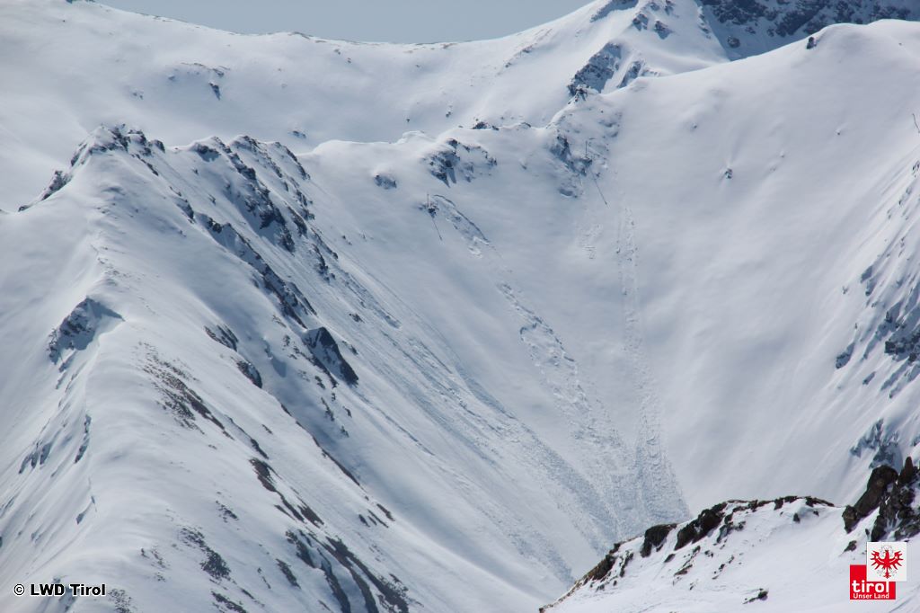
 |
| Snow profile, north, from 2 May in the Tux Alps: the sequence of crusts and softer layers is visible near the surface. Stability tests show stable layering. Fractures could not be propagated. The picture about 1000 m higher up is quite different, particularly on sunny slopes where the snowpack previously was moist or wet and was covered by cold, fresh snow at the end of April. Faceted crystals between crusts were probably the cause of avalanche releases involving persons. |
Weak layers near the surface at high altitude will probably also be the main problem in the coming snowfall. In addition, the loosely packed fresh snow could generate a weak layer for a brief interim if it gets blanketed over by snowdrifts.
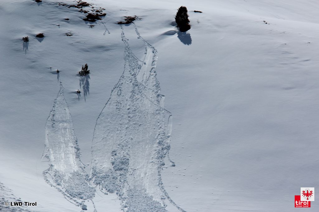
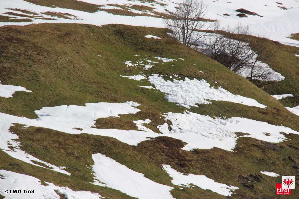
As was observed last week, fresh snow can glide on grass-covered slopes, especially when there is ample snowfall on bare ground.
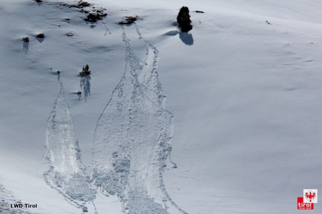
 |
| Gliding snowslides from the end of April. Similar things can be expected this coming weekend. (photo: 02.05.2019) |
To sum up, winter is not yet over. Avalanche danger still needs to be given serious consideration, apart from other mountain risks.