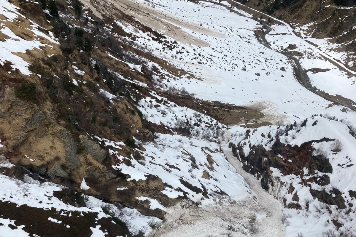
Am darauffolgenden Sonntag, 13.04. war die Luft merklich feuchter. Das „Waschkuchlwetter“ mit diffuser Strahlung und gebietsweise leichtem Regen führte an Schattenhängen zu einer merklichen Anfeuchtung der Schneedecke (©Barbara Fink, 13.04.2025).

Heavy precipitation in the south, large amounts of fresh snow regionally at high altitudes

Since Wednesday evening 16.04, 40-80mm of precipitation was registered on the Main Alpine Ridge and in East Tirol. Snowfall level initially sank only slowly from 2800m, but large amounts of snow fell at high altitudes. Amid often stormy winds, widespread snowdrift accumulations were generated which at least will be easy to trigger on Friday. In addition, numerous moist loose-snow avalanches up to medium size can be expected in extremely steep terrain in regions with extended bright intervals. On the weekend conditions will remain variable, esp. in the south, and temperatures will rise. The clearer the nighttime skies, the greater the daytime danger cycle of wet-snow avalanches.

Multi-faceted avalanche situation following heavy precipitation

A powerful low pressure front over Genoa has supplied heavy precipitation to East Tirol and the Main Alpine Ridge since Wednesday evening, 16.04. The moist/warm air masses brought rainfall to over 2800m in places, thereby triggering numerous wet slab and loose-snow avalanches, increasingly frequently also on steep shady slopes. The snowfall level didn’t descend to 2000m until Thursday afternoon, so most of the precipitation fell as rain.
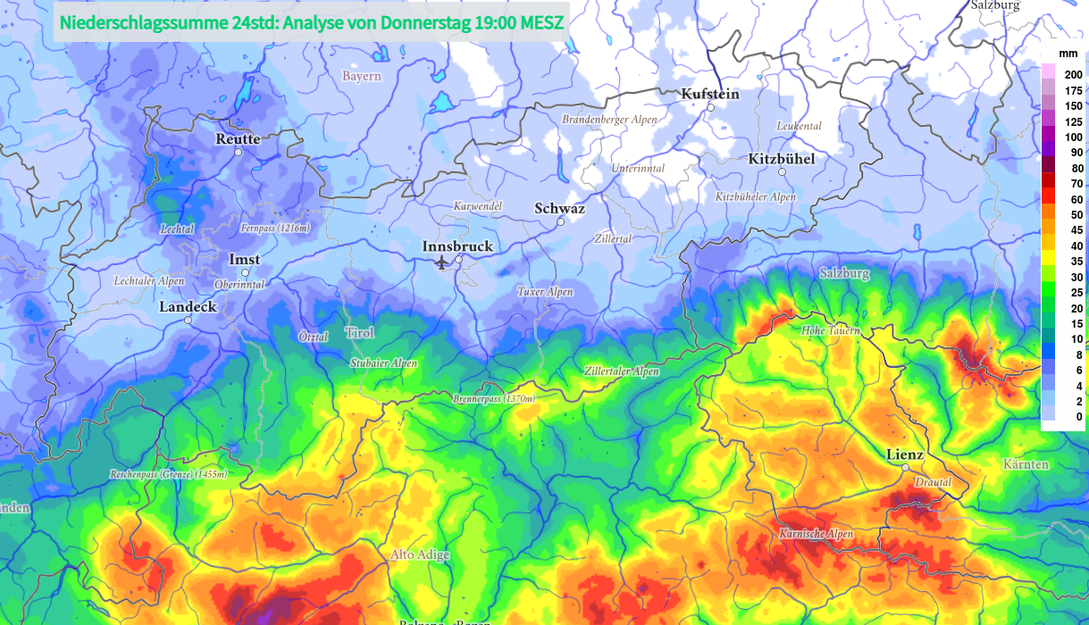
24h- Niederschlagssumme von Mittwoch, 16.04. 19:00 Uhr bis Donnerstag, 17.04. 19:00 Uhr. Der höchste 24h- Wert wurde mit 84mm bei der Karlsbader Hütte (2260m) in den Lienzer Dolomiten verzeichnet.
24-hr precipitation amounts from Wednesday, 16.04, at 7:00 pm until Thursday, 17.04, at 7:00 pm. Highest 24-hr value was 84mm at the Karlsbader Refuge (2260m) in the Lienz Dolomites.

Wet-snow problem below 2600m

As temperatures dropped and intensive precipitation ended on Thursday night, the likelihood of wet-snow avalanches triggering receded. However, the snowpack remained wet and weak. Persons can still trigger the thoroughly wet snow as loose-snow avalanches, esp. on very steep slopes. Avalanches in their plummet path can sweep along masses of snow and grow to large size in isolated cases. Avalanche prone locations occur more frequently on shady slopes, since steep sunny slopes have much less snow on the ground.

Regionally lots of fresh snow and drifts at great heights

Above 2600-2800m it can be assumed that in the course of the heavy precipitation lots of fresh snow fell. This is particularly the case for the mountains along the Main Alpine Ridge, especially Hohe Tauern and Gurgler Massif in the Ötztal Alps. Southerly winds were often blowing at strong-to-storm strength during the precipitation, thus, far-reaching snowdrifts accumulated freshly which in places can be triggered by persons following the precipitation, particularly where snowfall was heaviest. Snowdrift accumulations are especially plentiful on shady slopes, in gullies and bowls, and in general behind protruberances in the terrain.

In case of extended bright intervals on Friday, 18.04, and Saturday, 19.04, numerous moist loose-snow avalanches are expected to trigger naturally on extremely steep slopes. These releases can also sweep along masses of unbonded snow and, particularly in long plummet paths, grow to dangerously large size.

Variable conditions will continue after Easter

Also after the holidays have passed, weather conditions will remain variable, temperatures will stay mild. Thus, the snowmelt will continue and the wet-snow problem will remain dominant. Nocturnal cloud cover will determine whether a melt-freeze crust will form on the surface and whether it will be capable of bearing loads the next morning. Friday night (18.04) appears promising, particularly in the northern regions. However, with warm temperatures and solar radiation, the danger of wet-snow avalanches will be subject to a slight daytime danger cycle on Saturday, 19.04.

The freshly generated snowdrift accumulations will settle and consolidate rapidly in the current springtime conditions.
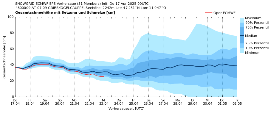
Prognostizierte Schneehöhenentwicklung für die Grieskogelgruppe auf 2240m. Zumindest bis zum nächsten Wochenende schreitet die Schneeschmelze in dieser Höhenlage weiter voran (GeoSphere Austria).
Forecast of snow depths for the Grieskogel Massif at 2240m. The snowmelt will continue at that altitude at least until next weekend. (GeoSphere Austria).
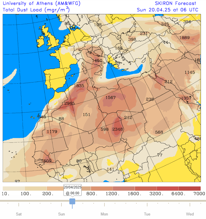
Bereits während der vergangenen Niederschläge wurde Saharastaub auf der Schneeoberfläche abgelagert. Mit der andauernden Südströmung gelangt auch am Wochenende neuerlich Staub aus der Sahara in unsere Breiten (©University of Athens).
During the recent precipitation, dust from the Sahara Desert got deposited atop the snowpack surface. Due to the persistent southerly air current, more Sahara dust will waft our way next weekend. (©University of Athens).

Review: high activity of wet-snow avalanches due to rainfall, warmth

Last week was marked by warm, moist southern barrier cloud weather. Rain, moist air masses, diffuse radiation made the snowpack increasingly wet and, as a consequence, high activity of wet-snow avalanches resulted. Particularly on W/N/E-facing slopes (above 2200m depending on aspect) the snow was thoroughly wet for the first time. Thereby, especially numerous wet slab and loose-snow avalanches released. Also the gliding snow activity on steep grass-covered slopes increased noticeably due to water seepage. Snow depths receded markedly. Currently, shady slopes up to 2600m and sunny slopes up to 3000m are zero-degree isotherm.
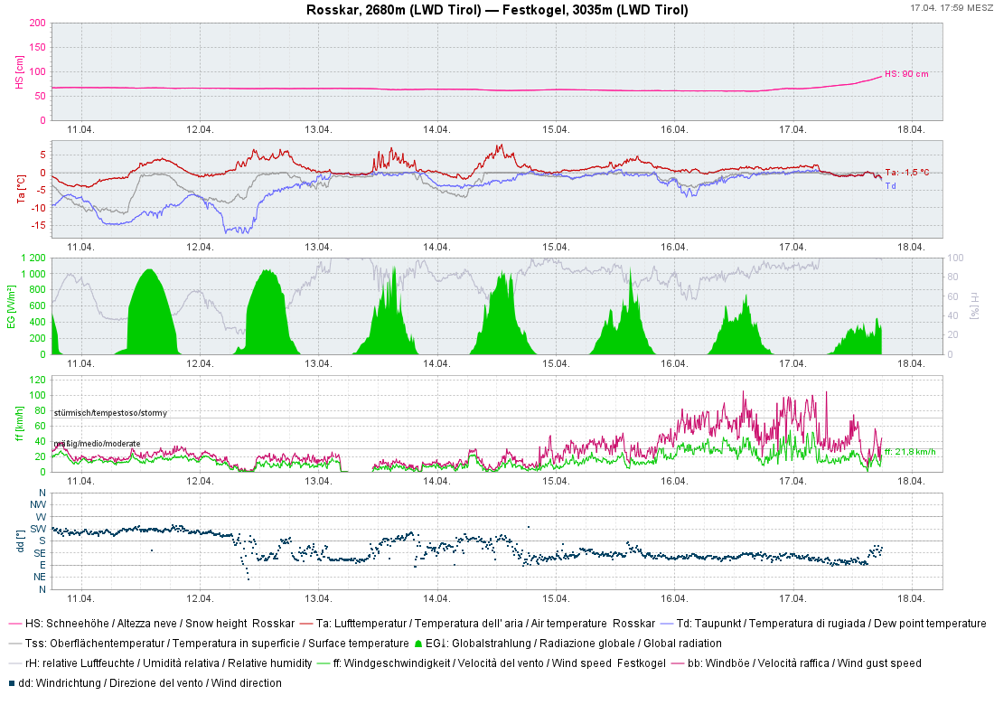
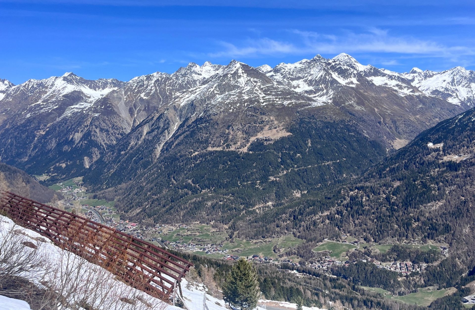
An der Wetterstation Rosskar in der Gurgler Gruppe lässt sich die Wetterentwicklung der vergangenen Woche gut nachverfolgen. Am Samstag, 12.04. ließen sich nach einer perfekten Strahlungsnacht noch gute Firnbedingungen finden. Ab Sonntag stellte sich mit feuchter Luft zusehends Tauwetter ein. Am heutigen Donnerstag, 17.04. wurde etwas Neuschneezuwachs verzeichnet.
At the Rosskar weather station in the Gurgler Massif, recent weather developments can be clearly followed. On Saturday, 12.04, following a perfect night of outgoing longwave radiation, there were good firn-snow conditions. Starting on Sunday, moist air masses launched a period of thaw. Today, Thursday 17.04, there was some fresh snowfall registered.
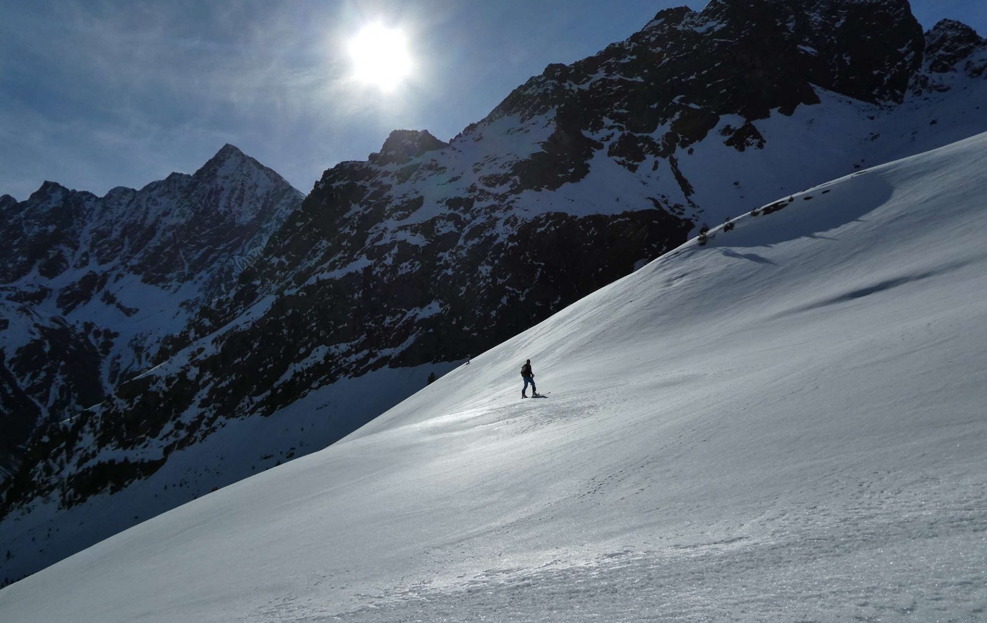
Strahlend sonniges Frühjahrswetter in Sölden. Auch vor dem Tauwetter waren Sonnenhänge vielerorts bereits bis weit hinauf ausgeapert (©Tobias Holzknecht, 12.04.2025).
Brilliantly sunny spring weather in Sölden. Even prior to the thaw, sunny slopes were often bare of snow up to high altitudes. (©Tobias Holzknecht, 12.04.2025).
Perfekte Firnbedingungen nach klarer Nacht am Tonigenkogel (3011m) in den Stubaier Alpen (©Barbara Fink, 12.04.2025).
Superb firn-snow after clear nighttime skies on the Tonigenkogel (3011m) in the Stubai Alps (©Barbara Fink, 12.04.2025).
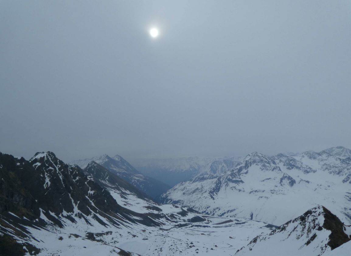
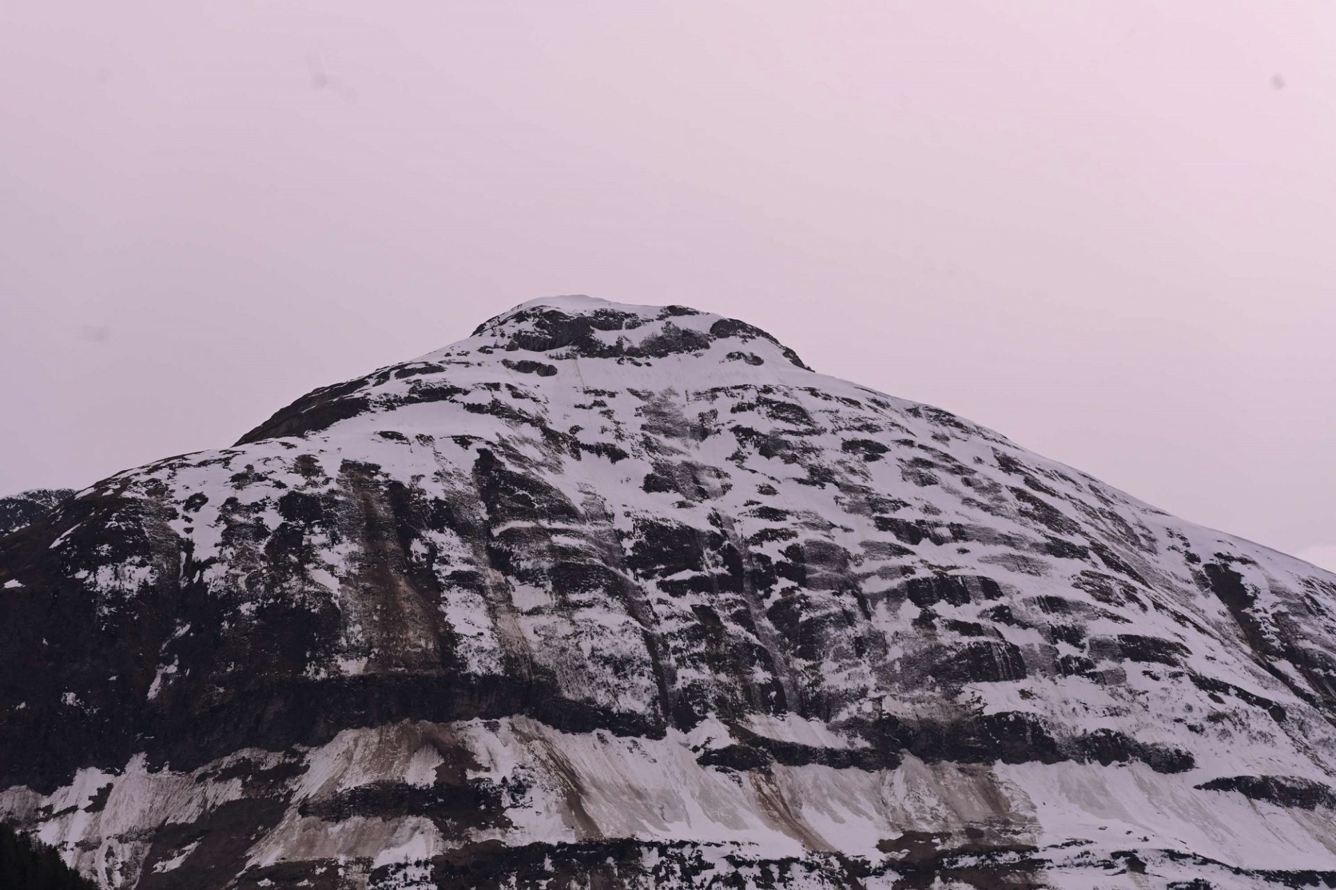
Am darauffolgenden Sonntag, 13.04. war die Luft merklich feuchter. Das „Waschkuchlwetter“ mit diffuser Strahlung und gebietsweise leichtem Regen führte an Schattenhängen zu einer merklichen Anfeuchtung der Schneedecke (©Barbara Fink, 13.04.2025).
On the following Sunday, 13.04, the air was measurably moister. “Laundry-room weather” with diffuse light radiation and light rainfall in many places led to shady slopes getting a very moist snowpack. (©Barbara Fink, 13.04.2025).
Der Feuchtigkeitseintrag führte am Sonntag, 13.04. zu einer Schwächung oberflächennaher Schichten und folglich zu zahlreichen nassen Lockerschneelawinen an West-, Nord- und Osthängen bis etwa 2400m hinauf. Dies besonders auf den Bergen südlich des Inns. Hier im Bereich des Stubaier Gletschers (©Günter Chwojan, 13.04.2025).
The moisture led to a weakening of the upper snowpack layers on Sunday, 13.04, and then to numerous wet loose-snow avalanches on W/N/E-facing slopes up to 2400m, particularly in the mountains south of the Inn. Above, near the Stubai Glacier. (©Günter Chwojan, 13.04.2025).
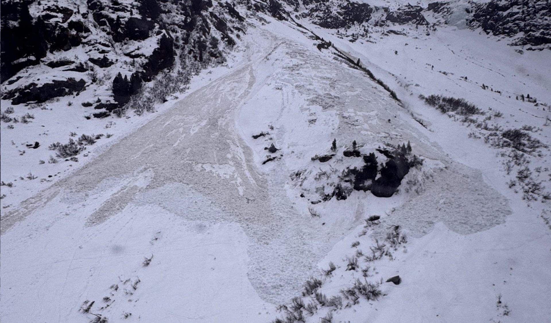
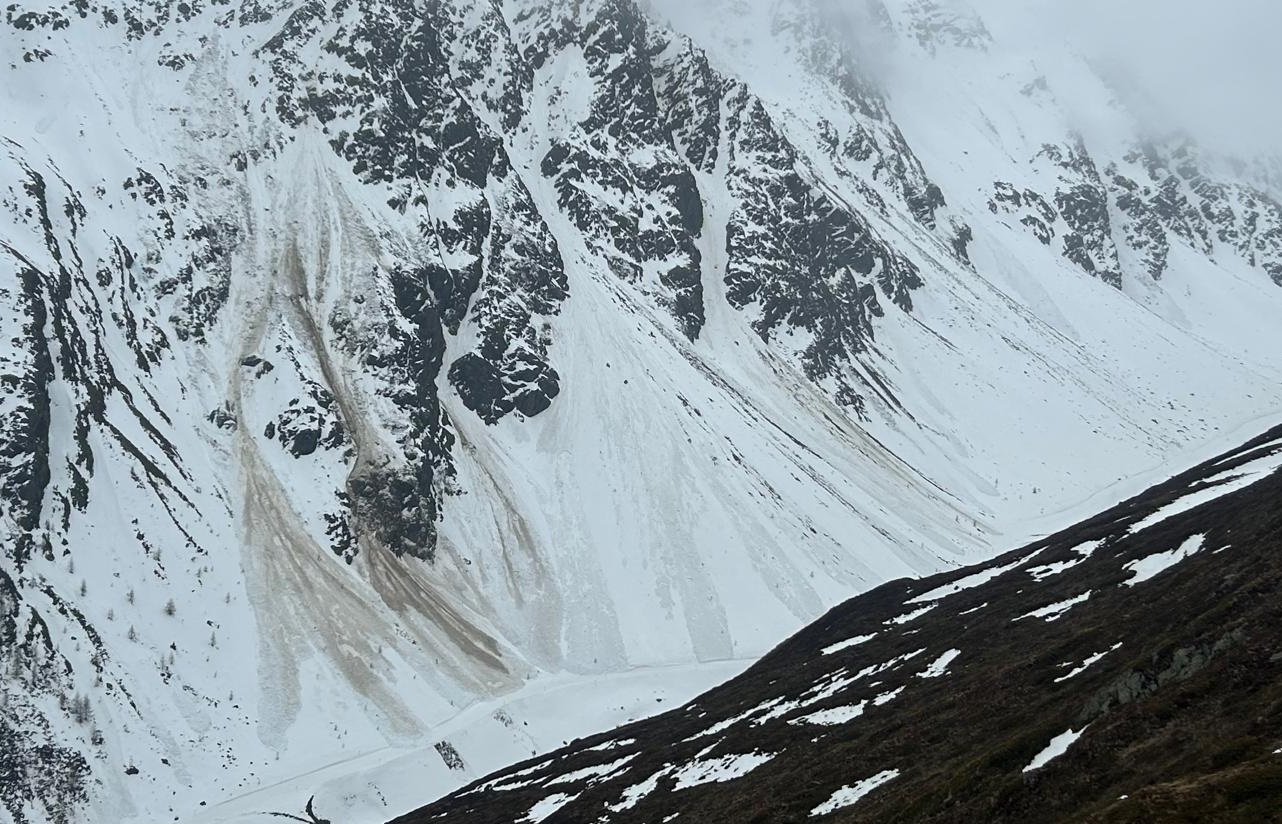
Aufgrund der unterdurchschnittlichen Schneehöhen blieben die Auslauflängen der Lawinen im Vergleich zu ähnlichen Situationen in vergangenen Wintern eher gering. Jamtal, Silvrettagruppe (©Christian Riepl, 14.04.2025).
Due to below-average snow depths, the runout zones of avalanches were less long than during the last few winters. Jamtal, Silvretta Massif (©Christian Riepl, 14.04.2025).
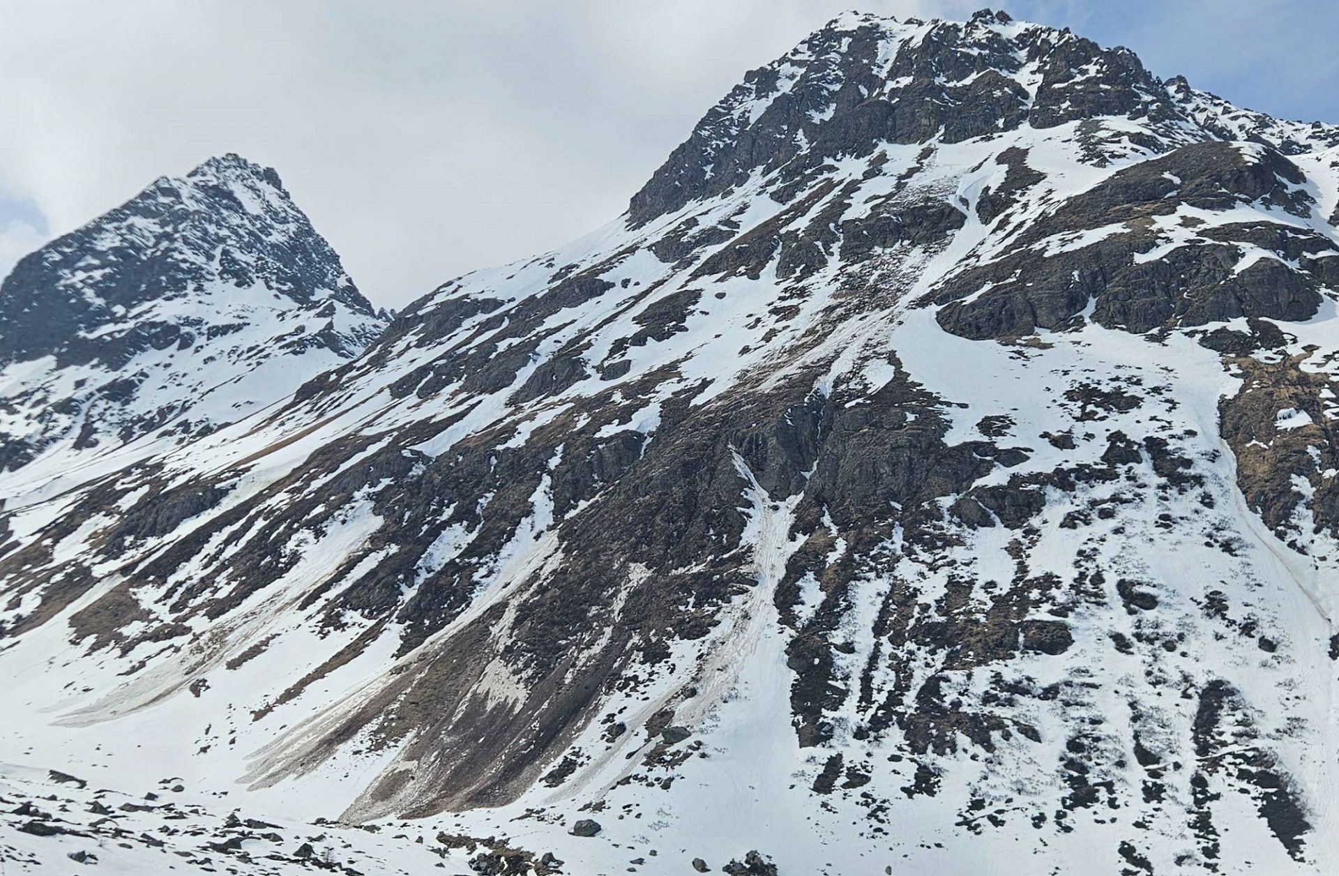
Auch die Gleitschneeaktivität nahm mit der Durchnässung merklich zu. Im Bild die Pimigspitze (2405m) bei Steeg im Lechtal (©Adi Kerber, 14.04.2025).
Gliding snow activity increased noticeably as the snow became wetter. Above, the Pimigspitze (2405m) near Steeg in Lechtal (©Adi Kerber, 14.04.2025).
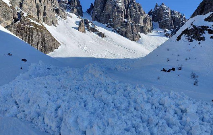
Ablagerung einer spontanen, nassen Schneebrettlawine an einem Nordwesthang auf etwa 2200m unterhalb des Ampfersteins in den Kalkkögeln (©Mats Aksnessæther, 15.04.2025).
Deposit of a naturally triggered wet slab avalanche on a NW slope at 2200m below the Ampferstein in the Kalkkögeln. (©Mats Aksnessæther, 15.04.2025).
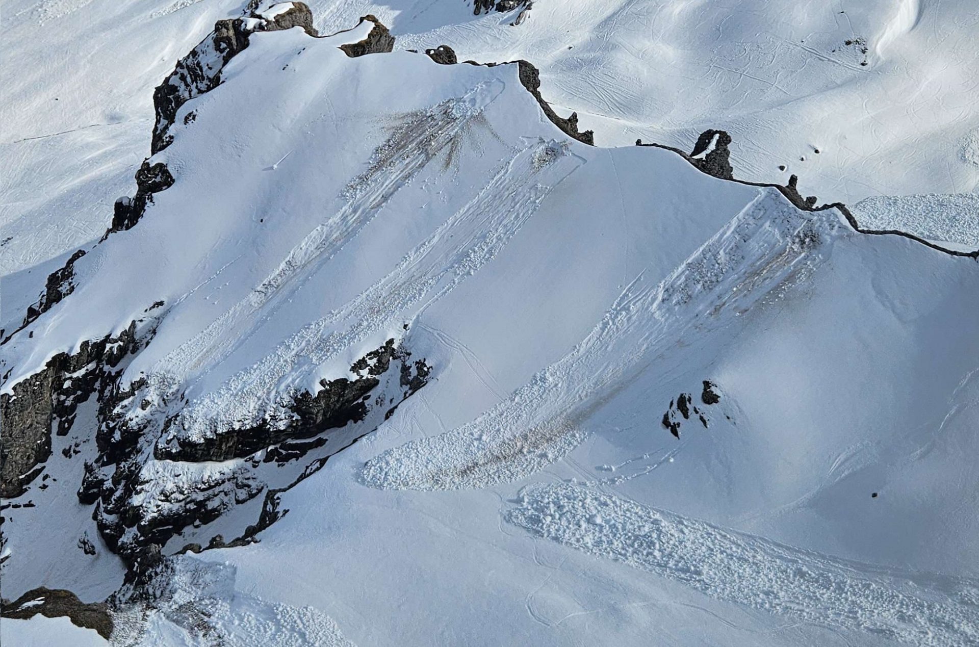
Durch Sprengarbeiten ausgelöste, kleine, oberflächliche nasse Schneebrettlawinen im Skigebiet Schlick 2000 (©Domenik Jenewein, 15.04.2025).
Through artificial triggerings via explosives, small near-surface wet slab avalanches in the Schlick 2000 ski area. (©Domenik Jenewein, 15.04.2025).
Hohe Lawinenaktivität auch im Skigebiet Sölden. Zahlreiche Lawinen lösten sich während des Tauwetters in den vergangenen Tagen spontan, auch Auslösesprengarbeiten zeugten von Erfolg (©LK Sölden, 15.04.2025).
Intense avalanche activity also in the Sölden ski area. Numerous avalanches released naturally during the thaw over the last few days, also successful artificial triggerings with explosives. (©LK Sölden, 15.04.2025).
Ablagerungen von Gleitschneelawinen bei der Alpe Tritsch, St. Anton am Arlberg (©Jochen Gstrein, 15.04.2025).
Deposits of glide-snow avalanches on the Alpe Tritsch, St. Anton am Arlberg (©Jochen Gstrein, 15.04.2025).
Blick in Richtung Dristner (2767m) in den Zillertaler Alpen. Links eine Aufnahme vom 11.04., rechts vom 17.04. Die Ausaperung der vergangenen Woche ist augenscheinlich (©foto-webcam.eu)
View towards Dristner (2767m) in the Zillertal Alps. Left: a shot from 11.04; right: shot on 17.04. The slopes became bare of snow in that time. (©foto-webcam.eu)