Mostly low danger prevailed during this last week, moderate danger regionally. Dominant (contained) problems were snowdrifts and a marked persistent weak layer. Starting Sunday, 2 March, a powerful high-pressure front will move in. Springlike temperatures and often a shallow snowpack on sunny slopes will make the snowpack increasingly moist/wet. When nocturnal skies are clear, firn-snow conditions can be enjoyed (as long as you have a good time plan).
Small snowdrift masses esp. in SE regions
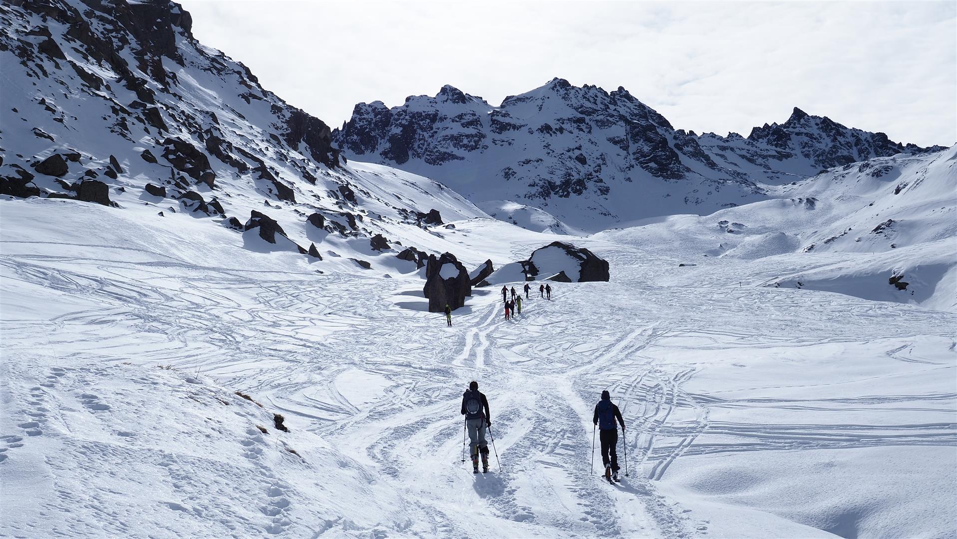
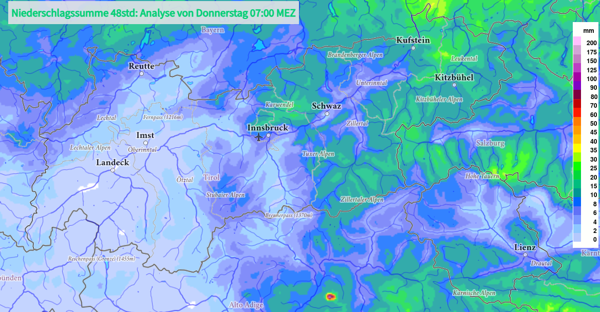
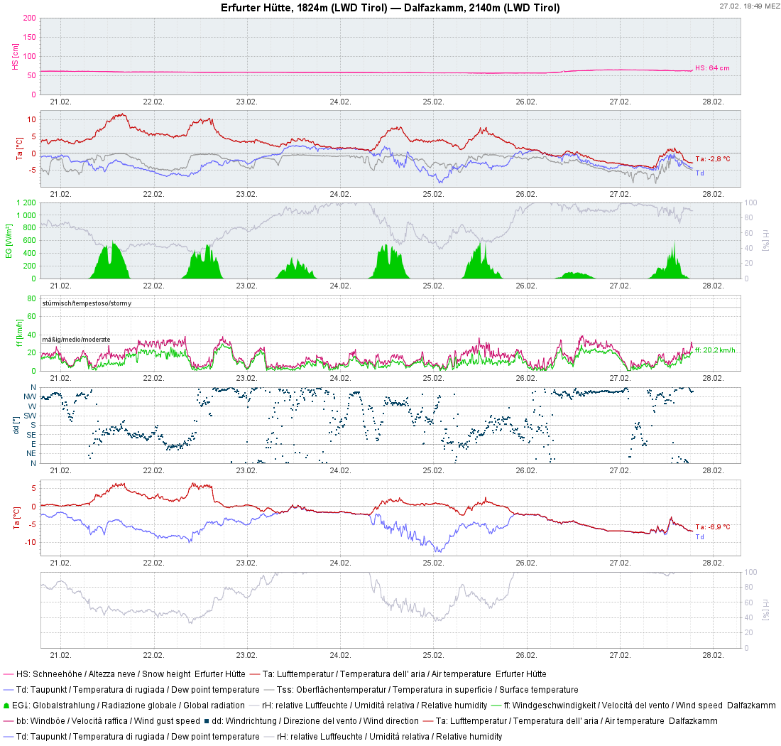
There was regionally some snowfall from Tuesday, 25.02 until Thursday, 27.02, often less than 10cm. Most fell in eastern and southeastern regions, up to 25cm. Winds were light to moderate. In places, relatively small snowdrift accumulations were generated. For a short time these easily-recognized drifts can be triggered with ease by winter sports enthusiasts. Such danger zones occur particularly in very steep ridgeline terrain and in very steep gullies and bowls. The risks of being swept along and forced to take a fall require adequate consideration on extremely steep slopes.
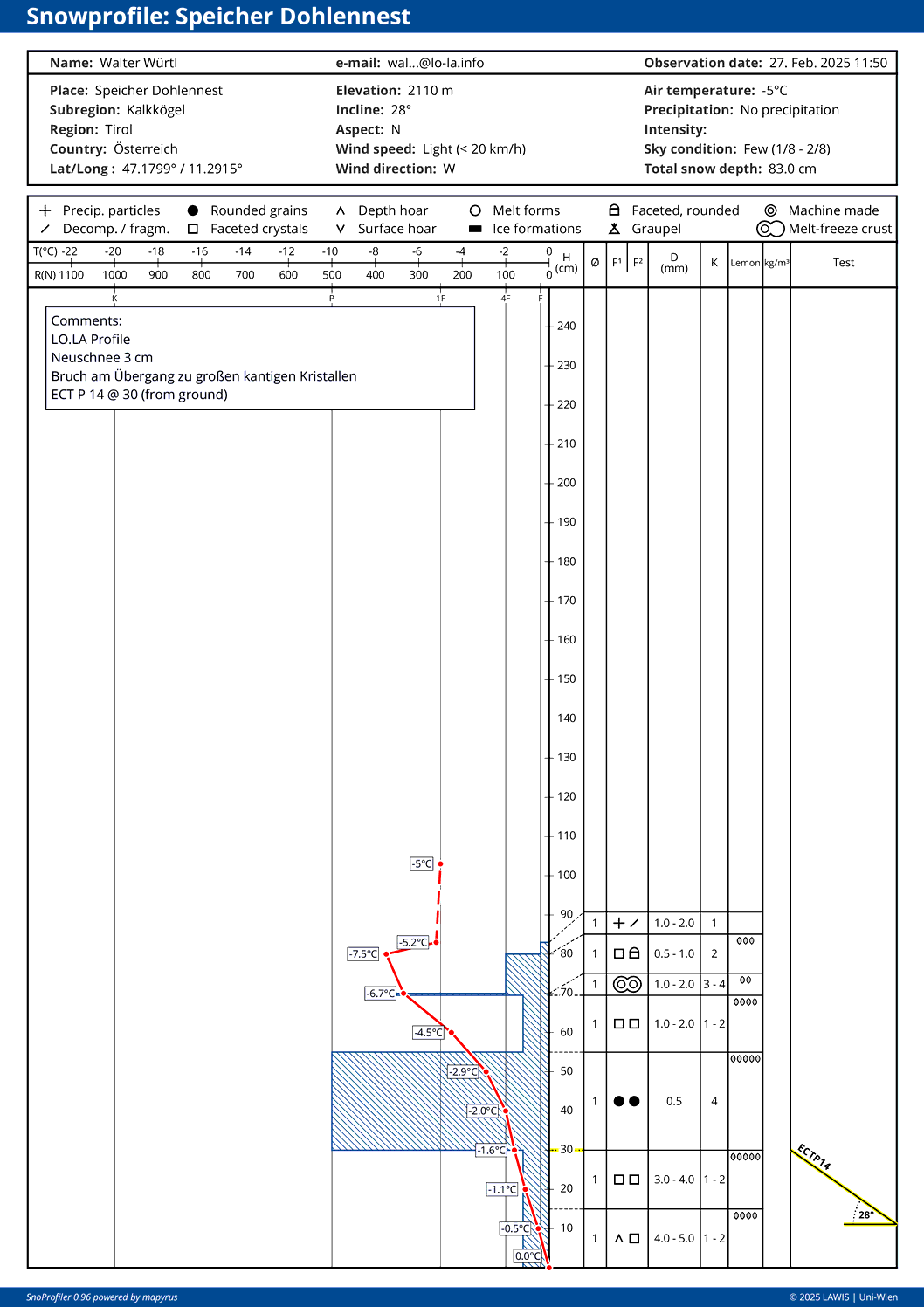
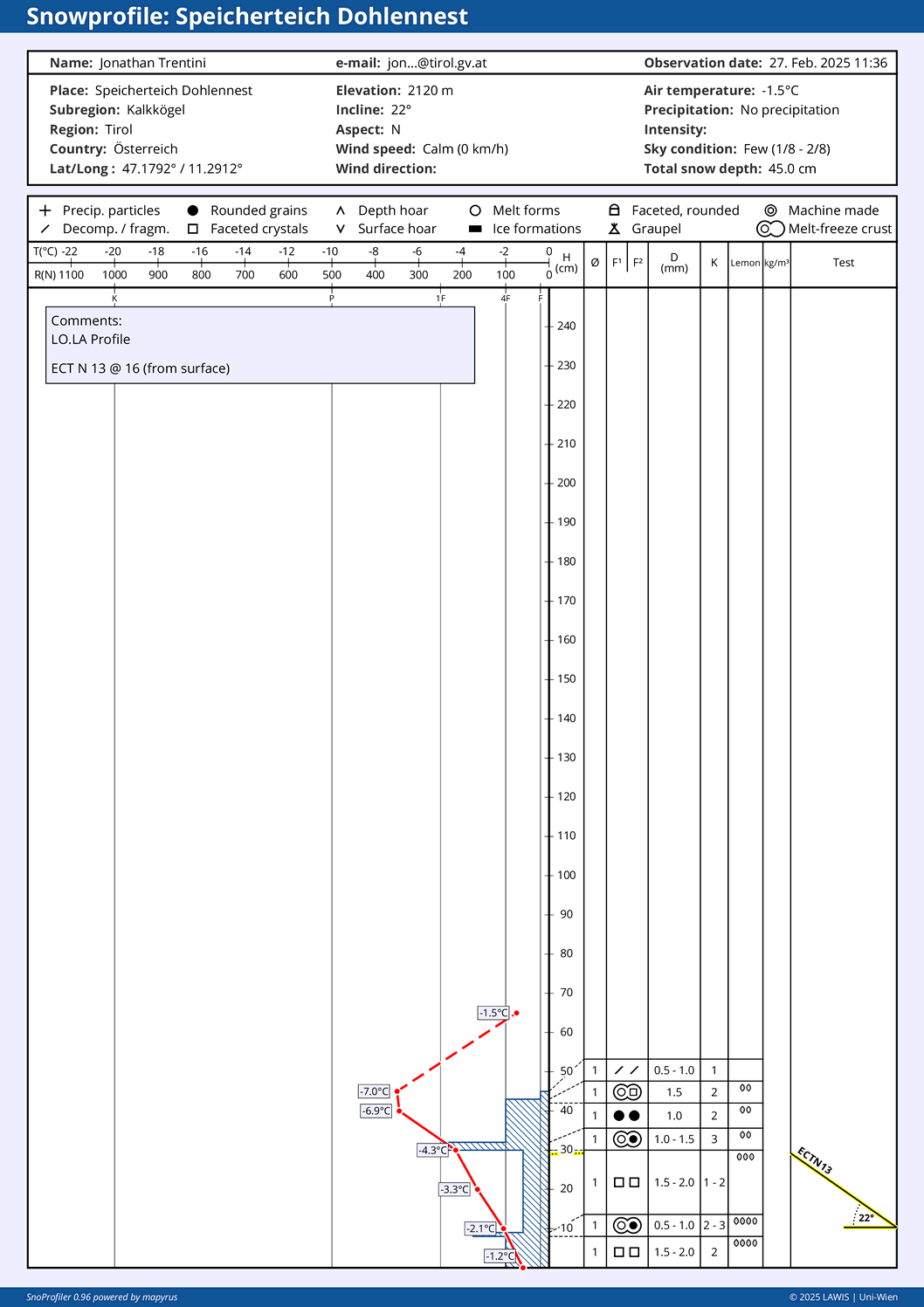
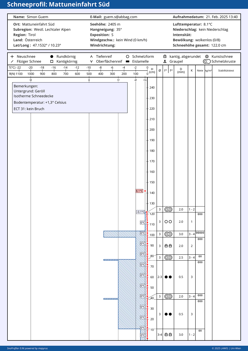
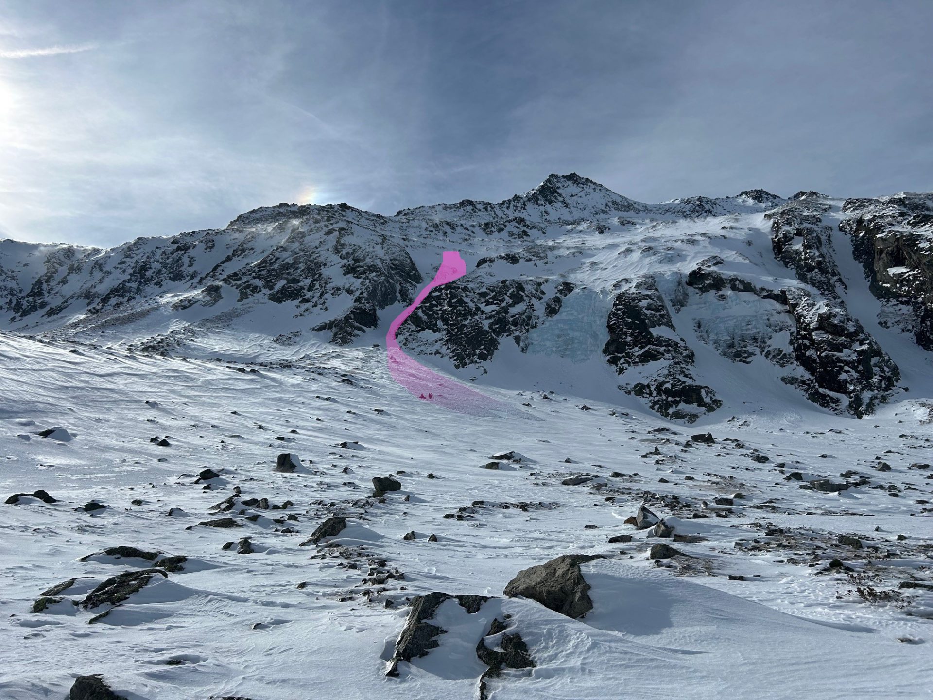
Isolated danger zones in old snow
In regions south of the Inn in a small number of places, we are faced with a trigger sensitive old snowpack. The avalanche prone spots are difficult to see, they occur particularly on very steep shady slopes above 2200m. Wherever there was more snowfall, particularly in the northern Zillertal Alps, Venediger Massif and southern East Tirol, the fresh fallen snow has intensified the slab. Thereby, proneness to triggering is higher. Apart from that, starting at the end of this week, high-pressure front conditions, rising temperatures and solar radiation will raise danger also on west and east-facing slopes at high altitudes as the snowpack becomes wetter.
Review of last week
Variably cloudy, initially warm, wet snow, then dropping temperatures
Last week was marked by variable weather: unseasonably warm to start with, a moist snowpack at least up to 2500m, sometimes wet down to the ground.
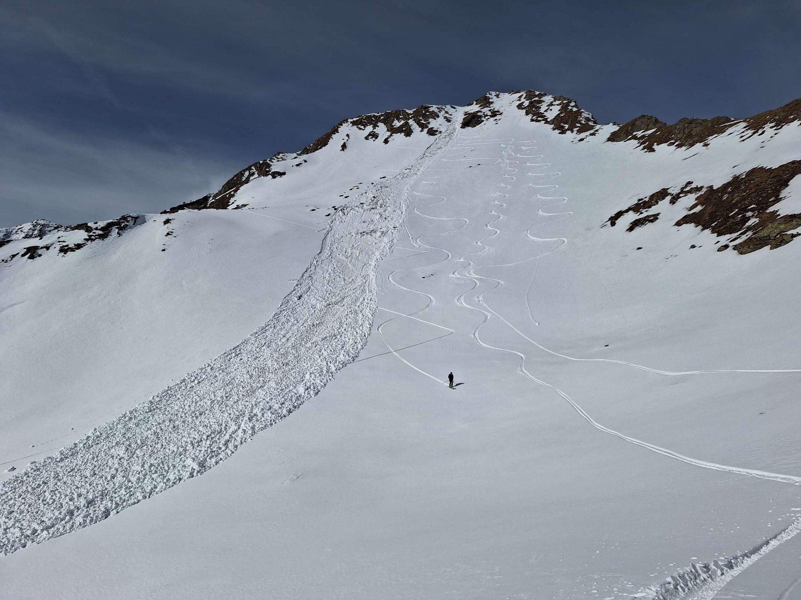
Several avalanches, mostly small-sized
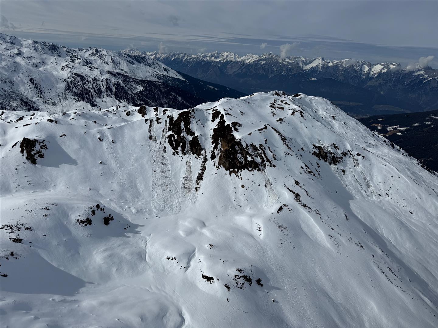
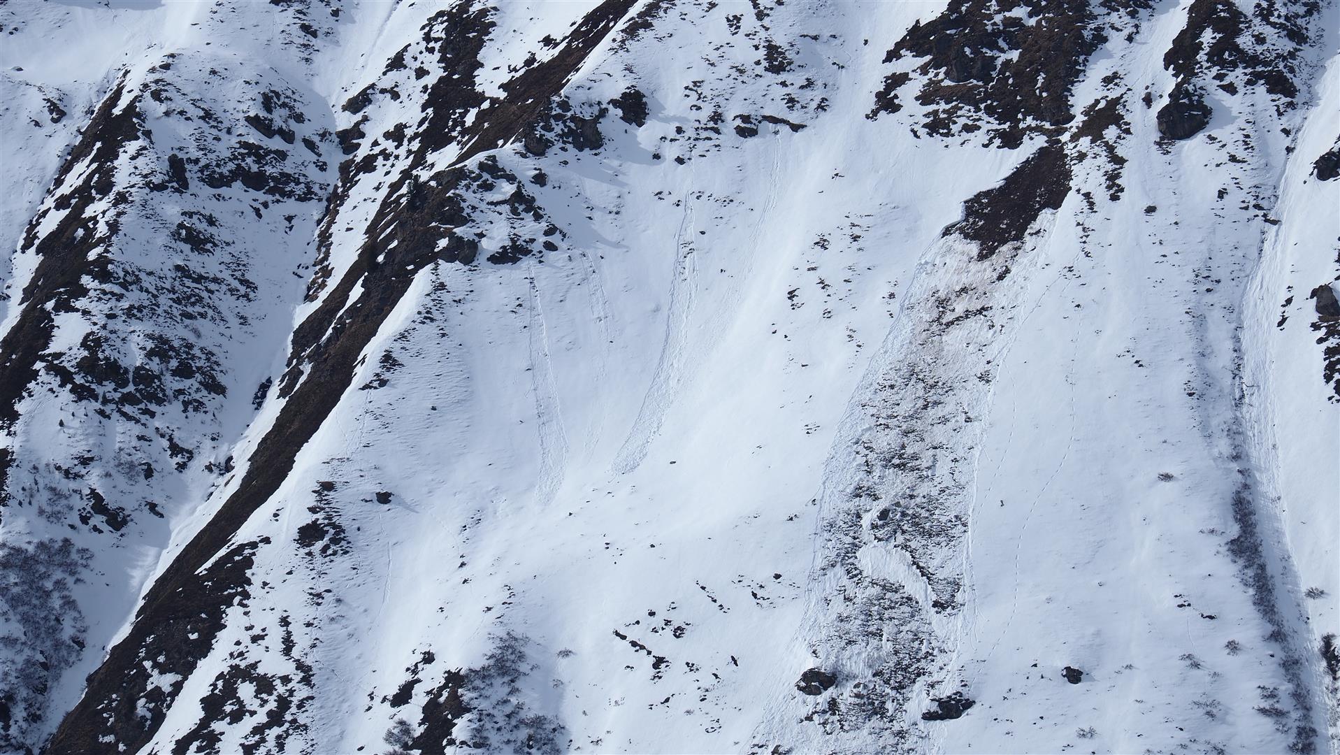
The wetness of the snowpack referred to weakened the snowpack overall. Particularly on Friday, 21.02 and Sunday, 24.02, generally small-sized glide-snow avalanches and loose-snow avalanches were observed increasingly often. The latter were repeatedly triggered by winter sports enthusiasts in extremely steep terrain.
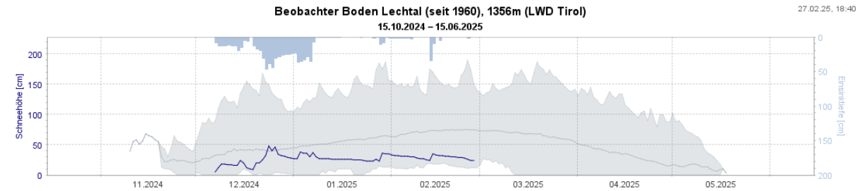
Still too little snow for this juncture of the season
The snow-poor winter continues. A glance at the weather stations of our longtime observers shows mostly below-average snow depths for this season.
Final points
In backcountry terrain the danger of unwelcome contact with barely covered rocks continues to be a threat. Good snow can be found in the regions where there was recent snowfall or on shady, wind-protected slopes at high altitudes. Otherwise, snow quality varies immensely over small areas. Moreover, lots of popular goals for backcountry tours show signs of having been heavily skied.