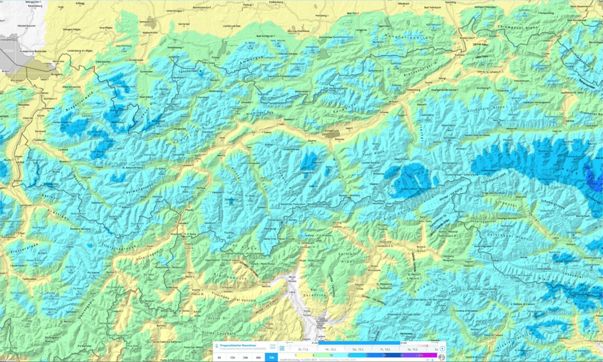
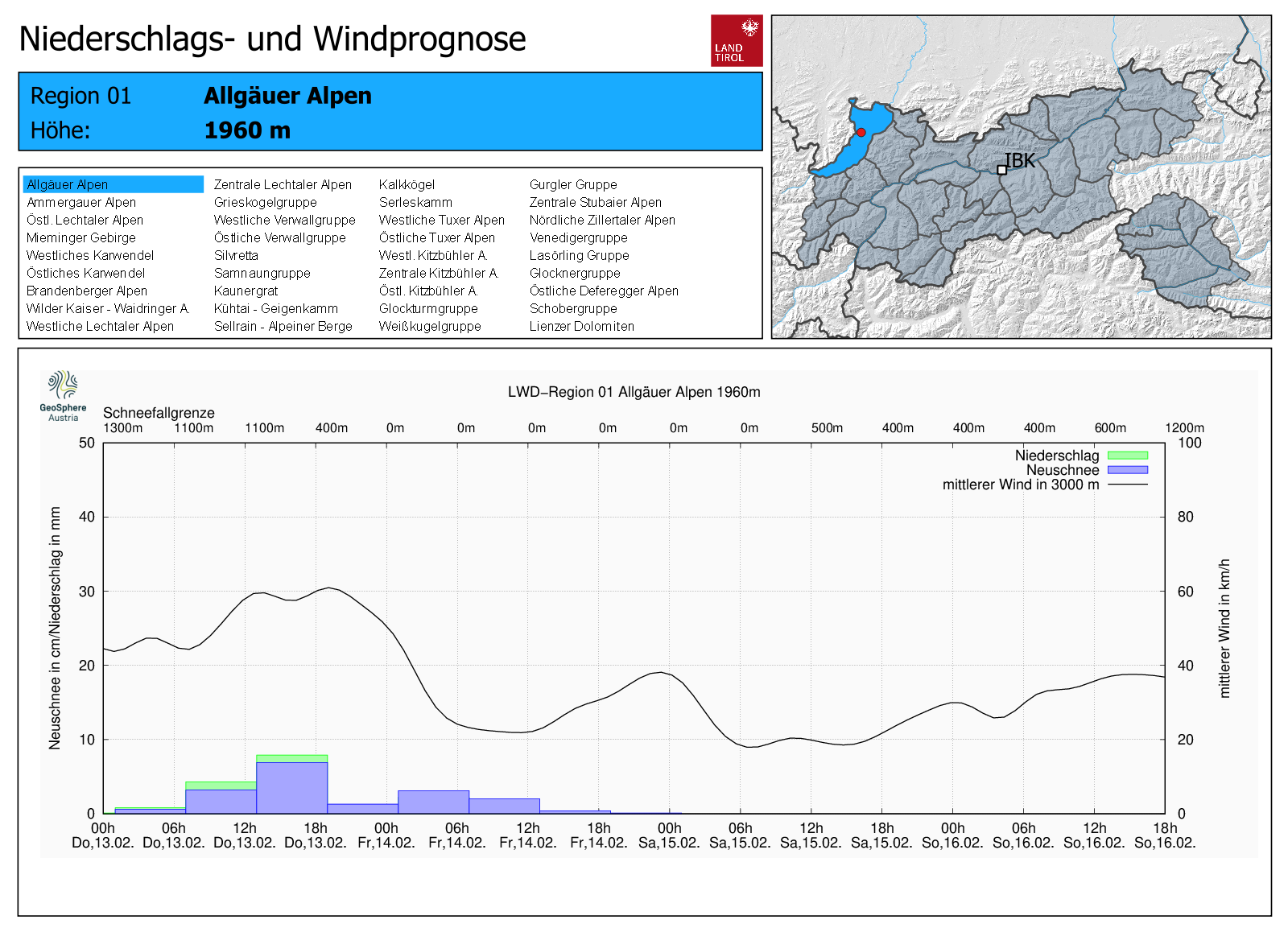
From 13.02 to 14.02 some fresh snow is expected (10-20cm, locally more). Whether a snowdrift problem develops depends on wind impact. Current expectation: light-to-moderate, initially southerly wind, then shifting to N/NW. A note of caution: fresh snowdrifts in steep terrain can be quite prone to triggering due to measurably dropping temperatures. Especially dangerous is the risk of being swept along and forced to take a fall in extremely steep terrain.
Some fresh snow
Snowdrifts deposited on soft layers
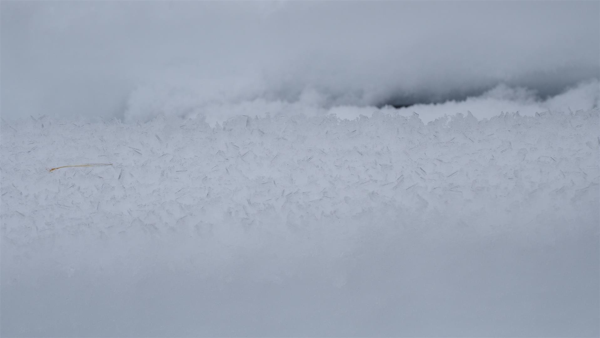
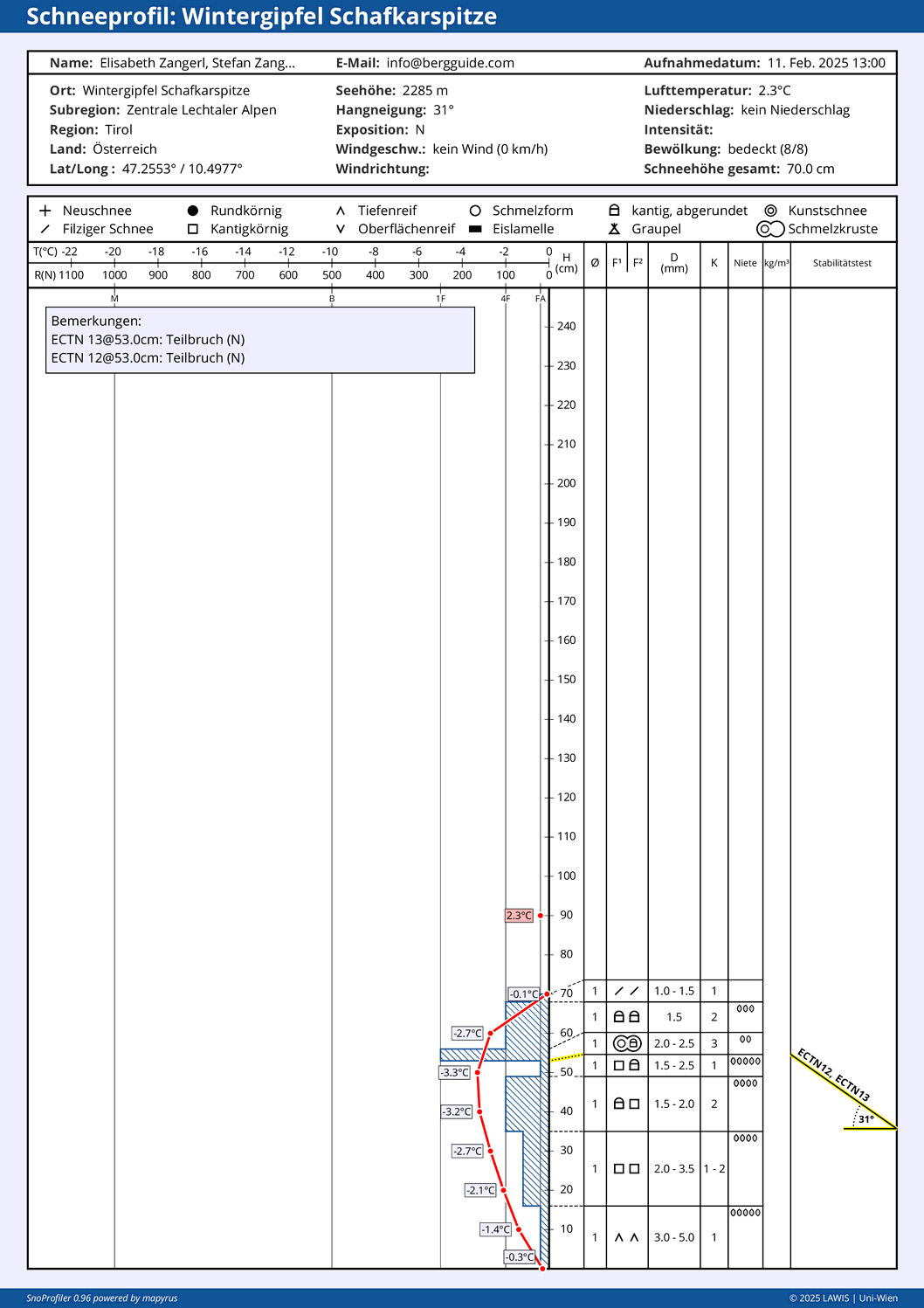
All week long, marked surface hoar formed at low and intermediate altitudes. As clouds moved in and diffuse light conditions reigned starting on 11.02, the snowpack surface then moistened up to at least 2000m. To a large extent the surface hoar dissipated thereby.
Loosely-packed, downright fluffy snow is expected as a result of the strikingly lower temperatures on 13-14.02. If snowdrifts accumulate on top of it, we can assume a short period of heightened proneness to triggering. The prerequisite: that the drifts have a certain depth.
Weak layer at ground level no longer likely to trigger
Our snowpack analysis has shown us, further corroborated by our active observers in backcountry, that in the interim the snowpack is often soft, but largely quite stable. This is partly the result of the snowpack surface becoming increasingly loose. That means: the slab is disappearing. Moreover, ground-level crystals are tending to coalesce and combine, further raising its firmness.
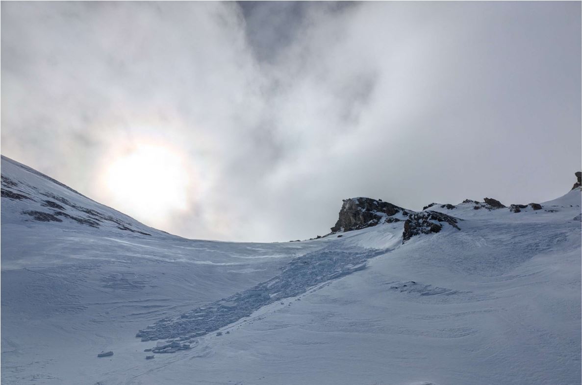
Esp. in western regions with lots of snow: isolated slides and avalanches of gliding snow
Through the higher temperatures and slight moistening of the snowpack this week, gliding snow activity has increased somewhat. This created isolated danger zones. Glide-snow avalanches often mark their approach by cracks in the snowpack.
A brief spell of loose-snow slides/avalanches in steep terrain
In extremely steep terrain, particularly when weather conditions improve and bring solar radiation, increasingly frequent loose-snow slides and avalanches will release in rocky terrain. Due to the anticipated amounts of coming snowfall, danger is not anticipated.
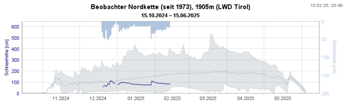
Below-average snow depths
The approaching snowfall will not affect the significantly below-average snow depths for this juncture of the season. They are closer to average in W/NW regions of Tirol.
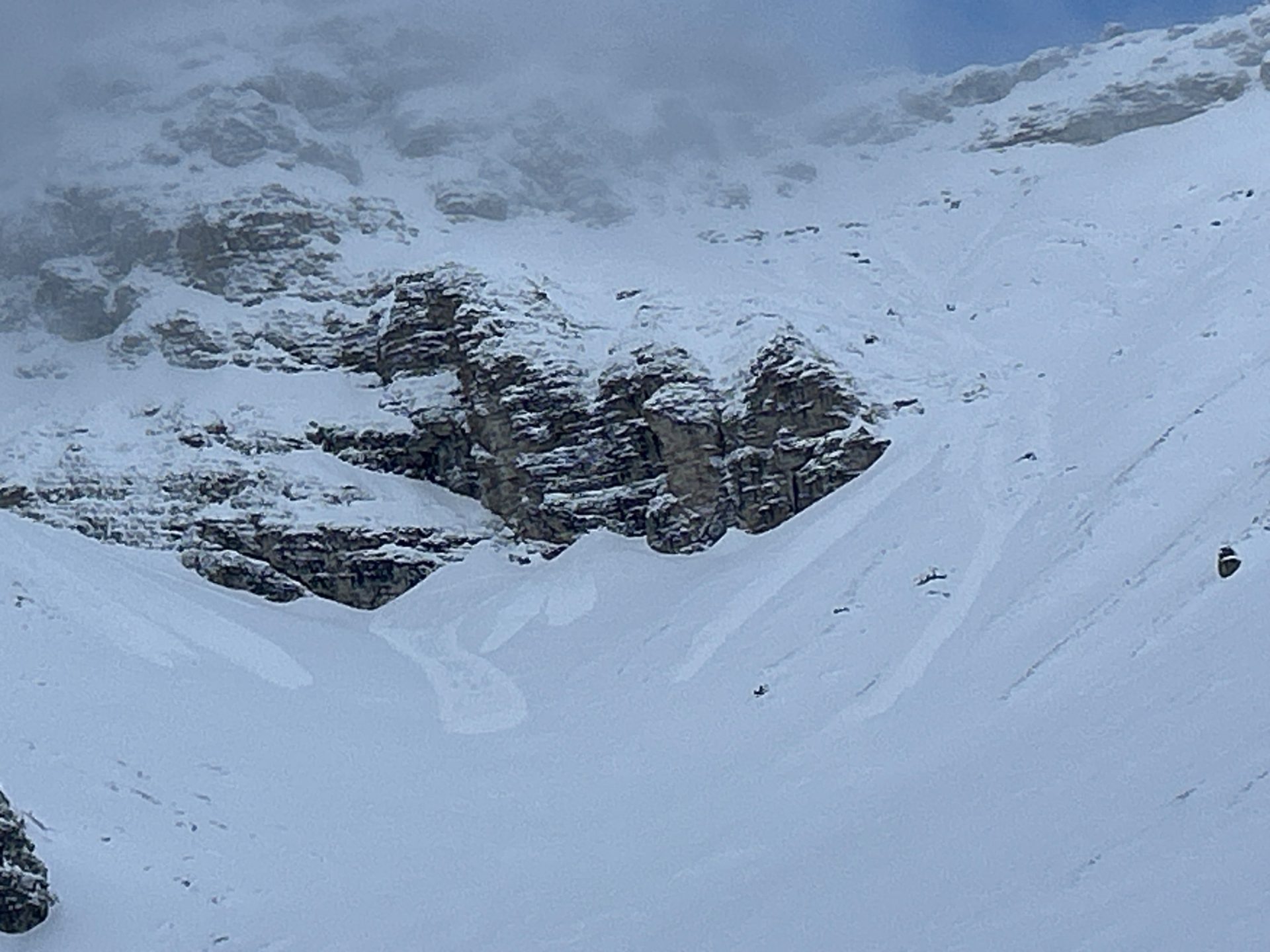
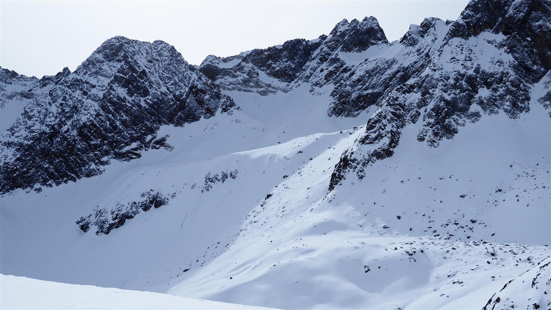
Watch out for sharks, i.e. unwelcome contact with rocks and their consequences
The term “shark” denotes rocks just barely beneath the surface. If you hit them on your descent, it can lead to terrible falls. This season, several persons have died from such incidents.
No major precipitation in sight for the rest of the month
According to information from GeoSphere Austria, the current period without precipitation will continue. Starting Saturday, 15.02, a high-pressure front will prevail, temperatures will again rise. Snowfall is not in sight.