Schneedecke mit Schwachschichten in den Zentralen Stubaier Alpen (Foto: 17.12.2024, © Stefan Ortner)

Fresh snow initially causing rise in avalanche danger. On 23.12, danger increasing significantly.

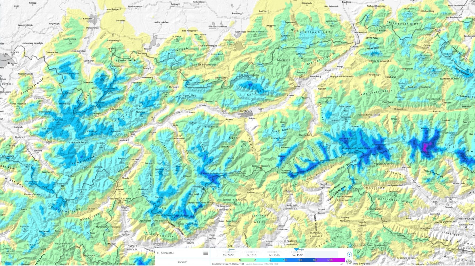
On Friday, 20.12 a cold front is bringing generally 15 to 30 cm of fresh snow. Starting on Sunday, 22.12, and until 25.12, three rounds of precipitation. In northern and northwestern regions of North Tirol, intensive snowfall. Caution: avalanche danger will increase significantly.

Mit Neuschnee und Wind werden sich vermehrt störanfällige Triebschneepakete bilden (13.12.2024, © Franz-Josef Tanzer)
Due to fresh snow and winds, increasingly frequent trigger-sensitive snowdrift accumulations will be generated. (photo: 13.12.2024, © Franz-Josef Tanzer)

Current situation

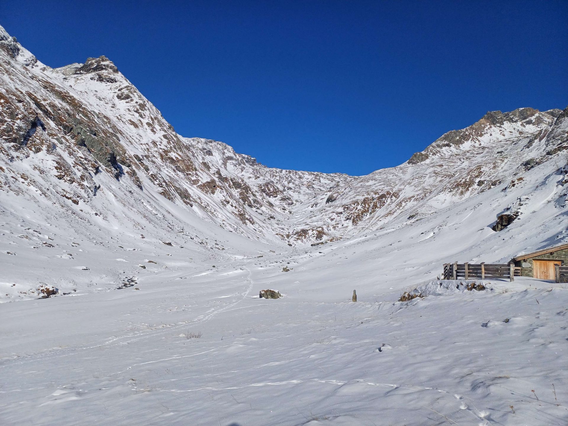
Not much snow on the ground

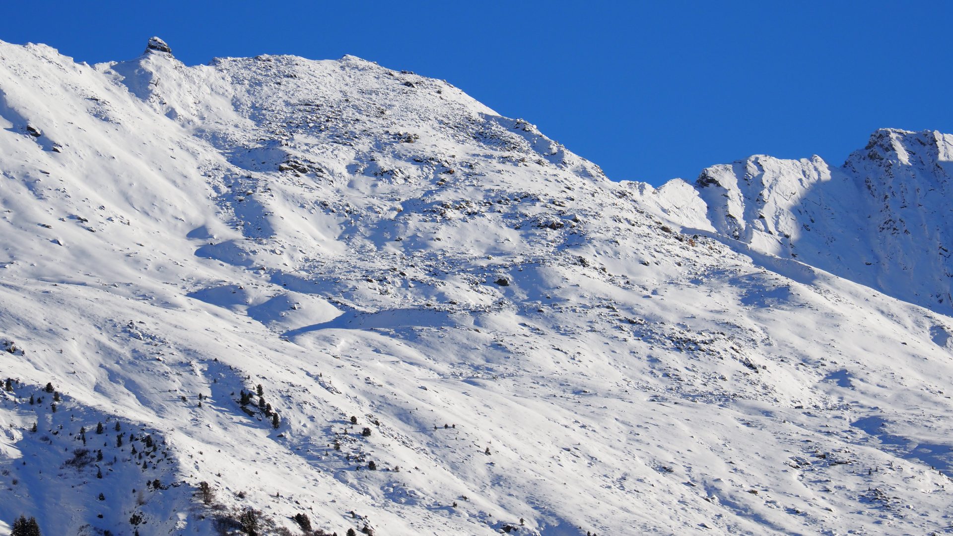
The snow depths in Tirol continue to be below-average. Reasonably good conditions for backcountry skiing and freeriding tours are rare. The danger of injuries from meeting up with rocks in outlying terrain is higher today (19.12.2024) than that of avalanches. Most snow is found in western regions and at high altitudes along the Main Alpine Ridge.

Karte der Gesamtschneehöhe in Tirol
Map of overall snow depths in Tirol
Wenig Schnee auf einem Westhang in der Silvretta (Foto: 11.12.2024, © LWD Tirol)
Not much snow on west-facing slopes in the Silvretta (photo: 11.12.2024, © LWD Tirol)
Wenig Schnee auch bei der Bodenalm oberhalb von Prägraten in Osttirol (Foto: 13.12.2024, ©Andreas Rainer)
Snow also lacking on Bodenalm above Prägraten in East Tirol . (photo: 13.12.2024, ©Andreas Rainer).
Vorsicht bei Abfahrten im freien Gelände. "Sharks", also versteckte Steine unter der Schneeoberfläche, können zu Stürzen und Verletzungen führen. Sellrainer Berge (Foto: 17.12.2024, © LWD Tirol)
Caution on descents in open terrain. “Sharks” – hidden stones beneath the snow surface – can lead to falls and injuries. Sellrain mountains (photo: 17.12.2024, © LWD Tirol)

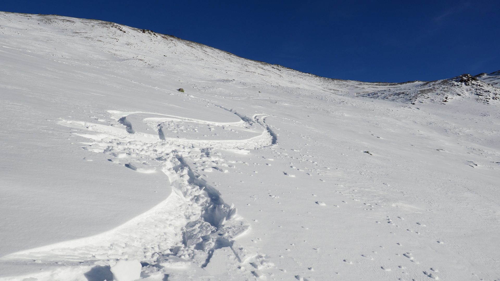
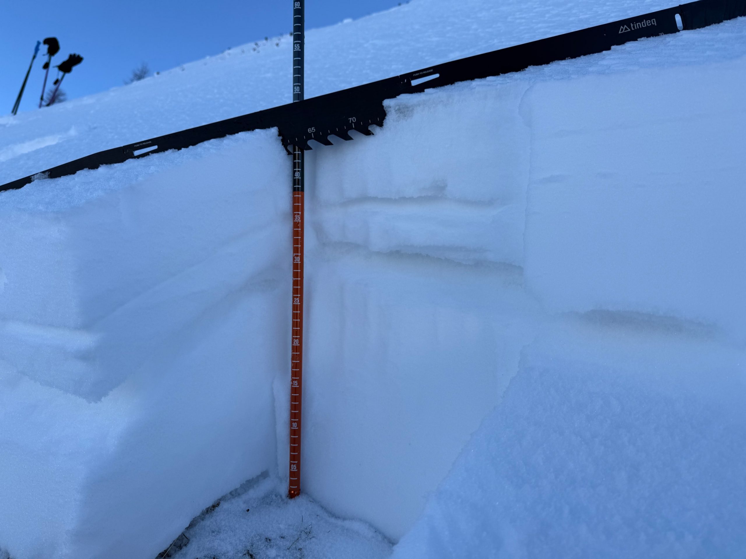
Snowpack generally weak

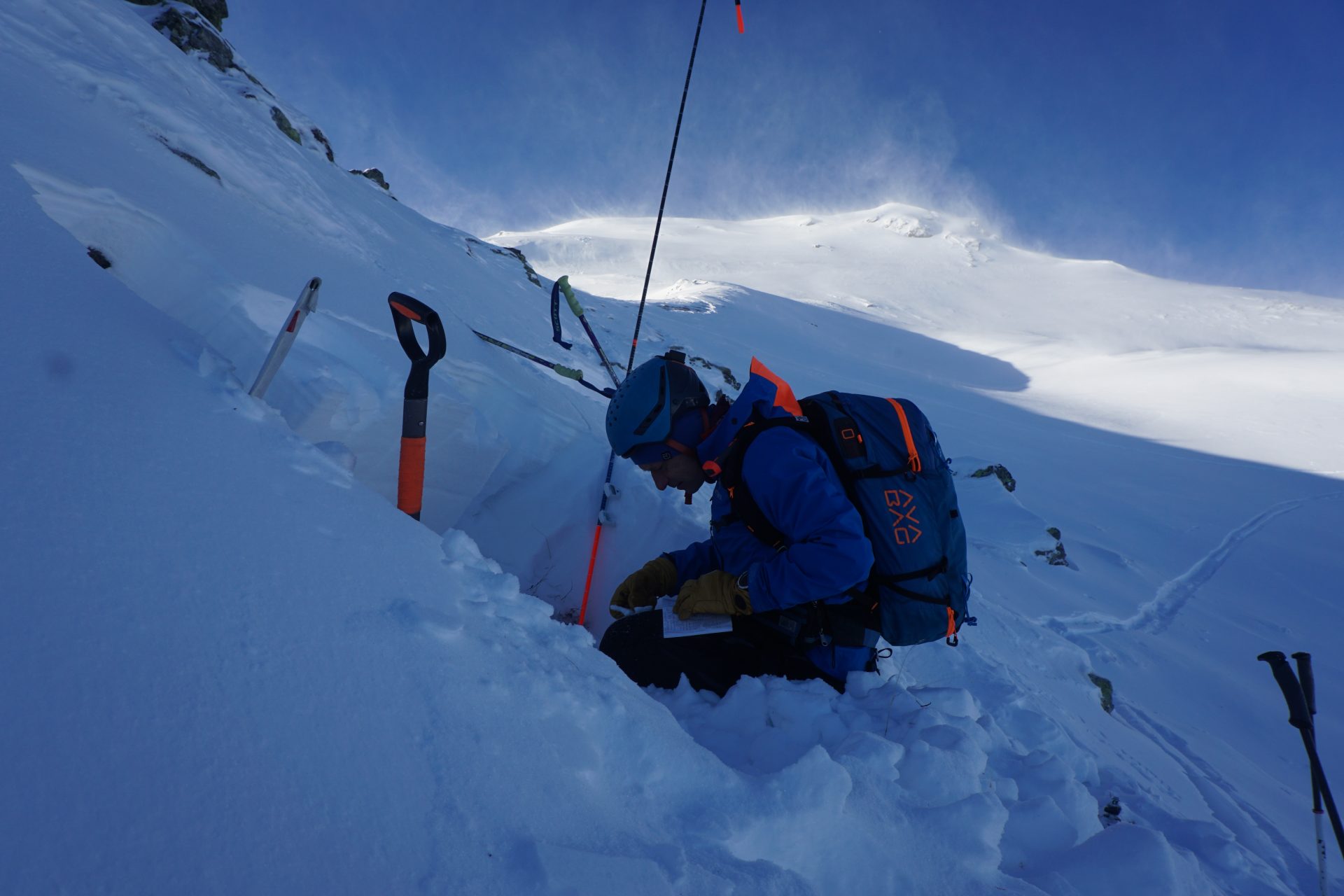
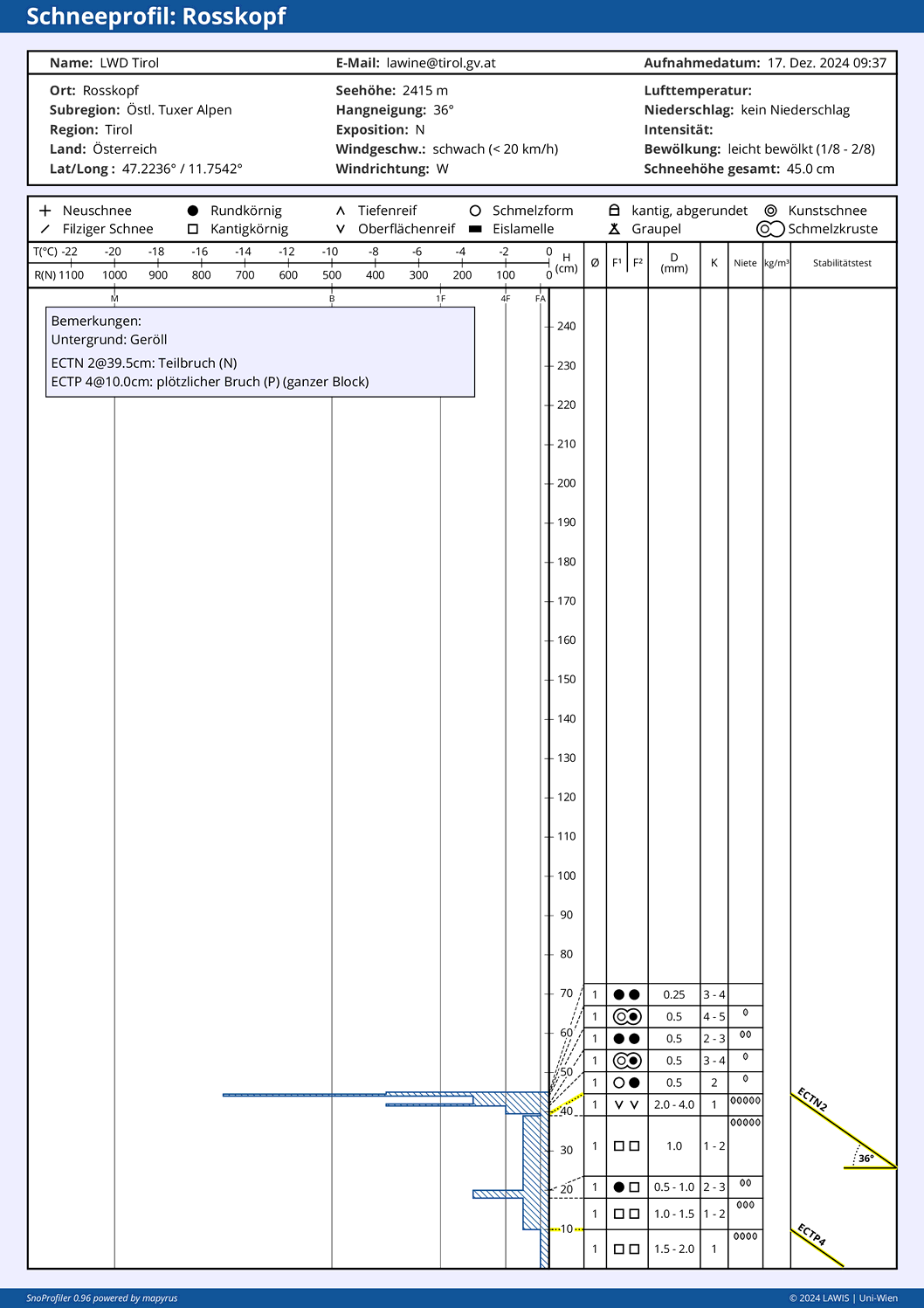
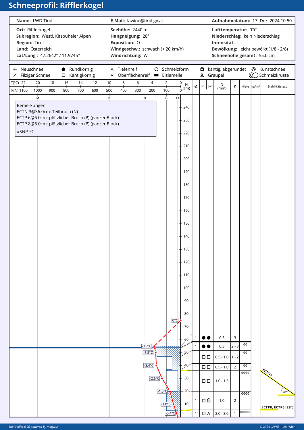
Several snowpack analyses and numerous reports from outlying terrain by our observers and winter sports enthusiasts corroborate amply that the snowpack layering is weak. This currently applies to altitudes above 2000m. To start with, mostly shady slopes, then with ascending altitude also on west-facing, east-facing and south-facing slopes. Currently (today on 19.12) a marked slab above the weak layers of the shallow snowpack is frequently still lacking.

Schneedeckenuntersuchungen schärfen unser Bild über die Lawinengefahr. Tuxer Alpen (Foto: 17.12.2024, © LWD Tirol)
Snowpack analysis increases precision of avalanche danger. Tux Alps (photo: 17.12.2024, © LWD Tirol)
Schneeprofil in den Tuxer Alpen. Nord, 2415m, 36°.. Oberflächenreif und kantige Kristalle als potentielle Schwachschichten (Profil vom 17.12.2024)
Snow profile in the Tux Alps, north, 2415m, 36°. Surface hoar and faceted crystals constitute potential weak layers. (profile from 17.12.2024).
Dank der Unterstützung der Alpinpolizei konnten wir am 17.12. über Nordtirol verteilt zahlreiche Schneedeckenuntersuchungen machen. (Foto: 17.12.2024, © LWD Tirol)
Thanks to support from the airbourne police, we were able to make numerous snowpack analyses across North Tirol on 17 December. (photo: 17.12.2024, © LWD Tirol)

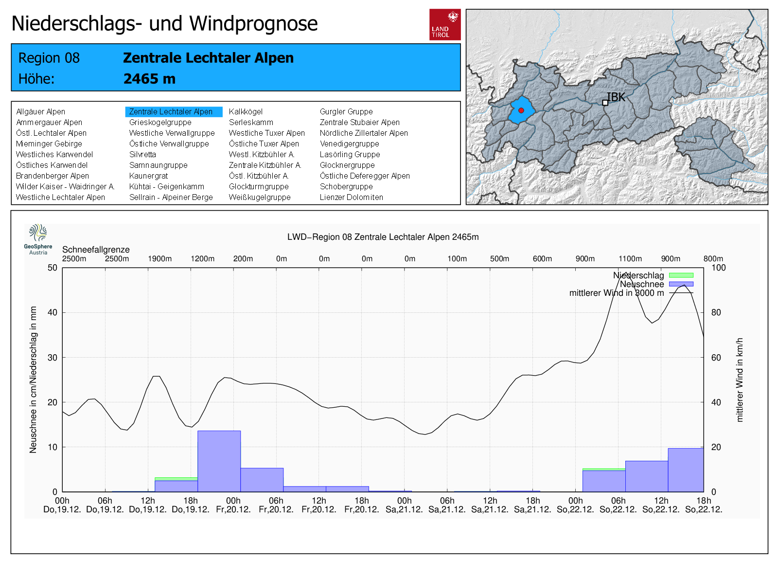
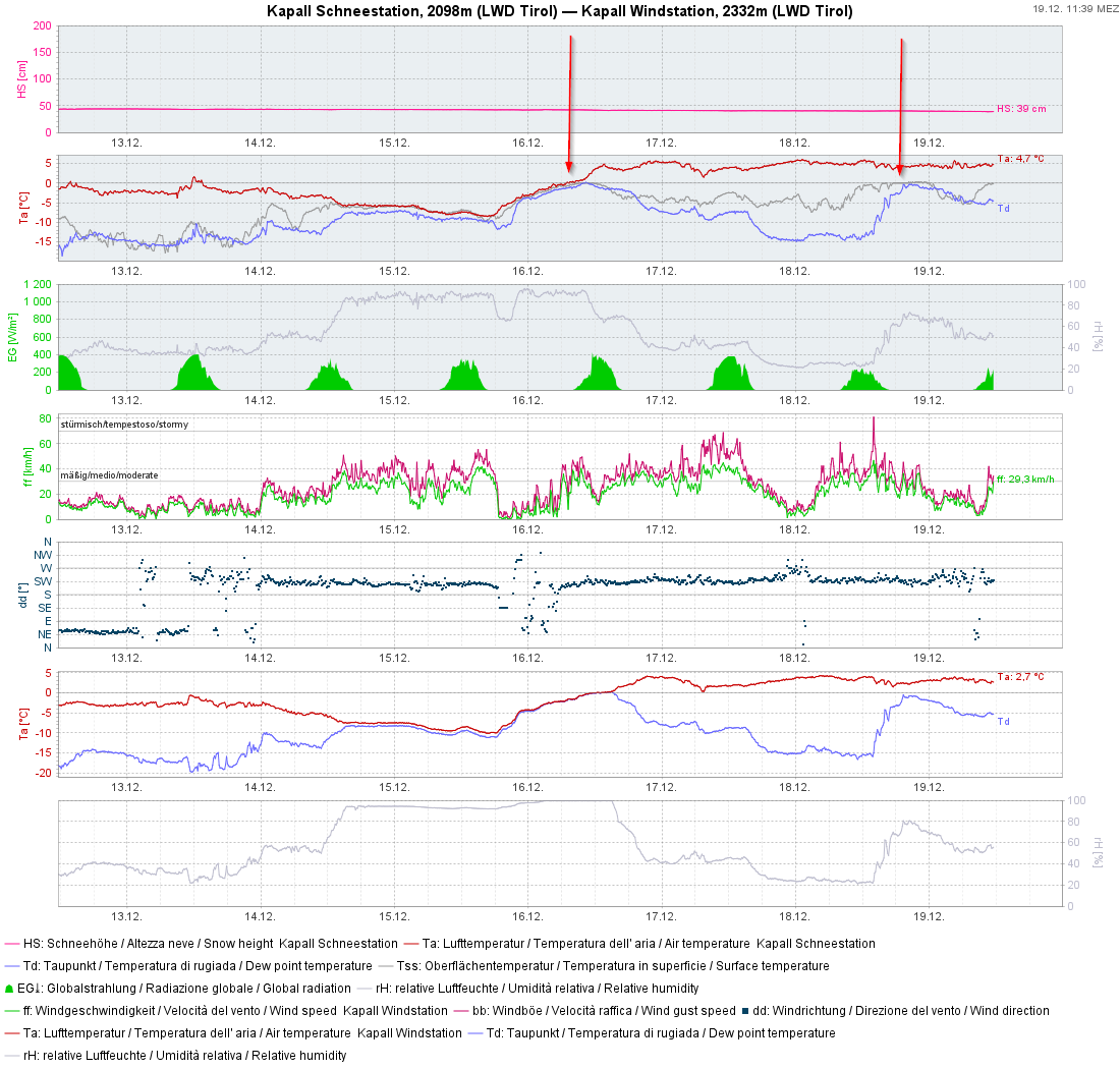
The warm front on Sunday night, 16.12, has a certain significance for the approaching precipitation: in the eastern and northern regions there was about 5-10mm of rainfall, in the remaining regions it rained up to 2200-2400m regionally.

Auf den ersten Blick unbedeutend. Der Regen vom 15.12. auf den 16.12. könnte zukünftig Auswirkungen auf die Schneedeckenstabilität haben. Ca. 5-15mm Niederschlag im Osten und Norden, sonst meist Spuren.
At first glance insignificant. Rainfall on 15-16 December could have future effect on the snowpack stability. About 5-10mm of precipitation in eastern and northern regions, elsewhere less.

In the wake of this rainfall, ice films and a thin melt-freeze crust were formed on the snowpack surface. These will soon be covered by fresh snowfall. Then the likelihood of larger-scaled fracture propagation will increase.

Eislamelle in den Westlichen Kitzbüheler Alpen aufgrund des Regens vom 15.12. auf den 16.12. Darunter ist die Schneedecke schwach. (Profil vom 17.12.2024)
Ice film in the western Kitzbühel Alps as a result of rainfall on 15-16 December. Beneath it, the snowpack is weak. (profile from 17.12.2024)

Below about 2000m the snowpack is moist in all aspects due to the rise in temperatures starting on 16 December. On sunny slopes the snowpack became wetter deeper down.

Schneeprofil im  Mieminger Gebirge, 1960m, SO, 32°. Die Schneedecke ist bis zum Boden feucht. (Profil vom 17.12.2024)
Snow profile in Mieming Massif, 1960m, south, 32°. The snowpack here is moist down to the ground. (profile from 17.12.2024)

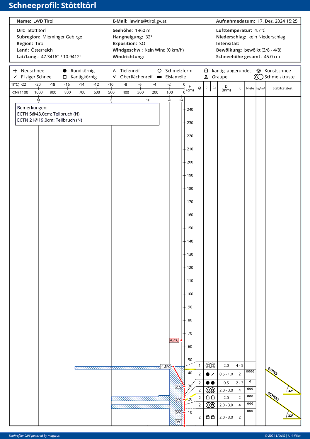
For further snow profiles, see this Link.

Outlook: (significant) increase in avalanche danger

Starting today and tomorrow (19-20 December) a cold front will spread about 15-30cm of fresh snow and strong, then slackening off NW winds.

48h Neuschneeprognose. Der intensive Schneefall ab Sonntag, den 22.12. ist hier noch nicht abgebildet.
48hr snowfall forecast. The heavy snowfall starting on Sunday, 22.12, is not depicted.
Kaltfront vom 19.12. auf den 20.12., dann ab Sonntag, 22.12. Intensivierung der Niederschläge samt deutlicher Windzunahme.
A cold front from 19-20 December, then on Sunday, 22.12, intensifying precipitation including marked rise in wind velocity.
Die Kaltfront hat am Abend Tirol erreicht. Juifenalm in den Sellrainer Bergen (Foto: 19.12.2024, © LWD TIrol)
The cold front reached Tirol in the evening. Juifenalm in the Sellrain massif (photo: 19.12.2024, © LWD TIrol)

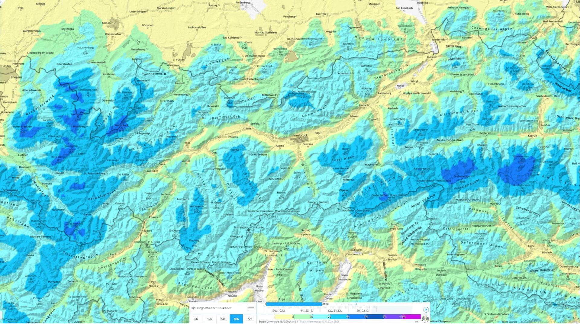
Starting on Sunday in three bouts of precipitation, heavy snowfall will often be registered in North Tirol. Further details will be published at latest on Monday, 23 December, in a new blog.

Es steht wechselhaftes Wetter bevor. Eine Abfolge von Nord- und Südföhnlagen.
Capricious weather conditions lie ahead: a sequence of north and south foehn scenarios.

One thing is certain: avalanche danger in the regions with the heaviest snowfall will rise markedly.

Review

Highly varied weather developments

Last week was variable. Initially, high-pressure front and cool temperatures, then a bit of precipitation and rising temperatures, followed by more high-pressure front conditions and increasing wind impact. The snowpack was moistened up to about 2000m in all aspects, higher up on sunny slopes.

Wetterstation Kapall im Arlberggebiet. Die Pfeile zeigen auf die Schneeoberflächentemperatur. Die Schneedecke wurde in tiefen und mittleren Lagen angefeuchtet.
Weather station Kapall in Arlberg region. Arrows point to snowpack surface temperature. The snow cover was moistened at low and intermediate altitudes due to higher temperatures and solar radiation.

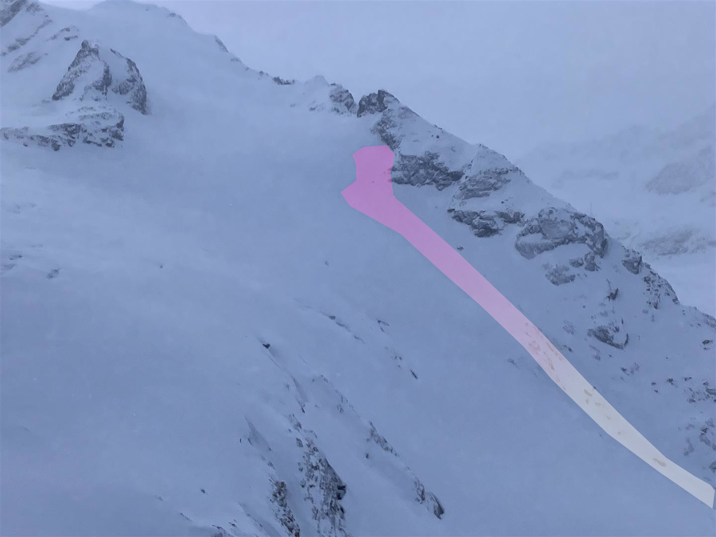
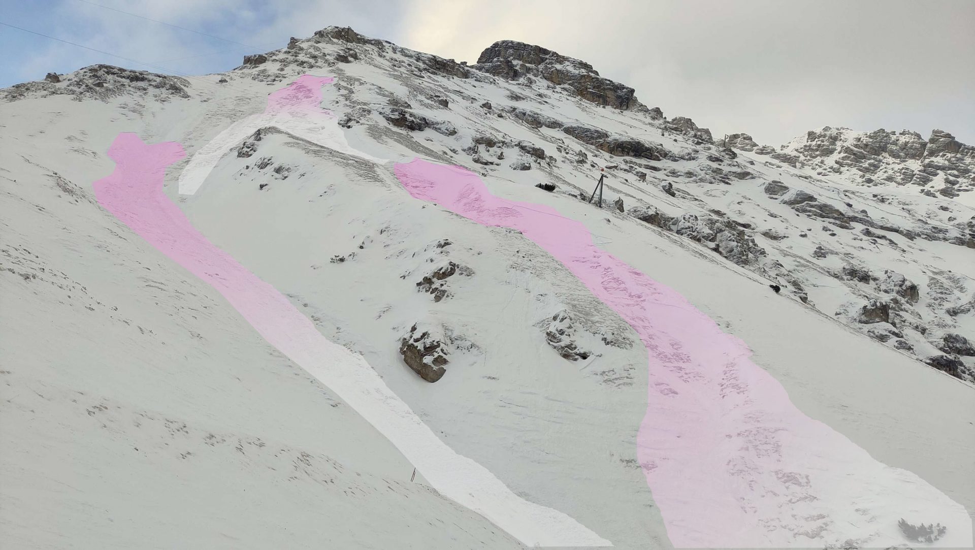
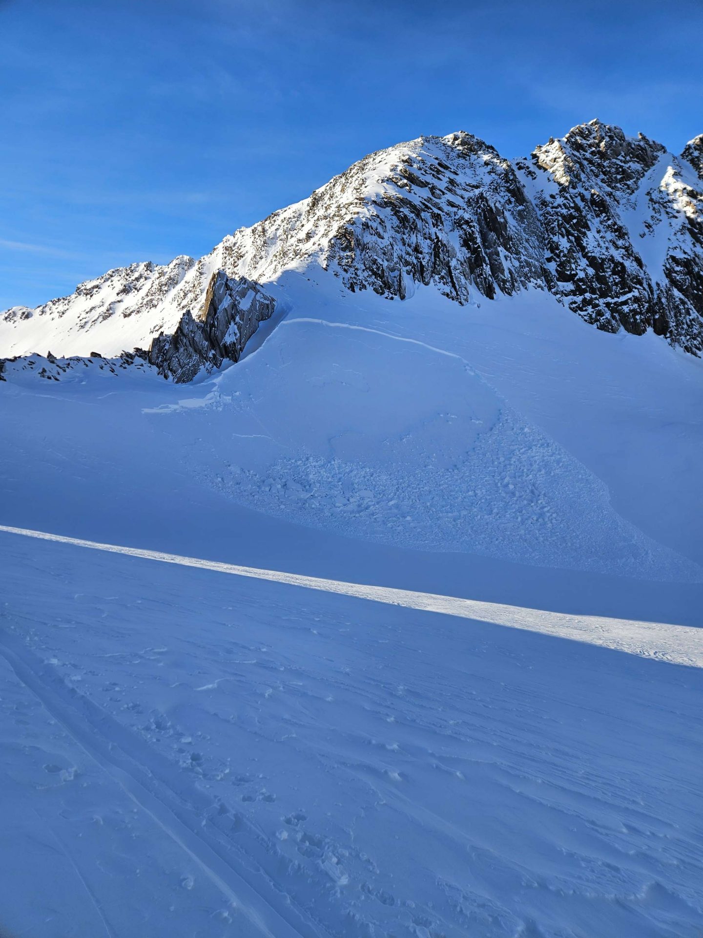
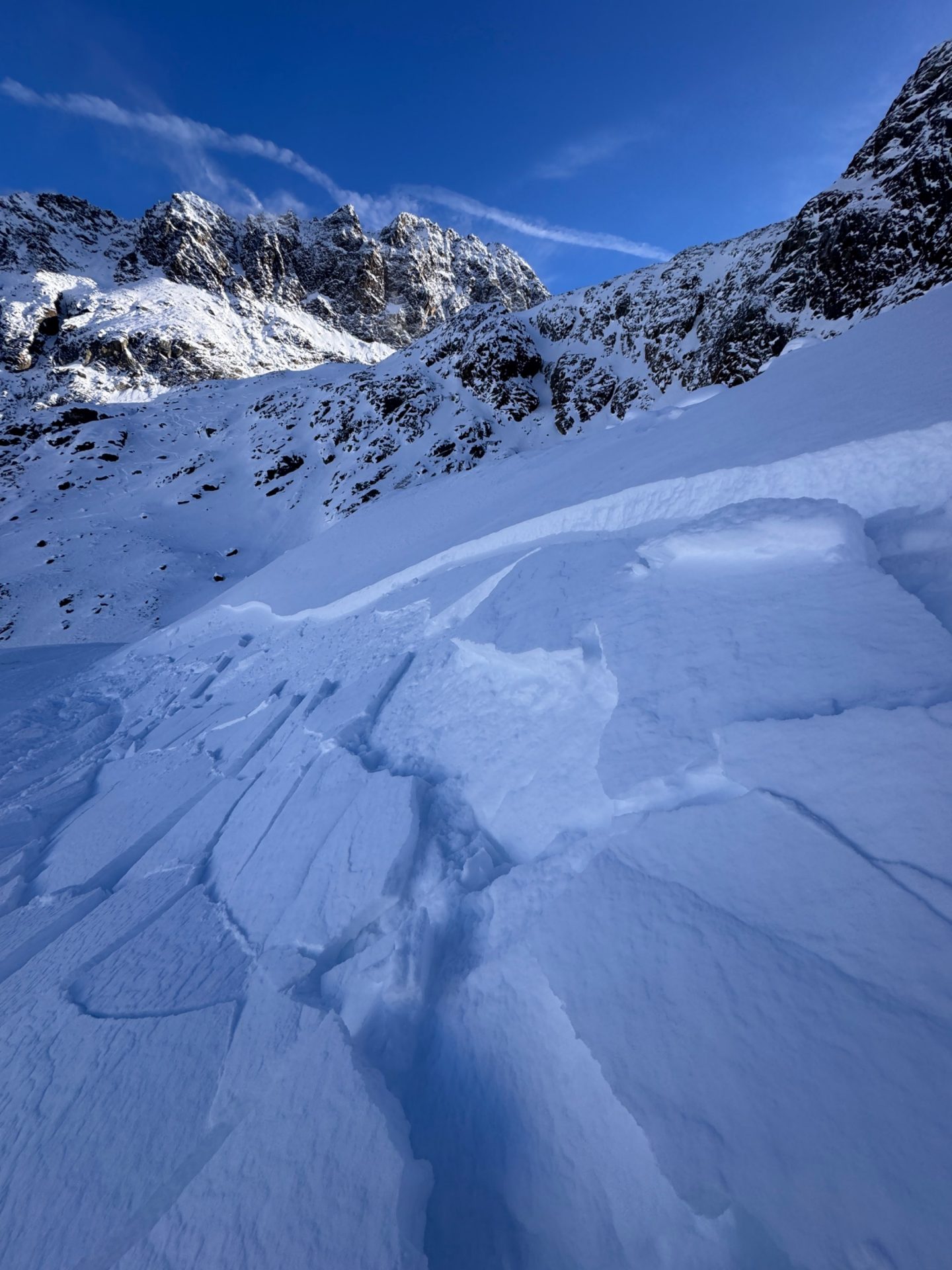
Avalanche releases mostly from persistent weak layer

During the course of the week we were informed of a few avalanche releases. As far as we know, none involved persons. The avalanches were mostly due to the persistent weak layer. As a result of rising temperatures and the moistening of the shallow snowpack at low and intermediate altitudes, glide-snow slides increased somewhat.

Lawinenabgang am Linken Fernerkogel in der Weißkugelgruppe. (Foto: 14.12.2024, Lukas Pössl)
Avalanche release on Linker Fernkogel in the Weisskugel Massif. (photo: 14.12.2024, Lukas Pössl)
Gesprengte Schneebrettlawinen in der Schlick in den Kalkkögeln. Förderlich für die Auslösung war die leichte nächtliche Anfeuchtung und dadurch vermehrte Bindung der Schneedecke durch Regeneinfluss. (Foto: 16.12.2024, © Dominik Jenewein)
Artificially triggered slab avalanche in the Schlick in the Kalkkögeln. The slight nocturnal moistening and then increasing consolidation of the snowpack from rain impact were necessary for the release. (photo: 16.12.2024, © Dominik Jenewein)
Fernauslösung am Pfaffenjoch im Nahbereich des Zuckerhütls - ein Indiz für einen sehr schwachen Schneede kenaufbau (Foto: 16.12.2024, Andreas Gastl)
Remote triggering on Pfaffenjoch near the Zuckerhütl – an indication of very weak snowpack layering. (photo: 16.12.2024, Andreas Gastl)
Gleitschneerutsche in den Zillertaler Alpen (Foto: 17.12.2024, © LWD Tirol)
Isolated glide-snow slides in the Zillertal Alps (photo: 17.12.2024, © LWD Tirol)