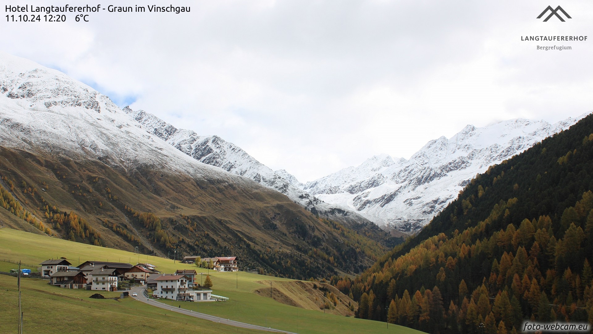
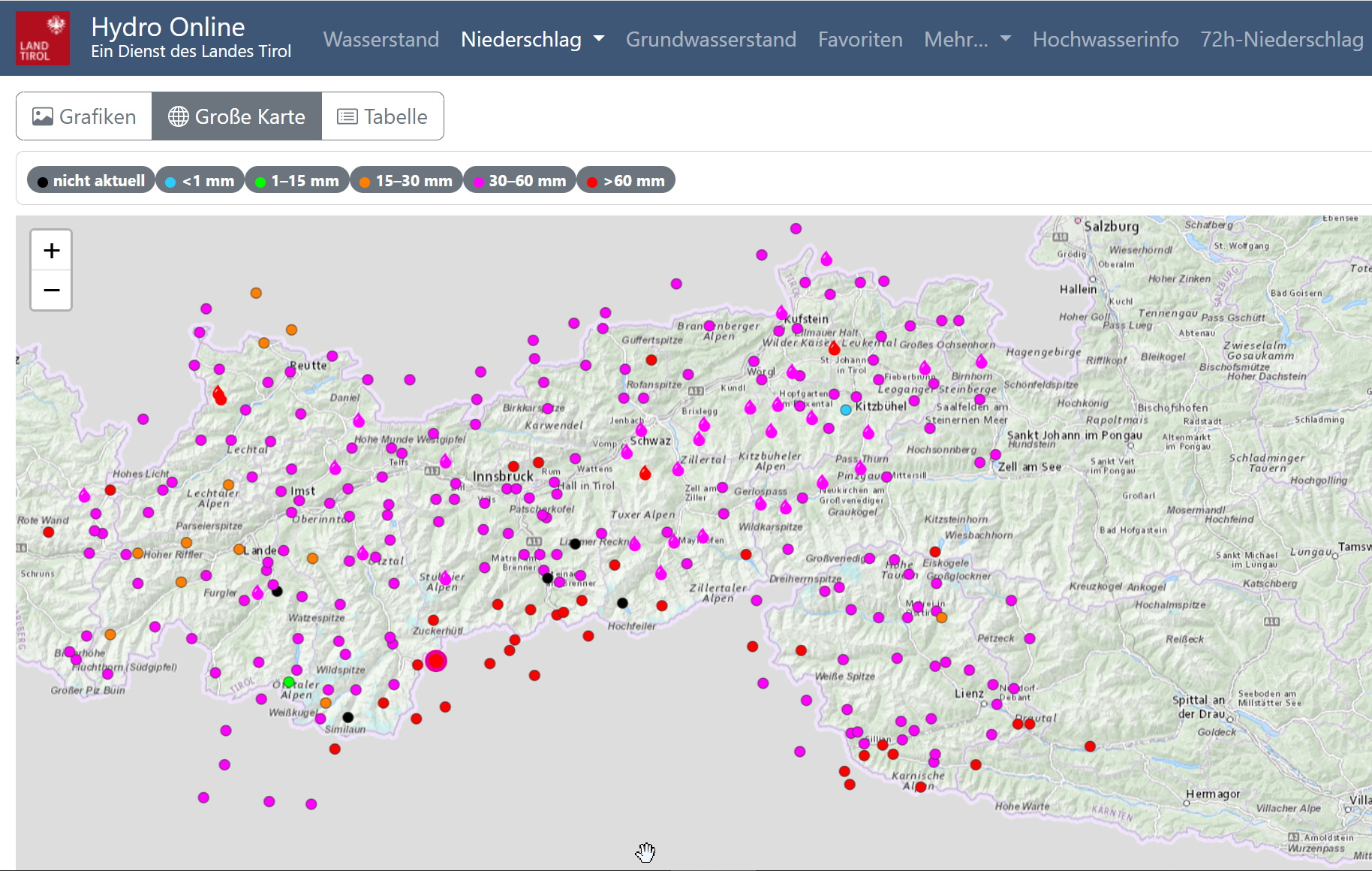
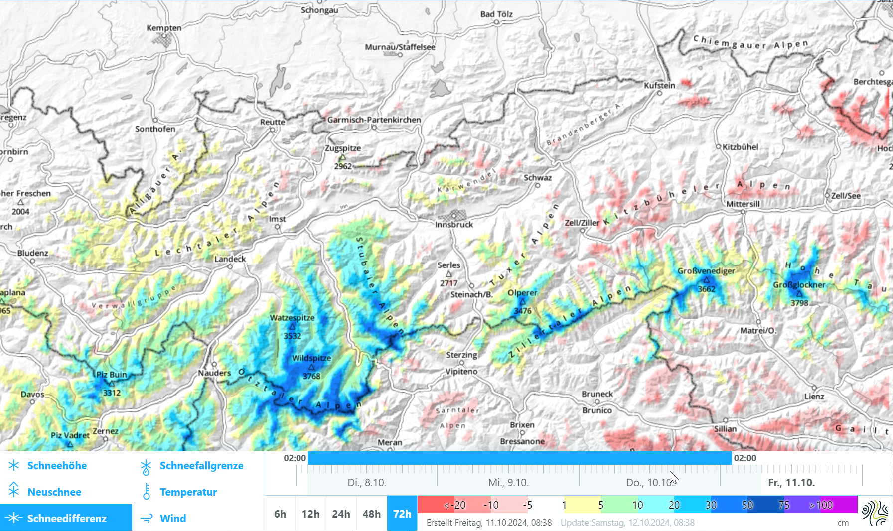
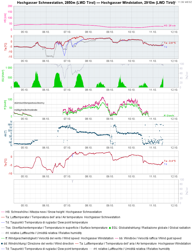
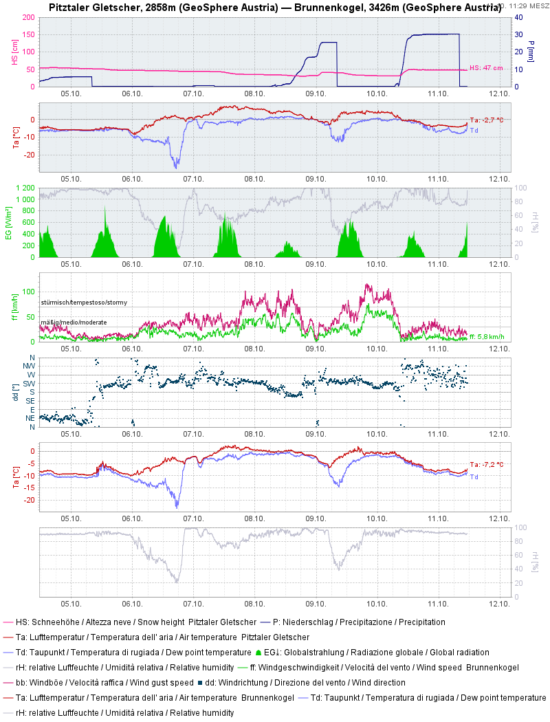
Two spells of southerly foehn brought lots of precipitation. Due to higher temperatures it frequently fell as rain even above 3000m. For that reason, lots of snowfall only accumulated in high alpine terrain in the Main Alpine Ridge regions. Freshly drifted masses were generated there which, for a brief time, require attentiveness. In addition, we anticipte heightened loose-snow avalanche activity in extremely steep terrain.
Widespread precipitation, heavy snowfall only at very high altitudes
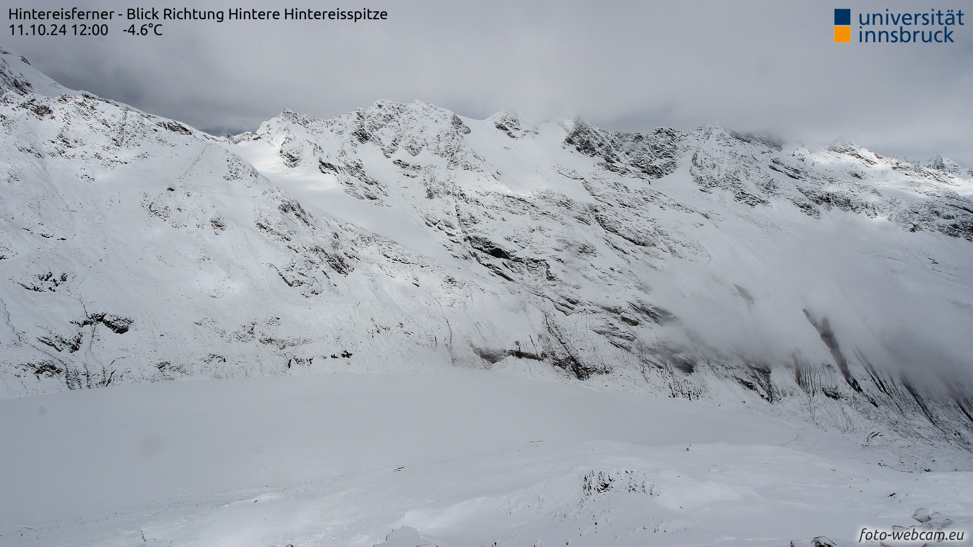
Fresh snowdrifts from strong winds
During these periods of precipitation, strong to storm-velocity winds were blowing from the south. Thus, it can be assumed that at high altitudes near ridgelines and on very steep shady slopes, snowdrift masses have been generated which are prone to triggering.
Loose-snow avalanches in extremely steep terrain
The improving weather including solar radiation and rising temperatures will also lead to numerous loose-snow avalanches triggering in rocky terrain for a short time. These will release mostly on sunny slopes.
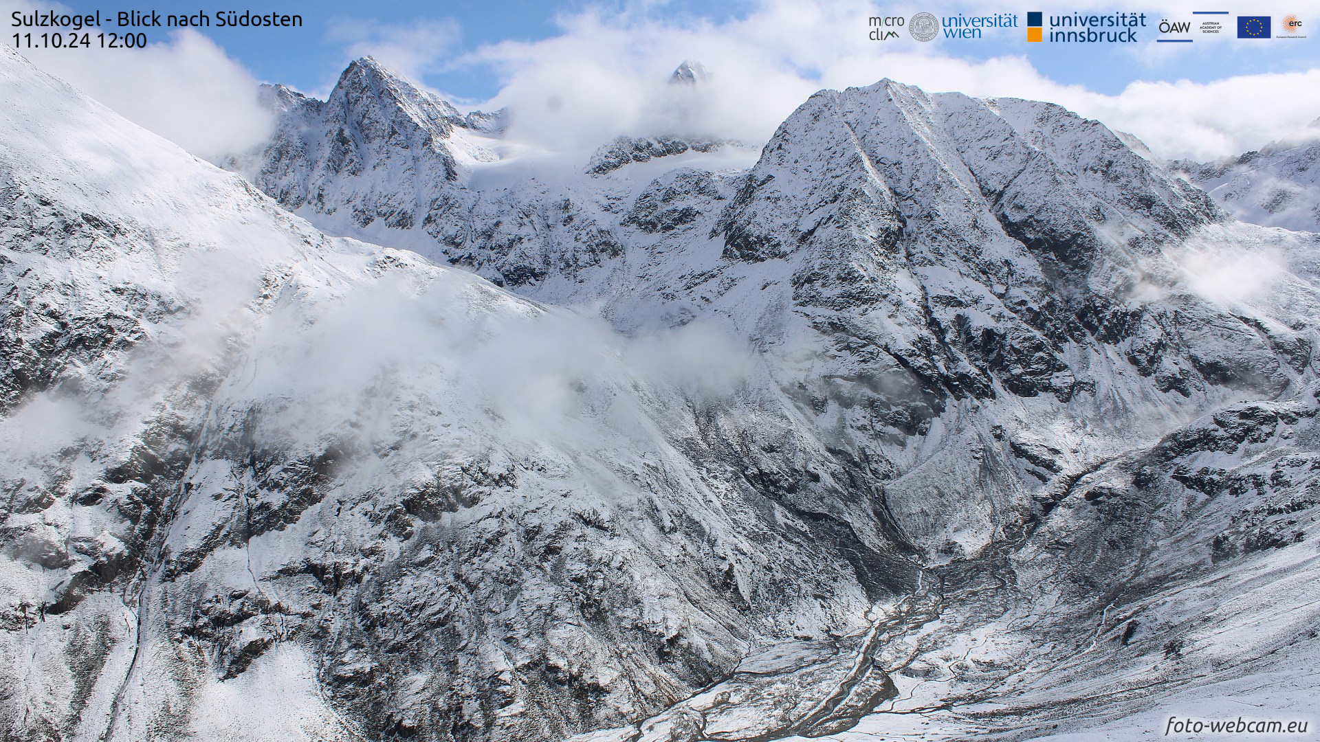
This avalanche danger is expected to be a peril for only a short time.