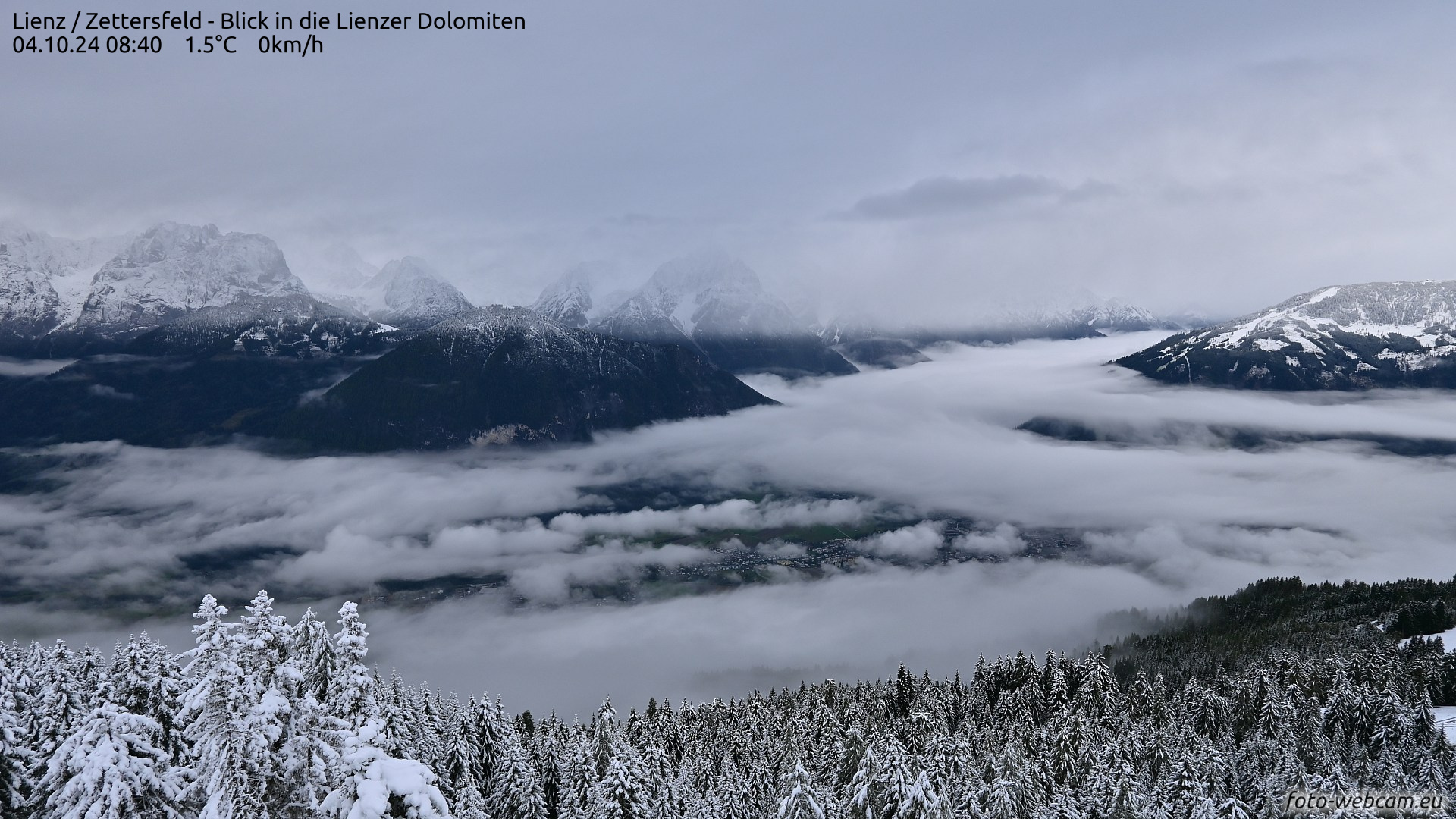
Starting this weekend, Tirol’s glacier ski areas will all have launched their winter season. This prods us to give an initial brief estimate of current avalanche dangers.
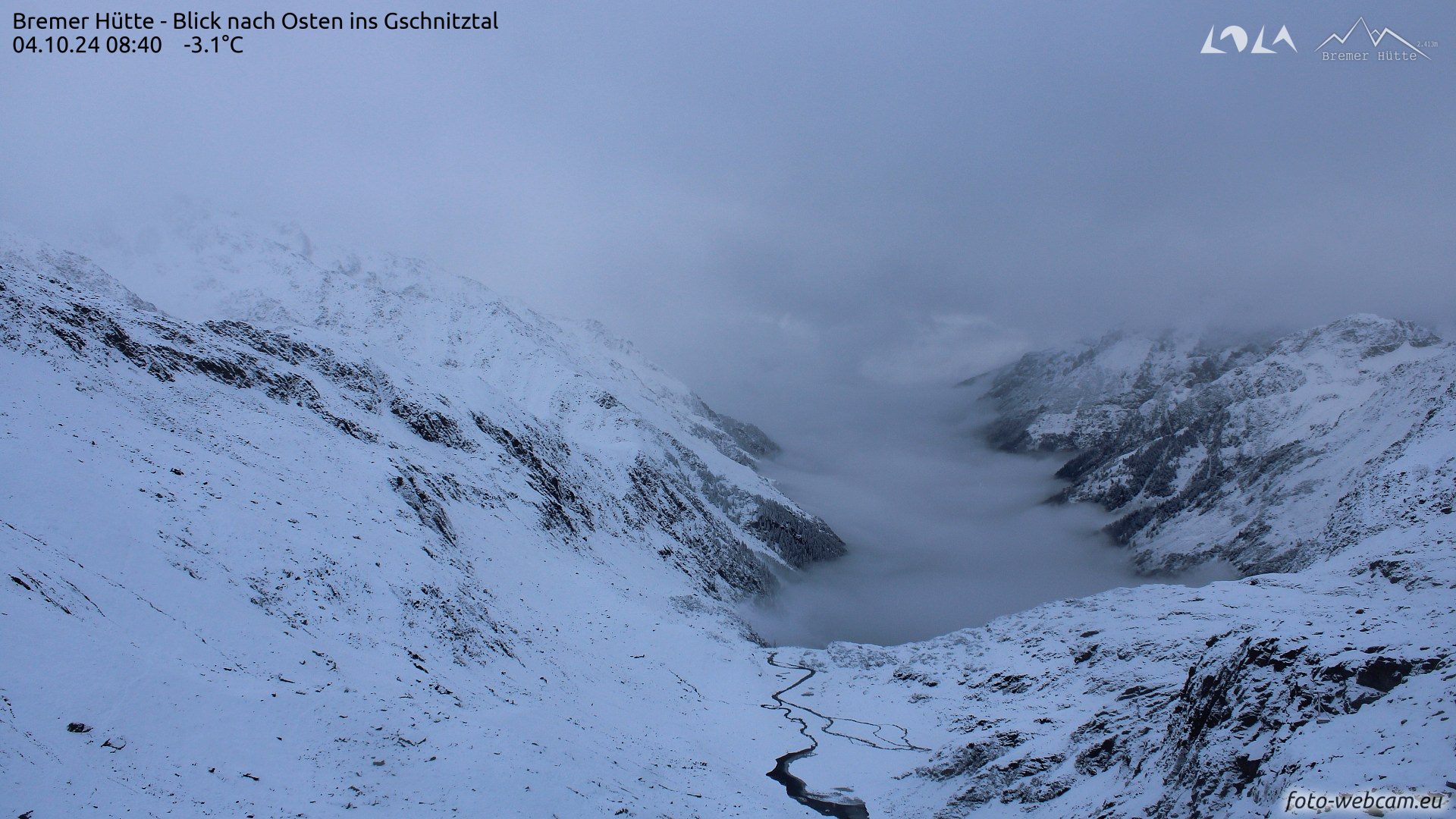
Fresh snow in the mountains
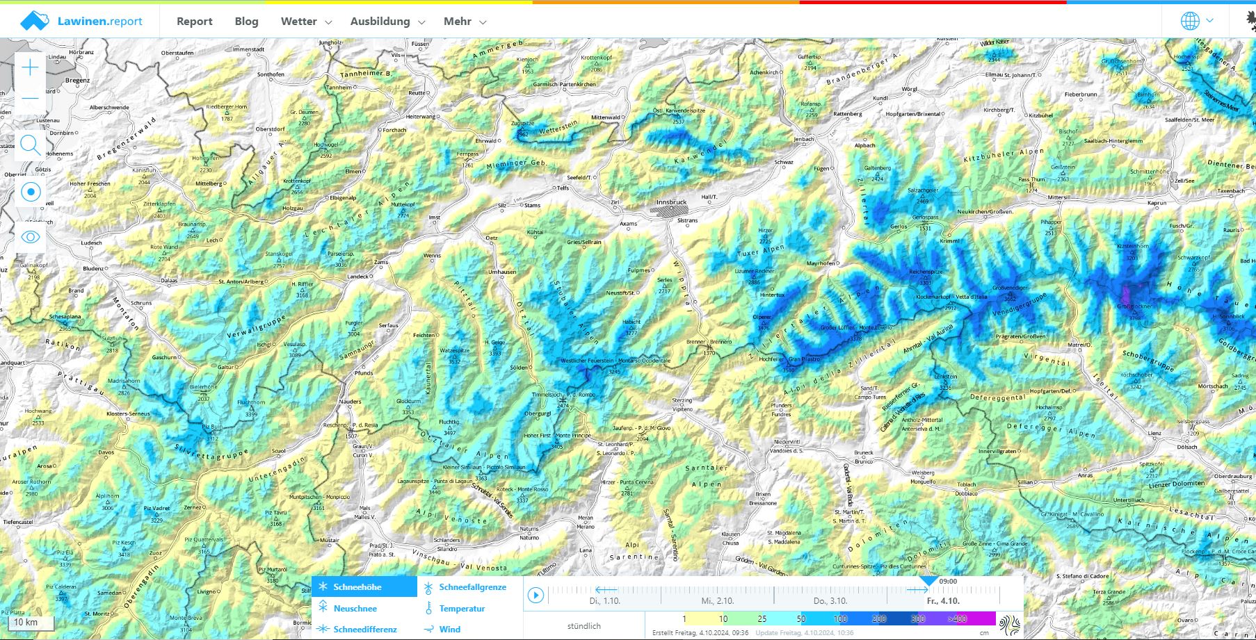
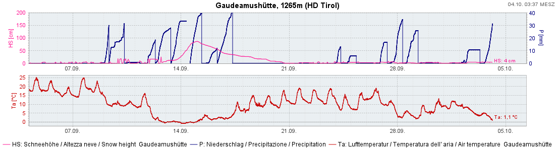
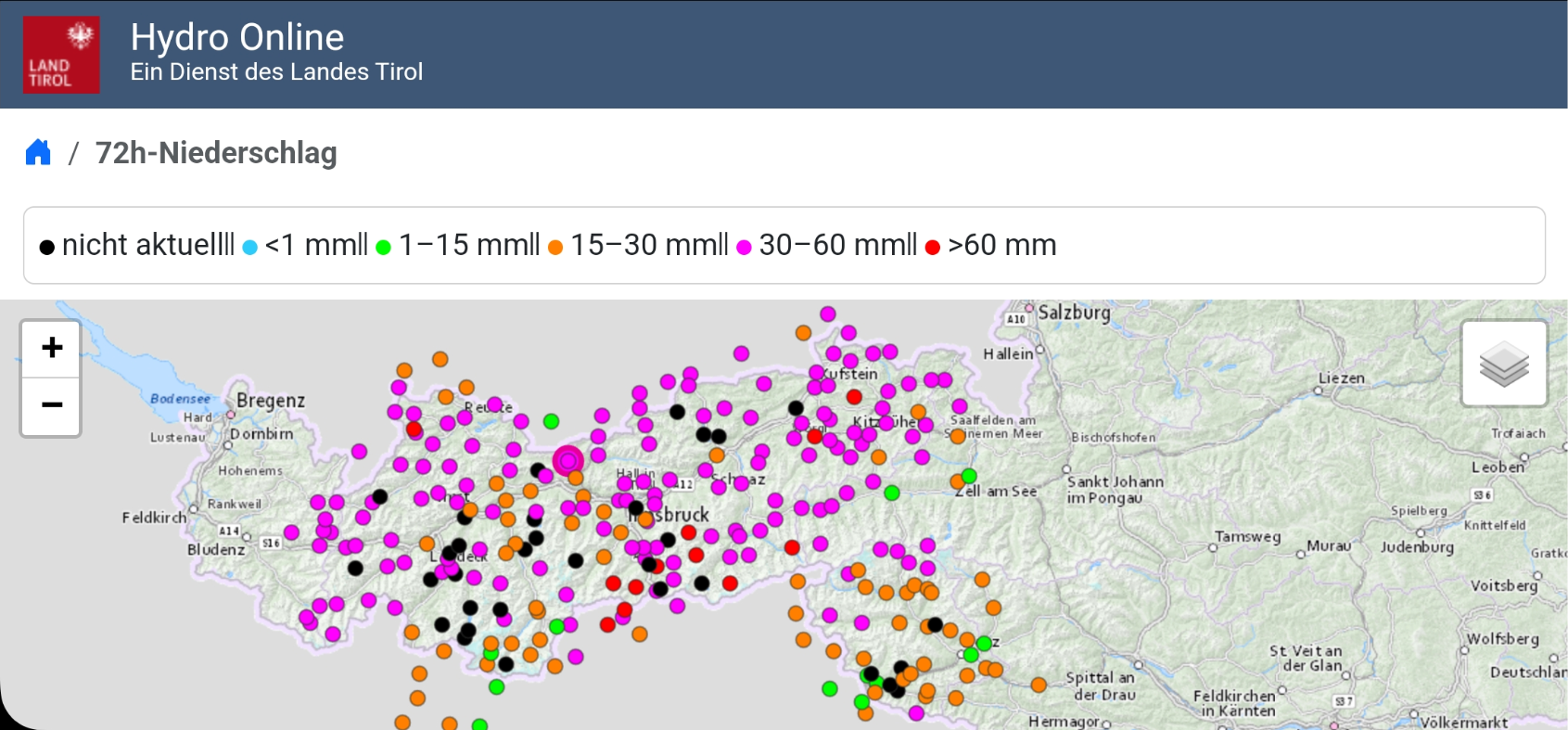
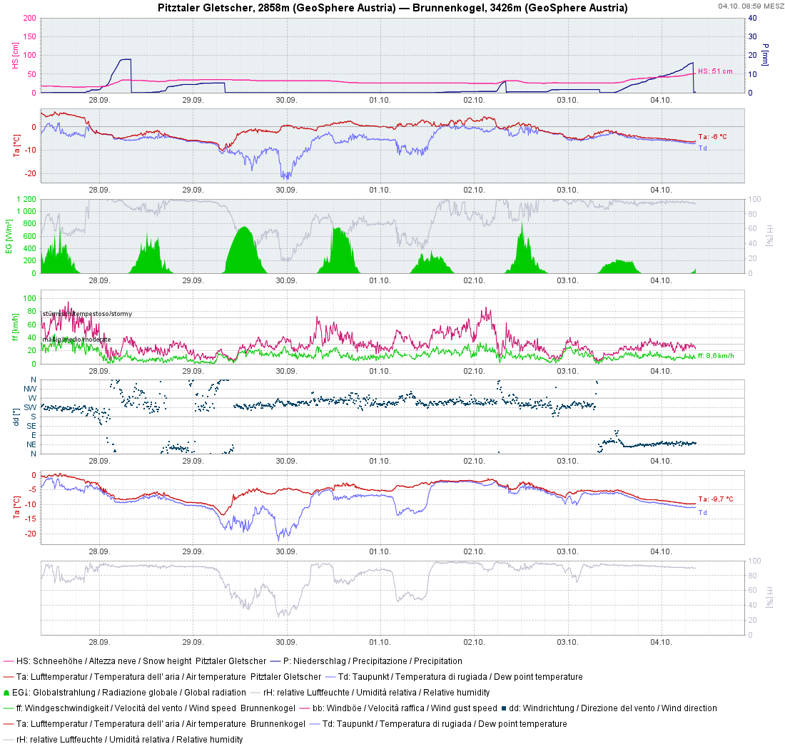
We look back on an initially very warm, then very rainy/snowy September. In northern and eastern regions of Austria, September recorded more precipitation than any time in measurement history. This brought ample snow to the glacier regions for the start of the winter season.
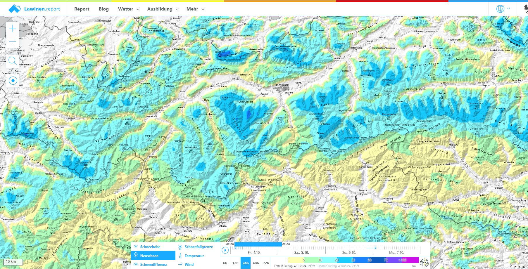
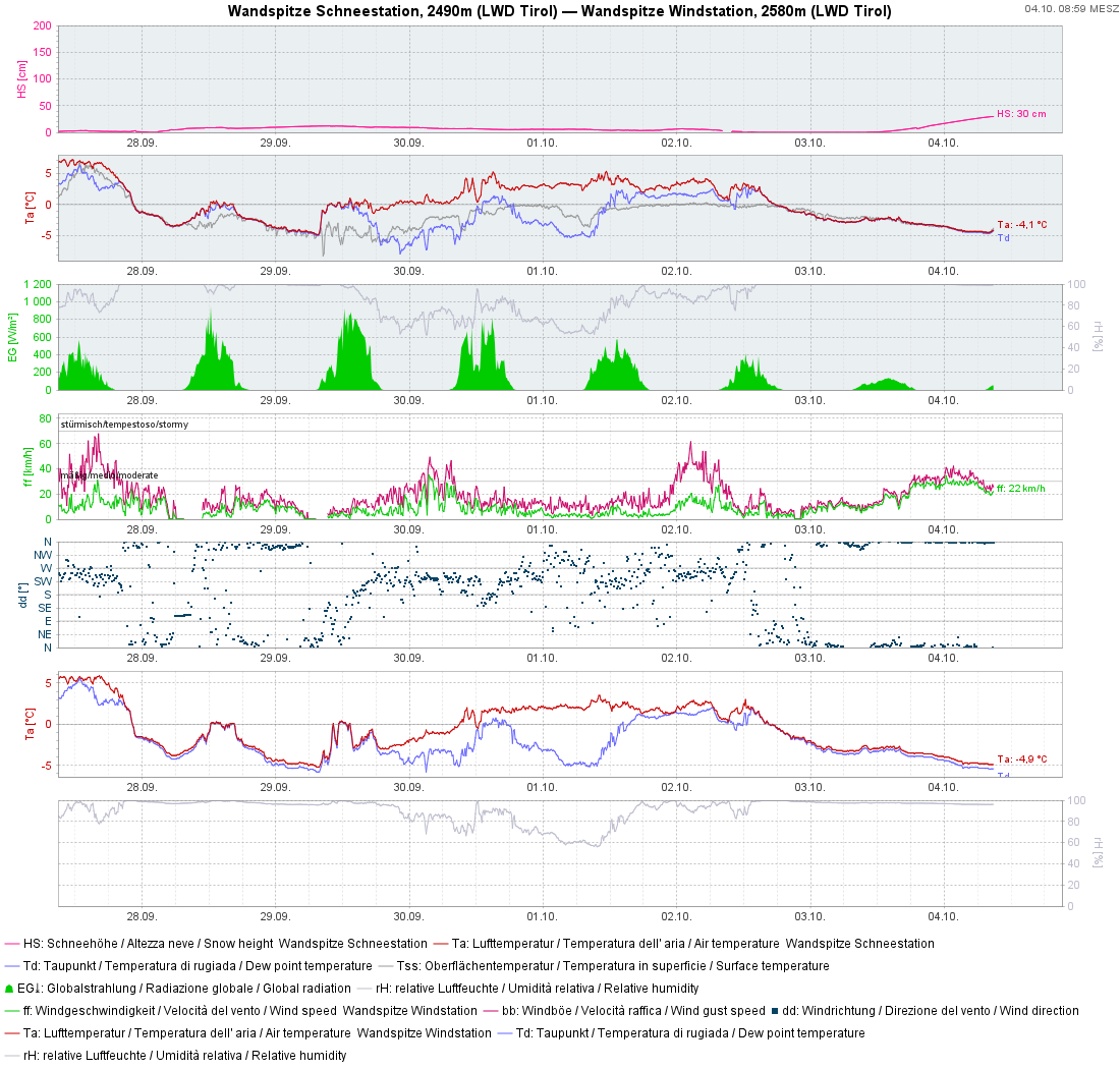
Today at 4:30 am: an additional 10 cm, from place to place as much as 20 cm of fresh snow will be added to this. Winds at high altitudes will be moderately strong to strong in some regions, mostly northeasterly.
Effects on avalanche danger
Small-area snowdrift masses
In high alpine regions snowdrift masses are currently being generated wherever there are strong winds. Where wind is absent, near ridgelines, on very steep slopes, these accumulations can be triggered by snowsports participants. With adequate visibility, these danger zones are easily visible and avoidable. Besides, it is a short-lived problem. By the beginning of next week at latest, when temperatures rise again, these snowdrift accumulations will have stabilised.
Glide-snow slides on steep grass-covered slopes
In those regions where recent snowfall has been heaviest, the fresh snow can glide away over steep grassy slopes. Due to the amounts of snowfall (usually 10-20 cm, locally up to 40 cm) these will be glide-snow slides which for a brief time require caution. The perils of being swept along and being forced to taking a fall outweigh those of being buried in snow masses. The situation is a far cry from mid-September, when numerous, sometimes large glide-snow avalanches triggered in Tirol, and one person lost his life in a glide-snow avalanche (Blog).
The next update will be published whenever the avalanche situation changes significantly.