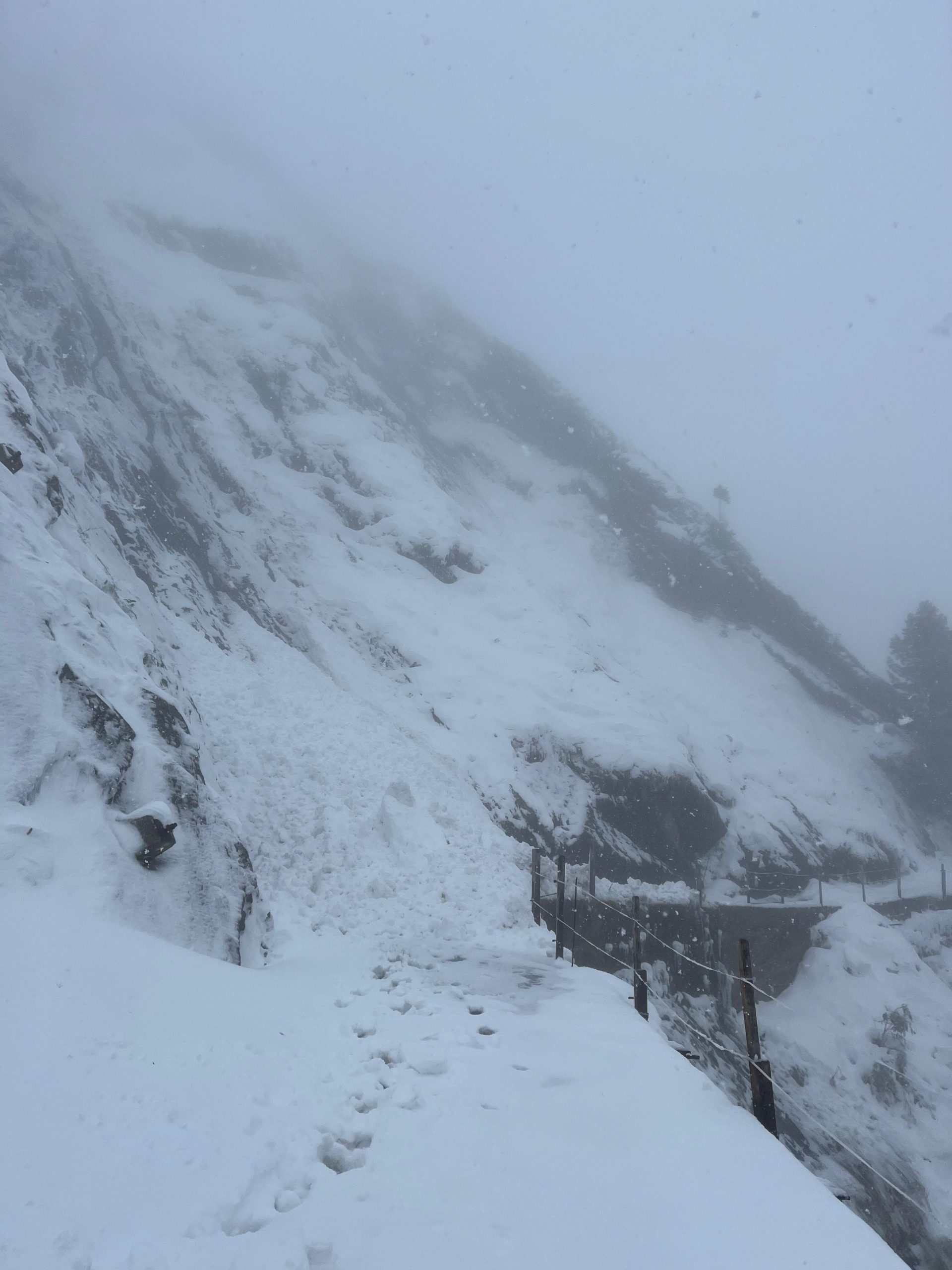
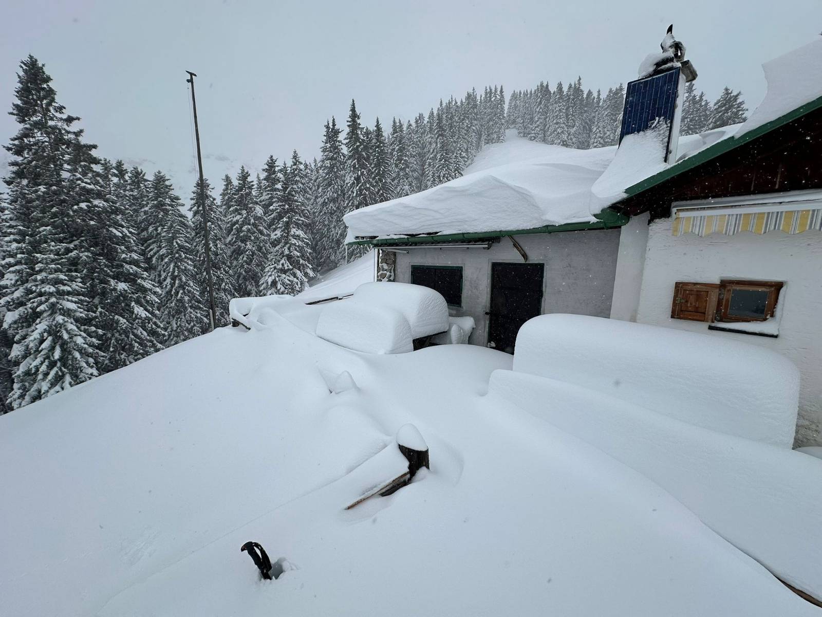
The first onset of winter this season is a knockout: in widespread parts of Tirol, heavy snowfall down to intermediate altitudes. Whereas freshly generated, trigger-sensitive snowdrift accumulations require caution at high altitudes, further down high numbers of glide-snow and loose-snow avalanches can trigger naturally.
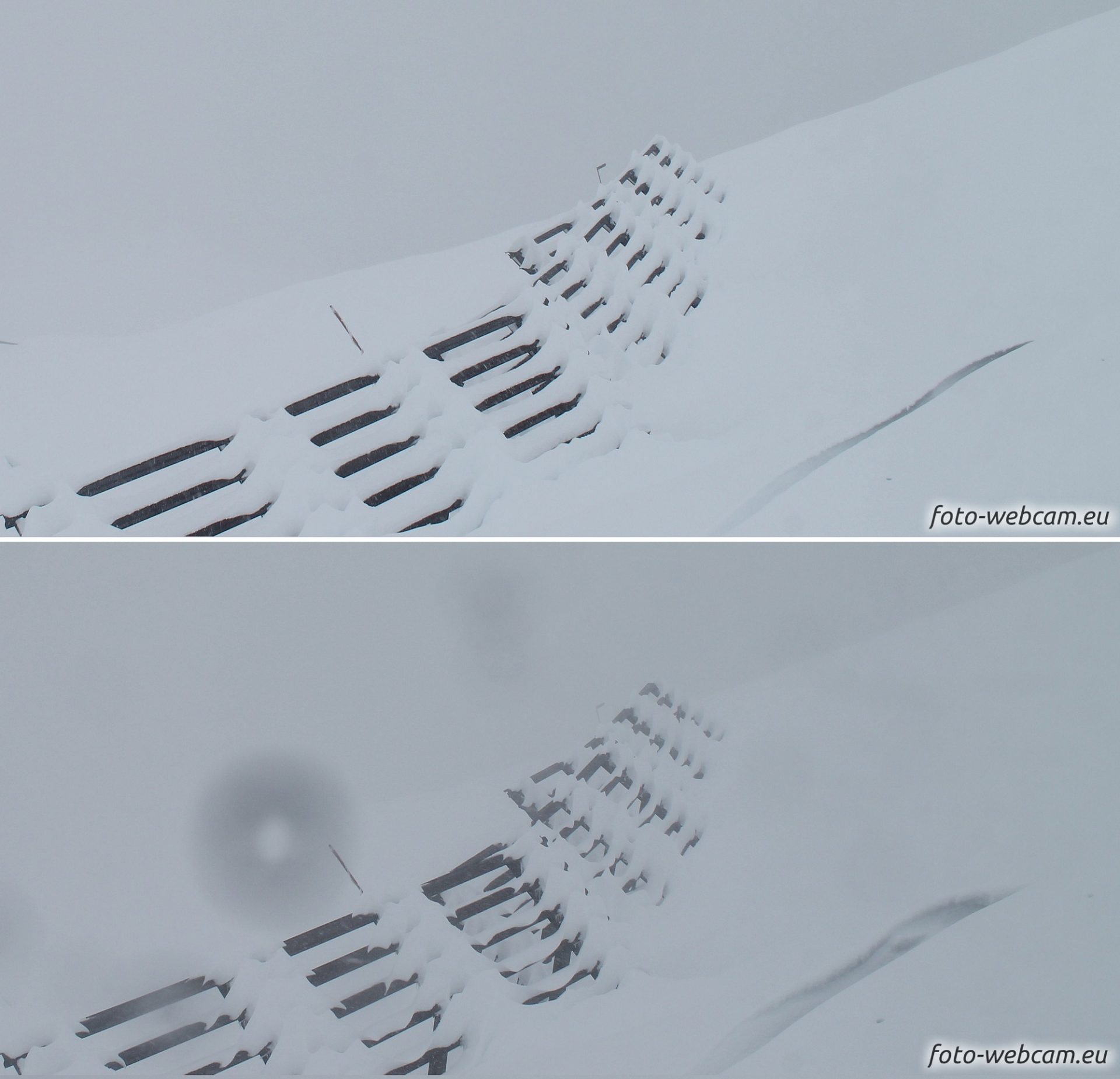
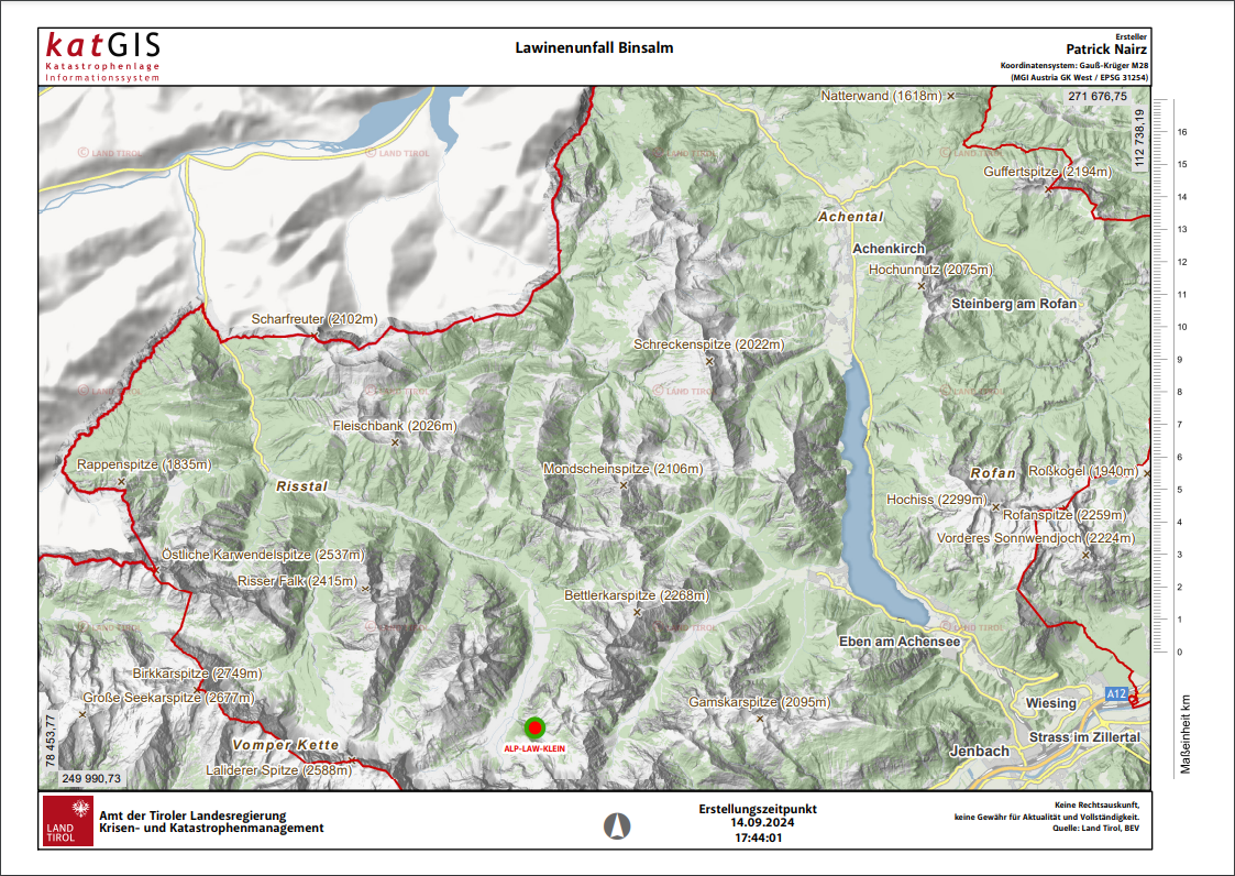
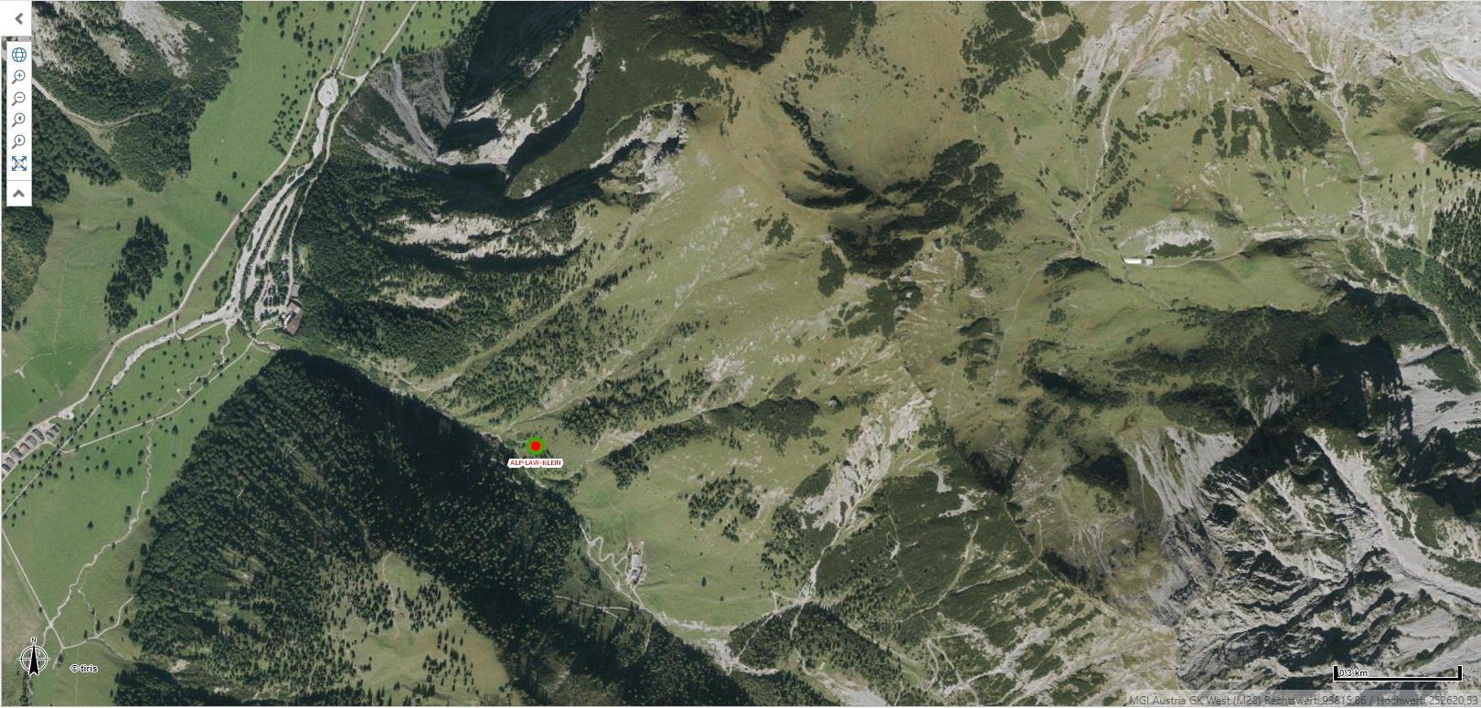
On the Binsalm in Hinterriss (community of Vomp, in the eastern Karwendel region) one person in a group of hikers was caught in a naturally triggered avalanche today, Saturday, 15 September. The search had to be called off.
Highly multi-faceted danger situation: caution + restraint urged!
During the early hours of Sunday, 15.09, weather conditions temporarily improved for a brief interim. On Sunday it will be predominantly dry, a bit of sunshine is possible further west. Northerly winds are expected to slacken off but will continue to blow at high velocity in many parts of the mountains of East Tirol.
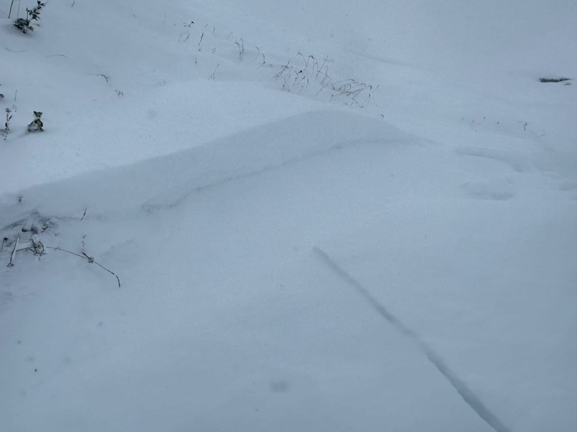
Heightened glide-snow avalanche activity on steep grass-covered slopes
With the improved weather conditions the fresh-fallen snow is settling a bit and consolidating. We assume that glide-snow activity on steep grass-covered slopes will thereby increase somewhat over the next few days. Small (and in the regions where snowfall was heaviest also medium-sized) glide-snow avalanches are likely. All zones at the foot of slopes or hillsides with glide-snow cracks should be avoided.
Slab avalanches at high altitudes
At higher altitudes the wind has transported the snow massively. Snowdrift accumulations generated will consolidate through sunshine and diffuse radiation, nevertheless they will remain prone to triggering, particularly on very steep shady slopes. Avalanche prone locations occur behind disconinuities in the terrain, in gullies and bowls, and tend to increase in frequency with ascending altitude. Wherever the wind is blowing more strongly and snow is still being transported, trigger-sensitive snowdrift accumulations can still be generated.
Numerous loose-snow avalanches in rocky terrain
As occurred today, Saturday, naturally triggered loose-snow avalanches will trigger also tomorrow, Sunday, 15.09, in extremely steep terrain (>40°) due to the expected solar radiation and slight rise in temperatures, particularly in the west. These releases can sweep along additional snow masses on their plummet path and thereby grow to large size.
All in all, this is a quite complex avalanche situation. And it comes at a juncture of the season when most people have not yet adjusted their sights to wintertime perils. It is easy to forget that only a week ago we were enduring temperatures just like in high summer.
Caution urged in avalanche starting zones above hiking paths and forest trails
As in wintertime, this is valid now: don’t forget to pack your beamer, your snow shovel and your probe in your backpack. In addition, it is especially advisable now when intensified danger of glide-snow and loose-snow avalanches prevails, to be very mindful of tracks in the snow (ascending and descending) in avalanche starting zones, paying particular heed in terrain which is not visible from further down.
Outlook: starting Tuesday, improving weather and rising temperatures
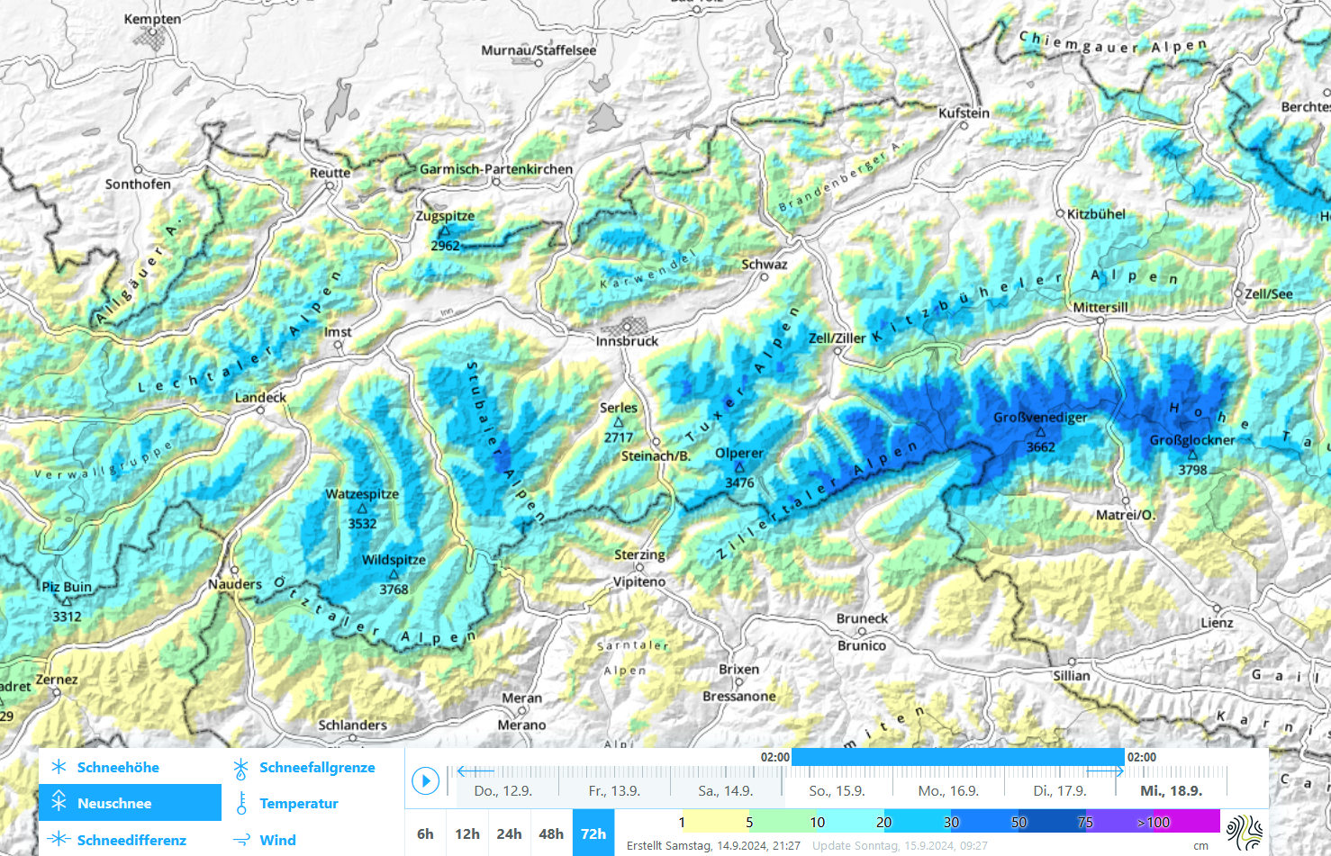
On Sunday evening another front will reach us from the north which is expected to bring 20 to 30 cm of fresh snow widespread by Tuesday, 17.09. The snowfall level is expected to ascend to approximately 2000m.
Starting Tuesday, the air will dry out quickly and sunny weather will prevail. Temperatures will rise significantly over the course of the week. Avalanche danger will thus largely be a matter of wet-snow and glide-snow avalanches. As the snow cover melts, these releases will rapidly decrease at high altitudes.
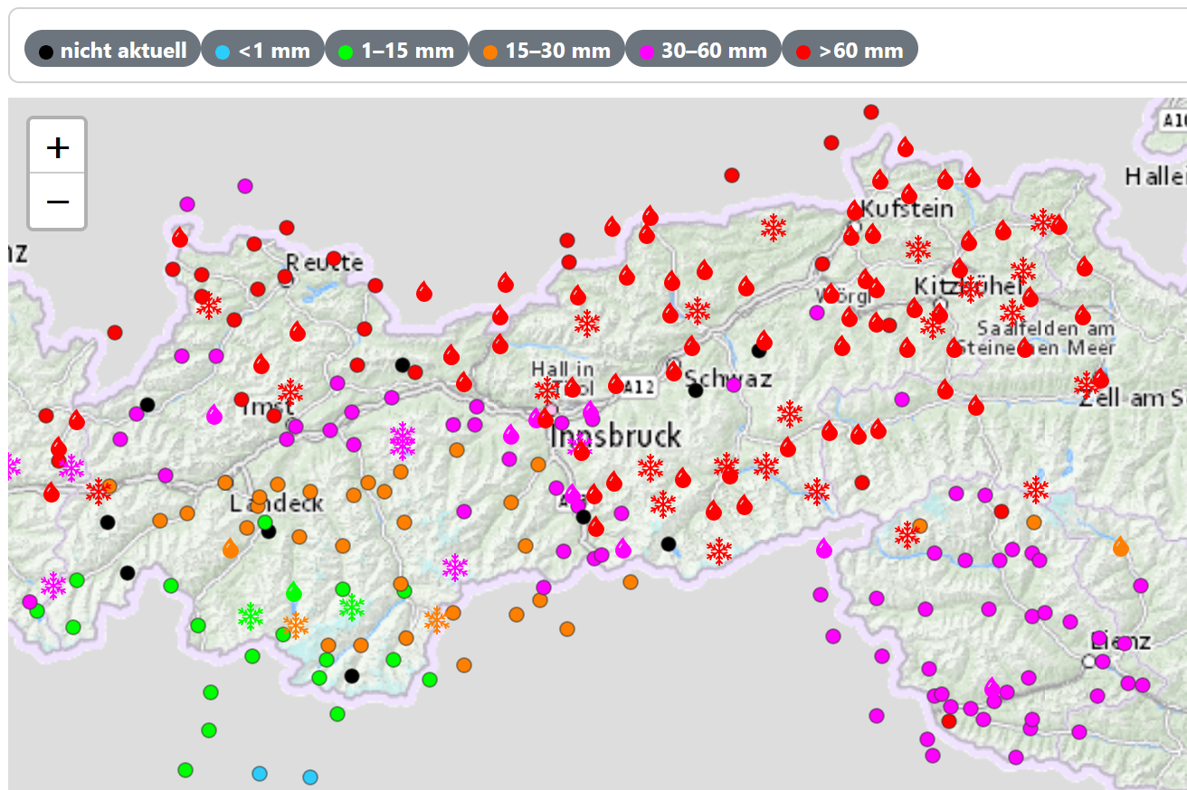
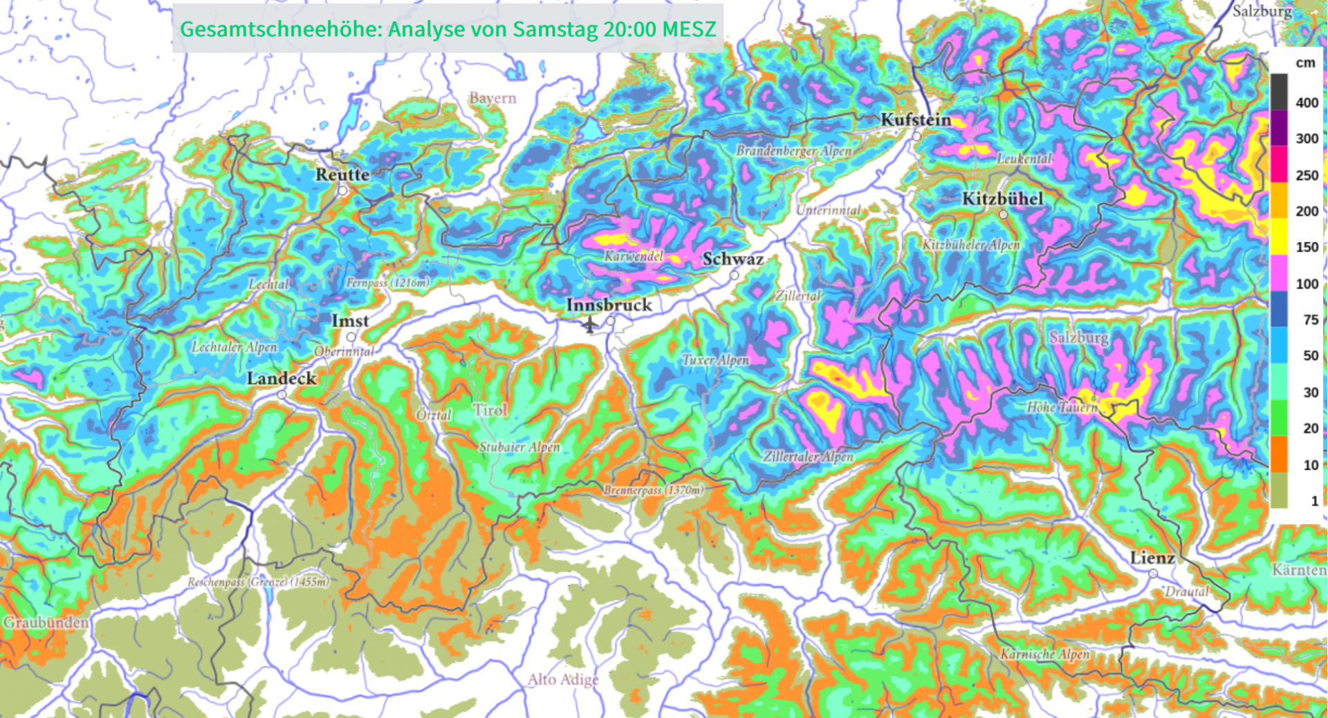
Review: heavy snowfall & often stormy northerly winds down to intermediate altitudes
The heavy precipitation of the last few days fell as snow above altitudes of about 1200 to 1500m. As forecast by GeoSphere Austria, also large amounts of snow fell in the eastern regions of North Tirol and along the Hohe Tauern, but also in the classic northern barrier cloud regions of the Karwendel-to-Allgau and Lechtal Alps got lots of precipitation. In addition, starting on Friday winds intensified in velocity, blowing at strong to storm strength from northerly directions.

Avalanche incident Binsalm – search broken off
Person buried in avalanche
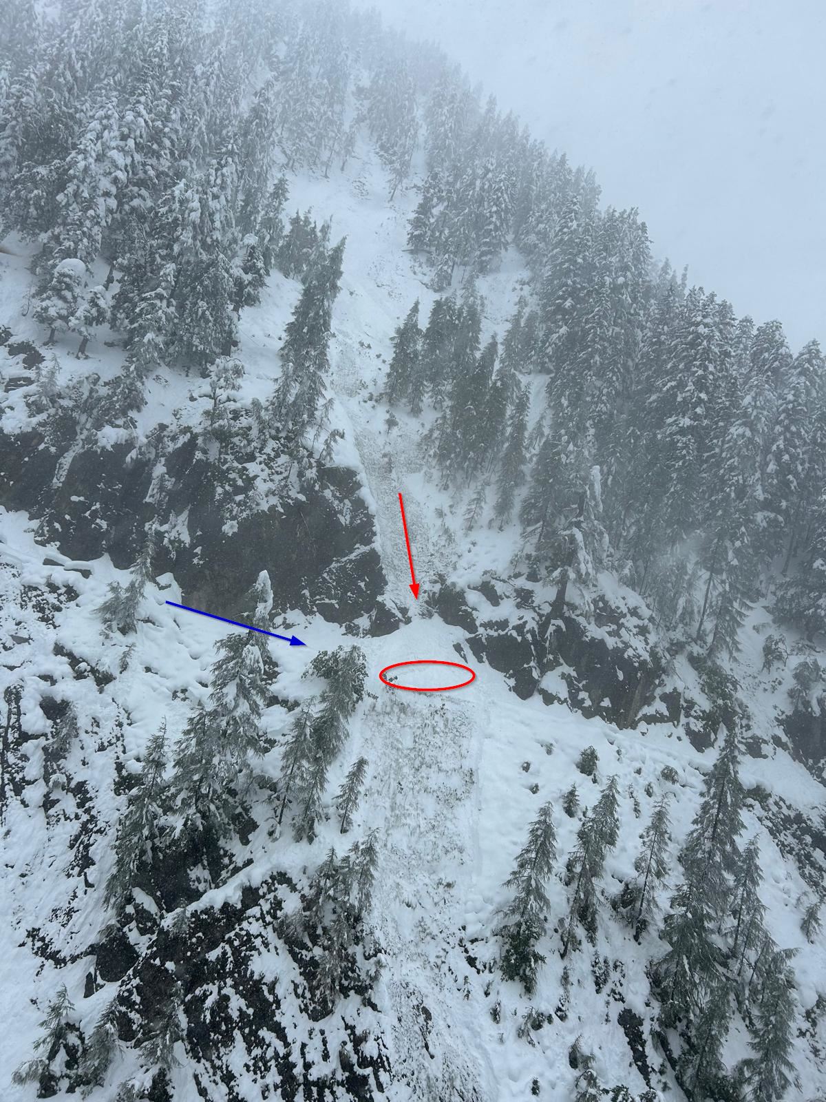
Just before 10:30, Tirol avalanche headquarters reported an avalanche had released near the Binsalm (1500m) in the eastern Karwendel region. One person in a large group of hikers was caught by a naturally triggered avalanche when descending from the Binsalm and buried in snow masses.
Difficult search – temporarily called off
The search for the buried person proved to be very difficult and dangerous. Difficult because the helicopter was initially unable to fly to the site of the incident due to bad weather; so the search-and-rescue team including avalanche dogs had to climb to the site on foot. Dangerous because of continuing avalanche releases. One member of the search-and-rescue team was caught and partially buried in such a release during the search and had to be transported to the hospital. The search has been temporarily broken off, in hopes of better visibility on Sunday, 15.09, when the situation will be analyzed/approached anew. A detailed analysis of the incident will also be made by the Avalanche Warning Service and the Alpine Police.