Still wintery in high alpine regions

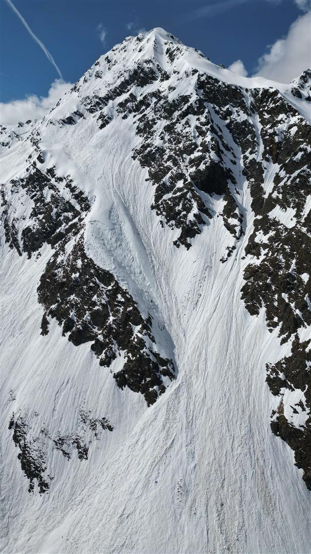
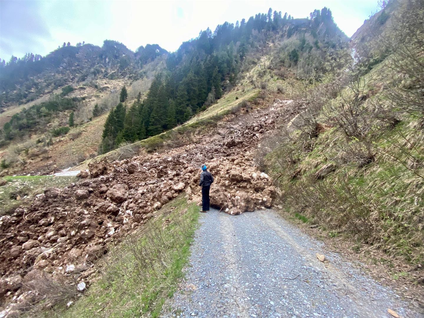
Some rainfall and weeklong lower temperatures lie before us – in high alpine regions local snowfall is possible. The fresh fallen snow will be deposited mostly on a wet old snowpack. Recent precipitation was shower-like, which generated a marked layer of graupel. This serves as a weak layer. On very steep shady slopes in high alpine regions isolated snowdrift accumulations can be prone to triggering for that reason. In addition, in rocky terrain, diffuse radiation makes numerous naturally triggered small-to-medium sized loose snow avalanches expected. In isolated cases the wet old snow will be swept along. Also glide-snow avalanches are possible on steep grass-covered slopes.

Current avalanche and weather situation

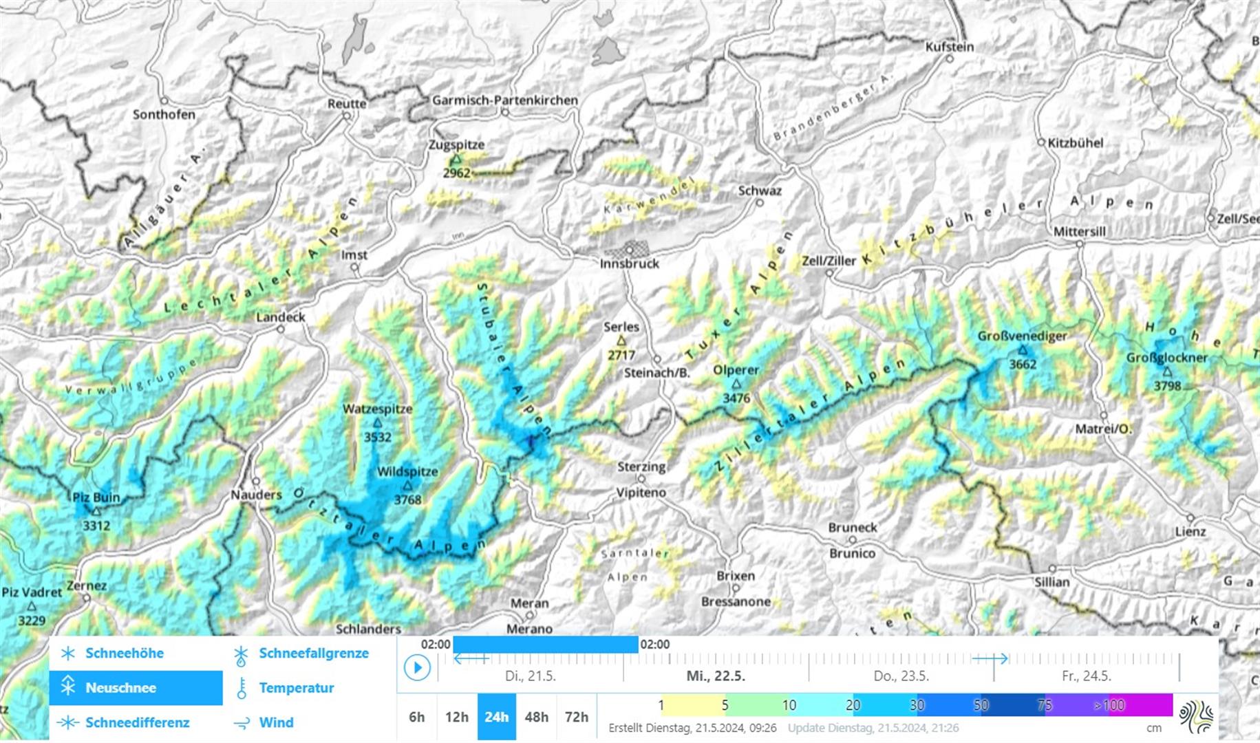
Fresh snow in the mountains, focus on Main Alpine Ridge

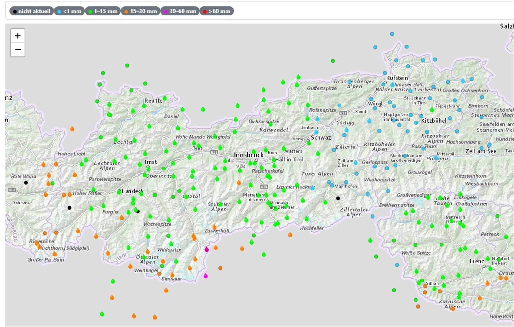
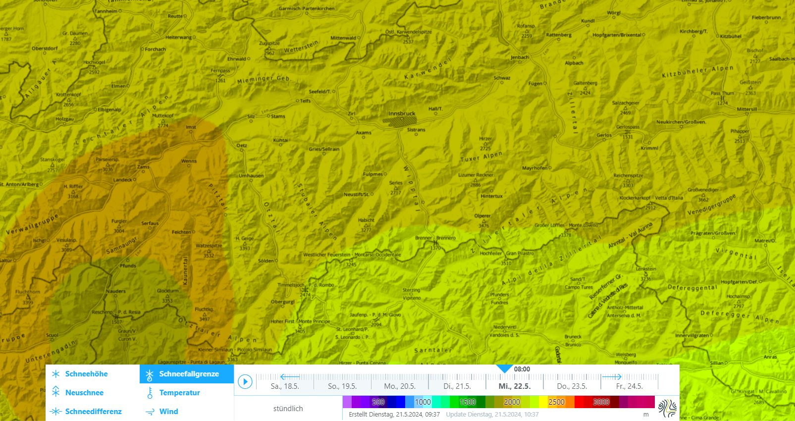
Since this morning (21.05.2024) it has been raining, sometimes heavily, especially along the Main Alpine Ridge and in southern East Tirol; in the lowlands it is predominantly dry, the precipitation will set in somewhat later in the evening and persist through the night. Snowfall level will descend to 2000m, in East Tirol somewhat higher. On Wednesday morning, scattered clouds in North Tirol, gray skies in East Tirol. In afternoon showers will spread over all of Tirol. Cool, instable for the rest of the week, repeated bouts of showers possible. Winds mostly light to moderate, where there are showers a bit stronger winds.

Niederschlagssumme der letzten 24 Stunden. (Stand: 21.05.2024)
Sum of precipitation in last 24 hours (measured on: 21.05.2024)
In den nächsten 24 Stunden fallen entlang des Alpenhauptkamms verbreitet 10-20cm Neuschnee, lokal auch bis zu 30cm.
Over the next 24 hours along Main Alpine Ridge: 10-20cm of fresh snow, locally up to 30cm.
Schneefallgrenze für Mittwoch, 22.05.2024 morgens um 08:00.
Snowfall level on Wednesday, 22.05.2024 at 8:00 am.

Higher avalanche danger for a short time

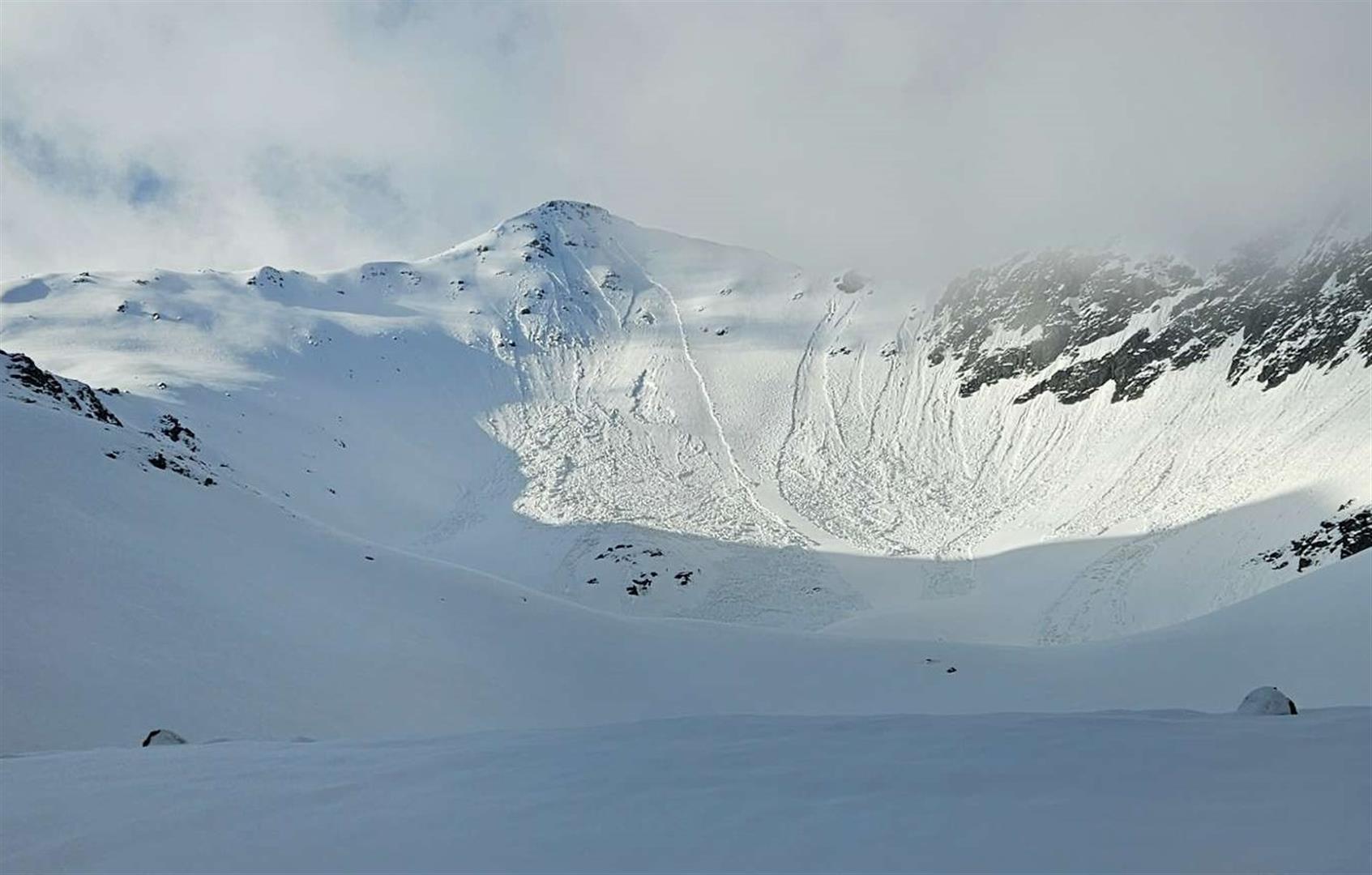
The fresh snow in the coming days will be deposited in all aspects atop a wet old snowpack. Due to the shower-like quality of the precipitation, conditions for slab avalanches may be a given from place to place: massive graupel layers as the weak layer. Stronger winds where there are showers can lead to freshly generated snowdrift accumulations and form a slab. Isolated danger zones are found on very steep shady slopes and very steep slopes near ridgelines in high alpine regions. Avalanches will be mostly small, triggerable only for a short spell. As a result of the strong diffuse solar radiation (also unleashed by showerlike precipitation) the snowdrift masses quickly consolidate. Whereas diffuse solar radiation leads to a quick loss of firmness in the fresh snow. For that reason, numerous naturally triggered loose-snow avalanches can be expected from steep rocky terrain in all aspects. Depending on the amount of fresh snow, they will be mostly small but medium-sized ones are also possible. In isolated cases they can sweep along deeper layers. Isolated glide-snow avalanches are possible on steep grass-covered slopes.

Review

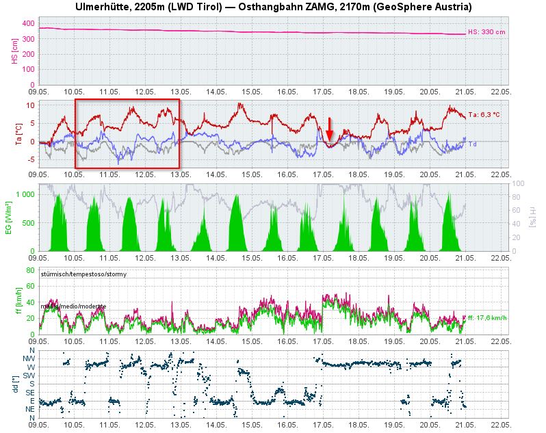
On the weekend of 10-12 May there was sunny weather in all of Tirol amid a high pressure front and dry air masses. Nocturnal outgoing long wave radiation was good, and thus, firn snow was good. An extended stable phase has not occurred since then. This has deteriorated snow quality.

While in North Tirol on Wednesday 15.05 there was still foehn, bringing dry weather, in East Tirol the southerly air current brough heavy precipitation. Showers like in thunderstorms spread to North Tirol on Thursday evening. Focus was in East Tirol, where up to 40cm of fresh snow was deposited. Also along the Main Alpine Ridge there was fresh snow registered. Snowfall level lay at 2000-2500m.

Wetterrückblick an der Wetterstation Ulmerhütte. Rot markiert das Wochenende des 9.-11.5. mit guter nächtlicher Abstrahlung (die Oberflächentemperatur lag unter der Taupunkttemperatur), sowie das Niederschlagsereignis in der Nacht auf 17.5. (roter Pfeil). Mit dem Niederschlag hat auch der Wind kräftig zugelegt.
Weather review at Ulmerhütte weather station. Red: the 9-11.05 weekend with good nocturnal radation (surface temperature below thawing point) and precipitation in the early hours of 17.05 (red arrow). With the precipitation, winds strengthend.
Ein Archivbild von Mitte April 2024: Ähnlich gute Firnverhältnisse herrschten am zweiten Maiwochenende. Nach guter nächtlicher Abstrahlung sorgte sonniges Wetter für skifahrerischen Genuss. Foto: © LWD Tirol, 06.04.2024.
A photo from the archives from mid-April 2024: similarly good firn conditions on the second weekend in May. Following good nighttime radiation, sunny weather provided good skiing conditions. photo: © LWD Tirol, 06.04.2024.
24h Schneehöhendifferenz des Niederschlags von Donnerstag Nacht (16.05.)
24-hr snow depth difference on Thursday night 16.05 with focus of precipitation in East Tirol and along Main Alpine Ridge.
Schneefallgrenze an den jeweiligen Wetterstationen, sowie Niederschlag (schwarz) in den östlichen Deferegger Alpen. Osttirol war der Niederschlagsschwerpunkt des Ereignisses, die Schneefallgrenze bewegte sich um 2000 - 2500m.
Snowfall level at individual weather stations and precipitation (blue background: times in which precipitation >0.1mm are registered) in eastern Deferegger Alps. Focus of precipitation was in East Tirol, snowfall level lay at 2000 – 2500m.

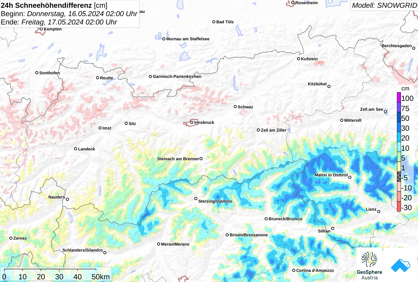
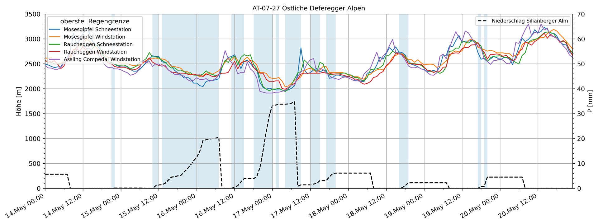
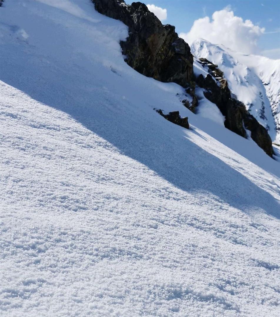
The precipitation brought wave upon wave of graupel. On the Grossen Möseler in the Zillertal Alps, a 5-10 cm thick layer of graupel formed at 3000m.

Graupel an der Schneeoberfläche war durch die Gewitter am Pfingstwochenende vielerorts ein Thema. Hier im hinteren Bruggeralmtal in den östlichen Dereregger Alpen. Foto: © Mark Kleinlercher, 20.05.2024.
Graupel on the surface was frequently evident on Pentecost weekend due to thunderstorms. Above, rear Bruggeralmtal in eastern Deferegger Alps. photo: © Mark Kleinlercher, 20.05.2024.
In der vergangenen Woche waren nach den teils starken Niederschlägen mit diffuser Strahlung zahlreiche nasse Lockerschneelawinen zu beobachten. Hier ein Bild aus einer der niederschlagsreichen Regionen, den östlichen Deferegger Alpen (Staller Sattel). Foto: © Mark Kleinlercher, 20.05.2024.
Last week, heavy precipitation often with diffuse radiation caused numerous wet loose-snow avalanches. Above, a photo shot in one of the regions where there was lots of precipitation, the eastern Deferegger Alps (Staller Sattel). photo: © Mark Kleinlercher, 20.05.2024.
Lockerschneelawinen sind im felsdurchsetzen Gelände zu finden, vereinzelt können sie auch die Altschneedecke mitreißen. Foto: © Daniel Kleinlercher, 18.05.2024.
Loose-snow avalanches occurred in rocky terrain, in isolated cases they also swept along the old snowpack. photo: © Daniel Kleinlercher, 18.05.2024.
Ablagerung einer Gleitschneelawine im Arlberggebiet (Foto: 16.05.2024; © Markus Lorenz)
Deposit of a glide-snow avalanche in Arlberg region. (photo: 16.05.2024; © Markus Lorenz)

Die Schneedecke apert aus. Während sonnseitig in hohen Lagen wenig bis kein Schnee mehr zu finden ist, halten sich im Kammbereich noch beachtliche Wechten. Auch davon geht noch eine gewisse Gefährdung aus. Hier an der Elmer Kreuzspitze in den östlichen Lechtaler Alpen. Foto: © Stefan Zangerl, 19.05.2024.

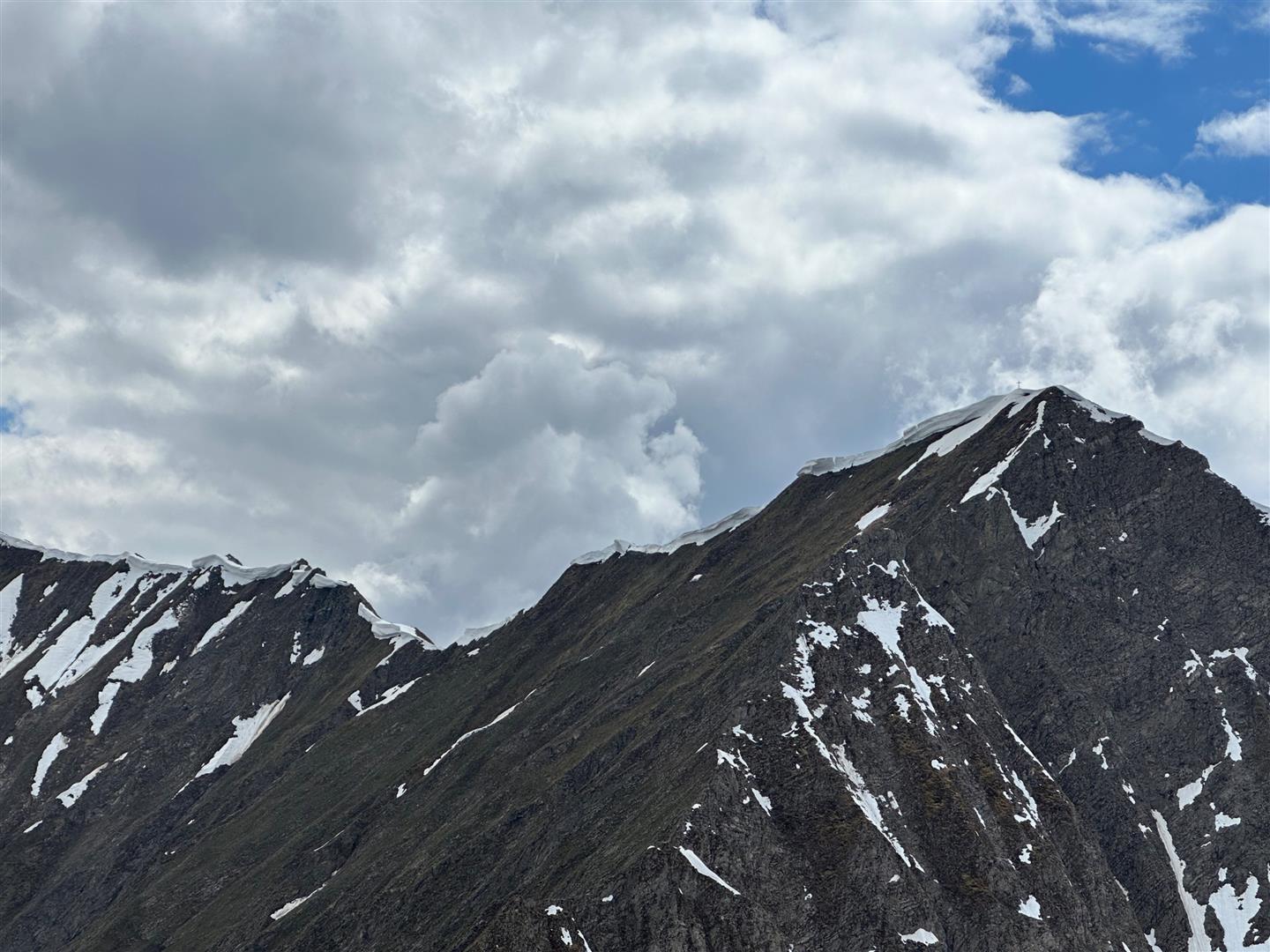
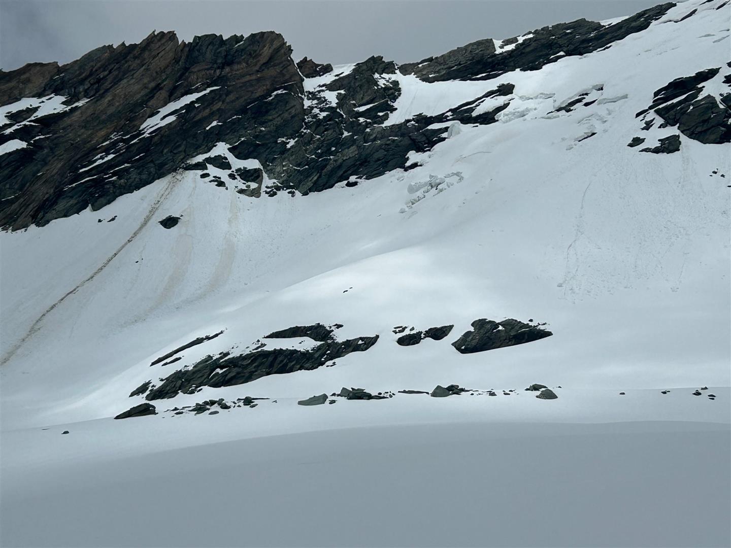
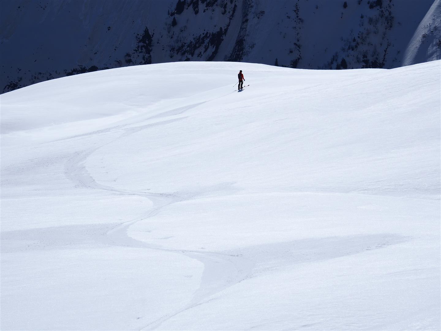
The slopes are becoming bare of snow. While there is little or no snow on sunny slopes up to high altitudes, in ridgeline terrain there are still impressive cornices, from which a certain danger arises. Above on the Elmer Kreuzspitze in the eastern Lechtal Alps. photo: © Stefan Zangerl, 19.05.2024.