Following a period of early-summer weather lasting until 15.04, the winter has made a comeback: low temperatures, snowfall down to low lying areas and measurably rising snow depths with ascending altitude. Avalanche danger is assessed as moderate, despite ample amounts of fresh snow. Main problem currently: fresh snow problem resulting in increasing loose-snow avalanches in extremely steep terrain.
Winter is back
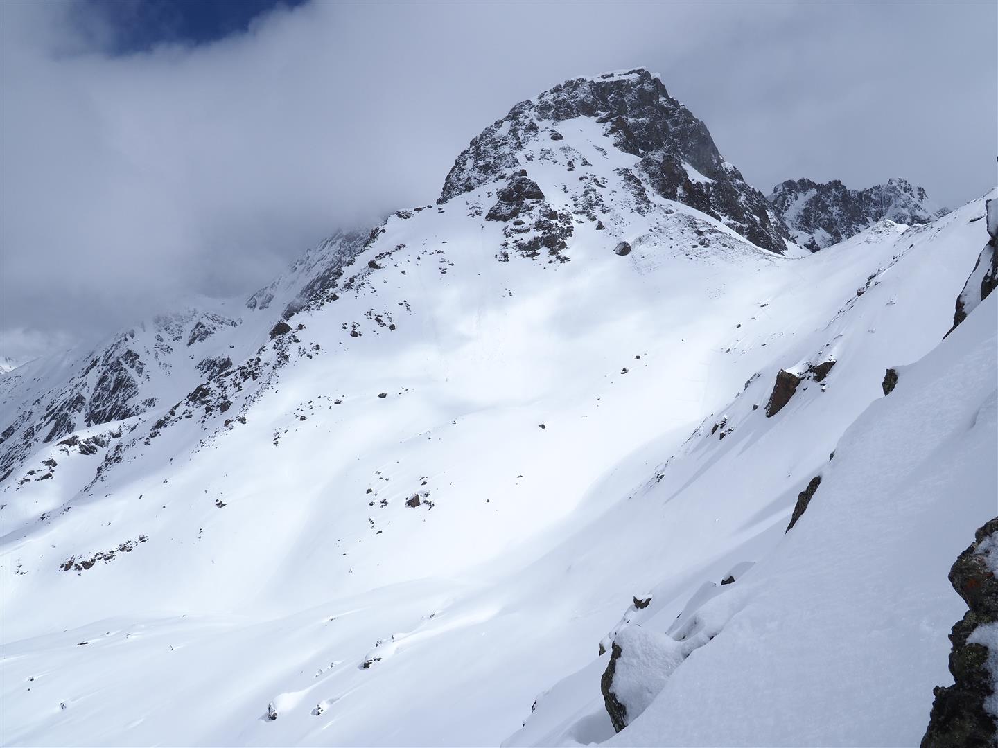
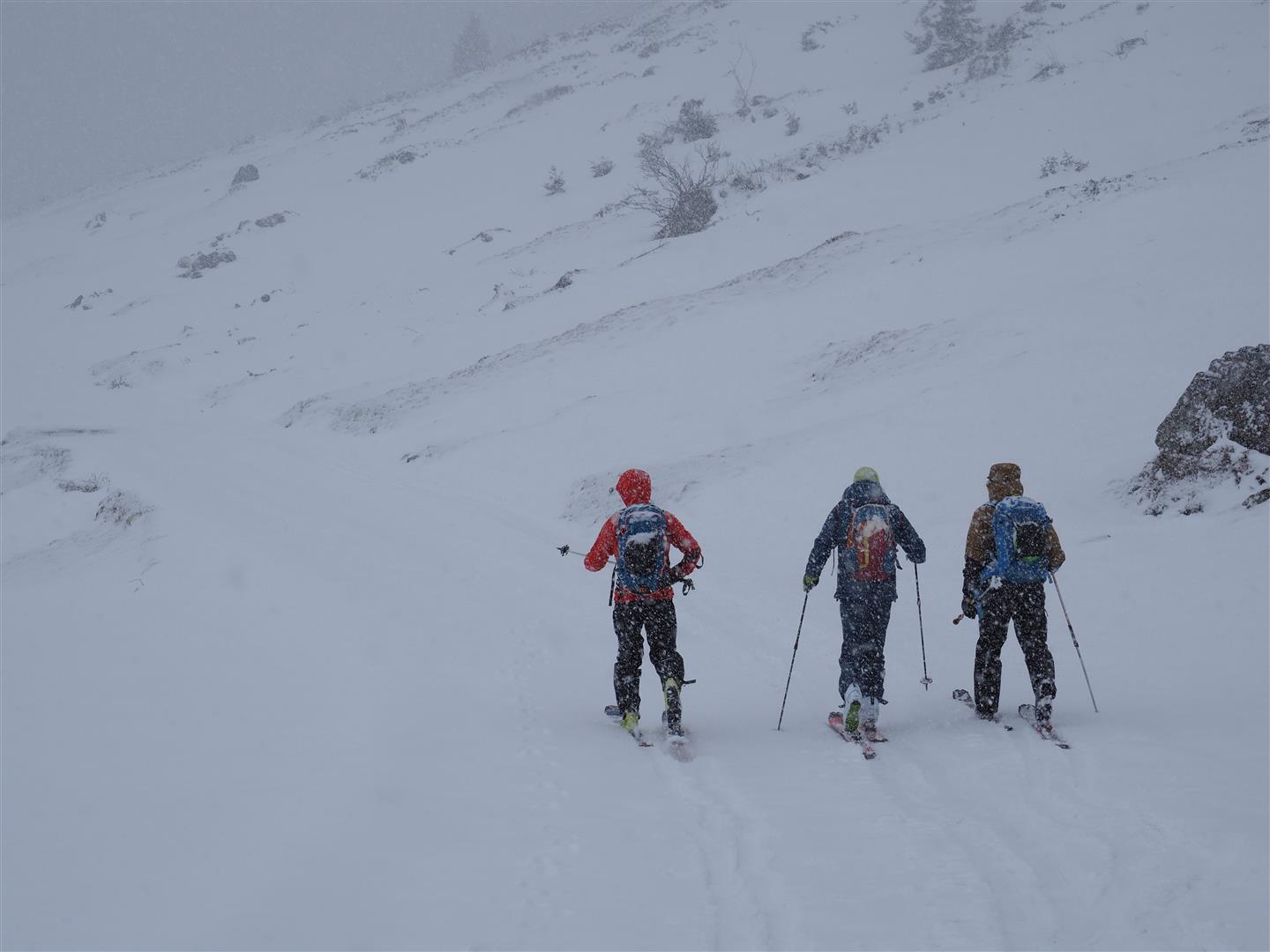
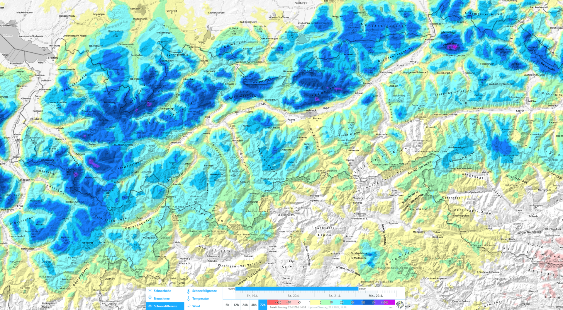
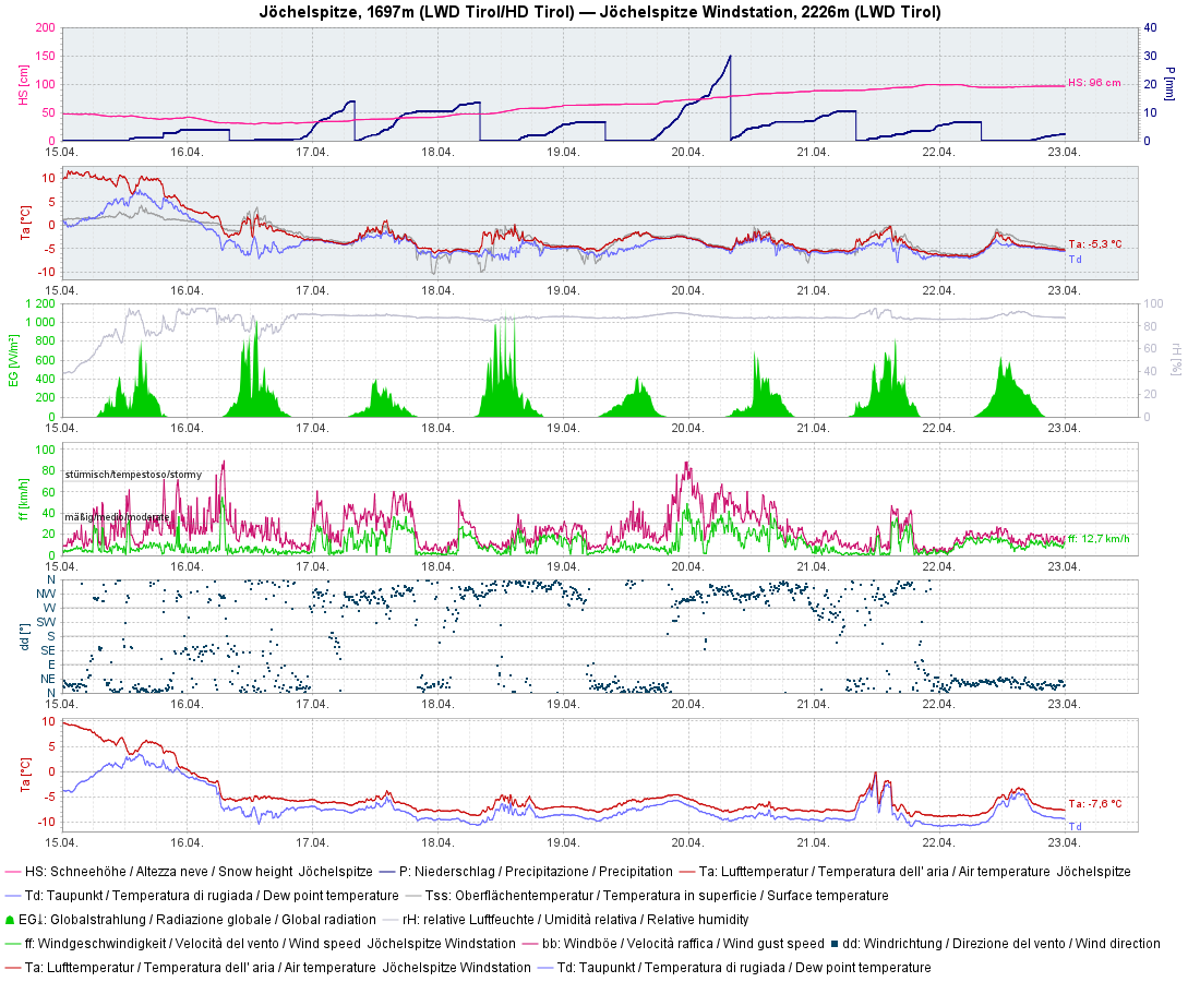
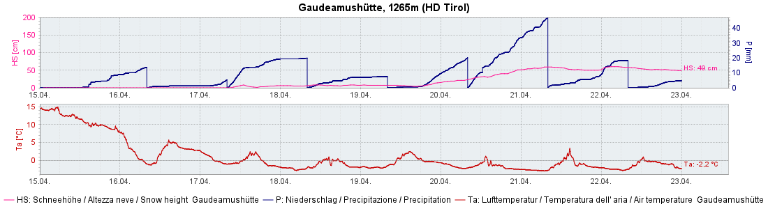
Last week was marked by a striking drop in temperatures and regular rounds of fresh snowfall. All in all, more than 100cm of fresh snow was registered. What was interesting, as is often the case in April: significantly increasing snow depths with ascending altitude. Based on observations in outlying terrain, 50-75cm of snowfall was registered over the last few days, winds were initially strong, then slackened off noticeably. In the interim there is lots of good powder at high altitudes.
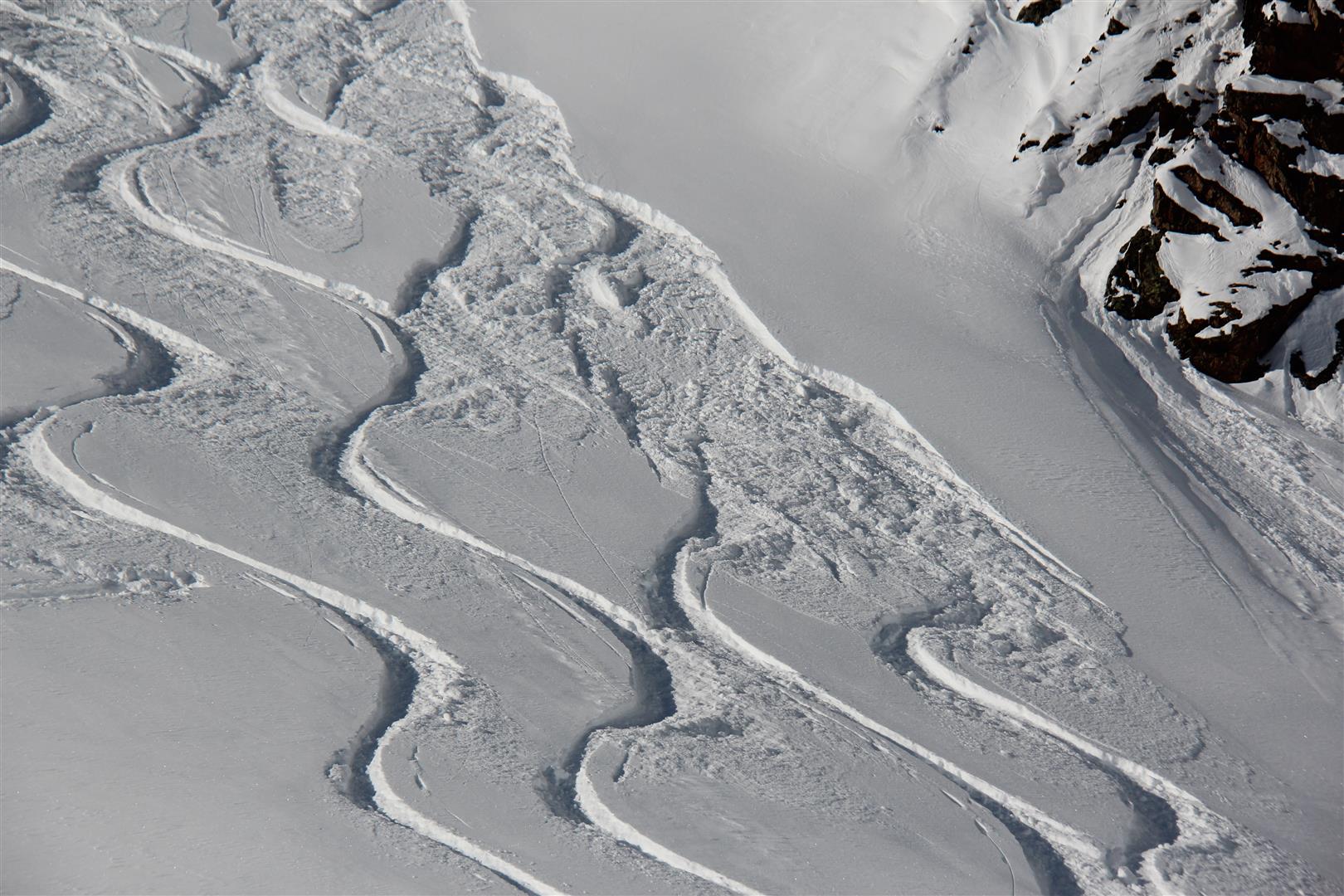
Main problem: loose-snow avalanches
Reports from our observers confirm mostly loose fresh fallen snow at high altitudes, covering the snowdrift accumulations which were generated on Friday and Saturday (19-20.04). Weak layer for these snowdrifts: loose powder from last week which in the interim has transformed to decomposed or round kernels of snow. Above 2600m we currently see a steadily decreasing proneness to triggering, corroborated also by artificial triggerings which were carried out today, 23.04, in the Stubai Alps. Apart from mostly small loose-snow avalanches, no avalanches were triggered.
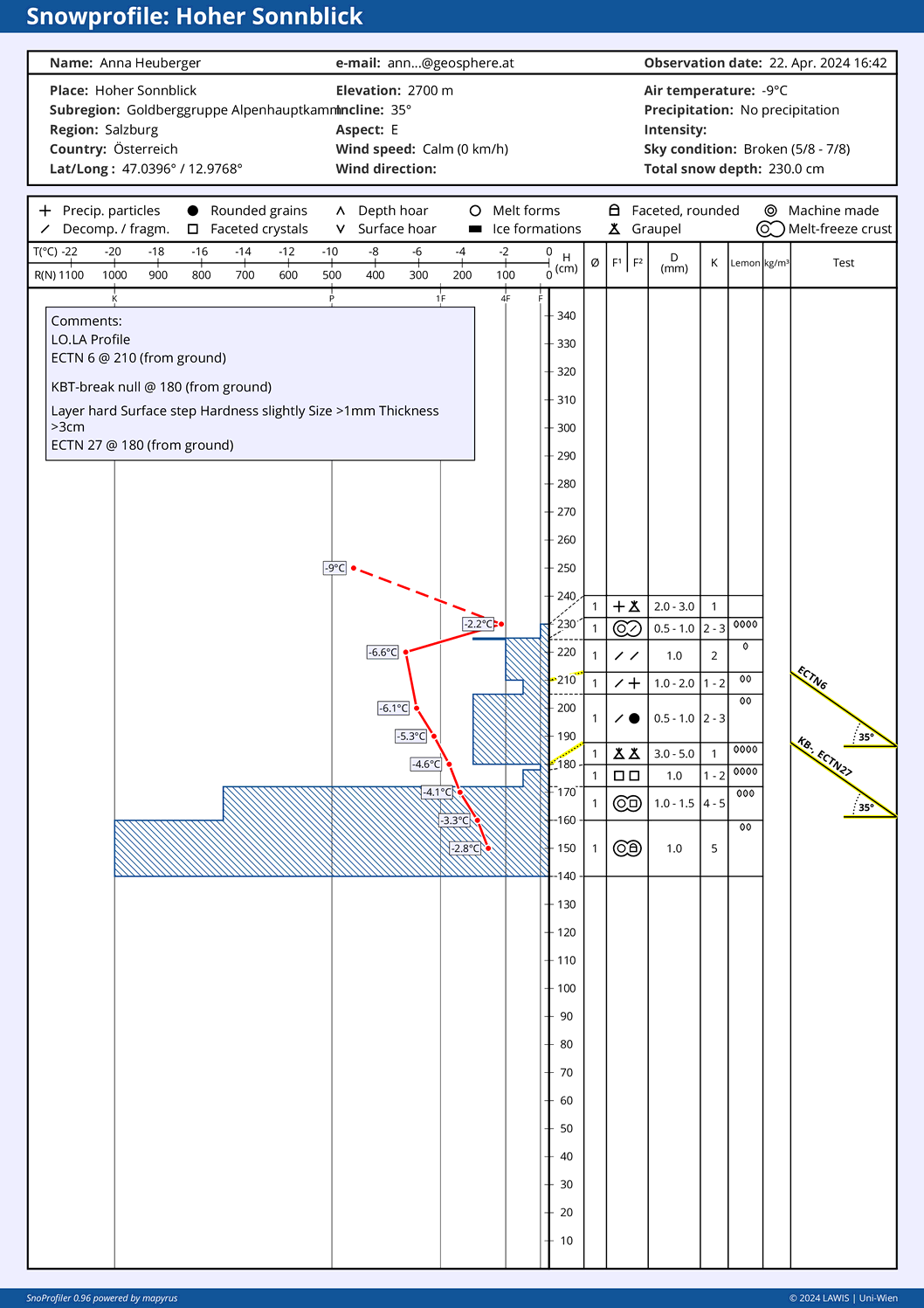
Danger pattern “cold on warm” is possible
Since 15.04 we have the prerequisites for Danger Pattern “cold on warm”: atop a moist-to-wet snowpack surface at the time, snowfall was deposited during a spate of significantly dropping temperatures. Due to huge temperature disparities between moist/wet/warm and dry/cold, faceted crystals formed on the surface. Currently we have no reason to believe that malevolent wide-surface weak layers have formed. Many times the slab is lacking on top of the faceted crystals which formed.
Nevertheless: we view it is quite possible that in the course of this week as the fresh snow settles increasingly, conditions for possible slab releases could result. Currently, the only help is to take a quick look inside the snowpack, where attention must be paid to what lies next to the near-surface crusts atop faceted crystals. Increasingly, we expect problems with dp.4 starting above 2400 m.
We would be extremely grateful for information regarding possible formation of weak layers due to danger pattern “cold on warm.” If possible, with info of altitude and aspect. Report your observations to SNOBS.LIVE
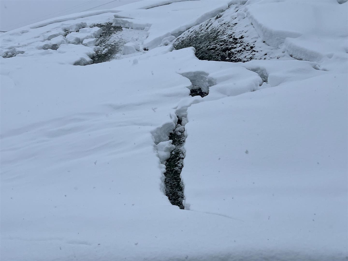
Glide-snow avalanches esp. over ground previously bare of snow
In those regions where snowfall was heavy, increasing glide-snow avalanches have released wherever the ground was bare before the snowfall. Whereas glide-snow avalanches have decreased significantly wherever there was a well settled old snowpack.
What’s next?
To begin with, cold and capricious. Precipitation will recede starting on Thursday, sunshine will return. As of Friday the air current will shift to southwesterly. It will get warmer, winds will intensify. Loose-snow avalanches will remain at the forefront to start with. The snowpack will react swiftly to diffuse radiation and rising temperatures. The development of increased slab-avalanche danger (due to dp.4 – cold on warm) can’t be predicted far ahead of time.